Places of Interest
|
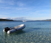
Edgigen island (sixth island), Kwajalein Atoll GPS: 9 19.98556n 167 30.43468e Edgigen island (sixth island), Kwajalein Atoll >>> View Map |
|
|
Ebeye island on Kwajalein Atoll GPS: 8 46.51555n 167 44.15290e Poor people but happy and basic foodstuffs available. Note: no ATM and bank will not change currency so bring what you need. >>> View Map |
|
|
likiep Island, likiep Atoll GPS: 9 49.56976n 169 18.32249e Beautiful calm anchorage off unique village settled by Europeans in the 1890s. >>> View Map |
|
|
Wotje Island, Wojte Atoll GPS: 9 27.47376n 170 13.77269e Old Japanese Seaplane ramp. Beautiful calm anchorage. Sunken ships and aircraft in the lagoon. Japanese bunkers, aircraft and war relics abound on shore. Great place for divers and history buffs. >>> View Map |
|
|
Ollot Island, Maloelap Atoll GPS: 8 45.91120n 171 10.38253e Ollot Island, Maloelap Atoll >>> View Map |
|
|
Rongelap Island GPS: 11 9.92094n 166 53.47374e Rongelap Island is the main habitation for this atoll. Anchor off the municipal dock. A modern ghost town, complete with an empty resort, wonderful concrete roads and paved airport with new terminal... >>> View Map |
|
|
Eniwetak, south Rongerik GPS: 11 18.18733n 167 28.57099e Cruisers have reported pretty bommies, beach combing and a turtle from this anchorage. >>> View Map |
|
|
Lelu Harbor, Kosrae GPS: 05 19.711n 163 01.359e Lovely harbor/Bay. Nearly 360 protection. The bay is surrounded by mountains and hills, with the narrow entrance channel open to the East. As of 2019: Range lights are not working, outer marks have... >>> View Map |
|
|
Lelu Bay, Kosrae, FSM GPS: 5 19.723n 163 01.355e Good protection from all directions. This gorgeous bay is nearly completely circled by mountains. Services are just ashore in Lelu Village: Grocery and Produce stores, Laundromat, Ace Hardware. There... >>> View Map |
|
|
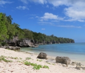
Karikana Island, Marovo Lagoon GPS: 08 27.76S 158 03.55E Nice beachy anchorage with clear water and hopefully no crocs. Anchored in 5-6m, 3G cell signal. Probably not good in strong SE. >>> View Map |
|
|
Cheke Village GPS: 08 31.48S 158 05.02E Off tiny village in Marovo Lagoon. Carvers here, friendly and not pushy. >>> View Map |
|
|
N Russell Islands GPS: 08 58.37S 158 11.31E Great anchorage in good sand 10-25 ft deep. Great in Ely wind, not bad in southerlies. >>> View Map |
|
|
N Russell Islands GPS: 08 58.37S 158 11.31E Great anchorage in good sand 10-25 ft deep. Great in Ely wind, not bad in light southerlies. >>> View Map |
|
|
Lenakel GPS: 19 32.04595S 169 15.94087E Lenakel is an official port of entry for Vanuatu but is quite exposed and can be a very rolly anchorage. We recommend checking with customs whether you can arrange to have officials come over to Port... >>> View Map |
|
 |
Paul's Reef GPS: 17 40.04958s 168 11.15894e Small anchorage with good holding in 5m over sand in close to the sandy beach. A stern anchor is recommended to avoid roll and to keep away from coral bommies as the sandy patch is not that large.... >>> View Map |
 |
Lelepa NE GPS: 17 34.67509s 168 12.85246e There is plenty of room on sandy bottom on the northeast side of Lelepa Island. This spot can get quite windy but the holding is good and we found it perfectly comfortable with a stern anchor out... >>> View Map |
 |
Laonmeten Bay, Moso Island GPS: 17 32.988s 168 13.396e Anchor in 15m or so in sand. We experienced light roll coming from two directions so little point setting the stern anchor. Not uncomfortable though. Worth it for the lovely beaches, gorgeous blue... >>> View Map |
|
Revolieu Bay, Epi Island GPS: 16 43.726s 168 08.537e Tuck in behind the reef in 9m on sand for best protection from the sea. There are two villages here (Chiefs Baron and Fred) and a fresh water stream. Lovely black sand beach makes for an excellent... >>> View Map |
|
|
Sulua Bay, Emae Island GPS: 17 02.973s 168 22.280e Mixed coral and sand bottom. 10-15m. Nice beach on this side of the island. You can also walk through to the windward side beach from here, passing through a village. >>> View Map |
|
 |
Lamen Bay, Epi GPS: 16 35.756s 168 09.882e Great holding in 5-8m on sand and light seagrass. A bit rolly, particularly further out in the bay. Be sure to snorkel through the anchorage to admire the beautiful large and very placid turtles as... >>> View Map |