Taranui
Land launched bikes onto Queen Charlotte Track.
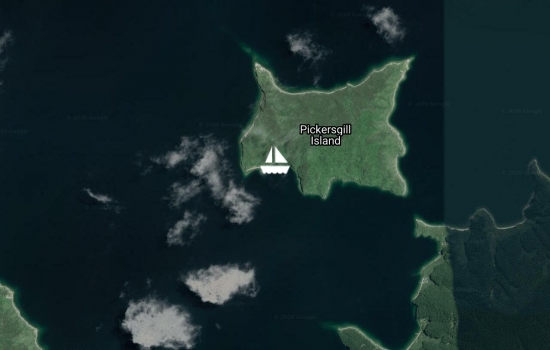
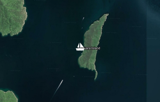
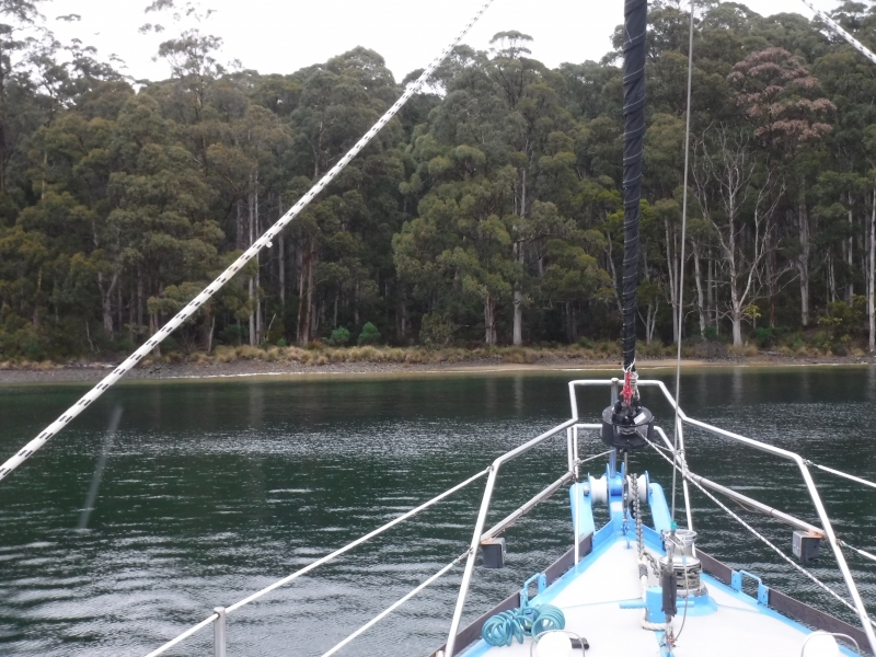
Sail around White Rocks and into East Bay before anchoring in Wharehunga.
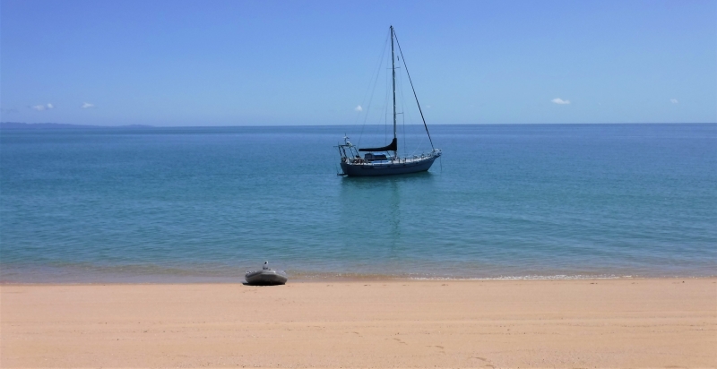
Freshly antifouled.
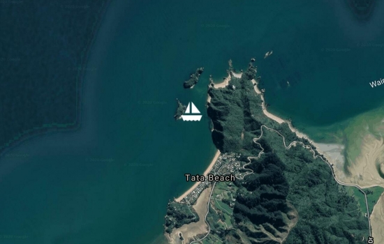
Blissfully anchored at Whariwharangi, Golden Bay, Abel Tasman National Park.
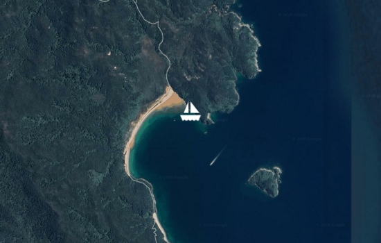

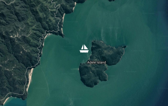
35.6NM from Waikawa Bay, Current Basin to Adele Island, Abel Tasman National Park.


Avg: 30knts
24hr: 720nm
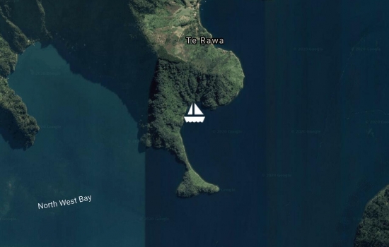
First cell phone reception in two weeks while cruising Pelorus Sound.


Avg: 16.9knts
24hr: 406.6nm

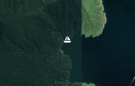
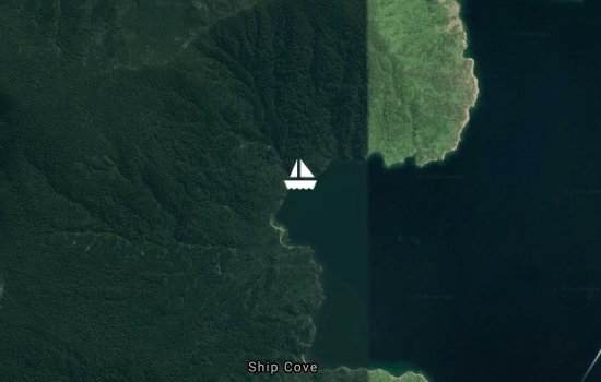
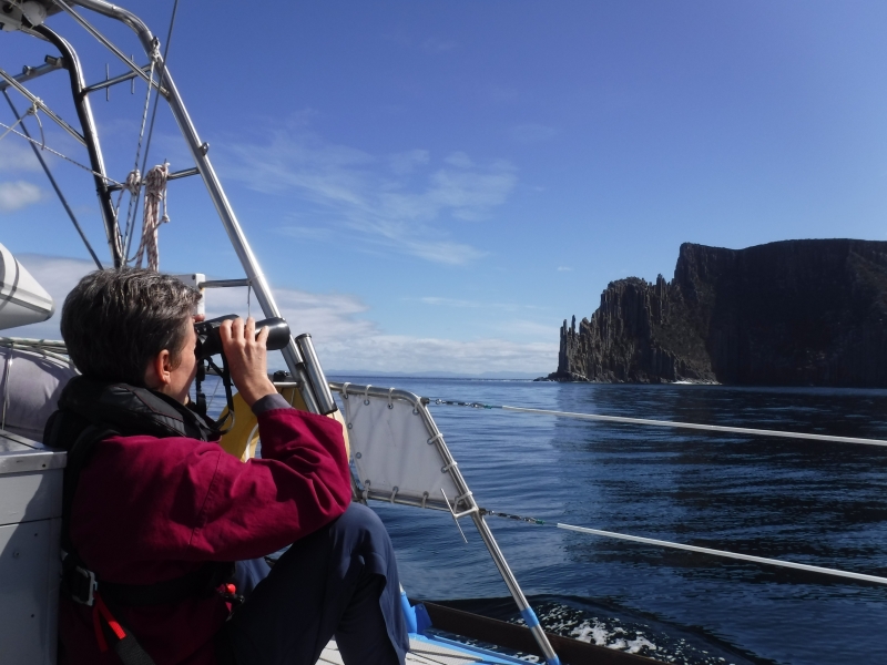
Flipper Bay. Also known as Blind Bay.
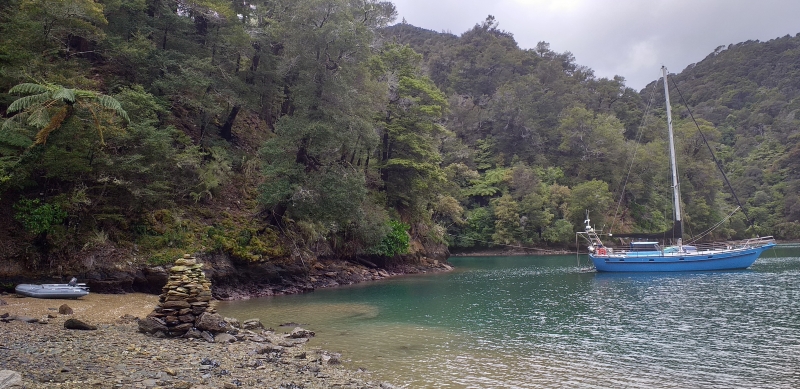

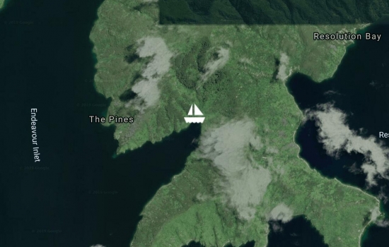
Engulfed in beautiful NZ native bush, green water and birdsong. Walked up untracked spur to Queen Charlotte Track today.
Light cold southerly. Cosy with diesel fire lit.
Walk to one of the largest Rimu trees in NZ. Approximately 1000 years old!!
Avg: 76knts
24hr: 1824nm
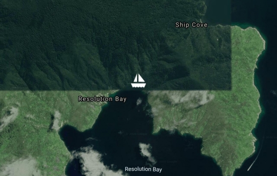
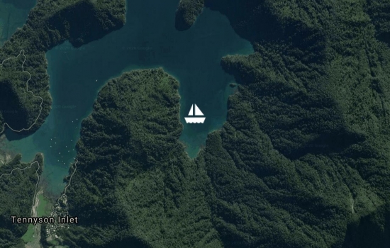
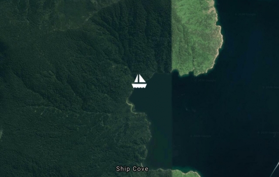
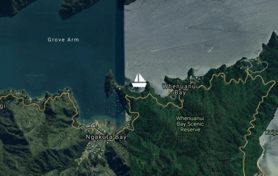
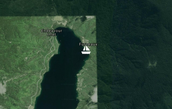
Anchored in the beautiful bush-clad Tawa Bay in Endeavour Inlet.
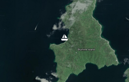
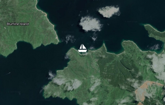
Birdsong on Blumine Island sanctuary.
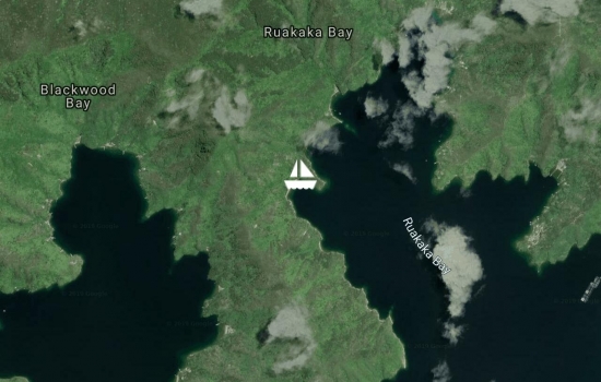
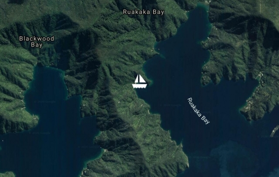
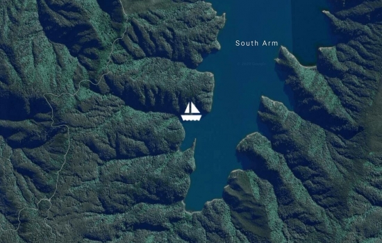
Ratimera in Ruakaka Bay,
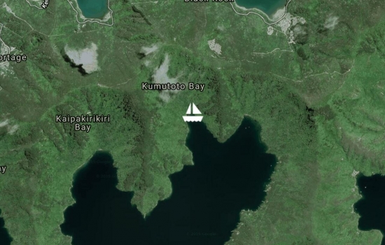
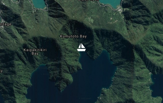
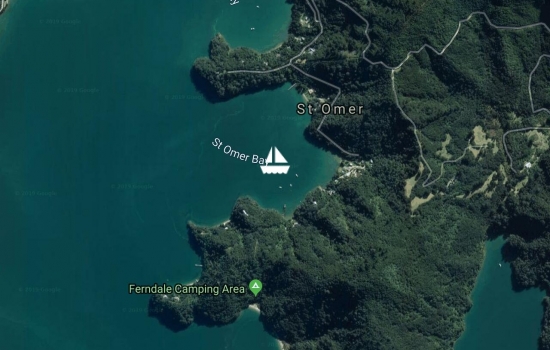
Anchored in tranquil Kumutoto Bay after a week in Nelson on house maintenance.
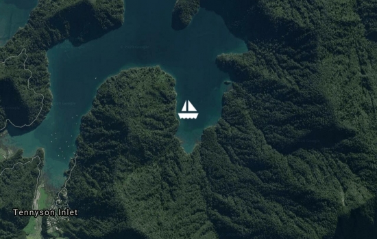
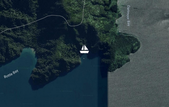
Back home on Taranui next to the diesel fire after 5 months (Hilary) and two months (Brian) in the UK. Harbouring up in our local haunts not too far from the mooring at Anakiwa including our latest position in Mistletoe Bay.
Kumutoto Bay, Queen Charlotte Sound
So your present adventures
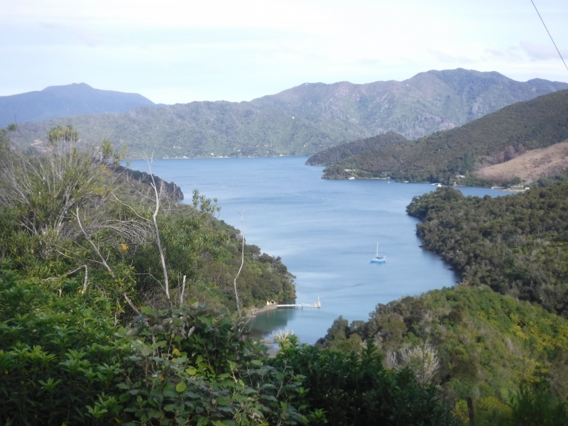
Taranui is home on her own mooring at Anakiwa, Queen Charlotte Sound, Marlborough Sounds.
Avg: 3.2knts
24hr: 76.6nm
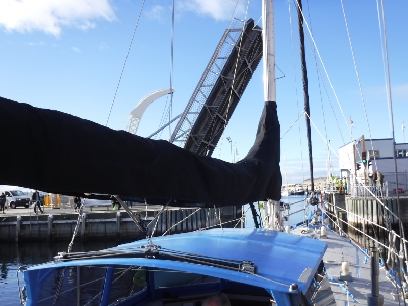
Arrived Port of Entry Picton, Sunday 0200hrs. Ready to great us at the dock were both customs and quarantine officials. Sleep deprivation is hence extended! Thank to Ed (yacht Aka) for weather reports and YIT programming and Ron (yacht Pilgrim). SSB communication was excellent.
Avg: 5.9knts
24hr: 140.5nm
COURSE.134T..4.5knts
101,MILES,Picton
eta.Sunday 1500hrs.
Avg: 5.5knts
24hr: 133nm
course 125 true 5 knots 223 miles to Picton,
ETA Sunday all well
Avg: 4.2knts
24hr: 101.5nm
5.5 knts. 126 true, 339 miles to Picton E.T.A. Sunday morning. have contacted Taupo Maritime with arrival notice. all well
Avg: 2.9knts
24hr: 69.3nm
motorsailing 125 true 427 miles to Picton
eta saturday alls well
Avg: 3.9knts
24hr: 92.5nm
motoring slowly had a nice new years eve. calm, with fish dinner. 478 miles to picton ETA now saturday
HAPPY NEW YEAR TO ALL..
Happy new year!!
127 TRUE ,3 KNOTS 552 MILES TO RUN.
ALLS WELL
Avg: 3.1knts
24hr: 74.2nm
127 true, 3 knts, 552 miles to run to Picton
all well
Avg: 5.1knts
24hr: 123.3nm
4.4 knots, 127 tue 629 miles to run to Picton all well
Sounds like a good trip so
Avg: 4.9knts
24hr: 117nm
736 Miles to run ETA Friday
all well
Left Lord Howe for Picton about 880 miles run
all well aboard.
Moored atLLord Howe looking at weather for tasman crossing to Opua all well..
On mooring through Man of War Pass underneath towering sheer faced Mt Gower (875 m). Stunning destination!
Well done. Glad you're in
Avg: 3.6knts
24hr: 85.5nm
Hove to waiting to enter Lord Howe Island, all well,
departure for New Zealand weather dependant.
Avg: 4.9knts
24hr: 117.9nm
ALL WELL ABOARD 68 MILES to Lord Howe island
Fantastic that some kind
SOUTHPORT TO LORD HOWE 282 MILES TO RUN
ALL WELL
After returning from a ten day inland trip left Sovereign island and anchored on northern side of Wave-break Island. Nice beach and warm water!
Snug Taranui up in Sovereign island to begin 10 ten day inland National Parks trip in northern NSW.
26 NM beaut downwind sail (jib only) weaving through the shallows back down to Tipplers. Last hour in dark.
Nice 24.6 NM warm downwind sail from Tangalooma to Horseshoe Bay, Peel Island.
30.3 NM from Brisbane to Tangalooma yesterday afternoon with outgoing tidal stream. Anchored between wrecks and beach.
32.7 NM onward and we are up the Brisbane River right in the city.
Wild unsettled weather over past few days and more to come. 4.2 NM from Dalpura Bay, Macleary Island to Coochiemuldo Island for a change of scene and an even more secure anchorage from the southerly winds.
Moved 5.4 NM to Dalpura Bay on Macleay Island to shelter from forecasted SE. Beautiful Island!!
Back to Horseshoe Bay, Peel Island
2.8NM over to Dean Billa Bay, Dunwich on North Stradbroke Island. On the bikes today to Point Lookout and Amity Point. 50km
10.6NM northward from Karragarra Island to the popular south side of Peel Island (Horseshoe Bay). The Island is also a Conservation Park (Teerk Roo Ra) and was also a Leper Colony with some historic remains. Having seen a Dugong and sea turtles feel we are on the periphery of the tropics. Water temp; 20 degrees cel.
9.6 NM further north from Jacobs Well in the Gold Coast Seaway to Karragarra Island.
After anchoring in 'Bums Bay' for a few days to restock headed 14.4 NM northward through the Gold Coast Passage to Jacobs Well. Pete Brady on board who cycled back home at the Gold Coast.
Motored Taranui 1.4NM from its two week primo berth on Sovereign Island, while we were in NZ, to Paradise Point.
6 NM to The Sovereign Mile, Sovereign Island to put Taranui in a 'holiday home' while we fly to NZ to catch up with Charlotte at Whakapapa , NZ.
3.6NM back toward Southport to Tipplers. A huge camping area and resort. Beaut walk through forest to east coast.
3.4 NM back from Slipping Sands to Jump Pin Lagoon. Very tropical.
3.5 NM at near high tide into the very shallow Canaipa Passage to Slipping Sands anchorage. Down to 0.1 metres (10 centimetres) under the keel. Excellent shelter from the fresh northerly.
Ventured 13.6NM northward through inland waterway to South Stradbroke Island just south of Jumpin Pin bar. Anchored here November 2016 on way south.
Pleasant sailing from Iluka to Southport. 101NM. Arrived in 'Bums Bay, Southport 4am this morning.
Early start from Coffs Harbour to reach Iluka (Yamba) in good time. 59.3 NM. Plenty of whale sightings, breaching, spy hopping, pectoral and tail flapping.
36.4 NM northward from Trial Bay to Coffs Harbour.
Overnight in Trial Bay en-route to Coffs Harbour. 38.6 NM today from Port Macquarie. Still plenty of whales heading slowly north as we are.
Moved from rented mooring to courtesy mooring.
31.2 NM from Crowdy Head to Port McQuarrie.
Early start for the 57.3 NM sail northward to Crowdy Head. Joined the conveyor belt of Humpback and Southern Right whales heading northward at a similar speed to Taranui.
3.9 NM to Esmerelda Cove on south side of Broughton Island.
11.7 NM sail northward from Shoal Bay, Port Stephens to Providence Beach, north side of Broughton Island
After being in Nelson Bay for two nights for fuel, water, supplies and bike ride up Gan Gan lookout, Boat Harbour, Anna Bay and Salamander have anchored at Soldiers Point for protection from the imminent strong westerly's. All settles down again tomorrow.
Navigated Taranui carefully through the shallows of the Myall River entrance. Beautiful anchorage close to Winda Woppa surrounded by Pelicans, numerous other wading birds, sand dunes and mangroves.
Delightful Fame Cove after a short slow moving sail from Taniba Bay in Port Stephens.
5NM around other side of peninsula to explore Taniba Bay

After cycle to Fingal Bay motored further into Port Stephens to Tilligery Creek close to Lemon Tree Passage.
Moved around corner to Nelson Bay for supplies and laundry.
Avg: 2.8knts
24hr: 67.8nm
3am start to cover the 75.2NM from Fishermans Beach, Broken Bay to Shoal Bay, Port Stephens. Sighted a number of humpback whales migrating north, but none of the 84 containers lost overboard a few weeks back in this area. Harder to sight as they don't spout!!
Moved to Fishermans Beach for a change of scene and closer to Broken Bay entrance ready for departure north.
Motored 12NM into Jerusalem Bay in preparation for a walk on the Great North Trail tomorrow.
Up into McCarrs Creek to meet up and dine with couple on yacht Azimba. Very tranquil and scenic. But as you can see we are not the only vessels up here!!
22.6NM from Balmoral, Sydney Harbour to Coasters in Pittwater. No longer Sydney Siders!!!
Avg: 65.1knts
24hr: 1561.4nm
Back up to Cabarita after a very interesting day on Cockatoo Island.
Anchored off Hunters Hill Sailing Club in the Parramatta River as a convenient spot to access Sydney Harbour's largest Island - Cockatoo Island. Steeped with ship building history and has National Heritage.
Chowder Bay for a change of scene.
Back out to Rose Bay ready to walk the coastline between Bondi and Cooge.
4.2NM further up-river to Cabarita to launch the bikes for the Paramata cycle trail and the Olympic Park.
4.5 NM up river to Lane Cove for a snoop around Woolwich and walk on a part of The Great North Walk.
Back to Black Wattle.
3 NM to Balls Bay to access a walk.
5 NM under Harbour Bridge and Anzac Bridge and through the now unused Glebe Bridge and into Black Wattle Bay for easy access to 'Vivid Sydney'.
21.8NM run from Coasters Retreat back into Rose Bay, Sydney Harbour to experience Sydney's Vivid Light Festival. The Sydney Harbour Bridge is in "bling" and beaming powerful laser beams in different directions. All seen from our Rose Bay courtesy mooring.
Careel Bay for a change in scene and a walk.
Moved to Morning Bay, Towlers for social dinner on yacht Kimbo.
Avg: 10knts
24hr: 240.7nm
Moved 1NM across to the delightful Coasters Retreat.
11.1 NM from Cotton Tree Bay to Palm Beach in Pittwater for a walk up to the iconic Barronjoey Lighthouse. Observed a bit of "Home and Away" filming!
Just a 1.5 NM shift back up the Cowan Creek to Cotton Tree Bay with a magnificent fringe of sandstone bluffs and bush.
6.5 NM from Jerusalem to yet another beautiful anchorage at Bobbin Head in Cowan Creek..
6NM from Smiths Creek to Pinta Bay in Jerusalem Arm for a change of scene and another walk.
A further 5.6NM ingression into Broken Bay to the head of Smiths Creek and it is absolutely tranquil, peaceful and stunning. In the midst of Ku-Ring-Gai Chase National Park.
27.8 NM from Ball Head Bay, out through Sydney Harbour Heads and north along the coast to Refuge Bay in the greater Broken Bay. NSW's answer to NZ's labyrinth of waterways; the Marlborough Sounds.
Moved to quieter Balls Head Bay.
Avg: 110.9knts
24hr: 2662.1nm
Back in Black Wattle Bay in prep for Charlotte's departure early tomorrow morning.
Stop off at the beautiful Camp Cove for final swim and sun soak with Charlotte before she departs tomorrow.
Into Manly Cove to take Charlotte out for a meal.
2.4 NMN across from Quarantine to Balmoral for the day.
Moved back out to Quarantine Bay, Manly for a bit of beaching, swimming and walking North Head.
Moved to Sugar Loaf to access some different walks. Happy to be in the very sheltered Middle Harbour while a frontal system passes. This one gave Tasmania a bit of a hammering.
Into Bantry Bay, Middle Harbour from Store Bay for protection from westerly. Bridge to enter opened at 8.15pm hence some careful night navigation. All went well and worth it.
Into Black Wattle Bay in prep to pick up Charlotte at airport.
Avg: 77knts
24hr: 1848.6nm
Overnight move for shelter in Rose Bay from predicted SW. A blow is passing over for a short while. Will move back to Manly tomorrow morning.
On courtesy mooring for a few hours in Manly Cove to enable easy resupplying.
19.7NM from Port Hacking to Store Beach, Manly in Sydney Harbour. Gorgeous motor sail close to the scenic coast past Botany Bay, Bondi Beach and South Head into Manly.
72.7NM, 13 hours pure sailing from Jervis Bay to Jibbon Beach, Port Hacking. Anchorage backs on to Royal National Park. Only 18NM from Sydney Harbour Entrance.
Avg: 7.6knts
24hr: 181.6nm
Arrived at Jervis Bay 2130. Calm anchorage and catch up on sleep after busy and challenging 330 NM sail from Babel Island - 64 hours.
Avg: 6knts
24hr: 142.9nm
Off the Red Cliffs lighthouse, Eden. Boxing on!
Avg: 13.1knts
24hr: 314.7nm
Uncomfortable sailing in Bass Strait. One poop over stern.
Out through the Pot Boil again from Franklin Sound then north to Babel Island.29NM.
24.9NM from Jamieson Bay to Lady Barron in Franklin Sound (Between Cape Barren and Flinders Islands). Passed through the notorious Pot Boil.
Avg: 11.1knts
24hr: 267.5nm
22.8NM from Spike Cove to Jamieson Bay on East Coast of Cape Barren Island, Furneaux group.
46.8 NM from Binalong to Spike Bay, Clarke Island in the Furneaux Group. This Bay is surrounded by spectacular natural granite rock landscaping.
59.9 NM from Wineglass Bay to the beautiful Binalong. Visited here by road about a month ago. Had some pure sailing today.
Early start to Wineglass Bay (11.5NM) before the predicted northerly "kicks in". Decision to tack into the northerly today or "chill out" in Wineglass and motor sail in the variables tomorrow. Opted for the latter!!
Taken advantage of the dying SW (was 50knots) to get to Schouten Passage to begin the hopping voyage to Sydney after 1 year and 2 months in Tasmania. Anticyclonic weather on the way. 26.8 NM today without burning diesel.
Into Triabunna for four or five days while the wild weather passes and while we head into Hobart by land with Hilary's sister who departs Wednesday. Then await a weather window to start sailing north to Sydney.
Into Triabunna to land trip into Hobart for a few days with Sarah who fly's out of Hobart on Wednesday. Then we await a weather window to start heading north to Sydney.
A gnarly beat into the southerly for a large proportion of the 28.9 NM's from Schouten Passage, Freycinet to Prosser Bay for shelter from the upcoming unsettled weather.
30.3 NM sail from Shoal Bay, Maria Island to Passage Beach in Schouten Passage. Re-anchored in Bryans Corner later in day.
Avg: 169.6knts
24hr: 4070.5nm
From Fortescue Bay to Shoal Bay, Maria Island stopping at North Bay en-route to walk northward to Tasman Bay where Abel Tasman landed in 1642. First white people to land in Tasmania. Total of 34 NM today.
Anchored in to North Bay and walked over to the monument in Tasman Bay. Abel Tasman landed here in 1642; the first white people to land in Tasmania.
17.8 NM passage from Port Arthur to Fortescue Bay. Anchored behind wreck in Canoe Bay. Mirror calm.
53.6NM from Deep Hole, Southport to Port Arthur via east side of Bruny Island.
11.2NM from Port Esperance to Southport.
From Deep Bay to Port Esperance for festival. 10.6NM
From Randalls Bay to Deep Bay.4.6NM
Avg: 27.3knts
24hr: 656nm
17.7NM Missionary Bay to Randalls Bay. Anchored in Isthmus Bay opposite The Neck en-route. Lookout and walk on Adventure Bay beach.
Duckpond to Missionary Bay. 9.2NM
24.4NM from Lagoon Bay to the all-round shelter of Duckpond on Bruny Island ready for the prospective SW 40knots tomorrow. There may be a few ruffled feathers in the pond!!
From Connellys to Lagoon Beach. 5.7NM. Now 3 POB. Hilary's sister Sarah with us for a few weeks.
Departed Dunalley at high water to pass through the Denison Canal and anchor at Connellys Bay. 5.7NM.
Departed Prosser Bay 0400 and passed through the Marion Narrows at 0730 and onward to Dunalley mooring. 24NM. Aurora Australis entertained us for a short while. Renting car and taking mountain bikes to Derby in the NE. Derby is becoming world renown for mountain biking.
Sail from Schouten Island to Triabunna for fuel and water (26.7NM) then to Prosser Bay (3.8NM). Very early start tomorrow morning (0400) to catch high tide at Marion Narrows to then head to Dunalley.
Shuffled across Schouten Passage from Bryans Bay to Crockett Bay for southerly wind shifts.
13.2 NM pleasant sail from Wineglass Bay to Bryans Corner, Schouten Passage.
Avg: 3.6knts
24hr: 86.1nm
72NM fast motor sail from Eddystone Point to Wineglass Bay. Stunning day.
Beaut sailing on slight sea through Banks Strait between Foster Inlet and Eddystone Point. 37.1NM
Early start to catch the tidal stream for the 17.2NM sail from Water House Island to Foster Inlet west of Banks Strait.
52NM sail from West Arm, Tamar River to Water House Island.
Great sailing from Stanley back to West Arm in the Tamar River. 80NM.

Yesterday - 84.8 NM sail from Sheep Tail Point, Tamar River to Stanley beneath "The Nut".
Just another 3.6 NM further down the Tamar River to Sheep Tail Point for protection from the SE.
14.1 NM downriver from Freshwater Point to Batman Bridge. Stopped at Windermere en-route for another pick of wild black berries.
Avg: 6.3knts
24hr: 151.6nm
After exploring the Tamar Island Wetlands travelled a further 2.3 NM to Freshwater Point. Very relaxing this river-boating!
4.7 NM down river from Launceston, anchored to visit the Tamar Island wetland walk. Another of Tasmania's Great 60 Short Walks. Excellent.
The final 13 NM up the Tamar River into the Launceston Basin. On Tamar Cruises dock adjacent to the Royal Park. Nice piece of real estate.
A further 8.3 NM upriver (Tamar) early this morning to catch last of incoming tidal stream. Anchored at picturesque Windermere.
11.8 NM further up the Tamar River from George Town and just after passing under the Batman Bridge, Taranui is anchored in tranquil Newmans Bay.
Shifted a short distance to York Cove at Georgetown. Debagged the bikes to ride out to Low Head and the Pilot Maritime Museum. Stories of ship wrecks, piloting, communications and more. Very well presented. Conveniently on public pontoon in Georgetown.
Avg: 3.3knts
24hr: 78.6nm
Weighed anchor at 0300, East Kangaroo Island to sail 81.2 NM to West Arm, Tamar River. Exciting sailing up the River on incoming tide; 10 knots SOG! Will be a flat, tranquil anchorage tonight to catch up on some ZZZ's!
30.6 NM sail from Killiecrankie southward to Kangaroo Bay. Between 6 and 7.5 knots. Plan is to hitch a ride on tomorrows NE wind conveyor belt to the Tamar River on the Tasmanian mainland's north coast.
11.6 NM from Roydon Island to Killiecrankie. Magical!!
Just sail cruised for 8.3 NM on the run with jib alone at between 2 and 3 knots to Roydon Island. Beautiful and tranquil!
20.9 NM fast sail to Port Davies on Flinders Island from Badger Island. Large swell for first half before the protection of Prime Seal Island due to the overnight 30 to 40 knot SW.
11.7 NM pleasant sail to Badger Island for protection from the forecasted southerly change.
24.8 NM sail from Spike Bay to Trouser Point on Flinders Island. This anchorage is stunning with the Strzelecki Peaks bearing down on us. Clear water and beautiful beaches.
33.4 NM sailing between Eddystone Point and Spike Cove, Clarke Island in the Ferneaux Group, Bass Strait. Assisted by a 2 to 3 knot tidal stream.
Avg: 2.9knts
24hr: 70.7nm
72.2 NMN today from Wineglass Bay to Eddystone Point. Anchored beneath the Eddystone Lighthouse built in 1889.
Avg: 2.6knts
24hr: 62nm
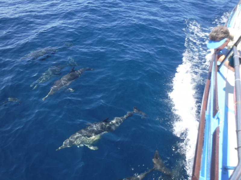
1645 and 60 NM on the passage between Wineglass Bay and Eddystone Point.12.7 NM to go. Off the entrance to St Helens. Motor sailing at around 6 knots. Although not much pure sailing it is a perfect day. Plenty of Common Dolphins to keep us amused.
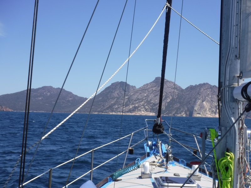
12.4 NM from Bryans Bay, Freycinet Peninsula to the infamous Wineglass Bay. The Hazards are bearing down on us. This was our first landfall in Tasmania February last year.
36.8 NM from Shoal Bay, Maria Island to Bryans Bay, Freycinet Peninsula. Passed close by to Isle Du Phoques to observe hundreds of seals. Also diverted to check out Hen and Chicken Bay on the southern coast of Schouten Island. Dramatic, narrow and a roll running in. Fancied a good nights sleep so vacated and headed for Bryans Bay.
32 NM from Slopen Main, through the Dennison Canal for the fourth time and on to Shoal Bay on Maria Island. Caught two Flatheads and one squid (Calamari) en-route for dinner. Beautiful sail between 5 and 7 knots. Taranui is responding to her recent anti foul.
29.3 NM from Kettering to Sloping Main in Fredrick Henry Bay. Boat speed between 6 and 10 knots. Taranui much happier now after her "bum cleaning"!
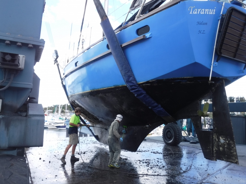
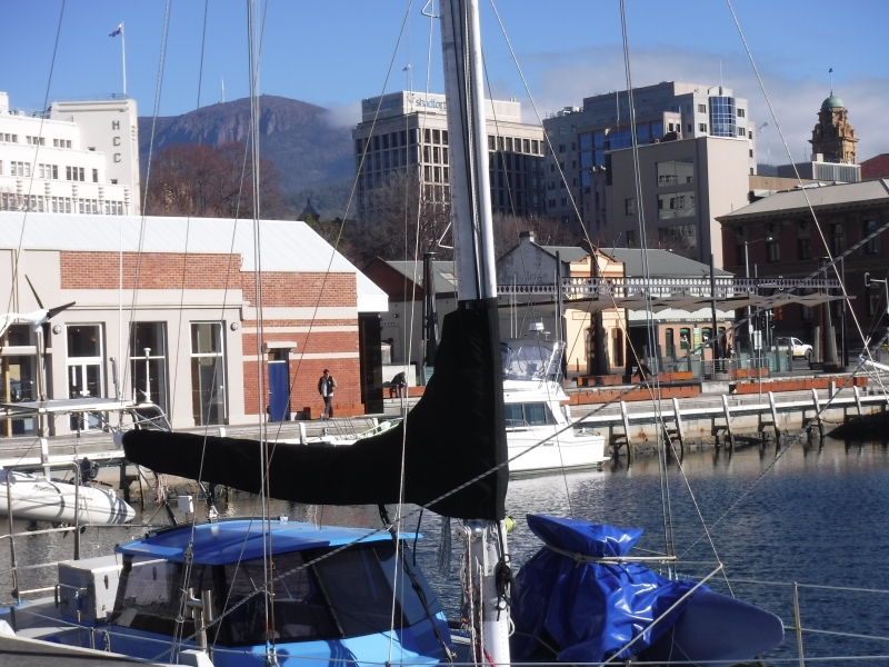
Hoisted up on hard-stand yesterday at Kettering. Anti-foul, replace anodes and have fitted new through-hull transducer. Last haul-out was in Whangarei 21 months ago.
37 NM yesterday from Dunalley through canal. Short stop-over at Lagoon Bay before heading to the Duckpond. Arrived approximately 2100.
From Shoal Bay to Dunalley stopping en-route to catch a few Flatheads for dinner. 18.1 NM. Bike ride to Marion Bay tomorrow morning before passing through the canal at high water approximately mid-day.
South end of Shoal Bay, Maria Island
Sailed yesterday from Crocketts bay, Schouten Island to Prosser Bay stopping at Darlington Harbour on Maria Island for a few hours on route.
Schouten Passage shuffle yesterday from Crocketts Bay on Schouten Island to Bryans Corner on Freycinet Peninsula; 2.8 NM. Cowering from the gale force winds that the Sydney to Hobart leaders are using to potentially shave hours off last years record. They flew past us a few hours ago at between 20 and 30 knots!!
In Crocketts Bay, Schouten Island. Climbed the granite peak Bear Hill.
After fuel and water in Triabunna six hours to Bryans Bay in the Schouten Passage, Freycinet National Park.32.7 NM. 6km return walk to Cooks Beach and swim.
From Shoal Bay, Maria Island to Prosser Bay (11.3 NM) ready to motor into Triabunna tomorrow for fuel and water.
17.9NM from Dunalley and back to Shoal Bay, Maria Island for the third time..
Back on-board Taranui after 16 days exploring the inland world heritage wilderness areas. Over 200 km on "the pegs".

5.6NM from Connelly's to Dunalley via the Denison Canal.
8.1 NM from Lagoon Beach to Connelly's.
Left Constitution Dock 0900. 26.2 NM to Lagoon Beach in Frederick Henry Bay. Beautiful white sand beach.
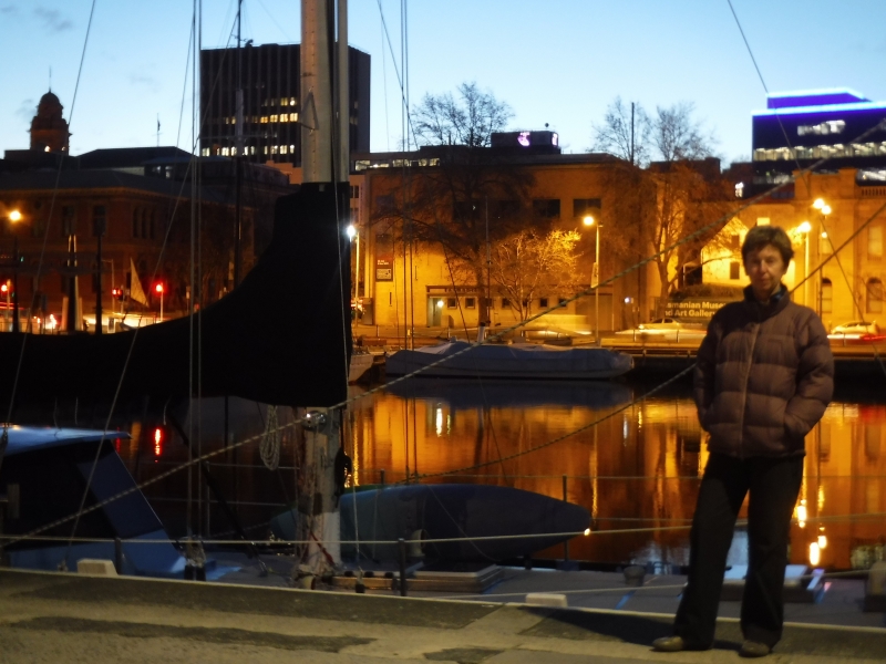
Home Alone in Constitution Dock!!
Hilary flew back to Nelson, NZ for two weeks for a catch-up and our visitors dropped off at the Hobart airport this morning.


23.7 NM from Shoal Bay, Maria Island to Connellys Bay, Fredrick Henry Bay via Dennison Canal. Using the Canal reduces the distance to Hobart by approximately 40NM.
Darlington, Maria Island again with visiting nephew and fiancée. Up onto Bishop and Clerk again yesterday.
Back on MAST mooring in Prosser Bay.
Whalers Cove for two nights as part of Maria Island circumnavigation.
In Shoal Bay, Maria Island. The depth in the Bay is a fairly consistent 4 metres apart from "The Hole" which drops to 9 metres and easily seen on the google map. Climbed the peak Bishop and Clerk today. Spectacular!!
Avg: 5.2knts
24hr: 124.8nm
Encampment Cove sheltering from last nights strong westerly wind. Now veered to the more favourable NW. Continuous equinoctial winds all around the clock lately with ccasional light winds and variables.
In "The Hole", Shoal Bay (9 metres) for a few Flatheads for dinner. Quickly successful!! Flatheads are great eating and put them up there with NZ Blue Cod. Apart from "The Hole", Shoal Bay is consistently about 4 metres deep.
Avg: 30.7knts
24hr: 735.6nm
Beaut sail from Darlington Harbour back to Shoal or Chinaman Bay. Magic moonrise.

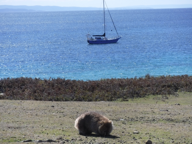
In Darlington Harbour on Maria Island for the day before sailing 8NM northward to anchor in Shoal Bay again for protection from the 20 to 30 knot NE forecasted. Walked the Fossil Cliff and Painted Rocks circuits as well as snooping around the historic penal colony. many Wombats and other wildlife.
Departed Triabunna marina this evening for Prosser Bay. On another of those wonderful MAST (Marine Safety Tasmania) free moorings. Smooth sea, no wind and a full moon. Absolutely gorgeous! Back to Maria Island tomorrow.
Made a 12NM dash across Mercury Passage and into the very sheltered Triabunna Marina on mainland Tasmania to resupply and replenish while a low pressure system passes over. On a brand new marina dock not shown on Google Earth. Back out to Maria Island for plenty more exploring tomorrow.
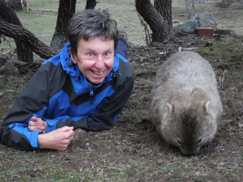
In Chinamans, Shoal Bay on Maria Island in approximately 3.5 metres of crystal clear water.. This Island is absolutely stunningly unique. Zillions of Wombats.

In beautiful Canoe Bay in Fortescue Bay tucked in behind a wreck in about 3 metres of crystal clear water. 20km walk above the dolerite sea cliffs to Mt Lichen and return. Stunning!!
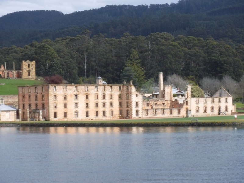
After two days of stories of escaping convicts, punishment strategies and solitary confinement at the most fascinating Port Arthur Penal Colony Historic Site, Taranui is now anchored at the most delightful Ladies Bay. Calm, sheltered clear water, excellent holding in 4 to 6 metres with a beautiful beach back dropped by mature Australian trees and the diesel heater murmuring away providing dry heat; it is as good as anywhere to enjoy a breakfast of banana fritters and coffee during the present frontal system passing!!
40nm from Duckpond on Bruny Island to Port Arthur.
Left Constitution Dock this morning for Deep Bay in Cygnet. Stopped off en-route at the Neck, walked over to other side to walk along the Adventure Bay beach.
Still in Constitution Dock and will be for another few days. Been active in land based activities such as mountain biking and walking.
18NM from Duckpond and into Constitution Dock, Hobart. The bridge has to be lifted then into a "large swimming pool" only 100 to 200 metres from the Museum, Nautical Museum, Mawson's replica hut and more. Easy walk to everywhere in the city. A prime piece of real estate at minimal rent. Be here for 12 days.
Back in Duckpond. Quack! Quack!
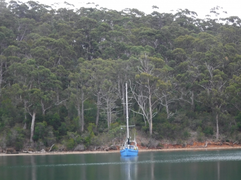
Day visiting the historic site of Tasmania's Quarantine station. Back on board Taranui just on dusk with diesel heater burning ready for another cozy evening. Were in Duckpond last night but internet signal "touch and go" so wasn't able to post position.
Another visit into Port Esperance, Dover. Anchored next to picturesque Rabbit Island.
Back from UK (flying) a few days back so on mooring in Cygnet. However, did anchor over at Deep Bay last two nights. Moved back over to mooring this morning. Diesel heater humming away keeping interior cozy!!
Back on rented mooring in Cygnet.
Arrived Deep Bay, Cygnet from Duckpond via Kettering for fuel; 25.3NM. NW 10knots and slight sea. Water temperature now 12 degrees.
Back in the Duckpond after a week snooping around Hobart on the bikes. Museums, Mawson's replica Antarctic Hut, ride to Kingston, Salamanca Saturday market ++++
Back on the Sandy Bay mooring in Hobart after two and a half months. In for some resupplying and the dentist before heading slowly back to Cygnet.
Moved into Duck Pond this morning for better protection from the light southerly and to launch the bikes for a 25km circular ride to northern tip of Bruny Island; Dennes Point.
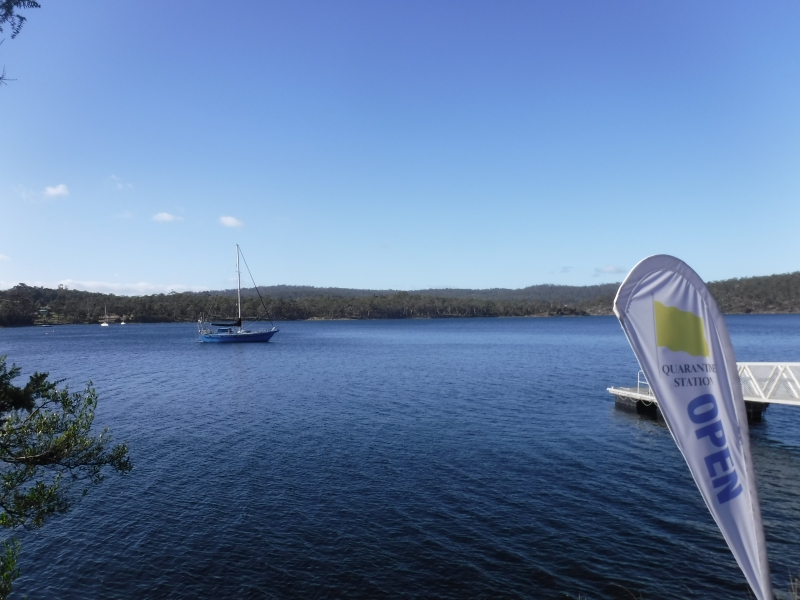
From Snake Bay to Kettering for fuel, water and an engine oil change on the visitors day berth. Then over to Quarantine Bay to anchor just on dark. Had some incredibly calm, windless and sunny days.
After 3 days of bike riding from Simpson Bay totaling 150km we have moved 6.4 NM northward to the delightful Snake By anchorage.
Moved Taranui close to a public boat ramp so we can launch the bikes!
17.1 nm sail from Cygnet to Aitkens Point, Simpson Bay close to the neck between south and north Bruni Islands. Tranquil millpond conditions in here.
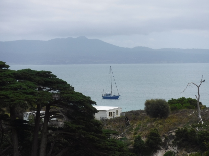
On rented mooring in Gardners Bay in Cygnet. Taranui will be based here for local sailing (SE coast) and so we can do some land based trips.
Cool light southerly with leaden sky assists 18.7nm passage from Deep Hole in Southport to Deep Bay in Cygnet.
A very relaxed 1.4 nautical mile passage this morning across Southport to Deep Hole for better protection from the predicted post frontal southwest. It has a very tropical look here with its clear water, white sand and native forest. That's where it ends though because the water temperature is 14 degrees celcius.
Headed a little further north to Southport this morning after a couple of recuperating nights from the west coast passage at Coalbins, Recherché. Increasing northerlies today ahead of a frontal system. Looks like we may be in for another high next week.
Arrived in Coalbins Bay in Recherché Bay at 1000 after motor-sailing entire 144NM passage due to a "fat high" parked over us. However beautiful sunset, sunrise, coastal scenery (especially south and southeast capes) and the southern lights (Aurora Australis).
Avg: 3.3knts
24hr: 79.3nm
Anchored in Pilot Bay after navigating back out of Macquarie harbor through "Hells Gate". At the "starting blocks" to sail back to Recherché Bay, SE Tasmania (144 NM). Will leave at 0700 tomorrow and should arrive in Recherché Bay mid-morning next day. Walked the 2km to the most magnificent Cape Sorrell Lighthouse from Pilot Bay. Supposedly the second highest in Australia with the structure standing 53 metres.
Avg: 284.4knts
24hr: 6825.2nm
Strahan in preparation for 170 NM coastal passage back to Recherché Bay, SE Tasmania. Depart Tuesday early morning.
Explored historic Sarah Island. Was a penal island.
Ledger Point Bay in Macquarie Harbour
Kelly Basin in Macquarie Harbour
Sir John Falls
Snag Point
Heritage Landing
After a fortnight in Port Davey climbing peaks, walking, kayaking gorges and enjoying the tranquil waters of this World Heritage Wilderness Area we have arrived in Strahan in McQuarie Harbour. The entrance into the Harbour is called Hells Gate and was particularly interesting and scenic.
Bramble Cove.
Scooners Cove
Two nights at Carvers Point to explore 5nm up Port Davey river by dinghy towing kayaks to access Hells Gate gorge with rapids.
Claytons Corner at mouth of Melaleuca Inlet. From here we climbed Mt Beatie and kayaked 4nm up the Melaleuca River to the only bush settlement in Port Davey. Airstrip, tramping hut, bird hide and museum here. Also dinghed up the river on another occasssion to walk 24 km return walk on South Coast trail to Coxes Beach on the south coast.
Moulders Inlet. From here we climbed Kroanna Hill.
Iowa Bay is like a cute little holding pen. From here we dinghy across channel to start of trail to climb Mt Rugby.
Anchored in Wombat Cove in Port Davey after 70nm motor.sail from Recherce. Sunny day.
Sailed approximately another 20NM south in the D'Entrecousteaux Channel to Port Esperance anchoring adjacent to Rabbit Island. Passed many salmon farms before entering this beautiful bush clad bay with Mt Hartz Peak (1254m) in the Hartz National Park as a backdrop.
Vacated Prince of Wales marina after a week of giving Taranui some TLC including getting her heat exchanger raw water flowing more efficiently, main sail repair and a few other fix ups which always take longer than expected. However all done and motored out past the docked Queen Mary 2 and twenty nautical miles onward to Quarantine Bay stopping at Kettering Marina en-route for fuel.
Moved into Prince of Wales marina for probably one week so we can easily tend to a few boat tasks mixed with some "playtime" as well. Rode the bikes up to Tolosa Park this evening for the "Symphony Under the Stars" featuring the Tasmania Symphony Orchestra with a very perky Jessica Cottis as conductor and guest saxophonist Amy Dickson. Rhk Goddard a New Zealander was the compere. World class performances.
Sailed into Hobart behind the Wooden Boat Festival Sail Parade and anchored in Sandy bay, Hobart. have since moved onto a nearby mooring. Although Taranui is steel we felt it appropriate to be part of the fleet as we do have NZ native Rimu and Totara inside!!
Shifted to Duckpond after this mornings southerly change. Yacht dragged anchor on to us as well in Quarantine resulting in a small scrap on starboard side. Taranui doesn't deserve that kind of treatment!!!
Lowered anchor in Quarantine Bay, Barnes Bay 2100 yesterday after a 109 NM passage from Wineglass Bay. Incredible coastal scenery passing through "the hole in the wall" and rounding Cape Raul. Wooden boat festival atmosphere already in the Bay.
Crossing Stormy Bay for north Bruny Island and down D'Entrecasteaux Channel to potentially anchor in Quarantine Bay. Left midnight from Wineglass Bay to get in before two days of mischievous weather. Very nice day today and passing through some amazing landscapes. Bi-annual wooden boat festival begins Friday.
Arrived Wineglass Bay, Tasmania from Eden 0320 this morning. Overall an excellent and varied 329 nautical mile sail taking 55 hours (2 days 7 hours). Left Eden 2000 Thursday 2 Feb motor sailing first 70NM before the predicted SW was strong enough to sail. The SW headed us eastward off the rhumbline by 25 NM before the wind became westerly, then north westerly so we could lay toward the waypoint off Wineglass Bay. This was excellent fast sailing which became more thrilling passing the wind constricted Banks Strait with winds in excess of 40 knots and boat speed between 7 and 10 knots with storm tri and staysail set. Eased later in the evening and motored last 17 NM. Wineglass Bay is stunning with its white sand beach, bush and granite rock formations!
Well sailed, happy
Avg: 2.7knts
24hr: 64nm
Arrived in Eden at 0800 after a 23 hour 130 NM sail from Jervis Bay. Some motor sailing but predominantly good sailing with the wind 10 to 20 knots NE and N. So we are now in the "starting blocks" for Bass Straight along with at least three other yachts
12 Nautical miles off the coast and ENE of Bermagui heading for Eden; the starting blocks for Bass Strait! 50 NM to run. Good sailing through the day with 10 to 15 knots NE. 20 to 25 knots northerly was forecasted for now but only experiencing light winds hence motor sailing between 6 and 7 knots,
Arrived in Jervice Bay 0600 after a benign 89 nautical mile light northerly wind passage. Dolphins led us to the mooring area!! The Bay is pristine with clear water and white sandy beaches with courtesy moorings so that the sea grass seabed is protected against anchor damage. It is part of the Booderee National Park.
Anchored in Rose Bay in preparation for a Sydney departure and a sail to Port Hacking tomorrow.
Anchored by the Roseville Bridge in Middle Harbour. Twenty minute walk to Killarney Heights Coles Supermarket today to re-provision. Running low on Rum and Raisin chocolate and Gingernuts!! Good shelter from tonight's fresh southerly.
Changed anchorage to Bantry Bay in Middle Harbour both for a scene change and to access further walking tracks in Garigal National Park. May as well stay tight in Sydney Harbour, in particularly in the very protected waters of Middle Harbour, to wait for the weather to settle further south. A welcome southerly change this morning to help cool the air temperature.
<p>Hi,</p>
Approximately 5 NM from Manly and passing under a time-tabled opening bascule bridge we are now anchored in Castle Cove in Middle Harbour, Sydney Harbour. Surrounded by a national park and tracked Australian native bush and the water temperature 25.5 degrees C we are yet again in another yacht cruisers paradise.
Still in Q beach Manly and not moving anywhere today. Predicted maximum temperatures for Sydney today is 39 degrees and 41 degrees in the west. The local radio said to be aware of "heat stress" today so doing our best to avoid it by doing little except frequent immersions off the swimming platform into the 22 degree water! Temperature on Taranui at 0830 was 30 degrees. Managing "heat stress" ok so far!
Back to our Manly anchorage thinking about starting south again.
Re anchored this morning from Rose Bay to Blackwattle Bay virtually in the heart of the city. This move involved passing under the Sydney Harbour Bridge, through the permanently opened Glebe Island Bridge and under the modern Anzac Bridge before anchoring opposite "The Fish Market".
Moved from Athol Bay where we viewed New Years fireworks to Sirius Cove. On the bikes for a cruise around "bike friendly" Sydney which included crossing the harbour bridge. Returned to Taranui resting in beautiful Sirius Cove and then re anchored in Rose Bay 2.5 nautical miles to the south east. Southerly forecasted tonight.
Happy New Year with continued
Moved to Athol Bay in preparation for the viewing of the renown Sydney Harbour New Years eve fireworks and other entertainment. Apparently not to be missed. We are not the only ones here!!! Far removed from the rural islands in Vanuatu!!
This mornings passage entailed weighing the anchor and heading south-east by approximately 200 metres to pick up an available 24 hour visitors mooring next to the gorgeous Quarantine beach with cold rinse off shower. Temperature forecast is a high of 35 degrees today!
Back in Manly after a day's "harbour cruise" with Nelson friends to the opera house and bridge.
Anchored next to the "Opera House" for lunch. Not sure our "cracker biscuit" lunch matches the ambience!!!
Twenty three nautical miles from Refuge Bay to Manly in Sydney Harbour. Pleasant light wind sail along golden sand beaches and housing.
75 nautical miles from Port Stephens to Refuge Bay, Hawkesbury River Mouth. Non descript sail with its lack of wind and swells but what an ending. This is Australia's answer to NZ's Marlborough Sounds with its labrynth of waterways penetrating into the native bush. The NSW Alan Lucas Guide Book states ""Described by some long distance sailors as the finest anchorage in the world". The anchorage is engulfed by Ku-ring-gai - Chase National Park. Suppose there will be a bit of exploration tomorrow!
Departed from Dunbogan in Camden Haven at 0330 wearing jacket and beanie!!! Arrived in Shoal Bay in Port Stephens at 1630. Light northerlies but picked up as we approached Port Stephens. A skipjack tuna struck the line and was successfully decked.
Avg: 2.6knts
24hr: 61.9nm
Crossed the bar into Camden Haven at first light this morning. Haven is very apt. Two milestones while sailing here. Crossed into the 30 degree latitudes and transited from the Coral Sea into the Tasman Sea,. On a mooring at Dunbogan and will probably be here exploring through to Monday next week.
Avg: 4.2knts
24hr: 100.7nm
Fifty seven nautical miles to run for Camden Haven. Excellent sailing at the moment with north-east wind and sitting on the East Australian conveyor belt adding about two knots to our speed. Currently pacing along at eight knots. Will arrive too early at this rate!! High tide at the bar is 0830.
Moved back to Iluka late this afternoon ready for an early start for Camden Haven 140 NM away. Had a fantastic time over two days exploring Yamba by mountain bikes. Visited the excellent Yamba museum as well.
Moved 2 Nautical miles from iluka to Yamba marina. It is so cute and snug here. Unbagged the mountain bikes and had a good look around Yamba including Yuraygir Nation Park.
Peter didn't let us through the "Pearly Gates" (Harwood Bridge lift) this morning as planned so anchored next to Uigundai Island for 6pm when he will hopefully remember this time. Maybe the real Messiah has informed Peter not to let Brian's through the Pearly Gate subsequent to Monty Pythons "Life of Brian" because they are "nothing but naughty boys". If this is the case then he needs to "look on the bright side of life" and just open the bridge when planned!! Will anchor at Iluka after passing through the bridge this evening.
Seven more miles downstream and we are back at the delightful Scottish Heritage settlement at MacLean. On pontoon berth with yacht Zefr 1(video technology company) from Coffs Harbour. Have organised for the "Pearly Gates" (Harwood lifting bridge) to open for us at 0630 tomorrow. Will then be in Yamba for a few days.
Further down river and now on the seaward side of the shallowest area we are anchored at Lawrence.
Approximately 6 nautical miles down river from Grafton is the quaint little settlement of Ulmarra. Taranui lies alongside a newly established (2011) floating dock provided by the NSW Government's Better Boating Program. 24 hour free berthage and is right by the main centre of Ulmarra.There are a few of these along the river's edge. Temperature in the relative coolness inside Taranui is 35 degrees!!
Same position as last night but start heading slowly back down the river tomorrow. Grafton is renown for its beautiful big bushy trees (a lot of fig trees) and old buildings and we can confirm that after an explore through the town with a population of 17 000. Very hot today (mid thirties) but easy to slip off Taranui's boarding platform into the 26 degree fresh water to cool off.
Twenty three more nautical miles upstream from MacLean on the Clarence River and we have arrived at Grafton. Tall mast yachts can go no further as we are anchored next to a combo road and train bridge with no budging bridge part to allow us through. Trip up the river was absolutely beautiful but Grafton doesn't compare with MacLean.
left Iluka in good time to be at the organized 1030 lifting of Harwood bridge so we could continue up the Clarence River as far as Grafton. Have anchored on-route at the Scottish Heritage town MacLean.
Haven't moved today cause we only just arrived here. Went to bed for a few hours after anchoring at 5am. Woke gently with late good breakfast and coffee before adjusting all clocks, watches and GPS for NSW daylight saving. Reconnaissance on shore before purchasing our $5.50 fish (mullet) and chips and ate them from the shore while watching all the prawn boats leave for their all night fishing.
Avg: 3.7knts
24hr: 89.8nm
Anchored in Iluka in the Clarence River just on first light. Clear crisp sky post thunderstorms last night.
Avg: 6.7knts
24hr: 160nm
2300hrs NSW Australia Daylight saving time. Overnighter to Iluka opposite Yamba in Clarence River. Just experienced an incredible two hour lightning storm!!! We are now on the East Australian Current pushing us along at between 2 to 4 knots so will be arriving before light so have slowed Taranui down.
Avg: 5.6knts
24hr: 135nm
Avg: 3.3knts
24hr: 78nm
In "Bums Bay" next to the Gold Coast Seaway from where we will leave late tomorrow for the 100 NM sail to Yamba.
Another early start to sync in with high tide to pass over more shoals and head a short distance south through the Canaipa Passage to anchor at Junpiun Pin along the northwest tip of South Stradbroke Island.
Early morning start (0500) to catch the height of tide over very shallow shoals. Anchored at Slipping Sand.
Another night at Canaipa Point although we have moved approximately 200 metres into a better spot after a yacht left this morning.
Twelve nautical miles from Peel Island to further into the depths towards the Gold Coast seaway. Minding our feet and heads as Taranui weaved amongst the shallow shoals and passed under one overhead power cable 20 metres above MHWS. We took the liberty to recheck the height of our mast above water level prior to departure finding we have approximately three metres of leeway depending on height of tide. Delightful anchorage at Canaipa Point in the Canaipa Passage.
From Tangalooma to north side of Peel Island, Moreton Bay - 21.8 NM. SE wind 15 to 20 knots.
Another night at Tangalooma on Moreton Island. Can see the lights of Brisbane to the west. Snorkeled the thirteen ex harbor board wrecks deliberately put here between 1964 and 1984 as a protective reef from westerly's. Apparently it doesn't work as they offer no protection at all. So!! that was a good idea. However they do provide interesting easy wreck snorkeling.
39 nm sail from Mooloolaba toTangalona on west side of Moreton Island in Moreton Bay. Cruise ship anchored out from us.
No big mileage today. Shifted from the indifferent anchorage in the river at Mooloolaba to just downriver to the marina. Very cozy!! Will be in marina till at least Saturday.
Left Pelican Bay 0530 today to pass safely through Wide Bar and 62 nautical miles on to Mooloolaba. Anchored in river at 0530. Very pleasant days sail.
In Pelican Bay next to Inskip from where a vehicular ferry is continuously ferrying people and vehicles to and from Fraser island. A gorgeous sand cay is only metres away where pelicans chill out. Pelican Bay is also popular as a "holding pen" for boats readying to cross the nearby notorious Wide Bar to the open sea which is the main reason we are here. Four other yachts also anchored here. Plan to cross the bar early morning and head to Mooloolabar
approximately 56nm south.
Weaved our way 18nm around shoals from Garry's anchorage to Tin Can Bay on the mainland but still in the Great Sandy Strait.
Yep!! In Garry's Anchorage again tonight. Caught up on a few tasks and went kayaking around Stewart Island this afternoon. Delightful; returning on sunset.
In Garry's anchorage again this evening. Gusting 30 knots northerly at the moment. Took a walk through the enchanted forest on Fraser Island this morning. Heard Dingoes in the distance.
Interesting and enjoyable navigation through the shallow shoals in Great Sandy Strait to end up at Garry's anchorage in the narrows between Fraser and Stewart Island.
Anchored at southern end of Booker Island in the Great Sandy Strait. Sheltering from a "sporty" northerly wind. South white cliffs on Fraser island to our east.
Another night at Kingfisher Bay before heading into the shallows of Garry's anchorage tomorrow.
Overnight sail (100NM) from Lady Musgrave reef lagoon at the very south of the Great barrier Reef to Kingfisher on the inland passage between Fraser Island and the mainland. Fraser island is the largest sand island in the world (120km by 15km) and the only place where rainforest grows on sand. Most of the area is National Park and in 2004 the 90km Fraser Island Great Walk was opened.
An overnighter from Middle Percy Island to Musgrave Reef. Love it here. The lagoon is full of turtles copulating and females egg laying on the beach at night. Many fish and turtles when snorkeling.
Avg: 15.2knts
24hr: 363.9nm
Avg: 2.8knts
24hr: 68.4nm
Excellent day! Sailed 65 NM to Curlew Island which is absolutely beautiful. Only ones here. Had one hour before dark to go ashore. Pulled the tender onto the beach just where a turtle had waddled up the beach, did its thing with the eggs and waddled back down again. Hence two tracks. To top the day off we hooked a Mackerel.
Avg: 2.8knts
24hr: 67.4nm
Gathered in approximately 40 NM of south today and anchored at Goldsmith Island for the night ready for another early departure in the morning. Sailing today was "dreamy".
Heading south 7 knots in 15 knot easterly. Tidal stream assisting.
Had our fill of Airlie Bay. Refueled and watered in the marina this morning before sailing around to Moonlight Bay on the South Molle Island ready for a departure south around Sunday. Northerlies predicted starting Monday.
Anchored out from Airlie Beach in the Whitsundays. Walked up to Honeyeater lookout for magnificent outlook over some of the islands.
Avg: 9.6knts
24hr: 230.2nm
ETA Mackay early Sunday evening
Avg: 5.9knts
24hr: 142.5nm
will have pretty much the same conditions all the way to Mackay so they are cheerful with the very pleasant sailing
Avg: 5.8knts
24hr: 138.2nm
ETA Sunday. Report via Blowin Bubbles. Thanks Kyle
Avg: 5.2knts
24hr: 125.2nm
What great conditions to meander home in.
Avg: 10knts
24hr: 240.7nm
LOOKS LIKE AN ETA OF LATE SATURDAY
Hi Guys
Avg: 3.7knts
24hr: 88.4nm
good progress and great to talk to as they have a strong radio to go with Hillary's good clear voice. ETA Sunday which Brian is happy with as good wind direction then
they are about 20m NW of top of espiritu Santo. beautiful conditions. Great clear signal from Hilary this morning. We wont be on the radio tomorrow so next update will be Monday
Anchored in Sola, Vanua Lava, Banks, Vanuatu
No blogs available for this yacht.