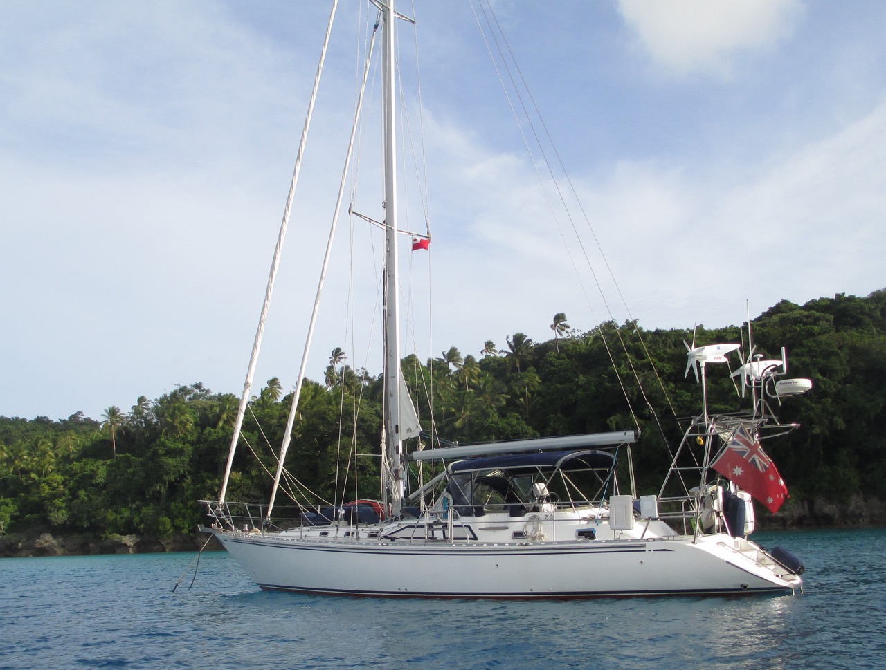
Iolea

Fri Oct 4 8:59 2019 NZDT
GPS: 48 39.150N 123 23.670W
Run: 13.8nm (25km)
Weather: overcast with light rain and little wind

Yeah we've arrived at Port Sidney Marine, which will be our home for the next six months. Sure pleased to be in here, this is a lovely marina, with good facilities and a top location. Now we're back in civilisation we plan to go to the cinema, also to see a concert, we've bought tickets to see John Fogerty play in Victoria.


Thu Oct 3 10:35 2019 NZDT
GPS: 48 47.960N 123 11.286W
Run: 42.6nm (77.1km)
Weather: SE 15-20kts overcast with light rain

Pulled into Lyall Harbour yesterday. This is where we will spend our last two nights on anchor before heading into Port Sidney Marina where Iolea will remain for 6mths. Sure looking forward to going to the Saturna Pub here on the SW point of this anchorage for dinner, the guides say the pub is well respected for the quality of it's fish & chips and lamb burgers; guess what we're having for dinner tonight.


Tue Oct 1 14:54 2019 NZDT
GPS: 49 10.520N 123 55.973W
Run: 29.3nm (53km)
Weather: clear skies with no wind

Well we are now anchored off Vancouver Island in an anchorage called Nanaimo Harbour. This feels a bit like Sydney Harbour back home as it is back in the big smoke. Today's plan is to finally get in the water and change those zincs as the water is a cosy 12 degrees rather than the usual 8 degrees we've b been experiencing.


Mon Sep 30 14:51 2019 NZDT
GPS: 49 29.810N 124 21.399W
Run: 46.9nm (84.9km)
Weather: clear skies with little wind

A functional stop tonight after leaving Desolution Sound to break up the trip south. I've never seen so many jelly fish before. We belatedly realised that was why two local boats had anchored further out where there were no jelly fish.


Sun Sep 29 14:37 2019 NZDT
GPS: 50 08.482N 124 41.202W
Run: 30.5nm (55.2km)
Weather: clear skies with little wind

Well today intense as we traverse the holy trilogy of dangerous rapids around the Cordero Channel being - Dent Rapids, Gillard Passage & Yuculta Rapids. Timing is absolutely critical here as these rapids run up to 14kts and there are vicious eddies due to sink holes, your can imagine what it is like when there is wind against tide! There is a story of a fishing trawler getting one of these wrong and getting caught out badly. In rough conditions when there is a lot of white water there is more air in the water, which means that your boat is not as buoyant and as such sits lower in the water with less freeboard making it easier for water to get into your boat, the air in the water also means you do not have as much control as your propeller does bite as well nor does your rudder which combined affects speed and steerage. On a fateful day that trawler got an eddy so badly wrong that it was capsized. In our case we were anxious to ensure we were early rather than late as when your are heading east the slack water is later with each rapid you go through, if you get the first one wrong you are toast. In our case we were indeed early pushing into 5kts of current, even though it was well after the change of tide. But we managed to get through without issue making the next two rapids easier to traverse. After that we wanted to anchor in Pendrell Sound, not for the beauty as most people argue, rather in our case it was because it is meant to have the warmest water in Canada which meant I could change our zincs. I was hoping for 13 degrees or more rather than the 8 we've been experiencing, alas it was too deep to anchor and had a varying rocky bottom with no other option as a fish farm was placed in the only other possible anchor spot. So we moved onto down to Prideaux Haven which was lovely.


Sat Sep 28 14:28 2019 NZST
GPS: 50 20.328N 125 18.202W
Run: 109.6nm (198.4km)
Avg: 4.6knts
24hr: 109.5nm
Weather: clear skies with 20-25kts from the north

Today we tackled the top half of the notorious Johnstone Strait where 4-5kts currents normally hit 4-5kts, which in a wind against tide scenario would be out right dangerous. Fortunately for us we had a 20kt wind and tide in the same direction so we averaged 10-11kts SOG motor sailing most of the day allowing us to cover good mileage and make it down to Cameleon for the night which had great wild life including bears.


Fri Sep 27 14:27 2019 NZST
GPS: 50 51.444N 127 39.902W
Run: 43.7nm (79.1km)
Weather: clear skies with little wind

Well after crossing Queen Charlotte Strait in what we expected to be good sailing conditions which were favourable current, favourable 2-3m swell, and 20kts of wind from behind, all being in the right direction we now know why locals fear this crossing so much. The sea state was an absolute shocker. Next time we do this I think we will follow the local fishing boats and hug the coast rather that traverse straight across. That said, it is nice to have finished the crossing and be safely on anchor in Port Alexander.


Thu Sep 26 14:20 2019 NZST
GPS: 51 29.244N 127 45.629W
Run: 11.2nm (20.3km)
Weather: light rain with a gentle southerly

Our staging point for tomorrow's crossing to Queen Charlotte Strait is Fury Cove. This is a modestly sized anchorage with good anchoring depths and great vista through various cuts to the ocean and some sandy beaches. Its a great place to stage for the crossing.


Wed Sep 25 14:17 2019 NZST
GPS: 51 38.949N 127 45.630W
Run: 36.8nm (66.6km)
Weather: clear skies with little wind

We decided to anchor in Joe's Bay tonight which is a bomb proof tiny little deep water anchorage. What is bizarre about this place is that the maximum ebb tide out of the anchorage occurs at the top half of the flood tide because there is a large lake that feeds a river through the bay, but the river dries at low so there is no flow. Once the tide comes in though it starts to run strongly and due to the rapids the suds that flow into the bay are like ice bergs, you feel like your boat is sitting in one giant bubble bath. This is definitely an anchorage that we would recommend as a must visit.


Tue Sep 24 14:20 2019 NZST
GPS: 52 08.672N 128 04.627W
Run: 27.1nm (49.1km)
Weather: light rain with a gentle southerly

Well today's passage was real heart in your mouth stuff as we had to traverse Perceval Narrows which is unpassable for most boat at anytime other than slack tide, which of course never occurs on time.  Fortunately we had a 85ft power boat attempt to go through 30mins before us only to turn back at the sight of standing 3m waves that had no backs and were breaking in the pass.  45mins later it was amazing how much it settled, not that the pass was great but at least it was doable.  Tonight's stop was in a large well protected anchorage called Shearwater which boasts a resort that is well regarded. We didn't think much of it as it lacked intimacy, was not that pretty and there was too much noice from generators ashore.


Mon Sep 23 14:12 2019 NZST
GPS: 52 30.848N 128 17.321W
Run: 47.8nm (86.5km)
Weather: overcast with moderate southerly breeze

Tonight's stop was in the well protected Rescue Bay. This is a large anchorage that could take a lot of boats.


Sat Sep 21 14:10 2019 NZST
GPS: 53 09.629N 128 41.671W
Run: 54.1nm (97.9km)
Weather: raining with 25-30kts from the SE

We needed good protection from a forecast 30kt blow from the SE with heavy rain so we pulled into Butedale to tie alongside the public dock for two days to let the weather pass. A functional stop with an impressive nearby waterfall but overall not that pretty; we did see a black bear on shore though which was a bonus.


Fri Sep 20 14:08 2019 NZST
GPS: 53 39.594N 129 42.384W
Run: 52nm (94.1km)
Weather: Foggy with little wind

Our first stop since leaving Prince Rupert is a tiny little anchorage half way through the Grenville Channel called Exposed Inlet. It is a lovely little anchorage that is well protected against all winds except those with some north in them. This whole Grenville Channel passage is fascinating as the tides meet in the middle and can get quite strong, up to 4-5kts. So the strategy is to time your arrival in the centre so that it coincides with high tide, that way you get a free ride in with a flood tide and a free ride out with an ebb tide. Trouble is that like one local put it, the actual current you experience varies so much from the predictions its almost a random event due to the combined effects of wind and rain on water flows.


Tue Sep 17 9:21 2019 NZST
GPS: 54 19.224N 130 19.190W
Run: 50.1nm (90.7km)
Weather: no wind and clear skies

Woo Hoo! We've arrived in Canada clearing into Prince Rupert. This was the easiest clear in process we've had in 9yrs of cruising, it was all done over the phone. The harbor master's office is new here which means the bathrooms, showers and laundry are also new making this the best facilities we've seen since the recently redeveloped Opua Marina in the Bay of Islands NZ, and quite the contrast to what we saw in Sand Point Marina along the Aleutian Islands.


Sun Sep 15 9:15 2019 NZST
GPS: 54 57.025N 130 56.463W
Run: 40.4nm (73.1km)
Weather: light rain, overcast

Wow what a sensationally well protected anchorage, and a great place to cut the passage from Ketchikan to Prince Rupert in half and avoid an overnight passage. This bay is the officially approved spot to anchor when cleared out and in-between the USA and Canada. The route into this anchorage is super tight, not heart in your mouth stuff but definitely tight, and without any chart datum, but locals and cruiser guides assured as we could get in without issue, and we're so pleased we're here.


Sat Sep 14 9:12 2019 NZST
GPS: 55 21.049N 131 41.119W
Run: 35nm (63.4km)
Weather: cloud, fog, rain

This was a quick one night stop to clear out of USA, do laundry, reprovision, drop off garbage, and have a meal ashore. Not a place that appeals to us as it is essentially a cruise ship town with up to 5 cruise ships at a time dropping off 15000 tourists.


Thu Sep 12 16:07 2019 NZST
GPS: 55 44.375N 132 15.480W
Run: 25.1nm (45.4km)
Weather: rain with 20kts from SE

We so pleased we decided to come into Meyers Chuck to hide from the impending two days for rain and strong SE based winds. We were a little nervous as we have not chart data, but locals assured us it was fine. It is the prettiest of little coves with a small permanent community. Including Steve and his wife Casey. Casey dropped off half a dozen of her famous fresh bakes cinnamon buns this morning, Steve have us a tour up to the Fire Tree, and another local showed us how to skin an otter.


Tue Sep 10 16:04 2019 NZST
GPS: 56 03.856N 131 58.122W
Run: 31.6nm (57.2km)
Weather: showery

Now that our engine is starting perfectly again we headed further south to Frosty Bay for a night, which was a lovely little well protected anchorage.


Mon Sep 9 16:02 2019 NZST
GPS: 56 27.490N 132 23.090W
Run: 39.4nm (71.3km)
Weather: showery

We were lucky to make it out of Thomas Bay as our engine wouldn't start, thought it may have something to do with the 1 degree water we went through. Luck has it that we did get it started eventually. Pulled into Port Wrangell and proceeded to search for why the engine wouldn't start. The starter battery was 6yrs old and appeared to have low voltage so we bought a new one, albeit smaller. Turns out it was not the battery. We were told by an electrician that it was our starter motor, which was only 3yrs old so we replaced it with our spare. Turns out it was not the starter motor either, rather a local mechanic (Chris) discovered that is was merely a poor ground connection, which was of course in an incredibly difficult spot to see and access.


Fri Sep 6 4:54 2019 NZST
GPS: 56 58.603N 132 48.915w
Run: 59.1nm (107km)
Weather: Clear skies, no wind or swell.

We saw no bears in our last anchorage despite having spent two nights in Chaplin Bay; we're starting to wonder about where all the bears have gone. Today we moved down to anchor off the south eastern corner of Ruth Island inside Thomas Bay which is another top spot, one where we got to celebrate Kate's birthday. The water on the way in here was the coldest we've ever seen, the lowest reading we saw was a mere 3.1 degrees celcius. This morning we'll head up to the mud flaps at the face of the receding Baird Glacier.


Tue Sep 3 15:30 2019 NZST
GPS: 57 09.461N 134 21.150w
Run: 18.6nm (33.7km)
Weather: Rain, no wind or swell.

After our short stay at Warm Springs Bay on Baronof Island with the lovely baths we decided to move to Chapin Bay where we intend to stay for two nights and let some foul weather pass by. The guide books say that there is more bears here on Admiralty Island than any other part of Alaska, particularly Grizzly Bears who like to swim to yachts if they get a whiff of food on the boat. So we are hopeful of seeing Grizzly Bears in their element, albeit not swimming out to Iolea for a free feed.


Tue Sep 3 4:24 2019 NZST
GPS: 57 05.320N 134 49.970w
Run: 31.4nm (56.8km)
Weather: Rain, no wind or swell.

We had a leisurely motor sail yesterday around to Warm Springs Bay on Baranof Island. Its immediately obvious how popular this stop is with its lovely bay, impressive waterfall a stone's throw away from the relatively new floating dock and the lodges along the shore. The walk up to the lake and the warm baths did not disappoint nor did the wildlife, we saw a black bear fishing along the shoreline; which made us wonder why we did not bring our bear spray with us when we went on our walk. This morning the rain has set in so we will reconsider whether we want to stay rafted up to our friends John & Ivy on Ruby Slippers alongside the dock or move on top our next anchorage.


Mon Sep 2 4:36 2019 NZST
GPS: 57 28.263N 135 17.305w
Run: 28.7nm (51.9km)
Weather: Clear skies, no wind or swell.

Our friends from Australia (Gudrun & Oscar) joined us at Sitka a few days ago. After painting the town red we pulled out at dawn yesterday for Appleton Cove via the notorious Sergius Channel. Upon arriving here yesterday we were greeted by two large pods of whales feeding. It was one of those scenes where the whales cirles blowing bubbles then all come together at the same time and rise to the surface with mouths agape; very impressive stuff.


Tue Aug 27 4:33 2019 NZST
GPS: 57 03.475N 135 21.328w
Run: 17.5nm (31.7km)
Weather: Overcast with rain, no wind or swell.

We pulled into Sitka today to get the boat ready for friends from Australia who will be joining us on board for a week. This is the most substantive town we've sailed into so far in Alaska. They also have a small cinema which is a real treat for us, assuming they are showing a film we want to see.


Sun Aug 25 15:00 2019 NZST
GPS: 57 28.710N 135 53.629w
Run: 14.7nm (26.6km)
Weather: Overcast with light rain, no wind or swell.

Tonight's anchorage is in Wooded Knoll Cove, which is towards the head of Slocum Arm. Whilst its well protected and seriously pretty we are anchoring in what is essentially one giant rock hand basin. There appears to be no sand, mud, gravel, shale, grass, weed, basically nothing but a smooth hard rock bottom. Fortunately we have benign conditions so 60m of chain with a 100lb bruce is more than enough in 15m of water to keep us held tonight. Interestingly on the way in we thought we saw an uncharted shoal in 120m of water when approaching the northern end of the entrance to the anchorage. We later realised that is was a dead whale that was around 2m underwater lying upside down. Another eye opener was that the Navionics charts were off by a very large margin, and were so for most of the anchorages nearby. If you looked at our tracks on Navionics we have anchored on land. The government charts available via Navionics however were fine, as were the C-Map charts from Jeppersen on our chartplotter.


Sun Aug 25 15:00 2019 NZST
GPS: 57 17.143N 135 33.571w
Run: 18.2nm (32.9km)
Weather: Overcast with light rain, no wind or swell.

Had a fascinating day today. We took a local short cut through the Piehle Passage as a means for shortening our voyage south. When y9ou first look at this passage on the charts your immediate reaction is no way! But when we read a cruising guide and studied it more carefully it not only made sense but it looked like a lot of fun. Suffice to say that it did not disappoint. Whilst it was tight at times with a few very sharp precise turns required it was fine, very pretty along the way, the exit into the ocean was somewhat heart in your mouth stuff though as we had 10ft seas. We're now safely on anchor at the head of St John Baptist Bay, which is our staging point to make the run down Neva Strait and Olga Strait into Sitka tomorrow. Its a nice anchorage with good holding and swing room.


Fri Aug 23 3:54 2019 NZST
GPS: 57 39.739N 136 05.474w
Run: 2nm (3.6km)
Weather: Overcast with light rain, no wind or swell.

We moved onto Klag Bay today, anchoring up in the head of the bay. Whilst the charts have generally been okay around here, with only a few errors, they had an island at the head of the bay on the wrong position, it was 300ft further north and 100ft further west than what the charts suggest. Fortunately the depths and coastline etc all seem to be pretty good. Tomorrow we plan to move around the corner and up into Lake Anna to hide from another pending bout of bad weather.


Thu Aug 22 5:15 2019 NZST
GPS: 57 41.330N 136 06.640w
Run: 4.9nm (8.9km)
Weather: Clear skies, no wind or swell.

We're thoroughly enjoying our gunk-holing down the SE coast of Alaska. Another day another new anchorage, this next one was just a mere 6nms around the corner to Kimshan Cove via a very tight cut which was not much wider than the length of Iolea. Fortunately the charts were good; which was a stark contrast to the last anchorage which didn't show a drying shoal that was so large you needed to ensure you did not swing any closer than 100m to the 5m contour at the head of the bay. Back to Kimshan Cove though, wow what a sensationally well protected anchorage; your only exposed to a NW wind, the bottom is sandy mud and is as flat as a billiard table with very easy 10-15m anchoring depths. We'll just stay here one night though as we do need to make progress south, and there is a lot of wind and rain coming in 2-3 days which will be looking to hide from via an anchorage as well protected as this.


Wed Aug 21 5:03 2019 NZST
GPS: 57 44.698N 136 11.465w
Run: 14.9nm (27km)
Weather: Clear skies, no wind or swell.

The weather improved, as forecasted, so we popped around to Didrickson Bay. This is a well protected anchorage with an abundance of wildlife; we have salmon running up streams, bears, deer and eagles. A fishing trawler came in the following morning and set its net from one side of the bay to the other, its in the process of beginning to bring its net up as I type, it will be interesting to see the size of their catch.


Sun Aug 18 4:33 2019 NZST
GPS: 58 11.738N 136 20.830w
Run: 13.4nm (24.3km)
Weather: Clear skies, no wind or swell of course, but plenty of dense fog.

There is some nasty weather coming so we decided to head into Elfin Cove for a night before moving onto Pelican to hide from the storm. Elfin is a lovely little boardwalk based town that survives on fishing, and tourists in the summer, during winter it has only 6 permanent residents. Its so small there is only one bar and a small grocery store with no facilities other than fuel and water. The outer harbour has a single town dock, which is free. There was plenty of partying going on amongst the fishermen as they had all come back in from out there catching fish.


Sun Aug 18 4:33 2019 NZST
GPS: 57 57.563N 136 13.714w
Run: 16.9nm (30.6km)
Weather: Clear skies, no wind or swell of course, but it is raining and we are in fog again.

To our pleasant surprise we were able to sail the last half of the way into Pelican yesterday. It is another lovely little boardwalk based town, albeit larger than Elfin, that survives on fishing and tourists in the summer. We've been told by locals that we will certainly see bears here down by the bridge and up at the dump. Sure pleased to be here given the weather forecast, which is for winds from the NNE gusting up to 50kts. Wind that strong and from that direction would blow straight into Elfin whereas here in Pelican we are extremely well protected and much further inland. We're keeping our fingers crossed this weather passes through by Sunday night, but according to the EC model there is a chance an even bigger storm gusting from the SW may hit us on Tuesday and Wednesday. So far that second storm looks unstable and may stay further south than forecasted by the EC model. The GFS models says the weather will be fine from Monday on, so we're hoping the GFS is right and that storm does stay much further south.


Thu Aug 15 7:45 2019 NZST
GPS: 58 16.541N 136 41.012w
Run: 140.8nm (254.8km)
Avg: 2.8knts
24hr: 66.1nm
Weather: Clear skies, no wind or swell of course.

We motored down from Yakutat to Graves Harbor over night. This anchorage is almost completely land locked with plenty of swing room and good holding. We have friends who saw bears here last time they anchored in this bay, we're hoping to also see bears. The weather forecast is predicting gusts up to 55kts from the NNE on Saturday night. Not sure how this anchorage will fair in that direction and strength. If was clearly NE it should be fine, but if it turns out to be more N than NNE then we may have a problem. So we'll probably head down around the corner on in a day or two past Cape Spencer through the North Inian Passage to Elfin Cove, which everyone unanimously says is a lovely little town that is a must see on your way down the Inside Passage. So Elfin Cove here we come.


Tue Aug 13 4:39 2019 NZST
GPS: 59 33.864N 139 44.494w
Run: 61.7nm (111.7km)
Weather: Clear skies, no wind or swell of course.

Popped down to Yakutat today to stage for our last overnight of the season which will be a short 120nm hop to Graves Bay. A neat little town which we are looking forward to exploring.


Sun Aug 11 3:39 2019 NZST
GPS: 59 55.404N 141 21.868w
Weather: Clear skies, no wind or swell of course.

Icy Bay is turning out to be the most stunning of anchorages. Apart from the views, looking at the second tallest snow capped mountain in all of Alaska and Canada, and the glacier, there is excursions up inside the glaciers. Yesterday we used the dingy to go up to the face of three of the glaciers. This was the farthest we'd ever taken the dingy, it was 34nms to get there and back. We took precautions knowing it is remote, icy waters, and a long way. We took spare fuel, our 2nd little outboard and spare fuel for that one also. Had lunch prepared, a thermos of tea and one of soup. There was also the VHF, bear spray, air horn etc. Everything worked out sensationally, got to dodge and weave our way through the ice, at times having to stop the engine and move with oars pushing away ice bergs to clear a path. The glacier we stopped at for lunch was cracking loudly, it sounded like deep thunder and lightening. There were hundreds of seals around lounging on the ice bergs, many of which came up close to check us out. Some very weird water up there too. We saw the typical grey glacial water, green, blue and swirling brown waters in 150m of depth which we put down to large chunks of the face peeling off under water. All up this was an extraordinary day. One that was most unexpected as we've not read any other blogs that talked about how much this anchorage has to offer. We'd highly recommend this stop to other cruisers.


Fri Aug 9 15:03 2019 NZST
GPS: 59 55.404N 141 21.868w
Run: 180.5nm (326.7km)
Avg: 6.3knts
24hr: 150.7nm
Weather: Clear skies, no wind or swell of course.

As there was no wind forecast for the next 7-10 days we bit the bullet and headed off to Icy Bay yesterday. As expected it was a motor sail at best, but hey we're here now and loving it. No anxious moments had we deferred and stayed in Prince William being concerned about getting weather to head this way, rather we have oodles of time now to enjoy this part of the word. We are anchored off a wilderness lodge with views of a glacier and an 18000ft snow capped mountain. Plan is to dingy up to the face of the glacier before we head further south.


Thu Aug 8 10:18 2019 NZST
GPS: 60 20.189N 146 32.702w
Run: 30.2nm (54.7km)
Weather: Clear skies, no wind or swell of course.

We headed around to Garden Cove anchorage in the SW corner of Hinchinbrook Island to stage for a morning departure to Icy Bay. This bay is large, dead flat, good anchoring depth with a sticky mud bottom, and lovely despite having to share the anchorage with a giant oil freighter/barge, the newest and largest tug boat we've ever see, two fishing trawlers and another cruiser in a trawler. Yes this is the most crowded anchorage we've been to since arriving in Alaska. We've only had to share one other anchorage and that was with just one boat for one night when we were in Whale Bay. All that said, if we weren't planning on going to Icy Bay tomorrow I would've liked to hang around here for quite some time.


Wed Aug 7 10:09 2019 NZST
GPS: 60 32.748N 145 45.965w
Run: 15.8nm (28.6km)
Weather: Clear skies, no wind or swell of course.

As we get ready to head east across the Gulf the weather is top of mind. The great westerly based breeze that has hung around for 7-10 days has ceased. Can't see any decent wind seven days out, so we risk having to motor. Thought it prudent to go into Cordova. This turned out to be a lovely little town and a productive stop. We arrived late afternoon, dropped off 4 bags of rubbish, re-provisioned, topped up our propane, refueled, met up with a couple of cruiser boats we'd met up here. Had a great walk around town and the best dinner i've had in Alaska which was the "Mussels & Clams" dish at "The Reluctant Fisherman". Currently heading back out to stage ourselves to most probably head out early tomorrow morning across the gulf for Icy Bay. Our staging point will be the Garden Cove anchorage in the SW corner of Hinchinbrook Island.


Mon Aug 5 8:18 2019 NZST
GPS: 60 44.774N 145 59.429w
Run: 22.4nm (40.5km)
Weather: Clear skies, no wind or swell of course.

Ducked into Bear Trap Bay yesterday; hoping to see bears of course. Its hard to believe that with each anchorage we visit they just keep getting better. Whilst there is a ton of room in here it still feels intimate as the surrounding Fjord is so high and the nearby waterfall so grand & loud. This anchorage would be one of our top three in Prince William Sound; which are Whale Bay, Fish Trap and here in Bear Trap. The only downside in here is that you don't hold a sat phone signal for long because of the height of the fjord.


Sun Aug 4 8:54 2019 NZST
GPS: 60 43.824N 146 39.236w
Run: 19.7nm (35.7km)
Weather: Clear skies, no wind or swell of course.

We headed out to Snug Corner Cove; which was intended to be a functional stop which cut the passage to our next anchorage (Bear Trap) in half but in the end had a double bonus. It was stunningly beautiful of course but even more so because it was so large an open with seas so flat you could shave in your reflection with clear skies, eagles, seals and otters and all to ourselves. Plus we had pretty damn good internet for a change.


Fri Aug 2 14:57 2019 NZST
GPS: 60 57.090N 147 01.347w
Run: 8.9nm (16.1km)
Weather: Clear skies, no wind or swell of course.

After a fabulous couple of days in Fish Trap we headed east towards the Columbia Glacier. It was sort of weird in that there was a lot of ice coming out of Columbia Glacier that we had to dodge going into Fish Trap, some of it quite large, but on our way into Columbia Glacier there was very little. We put part of this down to the large amount on the way in being rain that had washed it down and king tides. Also on our way into Columbia it was a rising tide but to a false high. When we got to the entrance we were not game to enter as it was not where the charts said it was, and when we looked at the speed and path of two tour boats ahead they were clearly having trouble navigating as there was just so many icebergs clustered so tightly we could not see a clear path into the glacier. So we took comfort in what we saw and headed to our anchorage for the evening which is Emerald Cove in Heather Bay. Once here, Kate decided to go for a kayak and a walk. In preparation she tried using the bear spray whilst on the boat. Wow that stuff sure does spray out in a wide arc! So armed with her bear spray, air horn and VHF she headed out. Once ashore she saw high grass that had been trodden down and extremely large poos so thought it better to retreat to her kayak and walk another day. Funnily once back to the boat she rubbed her eyes and wondered what was stinging, then she remembered her test spray of the bear spray. Oh and of course this is yet another stunningly beautiful anchorage.


Thu Aug 1 14:51 2019 NZST
GPS: 60 59.432N 147 16.491w
Run: 25nm (45.3km)
Weather: Clear skies, no wind or swell of course.

Ducked into an anchorage call Fish Trap for a couple of nights. Its called fish trap we think because at the head of the bay it dries at low and the fish get caught in all these ponds; after all you see 5m tides here around springs. Not seen any bears yet, but there are plenty of otters, seals, eagles and salmon jumping. What also differentiates this anchorage is that unlike most anchorages in Alaska it is not a rock/gravel/pebble bottom with poor holding, rather it appears to be good holding mud. It is also so quiet here that we are still struggling with the ringing sound you get in your ears when the silence is so deadening.; which admittedly is pretty standard in all the anchorages we've visited so far.


Wed Jul 31 5:30 2019 NZST
GPS: 60 38.321N 147 26.808w
Run: 28.2nm (51km)
Weather: Overcast, no wind or swell.

We started to inch further north into Prince William Sound today. Spent the night in Outside Bay on Naked Island. Apart from another great anchorage, there was one additional nice to have, namely internet. There is a cell tower on the island which has enabled us to do some long overdue Facebook posts and blog updates. Our blog is embarrassingly out of date, so much so that it had not been updated since we were in Vanuatu two years ago. Kate made good progress updating the blog for our passage from Hawaii to Alaska our first month's worth of gunk-holing along the Alaskan coast. Our plan is to have it updated for all of Alaska, Hawaii, French Polynesia, New Zealand and New Caledonia within the next few weeks assuming we can get enough cell coverage during that time.


Mon Jul 29 15:00 2019 NZST
GPS: 60 15.695N 147 45.911w
Run: 18.3nm (33.1km)
Weather: Overcast, no wind or swell.

After three days on anchor hunkered down hiding from wind and rain in the lovely Whale Bay, which is so well protected we didn't see a knot of breeze and the holding was all so good with its sticky mud bottom, we upped anchor and popped around to Snug Harbor on Knight Island. Motoring into this place is like motoring into Jurassic Park. It is even more protected than the other anchorages we've visited, which are all well protected. Unlike our last anchorage (Whale Bay) we are back to a rock bottom though; good thing there is not wind forecast for tonight. The bay is full of life, like lots of anchorages here in Prince William Sound, and interestingly has its own micro climate as we have clear skies outside but steady rain and low lying cloud inside this nook of an anchorage.


Sat Jul 27 4:45 2019 NZST
GPS: 60 12.407N 148 17.262w
Run: 5.6nm (10.1km)
Weather: Overcast, no wind or swell.

We checked out the Tiger Glacier in Icy Bay yesterday morning, the weather was perfect, clear skies and little wind, enabling us to motor up real close to the head of the glacier. Decided not to anchor there last night though despite there being what looked like a good anchorage. The water temperature had dropped to 6 degrees in there, which combined with what little breeze there was made the wind chill factor feel like sub-zero. We were also a little unsure about the idea of not being able to leave when we wanted to due to dense fog, which we've seen quite a bit of in the last 3-4wks, inhibiting our ability to navigate our way out through the thousands of little ice bergs. So we ducked around the corner to Whale Bay, which is absolutely stunning of course, water temperature back up to 10 degrees and ice free. It is so beautiful here we're going to spend an extra day/night before we continue on with our aquatic wander exploring Prince William Sound.


Thu Jul 25 13:42 2019 NZST
GPS: 60 11.208N 148 07.763w
Run: 15.2nm (27.5km)
Weather: Overcast, no wind or swell.

Another day, another stunning anchorage. Today we moved to Otter Bay, expecting to see otters. Whilst we're yet to see an otter or bear here, despite this anchorage having a reputation for an abundance of life, we have seen plenty of fish. We also had the privilege of being chaperoned around the anchorage as we kayaked by the local seal. They really are the dogs of the sea, love a walk and company. Tomorrow we plan to head around to Icy Bay to get an up close and personal with some more glaciers.


Thu Jul 25 5:06 2019 NZST
GPS: 59 58.026N 148 08.980w
Run: 45.6nm (82.5km)
Weather: Overcast, no wind or swell.

We finished our boat jobs in Seward and headed back out, this time to Fox Farm Bay in the SW outside corner of Prince William Sound. This is yet another amazing anchorage; one often used by fishermen to hide from a storm. We're pleased to have the anchorage to ourselves. There is not a knot of wind, the water is as flat and glassy as a mirror, and there is good anchoring depth here albeit not the best holding on gravel/pebble/mud. The vista is of course stunning, as is the wildlife with otters swimming nearby the boat.


Fri Jul 19 2:06 2019 NZST
GPS: 60 07.050N 149 26.103w
Run: 19.9nm (36km)
Weather: Clear skies, no wind or swell.

Pulled into Seward Small Boat Harbor Marina a couple of days ago for some much needed provisioning and as a base for a train trip to check out Anchorage. They are blessed here with the most stunning views; should be a fun stop.


Tue Jul 16 5:09 2019 NZST
GPS: 59 51.192N 149 39.714w
Run: 7.6nm (13.8km)
Weather: 10-25kts wind from the E-ESE but only 5kts where we are anchored, no swell, cloudy skies, lots of rain and fog.

Sure pleased we moved anchorages yesterday. We headed up towards the head of Aialik Bay to check out the other anchorage recommended by the Pilot Book which was in the SE corner of Coleman Bay Inlet. Whilst that anchorage was much better than Paradise Cove in that you could find suitable depths for anchoring, it felt closed in, there were some odds winds swirling around there, and the bottom wasn't as flat as we'd prefer. Fortunately we found a much better anchorage, which is a tiny cove just to the south of the pass into Coleman Bay Inlet which supposedly had a ranger's hut on the the land. We couldn't see the ranger's hut, but the bottom was very good in that the depths ranged from 15-25m with very steady gradual changes, nice and flat. We dropped in 18m and had no issues holding with 60m of chain out. The little unnamed cove also turned out to offer the best shelter from the forecast E-ESE25kt winds, there was no swell other than a little wake from the odd tour boat from time to time. A top spot that we would highly recommend. Our plan is to head into Seward either tomorrow or the day after, whenever the weather clears.


Mon Jul 15 8:33 2019 NZST
GPS: 59 45.013N 149 35.262w
Run: 17.1nm (31km)
Avg: 4.2knts
24hr: 100.1nm
Weather: 10-20kts wind from the east, no swell, cloudy skies, rain and fog.

Having spent the day checking out the Northwestern Glacier we didn't leave ourselves much time to get to our next anchorage which we thought may be either the SE corner Paradise Cove or the SE corner of Coleman Bay Inlet; these are the only two recommended anchorages named in the Pilot Book which says there are no other safe anchorages in the general Alalik Bay area due to the depths. Well the weather went to pot, winds picked up, rain set in as well as some fog so we had no visibility again. As the Pilot Book said the closer anchorage, namely Paradise Cover, was the best of the two recommended anchorages and it was the closest this is where we headed. When we arrived however we were somewhat alarmed to discover there was no area with suitable anchoring depths. The best we could achieve was in 30m on rock with poor holding and with a scope of only 2:1 with the shore a mere boat length off our transom. Why only 2:1 you may ask, particularly given its poor holding on hard rock with a strong wind warning. Well four reasons sprang to mind:-, 1) we know from our experience anchoring in 22m in Fiji in Manta Pass that even 25kts of wind could not straighten our chain; we had 66m out back then to give us 3:1 but there was at least 20m just sitting on the bottom. So with the deeper anchoring here we knew there was no way the chain would lift to the shank. 2) The further we anchored off shore the deeper it got, a steady decrease down to 50m; so we wanted at least some shelf for the anchor to sit on. 3) We didn't want to overload the windlass, once you get to a scope of 1:1 you still have 30m of 10mm chain attached to a 100lb Bruce anchor which makes for a huge load to lift. 4) We had chosen the best protected corner of the bay for the forecast winds, which turned out to be the case. We did think about taking a line to shore and med mooring to a tree, but didn't want the added complication that creates if the wind unexpectedly changed direction. We just put our anchor alarm on with a very tight range. Turns out that all worked fine. But we would not anchor in Paradise Cove again, nor would we recommend this anchorage to anyone. Today we are moving to another anchorage as the winds are forecast to continue increasing tonight. Hopefully will find a better anchorage tonight.


Mon Jul 15 4:27 2019 NZST
GPS: 59 49.494N 150 03.422w
Run: 13.2nm (23.9km)
Weather: no wind, no swell, cloudy skies and fog.

Had an extraordinary day motoring up into the Northwestern Glacier. The range of colours in the ice is phenomenal; everything from bright white, to light steel blue, to grey and a tan brown. We were somewhat surprised that the water temperature was not lower than the 7 degrees we saw as we were motoring around tiny icebergs as you push your way up towards the head of the glacier.


Sun Jul 14 10:57 2019 NZST
GPS: 59 41.599N 149 47.013w
Run: 23.1nm (41.8km)
Weather: no wind, no swell, cloudy skies and fog.

This was an odd day in that it started out with a lovely motor through a tight pass around to the bay which has the Northwestern Glacier at its head. We started with clear skies but things went to pot shortly after exiting the tight pass when a thick pea soup fog rolled in from the east. Apart from the having to deal with visibility that was reduced to one boat length we discovered that our desired anchorage which was immediately to the SE of the mouth to the Northwestern Glacier was nothing like any of our charts suggested. Whilst our charts suggested 5-18m of water we found 40m of water close to shore. So we ended up spending the next couple of hours trying out all of our back up anchorages only to discover they all had problems due to water depth. In a last ditch effort we decided to ignore what the Pilot Charts said and investigate the SE corner of Crater Bay; the Pilot Charts said that no good anchorage can be found in there. Yet we discovered a beautifully protected spot with a fairly level bottom; albeit rock and gravel. It turned out to be one of the prettiest little anchorages we had used and a great staging point for tomorrow's motor up into the Northwestern Glacier.


Fri Jul 12 15:12 2019 NZST
GPS: 59 31.427N 150 21.241w
Run: 6.5nm (11.8km)
Weather: no wind, no swell, cloudy skies.

Another day, another stunning anchorage. We spent last night in an unnamed cove just to the north of Moonlight Bay in the McCarty Fiord at the mouth of the McCarty Glacier. This was an easier anchorage than the last in that whilst the charts were also out by a country mile with much more water than shown, it was easier as the bottom was flatter making it easier to map. As per the norm here in Alaska, there is lots of wild life. Whales, seals, otters, Bald Eagles, Gulls, all manner of life in abundance; and giant sheets of glacial ice.


Fri Jul 12 10:00 2019 NZST
GPS: 59 34.923N 150 29.960w
Run: 24.7nm (44.7km)
Weather: no wind, no swell, cloudy skies.

We ducked around the corner to Pilot Harbor which is up the end of the North Arm to the east of the head of the bay where the Nuka River runs. This was a weird anchorage in that none of our charts bore any resemblance to the depths we were seeing, there was generally lots lots more water than what either C-Map, Navionics, Gov't or the Sonar charts suggested. When we followed the 18m contour oin our charts we saw anything from as little as 8m up to 35m. We must've spent 90mins mapping the bay trying to work out where there was a nice flat bottom that was not too deep. The recommended anchorage in the NE corner was meant to be in around 8-15m but we were seeing 30m+ and that was with us way too close to shore to be able to sleep easily at night. In the end we anchored slightly north of centre of the bay in 25m of water and slept like babies. This north arm is huge! We took off in the morning in the dingy to go exploring. The range of water colours we saw was quite remarkable in that we saw everything from green, greeny-blue, bluey-grey to grey; with next to no visibility, our guess was the water visibility was less than 1m. The most northern end of the bay as the most ferocious waterfall we've ever seen. It was loud enough in the dingy, it would've been deafening if you were underneath it. Whilst we saw seals, otters, lost of birds, there were no bears to be seen.


Wed Jul 10 7:45 2019 NZST
GPS: 59 18.381N 150 56.874w
Run: 82.1nm (148.6km)
Avg: 2.7knts
24hr: 64.6nm
Weather: no wind, no swell, clear skies.

We had an uneventful eastbound motor sail from Agfonak Island across to the mainland yesterday; although it was tiring due in part to a never ending 2kt current that slowed our progress substantially. Our anchorage for two night here is inside the stunning Tonsina Bay; wow what an anchorage, absolute total protection is all winds is possible inside this beautiful part of Alaska. Its been interesting to note the variability in water temperatures of late. We saw the water temp hit 15 degrees in the mouth of Kitio, and 16 degress inside Kitio Bay on Agfonak Island, whereas here in Tonsina the water temp has fallen back down to 11 degrees which is more typical of what we've been seeing in the bays that are not almost land locked.


Tue Jul 9 1:15 2019 NZST
GPS: 58 16.127N 152 03.803w
Run: 11.7nm (21.2km)
Weather: no wind, no swell, clear skies.

Another day another great anchorage. Moved east to inside the eastern arm of Tonki Bay today as our staging point to sail across to the mainland to Tonsina Bay. Whilst the bottom is gravel and does not appear to be good holding the anchorage is so dead flat and calm that it doesn't matter.


Mon Jul 8 4:39 2019 NZST
GPS: 58 11.983N 152 21.494w
Run: 3.7nm (6.7km)
Weather: no wind, no swell, dense fog.

Moved further into the larger Izhut Bay to drop anchor at Kitoi Bay which is at the head of the western arm and also where there is a salmon hatchery operating. Despite being a Saturday we managed to get a tour of the facilities, pretty amazing place and well worth a visit. There are apparently lots of bears here which is not surprising given all the salmon here as well as the lush berry filled plants. Plan is to keep moving east and head to the most eastern end of Afognak Island to stage for the sail east to the mainland


Sat Jul 6 15:21 2019 NZST
GPS: 58 09.110N 152 18.711w
Run: 25.5nm (46.2km)
Weather: no wind, no swell, clear skies now the midday fog has cleared.

Threw the dock lines off after a productive stock in Kodiak and headed east to Afognak Island where we dropped the pick in an unnamed bay immediately to the right as you enter the pass if you were to go all the way into Kitio Bay. Whilst the chart suggested a hard bottom our anchor appeared to set just fine and it appeared to be as flat as a billiard table along the 8m contour. Very nice kayaking here up the two rivers, one of which opens into a largish lake complex where the surrounding land appears to have been logged a few years ago. Whilst we did not spot any bears there are lots of seals, otters and small jumping fish (salmon) here.


Thu Jul 4 15:53 2019 NZST
GPS: 57 47.193N 152 24.583W
Weather: clear skies, no wind, no swell, very hot shorts and t-shirt weather

Woo Hoo! We've got our generator fixed. Turns out that the reason it stopped producing AC current was the AVR (Automatic Voltage Regulator) had failed. Apparently this was a known problem with Northern Lights 6kva generators. So much so that they kept changing that part regularly for years. We were told by our mechanic that he felt they finally got the right designed AVR as he has not had to replace any of these new model AVR he has installed over the last few years. The total cost for getting that fixed was the usual single boat currency unit. Plan is to stay here for the 4th July celebrations then head out early on Friday to continue our passage east.


Sun Jun 30 18:43 2019 NZST
GPS: 57 47.193N 152 24.583W
Run: 9.3nm (16.8km)
Weather: who cares now we're tied to the dock

Had a lovely combo sail in light winds finishing with a motor into Kodiak's inner marina. Pleased to be in a more substantive town for a change where we can reprovision, hopefully get our genset fixed, and heavens forbid catch a movie at the cinema - woo hoo!


Sun Jun 30 14:57 2019 NZST
GPS: 57 54.368N 152 31.430w
Run: 28.2nm (51km)
Avg: 282knts
24hr: 6768nm
Weather: still no wind, no swell, clear skies which is turning out to be typical of the Alaskan anchorages we've visited.

We picked the pick up today to sail east through the notorious Whale Passage, where we hooted along at 10kts thanks to 3.5 knots of favourable current which spat us out the other end, and onto tonight's anchorage which is called Neva Cove. Its a pretty little anchorage that is well protected on the mouth of a small river. Tomorrow we will duck around the corner to head into the marina at Kodiak Town and stock up on provisions, fuel, gas and binge on the internet hopefully for the first time since leaving Hawaii. We're also hopeful we might get our genset repaired.


Sun Jun 30 14:51 2019 NZST
GPS: 58 03.391N 153 14.349w
Run: 48.6nm (88km)
Weather: back to no wind, no swell, clear skies but no bears everywhere this time.

After four glorious days and three nights in the stunning Geographic Bay we sailed across to Kodiak Island. Inside Geographic Bay we started with zero knots of wind, as we left the entrance though we quickly found ourselves in 30kts, then an hour later we were sailing in deep fog with visibility limited to a single boat length and fortunately a lot less wind. As we approached Kodiak Island the fog cleared and we took aim for our anchorage for the night; which was Onion Bay. The entrance is dicey as it is narrow, windy and has a shallow spot that is a mere 1.6m of water. We got in without issue and were greeted my the most number of otters we've seen so far, we think they should've named this bay Otter Bay instead.


Thu Jun 27 10:39 2019 NZST
GPS: 58 06.661N 154 33.880w
Run: 34.7nm (62.8km)
Weather: no wind, no swell, clear skies, still got snow capped mountains and bears everywhere.

Just when you think it can not get any better it does just that. Yesterday we had a lovely sail from Big Alinchak to Geographic Bay. Had 15-20kts from behind with no swell so we pottered along with just our genoa out doing 6-7kts. Its hard to find the right words to truly capture how beautiful this bay nor its size. Whilst you enter via a very tight pass on inside you are spoilt for choice for anchorages, all with stunning views and bears you can easily watch from the comfort of your cockpit. We sure looking forward to spending three nights here before we sail across towards Kodiak Island on Friday.


Wed Jun 26 10:48 2019 NZST
GPS: 57 48.152N 155 18.606w
Run: 64.4nm (116.6km)
Weather: no wind, no swell, clear skies, still got snow capped mountains.

Moved to Big Alionchak Bay for tonight. Wow, this is yet another great anchorage with a gently sloping sand bottom, stunning views, and great protection from everything other than wind/swell with any meaningful east in it. Alaska is turning out to be a cruiser's paradise, one where you get every anchorage to your self; which is quite different to what we experiences in the tropics.


Mon Jun 24 5:24 2019 NZST
GPS: 57 06.789N 156 28.608w
Run: 18.8nm (34km)
Avg: 62.7knts
24hr: 1504nm
Weather: no wind, no swell, clear skies, still got snow capped mountains.

We sailed east to Port Wrangell as locals told us that nothing gets in there, that it is an extremely safe anchorage. Whilst it was well protected it was also tight with steep rocky hills suggesting a rock bottom. So despite the anchorage offering great protection and stunning scenery we headed straight back out over concerns our anchor may snag on something. Our next anchorage was fortunately just around the corner. Boy are we glad we decided to pass on Port Wrangell as the anchorage next door, which is called "Agripina Bay" is without doubt the most protected, and stunningly beautiful anchorage we've ever seen; even more beautiful than the legendary Fatu Hiva ("Bay of Virgins") in the Marquesas. You enter via a winding channel into a bay that has the most stunning array of different views, everything from the usual snow capped mountains to lower lying brilliant green shrubs; and we have it all to ourselves. Our timing couldn't been more perfect as the weather is stunning and to cap it off it our crew/friend Mike's 60th birthday today. Sure pleased we could celebrate such an auspicious day with such a stunning anchorage and weather. We brought out the fine china, the decanter for the red, the bottle of champagne stashed in deep storage, and put on a lamb roast for dinner followed by a freshly baked birthday cake. Then to our surprise after dinner Mike manned up and went for a swim in the


Mon Jun 24 5:06 2019 NZST
GPS: 56 57.783N 156 53.586w
Run: 57.1nm (103.4km)
Weather: 10kts from the NW, no swell, 100% cloud cover, snow capped mountains.

Had a surprisingly pleasant sail east to Nakalilok Bay which offered us a great anchorage tucked into the NE corner up the head of the bay. We moved in the morning to the NW corner hoping to dingy ashore but were surprised by 20-25kt winds there so we just headed on out to our next anchorage.


Sat Jun 22 5:57 2019 NZST
GPS: 56 30.131N 158 08.540w
Run: 16.4nm (29.7km)
Avg: 82knts
24hr: 1968nm
Weather: 20-25kts from the NW, no swell, 100% cloud cover, snow capped mountains and 1002 on the bar.

Motored 12nm to Hook Bay to check out a local legend's old digs. Many many years ago a Swedish guy called Smokey Chris built himself a cabin in this bay which also had a nearby log cabin version of the Australian brick shit house which was strong enough to withstand a bear attack. Legend has it that he lived a subsistence life out here only coming into the Chignik town twice a year to stock up on nails and a few other essential items. Each visit he'd end up getting drunk and would try to fight everyone in the town, then walk back home with his supplies. All the locals that spoke of him did so in likeable tones and had clearly a lot of respect for what he managed to achieve. But that was a long time ago, his cabin is now in a state of bad disrepair. Not sure how long we'll stay here, the weather is crap making any move over the next few days a potentially rough passage.


Sat Jun 22 5:45 2019 NZST
GPS: 56 18.240N 158 22.795w
Run: 51.5nm (93.2km)
Weather: no wind, no swell, clear skies, snow capped mountains.

Had another uneventful motor sail today, this time from Kupreanof Harbour anchorage to Chignik Harbour Marina. This is another very safe anchorage. This is a very small town with only 90 permanent residents. Got to hand it to the local fishermen for their hospitality. Their commercial season hasn't officially begun yet, but they still duck out to catch some fish to eat themselves. So we were given a generous quantity of Sockeye Salmon and live Triden Crabs upon their return. Guess what we're having for dinner this evening.


Tue Jun 18 15:15 2019 NZST
GPS: 55 47.316N 159 20.683w
Run: 60.5nm (109.5km)
Avg: 605knts
24hr: 14520nm
Weather: NW1kt, no swell, clear skies, snow capped mountains, 1011 on the bar.

Had an uneventful motor sail today to Kupreanof Harbour anchorage off Pual Island. This is a very safe anchorage, will be good sleeping this evening. Tomorrow the plan is to head further ENE to Necessity Cove for one night to break up our passage to Chignink.


Tue Jun 18 15:09 2019 NZST
GPS: 55 14.477N 160 33.125w
Run: 6.7nm (12.1km)
Weather: 15-20kts from the east, 100% cloud cover, light rain, 1007 on the bar.

The wild weather has started to ease so we pulled out of the pen and ducked around the corner to Baralof Bay to check out the old cannery. Now this is an interesting place. You go around to the western side of the dock and raft up against a couple of derelict freighters to attain the most wonderfully protected spot. You then clamor across those wrecks to get to the dock and are greeted by an affectionate Husky with the most stunnign light blue eyes and the sole inhabitant of the island; namely "Rick" the Caretaker of the old cannery. He maintains the place and the museum he has set up as well as rebuild all sort of equipment that has been salvaged by the cannery's owner. To call it a museum is actually not right as it has a full working machine shop run by old bet driven drive systems and welding shop. Given all the raw material and old parts here you could make anything you need if you have the skills. All up this was a cracking spot to visit; one we'd highly recommend.


Thu Jun 13 13:30 2019 NZST
GPS: 55 20.012N 160 29.802w
Run: 60.7nm (109.9km)
Weather: light & variable, 100% cloud cover, light rain, 1014 on the bar.

Well Bear Bay is not an anchorage we recommend. You anchor on rock that is poor holding and you get an almighty fetch from the east if there is any east in the breeze at all. So we picked up our hook and sailed east to Sand Point yesterday. The sail was as expected, thanks to local advice, which was if the forecast is for 10-15 expect 30-40 and that is what we got. So we arrived in good time after a rough sail and slept like babies. Took an opportunity to refuel this morning in the most benign of conditions. Its the cheapest fuel we've got in so long I cannot remember; it cost a mere USD383 for 125 gallons. Will take the time to catch up on sleep and boat jobs here as a blow is coming that will keep us here in Sand Point until at least Sunday.


Tue Jun 11 13:18 2019 NZST
GPS: 55 10.472N 162 00.664w
Run: 5.1nm (9.2km)
Weather: E10kts, no swell, clear skies, snow capped mountains, bears everywhere, 1018 on the bar.

Got up early this morning to move from Kitchen Anchorage around into the next bay to an anchorage called Bear Bay. Had a pretty unwelcome easterly breeze that kicked in shortly after arriving. Thankfully the wind has eased. Looking like we'll have a settled evening here. We'll be up early again tomorrow to head east into Sand Point Marina, where we're hang out until some nasty forecast easterlies pass through hopefully by the weekend.


Sun Jun 9 9:57 2019 NZST
GPS: 55 07.623N 162 06.545w
Run: 9.9nm (17.9km)
Weather: Light and variable with clear skies, 1020 on the baro

We moved out of the marina yesterday to an anchorage to the east just around the corner called "Kitchen Anchorage". Wow what a top spot, we took the dingy for a spin into the head of the larger bay our anchorage is off and were pleased to be greeted by a couple of sparring bears that took broke off their dual to check us out. Plan is to chill here for one more night then head further east to Bear Bay, which will be our last anchorage before we head into Sand Point to tie up in the marina there and do some reprovisioning in the Safeway supermarket.


Thu Jun 6 14:15 2019 NZST
GPS: 55 03.497N 162 19.671w
Run: 67.9nm (122.9km)
Avg: 2.9knts
24hr: 69.1nm
Weather: Who cares now we are tied to the dock!

0nms to go to King Cove, yes we have arrived and are safely tied to a great slip in King Cove Marina. Some stats from the trip are: - total passage time was 14.5 days - max boat speed was 10.4kts - average boat speed was 6.6kts - max wind gust was 30kts (i.e. yes we did not experience a single gale) - engine hours were 145 (i.e. 5 days, this is the most we've motored on any passage) - genset hours were 7.7 (well it stopped working 1000nms out of Hawaii) - water consumption from 3 of us was 96 gallons - gear failure was limited to our genset deciding it no longer wanted to produce AC current All up it was a good passage, despite the excessive engine hours which were due to the sea state being not conducive to sailing in the direction required rather than there being insufficient wind. In the end it was all worth it. We had the most stunning introduction to Alaska yesterday afternoon on approach via clear skies yesterday, calm seas and 6000-9000 foot snow capped mountains visible from 70nms offshore; wow wow wow! The winds eventually rebuilt from the north around midnight last night resulting in a boisterous yet slow progress towards King Cove. It is so nice to be here. The hospitality has already revealed itself. We were only in for a few hours, felt like we met most of the locals, were given enough king crab to feed a family of four, as well as freshly caught and smoked salmon with capers plus the crackers to put them on. We're told we should see bears from the marina on the hills nearby. The facilities are basic but there nonetheless. There is also a reasonably well stocked super market at the marina. Looking forward to hiring a car and exploring all the area has to offer.


Wed Jun 5 14:39 2019 NZST
GPS: 54 14.00N 163 15.00w
Run: 137.9nm (249.6km)
Avg: 5.8knts
24hr: 139.1nm
Weather: COG 000T, SOG 5kts, wind is 5kts from the NNW, 0.5m swell, 1025 baro, 20% cloud cover.

59nms to go to King Cove; which will make this a 15 day passage. The last few days have been tough; as we've been battling northerly winds and swell whilst trying to go north. The sea state got so bad last night that we could not sail close hauled or tight reaching in 12-15 knots of breeze due to a 1.5m swell with a mere 3.5 second interval which kept killing our speed and ability to point into the wind. This morning however we sighted land; a couple of 6000-9000 foot snow capped mountains. As we exited deep ocean water and got up onto the Alaskan shelf the adverse current collapsed, the sea state improved remarkedly and we were sailing again; this time doing 8.5 knots at 60 degrees apparent wind angle in 12-15kts from the west. We once again found ourselves having the most glorious of sailing conditions with clear skies and stunning views. Alas as we now get closer the wind has died so we are motoring the final leg into King Cove; our ETA is sunrise tomorrow morning. All is well aboard, spirits are high as the scenery is truly spectacular, and the colour of the water here is not blue rather it is a rather odd shade of olive green; go figure hey?


Tue Jun 4 14:51 2019 NZST
GPS: 52 16.00N 162 41.00w
Run: 153nm (276.9km)
Avg: 5.1knts
24hr: 122.6nm
Weather: COG 305T, SOG 4kts, wind is 5-15kts from the North, three short interval 1m swells (NNW, N & NNE), 1022 baro, 50% cloud cover.

167nms to go to King Cove. This is turning out to be the most frustrating part of the passage. The last three days are full of northerly winds and swells which has ground a progress down to a snail's pace. With only 167nms to go we could normally do that within a 24hr period, but this will take us two days as we have 10-15kts of wind from the north, with three short interval northerly based swells (NNW, N & NNE). We cannot sail northwards in these conditions, so we are motoring WNW, hopeful that a forecast wind change to the NW will play out sooner rather than later. That said, we can't complain as our batteries are fully charged, we've all had long hot showers, our water tanks are full, and we've all been well fed & read. All is well aboard.


Mon Jun 3 8:54 2019 NZST
GPS: 50 09.00N 161 39.00w
Run: 137.2nm (248.3km)
Avg: 7.4knts
24hr: 178nm
Weather: COG 356T, SOG 5kts, wind is 5kts from the North, swell is 0.5m, 1014 baro, 90% cloud cover.

296nms to go to King Cove. The winds finally eased for us around 4am, had some glorious light wind sailing up to 10am when the wind died and went north so we're motoring now. We are hoping to arrive late on Tuesday


Sun Jun 2 14:24 2019 NZST
GPS: 48 10.00N 161 30.00w
Run: 192.4nm (348.2km)
Avg: 8.5knts
24hr: 204.3nm
Weather: COG 000T, SOG 7.6kts, wind is 25-30kts from the W-WSW, swell is NW/W/SW2.5m, 1016 baro, 100% cloud cover.

412nms to go to King Cove. Quite a different 24hrs to yesterday. Late in the day the winds built to 25-30kts from the W-WSW, seas built back up to 2.5m from the NW / W / SW, and we've been experiencing swarming squalls. All up a rough wet ride! That said we're making good progress averaging 7.6kts to our destination and the winds and seas are forecast to begin abating in a few hours. All is well aboard.


Sat Jun 1 15:48 2019 NZST
GPS: 45 23.00N 161 25.00w
Run: 204.4nm (370km)
Avg: 7.1knts
24hr: 170.9nm
Weather: COG 355T, SOG 7.5kts, wind is 15-20kts from the WSW, swell is NW1.5m, 1016 baro, 100% cloud cover.

584nms to go to King Cove. After a slow night of light wind motor sailing, the breeze kicked back in late this morning resulting in some extraordinary sailing conditions that were further enhanced by a vastly improved sea state. Whilst we're pleased with our current conditions, there is a small low pressure system further north that will stunt our progress. We'll either face stiff northerlies or little to no wind if we decide to head NNE towards its centre instead of maintaining our current rhumb line to King Cove.


Fri May 31 11:06 2019 NZST
GPS: 42 27.00N 160 54.00w
Run: 168.5nm (305km)
Avg: 7.7knts
24hr: 185.1nm
Weather: COG 356T, SOG 7kts, wind is 15-20kts from the W-WSW, swell is N2m & NW2m, 1017 baro, 10% cloud cover.

764nms to go to King Cove. We're hoping this will take 5 days, but the winds in 3-5 days will either disappear or turn northly; if this is the case it will take us another 6 days to arrive. We had a boisterous ride again, whilst roughish it has allowed us to make good progress, averaging almost 7kts SOG despite an adverse current. The temperature has been dropping fast. Water temperature has fallen from 25 in Hawaii down to 8 here. We woke up last night shivering of cold despite three layers of clothing and a blanket. Now that we have switched to our sleeping bags as a blankets instead we're all nice and toasty again. Whilst the nights have been very cold, the skies have been clearing by noon making our enclosed cockpit nice and warm.


Thu May 30 13:15 2019 NZST
GPS: 40 01.767N 160 31.225w
Run: 202.9nm (367.2km)
Avg: 7.4knts
24hr: 178nm
Weather: COG 350T, SOG 7kts, wind is 15kts from the WSW, swell is N2m & NW2m, 1015 baro, 10% cloud cover.

Only 913nms to go, yeah! This translates into roughly 6 more days. We had a windy night and a squally start to the day; we've never seen squalls move so fast. The skies have cleared though and we have some glorious sailing conditions at present.


Wed May 29 9:54 2019 NZST
GPS: 37 06.479N 160 08.600w
Run: 153.1nm (277.1km)
Avg: 7.2knts
24hr: 172.9nm
Weather: COG 350T, SOG 6kts, wind is 15kts from the WSW, swell is N2m & NW2m, 1016 baro, 10% cloud cover.

We find a common observation with most passages, generally a mix of good and not so good. The good over the last 24 hrs is the winds have steadily abated to 15 knots, the seas have settled somewhat and we are still sailing. The not so good is that our Northern Lights 6kva generator is no longer producing AC current so we cannot use it to charge our batteries, heat water, or any other AC purpose. We've checked the manual, which is of course silent on this issue in the trouble shooting section. We've also checked for loose wires, tripped breakers etc. All to no avail. If anyone has any suggestions do please drop us an email. All that said, we are still able to charge our batteries, heat water, make water, run AC appliances etc via our inverter, solar panels, wind generator and engine. The cooler water here


Tue May 28 12:39 2019 NZST
GPS: 34 54.875N 159 45.672w
Run: 166.5nm (301.4km)
Avg: 6.8knts
24hr: 162.1nm
Weather: COG 356T, SOG 6kts, wind is 20-30kts from the WSW, swell is N2m & NW2m, 1018 baro, 10% cloud cover.

The forecast winds finally kicked in last night a little after midnight. We've been having a boisterous ride in rough seas with 20kts from the WSW gusting to 25-30kts at times. Given the emergence of these winds we reduced sail area last night, then again around lunch-time by going from 3/4 of a reef in the main to 1.25 reefs, the heavily furled genoa has been fully furled and replaced by our staysail with a couple of wraps. Whilst the ride is rougher than we'd hoped it is still preferred to motoring. We've been surprised by having to motor 2.5 days already in this passage, which gives us only another 3.5 days more motoring before we risk running out of fuel. Last night's forecast suggested we may have 3-4 days of motoring at the end of the passage; which caught our attention. Fortunately this morning's forecast now suggest this is more likely to be 1-2 days of motoring at the end. Either way we have no doubt we'll get into King Cove just fine.


Mon May 27 12:00 2019 NZST
GPS: 32 33.800N 159 07.990w
Run: 125.5nm (227.2km)
Avg: 5.3knts
24hr: 127.9nm
Weather: COG 002T, SOG 5kts, wind is 8kts from the west, swell is N1.5m & NW 1.5m, 1023 baro, 60% cloud cover.

"What a difference a day makes ..", as the song goes. At dawn this morning the skies were clearing, the wind was shifting to the west, we were able to pull our genoa back out, albeit still motor sailing. As I type though the winds are slowly filling in, so we have just turned off our engine and are cruising along in blissful silence. The forecast is for these light winds to hold until tomorrow morning when they are due to build up to 15-20 from the SW-WSW; which is a forgiving angle given our desired course. The longer term forecast is looking okay except for two potential glitches. Firstly all models suggest the wind will die on us around 2 days out of King Cove, so we are expecting to motor for the last 1-3 days of the passage. Secondly the GFS model is forecasting the wind to briefly shift to the NNE and build to 39 knots around the 3rd June just prior to the winds falling away to nothing; which is odd as none of the other three models are showing that spike nor did the GFS model's previous update, so we're hoping it will disappear when we download our next weather update tonight.


Sun May 26 12:27 2019 NZST
GPS: 30 45.390N 158 54.900w
Run: 130.8nm (236.7km)
Avg: 5.5knts
24hr: 130.8nm
Weather: COG 005T, SOG 4.4kts, N10kts, swell is N1.5m, 1023 baro, 40% cloud cover and rapidly clearing.

We knew there was a front that we had to go through, and upon exiting that front we would experience northerly winds for a day or two. That is pretty much how it played out over the last 24hrs. As yesterday afternoon unfolded the clear skies were no more, we had 100% cloud cover by late afternoon. At around 8pm we entered the front and were forced to bring in the genoa and motor sail with the main sail only. Apart from the normal rain and high variability in wind strength and direction, it fortunately packed no punch at all. Late this morning we started to exit the front. As expected the winds were northerly around 10 knots. What we didn't count on was the 1.5m southerly swell turning northerly which undoubtedly resulted in the creation of a northerly based current of 1.0 to 1.5 knots. That has slowed our progress north considerably. The good news is that as I type this update the skies are clearing; which we hope means the forecast westerly based winds may arrive sooner than forecasted


Sat May 25 12:27 2019 NZST
GPS: 29 03.390N 157 57.305w
Run: 160.3nm (290.1km)
Avg: 6.6knts
24hr: 159nm
Weather: COG 325T, SOG 6kts, S15kts, swell is S2m, 1021 baro, 90% cloud cover.

Another day of okay sailing conditions, particularly after we jibed this morning as the prior tack had the swell hitting us on the aft quarter which caused an uncomfortable motion and the genoa to flog as we were pinching somewhat. Now that we've jibed the swell is directly astern and the motion is much improved. We were aware of one other yacht that left the same day as us from the same port, namely a 60ft French boat heading for Kodiak, in the wee hours of the morning we sighted a second yacht also heading to Alaska. This one was a 69ft Italian steel boat that left from the Hawaii Yacht Club Aloha Dock on Ohau; they are making their 6th return visit to Alaska. Its nice to know that we are not alone out here. All is well aboard and we are happy with the progress we are making to our destination.


Fri May 24 12:15 2019 NZST
GPS: 26 44.315N 158 02.277w
Run: 189.3nm (342.6km)
Avg: 8knts
24hr: 192.1nm
Weather: ESE 15kts, swell is ESE 1m, 1020 baro, 10% cloud cover.

We're back into passaging mode. Last night bang on queue there was the mandatory sail changes between midnight and 3am during a cloudless squall, no point complaining though as its all part of the fun


Thu May 23 12:36 2019 NZST
GPS: 24 06.066N 158 51.279w
Run: 152.1nm (275.3km)
Avg: 3.1knts
24hr: 74.7nm
Weather: ESE 10-15kts, swell is ESE 1-2m, 1020 baro, 10% cloud cover.

Woo Hoo! We are well and truly under way. Threw our lines off a little after 4pm then had to motor sail for the first 8hrs in order to make any meaningful progress north. Around midnight last night the wind clocked to the ESE at a steady 10-12kts, which enabled us to turn the engine off and settle into a comfortable beam reach averaging 7-8 knots.


Tue May 21 11:45 2019 NZST
GPS: 21 56.978N 159 21.534w
Run: 108.4nm (196.2km)
Weather: that nasty congo line of lows trucking NE appear to be dissipating, which is what we needed to see before we were happy to set out, will check weather again tomorrow before deciding whether to go then or the day after.

We're almost ready to depart for Alaska. We're currently tied to a slip in the Niwiliwili Small Boat Harbor on Kauai in Hawaii. If the current weather forecast holds we may depart tomorrow or the day after, with the aim of making it as far west as King Cove on the Alaskan Peninsula. Apart from weather, the only potential snag in our plan at present is if a part we ordered arrives late or doesn't fit. We had an unfortunate case of butter fingers when up the mast a few days ago which resulted in our tri-colour assembly falling and smashing on the deck; that was a USD500 mistake! Our replacement part is due to arrive today, so long as it fits, we're good to go again. This passage will be the first time we'll have a crew member. Kate's oldest friend [way back from primary school] Michael will do the passage with us to King Cove then east to Seward; which will be fantastic!


Sat May 4 11:48 2019 NZST
GPS: 21 25.185N 157 46.228w
Run: 211nm (381.9km)
Weather: Not an issue for us at the moment, but for what it is worth its overcast with virtually no wind today.

Yeah we know, its been a long time between posts; which means yes we are testing systems as we get ready for our passage to Alaska. We're currently anchored off Kaneohe Yacht Club in what is the best anchorage in Hawaii. Its dead flat here, well protected, and the yacht club facilities are sensational, awesome showers etc which are free and unlimited unlike NZ! There is a bar, food, swimming pool and two tennis courts. What's not to like. We also have our guests from Australia, Michael and Alison, aboard. Michael is going to join us for the passage to Alaska, which will be the first time we've had crew, we are looking forward to having company and being able to get more sleep than we otherwise would on passage.


No blogs available for this yacht.

Loading map and updates ....
Loading track, please wait ....