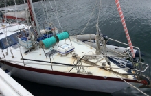
Chameleon
If I can send this then how come I cannot log onto yit with my ipad

Not going anywhere but thought we should reposition CHameleon back at the dock where she has been since Easter. We did not get further than Kawau in April due to a major kerfuffle but returned home and www.ghradio.co.nz was born so not all bad. An expensive and time consuming process fraught with disappointment but we met the challenge.
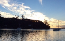
At anchor Schoolhouse Bay Kawau Island. This is our first time out this summer and we are about to turn the Clocks back. Better late than never..loads of boats here enjoying Bon Accord Harbour.
Well Chameleon will sadly not be going to Great Barrier this season. David has bursitis in two shoulders and a torn ligament in one so he is out of action - and in a lot of pain. All caused by painting a deck - five times! Getting appointments for scans and injections and specialists is proving challenging during holiday season. But we enjoy reading reports from others enjoying the summer.
Happy New Year , sorry to
Final stage of preparation for the summer on Chameleon at B42 Gulf Harbour. All soft furnishings were given the DrRug treatment today. Where does all that dirt come from! We keep threatening new carpet but can really enjoy the old rug as we dont have to worry about feet and wine and ,....The batteries are playing up a bit which maybe the result of the power going off from time to time on the dock and both banks getting depleted. The generator may have to come to Great Barrier with us.
Lets hope the great weather continues. We saw Fusio go by while we were working.
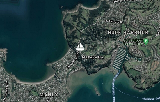
This is the first trial of the new yit Apple app. Hoorah. This is the position of Gulf Harbour Radio.

this is the southernmost anchorage on the west side of the Coromandel. Kirita bay with a small settlement Anchored in 5m of shingle on southern side. No life that we could see in the murky water but some interesting caves on northern side . Virtually no cell phone but maybe a Vodafone problem. Will head half way home tomorrow as it seems warmer there >
this is Rangipukea island at the entrance to Te Kouma. Theoretically crew can walk on shore but there seem to be a few of the not very welcoming signs that are common in the Coromandel. PRivate property, no trespassing etc. also there is a very large bull which is probably more off putting. it is a pretty anchorage but then most are in this area. There is a stock race leading down to the water from a stock yard and the anchorage is sand and we are quite close in 6m. Lots of fishing around the headland and it will remain to be seen whether crew gets in the water. Don't place any bets on that. There is good cell phone coverage. Actually there was even coverage at Hook Bay on Waiheke and there did not use to be. No photos as after the last effort I am scared to take my camera or iPad topside. The new iPhone is acting up without any encouragement.
now anchored in Deep Cove Whangarei island Coromandel . Quote of day "My seamanship is fine, I'm just lazy" We crossed the Firth of Thames in 21-29 kts of S to south east to ESE and 2-3m short seas. Have been up for a while as the wind turned to south south east at about 4am which made Hook Cove rather boisterous but the wind generator and new batteries thought it was great.
Yesterday was a lazy day and would have given better conditions but refer to quote above. However the captain found the French propane adapters so Tusi 2 Mike will be happy. The newly fixed 15 hours is about to go on the dinghy. At least the conditions will have knocked off some bottom growth but crew will need to attend to the dyna plate which seems to attract algae.
Thumbs Up are in This anchorage.
Chameleon finally got away from the dock yesterday bound for Coromandel. Laptop not working. some letters will not work. iPhone not easy to use on yit so there will not be too many updates. We are at Hook bay and will head from Waiheke to Whanganui island Wednesday
Avg: 3.6knts
24hr: 87.3nm
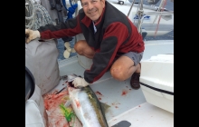
Back at the dock, B42, after a motor sail home. The main sail got aired and good that it was brought out as we have a self destructed out haul turning block. One more thing on the to do list. At 10.30am in the middle of nowhere we caught a fat king fish. 42inches long and it took a while to know he was dead. Nothing in his intestines so he must have been hungry.
Sad to leave but we are on our way as lots to do and fix onshore. Looks like a motor but we are ever hopefull for the 10e/se.
Another dinner of crayfish so Tusi 2 has lots of forecasts for this season! We did fish but nothing large enough to take home.
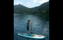
Lovely and calm today. The water was like glass earlier on and the local land resident took a picture of us reflected in the water. I will put it on when we get home. Helen (Tusi2) and I walked up to the top of Mt Hobson yesterday on the new track. Last time I walked it there were over 1056 steps. Now about 800 more have been added so it is not really like a normal track and I was thankful for the good company. The view from the top is worth it though and the day was perfect for walking as only about 22C and no wind. We met the crews from Andiamo and Margansie at the top. They were returning via the path I took last time and did not arrive back until a good 2 hours after us as we came down the steps. Just under 2.5hrs to the top and less than 2hrs return. After trying out one of Tusi2's new toys ( they have a blow up canoe and paddle board) we moved to Oneuru Bay. It was meant to be var 10 but now south so our plans to go outside were thwarted so we will attempt to catch dinner around the mussel farm here.
The paddle board was easy to get back on when you had fallen in the water. I suspect such dousings have been recorded so another picture will go on soon.
The paddle boarding looks
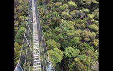
Well the rain continues but crew took off to walk to the kauri dam yesterday afternoon and amazingly had it mostly dry despite the anchorage being in rain all afternoon. The track was semi destroyed last time and has been re routed and magnificently repaired with graveled paths, lots of drainage , board walks and steps! It took less than 1.5hrs to get to the dam and that included a fair amount of track tidying as the rain had dropped lots of fern and palm fronds. We moved to the other side when I got back to make it easier to socialize with Katie M11, Vixen 7 and Tusi 2. We almost feel we need a number!
Moved in between torrential rain bursts this morning to Kaiara Bay. Well we up anchored in dry conditions but sadly for the captain the anchor went down in heavy rain. At least the thunder waited. We have had 24hr of heavy rain so the tracks will be boggy. More inside jobs like baking cinnamon rolls, replacing water maker filters ( yes who needs the watermaker!). Making a to do list and a things to buy llist.
Heavy rain here today so everyone will have filled their tanks. The walk this morning was canceled! Yesterday was an interesting day at Port Fitzroy as an unusual sound filled the air just before 10am. An elderly radial engine float plane, reg. AMA, landed and taxied through the moored boats, right beside us. Then we were visited by a man in a tinny to say we needed to move to allow the rather large 'barge' the long Islander Navigator supply ship to arrive. We anchored at the northern end but it took a long time to leave and as the tide was dropping quickly we moved again before going ashore to stock up on fresh fruit and bread.
Then Kat and Dan from Camelot arrived for sauerkraut cake and cream - yes really. It is a chocolate cake with a twist! I found the recipe in a Chilean cook book which shows I was getting bored with other reading material. And delicious. No swimming here after seeing a rather large shark off the bow. So then we decided to go and eat dinner at the one and only option to eat out. With the forecast rain we decided to make the most of the opportunity. We enjoyed a cooks night off despite the aged terakihi.
left Nagle this morning for Fitzroy as needed to post letters and shop. The lack of a phone requires writing skills to be resurrected. Yesterday though the crew had another good walk as the NW25g35 never eventuated. At low tide you can walk around the headland on the rocks for quite a way. Then at the little beach at the end, between the homestead and the house on the next property, you can find the trail just passed the shed with the tractors. I walked up the tractor track to the top of the Nagle farm to look for the wind from the top where the two defunct windmills are sited. The farm is now owned by the Chinese and there is no manager anymore which is starting to show. Gorse of course is taking over and some of the sheep need docking. Back down again, and the other fork in the trail is the 5hr walk to Karaka Bay which I did not explore. Instead I walked along the rocks and through the rock cave to chat to the lady at the next house. Here I learned the local gossip. The forecast for the rest of the week is not good so after stocking up when the ship arrives tomorrow we will hunker down not too far from here.
There are a few familiar boats here in Fitzroy. Former dock neighbours Kat and Dan are here and Tony from Tactical Directions came and introduced himself. It is always good to meet those on YIT who we have talked to. He is heading back to Tonga mid May.
Hi Dave and Patricia we are
We are still in shock from the news that Hazel Saunders, SV Liberation, has passed away. Hazel loved the cruising life and was the always happy in or near the water or socializing with cruiser friends. We last saw her on new year's eve at Kawau and she looked full of beans buzzing around in the dinghy with Bill. Our sincere condolences got to Bill and their family. We have raised the big NZ flag in her memory as Hazel always liked to see the NZ flag flying. It is now dubbed the Hazel flag in her honour.
Still in Nagle Cove where the wind this Monday morning is meant to be NW15 rising to 25 gusting 35 this morning but so far is only 10NE. We were the only ones here the first night but the anchorage looks very different now with over 16 boats at last count. Even split between power and sail with two foreign boats. Joalea, a 16m Oyster from Canada and Avalanche, a similar length interesting looking trimaran from Colorado. Flying the state flag as well as the stars and stripes. All anchored well spaced except for a power boat that was 1.5 lengths in front of us! Sarita was second into the anchorage so had a lot of choice. He has just decided to move this morning thank goodness in case this forecast is correct. Where is Gulf Harbour Radio when you need them! Crew might have to do some inside boat work as it is also meant to rain today. She is getting sick of reading. It would have been good to have used this wind direction to get to Coromandel but without a reliable and working dinghy engine that will have to be put off until next trip.
We moved today to Nagel Cove in anticipation of the NW blow tomorrow, but not before the crew had a wonderful walk in the hills behind karaka Bay. The track starts to the left of the black barn with the Hillary Outdoors sign on the front. It goes straight up the hill, through a couple of gates and winds its way over to Katherine Cove, Nimari Bay. A sign says 45mins but the same sign is posted about 20mins later so allow an hour to get there. It is mostly in Manuka bush so sheltered from wind and sun. About two thirds of the way up the trck splits and you take the left fork to the sandy beach beside the bay hat has the mussel farm. It was low tide when I got there and the beach is very clean. Land a dinghy left of centre as there are no rocks there. It is hard to find the start of the track from this end. Look for a huge multi branched tree on the right, walk through the agaves and you will find the start of the trck. The rest of it is wide and clear. The view from the lookout, if you take the other fork on the way home is spectacular as it looks out over the entrance to Abercrombie and out to Kaikoura island. Bird song is good. The Karaka Bay area is owned by a religious group, Orana, who lease it to the Hillary Trust. There is a tall and very long pest fence at the centre of the bay to protect the land on one side from rodents. There were a lot of rabbits on the walk I took by the way. Anyway you cannot start the Redfern track from here as you need permission and this is given at Fitzroy. There are a lot of traps around. The Hillary Trust welcomes people on their side and also offers a coin operated laundry. There is a long hose on the dock for those needing water so ask if you need it. there is a shop which David had hoped had ice cream and candy bars but no such luck. You cannot eat postcards! Nagle Cove is a good spot in a NW. We tucked in close around the headland as it is still sw but will change early tomorrow. We will have to go to Fitzroy nect week as we are running out of food.
Nice to have a calm sunny morning after the blow. After the ham net we motored around to Karaka Bay in Abercrombie. Anchored in 5m of good holding mud/sand. There seems to be an adventure park here with lots of Hillary structures for testing strength and agility. There was a problem with propagation on 20m this morning and the only person I had a good conversation with was Suzanne, N1QFE, who is single handing in a 40' Al boat currently at 47S and 179 33E. By lunch she will be in the western hemisphere on her way to Hawaii. An amazing sailor.
Due to a fire drill a short while ago we are now in a slightly different position here in Nimaru Cove, Katherine Bay. It has been a torrid night. The rain started around 5pm yesterday and the wind kicked in at 10pm with a solid 35 plus all night, mostly as forecast from the SE. However this morning it turned to the ENE and a somewhat different sound from the stern had us checking topside. Hmm, clear water and no crays on the rocks a meter behind the boat! Note for file. The Royal Akarana Yacht Club was correct about indifferent holding here. There is more fetch now we have turned but we will not be heading out into the 3m SW swell or the 1m NE swell. Comfort food is in preparation.
We moved today to the NW side of great Barrier. We were going to leave it until the afternoon based on the forecast of var 5 in the morning but reports from those on the ham net said that 100%cc and misty rain was already at Waihi and south auckland so off we went. had to motor sail but the water tanks are now full. We are in a lovely spot, Nimaru Bay a little cover in Kathryn Bay. And it is still 100% blue sky this evening. There is SE35 tomorrow afternoon so good we are in a great spot. Beautiful as no body living around here and we are protected. Also we are in board of a small mussel farm so there should be good snapper around. A 29m ship has just arrived about 200m away so we are not the only ones that think it is great.,Rain tomorrow so that will be good if it comes to my pot plants at home.
Still at Arid/Rakitu Island. Incredible weather. Had an entertaining day yesterday. First off the lovely 80' power boat could not leave as its anchor was stuck. It was interesting seeing such a large vessel cope with something that smaller yachts deal with from time to time. They had anchored surprisingly close to shore and there are the odd bombies. Eventually one person got a tank and sorted out what to do and the rather small anchor was raised.
Then we managed to get the heavy 15hp onto the dinghy to replace the spluttering 2hp. Sadly, no luck getting the 15hp to fire. Not a fuel problem. All avenues there were fully tested. It seems to be ann electrical problem. So , no going ashore but crew got a good snorkel around the area trying to work out which rock the power boat had got stuck on. There is a buoy on the left side of the anchorage quite close to shore which could be used in an emergency as it attaches to a very heavy line that goes to something heavy beyond my visibilty. The viz was not good late afternoon.
We will stay here until Wednesday morning when the wind changes to the SE after a front. The only email we have is K6AHS@winlink.org. It is good that the 3 boats tethered together (new ones) will no doubt leave today as it is back to work tomorrow. They had two dogs between them, one very noisy! The kids seem to have different blood as they stay in the water a long time. oh to be young.
Still at Arid/Rakitu Island. It is amazing what a wonderful spell of weather we are getting as we did not think we would be able to stay this long on the eastern side of Great Barrier/Aotea Island. Today crew will walk the island an come back for a swim - in nylon full cover and shortie wet suit. The nylon for protection against numerous jelly fish and the wet suit for warmth. There were about 9 boats crammed in here late afternoon, including 3 rafted together beside us which was a bit of a worry but they all took off for the evening. Phew. Just us and two power boats. If I had a couple of million I would put an offer in for Iridium, including the bacon smells that wafted our way this morning. And provided a lot of hash noise which destroyed our ham net. I could just work out that ZL4GD was there but that was it.
Not the boat - just conditions.
Oh dear, I'm afraid you may
We shifted this morning to the anchorage we had been waiting to visit but needed anything other than nw. There is a lovely walk on the island and lots of interesting things to explore in the craggy coastline here on Arid/Rakitu. It is 2.5m from the anchorage at Whangapoua. We took off but got passed by a very beautiful large power yacht Iridium, who clearly wanted first choice of position!. It is very protected here from virtually everything, not that there is much to avoid wind and sea wise.
A very pleasant morning meeting the folk on the beautiful 1936 power boat beside us. Crew did not mind being grounded! The day slowly became more cloudy so we decided to leave the beautiful anchorage (and the marauding bronze whaler) and head north a bit to Whangapoua as the wind is meant to strengthen tomorrow from the north. As we came into the anchorage we watched an orca about 50m from us cruise along crossing our bow. Only one. Anchored in 7m sand at low tide. There is good cell phone coverage here so a pity I drowned the iPhone yesterday.
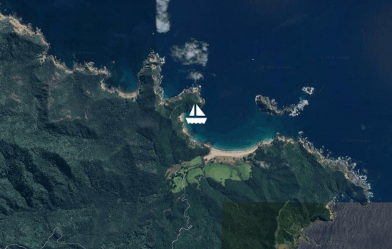
Well a day of action today. Most of it not good. The plan was for the crew to go ashore for a walk while the captain cleaned out the sail locker.. After the ham net I quickly tossed things in my back pack - nut bar, oranges, water, VHF, shoes and sox, and then at the last minute added the iPhone and good digital camera. Off we went with the boss muttering about getting ashore in surf. A beautiful day with blue sky and barely any wind. We cut the engine near shore and the idea was to go just after the bigger set. Well that turned out to be difficult as after the bigger set there is a lot of undertow taking you back out to sea! However I jumped off when it was shallow enough and headed to shore glancing back when I heard a string of expletives. The dinghy was near upright and the captain standing at the bow. Just as well he is a bit overweight as he managed to get through the wave looking like he was competing in the Mt Maunganui surf championships. Now I have learned over the years not to respond verbally or laugh at such events. The sanitised and summarized version of what he said was 'dearly beloved I told you this was a bad idea'., Anyway off I went and wondered through lovely farm land with black headed sheep and beef cows. It is DOC land and soon I cam across one of their camp grounds and headed off on a loop track that took you through the bush, up to the headland. Fantastic views and I was glad I had the camera. On the return I overlooked Chameleon and after a few photos I called David on the VHF. He replied but that was when my handheld lost power. It had been put in the charging bracket but not connected. He thought I was calling for a ride and said I will pick you up at the southern end! Oh dear. Here I was nowhere near - and on a ridge at the northern end. Off I ran but by the time I got there 20mins later he was back at the boat. And it still looked quite surfy and not much better than the northern end. So I stripped off to colourful underwear and waded out to waist height, tossed the backpack in the dinghy and scrambled in. Our dingly is not that easy to get into now as fittings have been put back in an awkward position. As I got in I looked behind and had an Oh Shit moment as a huge wave had grown further back from where they were most often breaking. It picked up the dinghy, turning it over , I fell out and we crashed towards shore. When I surfaced, there were lines, backpack, seat, and David's hat floating around but no david. The dinghy was inverted and stuck in the surf. It is a very heavy twin hard bottomed dinghy, with wheels so I had a bit of a problem. Somehow the adrenaline kicked in and I managed to lift the dinghy and he crawled out. he was too shocked to berate me especially as we now had an upside down vessel and engine stuck in the surf. We dragged it back out in between wave sets and after a couple of tries managed to get it right was up. I raced back to get the swamped back pack and other stuff from the shoreline and David rowed out past the surf with me swimming alongside. I finally got aboard when it was safe to do so and then the long row home with a stuffed engine. meanwhile another boat, the first, had come in from the other side and seen the fiasco. They put their dinghy in the water and came and gave us a tow home which saved a lot of energy.
An expensive walk as one iPhone 6S now caput, 1 good digital camera caput, one 2 hp outboard semi caput but recoverable. One handheld may recover. It is in the oven drying out. So we now have no internet or telephone. Just as well we have this system.
David has just read this and says it is lacking a mea culpa. Knowing big swells were coming down from Fiji I should have known there would be surf and should not have pressed to go. And although I had the handheld in a plastic bag the camera and iPhone were not as i had taken them out to use on the walk. Given I did raise the dinghy for him, and am making cinnamon rolls for him and our new friends, he has been pretty calm about the incident. He knows I have learned a lesson!
What an adventure! Are you
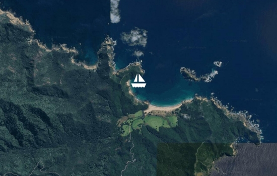
Motored down to probably the most beautiful anchorage on Great Barrier. Harataunga is just lovely. We may never leave! We are tucked into a little cove on the NW side. It is protected from the N swell (from Fiji) by Arid/Rakitu Island) and there is also an island on the southern side. The long beach has access to the walkways which has my interest. And there are not the number of jelly fish as at the last anchorage. We left there with three big dolphins this morning. They did not spend long there as they found the fishing was not good. We could have told them that. Anyway the place is just lovely and a commercial cray potter has arrived to keep us company for the night so it must be a good protected spot. I wonder what they need to trade!
Motor-sailed to Great barrier Island yesterday. Took 8.75hrs to get to the NE end, Rangiwhakea Bay. Blue sky and light to zero wind the whole way until we rounded the corner when it was stronger on the nose. Great to be out. Today, Saturday we are alone in the bay but in the middle of the night I counted 18 anchor lights! Maybe they will bring back fish as today is really lovely except for the wind. We assume the weird direction is sea breeze and it will revert to the SW soon. Will stay here a couple more days before moving down to Whangapoua or Arid Island. There is a track that leaves from where we are now and maybe it will get hot enough to get in the water.
Will await the mild front tomorrow and head off to the east side of great Barrier on Friday. really looking forward to getting away at long last. Especially as the Boss seems to think we will have at least a week of decent weather.. Will meander around Great Barrier and the Coromandel and Haurakei Gulf Islands for a month. This position is the home/Radio QTH
At Kawau Is for New Years along with around 250 other boats. Bon Accord harbour looks great.
We were slow to get out this year as some low life decided to slash the side wall of one of the Suzuki tyres and as it was Christmas Eve there were no tyre places open for a week! Fortunately an Indian small business opened up just before new year so we were able to replace it. Motored up Friday but we will have a good steady north west to go home today, Sunday We going to be in Taupo for a week for car and shooting.
Happy New Year to all and may 2017 bring fun and fair winds.
Thought I should position Chameleon back in her berth at B42 Gulf Harbour as we have been running the net from Home for 2 months now!
Wow and cool. I am using the new iPad App and I don't even have to input the position as it finds me automatically.
Will likely stay in South Cove�Kawau as it is not often you get such tranquil conditions here, hopefully the grey skies may keep the holidaying school kids on land today. We are the only anchored boat�so a great marker for all those�racing around in power�boats towing skiers and other kid carrying contraptions!
Avg: 40.8knts
24hr: 979.3nm
back home and looking forward to meeting some new faces at kawau later in the week
Hi Dave and Patricia, we have
Avg: 4.6knts
24hr: 111nm
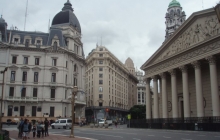
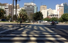
Buenos Aries and at the dock after the slow trip up the river Plate overnight. It is shallow but again my chart does not give much detail. The boat Info screen said 20m but it looked less and the tide gave 1.8 m range although water seemed to be flowing out.
We walked into town wishing we had brought sweaters. It did not warm up. Lots of familiar monuments. We stopped by the hotel we were going to be staying in and found they had no record of us so a long walk back to ship to get booking details. Yes we are there. durr. Hard to get David back out today.
They really do tango in the street! The show we attended at night was unbeleivable. We also attended a wine tasting at Palermo and had the most exciting bus ride to get there. The driver needed to be in a F1 car . His judgment of where the bus finished and the next vehicle started was fractions of a mm! David decided we would taxi back! We ate magnificent steak every night which for Patricia was amazing. And the malbec wine was glorious. Wine from Grapes grown over 1500m seem to have no side affects. And we really tested that out.
Avg: 6.6knts
24hr: 157.7nm
just as we approached Montevideo Uruguay dock a squall came through with 60 kts so the port was closed and we got to hang about. Eventually we docked in 20kts and driving rain but as the electrical storm and heavy rain continued we decided to go to the gym. It was wonderfully empty for the first time. At this time, 10am it looks as if we will not be going a shore for quite a while. We have only a day here.
The weather did not stop Patricia from shopping.
Avg: 32.2knts
24hr: 772.9nm
There is over 1000nm from the Falklands to Montevideo Uruguay so we are sailing for two days at around 18-20 kts in pea soup. A good time to catch up on reading and gym work. There are various seminars to go to including cooking and management of Windows programs. Today was photo handling. The digital workshop has about 30 computers and the tutor is excellent. I should have been to more. Despite the increasing number of coughs and sniffles around us we are still healthy. Hygiene on this Holland America Line ship is the best we have ever experienced. Tomorrow we have a day ashore in Montevideo �then a day ashore in Buenos Aries before leaving the ship for a hotel and hopefully catching up on Internet work. And less eating! Fat chance as David us looking forward to the beef. Will update on YIT first. The slow and expensive ship internet connection makes us appreciate what the Falkland Islanders have to deal with.
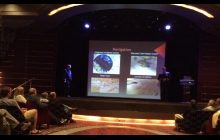
There were a couple of sessions from the officers. The one given by the kiwi - on the right in the photo - was about navigation and weather.
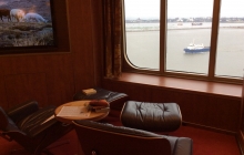
Every night there was a new towel animal left on the turned down bed. Our favourite was the�Yoda!
Avg: 26.7knts
24hr: 639.9nm
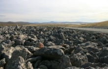
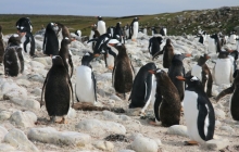
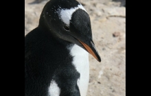
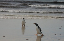
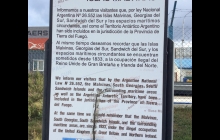
�The Fawklands Islands.An amazingly good day for our trip to the northern part of these very barren islands. Not a tree In sight and very rugged barren landscape. The very colourful houses in Port Stanley look attractive and with such good weather there was no problem getting the tender to shore. We had a Landrover with an ex marine driver guide who first arrived here during the war so we had a fantastic insight to the 82 days in 1982. The best land �trip we have had and we now have a very different appreciation of life here. Sheep are 6 acres to one sheep! The penguin colony was in the north of the island at 51 18.908S and 58 49.434W.
Most folk here have a 4 wheel drive of some sort and all are pressed into action when a ship arrives. There were various trip options. It is not free that the weather is s good and one time tourists got left onshore overnight as the ship had to leave the anchorage. They were accommodated in army barracks and homes.�
�
Avg: 10knts
24hr: 240.3nm
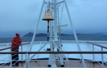
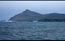
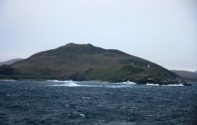
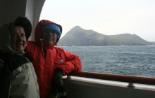
We approached Cape Horn at dawn and slowly approached in great conditions. A long 4m swell and about 25 kts wind. A little difficult to stand on the bow and take photos but we managed and it was indeed the highlight and raison d'�tre of the trip. We got very close and when we passed into the Pacific Ocean the ship sounded the horn, and again when we returned to the Atlantic.
Avg: 4.6knts
24hr: 109.4nm
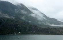
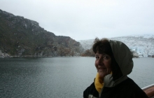
currently circling the harbour in Ushuaia waiting for the wind to drop so we can pull along side the dock. We traveled through Glacier Alley this morning and although the low cloud stopped us seeing the peaks we got a good look at all the glaciers. It was not raining then. Passed at least three sail boats in the Beagle Channel going the opposite direction and not enjoying the squalls and head winds. Amazingly they did not have protection in the cockpit but they were from Europe so I guess used to conditions like this. We will wearing as much as possible when we go ashore but we are getting used to single digit temperatures. Later, the ship finally docked but it will be an interesting exercise getting it off later.
Well wrapped up we wandered around town and finally found an info desk. When we asked when the shops re opened after lunch we were reminded it was Sunday! We took some great photos of sail boats rigged for Tierra Del Fuego which we will post later. It was hard to stand up right on the dock as the wind was so strong. Amazingly they did not have cockpit protection but had really good lines on reels for tying to shore.
We finally found a hotel to change some money and found that my long stored Argentinian notes were no longer valid! There are about 15 Australs to the US dollar so easier to compute than In Chile where there were 670 pesos to the dollar.
�
Avg: 5.1knts
24hr: 123nm
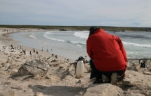
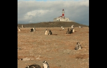
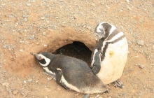
Amazingly dry all day in Punta Arenas. Fairly calm for the start of the trip to Isla Magdalena to see a trillion little penguins. Then a walk around the town that made us happy we lived elsewhere. Not much to do if you lived here but eat and drink and maybe fish when it was not blowing an icy 40 kts as it was yesterday. Our cabin window was finally cleaned of the chemical scum that prevented any viewing so we will be able to see out tomorrow in glacier valley. We had offered to do it if they provided a rope for David to lower me from the deck above! Must have embarrassed them into action.�
Isla Magdalena is 52 55.170S and 70 34.434W
I'm going to be in Punta
Avg: 11.9knts
24hr: 284.9nm
Stayed inside all day and went to a concert with a bandoneon. A South American accordion. Also the very good violinist and pianist. Also guitar and drums when needed. Mostly tango and related music. Spent a goodly time in the gym to counteract the calorie intake. Generally a relaxing day and gathering strength for the 2 hr ride in a ferry tomorrow with a forecast 40 kts. I hope the Penguins are worth it. We will be wearing as much as we can to keep warm. Sadly not too many pictures are worth while in these weather conditions. We are cruising Canal Sarmiento and very happy we are in a big ship.
�
Avg: 7.3knts
24hr: 175.7nm
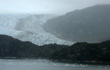
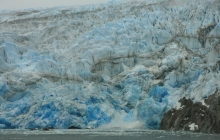
noon position above. The weather has changed today more often than it does in Wellington. We entered Canal Messier at noon then went south then east to a huge glacier Tempanos. Very spectacular and the rain stopped to enable great photos including a large calving. Noisy and visually spectacular. Then back via a ship wreck then Into Canal Adalberto with a higher ceiling. Wind goes from nothing to 30 kts in minutes and we are thankful not to be sailing in Chameleon. Hats off to Ithaca crew. It is chilly in Chile and we have need of the odd Whisky for medicinal purposes! Internet is expensive so reports with photos will be delayed.
The poor light was evidently good for seeing the blue colour of the glacier. The ship came in quite close among the burgies . There are so many glaciers that the one chosen varies depending on weather. It changes quickly and the captain needs to chose what will give the best view. He would get a report from the ranger station at this one.
Avg: 7.6knts
24hr: 182.1nm
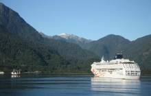
A beautiful early morning cruise up the fjord which is not charted well on the Navionics chart. Two sail boats were going out with the tide. Tide is more important than wind in this area as they can be up to 8 kts. We arrived at Chacabuco to find another cruise ship, Norwegian Sun, which may have�Gary and Marion on board, going the reverse direction. Chacabuco is a very small town with what looks like a salmon processing plant. Will likely stay on board this morning and get some exercise in the gym. The weather is the best it has been and we really should be outside but the food intake needs attention.
Ps later. You know you are somewhere strange when the treadmill tv has a cricket game on - between Oman and Ireland!
Avg: 21.3knts
24hr: 511.3nm
position] 41 21.19s 72 56.2w
[weather] cloudy and drizzle most the of day but a little sun by 4pm . Little wind inside here
[status] anchored at P Montt and we went road touring with a very informative guide , Giraldo, who gave us a passionate review of the political and social history of Chile. We drove to P Varas which has a strong German influence then Lago Llanquihue and the falls. Onto Lago Todos Los Santos and Parque National Vicente Perez Rosales. We ate Murta berries at every opportunity. They are tiny and delicious . Ignea Molinari is the scientific name. We tried to find Ithaca and Westerly Serenade back in the rather seedy commercial port area of P Montt but there are three areas of sailboats behind Isla Tenglo and no boat had a courtesy flag so we gave up and went and ate an empanada carne instead. We will get a good view of the Chacao passage on the way out to sea at 6 pm. It is calm. No sign of the Andes due the low cloud and drizzle.
Avg: 15.5knts
24hr: 370.9nm
On route to P.Montt. Hard to use a treadmill with the swell. Have to use it to counteract the very good food. Positions will be noon positions. Ship library is amazing with lots of choice for all interests.
�
Positioned in Valparaiso, city of stray barking dogs, and awaiting the long, ship�boarding process. I will attempt to add a picture but using an iPad for updates is not easy, Mike. We note Mirabilis is still AWOL. Later. Unlike other experiences the ship boarding was quick and painless.
Hi U2, We know you're having
Avg: 32.2knts
24hr: 772.3nm
We thought we had better reposition ourselves before boarding our temporary replacement for Chameleon on Sunday. Santiago is a fairly tired looking city but a good place to relax and regain energy after a long flight. We are staying in the Lastarria area which abounds with cafes and restaurants offering wonderful Pisco�sours which David insists we must drink as we can quote get wine anywhere! We finally managed to buy ground coffee yesterday. Not many supermarkets have it as everyone drinks instant coffee. The heat takes a bit of getting used to and just when we are in fact used to it we will be heading south and needing warm clothes. We hope to see the Ithaca crew in P.Montt.�
Back at the dock and missing all this beautiful weather but there was lots to do. The new Gulf Harbour Radio antenna is now ready to hoist. And bags are almost packed to go to South America next week. See you all at the picnic when we get back.
Still Anchored in Whangaparapara Harbour Great Barrier Island. A wet day to catch up on indoor things. The walks have been great and my favourite is surprising - up Whanga hill. Yes there is a steady climb to 308m but the track is soft and through beautiful native growth including a lot of kauri. Much more interesting than the other tracks which have mostly manuka and fern. This track gives the only view of the Bay from the top, which is about 50min from the turn off. (not 1hr 10m as stated). For those with bad knees or hearts the short walk to the kauri falls is absolutely flat on a real tourist path including bridges over the meandering river. You start all walks by taking the road to the head of the bay and then walk through the gate on the left which is well sign posted. The walk to the hot springs is about 3.5hr return via the road. Witheys track is also nearly 3 hours as it is no longer a round trip. The pack track has been closed at the Tramline track end. The Old Mill track needs to be done at lowish tide to get through the sea inlet near the start.
Anchored in Whangaparapara Great Barrier Island enjoying a beutiful sunset. Will stay here until the remnants of TC Victor have passed.
The day walks from this anchorage are superb as you can tie the dinghy to the very good commercial dock and it is a short walk to the start of the tracks. The bush is quite varied and the views fantastic on a clear day. One of the shortest is up Mt Whangaparapara but the native vegetation is excellent and you are rewarded with the view to Little Barrier from a not very pleasant summit.
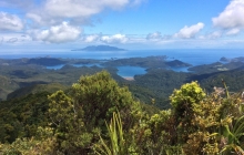
The pictures below include those from the Fitzroy anchorage when I walked up Mt Hobson. This is a long day but well worth the effort.
Back at dock to sit out the rain and get things done at the house. Sorry to have missed Maunie as judge was ready.
Kawau Is after a motor all the way. Does not seem to be any rain in the front . There has been quite an emptying out if boats as many have headed back for work tomorrow. We will return Friday with north winds.
Believe it or not we enjoyed being at the dock. Lots of entertainment with boats pouring in to escape the weather. We were able to go see Star Wars in 3D, have our neighbours in for the New Years dinner, and listen�to the now casting with no fear of draggIng! It was amazing that for two full days Tiri had higher winds than Chanel island. Consistently peak winds of 47-51 with average 38-43. Home to a scene of devastation with tomato plants and leaves scattered around the deck. At least the forecast for Monday looks good and we are now squared away inside the boat with a list of what we need before sailing away.
We thought we should place Chameleon back in her berth before departing. The weather Yoda thinks we should stay at the dock for a few days rather than have to face the 30-35�kts to return on Saturday. We do of course have to be back for shooting on Sunday! Poo on the sub tropical low. How about Monday he says!
Avg: 21.3knts
24hr: 510.9nm
depth 70m and we have traveled 2368nm and will arrive in Singapore tomorrow. Seas are still flat but cannot report on 30 plus temperature as I have been inside all day. The boss says the sky is full of cumulus congestus. And he got his last sun tan as the weather on arrival does not sound goodWe had a fantastic classical piano performance by the phillipino man responsible for the song and dance part of the entertainment. He is a graduate of Moscow piano school and was magnificent. Wasted on a cruise ship. And packing took a bit even with the extra bag we purchased at the market in Saigon! Who knows whether we will be on air Monday! We enjoy sleeping in.
Avg: 10knts
24hr: 238.8nm
Depth 40m and how they navigate through all the fishing boats I dont know. Had a great day in Sai Gon yesterday. That is the way it is spelled but with accents. It turned out to be only 1hr 15m on the new expressway. We found the site of a hotel that David had stayed in for a short in country R&R with a River Patrol boat mate and then made our way to the cathedral and the Presidential Palace which was very interesting. The bunker rooms had much of the old communications gear and lots of maps. Lots of history to read about and our bus guide filled in the sad gaps of a country that seems to have a thousand years of war with one foe or another. There was no problem with a US veteran coming back. Just incredulity that someone who had been at Phan Thiet (Fire Base Betty) during the year of the TET in 1968, was alive to return! This was the remark of the manager of the old Tu Do Hotel! Good to be lucky. Shopping at the market was a trial as despite theoretically being communist, individual capitalism is alive and well but very annoying if you dont want to buy all the junk for sale
Avg: 10.9knts
24hr: 261.7nm
anchored at Nha Trang, Vietnam and David has revisited places he last saw in 1968. The trouble is that the place has boomed as it is the Miami of Vietnam. A beautiful long beach attracts many tourists although how you could sit on a beach in 33C I dont know. We climbed up to the big white buddah that no longer can see the sea due the high rises. Also visited the embroidered 'paintings' and watched the seamstresses at work despite it being Independence day.
Avg: 11knts
24hr: 264.2nm
on the SE side of vietnam heading for Nga Trang. A day at sea. Cloudy and light SW, 15. Calm seas
Avg: 17.7knts
24hr: 425.5nm
Sihanoukville Cambodia. We toured around in a very nice Lexus taxi and ended up feeling very grateful for having been born in NZ/USA. Garbage and very poor people everywhere. More golden buddahs, temples, and a waterfall. The highlight was the fishing village with some ancient fishing boats
on our way to Sihanoukville Cambodia. great speed.
Avg: 63.6knts
24hr: 1527.2nm
at Laem Chabang Thailand which is closest port to Bangkok, which we will avoid. Will go to Pattaya and see a wooden temple. Getting templed out but not much else to see. Still enjoying good food but the gym on this ship is not as good as the last and the previous voyage had norovirus so you spend a lot of time cleaning the old equipment.
at anchor Ko Samui Thailand. Went ashore for usual stuff like big Buddah, motorcycles, food etc. Bangkok tomorrow which we will give a miss. Cannot get YIT App to work!
Hanging out at Kawau Is waiting for a decent wind direction to get to Great Barrier. metService have changed their mind AGAIN!
Back in Schoolhouse Bay, Kawau Is as reluctant to come home but looking at the faxes gives us a bit of concern!!!! I have never seen a central pressure of 924HPa before and we would not want to be in the Tiri Channel when that hits on Monday. Home to secure house and boat tomorrow.
North Cove Kawau Is but it should be called cove of many docks. This is a beautifully protected anchorage when you can go way down the bay- only possible out of the peak of the summer season. We came in to say goodbye to Taleisin as she leaves soon with her new owners for new adventures. At least they have a boat that will know how to go hove to comfortably in 60Kts and that will make up for the lack of engine and all the accoutrements that go with having power. Lin Pardie gave us a great tour through what is actually a very spacious interior when you don't have to house batteries and electronics etc! Lin has new challenges ahead and seems pleased to know that Taleisin will be actively sailing again.
I have included quite a few photos as this is quite a momentous time for Lin and Larry and Taleisin.
Had a wonderful night at the new Kawau�Yacht Club. It was previously managed by the Auckland Squadron Yacht Club but was closed due lack of patronage. Lin Pardy explained the way it has risen. Six�locals with many local helpers have now got it really humming. The bar�and restaurant are open with magnificent food from the great cooks. We enjoyed slow cooked goat shank curry while keeping an eye on the cricket World Cup. You know the world is warped when you watch Afganistan�play Scotland! We will definitely be spending more time at Kawau and will be returning soon to visit Lin who still has Taleisen at home for another month.It will be sad to see her go but it has been sold to a couple�who will make good use of it and hopefully have as many adventures as did Lin and Larry. membership of the Kawau Yacht Club enables you to take their excellent water for free and also a 20 cent discount on fuel and a discount at the bar which is handy on a hot day! And it is good to be able to support this great resource in the area. The bar and restaurant is open 7 days until after Queens Birthday in June. After a winter break it will reopen for the season.�
photo shows Navire
Sailed from great Barrier to Kawau Island in less than ideal conditions. Wind a good direction but the swell from the low way to the NE made life miserable for the crew who made it a one bagger! Came in the north side of Kawau and dealt with 3m confused swells as current rushing out. Glad the wind was not stronger. Looking forward to a visit to the new yacht club tomorrow. Across from our anchorage in Schoolhouse Bay.
�
In a tiny one boat bay just SE of Smokehouse and very pretty. Took dinghy to visit Sven at Barier Gold to buy some honey yesterday. With nothing but manuka flowers around for the bees you know what you are getting! Maybe a little pohutakawa in summer and gorse flower but the rest is all manuka up this part of Barrier. They also have a variety of other products and the lip chap has just the right amount of tingle. Watched a couple of boats clean and paint their bottoms tied to the poles at Smokehouse. There are big tides at the moment so they have plenty of time to get the job done. Still have not braved the cold water. Will move soon due wind direction.
Anchored in Kaiaraara Bay so that crew could walk up Mt Hobson yesterday, 627m including 1056 steps at the top! She does not want to walk today but it was worth it for the view around the island. From Bush's beach it is 3 hours to the top via the South Fork Track. It was a good day for it as some cloud and no wind. Two 3m killer whales circled the bay and I even got photos. Spectacular.
It is best to get dropped off as this is a very tidal bay and the soft mud makes dinghy wheels useless. High tide is needed for the return.
�
Moved today as the mussell farm was snapper free! Fished at Bradshaw cove on Kaikoura Island and caught 2 legal snapper for dinner and threw lots back for next year. We are now in a bay that is east of Nagle but does not have a name despite being really beautiful. Holding not great so good the wind is light. The walk up to the lookout on Kaikoura via and thru the scrubby fence line track is spectacular and worth the trip. Wish I had my camera to share it with you!
The map of Kaikoura is available from the start of the track at Bradshaw Cove.
Had the most brilliant sail for a long time yesterday to arrive in great barrier Fitzroy area. What was forecast to be a motorsail to Tryphena in light SE turned out to be a wonderful 17kts from the NE in flat seas. Some times you love it when they get it wrong but it is a bit of a complicated system to forecast says the boss. Anchored in Oneura Cove and now have Dancer, Carmina and Spirare along with several others including a NZ boat with the loudest generator we have ever heard so may move tomorrow!
Anchored at Colville Bay on the NW side of Coromandel south of Port Jackson�which is meant to be not good for an overnight. Will head for Great Barrier tomorrow but it is very beautiful here with the spectacular backdrop of high hills. And the attraction of two shops with ice cream, after a bit of�a walk.
Anchored at Ponui Island in between Auckland and the Coromandel as we were trying to get to Coromandel and ran into strong winds as we left late on Monday. Will be stuck here by the look of the forecast so may divert to great Barrier when the seas get acceptable to the crew. You cannot go walkabout on this island so cabin fever may set in earlier than normal
Anchored up the Maharangi but about to depart for home as the wx is turning to custard. Took the dinghy to Warkworth yesterday which is a great trip especially as there is a great craft beer bar and cafe to visit now! It takes about 30mins with the dinghy on a plane which is hard in a heavy boat with an 8hp! American cruisers should note to keep the red marks on the port side going up stream. Tie to the dock with the rusted bird by the childrens play ground or go past the Jane Gifford.
Anchored up the Maharangi and very peaceful after the boisterous previous night. No wind as yet for the races but a beautiful day
On west side of Motutapu sheltering from the winds and trying to persuade ourselves to go walking on the great tracks accessible from this anchorage. Will head to Mahurangi tomorrow.
A few planned days at Motutapu before going to Maharangi for regatta day on Saturday.
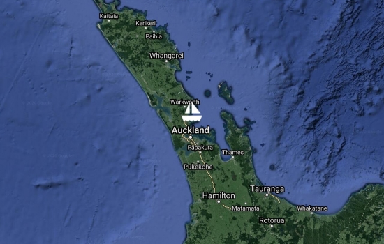
this is B42 at Gulf Harbour Marina where we are waiting for summer to get out in the Gulf.
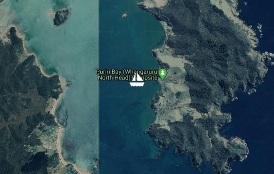
now at whangaruru to await the fronts as the ne swell at tutukaka would not be comfortable.
whangaruru where the walks in the bush are great, the views fantastic as the weather is good but the snapper dont seem to be interested in died mackeral
this is the q dock and we were back on saturday so 7 days even. not bad given the longer than rhumb line route and an absolutely beautiful entry to the bay of islands. the wind did not go south so we had a lovely sail down the coast in flat seas. lost the windat 6.30am so had an hours run to ninepin sunday was warmer than new cal but cloudy today. a pleasant check in with familiar faces and we are now further down the breakwater past the q dock.
Avg: 7.6knts
24hr: 183.2nm
111nm at 130t so we are smelling the barn. a good days sailing but the swell is getting up again and we are hard on. 32miles to get in the lee of north cape. days averaging 15 - 160 miles so not too bad
Avg: 6.8knts
24hr: 163.6nm
the best day sailing of the trip. perfect conditions after the swell dropped to 1m. wish it was always like this and it will make up for the low that has formed on our destination and the trough we have to go through to get there. likely saturday but too late for checkin.
Avg: 7.5knts
24hr: 179.7nm
turbulent day due 4m sw swell. not much sleep and not much work in the galley. outlook not good with a new low formed below us so s winds - not helpful! a pity we could not stop at norfolk to let it pass.
Avg: 5.8knts
24hr: 138.7nm
a bit of everything the last 24hrs. good winds last night took us south, first ene, the ne then nw. entered front at 7am this morning and have had sw since then up to 25 in squalls and then down to next to nothing. seas getting up a bit now but were only 1m during the wind changes. will miss norfolk again as it will be dark and we will be to the east anyway. no rest until opua. good speed at the moment of 7.5kts but it has been up and down.
Avg: 7.4knts
24hr: 178.5nm
had a lot of wind last night so progress south was good. no sleep though. today has been a motor sail with wind less than 9kts and lots of blue sky.
lumpy hard on start with a miserable negative 2kt current which we lost at 5pm thank goodness. heading for lord howe! i hear it is nice there. wind should back tomorrow and at least we have sun.
waiting at isle de pins for departure weather. unpleasant at the moment with a front going through but the guru says tomorrow will be better. a quote interesting tactical passage end quote. translated i think that means we will be going different directions each day due the high, then low and front, then high. we have pressure to return unfortunately as i am enjoying the temperatures here. we have wifi via i-net at this point which is out from the restaurant at the resort. it is weak and on and off but at least something. our external antenna is caput. cruise ship carnival spirit arriving thru the murk. they wont like the conditions here today.
officially on our way back to nz as we have checked out. currently in port boise as they have internet at the resort - and great curried shrimps from dumbea! 11m good holding, little jiggly at hi tide. tomorrow to isle de pins and sunday to norfolk.
our favourite island or rather ilot- ua. this is an anchorage you will not find in the guide book as we are on the south side due to a light ene wind. we watched where the local boats went to one day when anchored on the other side and the wind changed. it certainly saves going back to mato for shelter. this is a beautiful ilot and one of the '5 isles'. you need the chart 6827 (buy at marine corail or the big book shop on rue d'alma)) for the area as there are a few nasty reefs to get by but once here you can walk around the ilot at low tide and see the nesting sea eagles. for some reason they prefer to build their nests on the wind ward shore in a pile of drift wood and trees. snorkeling is great around these isles and you soon find the good spots. watch the weather though as there is little protection in strong winds and you dont want to destroy any coral. there is no dinghy access from the windward side of ua and getting ashore from uatio is also difficult. good s
norkeling on uatio though.
anchored at isle mato but may not stay long if the front is a reality on the wx fax. there was no pint in going further to the 5 iskes until the weather picture clarifies as would likely have to back track to east side of i ouen.
in baie ouie which is good and protected and quite pretty. off tomorrow to the 5 isles
in baie ouie which is good and protected and quite pretty. off tomorrow to the 5 isles
anchored at baie ouie. thats a lot of vowels. tried to get to ouen but the forecast 15se turned out to be 26se so as this is a beautiful bay here we are
settled into ua and enjoying sun and light se and tranquil beautiful views of the ilot. have not left the boat as busy trying to dry out the books and maps near the nav station that again succumbed from the mystery water source. found the mom8 missing in action and one solaer panel smashed but the wind genny only showed a little dent in on blade from cutting the guy line to the vertical antenna. will stay again tomorrow and go to noumea for check in on monday
Avg: 6.4knts
24hr: 154.5nm
entered lagoon thru kyare pass at 3pm. used way points frm the new rocket guide which is a must have. great to be in flat seas. heading to one of our favourite anchor spots at ua ilot.
Avg: 6.4knts
24hr: 154.2nm
beautiful sailing at last. boat getting sorted. one solar panel very smashed. windward side so it took a pounding. inside lagoon on saturday.
Avg: 6.3knts
24hr: 150.8nm
autopilot dead but have complete spare. spare causeed fire so back to fixing the forst. getting thru front.
Avg: 271.5knts
24hr: 6515.1nm
getting sick of gale winds and 3m seas.
speed in 7s so good progress but not comfortable. patricia took toilet seat when she lurched sideways and wind instruments not working. computer about to give up so reports maybe few
trying to be patient here in opua as we wait for decent weather and seas to new caledonia
Chameleon - Still in Noumea
Still in Noumea as it is still blowing- as it seems to be in the entire pacific due to stationary highs. Oh well, the economy of Noumea is improving as we stock up on french shoes and clothes. The Bastille Day parade was very different to those in French Polynesia. David missed the hip swaying hula girls but enjoyed the military display. Very spic and well armed. All branches of the military and police were represented as well as the fire brigade and a pipe band- seen practicing near the marina Read more...

