Blogs
|
Port Vila to Opua GPS: 17 44.600s 168 18.813e Leave at 0900 on 25/9 for Opua. Should take 5days and 4 hours >>> View Map |
|
|
Off to Tonga GPS: After a long wait for weather we are clearing out from Auckland on Sat 8/6. Bound for Minerva and then Vavau. >>> View Map |
|
|
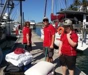
Amazing Grace - 621 Jun 2019 GPS: 16 46.698s 179 20.015e 6 June 2019. 0730 hrs. This begins our 4th day in Savusavu. Got the wind generator fixed by installing 3 new blades. Yesterday refueled with diesel. Still waiting to get our laundry done. Big... >>> View Map |
|
|
Phew! High winds have passed...we hope! 29/05/2019 GPS: 30 28.005S 175 30.250E 3rd day in toward Tonga. Yay! 1st 24hrs left on top front of low thus expected not pleasant start to get north as quick as possible to be past most of next low pressure which will likely be nasty.... >>> View Map |
|
|
Day 5 01/06/2019 GPS: 25 05.290S 176 87.530W Day 5...past couple of days 20+ winds which was great but very confused seas made it bashing conditions to windward, unpleasant with very little sleep and many sail mods. Squalls. Great day today!... >>> View Map |
|
|
Amazing Grace - 403 Jun 2019 GPS: 16 46.698s 179 20.015e 4 June 2019. This is a test of a new feature on YIT - Blog. Thank you. >>> View Map |
|
|
Imagine - 2603 Apr 2019 GPS: Yesterday we left Whangaparaoa and good friends. Tears were shed as Dani, Greg and Elo waved goodbye from the beach >>> View Map |
|
|
Imagine - 2503 Apr 2019 GPS: 36 37.110S 174 45.867E We have just finished stocking the boat with canned and dry food. On Friday we will stock up on fresh fruit and veg and meat. >>> View Map |
|
|
Pacific Rally 2019 GPS: 36 50.402S 174 45.012E This year I am taking part in the Island Cruising New Zealand (ICNZ) Pacific Rally in my yacht Libertalia, and thought I would record my adventures in the form of a blog (this being the first entry... >>> View Map |
|
|
in Fiji GPS: 16 46.726s 179 20.102e coming to end of our first year in the south pacific, it’s been amazing. Arrived in Savusavu yesterday after a 3 day passage from Tonga. Lots of rain to day so taking it easy. >>> View Map |
|
|
Tonga - The Friendly Isles GPS: 18 39.562S 173 58.872W Captain Cook must have been an amazing man. I can't imagine what it would be like for Captain Cook or the Tongans to meet each other 250 years ago. Tonga has me really confused: the towns and... >>> View Map |
|
|
Passage to Tonga GPS: 21 07.67s 175 09.69w Ten days at sea with a 30-hour stop at Minerva Reef (North Minerva). The trip of a lifetime with a couple of lovely cruising days, one which we had to motor most of the day but the others saw us... >>> View Map |
|
 |
University of Hard Knocks GPS: After arriving into Suva Harbour on Wednesday 6 June, I anchored in the small yacht anchorage off the Royal Suva Yacht Club. After clearing in at around 4pm, I went ashore and enjoyed a cold beer at... >>> View Map |
 |
Comms and Passage Planning GPS: 35 19.03s 174 07.24e Four weeks and we're still not quite on top of our comms and downloads. Nearly there. IridiumGo and PredictWind are great but the setup is something you wouldn't believe. Ian has been working on... >>> View Map |
 |
Stress free Safety Category 1 - Yeah right! GPS: List after list after list. Then lists of lists. Rationalising lists. Striking items off lists then adding three items for every one struck off. Tetchy with the system, with partners, with... >>> View Map |
|
test 1 GPS: Danes sem cel dan posvetil raziskavi kako najbolje pripet vrv ki jo vlecem za sabo v neurju in katera je najbolj varna smer ce imamo valove ki prihajajo z dveh razlicnih smeti. Konec test1 >>> View Map |
|
|
We love the Isle of Pines GPS: 22 39.482S 167 26.440E Picture a long white sandy beach, in a neat curve, forming a bay that protects us from wind in any direction (apart from westerly and that almost never happens). Behind the beach you find long tall... >>> View Map |
|
 |
Townsville - the "Duck Pond" GPS: 19 14.754s 146 49.654e Seawindow is in the Duck Pond, Townsville QLD. Nice little anchorage close to landslide facilities and services. You can dingy up to the marina and pay $5/4hrs or $10/day to tie up your ducky. Add... >>> View Map |
|
Matuku Island and arrival in Ono Island GPS: 18 51.583S 178 31.050E We sailed to Matuku Island on 14th August because troughs and fronts were on the way, bringing changing wind directions and unpredictable conditions. Matuku harbour is very protected from wind of any... >>> View Map |
|
|
Matuku Island and arrival in Ono Island GPS: 18 51.583S 178 31.050E We sailed to Matuku Island on 14th August because troughs and fronts were on the way, bringing changing wind directions and unpredictable conditions. Matuku harbour is very protected from wind of any... >>> View Map |
|
|
Highlights of Vanua Balavu GPS: 17 21.006S 178 52.530W We have been in Vanua Balavu for 11 days. What a wonderful time we have had! The first thing we had to do on arrival is a gift ceremony, called sevusevu. When a yacht comes into a bay here, that bay... >>> View Map |
|
|
Highlights of Matagi GPS: 16 43.876S 179 44.648W This is a beautiful island, in the shape of a horse shoe. We are anchored inside the horse shoe and it is very protected from the strong winds and lumpy seas that are evident on the outside of the... >>> View Map |
|
|
Highlights of Savusavu GPS: 16 43.762S 179 42.548E Savusavu is a very convenient harbour town for yachties. It is not a tourist town as such. So it is not full of resorts and people trying to sell you something. It is a town full of normal everyday... >>> View Map |
|
|
Highlights of our trip to Tonga GPS: 19 56.988S 174 41.771W The first thing that stands out was the snorkelling in the NE part of north Minerva. Stunning! Large crayfish, I mean really huge! Wow. And just the fact that here we were again, enjoying this... >>> View Map |
|
|
navire - 701 Jun 2017 GPS: 5 53.013N 172 48.994E Passage Log 1 Majuro to Wallis At last time to get some posts up about our 1500 mile passage from the Marshall Islands to Wallis, from the northern hemisphere back to the south. Currently we are in... >>> View Map |
|
|
Aradonna - 3003 May 2017 GPS: 23 39S 178 53W After one week at sea we were thrilled to arrive at South Minerva early on Sunday morning. South Minerva is a reef shaped like a figure 8, but you can only get the yacht into one of the loops, the... >>> View Map |
|
|
Kea Lani - 2903 May 2017 GPS: 22 16.7S 166 26.5E Crossed Boulari pass (Passe Nord) at 0730 Sunday morning, berthed at Port Moselle Marina by 1100 hours. All aboard well and sober. Enjoying the ambience of the quarantine dock in full view of passers... >>> View Map |
|
|
Kea Lani - 2702 May 2017 GPS: 23 24.9S 165 38.7E 11am AEST on Saturday: 15 knots with the odd squally thing overnight, so reefed down. Heading for Noumea now, 70 miles from Amadee lighthouse. Still doing over 10 knots down waves with double reefed... >>> View Map |
|
 |
Heading Out Of The BoI GPS: We are now an hour out of Opua and it's a beautiful day to start our adventure! Yachts ahead of us and behind us as far as the eye can see. All heading to Cape Brett and beyond. And all motor... >>> View Map |
|
Watch this space! GPS: Saturday has been confirmed as departure day! So we're off back to Opua to restock the chocolate (and other goodies) consumed during our sojourn in the Bay! >>> View Map |
|
|
Kea Lani - 2403 May 2017 GPS: 27 42.9S 156 44.7E Approaching sunrise marks our first 24 hours which put us about 190 nautical miles offshore, motor sailing in light ESE winds for most of the night. Wind now out of the south again, so we'll be... >>> View Map |
|
|
Kea Lani - 2303 May 2017 GPS: 27 48.68S 155 04.55E First day out and the weather is as good as it gets. >>> View Map |
|
|
Don't Get Excited! GPS: It may look as if we're on the move, but sadly it's only out into the Bay of Islands! Next weekend is our next projected weather window (we've had them before, but they haven't materialised!) So we'... >>> View Map |
|
|
Still in Opua GPS: Cyclones Donna and Ella have delayed our departure. . we sit and wait while the weather chaos clears! >>> View Map |
|
|
Kea Lani - 1103 May 2017 GPS: 27 27.25S 153 11.53E Kea Lani is in good shape, crew is ready to go, weather delay is frustrating! >>> View Map |
|
|
Throwing the toys out of the cot. GPS: Today is Good Friday and a very, very good day it is indeed. Today we have thrown the lines off and departed the Boatworks dock to motor up to the Dux anchorage, where in a few days time we... >>> View Map |
|
 |
Minerva Reef GPS: North Minerva. 178 23 09W 23 37 063S Sunday 28 May 2017 Udderlife happily enjoying the benefits of North Minerva with ample Crayfish, whilst I relax in the Ha'apai Beach Resort eating delicious fresh fish sipping cocktails and... >>> View Map |
 |
navire - 1703 Apr 2017 GPS: 01 51.546N 173 00.126E =20 Abaiang, Kiribati, One degree north of the equator December 22, 2015 (Posted from Majuro, April 2017) Abaiang, Abaiang. A destination to linger at, not a port of call on the way to somewhere... >>> View Map |
|
Kea Lani - 207 Jun 2017 GPS: 22 16.500S 166 26.200E Spent a couple of days in Port Moselle, Noumea resting, reprovisioning and partying with our fellow rally participants. Look forward to exploring the town more when we come back in July. Now we... >>> View Map |
|
 |
navire - 2304 Mar 2017 GPS: 01 22.067N 172 55.684E Kiribati first impressions 01 22.067n 172 55.684e See updates from YIT December 2015 (Posted from Majuro March 2017) *** Just in case anyone thinks we are still on our way to the Marshall Islands,... >>> View Map |
 |
navire - 2303 Mar 2017 GPS: 01 22.067N 172 55.684E Kiribati first impressions TE 01 22.067n 172 55.684e See updates from YIT December 2015 (Posted from Majuro March 2017) *** Just in case anyone thinks we are still on our way to the Marshall Islands... >>> View Map |
|
navire - 1302 Mar 2017 GPS: 01 22.067N 172 55.684E Putting aside the grounding, my memory of Nanumea, from this distance, is the flies. Never before or since have we been so tormented. The other memory, especially from this distance, is how... >>> View Map |
|
 |
navire - 702 Mar 2017 GPS: 01 22.067N 172 55.684E Nanumea to Kiribati THIS TIME WITH PICTURES Crossing the equator Dec 8, 2015 (posted from Majuro Feb 2017) Janet The bloody sails are flogging. We are in the light winds of the equatorial region.... >>> View Map |
|
navire - 502 Mar 2017 GPS: 01 22.067N 172 55.684E Nanumea to Kiribati Crossing the equator Dec 8, 2015 (posted from Majuro Feb 2017) Janet The bloody sails are flogging. We are in the light winds of the equatorial region. Dusk is falling. I wipe the... >>> View Map |
|
 |
navire - 2802 Feb 2017 GPS: 05 40.379S 176 06.360E Nanumea's Last Goodbye DAVID I have to write this piece because it was my fault. There's no way round it. Nanumea still had the unexpected waiting for us, held back for the very last moment... >>> View Map |
 |
navire - 2602 Feb 2017 GPS: 05 40.314S 176 07.071E Nanumea 05 40.314s 176 07.071e December 3, 2015 (Posted from Majuro February 2017) Janet We made it. Outside the reef of Nanumea atoll, 300 miles north of Funafuti, we faced a line of breaking water... >>> View Map |
 |
navire - 1603 Feb 2017 GPS: 05 40.314S 176 07.071E Tuvalu to Nanumea December 1, 2015, (Posted from Majuro January 2017) *** Dec 3, 2015 Janet journal We left Funafuti several days ago after rushing around getting final provisions and food. Clearing... >>> View Map |
 |
navire - 1302 Feb 2017 GPS: 08 25.950S 179 07.425E Storm at Tuvalu (Sent from Majuro Jan, 2017)=20 (Pics will be bigger next post!) Monday Nov 23, 2015 Funafuti After a quick dash around Funafuti we motored for an hour to the north end of the lagoon... >>> View Map |
 |
navire - 703 Feb 2017 GPS: 8 31.491S 179 11.376E Life in the Anchorage at Funafuti, Tuvalu November 2015 (posted from Majuro Jan 2017) Position 31.491s 179 11.376e *** Nov 18 "Doesn't look like we'll be going anywhere fast," I said... >>> View Map |
 |
navire - 704 Feb 2017 GPS: 8 31.491S 179 11.376E Life in the Anchorage at Funafuti, Tuvalu November 2015 (posted from Majuro Jan 2017) Position 31.491s 179 11.376e *** Nov 18 "Doesn't look like we'll be going anywhere fast," I said... >>> View Map |
 |
navire - 103 Feb 2017 GPS: 8 31.491S 179 11.376E Kioa Picnic (Posted from Majuro January 2016) Sat Nov 14, 2015 Funafuti, Tuvalu Janet We struggled to get the dinghy up the steep coral-strewn beach. Just through the coconut palms we saw our... >>> View Map |
 |
New Year at The Anchorage GPS: 40 57.311s 173 03.418e We are now anchored in the popular “Anchorage” in Torrent Bay next to our old neighbours Dan and Alex from Chaffers in their new yacht Amok on board which we spent New Year’s Eve... >>> View Map |
 |
Totaranui & Separation Point GPS: 40 49.046s 173 00.588e It is lovely and warm over here and as soon as we had set the anchor it was in for a swim followed by a quick trip ashore to explore and a lazy evening enjoying the warmth in the cockpit. The next... >>> View Map |
|
navire - 2302 Dec 2016 GPS: 8 56.91S 17178 59.56E Rotuma to Tuvalu Posted from Majuro Dec 23, 2106 (THIS ONE SHOULD BE BEFORE THE ONE I JUST SENT - MY FAULT THIS TIME) Position 8 56.91s 17178 59.56e Nov 6, 2015, (Posted from Majuro Aug 2016) Ahead... >>> View Map |
|
 |
navire - 2303 Dec 2016 GPS: 8 31.491S 179 11.376E Arrival in Tuvalu November 8, 2015 (Written from Majuro August 2106) REPOSTED DEC 23 AS IT DID NOT SHOW ON SITE Position 31.491s 179 11.376e "Dolphins!" I cried. They danced around us as if... >>> View Map |
|
Going Dutch GPS: 51 26.697n 3 34.323e First we had to go Belgium, an easy 56 mile motor sail across the surprisingly quiet English Chanel from Ramsgate to Nuiewpoort. We had heard stories of the masses of shipping in the narrow, current... >>> View Map |
|
 |
navire - 1603 Oct 2016 GPS: 8 31.491S 179 11.376E Arrival in Tuvalu November 8 (Written from Majuro August 2106) Position 31.491s 179 11.376e "Dolphins!" I cried. They danced around us as if saying "Welcome to Tuvalu, well done, you made... >>> View Map |
 |
navire - 1602 Oct 2016 GPS: 8 56.91S 17178 59.56E Rotuma to Tuvalu Position 8 56.91s 17178 59.56e Nov 6, 2015, (Posted from Majuro Aug 2016) Ahead the ocean was completely empty. Behind me the hills of Rotuma were growing smaller by the hour.... >>> View Map |
 |
Living the life GPS: 15 22.506s 167 11.469e We've been everywhere man - Shark Bay, Champagne Beach, Hog harbour, Port Olry, Turtle Island, Blue holes and Oyster Island. We were kindly guided into Shark Bay by Peter of Lataro Island, which he... >>> View Map |
|
Port Resolution, Tanna GPS: 19 31.690s 169 29.642e anchored with Kiapa, Tranquilo, and Annecam >>> View Map |
|
 |
Week 2: in Vanuatu GPS: 15 32.261s 167 10.712e Well needless to say we have been busy exploring with very little time to keep you updated. So will rectify that without further ado! So Bob's last update let you know we had arrived safe and sound... >>> View Map |
 |
Libertalia for Sail GPS: I reckon its been about a month and weve been flat out with friends and family on board and all that entails, and doing a lot of sailing, and preparing Libertalia for sale! Yep, weve tod and frod,... >>> View Map |
 |
navire - 2902 Sep 2016 GPS: 16 40.212S 179 54.187E Kailopa He slept little, turning over in his mind a great decision. Palau, his daughter-in-law had consented but worried that it was perhaps too great a distance. His son, Batiki, had offered no... >>> View Map |
|
navire - 2903 Sep 2016 GPS: 12 28.825S 177 07.699E One day Kailopa and I decided to hitch around the island. We walked to the one road that circled the island and turned right expecting a vehicle to come our way, any minute, but none came. It was... >>> View Map |
|
 |
navire - 2902 Sep 2016 GPS: 12 28.825S 177 07.699E Rotuma, the final Fijian Island=09 Position: 12 29.239s 177 07.227e (Posted from Majuro September 2016) David We arrived at Rotuma early this morning, negotiating our way through coral=20 heads, to... >>> View Map |
 |
Birthday at sea GPS: 18 37.000s 163 43.000e A big thank you to all for the various birthday gifts the girls managed to smuggle on board without my knowledge. Great stuff. Just as well there was nothing requiring declaring to customs, as the... >>> View Map |
|
Big Mama's - Tonga Tapu GPS: 21 8.361s 175 12.297w See our blog at: http://benger.blogspot.ca/2016/09/tonga-tapu-waiting-for-weather-window.html >>> View Map |
|
 |
Underway at last GPS: 21 19.922s 149 26.137e So we are away. Forecast is for light winds, but we have a nice sea breeze currently getting us to the SE, so we'll go with it as long as we can. Nearly ran into a whale within the first 10... >>> View Map |
 |
Vanuatu to Lifou and Ouvea Loyalty Islands GPS: 20 42.437s 166 27.731e As we waited for a new hydraulic ram for the auto pilot in Vanuatu we realised that we were not going to achieve all our cruising objectives there this year. So we joined the ICA Rally for their leg... >>> View Map |
 |
navire - 1203 Sep 2016 GPS: 12 29.242S 177 07.235E Kioa to Rotuma, Nov 27, 2015 Written from Majuro July, 2016 David and Janet The phone rang early in the morning. "I'm coming with you." It was Kailopa. He had spent a greater part of the... >>> View Map |
 |
Captain Bob attending to blown bulb! GPS: 21 6.803s 149 13.472e Last minute preparations for the big trip to Vanuatu, weather permitting. >>> View Map |
 |
navire - 403 Sep 2016 GPS: :position 43=B042n 79=B024w ;image totem First stop British Columbia >>> View Map |
 |
|
 |
navire - 404 Sep 2016 GPS: 21 17.23N 157 49.58W Honolulu photo essay on our Canadian holiday. >>> View Map |
 |
Paddle Overboard! ...and we meet The Killers GPS: 22 22.8834S 166 54.8166E We are on our way south, more or less, slowly making our way towards Ile De Pins. At Baie De La Torture, some friendly Aussies popped over to torture us with their accents. They had spotted us out... >>> View Map |
 |
|
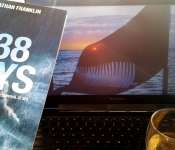 |
Counting the days GPS: 22 18.07969S 166 26.08570E This post is inspired by the story of Salvador Alvarenga, a man who the world once labelled a scammer, but whose story will undoubtedly save lives in two quite different ways. 500 days ago today... >>> View Map |
 |
navire - 1803 Aug 2016 GPS: 16 40.212S 179 54.187E Savusavu to Kioa Savusavu to Kioa Position: 16 40.212s 179 54.187e (written from Majuro, July 2016) Mon 26 Oct Fawn Harbour Horrible passage. 20-25 knot headwinds, more easterly than forecast, and we... >>> View Map |
 |
Baie De St Vincent and Bon Voyage Vikings GPS: 22 11.621S 166 14.236E They say that all good things must come to an end. That’s not entirely true, but most things do end and part of our human existence is managing the raft of emotions... >>> View Map |
 |
Snakes and Spiders, Turtles and Sharks GPS: 22 17.652s 166 17.409E Many a sailor has been heard to talk of respect for the ocean. The wind and the waves harness great power, and man can quickly realise just how small he is. Beneath the waves is another world again... >>> View Map |
 |
The day the boat came to town... GPS: 22 16.82S 166 25.70E When you sail in to another country, things are not quite as simple as they are at the airport. For seasoned sailing cruisers, this is all old-hat, so this post is certainly directed at our land... >>> View Map |
 |
First blog and the story of the Homeless Vikings GPS: 24 30.5S 168 02.2E I've been toying with the idea of using the blog feature on YIT to record some more of our meanderings and experiences along the journey. It is for us as much as it is for you. I enjoy the... >>> View Map |
") |
Change of Blog Setup GPS: 22 39.592S 167 26.445E From now on we intend to include all of our blog entries on the left hand side of the main page where they require a step less to read and will hopefully be easier to find. Internet access is... >>> View Map |
 |
|
|
Westpark Marina GPS: 37 46.041s 176 29.508e Sitting in F72 at Westpark preparing for a lazy cruise to Tauranga, late next week. Hopefully the weather will improve before then so that the stopovers will be more enjoyable :) >>> View Map |
|
 |
Photos from the voyage to rapa GPS: We're struggling to get usable Internet here but this is an attempt to upload some photos of my birthday cake and the pay we made for the engine on the way to rapa. Photos of rapa coming soon if... >>> View Map |
|
Exploring the north lagoon GPS: 22 06.047S 166 07.055E Sent from Iridium Mail & Web. Sent from Iridium Mail & Web. >>> View Map |
|
|
SV Stylopora - 2403 Jun 2016 GPS: 22 20.702s 166 51.391e Anchored flat glassy conditions at Baie during Carenage. Sent from Iridium Mail & Web. Sent from Iridium Mail & Web. >>> View Map |
|
|
SV Stylopora - 2202 Jun 2016 GPS: 22 28.643s 166 27.737e Anchored in 10m of beautiful clear water beside the Amedee Lighthouse. Sent from Iridium Mail & Web. >>> View Map |
|
 |
Light wind Tactics GPS: 24 11.904S 179 11.740W We are on day two with no real wind to speak of. At sundown last night we put together our strategy for approaching the southern reef at Minerva, we thought we would be approaching the southern reef... >>> View Map |
|
The one that got away GPS: 27 47.266S 178 16.331E We are travel on a course of 25 degrees magentic. The wind is 20 knots from the south east. The seas are moderate with swell from the east. We are reaching with a speed of 8 knots. The princess... >>> View Map |
|
|
Mid Voyage Update and the laundry list GPS: 29 39.091S 176 30.689E We have just crossed into 29 degrees. Things are looking good. The weather is warmer, seas are smoother with less chop and the sun is shining. It is nice for me to be able to look at a screen to... >>> View Map |
|
|
Departure Planned for Friday 0600 NZST GPS: 41 15.467S 173 16.931E We have made our appointment to clear New Zealand customs in Nelson tomorrow morning at 0600. There was a lot of hurry up and wait this week while we watched for a good forecast for departure. We... >>> View Map |
|
 |
navire - 801 Jun 2016 GPS: 16 46.641S 179 20.150E Mokagai to Savusavu Position: 16 46.641s 179 20.150e (Posted from Majuro, June 2016) Whoops got posts out of order. Only David's quick action on the tiller saved the day. Saved Navire. Saved the... >>> View Map |
|
Yasawas GPS: 16 56.495s 177 22.163e Arrived at Blue Lagoon a beautiful anchorage which despite the stronger winds we are having at the moment is very calm. The resort on shore are happy to see us and we are welcome at the bar, the... >>> View Map |
|
 |
Back to Noumea GPS: The trip back to Noumea was as good as the one north, although with fewer stops. The highlight for us was Ile Ndukue with its beautiful circular bay, its rocky hill that we climbed and its... >>> View Map |