Places of Interest
 |
Kelefesia GPS: 20 30.098S 174 44.381W Stunning but small rolly anchorage with room for three yachts max. The entrance can be trivky, navigate with care (Tonga cruising guide has good guidance). This spot is definitely worth the effort to... >>> View Map |
 |
Uoleva GPS: 19 51.017S 174 24.943W Anchorages are large and sheltered with good holding in sand. Uoleva has no village but a couple of resorts, the island's big enough though that you can still feel you have it mostly to... >>> View Map |
 |
Ha'afeva GPS: 19 56.46S 174 43.00W Anchor on the sheltered western side of the island near the wharf. This is an excellent all weather anchorage with a safe wide northern entrance. From here you can dinghy ashore and follow the road... >>> View Map |
|
Whangamumu Harbour GPS: 35 15.0024S 174 17.8986E Always a favourite to come back to. This harbour has good holding on a muddy sandy bottom and is sheltered in any blow except northeasterlies. There is old whaling station ruins to wander around... >>> View Map |
|
 |
North Minerva Reef GPS: 23 39.433S 178 54.354W North Minerva Reef is the larger and most preferred of two large submerged atolls, popular as a stopover destination and place to await favourable weather for yachts in transit to Tonga or Fiji.... >>> View Map |
|
Galoa Harbour GPS: 19 03.91S 178 10.63E Good protected anchorage. Reported to be unaffected by NW winds. >>> View Map |
|
|
Vuda Point Marina, Fiji GPS: 17 40.86S 177 23.21e Marina and approved clearance station with haulout facilities, repair and maintenance and good general services. This is also a recognised cyclone shelter. >>> View Map |
|
|
Waitepipi Bay GPS: 35 00.224s 173 43.957e Good calm anchorage, suitable in all winds except east and southeast. Good holding in 3-8 metres with sandy bottom. Climb up the hill on the southwest side of the bay for a greatview. >>> View Map |
|
|
Rere Bay GPS: 35 00.526s 173 43.788e Good calm sheltered anchorage, especially for smaller vessels with draft <2m which can tuck in further. Good holding in 3-6 metres in muddy bottom. Exposed to east, southeast and westerly winds. >>> View Map |
|
|
Waitapu Bay GPS: 35 02.616S 173 45.468E Calm shallow anchorage with good holding in muddy sandy bottom. Very sheltered, especially from southwest or northeast winds, exposed to northwest. >>> View Map |
|
|
Touwai Bay GPS: 35 01.804S 173 46.124E This anchorage has deep water close to shore - anchor close for better shelter. Good holding on muddy sandy bottom. Exposed to southwest, west and northwest winds. Beware of the 2.2m shallow when... >>> View Map |
|
|
Owhatanga Bay GPS: 35 01.405S 173 46.007E Sheltered anchorages can be found here for most winds except northwest. Good holding in broken shell, mud and sand and you can tuck in close to shore around most of the bay. Great spot for... >>> View Map |
|
|
Stephenson Island GPS: 34 58.235S 173 46.753E This anchorage is sheltered in northwest, north and northeasterly winds but can be fairly exposed otherwise and open to northwest swells. The bottom is rocky with seaweed so lay your anchor... >>> View Map |
|
|
Whangaihe Bay GPS: 34 59.736S 173 48.996E Good holding on sand and shingle bottom in 3-4 metres of water. Good shelter in all but northern quadrant winds. >>> View Map |
|
|
Mahinepua Bay GPS: 34 59.928S 173 51.078E Moderate holding in sandy bottom. Well sheltered in all but eastern quadrant winds. Anchor in the middle of the bay as it gets too shallow for most towards the head of the bay. >>> View Map |
|
|
Taiaue Bay GPS: 35 01.058S 173 51.924E Moderate holding in 4-5 metres of water on sandy bottom. Good shelter in southern quadrant winds. Exposed to north and northeasterly swells. Beware of the charted awash rock northwest of Omorere... >>> View Map |
|
|
Motutapere Bay GPS: 34 58.368S 173 56.250E Day anchorage only for diving the wreck of the Rainbow Warrior. Moderate holding in 6-10 metres on weedy rock and sand bottom. Can be a bit rolly and is subject to northeast, south, and western... >>> View Map |
|
|
Hamaruru Island GPS: 34 58.624S 173 56.775E Day anchorage only for exploring the Cavalli Islands, sheltered from northern quadrant winds. Moderate holding in 3-5 metres on weedy rock and sand bottom. >>> View Map |
|
|
North Bay, Motukawanui Island GPS: 34 59.277S 173 56.641E Good anchorage in southerly conditions near the Rainbow Warrior dive site. Good holding in 8-9 metres on rocky sandy bottom. >>> View Map |
|
|
Northeast Bay, Motukawanui Island GPS: 34 59.504S 173 57.185E Fair weather anchorage best in western quadrant winds. Anchor in 6-8 metres in the middle of the bay on rocky sandy bottom. Beware of rocks either side or the anchorage and the awash Te Haumi Rock... >>> View Map |
|
|
Horseshoe Bay, Motukawanui Island GPS: 35 0.762S 173 56.370E This shallow bay has moderate holding in the middle of he bay in 3m on sandy shingle bottom. Best in northeastern quadrant winds. Can be a bit rolly in norhterly and southerly swells. >>> View Map |
|
|
Orokaraka Bay, Matauri Bay GPS: 35 2.490S 173 55.183E Good holding in 3-4 metres of water on sandy bottom. Best in southern quadrant winds. >>> View Map |
|
|
Waiaua Bay GPS: 35 3.577S 173 55.787E Moderate holding on sandy bottom, well protected from northwesterly winds and swell. Exposed to southeast quadrant winds and swells. >>> View Map |
|
|
Maratea Point, Poor Knights Islands GPS: 35 27.330S 174 43.939E Anchor in 12-20 metres on rocky ground just north of Maratea Point. Sheltered in easterly winds but otherwise exposed and can be rolly. No fishing - this anchorage is in a no-take marine reserve. >>> View Map |
|
|
Sandagers Reef, Poor Knights Islands. GPS: 35 28.506S 174 44.162E Anchor in 12-20 metres on rocky ground. Sheltered in east and southeast winds but subject to northeast swells coming through the gap. No fishing - this anchorage is in a no-take marine reserve. >>> View Map |
|
|
Maroro Bay, Poor Knights Islands GPS: 35 28.835S 174 44.182E Good anchorage in south and east quadrant winds with rocky bottom. No fishing - this anchorage is in a no-take marine reserve. >>> View Map |
|
|
South Harbour, Poor Knights Islands GPS: 35 29.020S 174 44.641E This is a deep anchorage for sheltering in north and northwest winds. You will need to get close to the western shoreline to find anchoring sites in 15-30 metres on rocky ground. No fishing - this... >>> View Map |
|
|
Labrid Channel, Poor Knights Islands GPS: 35 29.262S 174 44.390E Approaching from the west, anchor in the middle of the channel in 12-20 metres on rocky bottom. Best in northern quadrant winds, can be rolly especially from the east. No fishing - this anchorage... >>> View Map |
|
|
Outu Bay GPS: 35 13.050S 174 18.554E Moderate holding in 6-8 metres on weedy rocky bottom among shingle and broken shell. Best in northerly and westerly winds. Can be rolly. >>> View Map |
|
|
Te Toroa Bay GPS: 35 13.978S 174 17.604E Fair holding in 6-8 metres on weedy rocky bottom among broken shell. Best in westerly winds. Beware of submerged rock on the northern side of the anchorage. >>> View Map |
|
 |
Bland Bay GPS: 35 20.539S 174 21.406E Pretty bay with quite good shelter but can be a bit rolly, best in northerlies. Moderate holding in 6-8 metres on rocky bottom. Nice beach to walk along and explore the rocky outcrop at the eastern... >>> View Map |
 |
Puriri Bay, Whangaruru Harbour GPS: 35 21.932S 174 21.313E Eastern end of the large anchorage that joins up with Sandy Bay. Very good holding in in 2-4 metres on muddy sandy bottom. Great shelter from easterly quater winds and swell. >>> View Map |
 |
Sandy Bay, Whangaruru Harbour GPS: 35 21.264S 174 21.313E Huge anchorage, pick your spot depending on the conditions. Very good holding in a large area of 3 metres on muddy bottom. You can get closest to shore on the northern side of the bay. Well... >>> View Map |
 |
Mimiwhangata Bay GPS: 35 25.845S 174 25.052E Very good holding in 3-5 metres (eastern side) or 7 metres (western side) on sandy bottom, great shelter from all but north quadrant winds and swell. You can get a bit of shelter from then... >>> View Map |
|
Motutohe Island GPS: 35 29.314S 174 28.033E Fair weather anchorage sheltered from south and east quadrant winds. Anchor in 3-4 metres on sandy bottom tucked in on the inside of Motutohe Island. >>> View Map |
|
|
Wooleys Bay GPS: 35 33.572S 174 29.450E Good holding in 3-5 metres on sandy bottom. Best in south quarter winds but some shelter form east in the smaller Whale Bay on the eastern side also. Very picturesque bay with a walking track. >>> View Map |
|
|
Matapouri Bay GPS: 35 33.675S 174 30.599E Very sheltered from all but east quadrant winds. Anchor in 3-5 metres off the beach in the middle of the bay, good holding on sandy bottom. >>> View Map |
|
|
Tutukaka Harbour GPS: 35 37.029S 174 32.046E Sheltered from all winds. Good holding in 2-4 metres on muddy bottom. Subject to some roll from an easterly swell. There is a small township here and the base for dive charter companies serving the... >>> View Map |
|
|
Whale Bay GPS: 35 10.112S 174 6.586E Moderate holding in 3-5 metres on sandy shingly bottom. Best shelter from north quadrant winds. Can be a bit rolly. >>> View Map |
|
|
Rangihoua Bay GPS: 35 10.249S 174 5.763E Moderate holding on sandy bottom, best in 3-5 metres on the northeastern side of the bay in north quadrant winds or at the southern end of he bay in westerlies. Can be rolly from north and... >>> View Map |
|
|
Opito Bay GPS: 35 11.644S 174 2.477E Safe anchorage in strong winds to shelter from all but south quadrant winds with good holding in a muddy bottom. >>> View Map |
|
|
Moturoa Island GPS: 35 12.400S 174 4.564E Good holding in a muddy bottom, calm and sheltered to all but northwest quadrant winds. Beware of rocks close to shore. >>> View Map |
|
|
Paihia GPS: 35 16.798S 174 5.843E Shallow anchorage with good holding in muddy sandy bottom. Beware of traffic around the busy wharf and cable lines in the southeast. >>> View Map |
|
|
Uruti Bay GPS: 35 16.721S 174 8.062E Good holding on a muddy bottom. Calm and sheltered from all but westerly winds. Inside the bay is very shallow so anchor at the mouth. >>> View Map |
|
|
Matauwhi Bay GPS: 35 16.121S 174 7.642E Poor holding in muddy bottom. Protected from all but south quadrant winds. >>> View Map |
|
|
Kororareka Bay, Russell GPS: 35 15.790S 174 7.205E Good holding in a muddy bottom but with lots of boat traffic. >>> View Map |
|
|
Roberton Island, Motuarohia Island GPS: 35 14.034S 174 10.114E Good holding in 3-5 metres in the northwest side of the bay. Good shelter from all but south quadrant winds. >>> View Map |
|
|
Mangahawea Bay, Moturua Island GPS: 35 13.260S 174 11.019E Moderate holding in sandy bottom. Anchor in the middle of the bay. Good shelter from all but west quarter winds. Exposed to northwesterly swells. >>> View Map |
|
|
Waipao Bay, Moturua Island GPS: 35 13.736S 174 11.374E Moderate holding in sandy bottom with some weed. Anchor in 3 metres in the middle of the bay. Exposed to southwest wind and swell. Beware of the awash rock at the north end of the bay. >>> View Map |
|
|
Awaawaroa (Pipi) Bay, Moturua Island GPS: 35 13.584S 174 11.965E Good bay for sheltering from strong winds from all but the south quarter. Good holding in muddy sandy bottom in 3-4 metres near the head of the bay. >>> View Map |
|
|
Waiwhapuku Bay, Moturua Island GPS: 35 13.097S 174 11.634E Moderate holding in sandy bottom, anchor in 2-3 metres in the middle of the bay. Best shelter in west quarter winds. >>> View Map |
|
|
Sunset Bay, Motukiekie Island GPS: 35 13.004S 174 11.888E Good shelter from all but west quarter winds. Bottom is a mixture of mud, sand and rocks. Look out for rocks close to shore and on the westernside of the northern channel when approaching. >>> View Map |
|
|
Waewaetorea Bay, Waewaetorea Island GPS: 35 12.143S 174 12.698E Good holding in 3-5 metres in sandy bottom with broken shell. Sheltered from all but westerly winds. Exposed to northerly swells. Beware of rocks near the middle as you approach the channel. >>> View Map |
|
|
Waewaetorea Passage GPS: 35 12.596S 174 13.246E Moderate holding in 4-5 metres on sandy shingle bottom. Good shelter from east and south quarter winds. Both bays here are good for anchoring but beware of the awash rock at the northern end of the... >>> View Map |
|
|
Otaio Bay, Urupukapuka Island GPS: 35 12.835S 174 13.435E Good holding in 3 metres on muddy sandy bottom. Good shelter from all but southwest quarter winds. Anchor in the middle of the bay as it is very shallow towards the head. >>> View Map |
|
|
Paradise Bay, Urupukapuka Island GPS: 35 12.835S 174 13.435E Anchor near the head of the bay in 2-5 metres to get the best shelter from all but west quarter winds. Can be exposed to westerly swells. >>> View Map |
|
|
Urupukapuka Bay, Urupukapuka Island GPS: 35 13.258S 174 14.356E Good shelter from north and west quadrant winds. Anchor in sandy bottom on the southern side of the bay unless you have a very shallow draft. Can be a little rolly. Good access to great walks on... >>> View Map |
|
|
Opunga Cove GPS: 35 15.551S 174 12.480E Good holding in 3-4 metres on muddy bottom. Great anchorage in east quarter winds. >>> View Map |
|
|
Orokawa Bay GPS: 35 15.226S 174 11.972E Good holding in mud and broken shell bottom. Good shelter in all but south quarter winds. >>> View Map |
|
|
Te Angamate Bay GPS: 35 15.268S 174 11.590E Good holding in mud and broken shell bottom, well sheltered from easterly and northerly winds. Subject to westerly swell. >>> View Map |
|
|
Pareanui Bay GPS: 35 14.996S 174 11.706E Good holding in muddy sandy bottom in 5 metres in the middle of the bay close to shore. Good shelter from east quarter winds though southeasterlies can funnel across. >>> View Map |
|
|
Putakokota Bay GPS: 35 14.983S 174 12.145E Good shelter in southwest quarter winds at the western end of the bay in 5-8 metres on muddy bottom. >>> View Map |
|
|
Parorenui Bay GPS: 35 14.780S 174 13.608E Good holding in muddy bottom. Good shelter in all bot north quadrant winds. Keep well clear of the rocks off both headlands when coming and going from this bay. Excellent spot to shelter from... >>> View Map |
|
|
Parekura Bay GPS: 35 15.222S 174 14.916E Good holding in 2-5 metres on muddy bottom. Shelter can be found in this bay from all but northerly winds and northwesterly swells though some wind can funnel through. >>> View Map |
|
|
Omakiwi Cove GPS: 35 14.417S 174 14.630E Good holding in muddy sandy bottom in 3-5 metres. Sheltered from all but west quarter winds. >>> View Map |
|
|
Kaingahoa Bay GPS: 35 13.953S 174 15.308E Good holding in 3m on muddy bottom near the mouth of the bay after which the bay shallows out to less than one metre. Good shelter from south to east quadrant winds. >>> View Map |
|
|
Oke Bay GPS: 35 13.679S 174 15.975E Good holding in 3-5 metres on sandy bottom just offshore. Sheltered from west quarter and southerly winds though the southeasterly flows around the hills. >>> View Map |
|
|
Maunganui Bay, Deep Water Cove GPS: 35 11.574S 174 18.183E Moderate holding in sandy bottom, best anchoring in 5-10 metres at the head of the bay in the northeast of this cove. There is also an anchorage in the southeastern part of the cove. Sheltered from... >>> View Map |
|
 |
Mistletoe Bay, Inner Queen Charlotte, NZ GPS: 41 13.572s 173 58.294e A nice sunny anchorage, reasonably well sheltered in a Northerly, plenty of room to swing. Around 8m of water and a sandy bottom. >>> View Map |
 |
Chaucer Bay, Bay of Many Covers, Inner Queen Charlotte, NZ GPS: 41 10.456s 174 9.579e A narrow entrance between submerged rocks. Holding OK in 10-15m water. >>> View Map |
|
Savusavu GPS: 16 46.65s 179 19.99e Very comfortable all weather anchorage, moorings are plentiful throughout the bay plus a few stern-to berths available. >>> View Map |
|
 |
Beveridge Reef GPS: 20 01.00s 167 45.00w Beveridge Reef, a submerged atoll in Niue's EEZ. The reef encloses a lagoon about 4x2 nm. Entrance is on the western side and is about 7m deep. Trade winds here are from the southeast, the... >>> View Map |
|
Saweni Bay GPS: 17 38.68s 177 23.53e Well protected an all but northerly. Beach and road access to Lautoka township (cab). >>> View Map |
|
|
Cuvu Bay Naviti GPS: 17 09.538S 177 12.172E Good in NW - E, holding good. close to Mantaray Pass >>> View Map |
|
|
Somosomo bay East Vomo Reef GPS: 17 05.755s 177 16.064e Sheltered from the roll at 1$ bay. Good NE to Southerly >>> View Map |
|
|
Cukuvou Harbour, Yandua Island GPS: 16 48.979s 178 17.105e Sheltered from most winds. Good holding on sand at 7m. >>> View Map |
|
|
Nanuya-Sewa, Blue Lagoon GPS: 16 56.573s 177 22.055e Beautiful calm anchorage, protected from swell and all but southerly winds, good holding. Good snorkelling and long white beaches. >>> View Map |
|
|
Denarau GPS: 17 45.536s 177 23.146e Good spot for picking up / dropping off friends from airport if local marinas full. >>> View Map |
|
|
Monu Island, Mamanuca Islands GPS: 17 35.620s 177 02.830e good in light winds and slight sea, day ancohage >>> View Map |
|
|
Monuriki Island, Mamanuca Islands GPS: 17 36.444s 177 02.381e good in settled conditions and southerly sector winds, good holding >>> View Map |
|
|
Loltong Bay, Pentecost Island, Vanuatu GPS: 15 32.704s 168 08.828e calm, inside reef, sand, good holding >>> View Map |
|
|
Nabouwalu Village GPS: 18 53.244s 178 27.857e Well protected, very welcoming village (sevu sevu should be done) >>> View Map |
|
 |
Vunisea GPS: 19 02.92s 178 09.30e Good shelter exept from W to N. Good holding in about 6m between shallowith reefs so good visibility or Google Earth images vital for pilotage, though Navionics charting seems reasonably accurate.... >>> View Map |
Pages
 |
Bird Island/Nukufotu, Wallis & Futuna GPS: 13 11.156S 176 12.245W The most fabulous island for bird life. Covered in frigate birds, brown and red-footed boobies and noddy terns, and teeming with crabs and moray eels which stalk the shoreline waiting for a nervous... >>> View Map |
 |
Stunning view, Wallis & Futuna GPS: 13 11.112S 176 11.923W This tiny island has the most amazing view with the open ocean on one side and on the other, the tranquil calm turquoise waters and islands of Wallis. Scramble around the western edge of this rock... >>> View Map |
 |
Nomuka GPS: 20 15.68S 174 47.82W Nomuka was a great village to visit and it wasn't long before a local lad took us under his wing to show us around and take us up to the village plantation where he lavished us with a bounty of... >>> View Map |
 |
Uanukuhahaki GPS: 19 57.98S 174 29.31W This is an absolutely stunning spot to stop and relax for a few days, walk around Uanukuhahaki and you won't be disappointed. This was our favourite island to walk around. We saw a huge sea snake... >>> View Map |
 |
Neiafu Lookout GPS: 18 38.922S 173 59.967W Access this lookout from tapueluelu road, walk is only about half an hour But you will be rewarded with great views out over neiafu and across to The eastern islands as well as across to the... >>> View Map |
 |
Euaiki GPS: 18 46.109S 174 01.230W At low tide you can walk right around this charming wee island. on the Southwestern side there are some fantastic caves and on the southern coast Pretty good birdlife with terns and a few... >>> View Map |
 |
Kenutu, Vava'u, Tonga GPS: 18 42.064S 173 55.550W Access this walk from the beach toward the south end of kenutu. climb up And explore the stunning vantage points that look out across the ocean Over the island's rugged eastern coast. you can... >>> View Map |
 |
Lac Lalolalo, Uvea, Wallis GPS: 13 17.965S 176 14.151W Walk or see if you can hitch a ride with a 4WD or one of the locals that are heading up to tend to their crops. While technically a main road, RT1 gets pretty rugged after Malaetoli village. The... >>> View Map |
 |
Faioa, Wallis GPS: 13 22.102S 176 10.203W A beautiful island with a perfect swimming spot at its north western tip where the sandy beach drops steeply away. Walk around to the eastern side and you will be met with a very different... >>> View Map |
 |
Nukutapu - Nukuatea, Wallis GPS: 13 21.790S 176 13.452W There is a nice walk to a lookout and one of the many catholic monuments that characterise French territories in the Pacific. At low tide you can walk across a sandbar over to Nukuatea for a look... >>> View Map |
|
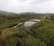
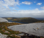
Dukes Nose Walk GPS: 35 00.2748S 173 43.8010E DOC hut with walkway beside up to Dukes Nose. This is a good walk with stunning views, but, the last part of the walk is hand over hand chains. Stunning views. >>> View Map |
|
|
Whangamumu Track, Te Toroa Bay and Cape Brett Track. GPS: 35 14.950S 174 17.591E From this anchorage you can access the tramping track north to Te Toroa Bay or a walking track that stretches across to the other side of the peninsula. If you are after a longer walk the track to... >>> View Map |
|
|
Urupukapuka Island Archaeological Walk GPS: 35 12.708S 174 13.080E arcaheological sites and great cliff top views. Full walk is 5 hours but you can do shorter stretches. More detail can be found on the www.doc.govt.nz website. >>> View Map |
|
|
Moturua Island Track GPS: 35 13.060S 174 11.513E This track can also be accessed from Mangahawea Bay or Waipao Bay anchorages. The full loop track is 4.6km and takes approximately 2.5 hours.The walk takes you through open grassy areas as well as... >>> View Map |
|
 |
Mimiwhangata - Kaituna Bay track GPS: 35 26.051S 174 25.398E There is a loop walk on an informal track that takes you around the peninsula along beautiful beaches and a bit of rocky coast, across farmland past wetlands full of native birds and through... >>> View Map |
 |
Whangaruru North Head Scenic Reserve - Sandy Bay end GPS: 35 21.538s 174 21.653e This is a beautiful scenic 2.5 hour walk through native bush and a couple of wetlands with views opening up of Bland Bay, Ocean Beach, offshore to the Poor Knights Islands and of Whangaruru Harbour... >>> View Map |
 |
Whangaruru North Head Scenic Reserve - Admirals Bay end GPS: 35 22.289s 174 21.686e This is a beautiful scenic 2.5 hour walk through native bush and a couple of wetlands with views opening up of Bland Bay, Ocean Beach, offshore to the Poor Knights Islands and of Whangaruru Harbour... >>> View Map |
 |
Kiwi walk - loop track to Ocean Beach GPS: 46 58.0725s 168 10.528e Dinghy to shore at this beach to access a loop track to Ocean Beach where kiwi can be spotted feeding in the sand at dawn and dusk. If you want to be ashore after 6pm or before 6am you need a permit... >>> View Map |
 |
Ulva Island - Te Wharawhara GPS: 46 55.594s 168 07.945e An open island sanctuary with fabulous bird and plant life, including rare mohua (yellow-heads) and tieke (saddle backs). Access easy walking tracks from Sydney Cove. Walks range from ten minutes to... >>> View Map |
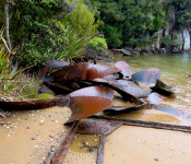 |
Historic whaling repair station GPS: 46 54.756s 168 02.920e Historic site and short walk. Foundations and remains from the old whaling repair station that serviced vessels hunting in the Southern Ocean. Huge ice-damaged props litter the beach. >>> View Map |
 |
Rakiura Track GPS: 46 50.206s 168 05.151e Good spot to access the stunning Rakiura Track with options of a jetty or beach landing. You can make the short walk over to Maori Beach (easy 2 hour return with a bit of time to explore, it has... >>> View Map |
 |
Ridgeline Walk, Evening Cove, South Pegasus GPS: 47 12.202s 167 37.435e Short walk up to the ridgeline with nice views. The track starts near a large boulder on the shore. Follow the blue markers and make note of where you emerge into the open for an easy return. >>> View Map |
 |
Frazer Peaks (Magog & Gog) from Evening Cove GPS: 47 12.374s 167 36.975e Walk to Frazer Peaks. You can choose to summit one or both peaks - Magog and Gog. We went to Magog and it was stunning. Incredible views over the island, including Gog, Seal Creek (Cooks Arm) and the... >>> View Map |
 |
Bald Cone (ex Billy's Cove) GPS: 47 13.597s 167 35.215e Spectacular 275m high granite peak. Two hours to the top. Follow small piles of rocks in the open terrain. When you emerge from the bush cross the gulley and follow the ridge a little before crossing... >>> View Map |
 |
Tin Range Track GPS: 47 09.248s 167 42.164e Walk to historic mining site. The track starts at the western side of the entrance to a very small narrow inlet opposite the historic settlement site on the other side of the bay. The track is... >>> View Map |
|
Inland Lake GPS: 03 46.331S 134 12.055E Hired guide in tiny village. 6 hr round trip through primary forest to huge fresh water lake. Many birds, beautiful forest. >>> View Map |
|
|
Dinghy River Trip GPS: 03 45.76S 134 07.52E Not really walking...dinghy trip up the fresh water river! We started at the river mouth (where lat long is) and went over the bar at near high tide. Had minimum 7 ft going over the bar, so could... >>> View Map |
 |
Airport, Leava, Futuna GPS: 14 18.829S 178 03.997W Beautiful rich and abundant life, fingering reefs which go quite deep pretty quickly and the most enormous boxfish we've seen. Would be a good dive site too. >>> View Map |
 |
Euaiki, Vava'u, Tonga GPS: 18 45.806S 174 01.276W The best kept secret of Vava'u! This amazingly active and diverse snorkel site can entertain you for hours. Work your way from the west side of the resort's pier right from the very shallows out... >>> View Map |
 |
Turtle Hole, Wallis GPS: 13 16.815S 176 07.849W Cool circular "hole" with reef on one side and a sandy incline on the other, plenty of fish included boxfish, whitetip reef shark, blacksaddle coral grouper, hawkfish, parrotfish, lots of two-tone... >>> View Map |
 |
Mariner's Cave, Vava'u, Tonga GPS: 18 41.451S 174 04.492W Wicked underwater cave you can surface in. Great sea fog effects with the swell - do not miss out on this amazing experience! To find the cave look for the stripes in the rock wall and where the... >>> View Map |
 |
Kelefesia, Ha'apai, Tonga GPS: 20 30.195S 174 44.357W Beautiful wee island that is privately owned but with no-one living there permanently. Amazing snorkeling with a reef that drops off vertically. There is also a wrecked yacht at about 10 m depth on... >>> View Map |
 |
Swallows Cave, Vava'u, Tonga GPS: 18 41.008S 174 02.839W Stunning spot to snorkel. There are two caves here, the northern cave is fun to start in with a bonus secret cave to the left of the entrance That you swim down and up into (a good introduction if... >>> View Map |
 |
Southeast Vakaeitu, Vava'u, Tonga GPS: 18 43.665S 174 05.468W Excellent snorkeling site with a good range of depths, large table corals and abundant fish life including some of the bigger guys cruising by in the deeper spots. >>> View Map |
 |
Kenutu, Vava'u, Tonga GPS: 18 42.113S 173 55.685W Beautiful and very different snorkeling to most sites around tonga. This is a shallow site (so best at high tide) with a lush seagrass meadow where you can find trigerfish, sea stars, sea cucumbers... >>> View Map |
|
Uoleva South GPS: 19 51.123S 174 25.463W Great spot for beginners, either straight off the sandy beach or from the boat. This sheltered site is packed with a variety of coral. Very calm water, nice and shallow so it is easy to get up close... >>> View Map |
|
|
Umuna Spit GPS: 18 40.744S 173 56.261W At the northern tip of Umuna there is a sand spit leading west. Walk out to the end of the spit and you will find an extensive coral landscape. Tremendous bushes of coral with different kinds of fish... >>> View Map |
|
|
Frenchman Rock, Whangaihe Bay GPS: 34 59.266S 173 49.013E Great tunnels and caves to explore. >>> View Map |
|
|
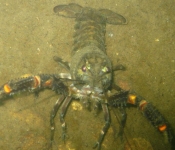
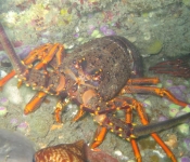
Mahinepua Bay GPS: 34 59.255S 173 51.888E Rich marine life, including rock lobster and snapper. >>> View Map |
|
") |
Manta Ray Pass GPS: 17 09.76158s 177 11.58258e Manta rays feed in the pass swimming up and down for hours. The best time to go is a couple of hours before high tide. There is a bit of a current but not so strong that you can't swim against it... >>> View Map |
 |
Blue Lagoon, Nanuya Island GPS: 16 56.922s 177 21.952e Huge schools of sergeant fish congregate here as they are regularly fed by the locals. Snorkelling among them is an incredible experience. The site slopes away from the beach and then quickly drops... >>> View Map |
 |
Mana Island, Fiji - outer reef GPS: 17 41.38722s 177 06.68934e Beautiful and healthy coral with the reef dropping off steeply. Occasional small gorgonian coral fans. Anchor your dinghy just south of the reef pass into Mana lagoon and then snorkel along the... >>> View Map |
|
Nell Island Pass GPS: 9 6.51747n 167 19.30974e Fabulous drift snorkelling and walks across the islands and passes to the west. >>> View Map |
|
|
Hideaway Island GPS: 17 41.85261s 168 15.61764e Best snorkelling we found at this site was either side of the dinghy mooring around this location. Quite good coral and plenty of reef fish and schools of fusiliers. There is a school of slightly... >>> View Map |
|
 |
Laonmeten South, Moso Island GPS: 17 32.81424s 168 13.58851e Decent spot with a lot of fish including aggregations of snapper and grouper over a sandy patch near the small dinghy mooring. The reef descends from the surface to about 8m. >>> View Map |
|
Laometen North GPS: 17 32.54864s 168 13.60358e Lovely snorkel site with some very good visibility areas. Descends from surface down to 10m. Some areas of nice healthy coral. >>> View Map |
|
 |
Lamen Bay GPS: 16 35.756s 168 09.882e Snorkelling through the anchorage here is an absolute delight with numerous large green turtles feeding on the seagrass. Various other species can also be spotted - rays, puffers, snakes etc. And if... >>> View Map |
 |
Grand Central, Namena Island, Fiji GPS: 17 04.290S 179 06.512E Amazing diving with beautiful basin rich with life and solid wall drop off. Great schools of big-eye barracuda and trevally, grey reef sharks hovering off the drop-off and lots of big pelagic fish... >>> View Map |
 |
Chimneys, Namena Island, Fiji GPS: 17 07.104S 179 03.960E Beautiful colourful fish and coral dive, chimneys covered in clouds of bright pink, orange and purple anthias with schools of blue streak fusiliers and the odd boldly patterned clown triggerfish... >>> View Map |
 |
Pinball Alley, Makogai, Fiji GPS: 17 24.762S 178 56.795E Lovely diving, fusiliers, peacock, coral, masked and black saddle coral groupers, bicolor rabbitfish and all the usual suspects plus a bonus turtle. >>> View Map |
 |
Split-apple Rock, Tu'ungasika, Vava'u, Tonga GPS: 18 39.508S 174 04.164W Start in the northwest and head southeast. The dramatic and very picturesque split-apple rock can be found here. Lots of soft corals, awesome swim throughs, and great fish diversity including... >>> View Map |
 |
Gorgonian Forest, Tu'ungasika, Vava'u, Tonga GPS: 18 39.667S 174 04.045W Fabulous gorgonian fans are the star feature of this site but it would be a brilliant site even without them, it has a great swim-through tunnel and an active cleaning station with pelagics like... >>> View Map |
 |
Northwest Meyr, Kermadec Islands, NZ GPS: 29 14.518S 177 52.705W Stunning clear water with a few corals and little algae make with loads of inquisitive Galapagos sharks and kingfish make this a unique and impressive site. A great mix of temperate (demoiselle... >>> View Map |
 |
Fofoa Is, Vava'u, Tonga GPS: 18 41.749S 174 08.208W Rich and pristine site on the southern outer side of the entrance to Hunga lagoon. This was one of the healthiest dive sites with the best coral diversity we found in Tonga. Lots of fish with big... >>> View Map |
 |
Passe Avatolu, Wallis GPS: 13 18.795S 176 16.591W Outer reef dive just south of pass, there's a buoy here you can tie your dinghy to if it's not being used which is likely in this place away from the usual tourist and cruising throngs. Midnight... >>> View Map |
 |
Ha'ano, Ha'apai, Tonga GPS: 19 40.457S 174 17.414W Brilliant dive site, explore the deeper areas on your way out but make sure you don't miss the shallower stuff on the way back - so much colour and plenty to see. There is a lovely wee village on... >>> View Map |
 |
zero plane, roi-namur GPS: 09 23.069N 167 28.198E great first dive for our wreck dives in roi-namur and close to our anchorage. the plane is in good condition for how long it has been here. dived to 17 metres. >>> View Map |
|
f4u corsair (nose down), roi-namur GPS: 09 21.000N 167 26.382E
awesome dive, plane sitting on nose, still intact. >>> View Map |
|
|
plane graveyard, kwajalein atoll GPS: 09 20.912N 167 26.305E
as the title implies, lots of planes, we counted 8 on our dive, 2 vertical, fantastic dive, 34m >>> View Map |
|
 |
eiko maru #2, kwajalein atoll GPS: 09 22.693N 167 28.126E awesome huge ship, lots and lots to see, close to anchorage at roi-namur, 30m >>> View Map |
|
c 46 plane, kwajalein atoll GPS: 09 20.933N 167 26.398E
swam over top at end of dive, had trouble finding, 31m >>> View Map |
|
|
b25 plane, kwajalein atoll GPS: 09 20.931N 167 26.412E
sitting upright on wheels, looks like ready for takeoff, 36m >>> View Map |
|
|
four sdb planes, kwajalein atoll GPS: 09 21.110N 167 26.512E
planes disused and scrapped at end of war, interesting dive, 37m >>> View Map |
|
|
bommie dives at sixth island, kwajalein atoll GPS: 09 20.101N 167 30.131E
didn't have good vis, lots of coral but not much fish life, 26m >>> View Map |
|
|
asakaze maru, local name k2 upright, kwajalein atoll GPS: 08 44.415N 167 43.067E
great ship wreck with lots to see including guns, even with the poor vis and rough seas we had on the day, an awesome dive, 36m >>> View Map |
|
|
prinz eugen, kwajalein atoll GPS: 08 45.133N 167 40.996E
top of wreck propeller out of water, great dive even with the poor vis we had, 27m >>> View Map |
|
|
namena marina reserve GPS: 17 06.616S 179 05.703E the diving is absolutely drop dead gorgeous and amazing !!!!!!!!!!!!!!!!!!!!!!!!!!!!!!!!!!!!!!!! as this is a marine reserve there is a $30/diver charge, but we have certainly got more than... >>> View Map |
|
 |
North Minerva Reef GPS: 23 36.79s 178 55.75w Scuba diving the outside wall drop-offs at the Minerva Reefs is spectacular due to the superb water clarity and extensive coral, fish and other marine life. There are few suspended particles and the... >>> View Map |
|
Limu Rise GPS: 20 1.625S 174 28.269W A cluster of large coral heads rising up to 3m depth, surrounded by sandy bottom at a depth of 20m. The water here is crystal clear, the best visibility you can get. The rocky coral rise is encrusted... >>> View Map |
|
|
Tongoa Wall, Tongoa Island, Vanuatu GPS: 16 52.359S 168 31.821E Amazing diving on the north side of the wall with lots of soft coral, fans, and sea creatures including banana nudibranch. The customary fee is 500 VT payable on shore although a higher fee may be... >>> View Map |
|
 |
Ringdove Bay, Epi Island, Vanuatu GPS: 16 37.366S 168 08.681E Surprisingly good diving and snorkeling on the N and SE portions of the reef with hard corals deep and soft corals near the surface and some shallow canyons. In addition, there is an 80 ft wall on... >>> View Map |
|
Faioa Fork GPS: 18 39.370S 173 55.388W Take the dinghy across the inner reef north of Faioa Island at between 2 hours before and after high tide. Dive the drop off between the inner and outer reef. Excellent visibility, lots of coral... >>> View Map |
|
|
Labyrinths GPS: 18 38.548S 174 03.895W From the surface this looks like just another coral garden. But the top of the coral reef is sitting on several towers of rock that plummet 15m down to sand. Swim through tunnels, into large caves... >>> View Map |
|
|
Makodroga Rocks GPS: 17 26.014S 178 56.748E A pile of black rocks jut out from the southern tip of Maodroga Island, adjacent to Makogai Island. Dive the western side of this reef. Large clams, turtles and a kaleidoscope of colours await you. A... >>> View Map |
|
|
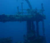
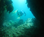
Rainbow Warrior GPS: 34 58.488S 173 56.094E The wreck of the Greenpeace "Rainbow Warrior", marked by a yellow buoy. The vessel was bombed by the French in 1985 killing one and was sunk here to form an artificial reef as a memorial in 1987.... >>> View Map |
|
|
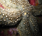
Motukumara Rock GPS: 35 14.060S 174 18.913E Weedy reef with deep cracks and guts where you will find rock lobster, sponges, kelp forest and rich encrusting invertebrate life, including nudibranchs. >>> View Map |
|
 |
Elsdon Pipe, Houghton Bay GPS: 41 20.75514S 174 46.93986E The topography at this site is great with a rocky reef full of of cracks, crevices and canyons. Plenty of kelp as well as invert encrusted patches on walls. Plenty to explore!Aquatic Life:This site... >>> View Map |
 |
Cape Rodney to Okakari Point Marine Reserve (Leigh Marine Reserve) GPS: 36 15.9687S 174 47.48706E Cape Rodney to Okakari Point Marine Reserve (more commonly known as Leigh or Goat Island) was established over 30 years ago and was New Zealand's first marine reserve. Previously charachterised by... >>> View Map |
 |
Taioma tug (Tauranga) GPS: 37 37.2S 176 24.6E The main deck of the Taioma is around 22m, base of the wreck at 27m and the funnel at 17m. There is only one ascent/descent line which leads down to the stern. when i was there it still had the... >>> View Map |
 |
Long Island - Kokomohua Marine Reserve GPS: 41 6.98094S 174 17.26776E There are reefs around the northern side of Long Island and the bottom slopes away on the eastern side. Towards the south east there is a steeper drop off where more pelagic species may be seen... >>> View Map |
 |
Sirens’ Rocks/Mermaids’ Kitchen, Taputeranga Marine Reserve GPS: 41 20.96922S 174 45.79788E This rocky coastline faces south and is exposed to the full force of the southerlies which regularly pound Wellington’s southern shores. A couple of days of northerlies though and this site is a... >>> View Map |
 |
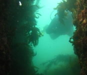
Blue Maomao Arch, Poor Knights Islands GPS: 35 29.32404S 174 44.46924E This site is based on the archway. A sandy bottomed channel (Labrid Channel) leads into the arch. Take a look at the large boulders in the channel where colourful triplefins and blennies perch.... >>> View Map |
 |
Hole in the Rock, Kapiti Island GPS: 40 49.29672S 174 55.37274E If you jump in on the eastern side of the point you find yourself in a fairly shallow bay kelpy dropping off fairly quickly to the north to sand flats. A reef runs along the west side of the bay and... >>> View Map |
 |
West side, Kapiti Island GPS: 40 50.72232S 174 54.411E The bay is very kelpy with some large rocky parts (from memory...feel free to amend!). Out towards the end of the reef it drops off a bit and there is a lot of life with fish seeming to congregate... >>> View Map |
 |
Mikhail Lermontov GPS: 40 59.136S 174 14.54862E The Lermontov now lies on her Starboard side and is fully intact. Diving on the Lermontov is a fantastic experience, with the propellers, damage, funnel, bridge and pool area all easily assessable.... >>> View Map |
 |
Middle Arch, Poor Knights Islands GPS: 35 27.4551S 174 43.95294E At the southern entrance to Middle Arch on the left is Bernie's Cave, a small cave with a sandy bottom at 13 metres and an air bubble at the top, about 7 metres. The cave has a ledge at the back... >>> View Map |
 |
Rocky Bay GPS: 41 5.98962S 174 49.92756E This site lives up to its name with plenty of rocky terrain to explore that gradually gets deeper with nice walls and gullies to explore. Most of this site is quite shallow, getting down towards 13... >>> View Map |
 |
Breaker Bay - The Crack GPS: 41 19.96734S 174 49.8804E The swim through bisecting the rocks here is the highlight of this site. It is quite narrow so be careful not to hit the sides as you go through. If you continue clockwise when you get to the... >>> View Map |
 |
Te Tapuwae o Rongokako Marine Reserve GPS: 38 36.52932S 178 12.3477E This site is representative of the habitats found along this coast. Rocky intertidal platforms have channels running through them , rocky reefs are covered in a variety of seaweeds to 10 metres below... >>> View Map |
 |
Lake Taupo GPS: 38 53.05308S 175 57.8004E Lake Taupo is NZ's largest lake and includes many dive sites, including deep drop-offs, walls and weed lines but is predominantly made up of sandy or muddy bottom. Lake Taupo has an area of... >>> View Map |
 |
Barney's Rock, Kaikoura GPS: 42 26.87688S 173 35.079E Barney's Rock is a popular wall dive with lush kelp forest. The rock itself is named after Barney O'Reily, a legendary local whaler who used the rock to spot whales from. Water temperature ranges... >>> View Map |
 |
Horoirangi Marine Reserve, North Nelson GPS: 41 9.32262S 173 24.20508E The boulder reef is a distinctive feature of this reserve and is interspersed with patches of bedrock reef. The boulder reef is more dominant in the southern end of the reserve. The many cracks and... >>> View Map |
 |
Milford Sound/Piopiotahi, Fiordland GPS: 44 37.78908S 167 53.95476E Diving in Fiordland is a unique experience due to the tea coloured (tanin stained) freshwater layer that permanently sits on the surface of the fiords reducing light penetration. Below this is the... >>> View Map |
 |
Ulva Island (Te Wharawhara) Marine Reserve, Stewart Island (Rakiura) GPS: 46 55.58112S 168 8.10654E Water temperature ranges from 8 degrees in the winter to 14 degrees in the summer. Visibility can be excellent here as there is little run-off from the land with 85% of the island covered in native... >>> View Map |
 |
Yung Pen, Taputeranga Marine Reserve GPS: 41 20.94804S 174 45.21288E Yung Pen is the wreck of a Taiwanese fishing boat that sunk in December 1982. Only the stern end of the Yung Pen is here, the bow ended up further on shore and was cut up for scrap. The wreck sits in... >>> View Map |
 |
Te Awaatu Channel/The Gut, Fiordland GPS: 45 17.53674S 166 56.63706E Diving in Fiordland is a unique experience due to the tea coloured (tanin stained) freshwater layer that permanently sits on the surface of the fiords reducing light penetration. Below this is the... >>> View Map |
 |
Vava'u, Tonga GPS: 18 37.50594S 173 56.73018W Usual coral walls and holes, shark spots, and a wreck. Used Beluga Diving when we stayed , professional informative and friendly.Aquatic Life:Sharks, turtles, tropical fish, Warnings:Tropical fish... >>> View Map |
 |
Tonga, Nokolo GPS: 21 16.36914S 175 7.68984W Dived off from the beach, hired the gear from the local resort, I only went out as far as the reef as the locals warned me not to go further as thats where the sharks feedAquatic Life:visability was... >>> View Map |
 |
Te Angiangi Marine Reserve GPS: 40 9.59904S 176 50.69184E This reserve protects a typical piece of the Central Hawke's Bay coast. At low tide a broad rock platform is exposed, giving access to a fascinating variety of marine life. At the northern and... >>> View Map |
 |
Pohatu (Flea Bay) Marine Reserve GPS: 43 52.5759S 173 1.33722E Although the water is cold, getting into it is one way to appreciate the reserve. With a wetsuit, mask and snorkel you can explore the rocks around the shore, while scuba gear will allow you to dive... >>> View Map |
 |
Lyttelton Head GPS: 43 35.22444S 172 48.50928E Rocky and weeds with some sandy spots. avg depht 15m - 20m A Cave which is full of sea foodAquatic Life:CRAYS CRAYS CRAYSWarnings:Rough water in N / NE and NW if the sweel is up. and rocks that... >>> View Map |
|
Radar Point Pinnacle, Cuvier (Repanga) Island GPS: 36 25.614S 175 46.57698E 17-30 metres. Source: DIVE New Zealand magazine.Aquatic Life:Big pelagics, including kingfish and sharks, feeding on baitfish schools. Plenty of rocklobster. Deeper reefs with colourful invertebrate... >>> View Map |
|
|
Black Rocks, Coromandel GPS: 36 41.92398S 175 51.91302E 0-25 metres. Source: DIVE New Zealand magazine.Aquatic Life:Kingfish work in baitfish boil-ups, especially in summer. Undulating reef with lots of kelp home to red and painted moki as well as... >>> View Map |
|
|
Gemstone Bay, Cathedral Cove GPS: 36 49.873S 175 47.790e 0-8 metres. Great snorkelling site, usually quite sheltered. Good site for kids.Aquatic Life:Snapper, leatherjackets, parore, spotties and triplefins all close to shore. Rock lobster can be found... >>> View Map |
|
|
Spectacle Reef, Mahurangi island GPS: 36 50.02002S 175 49.18998E 0-25 metres. Lots of deep canyons. Source: DIVE New Zealand magazine.Aquatic Life:Apricot and Jason nudibranchs on walls. Schools of maomao, demoiselles and butterfly perch. Kingfish and baitfish... >>> View Map |
|
|
Honeycomb Caves, Alderman Islands GPS: 36 57.255S 176 3.28698E 5-15 metres. Caves with various entries and exits. Can be a bit exposed in swells and strong winds but a really nice dive. Source: DIVE New Zealand magazine.Aquatic Life:Untold invertebrate life... >>> View Map |
|
|
Stingray Rock, Alderman Islands GPS: 36 59.18802S 176 4.893E 16-30+ metres. Very exposed pinnacle with steep walls and regular current. Awesome dive in blue water. Source: DIVE New Zealand magazine.Aquatic Life:Walls are covered with sponges, hydroids and... >>> View Map |
|
|
Mooring Bay, Alderman Islands GPS: 36 57.621S 176 4.65402E 0-20 metres. Exposed to easterly wind or swell. Good snorkelling over the reefs including a swim-through. Source: DIVE New Zealand magazine.Aquatic Life:Colourful walls with plenty of photographic... >>> View Map |
|
|
MacGregor's Reef, Alderman Islands GPS: 36 56.451S 176 6.35898E 10-30 metres. Source: DIVE New Zealand magazine.Aquatic Life:Reef fish include porcupinefish and scarlet wrasse. Sponges, anemones, ascidians and hydroids below 15 metres on the walls. Keen-eyed... >>> View Map |
|
|
Never Fail Reef, Great Mercury Island GPS: 36 34.197S 175 47.649E 0-33 metres. Source: DIVE New Zealand magazine.Aquatic Life:Great fish life with red moki, butterfish, john dory, scarlet and banded wrasses as well as large kingfis feeding on baitfish schools.... >>> View Map |
|
|
Coralie Bay, Great Mercury Island GPS: 36 36.081S 175 48.01002E 0-25 metres. Good anchorage and site good for snorkelling also. Kelp covered rocks. Source: DIVE New Zealand magazine.Aquatic Life:Schooling fish particularly abundant in the summer, occasional rock... >>> View Map |
|
|
Kingfish Rock, Hahei Marine Reserve GPS: 36 49.38702S 175 48.73398E 5-23 metres. Source: DIVE New Zealand Magazine.Aquatic Life:Schools of blue maomao, koheru, mackerel, kahawai and kingfish, especially in summer. Down the colourful walls are mussels, anemones,... >>> View Map |
|
|
South Sunk Rock, Hahei GPS: 36 49.06602S 175 49.13898E 0-30 metres. Large rock with swim-throughs and crevices to explore. Source: DIVE New Zealand magazine.Aquatic Life:Covered in invertebrate life with nice sponge growths in rock crevices. Reef fish... >>> View Map |
|
|
Stony Bay, northern Coromandel Peninsula GPS: 36 30.114S 175 25.62402E Kelp covered rocky reef, 0-20 metres. Source: DIVE New Zealand magazine.Aquatic Life:Typical life include rock lobster, red moki, leatherjackets, spotties and other wrasses. Schools of trevally and... >>> View Map |
|
|
Port Charles, norhtern Coromandel Peninsula GPS: 36 31.34202S 175 31.044E 0-30 metres. Quite well protected from the southwest wind with lots of broken reef, boulders and kelp forest. Source: DIVE New Zealand magazine.Aquatic Life:Rock lobster, red and painted moki,... >>> View Map |
|
|
Tokoroa Rock, northern Coromandel Peninsula GPS: 36 37.377S 175 35.334E 3-30 metres deep,reasonably sheltered with a good patch of reef inside the rock great for snorkelling. The reef varies in depth with lotsof kelp over it. Source: DIVE New Zealand magazine.Aquatic... >>> View Map |
|
|
The Lighthouse, Slipper Island GPS: 37 2.802S 175 57.41898E 0-30 metres. Exposed to northerly and easterly swells and strong winds. Good reefs with a few small caves. Source: DIVE New Zealand magazine.Aquatic Life:Big schools of demoiselles, blue maomao and... >>> View Map |
|
|
Rat Rock, Slipper Island GPS: 37 4.71102S 175 55.53E 0-25 metres. Exposed to any wind from the south and often has current. Good photographic dive. Source: DIVE New Zealand magazine.Aquatic Life:Jewel and common aneones among unusual sea chells like... >>> View Map |
|
|
Orongatea Bay, Mayor (Tuhua) Island GPS: 37 15.906S 176 16.30602E 0-20 metres. Good site for snorkellers above the kelp-covered boulders. Bubbles show where gas still rises from this extinct volcano's vents. Source: DIVE New Zealand magazine.Aquatic Life:Spotties... >>> View Map |
|
|
North West Bay, Mayor (Tuhua) Island GPS: 37 17.52798S 176 14.03502E 5-20 metres. In the shallows there is little but kina barrens but further down the walls it is magic.Aquatic Life:A few crayfish hide in the caves and reef fish include Sandager's wrasses. Large John... >>> View Map |
|
|
Tuhua Reef, Mayor (Tuhua) Island GPS: 37 18.39798S 176 17.28498E 0-30+ metres. Lots of volcanic rock form these reefs with chunks of black volcanic glass occasionally seen on the bottom. The fishing boat San Benito wrecked here but little is left that can be seen... >>> View Map |
|
|
SS Taupo Wreck GPS: 37 24.63S 176 3.25302E The SS Taupo sank in 1881, it sits on sandy bottom at 32 metres depth. The site is unmarked and the wreck is mostly collapsed though a large boiler can be seen standing up . Aquatic Life:Good fish... >>> View Map |
|
 |
Diadema Rock, Te Paepae o Aotea (Volkner Rocks) Marine Reserve GPS: 37 28.79472S 177 7.6554E 10-30 metres. Near vertical rock walls, submerged pinnacles and drop offs characterise this dive site which gets very deep very quickly. Minimal sediment run-off from the pinnacles result in very... >>> View Map |
|
Big Volkner, Volkner Rocks (Te Paepae Aotea) Marine Reserve GPS: 37 28.54302S 177 8.05002E 6-30+ metres. Submerged pinnacle in the path of the warm eastern current.Aquatic Life:Kingfish are common and other pelagics like marlin, tuna and sharks can occasionally be seen. The pinnacle is... >>> View Map |
|
|
Homestead Reef, White Island GPS: 37 31.60602S 177 10.40598E 12-25 metres. Swim-throughs between boulders and sand gutters.Aquatic Life:Blue and pink maomao, butterfly perch, sweep and occasional snapper, tarakihi and large blue moki. Kingfish can be seen... >>> View Map |
|
|
Club Rocks, White Island GPS: 37 32.127S 177 10.99902E 0-30 metres. Rocky reef extending out on the western side with caves and archways.Aquatic Life:Sponges, hydroids and bryozoans. Abundant reef fish, blue and pink maomao and occasional kingfish.... >>> View Map |
|
|
Lottin Point GPS: 37 32.00598S 178 10.086E 0-30 metres.Aquatic Life:This is a rich dive site well worth the treck. Fish include blue maomao, snapper, blue moki, porae and kingfish. Warnings:Beware of fishing line among the kelp.Directions:10... >>> View Map |
|
|
Taupo Point, Golden Bay GPS: 40 47.25498S 172 57.2448E Patch of broken reef starting at 5 metres with a little kelp cover dropping down to sand at 12 metres. Aquatic Life:Rock lobster, kina, some scallops. Fish life dominated by spotties and banded... >>> View Map |
|
|
Tonga Island Marine Reserve GPS: 40 53.32602S 173 4.0428E Large granite boulders with little macroalgae as the granite regularly scours off keeping the boulders clean.Aquatic Life:A close look at the boulders reveals triplefins, flatworms and nudibranch,... >>> View Map |
|
|
Hapaku Island, D'Urville GPS: 40 53.85702S 173 46.3656E Algal covered reef extending from 5 down to 25 metres.Aquatic Life:Sweep, blue cod, butterfly perch, sea perch, red moki and blue moki inhabit the reef. Rock lobster can also be found in cracks and... >>> View Map |
|
|
Lookout Bay, D'Urville Island GPS: 40 43.99302S 173 52.5E 5-20 metres.Aquatic Life:Butterfish, sweep, blue cod, butterfly perch, sea perch, and red and blue moki. Good invertebrate life on walls and rock lobster hidden about the place. A few kingfish and... >>> View Map |
|
 |
Hells Gates, Pearl Island GPS: 47 11.147s 167 41.450e Scenic dive with good fish life - blue cod, trumpeter, butterfly perch, blue moki, tarakihi, girdled and scarlet wrasses. We also had a sea lion come check us out during the dive. >>> View Map |
 |
Paul's Reef GPS: 17 39.94841s 168 10.87735e Nice reef just a short dinghy ride offshore from a very pretty, but exposed to sea, anchorage. There are a couple of lines floated by clear plastic bottles you can tie off your dinghy to. We... >>> View Map |
 |
Revolieu Bay GPS: 16 43.83229s 168 8.57112e Very good diving here if you are interested in invertebrates. Lots of nudibranchs, soft corals, lace corals, gorgonians etc. Really nice topography with swim-through crevices creating great habitat... >>> View Map |