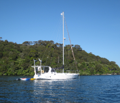
Anchorages
|
Tokoriki Island, Mamanuca, Fiji GPS: 17 35s 177 05e Poor - infringed with reefs. Rolly, but est NW through N to East. >>> View Map |
|
|
|
|
|
Hideaway Island, Mele Bay GPS: 17 41.5s 168 15.9e Open to S swell, good in E and SE winds. Excellent holding in 6-15 metres over sand. Anchor close to The Beach Bar. >>> View Map |
|
|
Asau GPS: 13 30.86s 172 38.72w Good protection with the small reef that is closing the bay. >>> View Map |
|
|
Bland Bay GPS: 35 20.62s 174 021.56e Great of there's little east swell. Good holding, Large bay. Pretty. We're anchored in 4 meters of water over sand and mud. >>> View Map |
|
|
Kingston Hbr Royal Jamaican Yacht Club GPS: 17 58n 76 48w Kingston Harbour Good holding but long fetch in prevailing winds >>> View Map |
|
|
Careys Bay, Otago Harbour GPS: 45 48.415s 170 37.608e Small shallow anchorage next to a fishing wharf where there is a fuel berth you can get diesel from with credit card and a cute old stone pub and restaurant. Just a few minutes walk from the lovely... >>> View Map |
|
 |
Aramoana GPS: 45 46.853s 170 42.960e S TO NW amazing soft squeaky white sand beach. Anchor eastern end in 3m. You can occasionally spot a sea lion or two here and there is a boardwalk on southeastern side of the township out onto a... >>> View Map |
|
Cousteau Resort GPS: 16 48.706s 179 17.222e Protected anchorage sheltered from all but SW winds. Just off Cousteau Resort. Good anchoring in 12m of water on the left side of the resort. Walk or bus into Savusavu >>> View Map |
|
 |
Port William, Rakiura GPS: 46 50.271s 168 05.220e Large shallow anchorage, good in SW to NE wind. Access to Rakiura Track. >>> View Map |
 |
Golden Bay, Stewart Island GPS: 46 54.304s 168 07.276e Good base for exploring Paterson Inlet as nice and sheltered with access to walking tracks and just a short walk to town. Sheltered from most but a bit exposed to SW from fetch building up across the... >>> View Map |
 |
Prices Inlet GPS: 46 54.632s 168 02.75e Sheltered from all but easterly winds, great base for exploring by dinghy or kayak especially at high tide. Good access to a walking track at the old dam and the historic whalers base. >>> View Map |
 |
Ben's Bay, North Pegasus GPS: 47 10.828s 167 39.857e Excellent all weather anchorage, stern-line to tree on northern side for best protection. Freshwater is available at the small beach on the north side half way down the arm. >>> View Map |
 |
East Arm, Evening Cove, South Pegasus GPS: 47 12.256s 167 37.465e Good all weather anchorage. Take extreme care navigating in as the point and islands both have rocks off them submerged at high tide and our charts were out showing us 50m or so inland when at anchor... >>> View Map |
 |
Abrahams Bosom, Port Adventure GPS: 47 03.641s 168 10.132e All weather anchorage with good holding in 3-5 metres. >>> View Map |
|
Nomuka Ika GPS: 20 16.61S 174 48.30W Off snorkelling today around the reef & small explore around island. Chill day today. >>> View Map |
|
|
Otiao Bay on the western side of Urupukapuka GPS: 35 17.734s 174 7.576e Great in anything with east in it >>> View Map |
|
|
Vliho Bay, Levkas Island, Greece GPS: 37 59.449n 23 44.705e Big bay, all round protection >>> View Map |
|
|
Kenutu Island GPS: 18 41.70205s 173 55.73197w Secure anchorage with large area of shallow water with excellent holding. Common sense needed to access the anchorage with good visibility. >>> View Map |
|
|
Pioneer bay Airlie beach GPS: 20 15.735s 148 43.827e Not good for Ne to W above 10 knots >>> View Map |
|
|
|
|
|
Welcome bay GPS: 17 07.451s 146 02.057e Most times a swell running in and can be uncomfortable >>> View Map |
|
|
Endevour river Cooktown GPS: 15 27.686s 145 14.740e Protected from e/se winds Good holding, >>> View Map |
|
|
Labuan Badjo, Indonesia GPS: 8 30.369s 119 52.477e Beautiful spot near the town, but far enough away from the extremely busy harbor - beautiful sunsets. Protected from SE, E and NE winds, but open to any wind from NW to SW. >>> View Map |
|
|
|
Pangaimotu GPS: 21 7.560s 175 9.691w Great anchorage off the perfect tropical island of Pangaimotu. Secure in all winds but choppy in strong Westerly's. Big Mamas Yacht Club caters to yachts, great atmosphere and staff. Daily water... >>> View Map |
|
Ninian bay GPS: 14.21 141s 144.36 059e Good holding,uncomfortable with a strong Se .wind >>> View Map |
|
|
Owen channel ,flinders isl. GPS: 14 10.496s 144 13.837e Good protected anchorage,except sw. Winds >>> View Map |
|
|
Princess Charlotte bay GPS: 14 15.230s 144 18.750e Good protection from a strong Se . Good holding. >>> View Map |
|
 |
|
|
Kennedy inlet GPS: 11 57.330s 143 12.600e Protected from E-S winds Shallow and sandbanks >>> View Map |
|
|
Margarett bay. Cape Grenville GPS: 11 57.330s 143 12.600e Protected from E-Se winds Good holding >>> View Map |
|
 |
Margaret bay Cape Grenville GPS: 11 57.330s 143 12.600e Good protection from E-S winds ,good holding >>> View Map |
 |
Portland roads Weymouth bay GPS: 12 35.552s 143 24.458e Protected from E-S winds Good holding >>> View Map |
|
Bua Bay GPS: 16 52.07178S 178 34.62510E Large natural harbour, well protected from waves but can be breezy. >>> View Map |
|
|
Sheltered anchorage GPS: 16 48(1)S 178 17(3)E Careful when entering the bay, there is a large coral outcrop in the middle on approach. >>> View Map |
|
|
Marsden Cove marina GPS: 35 50.213s 174 28.121e Very protected but relatively shallow. Great facilities >>> View Map |
|
 |
|
|
Kralendijk GPS: 12 9.812n 68 17.054w Mooring ball off main town beach - no anchoring permitted on Bonaire- a marine park >>> View Map |
|
|
Sheltered anchorage GPS: 16 48(1)s 178 17(3)e Careful when entering the bay, there is a large coral outcrop in the middle on approach. >>> View Map |
|
|
Tavua bay GPS: 17 22.79s 177 49.62e Large anchorage 8m mud, good holding. Sheltered W,E,S >>> View Map |
|
|
Baie de Wala, ile Art, Belep Is GPS: 19 42.835s 163 38.545e Good in all but westerly quarters. Dark mineral sands. >>> View Map |
|
|
Sawa-i-iau Island Caves GPS: 16 50.82s 177 28.07e Utterly beautiful, well protected anchorage >>> View Map |
|
|
Inverrel bay Cove hbr. GPS: 12 11.839s 136 42.239e Protected from W-S winds Excellent holding >>> View Map |
|
 |
|
 |
|
|
Kralendijk GPS: 12 9.573n 68 16.937w Moorings only off the town beach- can handle 40-50 boats. >>> View Map |
|
|
Southern end of Chesterfield Reef GPS: 19 57.32S 158 28.29E Chesterfield lagoon covers an area of approximately 3500 km2. A barrier reef surrounds the lagoon, interrupted by wide passes except on its eastern side where it is open for over 20 nautical miles (... >>> View Map |
|
|
Dolphin Island, Port Orly GPS: 15 02.165s 167 05.028e Port Orly is known for its white sand beaches, good snorkelling and nature reserve islands. >>> View Map |
|
|
Vanihe Bay, Ambae Island GPS: 15 16.609s 167 58.378e Beautiful anchorage in a horseshoe shaped bay surrounded by cliffs and trees full of fruit bats. Yachts have reported it can get quite rolly. >>> View Map |
|
|
Nopul GPS: 16 06.549s 168 07.831e Excellent holding in sand, about 10m deep, sheltered from southerly winds. >>> View Map |
|
|
Ranvetlam GPS: 16 09.084s 168 06.457e Excellent holding in 4-8 metres, sandy bottom, sheltered from southerly quarter winds. Anchor in front of moorings. >>> View Map |
|
|
Lutes GPS: 16 32.169s 167 50.202e Sheltered in all but southerly winds. Excellent holding in 13 metres over fine sand. Take care coming in with reefs on both sides. >>> View Map |
|
|
Lamen Bay GPS: 16 35.774s 168 09.75e Sheltered in easterly winds. Excellent holding close to beach in 4-8 metres over sandy bottom. Green turtles and dugong are regularly spotted in this anchorage. Avoid anchoring in south east where... >>> View Map |
|
|
Sulua Bay, Emae GPS: 17 02.993s 168 22.223e Best shelter in easterlies. Anchor in 4-8 m in sand, look out for coral. >>> View Map |
|
|
Tongoa Wall GPS: 16 53.071s 168 31.788e Best in NW quarter wind and swell. Good holding in 4-8 m of sand close to the reef. A little rolly. Near Tongoa Wall dive site. Check in with locals, you may be asked to pay a small fee. >>> View Map |
|
|
Escema Bay GPS: 17 33.126s 168 16.991e Very sheltered in all but strong westerlies. Good holding in 4-10 m of sand. You may be able to get fresh produce from local gardens if you ask. You can often see turtles and maybe a dugong if you... >>> View Map |