Error message
Anchorages
|
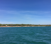
Eniaetok Island, Rongelap Atoll. AKA Pearl Farm GPS: 11 17.585N 166 53.337E Well protected from the NE to S. White sand bottom anchor in 4m deep close to the beach. Crescent shaped bay, beautiful beaches, lots of palms, crystal clear water few bombies. 2 black former Pearl... >>> View Map |
|
|
Bay of Islands, Vanua Balavu, Fiji Islands. GPS: 17 10.828s 179 2.161w Excellent holding and all round protection. >>> View Map |
|
|
Unnamed Village, Triton Bay, Indonesia GPS: 03 46.66S 134 10.18E Off tiny fishing village inside very protected bay. Friendly people. No store. >>> View Map |
|
|
River Trip GPS: 03 45.733S 134 06.944E Close to river, day anchorage, 15 ft near high tide, shallows slowly. >>> View Map |
|
|
Lobo Village GPS: 03 45.840S 134 06.407E Off village in light winds to run dinghies up the river at high tide. 50 ft here. >>> View Map |
|
|
Lobo Village 2 GPS: 03 46.168S 134 06.015E Alternate anchorage for river trip, protected from southerly winds. 55-60 ft close in. >>> View Map |
|
|
Middleton Reef GPS: 29 26.486S 159 05.779E Good in all but westerly directions. Great protection from the reef. Good holding (so far - knock on wood). Lots of wrecks visible - most pretty well rusted away. >>> View Map |
|
|
South currigee GPS: 27 54.442s 153 24.230e Good with winds in the east. lots of current that will hold you N/S. Great holding. Some boat wake from passing motor yachts >>> View Map |
|
|
Namata Bay GPS: 16 44.611s 179 46.183w Very protected bay with incredibly friendly local people on shore... >>> View Map |
|
|
Lami Bay GPS: 18 6.480s 178 23.655e Well protected and more secure than the normal anchorage in Walu Bay near the Royal Suva Yachtclub. Must clear customs in front of the yachtclub before moving to Lami Bay however >>> View Map |
|
|
Bora Bora Yacht Club moorings GPS: 16 29.376s 151 45.615w Well protected for S-SE- E and NE winds >>> View Map |
|
 |
|
 |
Honeymoon bay Wa. GPS: 14 5.940s 126 40.894e Good protection from Ne-S winds ,nice clean sandy beach ,good holding >>> View Map |
 |
Glycosmis bay Wa. GPS: 13.54 216s 127.03 794e Good calm anchorage,protected from all winds >>> View Map |
 |
Twin falls King George river GPS: 14 2.269s 127 19.762e Good holding ,protected from all winds >>> View Map |
|
Anthon landing (Wyndham) GPS: 15 27.753s 128. 05.783e Protected from Ne-Se winds Good holding. >>> View Map |
|
 |
|
 |
Up King George river GPS: 14 02.269s 127 19.760e Protected from all winds Great scenery and waterfalls >>> View Map |
 |
Jar Island in Van Sittart bay GPS: 14 09.648s 126 13.848e Protected from Ne-Se winds Cristal clear water ,good holding >>> View Map |
 |
Musket Cove GPS: 17 46.761s 177 10.595e Best anchorage around for most weather . 15-20m deep so need a lot of chain to stop dragging into many surrounding reefs when a gale blasts through . Only one in 3/12. >>> View Map |
|
Southwest Bay GPS: 16 28.745s 167 26.499e Large bay, anchor in 8-10 metres in sand. We anchored outside the village on the north side of the river which comes out of a large lagoon (quite pretty to explore by dinghy). The village has a small... >>> View Map |
|
 |
Woronav Point, Melip GPS: 16 34.697s 167 29.507e Anchor in 4m over sand in a pretty, small bay. The reef is not worth snorkelling as is almost entirely dead with little life. The best shelter from the sea is at the southern end of the bay. The... >>> View Map |
|
Awei Island GPS: 16 32.046s 167 46.159e Anchor in about 10 metres in sand. Very protected from waves and swell but open to southerly quarter winds. Between a small island (home to just three families) and the main island of Malakula. There... >>> View Map |
|
 |
Woronav Point, Melip GPS: 16 34.697s 167 29.507e Anchor in 4m over sand in a pretty, small bay. The reef is not worth snorkelling as is almost entirely dead with little life. The best shelter from the sea is at the southern end of the bay. The... >>> View Map |
|
Gaspard Bay GPS: 16 28.162s 167 49.003e Best protection from northerly sector winds with good holding in muddy sand in about 13 metres. The entire bay is surrounded by mangroves and seems to be a bit of a nursery for sharks as we had a... >>> View Map |
|
|
Port Sandwich - Lamap GPS: 16 25.798s 167 47.411e Sand with patches of coral. Anchor in about 13 metres a bit out from shore to avoid coral. Dinghy access to Lamap (when tide is in at least) by the sandy beach on the point or use the wharf at Port... >>> View Map |
|
 |
Townsville "Duck Pond" QLD Australia GPS: 19 14.748s 146 49.641e Soft mud. Couple of wrecks so check chart carefully. Protection via rock wall from open sea. Good even for NE. Draft will be an issue for some monos. >>> View Map |
 |
Horseshoe Bay, Magnetic Island QLD GPS: 19 6.907s 146 51.420e Good SE-E protection. Sand with good holding. Rolls a little in 10+kn >>> View Map |
|
Saweni Bay GPS: 17 38.5S 177 233.7E good in all but strong west winds; 8 meters depth, good holding >>> View Map |
|
|
Anse Majic GPS: 22 23.651s 166 53.581e Good sw thru s, se, e, ne, and n. 6 mooring buoys to use. >>> View Map |
|
|
Papaya Bay GPS: 22 10.878s 166 19.606e Good holding sand/mud 3 to 5 meters. Protection from south to east to north and 3 miles away of NW to SW protection. >>> View Map |
|
 |
Juno Bay, Fantome Is, QLD GPS: 18 45.308s 146 32.828e Good in northerlies. Bottom is a tad rocky so watch anchoring. >>> View Map |
|
Saweni Bay GPS: 17 38.5s 177 233.7e good in all but strong west winds; 8 meters depth, good holding >>> View Map |
|
|
Nukumano Island GPS: 19 43.399s 174 16.942w Clear sand, plenty of room in between coral. >>> View Map |
|
|
Muikuku pt GPS: 19 46.640s 174 21.145w Good for strong SE, good holding sand, very little coral. >>> View Map |
|
|
Qalito Island GPS: 17 43.740s 177 7.977e Good, light breeze from the SE Passing showers during the night >>> View Map |
|
|
Southport, Au GPS: 27 56.109s 153 24.325e Presently achored on the Northside of Wavebreak Island. >>> View Map |
|
|
Vlissingen Netherlands GPS: 51 26.697n 3 34.323e Very protected small harbour. Great winter rates. Lovely town with access by train to Europe. At the southern end of the Standing Mast Route through Holland to Germany and beyond. >>> View Map |
|
 |
|
 |
Awaroa Bay GPS: 40 51.241s 173 01.707e Day anchorage only. Good holding in sand 5m but very exposed to sea and swell. Access to kayak up Awaroa estuary and river (high tide). >>> View Map |
 |
Awaroa Bay GPS: 40 51.241s 173 01.707e Day anchorage only. Good holding in sand 5m but very exposed to sea and swell. Access to kayak up Awaroa estuary and river (high tide). >>> View Map |
 |
Totaranui GPS: 40 49.048s 173 00.629e Quite exposed but good in N to W winds. Great walk from here to Separation Point, or a shorter walk just on the north side of the estuary through some old growth forest. There is a campground here... >>> View Map |
 |
Totaranui GPS: 40 49.048s 173 00.629e Quite exposed but good in N to W winds. Great walk from here to Separation Point, or a shorter walk just on the north side of the estuary through some old growth forest. There is a campground here... >>> View Map |
 |
Awaroa Bay GPS: 40 51.241s 173 01.707e Day anchorage only. Good holding in sand 5m but very exposed to sea and swell. Access to kayak up Awaroa estuary and river (high tide). >>> View Map |
 |
Totaranui GPS: 40 49.048s 173 00.629e Quite exposed but good in N to W winds. Great walk from here to Separation Point, or a shorter walk just on the north side of the estuary through some old growth forest. There is a campground here... >>> View Map |
 |
Awaroa Bay GPS: 40 51.241s 173 01.707e Day anchorage only. Good holding in sand 5m but very exposed to sea and swell. Access to kayak up Awaroa estuary and river (high tide). >>> View Map |
 |
|
|
Ormed Island, Wotje Atoll GPS: 09 32.901N 170 09.029E Protection from the N, NE, E, SE. White sand bottom with some deep patches of coral. Light motion at high tide from water over reef. Small village ashore. >>> View Map |
|
 |
|
|
Naro Bay GPS: 16 11.868s 179 51.234e Good holding, very pretty area. Vodafone connectivity here (unlike just to the east off Nukusa). A few turtles and quite a few black... >>> View Map |
|
|
Naro Bay GPS: 16 11.868s 179 51.232e Good holding, pretty area. Vodafone connectivity here (unlike just to the east off Nukusa). A few turtles and quite a few black... >>> View Map |
|
|
Nawiliwili Harbor Anchorage GPS: 21 57.00n 159 21.29w Look for a space in between the numerous morrings and anchor outside the main harbor basin, just south of the green buoys. There is a little swell wrapping into the anchorage when trade winds are up... >>> View Map |
|
|
Pangiomotu Is. GPS: 21 7.584s 175 9.659w Good anchorage in all winds with goid holding in 10 to 20m. >>> View Map |
|
|
Pokai Bay GPS: 21 26.918n 158 11.347w Room for 1 boat behind the breakwater. If not, good holding anywhere in the bay. Good summer spot. >>> View Map |
|
 |
Pago Pago Harbour GPS: 14 16.375s 170 42.022w good in all winds. a bit noisy because of neaby power plant >>> View Map |
|
Cooktown GPS: 15 27.597s 145 14.990e Plenty of space on other (S) side of bar, but a little tight for space (clear of Entry channel and with sufficient LT draught) to N. Tide 1-2kn. >>> View Map |
|
|
Petersen Bay GPS: 15 22.702S 167 11.705E We're anchored outside the pass into Petersen Bay, which is quite shallow (1.5 at high tide). A bit rolly here, but beautiful. Skies are still gray over Vanuatu, but the kids will explore the two... >>> View Map |
|
|
Walbeen, W Papua, Indonesia GPS: 00 28.49S 132 57.84E Just barely out of swell in 32 ft. OK catamaran anchorage, poor monohull anchorage. >>> View Map |
|
|
Walbeen, W Papua, Indonesia GPS: 00 28.49S 132 57.84E Just barely out of swell in 32 ft. OK catamaran anchorage, poor monohull anchorage. >>> View Map |
|
|
Biak Northern Anchorage, Biak, Indonesia GPS: 01 10.58S 136 02.92E Anchorage in 8-9m in a nice sand area inside the reef off the BMJ Pier. Town anchorage is further south off the commercial pier, but not as nice. >>> View Map |
|
|
Roi Namur, Kwajalein Atoll GPS: 9 23.62269n 167 28.26517e Roi-Namur on Kwajalein Atoll is a US military base for tracking satellites, testing missiles etc. There is no entry beyond the dock without permission. Kwajalein is the world's largest atoll. >>> View Map |