Several boats have reported problems with the Navionic charts in Fiji. I, (Patricia at Gulf Harbour Radio) will copy their comments here and others with information can add what you have experienced.
Firstly, from Vanuatu. Distracted reported from the west side of Espiritu Santo. Navionics has one island that didn't exist at Wunpuko and two at Wusi, Remarkable point. Our British Chart , 1575 issued in the 70's has those islands so that is where that error has come. I wanted to mention that first to highlight that electronic charts are only as good as those charts that provide the data. We always say that you need to use paper charts but sometimes they have their problems. The good and essential thing about paper charts is that you can see the bigger picture. This is really important in areas where there are lots of reefs and also gives a good indication of how far off hard spots you need to be for safety. Nothing beats a good look out in good visibility.
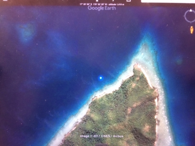
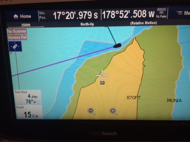
That brings us to Fiji which is a more confusing picture. Aradonna, currently in the Northern Lau are advising others not to put your trust in the Navionics. "Our chart plotter has older version. It is half mile out for most of Vanua Balavu, but it is correct for Munia island.
Latest version on iPad is correct for most of Vanua Balavu but half mile out for Munia island!
You would think the latest version would not introduce new errors!!!! Grrrrr.
See below, gps position shown on plotter and chart is correct with google earth (we are the blue dot)
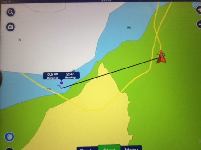
The last photo is our track over land and spot we are anchored according to new version on iPad!
And finally from Tika, commenting on Navionics in French Polynesia - our experience is that they were absolutely spot on for French Polynesia but have a few poor spots in Fiji. However I think the other brands and paper charts have the same issues.