ADAGIO
Avg: 4.8knts
24hr: 115.2nm


Local time i Wind speed is down a lot from low 20s to abut 12kn now. We have switched to wing on wing reacher rig with 2dn reef main on port reacher on starboard. Very effective - eliminates blanketing reacher by mainsail footprint. This has elimnated the crash-bang reacher collapsing noises. If we have no more winds in the mid-teens to twenties then will miss our 3pm Friday slot at Marion Narrows.

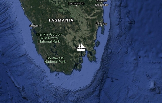
Local time i We are motorsailing on reacher along the east coast of Tasmania, 35nm east of Flinders Island. As forecast the wind has been light since 0400 this morning when the wind dropped from 18-21 down to 13kn. We've benefited from a favorable share of a 3.5k cross current that has a bit of slant in our favor, yielding 0.5 to 1.0kn favorable. We still hope to make high tide at Marion Narrows Friday afternoon so we've been spending diesel to keep our speed up. The best combination so far is our 1100 sqFt reacher plus engines at 2500. Much of the day that yielded 8 to 9kn SOG. On reacher only we are seeing about 7kn SOG. If tomorrow we are too late for Marion Narrows we will probably anchor at Wineglass Bay - easily one of the prettiest anchorages anywhere. If anyone has tips on catamaran motorsailing don't be shy, pass them along:-)
Local time i Wind speed is down a lot from low 20s to abut 12kn now. We have switched to wing on wing reacher rig with 2dn reef main on port reacher on starboard. Very effective - eliminates blanketing reacher by mainsail footprint. This has elimnated the crash-bang reacher collapsing noises. If we have no more winds in the mid-teens to twenties then will miss our 3pm Friday slot at Marion Narrows.
Avg: 9.4knts
24hr: 225.8nm
Local time i Wind speed is down a lot from low 20s to abut 12kn now. We have switched to wing on wing reacher rig with 2dn reef main on port reacher on starboard. Very effective - eliminates blanketing reacher by mainsail footprint. This has elimnated the crash-bang noise If we have no more winds in the mid-teens to twenties then will miss our 3pm Friday slot at Marion Narrows.
Local time i ADAGIO departed Bermagui, NSW for Hobart at 1130 AET. Motorsailing to start with light winds and VERY STRONG Australian East Coast Current (AEC) of 4.0kn setting 175T giving us almost a 3kn boost.This afternoon and tonight we are expecting nice sailing breezes from the part quarter in the 18 to 27kn range. Tomorrow midday the wind should go lighter to 9-13 as the cold front approaches.
Avg: 8.3knts
24hr: 199.2nm
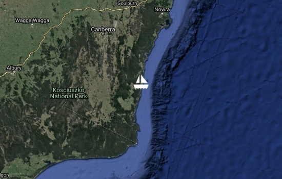
Local time i On Christmas Eve, 28 hours after departing Newcastle, we entered Bermagui Harbour at 1430pm. We had about 20kn N’ly with 1M seas running into the entrance. For a 28-ft beam catamaran it is a NARROW ENTRANCE. The "rocks to rocks" width measures on the chart about 60M. The navigable depth felt like 15M (not verified). The conditions we chose were good for this entrance, but I wouldn’t want bigger seas or a wind/tide conflict. As these modest seas shoved our transom around, I had my hands full keeping Adagio lined-up on the entrance centerline (rocks line both sides of entrance). Once inside the tight harbour we cautiously explored for space on the main Fisherman's Wharf. Our good luck gave us one slot we could just fit into on the west side of wharf right near the shoreside riprap. More luck came in the person of Rocky, the Bermagui manager, who spotted us coming in, then walked down to help us tie up. We sure didn't expect senior management help on Christmas Eve - so we were really happy to see Rocky patiently waiting for Adagio to maneuver our bows up against the riprap in shallows, then wiggle our transoms close enough to toss a stern line to Rocky. Now we get to enjoy Bermagui village while ADAGIO waits for good weather to cross Bass Straight for the sixth time.

Local time i Enroute from Newcastle to Bermagui
Avg: 6.2knts
24hr: 148nm
Local time i Adagio entered Australia today at 1715 at Newcastle NSW. We are on the Quarantine buoy until Friday morning when we hope to shift to the Newcastle Cruising Yacht Club to complete formalities. At 1212 today we logged "What a great sail, we are just rocketing along averaging 10+kn over bottom" under blue skies and scattered cumulus. We weren't so sure about entering port into a lee-shore deadend with 25-30kn NE'ly winds and associated seas blowing us into the corner. But it all worked out and we are happy to be in Australia.

Avg: 6.6knts
24hr: 158.4nm
Local time i Should make Newcastle today but ETA after Borders closes at 4pm. Received Rick Shema's Update #2 Thursday evening. Rick's forecast is good news for the last 85nm into port, executive summary is winds 15-25kn NE - NNE seas 1.3 to 2.2. and we should be tethered to Quarantine Buoy before the next cold front passes early Friday morning.
Avg: 7.3knts
24hr: 176.1nm
Local time i3T SOG 8.6kn
Avg: 8.3knts
24hr: 198.4nm
Local time isome breeze.
Avg: 9.5knts
24hr: 227.7nm
Local time i3T SOG 9.7kn

Avg: 8.8knts
24hr: 212.4nm
Local time i But SOW is 7.5, in and out of current that 80% slows us down 1 to 1.5kn. Seas are from stbd quarter and regular enough so that wind is not dumped out of reacher on every wave. Derwent Hunter Seamount is 83nm south right on our track. We intend to leave the seamount to starboard. Mark0 is 175nm south about 25 hours at 7kn so ETA of about 7 Dec 2200. Newcastle is another 205nm about 29 hours. So rough ETA 9 December.
Avg: 7knts
24hr: 167.5nm
Local time i Long spells of TWS 20kn Course to steer yo Mark0 is 195M. To avoid accidental gybe risk, the closest course we can sail to the 195 is 180M. Mark0 is 241nm or 35 hours at average 7kn giving ETA of 7 Dec 1100 NCT

Avg: 6.5knts
24hr: 156.1nm
Local time i Beautiful sunrise, clear sunny day, sea slight - all is well aboard. Last night's dinner was fresh mahi mahi and fresh sweet corn:-) Still too little wind from dead-aft to sail. It’s 176nm to AP05. Up until an hour ago have been making good only 5.9 SOG due to current of 2.3 setting 317M. SOG has just now increased with current measuring 1.9kn at 291M.
Avg: 6.8knts
24hr: 163.1nm
Local time i8T SOG 5.8kn
Avg: 8.6knts
24hr: 207.1nm
Local time i sea slight.
Avg: 10.8knts
24hr: 258.7nm
Local time i Happiness is following seas - finally the primary waves are from 105M just aft of port beam. Can now open the saloon hatches. Splendid sailing today and expected tonight as we already have a clear starry sky.

Avg: 10.7knts
24hr: 256.4nm
Local time i As wind backs we can fall off a bit to sailing AWA 85 and still hold Rick’s course to AP03. Last night we were sailing as close as feaible to carry the reacher powered up. During the night the wind started exceeding our reacher 22kn wind limit. So changed down to solent Jib, loosing 2 kn of boat speed on the same course. This morning we were able to switch back to reacher. Our days run from 1400 to 1400 looks like it will be 196nm.
Local time i Hi Rick, we are sailing about 12deg low and fast SOG 9.5. We can't hold AWA 60 with reacher but we are doing fine AWA 70. We will lose at least 2kn of speed if we switch from reacher down to solent jib. Lifts to headers ranging 20 to 40deg with headers lighter TWS by 5kn or so.We miss seeing your estimated SOW, SOG because that gives an easy cross check on how our pace compares to your modeled pace. Let us know if we should be trying to sail higher v. lower.
Local time i Preparing to sail for Newcastle Friday 2 Dec around 1100 NCT
Local date time is 11/29/2016 11:38 AM COG 321T SOG 0.0kn Test pos report format
Hi Steve & Dorothy
Avg: 5.3knts
24hr: 128.1nm
COG 053T SOG 4.1kn
Sorry to hear that, but so
COG 090T SOG 0.0kn
COG 131T SOG 6.4 All is well- we are verifying our position reporting
<p>Hi Steve and Dorothy,</p>
8/31/2016 5:51 PM ADAGIO is at anchor in Baie de Kuto. We are happy to see S/Y SPIRARE anchored just to starboard.
Are you departing soon? Nice
Spending some quality time
Avg: 8.6knts
24hr: 205.4nm
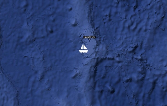
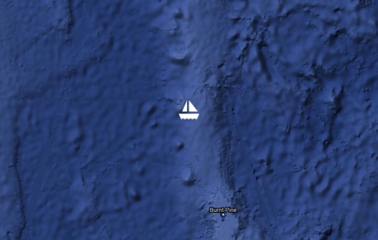
6/19/2016 1:31 PM Vanessa spotted the peak Pic Nga on Ile des Pins. We will be turning onto the main channel through the reefs around 2pm. We'll sail on to Noumea anchoring hopefully before local midnight.
Hooray! So glad you are
Hooray! BTW, yit has put you

Avg: 10.6knts
24hr: 253.7nm
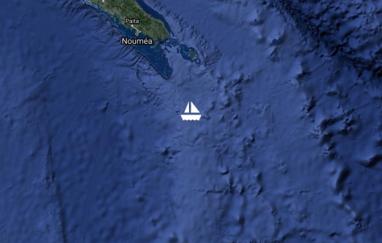
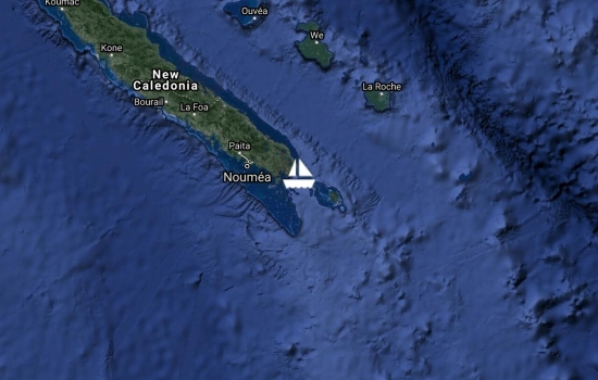
6/18/2016 4:22 PM local NZT 161 nm to NC entrance at current 7.5 avg approx 1330 Sunday. Our average boat speed SOW is 8.8 kn but we are still fighting 1.5 kn contrary tide. We are about one hour ahead of my Maxsea routing 1600 yesterday.
Avg: 6.7knts
24hr: 161.2nm
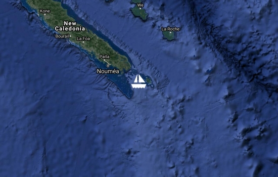
Local 6/18/2016 8:21 AM Adagio ETA at entrance to NC Southern Lagoon around midday Sunday. Last night Wayne logged the predicted easterly wind shift on his 0400 watch. The shift was introduced by a 50 degree header and wind dropping from TWS 16 to 10. After changing course to steer AWA 136 the sea state is more conducive to getting some sleep in the forward guest cabin. Before that the rowdy wave hits chased away the sleep.

Avg: 7.8knts
24hr: 188.3nm
6/17/2016 4:16 PM COG 308T SOG 7.5 It doesn't get much better than this - sailing into the sunset under reacher steering AWA 155 following seas.
Avg: 8knts
24hr: 191.6nm
6/17/2016 11:11 AM COG 327T SOG 7.5 Stow mainsail set reacher, gybed onto port crossing rhumbline by 13 degrees. New Caledonia southern lagoon entry 350nm about 48 hours ahead. ADAGIO crew has all showered and after breakfast sunning in the cockpit with e-books.
Avg: 8.5knts
24hr: 203nm
6/16/2016 8:42 AM COG 345T SOG 6.5 TWS increased to 12-16kn this morning so we have set jib and reacher wind-on-wing sailing close to rhumb line to AP03. Glorious morning at sea with sunrise and rainbows to leeward.

It was a fine day on the ocean for Day 2. Not too much wind or sea.Quite rainy this afternoon. Ran out of wind about 4pm. Now motoring until wind returns. UTC 6/15/2016 6:32 AM LOCAL DATE 6/15/2016 LOCAL TIME 6:32 PM

UTC 6/14/2016 8:17 PM LOCAL DATE 6/15/2016 LOCAL TIME 8:17 AM ADAGIO is very happy to be back at sea and leaving the cold behind. Albatross at sunset - check. No SW cross-swells yet. NZ Met reports 3M SW swell west coast. We have had 1.4kn+ contrary current Tuesday afternoon. We arrived AP01 at 0200 7 hours ahead of forecast schedule. About to set full main and reacher. Wind is forecast to veer if we don't get north quick enough.
Avg: 5.1knts
24hr: 122.4nm
UTC 6/13/2016 9:59 PM Departing OPUA
Happy sailing and safe
UTC 6/13/2016 9:16 AM Test position report. Adagio departing for New Caledonia approx 1000 NZT 160614.
UTC 11/28/2015 5:00 AM LOCAL DATE 11/28/2015 LOCAL TIME 4:00 PM COG 149T SOG 7.7 Apologies! Via Eva we learned that our “Final report†was not received by YIT. So following is a copy of what we sent.
"We are closing on the Bay of Islands, passing the Cavali Islands. This will be our final position report for Adagio’s Noumea to Opua passage."
Frank, still at it! Congrats.

Avg: 6.4knts
24hr: 153.6nm
UTC 11/27/2015 5:56 AM LOCAL DATE 11/27/2015 LOCAL TIME 4:56 PM COG 135T SOG 6.8
Avg: 9.2knts
24hr: 221nm
UTC 11/25/2015 9:39 PM LOCAL DATE 11/26/2015 LOCAL TIME 8:39 AM COG 135T SOG 7.3 Motoring in almost no wind
Avg: 8.6knts
24hr: 206.8nm
UTC 11/25/2015 1:03 PM LOCAL DATE 11/26/2015 LOCAL TIME 12:03 AM COG 161T SOG 9.1 MESSAGE
Avg: 9.4knts
24hr: 226.1nm
UTC 11/24/2015 8:20 PM LOCAL DATE 11/25/2015 LOCAL TIME 7:20 AM COG 158T SOG 7.1 MESSAGE ?ast night we had to strike reacher as execeeding 22kn wind limit whenever we sail high with AWA 75 or less. Wind down to 12 so have a slow boat full main and jib. Evaluating whether to pass Norfolk Island (110nm ahead)to port or stbd. If we set reacher we will have to sail further leaving Norfolk to port.

Avg: 12.1knts
24hr: 289.7nm
UTC 11/24/2015 8:58 AM LOCAL DATE 11/24/2015 LOCAL TIME 7:58 PM COG 192T SOG 10.3 MESSAGE All is well, we are going fast under full main and reacher - but can't sail as high if on jib. We are gaining about 3kn boatspeed over the breakeven of 6.25% for sailing 20 degrees low. So today we logged average SOG today of 10.6, 11.2, 10.6, 11, 11.2
Avg: 9.4knts
24hr: 226.1nm
UTC 11/23/2015 8:08 PM LOCAL DATE 11/24/2015 LOCAL TIME 7:08 AM COG 170T SOG 8.4 MESSAGE Sailing for AP02 26nm east of rhumb from AP01-02
UTC 11/23/2015 12:56 PM LOCAL DATE 11/23/2015 LOCAL TIME 11:56 PM COG 165T SOG 7.4 MESSAGE Sailing 27 degrees high of rhumb to AP01 full main+jib, port engine 2600
UTC 11/22/2015 6:43 AM LOCAL DATE 11/22/2015 LOCAL TIME 5:43 PM COG 066T SOG 0.0 MESSAGE Testing YIT pre NZ passage
Just subscribed to your
Kuto Bay, Ile des Pins, https://dardens.smugmug.com/Year-2015/New-Caledonia/Ile-des-Pins
Shopping Noumea, mis-installed reacher halyard just replaced. Took 2 riggers 2 days of effort to extract the perfectly good halyard that was killed by incorrect reinstallation.
UTC 6/29/2015 9:17 PM LOCAL DATE 6/30/2015 LOCAL TIME 9:17 AM COG 291T SOG 7.0 This is our final position report for this passage. We will berth at Port Moselle at 10AM this morning.
Congratulations! So glad to
Glad to hear you've arrived!
UTC 6/28/2015 9:01 PM LOCAL DATE 6/29/2015 LOCAL TIME 9:01 AM COG 316T SOG 6.2 Adagio will not make Customs time limit today, so we will slow down to time our entry for Tuesday morning.
Avg: 4.5knts
24hr: 106.9nm
UTC 6/28/2015 12:08 AM LOCAL DATE 6/28/2015 LOCAL TIME 12:08 PM COG 335T SOG 7.1 ETA Southern Lagoon near IDP about 0600NZT All is well aboard.

Avg: 6.8knts
24hr: 162.9nm
UTC 6/26/2015 9:54 PM LOCAL DATE 6/27/2015 LOCAL TIME 9:54 AM COG 344T SOG 6.2 We have freed the jammed main halyard, furled the mainsail and turned north for entry into Southern Lagoon west of Ile des Pins. All is well aboard.
Avg: 8.6knts
24hr: 205.6nm
UTC 6/26/2015 12:34 AM LOCAL DATE 6/26/2015 LOCAL TIME 12:34 PM COG 307T SOG 7.4 Rick Shema's forecast is progressively confirmed. Last night wished we had our reacher for the lighter winds. Didn't have so we motorsailed full main one engine 2800.
Enjoying watching your course

Avg: 7knts
24hr: 166.9nm
UTC 6/25/2015 12:47 AM COG 331T SOG 9.2 TWS 18.6 TWD 191T Much better ride now with full main & jib. Surfing to 15kn when TWS gets up to 21kn. Albatross circling.
Great! How exciting and
Avg: 8.9knts
24hr: 213.8nm
UTC 6/24/2015 10:42 PM LOCAL DATE 6/25/2015 LOCAL TIME 10:42 AM COG 331T SOG 7.2 TWS 16.8 TWD 184T MESSAGE

UTC 6/24/2015 4:25 AM LOCAL DATE 6/24/2015 LOCAL TIME 4:25 PM COG 336T SOG 8.8 TWS 26.5 TWD 188T MESSAGE
Avg: 6.1knts
24hr: 147.4nm
UTC 6/24/2015 1:17 AM LOCAL DATE 6/24/2015 LOCAL TIME 1:17 PM COG 333T SOG 9.6 TWS 21.5 TWD 185T
Avg: 4.9knts
24hr: 118.1nm
UTC 6/23/2015 9:42 AM LOCAL DATE 6/23/2015 LOCAL TIME 9:42 PM COG 001T SOG 6.8 TWS 24.5 TWD 155T Seastate is rough enough that we have slowed down for the night. We were surfing up to 17kn when we struck the reacher at sundown.
Surfing at 17 knots sounds
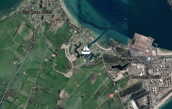
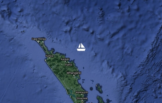
Waiting for NZ Customs at Marsden Cove. Refueling then sailing for New Caledonia.
Have a great trip. Time to go
Bon voyage! We're having a
Have a great trip. We are
Hi, I hope you have a great
verify update is received by YIT
Fair winds, and great sailing
verify update is received by YIT

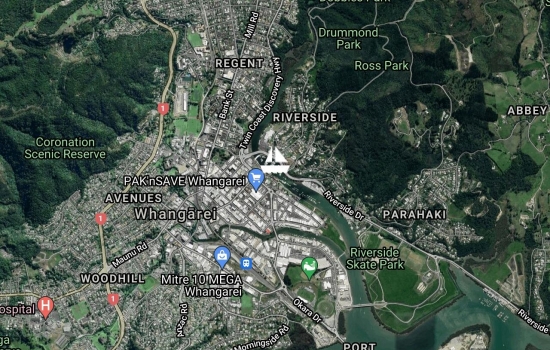
UNTIL TUESDAY in Town Basin, testing YIT auto position reporting UTC 6/15/2015 8:08 AM LOCAL DATE 6/15/2015 LOCAL TIME 8:08 PM COG 090T SOG 0.0 TWS 4.3 TWD 342T MESSAGE
No blogs available for this yacht.