Neptune's Highway

Mon Jun 1 13:15 2020 NZST
GPS: 37 32.3N 76 20.1W
Run: 404.3nm (731.8km)
Avg: 4.8knts
24hr: 115.2nm

Sunday, May 31, 9:00pm WE'RE HERE! Sorry I didn't update yesterday. We dropped the hook in Fishing Bay, near Deltaville yesterday at 6:00pm. The 35 miles from the entrance to the Chesapeake to here was tortuous, with wind on the nose and adverse current. We had sails up and motor running and struggled to make 4.5 kts.

So it took all day to get here but so worth it. This is a beautiful, quiet, protected Anchorage and we slept like logs. Today we took a long Sunday stroll to check out the very rural neighborhood. Tonight we are sore and ready for another good night's sleep. Sunny and warm ashore today but had to put blankets on the bed for nights on the water. Perfect! In the next few weeks we'll haul the boat for hurricane season and return to St. John for a house-sit until November. So, signing off for now Thanks for following us offshore.


Fri May 29 1:03 2020 NZST
GPS: 32 12N 73 25W
Run: 129.9nm (235.1km)
Avg: 32.5knts
24hr: 779.4nm

Thursday, May 28, 8:45am AST DAY 7 Back to wing and wing sailing and heading north. We'll have to jibe eventually, maybe before dark. Sun goes down at 8:45. Winds still around 10 kts apparent so pretty mellow. Saw two Portuguese Man-o-War sail by the boat, a sign of being near the Gulf Stream. They were heading south, sailing to weather and slightly heeled over. Mother nature does the most brilliant designs! Putting the lure back in the water...

Sent from Iridium Mail & Web.


Thu May 28 21:03 2020 NZST
GPS: 30 21N 73 02W
Run: 238.4nm (431.5km)
Avg: 5.1knts
24hr: 122.6nm

Wednesday, May 28, 3:30 pm AST DAY6 still cruising along with light winds on the beam. The wind is supposed to fill in today but hasn't happened yet. Expecting 20+ as we cross the Gulf Stream but it should be on our back. We anticipate entering the Gulf Stream Friday morning and spending the day getting across. Then entering the Chesapeake on Saturday morning. A cold front will come barreling down on Sunday so we will find a safe Anchorage before sunset Saturday At least that's the plan. Sent from Iridium Mail & Web.

Sent from Iridium Mail & Web.

Sent from Iridium Mail & Web.


Tue May 26 22:24 2020 NZST
GPS: 26 58N 72 16W
Run: 329.7nm (596.8km)
Avg: 7.4knts
24hr: 177.2nm

Tuesday May 26, 0600 Day 5 I did not post our position yesterday as I was not sure if anyone was getting them. Thank you, Liberty Bryer, for the confirmation.

Yesterday was brilliant! We were so worried that we'd have no wind for the first half of this trip but we've sailed the entire way. The first few days were very slow but then the wind filled in from the Northeast. Light (10-12) but our boat can do 6.5 to 7 kts close reaching in light air. Last night was cloudless and easy. We must be crossing a shipping lane because we had about 10 cargo ships pass either in front of us or behind us after days of being the only boat out here. For those of you familiar with the Bahamas, we are heading north and are about 300 miles east of Grand Bahama (400 miles east of West Palm Beach, Fla.). So we are skirting all the nasty weather that has been off the coast of Florida and have not had a single drop of rain or squall YET. I had a 12 inch flying join me in the cockpit last night. The biggest fish we've caught so far on this trip. I was tempted to save it for breakfast but returned it to its water world instead. Hope you are enjoying your morning and a cuppa. Cheers. Sent from Iridium Mail & Web.


Mon May 25 1:45 2020 NZST
GPS: 22 36N 70 09W
Run: 325.3nm (588.8km)
Avg: 271.1knts
24hr: 6506nm

Sunday, May 24, 9:30am AST DAY3 Yesterday was pretty much a repeat of the day before. In our excitement Friday evening of having wind forward of the beam, we packed away the spinnaker and pole. With yesterday's sunrise, the wind died, it became incredibly hot on deck, and Bruce had to muscle out all the spin gear again. At 10:00 we were back in the shade of the cockpick with the spinnaker valiantly pulling us along at 4 knots in 4 knots of breeze. Not a banner day but at least we were sailing. And like the day before, the wind switched to forward of the beam at sunset and we changed sails. Last night we had a whopping 10 kts, 13 apparent, and averaged 6.9 kts through the night. This morning we are still cruising along with sunny skies and a sea that is almost periwinkle. Time to put that lure back in the water. Sent from Iridium Mail & Web.

Sent from Iridium Mail & Web.


Mon May 25 0:33 2020 NZST
GPS: 19 11N 66 41W
Run: 286.4nm (518.4km)

Friday May 22, Day 1 Due to COVID-19, all countries in the Caribbean are closed except USVI. Hurricane season officially starts June 1, although Arthur came to the party 2 weeks early. Rather than sit around hoping an island below the hurricane belt will open up, we decided to sail up to the Chesapeake. Our plan is to put the boat on the hard, out of harms way, for the summer. We have a house-sit in Cruz Bay until November so we will return to St. John (by air). We expect very light winds for the first half of the 10 day passage. We left St. Thomas Thursday morning and have been sailing wing and wing with 6-7 knots apparent wind. This morning it's down to 4 knots so we will break out the spinnaker after breakfast. Bruce caught a tuna yesterday but it slipped the hook just as he pulled it up to the transom. Laura hooked a large chunk of sargasso weed that put up a lively fight before being reeled in. Catch and release. Our entertainment for the day.

Hope everyone is well and staying safe. Send news to neptuneshighway@myiridium.net We love hearing from you. Sent from Iridium Mail & Web.

Sent from Iridium Mail & Web.


Fri Mar 13 4:51 2020 NZDT
GPS: 17 14N 62 50W
Run: 26nm (47.1km)

Thursday, March 12, 11:30 am FINAL LEG! We had to leave Nevis because we were having too much fun and rum with the Maceks. We hope they will stop at St. John next month when they make their annual passage to Bermuda and Cape Cod. We are cruising along past St. Kitts with Statia and Saba in view up ahead. So far, a gentle, downwind sail. Can't wait to anchor off Caneel tomorrow morning and jump in the water for our final Caribbean initiation. So excited to be 'home'. Sent from Iridium Mail & Web.


Mon Mar 9 11:15 2020 NZDT
GPS: 17 09N 62 27W
Run: 226.7nm (410.3km)
Avg: 6.6knts
24hr: 158.5nm

Sunday, March 8, 6:00pm The anchor is down in NEVIS! In the past 30 hours we've sailed by Martinique, Dominica, Guadeloupe, and Montserrat. We would be in the lee of the island, then winds would change as we passed by the passes. So a little bit of everything. But today was spectacular! Everything you dream about Caribbean sailing. Nice steady breeze on the beam, sunshine, white clouds, gorgeous and sailing 7 knots! There is sailing traffic here, some on AIS and some not, so we must keep an eye out (after 26 days of being the only boat in the middle of the south Atlantic!). We are so happy to be here and tomorrow we will catch up with dear friends, Irene and Steve Macek, who sailed here from St. John in 1990. IF YOU WAIT LONG ENOUGH, YOUR WAKES WILL CROSS AGAIN! Tomorrow we expect a northerly to sweep down over the islands so we will sit it out here and resume our passage to St. John on Thursday. Cheers! Sent from Iridium Mail & Web.


Sun Mar 8 0:54 2020 NZDT
GPS: 14 10N 61 02W
Run: 8.9nm (16.1km)

Saturday, March 7, 8:00 am ON THE ROAD AGAIN! Back on Neptune's highway after a lovely, restful 3 day respite in Rodney Bay. We are on our way to Nevis, where we went to get married 35 years ago! Friends of ours left St. John and settled there 30 years ago so should quite a reunion.

We put 2 reefs in the main, anticipating some brisk Caribbean sailing. Once we get away from St. Lucia's acceleration zone, winds should come down to a comfortable 11-14 knots. We hope to arrive in Nevis before sunset tomorrow. Cheers! Sent from Iridium Mail & Web.


Thu Mar 5 12:09 2020 NZDT
GPS: 14 04N 60 57W
Run: 1.2nm (2.2km)

Wednesday, March 4th, 7:00pm This morning we moved into the marina for the full-on decadent experience! There is a regular Wednesday ladies lunch gathering so Laura went and met some great cruisers who spend their winters here in Rodney Bay and had lots of good information and spear-head several local charities. We plan to purge the boat of all our extraneous bedding, clothes, and canned goods leftover from our passage, knowing that they will be useful to someone here on St. Lucia. The ladies have also organized yoga and water aerobics. This is definitely the most civilized, upscale place we have been to in the Caribbean. But, alas, we must move on! We plan to leave early Saturday for a 36 hour sail to Nevis. Then leave next Wednesday for St. John, arriving Thursday, March 12. As always, plans are subject to whim and weather. Cheer! Sent from Iridium Mail & Web.


Wed Mar 4 0:27 2020 NZDT
GPS: 14 05N 60 57W
Run: 67.2nm (121.6km)
Avg: 4.5knts
24hr: 108.6nm

Tuesday, March 3, 7:15am DAY 26. ANCHOR DOWN, St. Lucia 3900 miles. 26 days, beer and burrito for breakfast. 'Nuff said. Sent from Iridium Mail & Web.


Tue Mar 3 9:36 2020 NZDT
GPS: 14 09N 59 57W
Run: 170.3nm (308.2km)
Avg: 6.7knts
24hr: 161.2nm

Monday, March 2, 4:00pm DAY 25, How Slow Can You Go.

Anothrer great 24 hours of sailing behind us. Although the crew did get some major wind shifts in the wee hours and had to wake the captain to help roll up the poled-out jib and the captain was very sleep deprived and grumbly. This afternoon we find ourselves surrounded by dark clouds that are messing with our wind direction and making it difficult to steer our course line. But we have lots of time to cover the last 50 miles before sunset tomorrow. All is well on board.

P. S. We scooped about a tablespoon of green slime out of our fuel tank today so shouldn't have a problem with the fuel line getting blocked and cutting out on us as we are making our approach to the anchorage. It amazes me that algae can bloom in diesel fuel (stainless fuel tank so no light gets in). Cheers! Sent from Iridium Mail & Web.


Mon Mar 2 8:15 2020 NZDT
GPS: 13 09N 57 38W
Run: 183.2nm (331.6km)
Avg: 8.5knts
24hr: 203.6nm

Sunday, March 1,5:00 pm DAY 23 Same-o Same-o We are loving this Caribbean weather. Perfect air temperature, 14 knots of wind aft of the beam, lots od cloud cover but they are the white, fluffy kind. We are 100 miles SE of Barbados and 200 miles from our destination, St. Lucia.

If there are 360 degrees of longitude at the Equator and 60 nm between degrees, that makes the earth's circumference 21,600 miles, right? We have covered 13,000+ miles since last February when we departed from Thailand. We are ready for break and looking forward to settling in for awhile on St. John. Cheers! Sent from Iridium Mail & Web.


Sun Mar 1 10:39 2020 NZDT
GPS: 11 51N 55 16W
Run: 3746.2nm (6780.6km)
Avg: 99.9knts
24hr: 2397.6nm

Saturday, February 29,5:00 pm DAY 22. Almost there! ETA Mar. 3.

Another gorgeous day. The pattern has been 17 kts of wind in the morning which is a bit lively, then it mellows out to 11 kts in the afternoon - enough to indulge in a glass of wine with dinner! I can't believe how much food we still have on board. When I provisioned in South Africa I had two things in mind: 1. A 30 day passage can easily turn into a 60 day passage if the engine fails (or run out of fuel) and there is no wind, and 2. everything in SA will be cheaper than than the Caribbean.

So our 'survival rations' include lots of jars of sun dried tomatoes, kalamata olives, roasted bell peppers, feta cheese, and gourmet vinegars as well as the usual pasta, rice, quinoa, lentils, wraps, canned beans, tinned tomatoes, nuts, and cuppa soup. I also have another 3 weeks worth of potatoes, onions, garlic, red cabbage and carrots and several pounds of cheese.

So it's nice to know that a trip to the grocery store won't be necessary for awhile. Our focus will be on checking in, fuel, minor repairs, major laundry, and general clean up.

And we are hoping that our 26 days off shore will count as sufficient quarantine for Corona Virus! Cheers! Sent from Iridium Mail & Web.


Fri Feb 28 21:09 2020 NZDT
Run: 3425.1nm (6199.4km)
Avg: 264.5knts
24hr: 6347.5nm

Friday, February 28, 6:00am DAY 21 Still cruising along with 14 kts on the beam. Another starry night. No rain. Our average speed since midnight has been 6.9. Not too shabby.

Hard to believe we've been offshore for 3 weeks. After about the first 5 days, time sorta stops until we get close to our destination. At least, on an easy passage, which this has certainly been.

Even harder to believe that in February last year we were departing Thailand! It's been an ambitious year in a notorious stretch of ocean and we're happy to have it behind us. Still no fish. Blame the sargasso weed! 600 miles to St. Lucia. All is well on board. Sent from Iridium Mail & Web.


Fri Feb 28 8:12 2020 NZDT
GPS: 9 18N 50 19W
Run: 165.3nm (299.2km)
Avg: 7.6knts
24hr: 183.2nm

Thursday, February 27, 5:00 pm DAY 21 Last night was so clear and, with no moon, perfect for stargazing. We've had no boat traffic for most of this trip but last night we had two cargo ships on AIS, heading SE. We also saw about six boats NOT on AIS, but their lights were so bright that we would see a glow on the horizon long before they were in sight so no surprises. We assume they are fishing boats. The closest land is French Guiana, about 300 miles west of us. This is the site of the infamous Devil's Island where Papillion made a career (and a book and a movie) of escaping, recapture, and escaping. It's now a popular tourist destination but we will give it a pass.

Another perfect day of easy sailing, reading, and cooking up big meals! Less than 700 miles to St. Lucia. All is well on board. Sent from Iridium Mail & Web.


Thu Feb 27 10:33 2020 NZDT
GPS: 8 05N 48 14W
Run: 197.7nm (357.8km)
Avg: 8.1knts
24hr: 194.9nm

Wednesday, February 26, 7:00 pm DAY 20. Today was gorgeous. We finally shook out the second reef and are sailing with one reef in the mainsail and full jib with 11-13 kts wind. We are able to sail our rhum line on a close reach. Excited to be closing in on the Eastern Caribbean. We still haven't caught a fish. One got away with our lure. Bruce has switched from pole to hand line using a rig he calls a meat hook. We've had sargasso weed since we crossed the Equator so that doesn't help. As we empty our freezer, it would be nice to refill it with Mahi or wahoo.

Really looking forward to landfall and being in familiar territory. All is well on board. Sent from Iridium Mail & Web.


Wed Feb 26 10:12 2020 NZDT
GPS: 6 43N 45 42W
Run: 196.9nm (356.4km)
Avg: 6.3knts
24hr: 151.9nm

Tuesday, February 25, 4:00 pm DAY 19. Mardi Gras. Fat Tuesday. Connor Masterson's Birthday! The winds came down, as forecasted, around 11:00 last night. Today the seas are MUCH mellower and we are on course for St. Lucia where we will make a pit stop for fuel, laundry, sail repair, and WiFi. We hope to arrive next Tuesday.

A gorgeous day, Laura is back in the galley making bread and Jambalaya, all is well on board. Sent from Iridium Mail & Web.


Tue Feb 25 3:06 2020 NZDT
GPS: 05 29N 43 07W
Run: 137.2nm (248.3km)
Avg: 6.9knts
24hr: 164.6nm

Monday, February 24, Noon DAY 18. This is our longest passage ever. It took 17 days to sail from the Canary Islands to St. John in 1996. We were on a 44 ft. catamaran with our crew, Maren Masterson age 9 and Connor Masterson age 7. In 2013 our passage from Mexico to the Marques as was 16 days, 20 hours. This trip will exceed those by 10 days. Someone asked about our fresh food supply. We still have lots a red cabbage and carrots in the fridge along with onions and garlic and potatoes. Laura is also growing some sprouts. So Cole slaw, potato salad, and bean salad are definitely on the menu.

Our wind has picked up again and we are bouncing along with just our double reefed mainsail. This should subside tomorrow and we expect smooth sailing for the remainder of the trip.

Cheers! Sent from Iridium Mail & Web.


Mon Feb 24 7:06 2020 NZDT
GPS: 4 53N 41 13W
Run: 185.6nm (335.9km)
Avg: 7.6knts
24hr: 183.3nm

Sunday, February 23, 4:00pm DAY 17 After about 12 hours of more boisterous conditions than we like, the wind came down and we are close reaching with about 14 kts. We still have a double reef in the main and a reefed jib because we have current helping us along and are doing 6-7 kts even with drastically reduced sail. It makes for a very pleasant, peaceful ride. The weather has been mostly overcast at night and in the morning with the sun coming out in the afternoon. Air temp has been perfect! T-shirt weather with a sweatshirt added at night.

We may decide to stop down island (possibly Rodney Bay, St. Lucia) to get more fuel, before sailing up the island chain to Nevis and St. John. St. Lucia is about 1300 miles from our current position so we could be there in 9-10 days. All is well on board. Sent from Iridium Mail & Web.


Sun Feb 23 6:48 2020 NZDT
GPS: 3 42N 38 48W
Run: 382.9nm (693km)
Avg: 7.4knts
24hr: 177.6nm

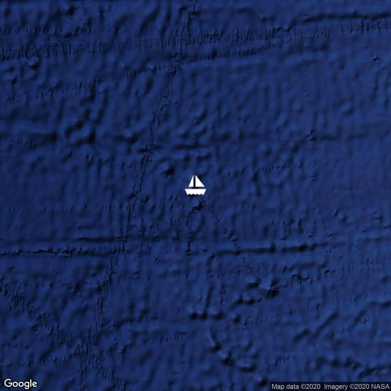
Saturday, February 22, 3:30 pm or 1730 UTC Day 16. Yesterday we broke free of the convergence zone. We encountered NE trade winds, 15-20, forward of the beam, and 3 meter seas which made for boisterous conditions. We are now sailing with double reefed main and reefed jib in 14-17kts. Most of our ocean passages have been downwind but this leg is closer to the wind and it has been a challenge. But today has moderated somewhat and the sun is trying to come out and all is well on board. Sent from Iridium Mail & Web.


Fri Feb 21 22:33 2020 NZDT
No position sent.

Friday, February 21, DAY 15 We struggled yesterday to keep wind in the sails. Before, it seems we have crossed the convergence zone in a couple of days. This time we figure it's been about 600 miles wide. Imagine trying to get through 600 miles of summer storms on a bicycle. But we persevere and think TODAY is the day we will come out the other side and find the trade winds. We've had steady wind 9-13 kts all night and will probably put a reef in the mainsail after coffee. We have not seen much boat traffic for most of this trip. We have AIS that transmits our boat position out about 12 miles. Cargo ships transmit about 100 miles. We have the boat name, position, type and size, and AIS gives their course and speed along with closest point of approach and time until closest point. If we are on a collision course, or passing too close for comfort, we can call the ship on the radio and agree to a plan for passing a safe distance. A few days ago we saw a 600 ft. cargo ship bound for Brazil on our AIS. They would pass 14 miles behind us. No problem. Then the radio came to life, "Neptune's Highway, Neptune's Highway, this is the cargo vessel (X)".I answered the call and the captain asked if everything was OK. I replied, Yes, I could see him on our AIS and that he would pass 14 miles behind us so no problem. He confirmed that and added, "But you are a very leettle boat in the middle of a very beeg ocean and I just want to make sure you are OK." Well , that's a first! I assured him we were fine and thanked him profusely for checking in on us! How sweet! And that's my feel-good story for today. YOUR TURN! Sent from Iridium Mail & Web.


Fri Feb 21 3:03 2020 NZDT
GPS: 1 29N 33 43W
Run: 227.2nm (411.2km)
Avg: 5.6knts
24hr: 134nm

Thursday, February 20, 12:00 noon DAY 14 Laura: Notice anything different about my hair? Bruce, swallowing his panic, thinks: It looks the same color, did she wash it? Did she cut it? Lord help me, has she always had bangs? Laura: There's wind blowing it! We had to motor sail a bit last night, but we're sailing with light NE winds. What a relief! Our diesel tank is critically low and we will still need to use the engine over the next two weeks to charge the batteries and run the watermaker. This morning's weather report indicates light but sailable wind until tomorrow afternoon, then the NE trades fill in. We've crossed the halfway point. Yay! Sent from Iridium Mail & Web.


Thu Feb 20 2:03 2020 NZDT

Wednesday, February 19, 9:00 am DAY 13 Crossing the Equator.

When sailors cross the Equator, they acquire Shellback status. Usually some sort of ceremony is involved. We're not party people so our ceremony is simple. Bruce pours a shot of good, Caribbean rum for himself and a shot overboard for Neptune. In our quest to be in the southern hemisphere when it's cyclone season in the north, and in the northern hemisphere when it's cyclone season in the south, we've crossed the Equator six times. Here's a quick synopsis : 2012 Bought Neptune's Highway in California, sailed to Mexico. All in Northern Hemisphere.

2013 First crossing of the Equator, going south. Sailed Mexico to French Polynesia, Cook Islands, Tonga, New Zealand.

2014 Second crossing, going north. New Zealand, Fiji, Kiribati, Marshall Islands.

2015 Third crossing, going south. Marshall Islands, Tuvalu, Fiji, Vanuatu, Australia.

2016 Fourth crossing, going north. Australia, New Caledonia, Vanuatu, Solomon Islands, Pohnpei, Micronesia, Palau.

2017 Fifth Crossing, heading south. Palau, Rajah Ampat, Timor Leste, Indonesia, Malaysia 2018 Malaysia (no cyclones here) 2019 Malaysia, Thailand, Maldives, Chagos, Rodriguez, Mauritius, Réunion, Madagascar, South Africa 2020 Sixth (and last?) crossing, back to the Northern Hemisphere, the Big Dipper, and home. South Africa, Namibia, St. Helena, St. John.

Last night was pretty miserable with intermittent, but sometimes epic, showers. With no moonlight and no radar (our radar dome is just for the birds and hasn't worked in years) we couldn't see the squalls so we'd get slammed without warning. In daylight we can steer to avoid them if possible. We were able to raise sails at 8:00 am, just in time to sail across the Equator, which also raised our spirits. . The silence after 3 1/2 days of motoring is miraculous. Bruce gave a heartfelt toast to Neptune and poured some delicious Malagasy rum, a break from our Caribbean rum tradition. Winds are light , 7 - 8 from the east, but it's enough. 1925 miles behind us, 2075 to go. Sent from Iridium Mail & Web.


Wed Feb 19 10:21 2020 NZDT
GPS: 0 33S 31 08W
Run: 118.8nm (215km)
Avg: 5.9knts
24hr: 141.1nm

Tuesday, February 18, 7:00 pm I was feeling a bit neglected as I hadn't heard from anyone since Valentine's Day, but then today we received emails dated February 15th. Maybe the folks at Iridium were in a chocolate coma. Well, better late than never.

DAY 12. DAY 3 OF MOTORING! Still no wind. We've put 5 of our 6 Jerry jugs of diesel into the tank. The last jug we have to save for making landfall. Of the 4 weather models we download daily, only one is showing some wind tomorrow afternoon so we are keeping our fingers crossed. Meanwhile, Bruce is starting his first watch, 7-10pm, as we head into a monstrous black thunderhead. We'll be so happy to get through to the other side of the convergence zone. We expect to cross the Equator tomorrow morning. Sent from Iridium Mail & Web.


Tue Feb 18 14:09 2020 NZDT
GPS: 1 30S 29 42W
Run: 214.4nm (388.1km)
Avg: 6.1knts
24hr: 145.4nm

Monday, February 17, 2359 UTC Day 11 Getting this in just under the wire at 11:59 pm. It's been a long day! After yesterday's post we had about 4 hours of torrential rain. Glad to be on a boat as it was the kind of rain that makes you want to start building an ark! But there was no wind in it and it's tropical-warm so not a problem, just very wet! We had our dinner in the main salon instead of the cockpit for maybe the first time ever off shore. The night was pretty clear with the Big Dipper on our starboard side and the Southern Cross on port.Today was spent repairing the mainsail. Laura stitched on new webbing and Bruce reinforced it with small nuts and bolts. Sounds easy but we broke 4 needles and had to use an acetylene torch to heat an ice pick to red hot to burn holes for the bolts (there's some kind of hard material sandwiched inside the sail cloth to make the clew area strong and stiff so it was a b!tch getting through it). And all this in the equatorial heat and no shade! We took a lunch break (r an out of propane so Bruce had to switch tanks half-way through cooking lunch) , did the last bit of stitching, and reattached the clew to the end of the boom and flaked the sail. Now we just need some wind to check it out. Laura crashed for an indulgent 2 hour nap (we each sleep about 5 hours each night over 2 off-watch intervals and supplement with a 1 hour nap during the day). Bruce did his laundry. Then we pulled out 2 of our 6 20-liter fuel jugs and siphoned diesel into our fuel tank. Bruce grabbed a 1 hour nap before sunset. And then it started to rain again. Fortunately a cold dinner had been planned as it was sweltering down below with all the hatches closed and the engine running. Bruce took the first watch. Laura sat on deck in the cool rain for a final rinse before going to bed. And now it's midnight. Whew! Sent from Iridium Mail & Web.


Mon Feb 17 2:45 2020 NZDT
GPS: 03 19S 27 11W
Run: 150.6nm (272.6km)
Avg: 6.1knts
24hr: 145.7nm

Sunday, February 16, 1300 UTC DAY 10 RAINY DAYS AND SUNDAYS...

Just after sunset last night the wind dropped so we took down our sails in the twilight and started motoring. We are now officially in the convergence zone where north meets south. We anticipate 3 days motoring to get through it. On the other side we should have NE trade winds (we've had SE since Cape Town). We'll take down the spinnaker pole, change our jib sheet leads, repair our mainsail and be ready for starboard tack.

Our birds did not show up last night. Either they did not need us on such a calm night or there's an invisible line (the equator) that they do not want to cross. We are 400 miles from the nearest land so godspeed.

We had our first rain this morning and Bruce grabbed a scrub brush and cleaned the deck. Laura has her speedy stitcher ready to go and will work on the sail repair between showers. All is shipshape on board. Cheers! Sent from Iridium Mail & Web.


Mon Feb 17 2:42 2020 NZDT
No position sent.

Sunday, February 16, DAY 10 RAINY DAYS AND SUNDAYS...

Just after sunset last night the wind dropped so we took down our sails in the twilight and started motoring. We are now officially in the convergence zone where north meets south. We anticipate 3 days motoring to get through it. On the other side we should have NE trade winds (we've had SE since Cape Town). We'll take down the spinnaker pole, change our jib sheet leads, repair our mainsail and be ready for starboard tack.

Our birds did not show up last night. Either they did not need us on such a calm night or there's an invisible line (the equator) that they do not want to cross. We are 400 miles from the nearest land so godspeed.

We had our first rain this morning and Bruce grabbed a scrub brush and cleaned the deck. Laura has her speedy stitcher ready to go and will work on the sail repair between showers. All is shipshape on board. Cheers! Sent from Iridium Mail & Web.


Sun Feb 16 1:57 2020 NZDT
GPS: 04 48S 25 35W
Run: 173.7nm (314.4km)
Avg: 6.6knts
24hr: 157.3nm

Saturday, February 15, 1300 UTC Day 9. We had a beautiful, quiet night last night. The birds settled in without a peep and no flying fish were propelled on board in the flat sea conditions. Winds have lightened up to 11-12 kts and with our reefed main we are under-canvassed. We are enjoying the slower pace. Today may be our last day with wind until we cross the equator and join up with the north east trade winds. We will take advantage of our time spent motoring to run the watermaker, do some bucket laundry, and make some bread.

BTW, I applaud our family members who spend their vacations camping and getting back to Nature. But for my next vacay, I want hot and cold running water, easy to access food storage, and APPLIANCES! Cheers! Sent from Iridium Mail & Web.


Fri Feb 14 23:27 2020 NZDT
GPS: 6 16S 23 32W
Run: 191.1nm (345.9km)
Avg: 7.7knts
24hr: 184.9nm

Friday, February 14, 10:00 am UTC Day 8. Happy Valentine's Day! As we close in on the equator, we are seeing, on our weather maps, storm cells (RAIN) developing in our path. Yesterday we did our daily jibe in order to skirt one of these cells. As the boom went over, there was a loud BOOM, and much chaos. Our clew had blown out of the mainsail (our clew is a stainless ring at the corner of the sail that secures it to the aft end of the boom). It was attached with 5 strips of webbing and we think the sun weakened the attachment points. We immediately put a reef in the sail as the 3 reef points have its own clew(s). Overnight the wind picked up to 20-25 so the reefed main was more than adequate. Our options are to go with a reefed main for rest of the trip, or, if we go through a calm patch at the equator, we can make a simple repair that should hold until we get to a sail maker. We anticipate that we will need to keep a reef in the mainsail once we're in the Caribbean trade winds anyway.

Our birds, Heckle and Jeckle, returned to their roost last night. A few of their friends decided to crash the party and much squawking ensued. They are a dark charcoal gray so might be sooty terns. They sound similar to the laughing gulls that migrate through the Virgin Islands in the spring. Our birds leave before the sun comes up so we haven't had a good look at them. They are welcome to ride with us so long as they stay where their poop doesn't hit the deck.

The casualty count for the flying fish decreased today 0 but still in the double digits. These are mostly babies, about 2 inches long. We had one about a foot long that would have made a good meal, but mostly the adults have better sense.

Cheers, The Highways Sent from Iridium Mail & Web.


Thu Feb 13 22:39 2020 NZDT
GPS: 7 27S 21 01W
Run: 157nm (284.2km)
Avg: 8.4knts
24hr: 202nm

Thursday, February 13, 9:00 AM Day 7, Stowaways and Deaths on Board. At each port we visited in South Africa, we were required to fill out a form that asked how many stowaways we had and how many deaths on board since our last port. We were happy to truthfully report zero. Now, however, we have two stowaways. Two sea birds are hitching a ride at night. We figure they must have spotted us as we passed 150 miles off Ascension Island and couldn't resist what appeared to be a good thing. They are gone during the day, most likely fishing. They return at night and perch on our radar dome (it's actually flat and mounted 10 feet above our stern so a perfect roost). There is now no land in site so we have become their floating island. Their next opportunity to find land might be when we pass by the Eastern-most point of Brazil. Or maybe Trinidad. Or maybe they will make Neptune's Highway their permanent home and we will have to name them. The birds look like crows. Can anyone tell us what they are(Jeanine?)? As for deaths on board, each morning reveals flying fish carnage on our fore deck. Today the count is 14. They seem to be attracted to light and the full moon is illuminating our white hull and deck. We sit in the cockpit looking at our lit instrument panel at our own risk. We have had them land at our feet, in our lap and, once, a slap in the face. These, at least, we can toss back while they are still twitching, leaving a shower of scales for us to clean up later. I think flying fish are my favorite fish. I'm in awe of how far they fly and to see a school of them airborne, looking more like birds than fish, defies notions of species-appropriate behavior. It's a bird, it's a fish, no! It's a lemming! We must have favorable current now as we sailed all night with only the mainsail and averaged 7.4 kts with 16-18 kts of breeze behind us. We have 1,000 miles behind us and 850 miles to the equator. The last time we were north of the equator on the Atlantic side was 2011. Homeward bound. Sent from Iridium Mail & Web.


Thu Feb 13 4:00 2020 NZDT
GPS: 8 24S 18 56W
Run: 214.3nm (387.9km)
Avg: 7.4knts
24hr: 177.7nm

Wednesday, February 12, 2:00PM Day 6 Give us this day our daily jibe. We are unable to sail our rhum line as it is too deep down wind and we have to keep 20-30 degrees off in order to keep wind in the sails as we get pushed around by waves. So we are zig zagging across our course line and jibing each day. This adds miles to our passage. I calculated that for every 100 miles we sail, we make 94 miles towards our destination. We can live with that, especially when we are churning out 155 miles each day. We were hailed on the radio today by a fellow traveler sailing about 8 miles from us on passage from Ascension Island to Brazil. It's an American flag sailboat that we met briefly in St. Helena. The owner and mate caught our attention for two reasons: 1. they are both black (African America- not sure which is the preferred adjective), which you don't see very often in cruising circles. 2. The owner of the boat has only one hand, giving new dimension to the term 'single handed sailor'. We met another one-armed sailor in Chagos who was from mainland China, another demographic not much represented in the cruising world. The majority of boats out here are European, Australian, American, Canadian, and New Zealand. This Chinese sailor is a professional yacht racer and had sailed solo in Trans Atlantic races. Now he's taking his non-sailor girlfriend around the world in his spiffy new catamaran. And my point is...... Just that we have met so many fascinating people in our travels. Friendships are facilitated by our common goal to survive cruising! Many friends who have retired from sailing say that the comraderie of this unique tribe is what they miss most. I know that will be true for us. Meanwhile, we are 1000 miles from the equator and things are heating up! . Sent from Iridium Mail & Web.


Tue Feb 11 23:03 2020 NZDT
GPS: 10 14S 16 24W
Run: 1115nm (2018.2km)
Avg: 56.3knts
24hr: 1351.5nm

Tuesday, February 11, 10:00 am Day 5 (again) Yesterday I mistakenly (and optimistically) posted that is was Day 5 when, in fact, it was Day 4. The mathematically inclined should have picked it up when I said that we were doing 150 mile days and had 600 miles behind us.

I'm hoping Bruce catches a fish so we can do Taco Tuesday in style. So far we've let one small bonito go and lost one that hit when we were putting a reef in the main.

Mostly we've been able to sail with the full main and 12-17 kts of breeze behind us. We are sticking close to our rhum line, jibing at the end of each day. We do most of our sail changes before sunset, which is also prime time for a fish strike.

All is well on board. We are especially enjoying your emails! Sent from Iridium Mail & Web.


Tue Feb 11 3:15 2020 NZDT
Run: 863.8nm (1563.5km)
Avg: 47.1knts
24hr: 1129.8nm

Monday, February 10, 1400 UTC Day 5 Still moseying along wing and wing. Last night was clear and full moon. Would've stayed up to watch Academy Awards but, alas, no TV. But we probably had a better show of stars. 600 miles behind us, 3400 to go. All is well on board so long as we have coffee! Sent from Iridium Mail & Web.


Mon Feb 10 8:54 2020 NZDT
GPS: 11 53S 12 41W
Run: 247.4nm (447.8km)
Avg: 8.6knts
24hr: 206.9nm

Sunday, February 9, 7:45 pm Day 3. Really? Only 3 days? Are we there yet? This morning was light wind, thrashing sails, irritable crew. But then the wind filled in and another good day of perfect weather and down wind sailing. Waiting for the full moon to rise, then off to bed for 3 hours while Bruce takes the first watch. Still not totally adjusted to sleep schedule. Getting there. Sent from Iridium Mail & Web.


Sun Feb 9 4:12 2020 NZDT
GPS: 13 54S 9 39W
Run: 117.7nm (213km)
Avg: 5.2knts
24hr: 124.4nm

Day 2, Saturday, February 8, 9:00 am We are steadily trucking along with light but adequate wind, trying to maintain our 6+ kt average. Some light showers around us and lots of rainbows. We are in radio contact with 2 other boats that are within 100 miles of us.

St. Helena gets a supply boat once a month from South Africa and we were warned not to expect much for reprovisioning. But, to our surprise, there are local farmers who bring produce to town once a week so we loaded up on green peppers, tomatoes, eggplant, kale, lettuce, green beans, and Butternut Squash. I already had lots of onion, garlic, red cabbage, carrots and potatoes. So we should have a pretty healthy diet for the first half of the trip. The second half will devolve into salami, cheese, bacon, and canned goods. Oh, and for our Aussie friends, St. Helena has Easy-yo! Don't know if our plan to drop a few extra lbs. on passage will happen. Maybe when we run out of chocolate? Cheers! Sent from Iridium Mail & Web.


Sat Feb 8 5:30 2020 NZDT
GPS: 14 23S 7 58W
Run: 183.7nm (332.5km)
Avg: 7knts
24hr: 168nm

Day 1, Friday, February 7 So far the sailing has been pretty easy. Bruce had some squally weather on his 2am to 5am watch. We've had some light air patches where the sails start to slat and that's annoying, but mostly we've had 14+. We are wing and wing, our usual downwind set up. When the wind picks up to 20, which it did from about 2 am to 2 pm, we roll up the jib and sail with just the main. Our first 24 hr. run, 3pm to 3pm, we averaged 6.5 kts. Any average over 6 is good! 156 miles down, 3,844 to go. The best part is that we are no longer freezing on night watches! We are at much more temperate latitudes. Soon enough we will be sweating across the equator so we'll enjoy this while we can. All is well on board. Sent from Iridium Mail & Web.


Fri Feb 7 3:15 2020 NZDT
GPS: 15 55S 5 43W

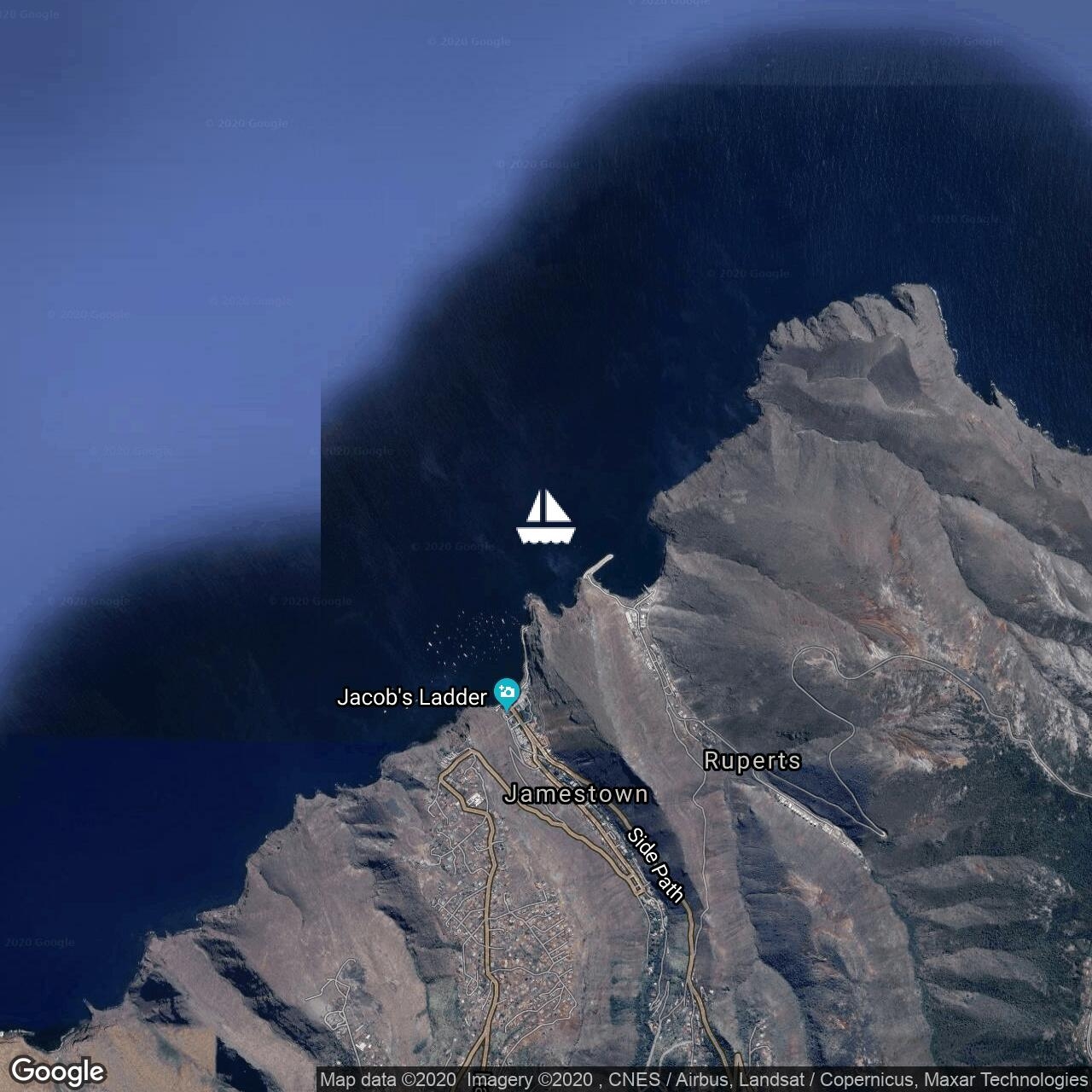
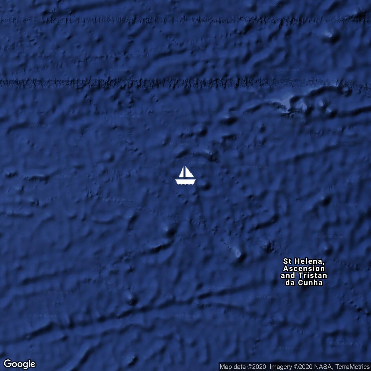
Thursday, February 6, 1400 UTC All checked out and getting ready to depart St. Helena. What a great stopover! Swimming with whale sharks was a highlight. Exploring the island by car was an adventure! Who knew such a small island (47 Sq. Mi) could have so many peaks and valleys. Makes St. John seem like Iowa! We were unable to visit Napoleons grave as it was Sunday but his body is no longer there, or any hint of France as evidenced by the 'no smoking' sign posted at the gate. The people here couldn't have been more friendly and we were able to spend some time with cruisers who we have been traveling with since Malaysia but may not see again. Bittersweet. Next stop, somewhere in the Caribbean. If weather is good, we'll make a short stop in Nevis and then on to St. John.

Thank you Graham and Diane for your lovely email. We hope to cross wakes again in the future! Winds here are light and should be behind us so hopefully a lazy first night to get acclimated. And we're off..... Sent from Iridium Mail & Web.


Fri Jan 31 9:24 2020 NZDT
GPS: 15 55S 5 43W
Run: 0.6nm (1.1km)

Thursday, January 30, 8:00pm local Our first day on St Helena was a blast. We took the water taxi ashore at 8:00 am (there is no place to land your dinghy and water taxi runs on the hour so very convenient). First order of the day was clearing customs and immigration. Then exploring the town which is basically one street of really old buildings that house guest houses, cafes, and small shops. Totally charming. St. Helena has a population of about 5,000. While the town is off the Harbour, most people live on the top of a plateau. That's because the island is bare, steep, crumbling rock for the first 1000 ft, and on the plateau there is water and soil and vegetation. There is a steep road going up from town, but we opted to climb the 699 steps (and each step is 11 inches high) up to the old cannons and stone buildings overlooking the Anchorage. The trip down turned our legs into a quivering mass of jello! This may be the #1 site in the world for whale sharks, which show up in January and February. We've signed up to go on a boat tomorrow morning to see and swim with them! There are a lot of pretty incredible hikes on this 47 Sq. mile island so we plan to do some exploring by car and foot over the weekend.

So we are pretty excited to be here, take in the sites over the next few days, then shove off for the 4,000 mile sail to St. John. All is well on board.

B&L Sent from Iridium Mail & Web.


Thu Jan 30 7:15 2020 NZDT
GPS: 15 55.4S 05 43.4W
Run: 132.3nm (239.5km)
Avg: 5.6knts
24hr: 135.1nm

Wednesday, January 29, 6:00 pm WE ARE HERE! Arrived St. Helena at 1:30 this afternoon after a really nice 8 day passage. There are about 10 other cruising boats already here. Tomorrow we will go ashore, clear customs and immigration, and check things out. This place is a rock, about 10 miles long, very little vegetation, with a small cluster of houses. It's in the middle of the south Atlantic and was probably uninhabited until somebody decided it was a good way station for defense. We can see the remains of a fort at the top of the island. We will check it all out tomorrow. We heard that 7 whale sharks have been spotted so we may splurge on an excursion boat if it means swimming with whale sharks! Meanwhile, we have been tidying up, enjoyed a bottle of South African red wine with dinner, and we're waiting for the sun to go down so we can go to bed and pass out. There's nothing so cherished as a full night's sleep after a passage! All is well on board! Cheers! B&L Sent from Iridium Mail & Web.


Wed Jan 29 7:45 2020 NZDT
GPS: 16 11S 03 45W
Run: 347.5nm (629km)
Avg: 7knts
24hr: 169nm

Tuesday, January 28, 6:30pm Zulu Really gorgeous day today. Hope for the same tomorrow as it will be such a nice way to end the passage. Last night winds were light and fickle so we dropped sail and motored, which for us is slower than sailing. So that's put us a bit behind schedule. Today we've had good breeze, around 17 kts all day but can't quite lay the course line so we are jibing (zig-zagging) across it. We are still hoping to arrive before sunset tomorrow. Today we started talking about the next leg: the 4000 miles to St. John and strategies for crossing the ITCZ at the equator where the SE wind below the equator meets the NE winds from above the equator. Not a good place to be so ideally you want to target the narrowest spot to cross, which is always moving. But that is weeks away and, for now, we are looking forward being tourists on St. Helena. Cheers, The Highways Sent from Iridium Mail & Web.


Tue Jan 28 7:18 2020 NZDT

Monday, January 27, 6 Still sailing wing and wing but jibed over to Port tack about 2 hours ago. The cook likes port tack because everything slides toward the back splash, whereas on starboard tack everything slides toward the floor! Our winds have lightened up but we will leave the main sail shortened down over night and shake the reef out in the morning. We always sail conservatively at night. Fast boat, slow crew.

Less than 48 hours to St. Helena. All is well on board.

Thanks Booker and Dave for the news updates! Sent from Iridium Mail & Web.


Mon Jan 27 6:24 2020 NZDT
GPS: 18 08S 1 06E
Run: 155.3nm (281.1km)
Avg: 8.1knts
24hr: 195.1nm

Sunday, January 26, 17:15 UTC.

So, for anyone paying attention to yesterday's post about time zones, I am now posting Zulu time, which sounds African, but is actually the time in St. Helena and Greenwich, England. The sun won't set for another hour, so 5:15 pm Zulu seems right.

Another good day of sailing. It was cloudy this morning with some occasional misting, but cleared up this afternoon. We expect to make landfall Wednesday afternoon. All is very well on board. Thanks to friends and family who have sent emails! Greatly appreciated! Cheers! B&L Sent from Iridium Mail & Web.


Sun Jan 26 11:18 2020 NZDT
GPS: 18 53S 03 20E
Run: 269.8nm (488.3km)
Avg: 7.4knts
24hr: 176.9nm

Saturday, January 25, 11:30 pm Almost forgot to post a position report today! It's almost midnight, so better get to it. Or is it (almost midnight). Time. We are racing towards 0 degrees longitude, aka Greenwich Mean Time. In nautical circles this is usually referred to as 'Zulu' or 'UTC'. Most sailors will (or should) refer to Zulu time in an effort to be accurate. But I post local time as that is more relatable.

On this passage we will be crossing 3 time zones. Because we have so many devices on board, we usually wait until we arrive at our destination to change all our clocks. Usually this is no big deal as we only cross one time zone (and we are notorious for being an hour early or an hour late for happy hour in a new location, and have gone DAYS before realizing we are in a new time zone!). But this is a much longer westward bound trip. So how do we know we are in the wrong time zone when there are no visible lines drawn on the ocean's surface? Well, when we started this trip, sunrise was at 5:30. Now it's at 7:45. So we should be turning our clocks back two hours to make the correction. But that's just too much trouble so we'll wait until we get there to reset everything to correct time. One of the first questions we ask when we step ashore is 'What time is it?'.

Meanwhile, we continue to have sunny days and excellent sailing conditions. Bruce put a lure in the water today and caught a small Mahi which he let go. We'll try again tomorrow. Mahi means that we are in warmer water. Whoo hoo! Back in the tropics! Sent from Iridium Mail & Web.


Fri Jan 24 22:42 2020 NZDT
GPS: 20 37S 07 03E
Run: 142.9nm (258.6km)
Avg: 7.2knts
24hr: 173.2nm

Friday, January 24, 11:30 am We had another peaceful, starry night last night. No moon on this passage! Light breeze but we are still averaging 6.5 kts boat speed. Every morning the wind has died for a few hours so we run the engine and the watermaker. Thats what's happening now. We expect to have another 24 hours of light wind then it picks up to 20 knots for the remainder of the passage.

Bruce and I are both reading 'Out There', a collection of quirky articles/stories from Outside Magazine. It's especially good because we've been to some of the featured places: Komodo, Indonesia (home of Komodo dragons), Papua New Guinea (cannibals!) , Marshall Islands (story about Bikini Atoll). If nothing else, this trip we've been on has improved my geography! Thanks to everybody who sent us emails to our iridium address, neptuneshighway@myiridium.net We appreciate it! B&L Sent from Iridium Mail & Web.


Fri Jan 24 2:54 2020 NZDT
GPS: 21 19S 009 08E
Run: 169.8nm (307.3km)
Avg: 7.4knts
24hr: 178.7nm

Thursday, January 23, 3:30 pm local time We've been hoping the South Atlantic would be an easy ride and so far she hasn't disappointed. We continue to have a light breeze on the beam and flat seas, averaging a little over 6 kts boat speed. In 48 hrs we've covered 320 miles so about 930 to go! And what a difference a day makes! We were freezing our first night out and wore ALL our gear: long John's, sweatpants, heavy socks, sea boots, hoodies over long sleeve T shirts, beanies, full on foulies top and bottom. It took a full 15 minutes to get dressed or undressed, cutting into our 3 hours of off-watch sleep time. Last night we shed the foulies. And right now we are sitting in our cockpit 'solarium', i. e. under the dodger with the sun coming through the clear vinyl windows, in shorts and Ts! We don't expect St. Helena to be tropical, but it should be comfortable.

Bruce says, " This sail reminds us of why we're doing this!" Cheers, B&L Sent from Iridium Mail & Web.


Thu Jan 23 4:06 2020 NZDT
GPS: 21 54S 011 42E
Run: 174.6nm (316km)
Avg: 7.1knts
24hr: 170.3nm

Wednesday January 22, 5:00 pm Happy hour and we are happy! We've had a gorgeous, sunny day and this afternoon we've had 12 knots true on the beam and are cruising along at 7 kts! This morning the wind died for a few hours which gave us the opportunity to motor and run the watermaker. That means hot showers! All is well on board. Cheers! Sent from Iridium Mail & Web.


Wed Jan 22 3:30 2020 NZDT
GPS: 22 43S 14 17E
Run: 19.9nm (36km)

Tuesday, January 21, 4:00pm We are once again under way with 20 knots on the beam, We are sailing NW on port tack slightly off wind of our rhum line but Bruce says gentle people don't sail to weather. We'll make the correction when the wind lightens up or goes more SE, both of which are supposed to happen in a couple of days.

Distance to St. Helena is 1250 nm and the trip should take 9 days. We've read that the grocery stores there can be pretty bare, depending on when the supply boat from Cape Town arrives. So we've stocked up the boat to get us all the way to St. John. Laura has food stashed everywhere. It seems like overkill but we'll see what's left after 6-8 weeks! Today's a sunny day and our cockpit dodger is a nice solarium but we expect to be fully geared up by sunset. St. Helena is about 420 miles further north at 15 degrees latitude so we are hoping it will be warmer. You can remind me of this post when we hit the equator and start complaining about the heat! Thank you Irene, Lionel, and Jeanine for the emails.

Cheers The Highways Sent from Iridium Mail & Web.


Fri Jan 17 6:15 2020 NZDT
GPS: 22 57S 14 28E
Run: 76.2nm (137.9km)
Avg: 2.7knts
24hr: 65.8nm

Thursday, January 16, 7:00 pm local time.

We arrived in Walvis Bay this morning. Last night we took down all the sails since we only had about 50 miles to go and needed to slow down. We still cruised along at 4-5 knots. So quiet it was easy to get some sleep. It was foggy and cold and around 3am we were invaded by moths who were seeking shelter from the drizzle. What the h were they doing 30 miles from land? It was truly biblical! A plague of moths. When the sun came up they stopped coming. But there were thousands clumped together in every possible nook, cranny, or fold of sail cloth. Laura went into full genocide mode, channeling her years living in New York City in an old tenement building held up by cockroach spit. Now the boat is covered with moth dust inside and out and will require a big clean up. But today's priority was checking in with customs and immigration (a loooong walk). Passports are stamped and we are back on the boat enjoying wine and internet. We will be here about a week and then no more internet until April when we arrive in St. John. But we can be reached at neptuneshighway@myiridium.net. We'd love to hear from you. And Bruce will want to know who wins the Super Bowl. Cheers. Sent from Iridium Mail & Web.


Thu Jan 16 2:27 2020 NZDT
GPS: 23 58S 14 00E
Run: 701.3nm (1269.4km)
Avg: 32.9knts
24hr: 790.2nm

Wednesday, January 15, 15:00 local time Last night we had 24-30 knots of wind behind us and some pretty big seas. This only lasted about 5 hours and then it settled down to a more comfortable 16-19. This morning was pea soup foggy and the boat was dripping wet and everything down below felt damp. Eventually the fog lifted and the wind has died down. It's still overcast but the boat is dry and we've been sailing along with only our reefed main. We want to slow down to about 4.5 kts so we don't arrive before sun-up tomorrow.

It's been cold out on the water and we've been living in our one set of long John's, sweat pants and hoodie, topped by our foul weather gear, heavy socks and sea boots. So it will be nice to get into Port, have a hot shower, clean clothes, and clean sheets.! Laura is reading How Not to Die by Mitchell Gregor, MD and getting inspired to make our daily diet more nutritious. That will be a challenge on our 30 day passage from St. Helena to St. John. Everything in the book is backed by legit research. It's definitely worth reading as there is so much conflicting information out there and this book takes a KISS approach. All is well on board. Cheers! Sent from Iridium Mail & Web.


Wed Jan 15 5:09 2020 NZDT
GPS: 33 28.0S 18 04.3E
Run: 548.7nm (993.1km)
Avg: 10974knts
24hr: 263376nm

(this post from our first day out didn't send so I am re-posting) Saturday , Jan. 11, 2020 1100UTC We left Capetown early this morning in a pea soup fog and glassy seas. This coastline heats up in the summer months but the water coming up from Antarctica remains cold, resulting in fog very similar to the summer 'Marine Layer' (Californian's won't admit to fog!) that we have in the summer months on the Central CA coast. It is now 2pm, the sun and sails are up and the engine is off. Wind is 14 knt true from SW, seas are flat, and we're cruising along at 7 knots! We should arrive in Walvis Bay on Thursday. All is well on board and we are keeping an eye out for whales. Sent from Iridium Mail & Web.


Wed Jan 15 5:06 2020 NZDT
GPS: 26 09S 014 31E
Run: 905.2nm (1638.4km)
Avg: 33.9knts
24hr: 813.7nm

Tuesday, January 13, 7:00pm Still cruising along downwind with sails wing and wing. Yesterday we passed through a fleet of dredgers off the Orange River, which is the border between South Africa and Namibia. They are dredging for diamonds! We were about 30 miles offshore in about 400 ft of water.

Our ETA for Thursday morning still looks good.

Cheers! Sent from Iridium Mail & Web.


Tue Jan 14 2:24 2020 NZDT
Run: 1151.7nm (2084.6km)
Avg: 5.9knts
24hr: 142.1nm

Monday, January 13, 2:00 pm We have crossed the line into Namibian waters. So far, an easy downwind trip (which means we are eating way too well - I count on these offshore trips to cut down!). Still on track for arrival at Walvis Bay on Thursday morning. Cheers! B&L Sent from Iridium Mail & Web.


Sun Jan 5 23:54 2020 NZDT
GPS: 33 55.1S 018 26.6E
Run: 18.3nm (33.1km)

Sunday, January 5, 2020 We left Simon's Town yesterday and (finally) motor sailed past the Cape of Good Hope. We are now in Cape Town at the Royal Cape Yacht Club. Sounds elegant but is actually a dirty, industrial area. We don't plan to be here long. Just enough time to do a final provision, fuel top off, and check out out of SA. We hope to be on our way to Namibia by the end of the week. Sent from Iridium Mail & Web.


Fri Nov 22 17:45 2019 NZDT
GPS: 34 11S 18 26E
Run: 79.4nm (143.7km)
Avg: 3.1knts
24hr: 73.6nm

Friday November 22, 0600 We arrived in SimonsTown yesterday afternoon at 4:00 after an easy 36 hour passage from Mossel Bay. We had a nice sail up False Bay on a clear, sunny day. It usually blows 30 in this area and gusts to fifty are not uncommon so we must have had the best day of the year with a gentle 11 knots of wind and flat seas. There are Cape fur seals swimming and waving at us everywhere we look. Tomorrow we meet with friends and will take a walk to the penguin beach. Today we will check into the marina and look for a laundry service to tackle our mountain of long John's, sweaters, sweatpants, and long sleeved shirts. We both had 3-5 layers of clothing on under our foul weather gear in order to keep warm offshore.

The town is small and this side of the cape is mostly uninhabited windswept mountains (no trees!). So there will be lots to explore. We expect to be here until after New Year's when we will start the 6000 mile trip up the Atlantic. But first some much needed R&R from the rigors of working our way across the Indian Ocean. We are now officially in the Atlantic.!


Thu Nov 21 15:51 2019 NZDT
GPS: 34 50S 19 35E
Run: 152.4nm (275.8km)

Thursday, November 21, 0430 local time We have just motor sailed past Cape Aguhlas, the southern most point of the African continent. 90 miles further is the more famous Cape of Good Hope. In between the 2 capes is False Bay and that's where we're going - to Simonstown Marina where we will spend the next month. We are looking forward to seeing penguins, hiking to the Cape of Good Hope, and doing a tour of South Africa's renown vineyards. We've been drinking some really nice reds and whites, all under$8. So we need to get educated and stock up before we leave in January. Also top of the to do list is replace our water heater which died and was removed from the boat back when we were closer to the equator. Now we are at the latitude of San Francisco (only South), sleeping under 2 blankets, and wearing socks and fleece. Hot water is vital to avoiding mutiny. We hope to be in SimonsTown before sunset. We've had a blessedly uneventful passage so far with clear skies, light winds, and a 10-12 ft swell. Fair winds to all, and to all, a good day. Sent from Iridium Mail & Web.


Sun Nov 17 4:24 2019 NZDT
GPS: 34 10S 22 08E
Run: 205.5nm (372km)
Avg: 6.2knts
24hr: 148.1nm

Saturday, Nov 16, Mossel Bay We are tied to the dock at Mossel Bay having a beer. This morning's weather report warned of strong winds at Cape Aguhlas after 11:00 pm and we were 150 miles away so decided to bail, along with the 2 other boats traveling with us. We made it into the harbor by 4:00 pm, tied up to a concrete wall with the shredded remains of our dock lines (see previous post about Port Elizabeth) and are snug in our main salon having a celebratory beer.

CHEERS.


Fri Nov 15 19:06 2019 NZDT
GPS: 33 59S 25 43E
Run: 4.9nm (8.9km)

Escape from Port Elisabeth, Friday, 0700 local time (UTC +2).

So happy to leave the tortuous situation at the dock in PE. We are blissfully motoring along in a comfortable swell. We hope to get to Simons Bay by Monday if the weather allowed. We have to get around Cape Aghulas, the southern most tip of Africa. If wind switches to SW, it may not be possible, in which case we'll have to bail out at Mossel Bay. Fingers crossed.


Wed Nov 13 19:15 2019 NZDT
GPS: 33 58S 25 38E
Run: 237nm (429km)
Avg: 3.3knts
24hr: 79.2nm

A strong circular weather system developed along our path. We had optimistically hoped to outrun it, but realistically decided we should bail and we put into Port Elizabeth along with the other three boats traveling with us. On arrival (Monday morning) in a 35 knot gale we questioned our decision! PE sets the bar at a new low for derelict marinas. It's all part of the sad state of affairs in South Africa and a recent government decision to close down marinas because they are viewed as only catering to a white demographic. When we came in, the bay was so bouncy that the boat was bucking wildly and it was difficult to walk on the dock. We are currently riding out this storm spider-webbed to the dock with more lines than we used for Hurricane Marilyn. Two have broken and Bruce is constantly adding more chafe gear. We hope to escape Port Elizabeth before something on the boat breaks. On the positive side, we took all our damp passage clothes to the laundry and we've both had a hot shower and regular hot meals. Still searching for that 'easy button' as we work our way past the cape of storms toward a more docile Atlantic.


Sun Nov 10 19:27 2019 NZDT
GPS: 32 31S 29 21E
Run: 195.4nm (353.7km)
Avg: 8.5knts
24hr: 203nm

Sunday, Nov 10, 0730 We covered 175 miles our first 24 hours. It was slow going getting away from Durban and into the Agulhas Current. Last night was overcast and drizzly but pleasant enough with light to moderate winds on our back and 3 knots of current pushing us along at 9 kts. The wind picked up at 0400 and we dropped the main and will do the rest of the trip downwind with jib only, which will make it easy to jibe when necessary. I'll just have to plan all our meals for when we are on STBD tack as galley is on port side! We are waiting for a thumbs up from the weather router to sail all the way to the cape. We really don't want to pull into Port Elizabeth which will be horrible in these wind conditions. We hope to pass by it in the morning and continue on to the cape of GOOD HOPE! Sent from Iridium Mail & Web.


Sat Nov 9 20:21 2019 NZDT
GPS: 30 05.6S 31 03.19E
Run: 16nm (29km)

Saturday Nov 9. 0900 We left Durban by 0600 this morning in the company of 4 other boats. Everyone along the coast is taking advantage of NE winds to sail south. We hope to make it all the way to Simons Town, near Cape Town, where we will park ourselves for the next month. Winds will be strong but wind and waves will be on our back. A bit white knuckle for Laura (Our slogan is 'fast boat, slow crew') but we really need to get down to Cape Town and put this notorious coast behind us (known as the Dangerous Coast because of wind and waves - not pirates!). Right now we have light wind on our beam and it will build after midnight. Our weather is cold and drizzly. We are happy to have an almost full moon tonight. Our biggest challenge tonight will be staying warm. Hope to make landfall Thursday so just have to bite the bullet for 5 days. Ok, stop the whinging! Everyone have a great day! Sent from Iridium Mail & Web.


Sat Nov 2 18:03 2019 NZDT
GPS: 29 51.8S 31 01.5E
Run: 97.8nm (177km)

Saturday, Nov. 2. We left Richard's Bay on Tuesday afternoon with the high tide (to get over a sandbar) and arrived in Durban the next morning. Richard's Bay marina was pleasant enough but RB is a coal shipment port and we were appalled by the amount of coal dust covering the boat! We were eager to move south and hoped to go farther than the 90 miles to Durban but the weather would not allow it. Durban is disturbing. There are two very friendly yacht clubs in the marina complex but outside the gates is a section of the city that has been taken over by squatters and the homeless. We have been told it is not safe to go out day or night so we are prisoners in our somewhat guilded cage. As someone who loves to explore new places on foot I am appalled. Like the Caribbean, the black population may be in charge but they are still the underclass, without capital, education or experience and the country is in an obvious decline. This feeds the prejudice and anger of the disenfranchised white people who rail about the incompetence of the blacks. No one is happy, crime is an ever present threat, and the word 'distopia' comes to mind. Keep in mind I've been in this country a month so this is simply my observation of the tiny slice of life I have seen. Perhaps my South African friends can enlighten me, but they've all sailed away to the US, Australia, or New Zealand.

Rant over. We will wait here for an opportunity to continue south, perhaps next Friday. Looking forward to putting the challenges of the South African coast, both on land and sea, behind us.


Thu Oct 24 17:27 2019 NZDT
GPS: 28 47.4S 032 04.9E
Run: 3742.7nm (6774.3km)
Avg: 17.3knts
24hr: 415.8nm

Thursday, Oct. 24, Zululand Yacht Club Marina.

We had a swift passage from Bazaruto to Richard's Bay, South Africa, arriving last Wednesday midnight. Our friends on Icaros had come in about 3 hours ahead of us and stayed up to catch our docklines. At low tide the seawall is about 6 ft. overhead which makes it impossible for old salts to scramble ashore with lines so Bev and Bob on Icaros were crucial for us being able to tie up. Friends on Nero, who had arrived a day earlier, were also standing by to assist. I can't repeat often enough how much we appreciate our cruising friends! Thursday was a blitz of checking into a new country and catching up with the other cruisers. On Saturday we moved the boat to the much quieter Zululand Yacht Club. Apparently there are hippos in these waters so we will have to keep a sharp eye out. Des Cason, the South African who provides free weather routing for anyone who wants it, drove up from Durban to put faces with names and we all had the opportunity to buy him a beer and thank him for his service. The rest of the weekend involved catching up on sleep, doing four loads of laundry, and restocking the fridge with fresh food. On Tuesday and Wednesday we rented a car and drove to a nearby game park with Nero and saw, up close and personal, herds of giraffe, elephant, rhinos, warthogs, and impala. No big cats sited, but a successful safari nonetheless. So now we are back on board. No weather window in site for moving further south so we will settle in for a few weeks. This weekend is Octoberfest at the Yacht Club. So I guess we will take it one beer at a time. Cheers.

Sent from Iridium Mail & Web.


Tue Oct 15 17:24 2019 NZDT
GPS: 25 17N 35 06.7E
Run: 3294.7nm (5963.4km)
Avg: 103knts
24hr: 2471nm

Oct.15, Tuesday, 7:00 am We had a good run last night with double reefed sails so kept the boat quiet and we slept really well on our off-watch time. Plus we had the gift of a full moon. I was grumbling to myself all day yesterday about the pitching and rolling motion getting old, but it's me that is getting old! We hadn't been able to talk to our friends on Nero on our SSB radio chat for several days. They went 'lone wolf's from Madagascar to Richard's Bay with only SSB radio and no access to weather information. But this morning our dear friend, Mick, on Zoa came on and let us know that Nero was entering the harbor at RB. Mick is still in Madagascar and has been lurking in the background to all our radio chats (@ 6:30 am!) to make sure everyone is OK. You just can't beat the cruiser network! The friends we make are the highlight of this nomadic life and fill in for the family and friends at home that we miss so much. So give someone a hug today on our behalf. We are sooo looking forward to giving hugs in person! Sent from Iridium Mail & Web.


Mon Oct 14 9:24 2019 NZDT
GPS: 22 23S 35 38E
Run: 52.5nm (95km)

Sunday, Oct. 13, 11:00 pm. The five boats anchored at Bazaruto decided to leave today for the 500 mile sail to Richard's Bay, South Africa. It will be our first official port of call in Africa. A new stamp in the passport, a new culture, currency, and cuisine. We hope to go to the dock which means hot showers, hopefully a laundromat (Laura's obsession), and being able to come and go as we please. There is a safari park nearby so we plan to take that in as well. So everyone was eager to go. The weather window looks good but first we must claw our way to windward in shifty winds for the first 130 miles. The full moon helps enormously. Sent from Iridium Mail & Web.


Thu Oct 10 23:18 2019 NZDT
GPS: 21 38.8S 035 26.2E
Run: 388.2nm (702.6km)
Avg: 6.2knts
24hr: 148.2nm

Dropped the hook at 10:30 am local time off Bazaruto. We knew that we would have wind and current on our final approach and we would need to slow down in order to arrive after sunrise but, damn, it was hard to slow down! Throughout the night we had no sails up (just 'bare poles') and were still maintaining 5+ kts. Going downwind in a monohull can be rolly and it was super annoying, but pretty peaceful under a 3/4 moon. Our timing was good and we arrived at low tide, as recommended by our African sailing guru, Des Cason.

I know I overuse the phrase 'stunningly beautiful' but I can't think of a better way to describe this location. The islands are white sand and the water is blue like the Caribbean. There are a few small flat islands with a resort and looks like the Bahamas. We are anchored off the big island, Bazaruto, which has giant sand dunes and reminds us of Frasier Island in Australia. The area is a park and reserve so there is no development other than the few small resorts. Who knew this existed in Mozambique (well, obviously people smarter than I - Mozambique has two crossed AK47s on their national flag and all I think of is 'Black Hawk Down'). We are just passing through and not actually going to the mainland to check in. Our destination is Richards Bay, South Africa, 500 miles south, and we will wait here for good weather to continue on. Looking forward to getting some rest after a 5 day passage. All is well on board.

Sent from Iridium Mail & Web.


Tue Oct 8 8:27 2019 NZDT
GPS: 17 49.4S 039 48.6E
Run: 165nm (298.7km)
Avg: 9.5knts
24hr: 228.9nm
Weather: Clear skies with apparent wind from the East @ 8 knots. Boat speed 6.5 kts with the help of current. Flat Sea conditions.

Monday, 10:00 pm. Motored most of the day with very light breeze from astern (or, as Bruce says, "up the butt"). Hot and rolly! Ran the watermaker and topped off tanks, washed decks and had showers! Back to sailing around 5:00 pm so now blissfully quiet and calm. We should have wind for the rest of the trip. 320 miles to go. All is well on board.

Sent from Iridium Mail & Web.


Mon Oct 7 15:09 2019 NZDT
GPS: 16 23.3S 41 48.4E
Run: 175.9nm (318.4km)
Avg: 5knts
24hr: 120.8nm
Weather: Clear night. Wind SSW @ 15 kts.

Sunday 10:00 pm. We've been out here 36 hours and covered 220 nm. About 500 more to go and we should arrive Thurs. morning, 10/10 at Bazaruto Island. Two boats we know arrived there today and another will arrive in two days so we should have company. Bazaruto is a deserted island - more of a sand bar with dunes. We are hoping that soon after we arrive there will be a weather window to sail the next 500 miles to Richard's Bay, SA. We will probably stay in RB for several weeks and plan to visit a nearby game park. But for now we are sailors and not tourists. All is well on board.

Sent from Iridium Mail & Web.


Sun Oct 6 4:12 2019 NZDT
GPS: 16 03S 44 26E
Run: 123.9nm (224.3km)
Avg: 3.3knts
24hr: 80.4nm

Just watched the sun set as we pass the eastern point of Madagascar and head west to Africa. We left around 9:30 this morning and have had great sailing conditions, covering 60 miles in 8 1/2 hours. Our destination is Bazaruto Island, Mozambique and we should arrive there Thursday, Oct. 10. Bruce caught a Spanish Mackerel this morning! Great way to start a passage.

Sent from Iridium Mail & Web.


Fri Oct 4 15:12 2019 NZDT
GPS: 16 03.2S 046 17.9E
Run: 204.6nm (370.3km)

We are anchored at Baly Bay on the west coast if Madagascar. We will wait here for a good weather window to make the jump across the Mozambique Channel to Africa. Our goal is to get to Richard's Bay, South Africa and eventually Cape Town but we will most likely stop at Bazaruto, an island off Mozambique, to wait for weather to continue on. There is a strong current running south along that coastline. When a 'buster' blows from the south with 35+ knots of wind, the wind-against-current kicks up huge sea conditions can break the back of a freighter! After a 'buster' the wind will clock around and blow from the north, providing a few days of favorable conditions. So we will sail when conditions are good and hunker down when it blows from the south. This is one of the most challenging parts of our journey so stay tuned! Meanwhile, we've had good sailing down the coast of Madagascar and enjoyed the scenery, snorkeling, baobab trees and friendly lemurs. There are quite a few cruisers here, many of whom we met in Malaysia and some new to us, so it's been a very social month. We now have an HF radio net so we are talking to cruisers on passage. It's always good to share experiences and to hear a familiar voice when offshore. We are in touch with 4 boats that left for Bazaruto laxt Monday and are halfway there. We are hoping that there will be a window for us to jump this coming Monday. But patience is the name of the game! Sent from Iridium Mail & Web.


Wed Sep 11 16:42 2019 NZST
GPS: 13 43.3S 048 11.2E
Run: 28nm (50.7km)

Anchored off Mamoko Island. This place looks like a movie set with a tiny village perched on a spit of sand. Ashore they have tame lemurs, two giant tortoises that the kids ride, and a single baobab tree amongst the palms to remind you that you are in Madagascar. The anchorage is very calm so we may stay a few days, although there is no internet. Today we plan to check out the nearby reef, do some repairs on our dinghy chaps (cover), and go ashore this afternoon with popcorn for the children and bananas for the lemurs.

Sent from Iridium Mail & Web.


Wed Sep 4 2:30 2019 NZST
GPS: 13 19.0S 48 09.6E
Run: 49.2nm (89.1km)

We sailed 45 miles today to Sakatia Island, off Nosy Be Island. Tomorrow early we'll motor 3 hours to Hellville, Nosu Be to finally check into Madagascar which will take all day.

As we are approaching tonight's anchorage we see about 5 boats sailing in from the opposite direction. And they are all boats we know from Malaysia! Also, they are almost all US flag, something we have not seen in a long time! Here's the run down: Slow Flight, Seattle Jaga II, Alaska Althea, Morro Bay, CA Nauti Nauti, Wisconsin Tiger Lilly, USA but not sure of hailing port.

Icaros, not US, but maybe Canada??? Great to see that we've all made it safely across the Indian Ocean. Each boat has had it's challenges and we look forward to hearing everyone's tall tale! But first, to Hell(ville) and back. Sent from Iridium Mail & Web.


Sat Aug 31 6:06 2019 NZST
GPS: 13 54.2s 048 34.5e
Run: 116.5nm (210.9km)
Avg: 4.4knts
24hr: 105.7nm

What a difference a day makes! After a 12 hour snooze, we raised anchor this morning for the 50 mile passage to Mitsios Island. Our friends on Slow Flight decided to stay another day at Cathedral but the Park Service visited their boat and wanted about $75 so they also raised anchor and followed us. The day was amazing, just like Caribbean sailing. We had flat seas, a steady breeze, close hauled doing 7 kts. Bruce steered the whole way and was in sailor heaven. So our first two days in Madagascar we've had possibly our worst day and our best day!!! As a bonus, we caught a beautiful Spanish Mackerel and a small tuna. We are now in a lovely anchorage where we can stay as long as we want, clean the salt off the boat, do some laundry and maybe some snorkeling, and share a fish dinner with friends. Life is VERY good.

A big thank you to everyone who sent emails: Vickie Crothers, Diane Masterson, Janice Johnson, Icaros, and our African weather guru Des Cason. Cheers! Sent from Iridium Mail & Web.


Fri Aug 30 3:39 2019 NZST
GPS: 12 15.6s 048 57.6e
Run: 96nm (173.8km)
Avg: 4.3knts
24hr: 103.6nm

Thursday, August 29, 6:15 pm.

We transited the top of Madagascar this morning and arrived at a safe anchorage by noon. This trip has been our windiest to date with winds consistently in the 20-30 kt range and 3-4 meter seas. As we rounded the cape and got in the lee, the seas flattened but the winds increased to about 35 knots and stayed like that until we were within 2 miles of our anchorage, when it dropped to 8-13! Thank goodness! We are anchored among several small deserted islands in an area that is National Park. The scenery is stunning and the stress of the passage was quickly forgotten. We ate a big 'breakfast' and immediately fell asleep as neither of us slept more than an hour or two last night. Officially we are not allowed to stay in the park without paying fees and we have no Malagasy money and are broke cruisers so we will leave tomorrow morning for an island outside the park. We plan to stay there several days cleaning the salt off the boat and exploring the area before we go to civilizatio n to check in with authorities. We looking forward to seeing lemurs and baobabs and experiencing Malagasy culture. Until we get local sim cards, we only have the irridium for communication. Feel free to email us at neptuneshighway@myiridium.net. We'd love to hear from you! Sent from Iridium Mail & Web.


Thu Aug 29 5:24 2019 NZST
GPS: 12 49.7S 50 15.5e
Run: 188.1nm (340.5km)
Avg: 8.2knts
24hr: 195.9nm

Wednesday, 9:00 pm. A moonless night but the stars are out which is an improvement over last night. After 24 hours of very slow, comfortable sailing, we took out the second reef this morning and pulled out the jib. We need to average 7 knots for the next 24 hours to get to the top of Madagascar at low tide/slack water. It is now 9:00 pm and we've been averaging 8+ so no problem. We put the second reef back in before sunset and with double reefed main and jib we are still screaming along. Too bouncy plus too nervous to sleep. We've been living in our foulies to keep warm on night watches and to keep dry in intermittent rain. We bought our jackets in St Maarten in 2011 and they are so disgusting and worn out and the rain comes right through. Laura has a 'new' Gill jacket that she picked up at REI in Seattle that same year. It's been stored since then. It is very warm and dry BUT the white waterproof inter-lining is rotting. The entire main salon looks like it's covered with fake snow and Laura looks like she has a terminal case of dandruff! So new foulies will be a priority when we reach South Africa.

But first, we must conquer Cap d'Ambre. We should survive and be safely anchored by sunset tomorrow.

Sent from Iridium Mail & Web.


Wed Aug 28 6:21 2019 NZST
GPS: 15 22.7s 51 14.3e
Run: 179.3nm (324.5km)
Avg: 7.5knts
24hr: 181.2nm

Tuesday, 10:00 pm. Wind is still steady 16-20 knts on our aft quarter. We put in the second reef at 8:00 this morning so we are going much slower - about 6 knts. It's all about timing to arrive at the top of Madagascar at slack water, low tide and we were going too fast. We'll probably add some jib tomorrow morning to bring speed up to 6.5 kts. No moon and no stars tonight. Last night was clear and today was beautiful. 36 hours to go to Cap d'Ambre, then another 30 miles or so to an anchorage. All is well on board.

Sent from Iridium Mail & Web.


Tue Aug 27 6:36 2019 NZST
GPS: 17 35.6S 52 38.8E
Run: 202.2nm (366km)
Avg: 8.6knts
24hr: 206.9nm

Monday, 10:00 pm. Laura does the 10pm to 1 am watch so good time to post an update. We've been sailing downwind with 15-20, wing and wing with reefed jib and main. Last night we rolled up the jib until daybreak today. To night We've left it up but may roll it up later if we need to slow down. We need to hit the tip of Madagascar at low tide Thursday which is at 10:45 am. We've been averaging better than 7 kts and will get a boost from a 2 kt current as we approach Cape d'Ambre. Seas are 3.5 meters, as predicted. We are not uncomfortable but trying to prepare food is a challenge and not yet inspired to cook much. That's why we ate so much pastry and French bread and drank so much wine in Reunion in preparation for this trip! The anchor will be down and celebratory glasses raised soon enough! 260 miles behind us and 440 left to go.

Sent from Iridium Mail & Web.


Mon Aug 26 7:09 2019 NZST
GPS: 19 55.1S 54 31.4E
Run: 86nm (155.7km)
Avg: 2.5knts
24hr: 60.7nm

Sunday, August 25, 10:00 pm. We've been on passage 12 hours and have put 77 miles between Neptunes Highway and Reunion. We motored into a light wind and 3-4 meter swell for the first 3 hours to get away from Reunions wind shadow. Then it was like someone flipped a switch and we had 17 knots on our stand quarter. So we are sailing down wind and averaging better than 7 knots. Our friends on Slow Flight gained about 5 miles on us. We were contacted by Reunion Coast Guard that a 10 meter sailboat was having problems (with their sails????) and had run out of fuel about 60 miles out. Miraculously, our friends on Slow Flight spotted a sailboat just before sunset and changed course to investigate. It was the distressed boat! We rolled up our jib and chicken-jibed to follow them. By the time we were closing in, Kimi and Trevor on Slow Flight had somehow managed to give the stranded sailor a 5 gallon jug of diesel. That will at least get him close enough to Reunion for the Co ast Guard to assist, if not all the way. So we chicken-jibed back to course, decided we needed to set the pole, and are continuing on wing and wing. A very busy first day leaving the dock, getting everything stowed away and ship-shape, getting sails up, gybing twice, setting the pole, and many chats on the radio with the Coast Guard. Tomorrow should be more routine.

Sent from Iridium Mail & Web.


Sat Aug 24 21:09 2019 NZST
GPS: 20 56.3S 55 17.1E
Run: 153.4nm (277.7km)

We left Mauritius on July 31 and it was such a fast trip (22 hours) that I didn't get around to updating our position. We have been almost a month in Reunion and it is amazing. There are no anchorages so we are at a marina (a big splurge for cruisers!) and enjoying the daily hot showers, walks to town, and the camaraderie of other cruisers. We spent the first week hiking the cirques and being tourists. Since then our daily life has been catching up with news, shopping, cooking, laundry, some varnish work, eating baguettes and pastries and studying the weather between here and Madagascar. It's been windier than we like with a 3-4 meter waves and blowing stink at the north point of Madagascar, which we have to round in the morning hours at slack tide on the 4th day of the trip (not always easy to time it right). But after 3 weeks with no change of weather in site, we have decided to leave tomorrow morning and make the best of what Neptune hands us. So stay tuned and hopefully we'll have the anchor down someplace safe by the end of the day Thursday.

Sent from Iridium Mail & Web.


Thu Jul 4 15:54 2019 NZST
GPS: 20 09S 057 30E
Run: 1.7nm (3.1km)

We are still in Mauritius and eating our weight in fresh baguettes and Dhal Puri Roti (our favorite street food). We just hauled out the boat yesterday to remedy our failing bottom paint that we put on last year in Malaysia! We expect to be in the boatyard for a week.

Happy Fourth of July to all our stateside friends and family! We hope to be celebrating with you this time next year!


Sun Jun 16 23:06 2019 NZST
GPS: 20 08.8S 057 28.4E
Run: 336.9nm (609.8km)
Avg: 7.4knts
24hr: 177.3nm

We arrived at the quarantine anchorage at Port Louis Sunday, June 16 at 13:00. 350 miles in 50 hours, average speed 7 knots, which is pretty darn fast for a monohull! The only stressful weather was the last few hours when we had 30 kts of wind in the lee of Mauritious when we were expecting something a bit tamer. There were several daysail charter boats out and Sunday sailors who didn't seem to mind the conditions. We are such wimps, but also sleep deprived and hungry so we were anxious to drop the hook.

Enjoying a big lunch, beer, shower and next a nap. We'll go into port and check in with authorities in the morning.


Sat Jun 15 1:30 2019 NZST
GPS: 19 40s 062 38E
Run: 51nm (92.3km)

Saturday, June 15, 17:00.

Checked out of Rodrigues this morning. Set up the boat for downwind port tack passage and it took FOREVER to get out through the reef to a point where the wind was on port and we could raise sail. A purist would have gybed but that would have been too complicated! Having a good run so far with about 14 kts apparent wind and 8 ft seas, wing and wing with a reefed main. Don't see any rain in the weather forecast. Hoping for an quick uneventful passage. ETA is Sunday afternoon.

Sent from Iridium Mail & Web.


Tue Jun 11 0:33 2019 NZST
GPS: 19 40.0S 063 25.0E

We bailed on leaving for Mauritious as the weather window wasn't that great. Looks like Friday might be better. There are now 4 boats here and we may all check out on Friday. Meanwhile, we enjoyed an evening out last Saturday to hear some traditional Creole music with dancing. We are amazed at how similar it is to Caribbean scratch band and contra dancing.

On Sunday the crew from a Montreal boat gave a French class to the rest of us, followed by wine, cheese, olives and beer - all on board Neptune's Highway. This morning we all had to leave the anchorage at 06:30, nursing hangovers, to allow a cargo ship to come in. Once the ship is tied to the dock, we file back in through a narrow channel and re-anchor. Tomorrow we may take the bus to a tortoise sanctuary (think Galapagos-style giant tortoises that used to be indigenous to Rodrigues but were devoured into extinction by visiting sailors and have now been re-introduced from neighboring Madagascar and are thriving in the protected environment). We will have to post pictures!


Thu Jun 6 16:39 2019 NZST
GPS: 19 40.0S 063 25.0E
Run: 1nm (1.8km)

We have really enjoyed Rodrigues and feel fortunate that we had a good weather window to sail here. Friends located to the north and east of us are abandoning plans to come here and instead are going to Seychelles or directly to Madagascar because the winds and sea conditions surrounding this area are so rough. Our next destination is Mauritious, which is only 340 miles to the east. But the weather forecasts are for high winds and 17 ft. seas. It does abate a bit on Sunday and Monday so we are planning to leave Saturday, which will get us there before things start to pick up again. We usually never leave if the wind forecast is for more than 15 knots, because in our experience 15 means 20. But in this case, we will leave with a forecast for 25 kts of wind and 12 ft. seas. This should not last long, and we should have a more manageable 13-15 kts for most of the trip. Also, the wind will be after of the beam which will help. For the non-sailors out there, if you are riding a bicycle at 15mph with a 20mph wind on your back, the apparent wind will feel like 5mph (20-15).

So we are watching the weather very closely and looking for an opportunity.

Not ideal, but it's what we have to work with .


Mon May 27 18:18 2019 NZST
GPS: 19 40.8s 063 25.24E
Run: 205.6nm (372.1km)
Avg: 7.4knts
24hr: 178.8nm

May 27, Monday, 9:00 am. BREAK OUT THE CHAMPAGNE! WE'RE HERE! 1034 miles, 7 days. It's drizzly but we are tied to the municipal wharf waiting for the customs man. No wind or wave. This passage is notorious for being difficult but thanks to Bruce's Irish luck and hours of studying daily weather forecasts, we picked the right day to leave Chagos and had a most excellent sail. Tonight the weather is supposed to turn nasty and stay that way so we are ecstatic to be here! Everyday of the trip it seemed I would come on deck and Bruce would tell me about the fish strikes he had so I was somewhat suspicious. But yesterday I witnessed a big beautiful mahi on the line. As we were lifting it from the water, in a burst of energy the fish thrashed, hitting it's head on the transom which knocked the hook out of its mouth. He quickly swam away, grateful for the headache. A few hours later just as a huge squall was closing in on us, we landed a slightly smaller mahi ( the big one always gets away). We were in a downpour until sunset so we were happy to finally catch a fish on our last opportunity.

We are eager to get cleared in, anchor the boat in the harbor, and come ashore for some exploring. Priorities are ATM, lunch, beer, wine, groceries, SIM card, locate laundromat, try the Dhal Puri Roti that street vendors sell. Then SLEEP! Bruce has been up since 1:00 am and I am so tired that when I stepped on shore it bucked and rolled more than the boat! We will be here for at least 2 weeks so no more updates for a while. We should have internet by tomorrow and will be using our usual Gmail address. Thanks to everyone who sent us emails during our 6 week internet blackout. B&L Sent from Iridium Mail & Web.


Sun May 26 14:42 2019 NZST
GPS: 17 26.4s 065 29.1E
Run: 273.1nm (494.3km)
Avg: 7.2knts
24hr: 173.4nm

May 26, Sunday 05:00. Day 7. I forgot to post our position yesterday! At 10:00 am yesterday, after 24 hours of motoring, we were finally able to raise sail and commence sailing. The wind filled in slightly north of east to an astonishing 17 knots (what a gift!). Our apparent wind was 14 knots on the beam - perfect! We also seemed to have about 1 knot of current pushing us along so, even with 12 knots of wind, we were maintaining 7-8 knots of boat speed. Before sunset we put a reef in the main (we usually do this just to make night sailing easier - if we get a squall or more wind, we only have to roll up the jib). The moon came up around midnight and we've had a beautiful night sail, averaging 7+ knots. Now, at 5:00 am Sunday, we have 185 miles to go so a Monday arrival in daylight is looking really good! Sent from Iridium Mail & Web.


Sat May 25 0:54 2019 NZST
GPS: 13 46.60s 067 01.5E
Run: 118.1nm (213.8km)
Avg: 6.1knts
24hr: 147.2nm

May 24, Friday. 17:00. Day five and we are past our halfway mark. Weather models look good but as the saying goes, the only weather that's predictable is yesterday's. We were supposed to have light winds at a favorable angle but instead have no wind. Had to drop the main as it is a bit rolly! Been motoring since 10:00 this morning with no end in sight. But we have lots of fuel so no worries. We ran the watermaker, had nice showers and naps. We are a bit slower than our 6 knots average but still hope to arrive on schedule and avoid bad weather. Sent from Iridium Mail & Web.


Fri May 24 5:39 2019 NZST
GPS: 12 20.50s 067 58.60E
Run: 220.6nm (399.3km)
Avg: 7.2knts
24hr: 172.2nm

Gotta say, last night was a gift! A clear, warm, moonlit night. Steady 15 knots of breeze. Steering for the Southern Cross. Thank you! Today was another nice day with a steady 12-15 knot breeze. Tonight we hope will be a repeat of last night. We are 82 hours into this trip and almost at our halfway point and so far, so good. We get two weather models (twice a day, at noon and midnight) and one model has changed radically so we are eager to see tonight's update so we can plan accordingly. When the models are radically different, it indicates that the weather is unpredictable! We would be foolish to believe either one. More on this tomorrow! Sent from Iridium Mail & Web.


Wed May 22 22:54 2019 NZST
GPS: 09 31.00s 069 29.30E
Run: 194nm (351.1km)

Day three. Last night we worked our way through a gauntlet of clouds packing wind and rain. Fortunately we can see them coming (thanks, moon!) and reduce sail (main is reefed so only have to roll up more jib) so we are ready when the wind picks up. Highest wind was 24 but mostly around 20-21 and lasts about 30 minutes. Today we have a steady 17-18 from SE and have had to adjust course from 190 to 205. Not too bad, we should be able to to make this up when wind shifts to the east. GRIBS still looking good for Tuesday morning arrival in Rodrigues. We are taking turns taking naps today to catch up on sleep and be rested for tonight in case it's more of the same. The boat is riding comfortably with reduced sail and we are averaging 6 knots overall. Getting really creative in the galley :). All is well on board.

Sent from Iridium Mail & Web.

Sent from Iridium Mail & Web.


Wed May 22 22:54 2019 NZST
GPS: 07 03.50s 070 51.420E

Day three. Last night we worked our way through a gauntlet of clouds packing wind and rain. Fortunately we can see them coming (thanks, moon!) and reduce sail (main is reefed so only have to roll up more of the jib) so we are ready when the wind picks up. Highest wind was 24 but mostly around 20-21 and lasts about 30 minutes. Today we have a steady 17-18 from SE and have had to adjust course from 190 to 205. Not too bad, we should be able to to make this up when wind shifts to the east. GRIBS still looking good for Tuesday morning arrival in Rodrigues. We are taking turns taking naps today to catch up on sleep and be rested for tonight in case it's more of the same. The boat is riding comfortably with reduced sail and we are averaging 6 knots overall. All is well on board.

Sent from Iridium Mail & Web.


Tue May 21 17:21 2019 NZST
GPS: 07 03.50s 070 51.420E
Run: 0.6nm (1.1km)
Avg: 6knts
24hr: 144nm

Left Chagos noon Monday with sun overhead to see reefs. As soon as we were clear of the pass, clouds rolled in over the the atoll with hard rain and no viz so we were very happy with our timing to make our escape. Weather forecast was for light winds but we had about 17 knots, close reaching for the first 12 hours. During the night we settled in to about 15 knots. Very cloudy but with full moon we could see what was ahead. At sunrise the wind decreased to a comfortable 12 knots so much more relaxed and Laura was able to make a nice breakfast. The forecast is for it to stay like this all day Tuesday and Wednesday. That would be nice!. Our first 24 hours should produce 150 miles so that's a good start. Two or three other boats may leave Chagos in the next few days so we hope to have scheduled radio chats along the way. All is well on board.

Sent from Iridium Mail & Web.

Sent from Iridium Mail & Web.


Tue May 21 17:15 2019 NZST
GPS: 07 03.0S 070 51.45E
Run: 149.5nm (270.6km)
Avg: 5.6knts
24hr: 133.6nm

Left Chagos noon Monday with sun overhead to see reefs. As soon as we were clear of the pass, clouds rolled in over the the atoll with hard rain and no viz so we were very happy with our timing to make our escape. Weather forecast was for light winds but we had about 17 knots, close reaching for the first 12 hours. During the night we settled in to about 15 knots. Very cloudy but with full moon we could see what was ahead. At sunrise the wind decreased to a comfortable 12 knots so much more relaxed and Laura was able to make a nice breakfast. The forecast is for it to stay like this all day Tuesday and Wednesday. That would be nice!. Our first 24 hours should produce 150 miles so that's a good start. Two or three other boats may leave Chagos in the next few days so we hope to have scheduled radio chats along the way. All is well on board.

Sent from Iridium Mail & Web.

Sent from Iridium Mail & Web.


Mon May 20 14:24 2019 NZST
GPS: 05 21.22S 072 12.480E

Chagos, Day 26 All good things must come to an end, and I 'm talking about food! No, really, our permit for Chagos expires May 22, and we are leaving today, May 20 for the 8 day sail to Rodrigues. Our last 'western style' supermarket was in Thailand around February 9th. Our last basic provisioning was in Maldives on April 22. Our fridge is empty so yesterday I filled it with baked goods - pita bread, cornbread, coconut cake, carrot muffins and roti (tortillas). Can't remember when I've baked so much and barely had enough flour, oil and salt. The eggs in Maldives were crap but luckily I had a box of egg replacement that I think I bought in the Marshall Islands in 2015 as a back up to fresh eggs! Finally using it and it's been great for cakes and muffins. I don't really like cooking offshore and we will be on port tack the whole way which means everything will want to slide off the counters and stove and onto the floor. I have a strap that looks like it came off a straight jacket that holds me in place between the stove and the sink. I've saved all the convenience food (jars of spaghetti sauce, cup o' soup, canned chili) for this trip. And, of course, peanut butter and crackers. I call it the offshore diet - take one boat, lots of waves, and shake vigorously. I expect to be svelte and tres chic when I arrive in French Mauritious.

So today's the day! We'll leave with the tide around noon. Looking forward to having moonlight for the night watches. Chagos will be a highlight of our travels but we are ready to move on.

Sent from Iridium Mail & Web.


Mon May 13 16:39 2019 NZST
GPS: 05 21.22S 072 12.480E

Chagos, Day 19.

Happy Birthday to Maren (May 10), Happy Anniversary to Jim and Barbara on Complexity (May 11), and Happy Mother's Day to everyone else.

Had a really nice beach BBQ yesterday and finally got to meet the cruisers from the other anchorage. There is a German retired couple, an English couple that has been cruising since 2002 and has been everywhere between here and England, a spry Frenchman with his Thai girlfriend, a young couple from China who bought their boat in Turkey two years ago and are already 3/4 of the way around the world, a young couple from Seattle taking a 5 year break from "real life", and a tall, charismatic Swiss guy on a 55 ft. yacht, who organized the BBQ, and whose crew includes his on and off Italian girl friend, a young Italian couple, and a newbie sailor from Kenya taking a break from a recent devastating divorce. We grilled a bunch of fresh-caught snapper, shared rice dishes and cake, took a walk to the windward side to look for white eels in the tide pools, and the young Italian guy brought a guitar to close out the day. His playlist was Nirvana, whereas mine is baby-boomer but it was fun nonetheless.

So looking at this morning's weather forecast (and now that we have new friends!) we have decided to postpone our departure until Sunday May 19. I just have to figure out how to make our food supply last another week! Cheers! Sent from Iridium Mail & Web.


Thu May 9 18:00 2019 NZST
GPS: 05 21.22S 072 12.480E

Chagos Day 15. The BIOT authorities arrived today. They came on a HUGE ship that stayed outside the atoll and they sent in 3 RIBs (20 ft inflatables) with at least 25 personnel. Three customs officers came aboard and stamped our passports. Is it a rule that customs officers for yachts have to be young and incredibly good looking? They are doing a one year rotation and said it's the shortest year of their career. They were going to snorkel the pass before leaving this area. Their land base is on Diego Garcia which the USA leases from the British and operates a B52 base. Totally off limits to the rest of the world and I think we have to stay 5 miles out if we sail by on our way south.

We are still planning a May 15 departure (give or take a day). An auspicious day for us as that's the day we tied the knot in 1985.

Sent from Iridium Mail & Web.


Sun May 5 0:03 2019 NZST
GPS: 05 21.22S 072 12.480E

Chagos Day 10. It's been 12 days since we left Maldives and we're eating really well! Our next visit to a market will be in about 3 weeks so we'll have to get creative towards the end. Bruce found 36 beers in the forepeak so we are now enjoying 1 1/2 beers apiece per day! Another boat arrived yesterday, Estreka. They anchored where we spent our first night, about 5 miles away so we've not yet met.

Bruce pulled out our water heater which had started to leak and pronounced it unfixable. We haven't needed hot water for over a year and now that we are heading to cooler climes we will not have hot water! Oh, the indignity! We have had near perfect weather and have been snorkeling the seemingly unlimited coral patches inside the atoll. We went ashore today to burn our paper trash and continue shredding and consolidating the plastic trash we collected off the high water line on the beach. Life is pretty simple. We would love to hear from you. We can't retrieve comments posted on the YIT site, but you can email us at neptuneshighway@myiridium.net.

Cheers! Sent from Iridium Mail & Web.

Sent from Iridium Mail & Web.


Mon Apr 29 5:00 2019 NZST
GPS: 05 21.22S 072 12.480E

Just wanted to let everyone know that we have not had any squalls since the two we had on Friday. We are on a mooring, the weather has been perfect, our view unbelievable, and we are the only boat here, although we received an email from Zoa saying that there are 9 boats in Gan waiting for a weather window to sail here! Bruce went out in the dinghy this morning to try his hand at fishing and immediately caught a small tuna (skip jack - not our favorite but it was great for fish tacos). He spent the afternoon working on his lures and wants to try again tomorrow. There are four big sharks that are attracted to the sound of the outboard and follow him everywhere. We will have to name them! Laura defrosted the fridge as there were some goodies under the freezer box that she had picked up in Ipoh, Malaysia last January and had been encapsulated in ice since then! Two blocks of haloumi, four blocks of feta, and a big chocolate bar! We have great ambitions for exploring the island soon. Laura wants to clean up all the plastic that has found it's way to these remote beaches in the middle of the Indian Ocean. Mostly water bottles! If she can shred them and package them in small bags, each cruiser can take one when they leave to dispose of properly at their next destination. And Bruce needs a haircut! So we will keep very busy! We have email service with our sat phone but no internet which has to be a good thing. BUT we love getting news from family and friends so drop a line at neptuneshighway@myiridium.net. I'll post an update weekly while we are stationary and daily when we are offshore.

Ciao.

Sent from Iridium Mail & Web.


Sat Apr 27 22:48 2019 NZST
GPS: 05 21.22S 072 12.480E
Run: 0.1nm (0.2km)

Last night we had another scary squall around 8 pm. It was pitch black out. Bruce looked at the GPS and it looked like we had drug 50-100 ft. And, of course, there was a reef behind us. In this 'anchorage' there is always a patch reef within 100 feet! I didn't think we'd drag any farther because the bottom was littered with coral and we had most likely snagged one. But I was worried about the chain wrapping around coral which effectively shortens your chain and can pull down the bow until something breaks! We have friends who lost their boat in a storm in the Cook Islands when their chain wrapped around coral. So my stomach was churning and internal stressometer off the charts! But I reminded myself that these squalls usually last less than an hour and we didn't have waves like we'd had that morning. It ended, we were safe though we couldn't see anything in the dark and rain, and we actually had another peaceful night. Tell me again, why had we come here? The morning was sunny and calm. While Bruce gathered all the gear and hardware he would need to make us a mooring in a better location, I ran a load of salty clothes through the washer and dryer. For those of you unfamiliar with the cruising lifestyle, the washer is a bucket and the dryer is the sun. We set off to resurrect a mooring we had scouted out yesterday As soon as we arrived at the mooring, four five-foot reef sharks appeared to check us out. They soon lost interest and swam away. Bruce added to the mooring 25 feet of chain and some 3/4 inch nylon rope that had been on board since the previous owners. Once that was set up, we went back to Neptune's Highway and snorkeled over our anchor and chain to see how badly it was tangled in coral. I pronounced it impossible without Bruce donning dive gear and freeing it up, and Bruce said, "I think it will come up." And you know what? It did! In minutes the anchor was up and we were tied to our 'new' mooring! I happily made us a nice big lunch! Then I treated myself to a swim/snorkle to the patch reefs surrounding the boat. They didn't disappoint and I kept thinking, oh yeah, that's why we are here! This may be our last opportunity to see coral and reef fish for a long time. Later today, we want to venture ashore, a la Robinson Crusoe. Did I mention we are the only people here? Sent from Iridium Mail & Web.


Fri Apr 26 22:33 2019 NZST
GPS: 05 21.14S 072 12.580E
Run: 4nm (7.2km)

Enjoyed a celebratory glass of wine last night (OK, two!) and a great night's sleep at anchor our first night in Chagos. Woke up this morning and had a hellacious storm come through ( basically 3 squalls in a row). We had big waves on the bow sending salt spray over the foredeck. Behind us was the reef and beach with the remains of a boat that encountered a similar storm a few years ago! Rougher conditions at anchor than we ever had on the trip here! We had the engine running and as soon as there was a break, we got the anchor up and motored out to deeper, safer water. Slowly worked our way over to the next (and only other) anchorage in the atoll, which is filled with coral bommies and requires that you make a mooring for yourself by wrapping any spare chain you might have around a dead coral head. By the time we got over there the wind and seas had calmed and the sun was out so we were able to pick our way through the mine field. We picked up a mooring left by last year's cruisers, launched the dinghy, and went to inspect the 4-5 existing moorings. All needed an upgrade. Back on board we made a really nice lunch from the tuna Bruce caught yesterday (big enough for 4 meals) and decided we'll set out tomorrow morning with spare shackles, chain, and rope to make ourselves a mooring. Bruce has done enough free-diving for one day and we've had way too much exctement (sounds better than saying 'stress' don'tcha think?). I am looking forward to happy hour and finishing off the wine. Making ginger beer for tomorrow.

Sent from Iridium Mail & Web.


Fri Apr 26 3:36 2019 NZST
GPS: 05 19.97S 072 15.87E
Run: 111.2nm (201.3km)
Avg: 4.2knts
24hr: 99.8nm

Arrived in Salomon Atoll, Chagos (BIOT) after an ideal, 50 hour, 290 mile passage. We were able to sail the entire way. We could see rain all around us but managed to stay in the ' donut hole' of clear sky. Except around midnight last night when a squall appeared suddenly out of nowhere on Laura's watch. In her attempt to roll up the jib, she lost control of the sheet. All hell broke loose and Bruce rushed on deck in the driving rain to help bring everything under control. It was quickly over, no-harm-no-foul, and both the boat and the Captain got a nice fresh water rinse! Laura's 4-7 am watch was much nicer. As the sun came up she approached a long line of flat-bottomed clouds, pregnant with rain threatening to fall. This reminded her of her apartment in New York where the flimsy shower stall was in the kitchen and overhead plaster was saturated and always on the verge of collapse. After a long shower, the downstairs neighbors would complain to the building super, w ho would show up to deliver a scornful lecture and tube of caulk! But I digress. We experienced no more rain and the day was beautiful. Anchor was down by 2:00 pm. We are the only boat here. Tomorrow we will explore.

Sent from Iridium Mail & Web.


Thu Apr 25 0:51 2019 NZST
GPS: 03 44.28S 072 28.69E
Run: 125.9nm (227.9km)
Avg: 6.7knts
24hr: 161.2nm

Day 2 Conditions were lively last night with the wind about 40 degrees off the bow and lots of clouds that would give us more wind. Our main was reefed so we were able to furl and unfurl our jib as needed. Miraculously, we seemed to sail between all the big bad black clouds so no true squalls or rain. It's sunset and the wind has backed off. Time to shake out the reef while there's light. Should be easy going the rest of the way and we hope to arrive midday tomorrow.

Sent from Iridium Mail & Web.


Wed Apr 24 6:06 2019 NZST
GPS: 01 57.5S 072 52.00E
Run: 132.2nm (239.3km)

Woke up this morning to a SUNNY day (after 5 or more days of continuous squalls!). Trying to decide if we should set sail today or if tomorrow might be less rainy. Discovered that our local internet service had run out so we raised anchor and left! Our wind has been consistently 14-16 knots, about 75 degrees off the bow and we've averaged 6.5 knots in our first 12 hours, with no squalls. If this keeps up, we can do the 285 mile trip to Chagos in 48 hours! Whoo-hoo! Sent from Iridium Mail & Web.


Tue Apr 16 21:00 2019 NZST
GPS: 00 4.00S 073 08.800E
Run: 303.7nm (549.7km)

After 60 days island hopping through the Maldives, we have arrived at Gan, the southern-most island. On the way, we crossed the equator for the 6th time. Yes, it has been more of a ' meander' than a 'highway' over the past 6 years. Our first equatorial crossing was on the way from Mexico to the Marquesas a lifetime ago in 2013! Bruce shared a tot of good Caribbean rum with Neptune, as is our custom. Our next crossing will be next year in another hemisphere when we sail the southern Atlantic from South Africa to St. John. We must be sure to save some of the good rum for that 7th and perhaps final crossing.

We hope to leave Monday, April 22 for the Chagos. For a month we will be in an uninhabited atoll owned by the British Indian Ocean Territories. We jumped through all kinds of expensive hoops for a permit to stop there on our way south. Then the dreaded 8 day sail to Rodrigues, one of the most challenging passages in the India Ocean. But Rodrigues, said to be like the French Caribbean 50 years ago, will be the reward (also beer and wine which are not available in the Maldives or Chagos). Once we are underway, we will be posting daily progress reports. Cheers!


Tue Mar 19 15:00 2019 NZDT
GPS: 4 18.45N 073 33.83E
Run: 118.8nm (215km)

We are three weeks into our sojourn through the Maldives. The good news is that we are enjoying the sailing, swimming, schools of reef fish, daily dolphin sitings, and the occasional Manta Ray. The bad news is that this world renowned reef system is 90% dead from coral bleaching. We wonder how long before the fish disappear too. Heartbreaking. This country's economy depends on very high end tourism and the attraction is the diving.

The Maldives is a 100% Muslin country which means no bacon and no booze! Anywhere! We've been living in Muslim countries for the past 2 years and typically the Chinese merchants sell non-halal products. But not here. So our beer stash has dwindled to about half a case and we won't have an opportunity to get more until the end of May when we get to Mauritious! Fortunately, Bruce stocked up on rum in Langkawi (it was $10 a bottle for the good stuff so we have a supply of good, Caribbean dark rum). I am experimenting with my first batch of ginger beer! Hopefully the only part of our adventures that will be 'dark and stormy' will be happy hour!


Thu Feb 28 22:33 2019 NZDT
GPS: 5 59.5n 73 13.3e
Run: 63.7nm (115.3km)

Spent the last few nights anchored inside reefs and not off an island. Beautiful, but not always as calm or secure as we would like. Did some snorkelling but requires towing dinghy as current is running. Today we did a short 11 mile hop to an island with an unfinished, abandoned resort.

We'll dinghy in later to explore this eerie ghost town. This should be a calm anchorage so we will stay here for a few days. Bruce has a few projects he wants to do and I would like to take down and reinforce our 7 year old bimini (that I made in Morro Bay, CA before we left on tbis adventure!). The scenery here still amazes us and we've had perfect weather so far so life is good!


Mon Feb 25 2:48 2019 NZDT
GPS: 06 54.84N 073 13.82E
Run: 24.5nm (44.3km)

Lovely 23 mile sail to our next destination, an uninhabited island in the next atoll to the south of Uligan. Uligan was an amazing experience.

It is a small island of about 350 (about 77 school-age kids). Our agent and the immigration officer threw a fish BBQ on the beach for the four visiting boats the day after we arrived. We were asking about the various Maldivian dishes, which were all delicious, and the immigration officer, Niyaz, volunteered his wife, Nisaha, to give us a cooking lesson! Their 'weedend' is Friday and Saturday with Friday being like our "sabath". So, on Saturday we went to his house in the morning and his wife taught us to make roti.

Hers were perfectly round and transparent-thin. Ours looked like Australia, Africa, and Spain, befitting our international status! Then we sat around the kitchen table and mostly watched as they prepared a feast and treated us all to a wonderful lunch. Later in the afternoon Niyaz took us in his golf-cart/truck (no cars on the island) to the local farm where we were able to get eggplant, pumpkin, cucumber, greens, and chilis, cut directly off the vine and still warm from the sun. We were overwhelmed by the hospitality we experienced in Uligan. Oh, and did I mention that it is drop-dead gorgeous here and we snorkeled off the boat every day? What an incredible first impression of the Maldives!


Wed Feb 20 16:21 2019 NZDT
GPS: 07 05.10N 072 55.07E
Run: 55.9nm (101.2km)

We arrived in Uligan, Maldives around 3:00 pm yesterday. Officials, all young men in nice uniforms and big welcoming smiles, came to the boat and swiftly and efficiently cleared us in. Our agent, Assad, invited us to join them for a quick dinner on a neighboring island. We declined as we were too tired, so he brought it to us as he didn't want us to have to cook on our first night.

Our surroundings are stunningly beautiful and I'm so happy we chose to come here! It's like Anegada or the Bahamas, but better, if that's possible. After we dropped the hook, which we can clearly see on the bottom, we were greeted by a large school of dolphins doing giant, joyful leaps out of the water. Schools of small fish went skip-stoning across the water, pursued by some unseen larger fish. I saw a huge splash in the distance that must have been a large Ray leaping out of the water. We haven't been in water we could swim in since Raja Ampat, almost 2 years ago! I feel like I'm 'home' in this beautiful water-world. After such an easy passage (1600 miles in 10 days) I feel like I'm getting my mojo back and might actually have the fortitude I need for the long trip back to St. John. But for now, I want to rejuvenate in these islands for the next few months. Sent from Iridium Mail & Web.


Tue Feb 19 16:51 2019 NZDT
GPS: 06 53.16N 073 42.43E
Run: 150.6nm (272.6km)
Avg: 6.7knts
24hr: 161.4nm

We are motor sailing at 7 knots with about 9 knots apparent wind. Yesterday it looked like we were way south of our course line and would have to claw our way north against waves and current, putting us at the entrance to the atoll around midnight tonight (and we would never attempt going in at night). But in the past 12 hours our wind angle and boat speed improved, we honed in on an exact course rather than approximate, and now it looks like we can make it to our anchorage before sunset today! That means a good night's sleep tonight before meeting officials and clearing into the Maldives tomorrow. 1540 miles and two time zones behind us and 60 miles to go,! Appreciate Sent from Iridium Mail & Web.


Mon Feb 18 18:27 2019 NZDT
GPS: 06 15.61N 075 48.46E
Run: 322.5nm (583.7km)
Avg: 6.2knts
24hr: 149.7nm

We are on our final leg and have been motoring with the main up since yesterday afternoon. Winds are light and, unfortunately on the nose. We are trying to go NW but there has been an unfavorable current so we are going below our rhum-bline. Our 24hr mileage was 120 and we will be adding distance by not being able to steer our direct route. So ETA is now February 20. The good news is that February 19 is the full moon and we will be able to enjoy it. Other than complaining about wind direction, our weather has been amazing the entire trip.

And speaking of complaining, allow me to indulge. I am very tired and cranky this morning. Our new engine, while quieter than the old one, produces a very loud and high pitched harmonic when run above 1500 RPM (recommended RPM is 1600-1800). As I was turning in for some shut-eye, Bruce cranked up the engine. Well in our aft stateroom, it was like an air-raid siren. I tried ear plugs, pillow over head, to know avail. Ended up in the main cabin to escape brain damage, but we don't have a bunk in our main cabin. So no sleep. We ended up reducing RPM to make it tolerable. Bruce slept like the dead when it was his turn to catch some sleep And......speaking of dead. In the middle of my watch, noticed a bit of gore on the deck that appeared to be a fish eye! How does that happen? When Bruce got up, he found a dead, one-eyed flying fish in the galley, almost in the frying pan on the stove! Sent from Iridium Mail & Web.


Sat Feb 16 14:45 2019 NZDT
GPS: 05 24.02N 080 25.06E
Run: 157.5nm (285.1km)
Avg: 7.1knts
24hr: 171nm

Dropped sails yesterday and motored across traffic separation zone. Non-stop line of empty tankers headed back to middle east to load up (fuel for China and Australia, etc). Fuel seems rather cheap when you consider the miles they go to deliver and return. Everywhere we go it seems we pay about $4/gal. for both gasoline (petrol) and diesel. The wind picked back up so once we were safely across the traffic lanes, we raised sail and headed SW, away from the traffic. At 0200 we jibed and set course NW for Maldives (YAY!). We are on a beam reach with 11 kts of apparent wind and traveling at 8 kts with benefit of current! The wind is supposed to die later today and we will most likely motor the rest of the trip so we are enjoying the breeze while we can. We just finished another 24 hours logging 166 nm. So much better than we expected. All is well! Sent from Iridium Mail & Web.


Fri Feb 15 16:39 2019 NZDT
GPS: 06 07.43N 082 35.41E
Run: 191.6nm (346.8km)
Avg: 7.7knts
24hr: 184.3nm

Dang! I've been composing my daily entry in the wee hours of my night watch, and then finishing it at 0830 when I have our 24 mileage. But the post I wrote last night has disappeared and I don't have anyway of knowing if it sent itself or deleted itself (I take no responsibility for either action). Sensei Jim Cole, any suggestions? Just after the sun came up we were hit by our first squall of the trip (pretty good considering this stretch of ocean). Laura's watch but no problem as the jib was already furled, we got a 50 degree favorable wind shift, and wind didn't exceed 20-22 knots (downwind so apparently wind was less). For you non-sailors, imagine bicycling against 20 mph wind as opposed to having that wind on your back). The rain wasn't very hard and, anyway, the old girl needed a fresh water rinse. The boat could use one too! We did 164 nm our 6th day, and we are grateful for the current assist as winds were light. Now we are approaching the 'highway' of commercial traffic that runs east-west below Sri Lanka. Some are bound for the Suez, Africa, or India, and others to points east. I did see the name of one ship on AIS, COSTCO UNIVERSE! Scary or progress? By the end of the day, before the sun sets, we should be safely across. Signing off for now.

Sent from Iridium Mail & Web.


Thu Feb 14 15:42 2019 NZDT
GPS: 05 17.11N 085 14.75E
Run: 205.1nm (371.2km)
Avg: 9.4knts
24hr: 225.3nm

Logged another 178 nm between 0800 yesterday and 0800 today, for a total of 800 nm in 5 days. Not to shabby!Now our winds are diminishing and will continue to do so for the rest of the trip. Peaceful, starry night as wind lightened. When the sun rose, we jibed and shook out the reef in the Mainsail. This takes about 30 minutes and involves more lines than we have hands or winches, plus moving the Spinnaker pole is much more complicated now that Bruce can no longer 'dip' it, but the two of us must disconnect it and carry it aft to clear the new inner stay. (I see some sort of quick-release hardware in our future.) We also had many un-fair leads to sort out as we weren't sufficiently caffeinated. So we begin day 6. Bruce is already talking about more fun and games with our Spinnaker as the latest weather report shows less wind than before. We have 5 days to go and fuel to motor 3-4.

BTW, on this side of the dateline it is February 14. So Happy Valentine's Day everyone and a special shout out to Dwight Long who is getting the gift of knee replacement surgery! Sent from Iridium Mail & Web.


Wed Feb 13 17:51 2019 NZDT
GPS: 07 04.43N 087 37.63E
Run: 299.4nm (541.9km)
Avg: 8.8knts
24hr: 211.3nm

We continue westward toward Sri Lanka with 16-21 knots of wind from ENE. Wing and wing with a reefer main and full (90%) jib. We've had a favorable current and achieved a remarkable 190 nm in the last 24 hours. The wind should come down later today and continue to dwindle so we are happy to make the most of the weather we've had. We'll most likely be motoring with no wind the last three days which will give us a chance to run the water maker and hand-wash some clothes! Also, I'll save my more ambitious meals for flatter seas. I must have 6 mos. of food stashed all over the boat and haven't even put a dent in the loaded refrigerator. All is well on board.

Sent from Iridium Mail & Web.


Tue Feb 12 7:51 2019 NZDT
GPS: 07 18.62N 091 59.23E
Run: 199nm (360.2km)
Avg: 7.3knts
24hr: 175.6nm

End of day three Enjoying our wing and wing downwind run with winds from the East around 17 knots.Jibed over to port tack after sunrise and coffee. Sailed through pass in Nickobar Islands by mid-day. Decided to jibe back to starboard tack before sunset as wind will eventually click north of east. Roller furling had fouled on the drum plus our newly installed inner stay makes moving the Spinnaker pole more difficult so it was dark by the time we had everything in order. Now enjoying a quiet, very dark night cruising at 7 knots. The wind is supposed to die around February 16 so we want to sail as many miles as possible before that happens. ETA still looking like February 19. Looking forward to more moonlight as February 19 is the full moon.

Sent from Iridium Mail & Web.


Mon Feb 11 4:39 2019 NZDT
GPS: 07 40.96N 094 51.97E
Run: 167.5nm (303.2km)
Avg: 7.2knts
24hr: 171.8nm

our first night underway was calm and gorgeous. Crew was well fed and well rested. No moon so a zillion stars. North Star and Big Dipper on the right and Southern Cross on our left as we sail towards Orion. Our first 24 hours yielded a measly 114 miles. But today the wind picked up and we were close reaching at 7+ knots. By 1300 we decided to reef the main. So more wind means lumpier seas and we are acclimating! The winds should stay with us for another 5 or 6 days which will get us around the southern tip of Sri Lanka. Mick on Zoa is within 8-10 miles of us so we are in regular radio contact. All is well.

Sent from Iridium Mail & Web.


Sun Feb 10 5:15 2019 NZDT
GPS: 07 17.5N 097 16.7E
Run: 82.5nm (149.3km)

Raised anchor at 0800. Heading west with light winds behind us. Motor sailed all day with fickle winds. Turned off engine at 2230. Currently sailing at 4 knots with 7 knots from the NW. A gentle way to ease into sailing! Spent most of the day charging batteries, topping off water tanks with watermaker, practicing ukulele, crocheting yet another beer coozie from (recycled) grocery bags, enjoying fresh food while it lasts, tweaking sails and enjoying being away from the stifling heat in the anchorage.

Sent from Iridium Mail & Web.


Thu Feb 7 18:45 2019 NZDT
GPS: 07 49.0N 98 21.60E
Run: 34.7nm (62.8km)

Happy Lunar New Year (year of the pig!). We are planning to check out of Thailand on Friday and depart on Saturday (Friday is considered unlucky for a nautical departure although we have done that many times). We will probably have no wind for the first 12-24 hours which will give us a chance to run the engine, charge the batteries, and top off our water tanks with the water maker. After that we should be able to sail. It seems like FOREVER since we've been offshore so I am hoping for a gentle re-entry! We plan to post daily while offshore and hope to make landfall in the Maldives February 19 (full moon!). If you need to contact us while we are offshore, you can email us at neptuneshighway@myiridium.net.


Wed Jan 16 21:36 2019 NZDT
GPS: 08 00.60N 98 49.7E
Run: 35.2nm (63.7km)

Spent a few days cruising the hongs of Phang Nga Bay.

Spectacularly beautiful and peaceful once you get away from day boats. Now we are at Krabi with a million noisy longtails ferrying tourists to and from the beach. Tomorrow we head back to civilization to make final preparations for our Indian Ocean crossing. I'm out of food after a week of cruising - how will I provision for 4 months. Yikes! Plus permits, visas, insurance, taxes... Ugh! Hope to be out of here first week of February.

Looking forward to having all the prep behind us and hopefully enjoy the ride.


Tue Jan 8 16:11 2019 NZDT
GPS: 7 48.6N 98 21.3E
Run: 28.2nm (51km)
Weather: 20 kts from the East. Clear and sunny.

Finally official! Checked in yesterday afternoon and took a walk to check out local supermarket. OK, but disappointing after Malaysia. Will have to figure out how to get 3-4 months provisions before we leave. Wind is still blowing and anchorage is very lumpy. Long dinghy ride to shore. Looking for a more favorable option.


Sun Jan 6 21:06 2019 NZDT
GPS: 7 44.71N 98 45.67E
Run: 29nm (52.5km)
Weather: 12-14 kts from SE in AM, lightening up to 5-7 in afternoon.

Perfect sailing conditions for 35 nm sail to Phi Phi Don.

Recounted plot of The Beach to Bruce as we sailed past the island where it was filmed. Picked up a mooring in gorgeous spot which we should have to ourselves once day trippers leave. Tomorrow we expect similar conditions for the 25 nm sail to Ao Chalong, Phuket to (finally!) clear in to Thailand and get some Thai food!


Wed Jan 2 20:21 2019 NZDT
GPS: 7 31N 99 07E
Run: 103.2nm (186.8km)
Weather: Hazy, but sunny with 12 knots from the north.

Well, we expected to beat our way from Langkawi to Phuket - sailing NW with NE winds. But the winds have been from the north! Yesterday we clawed our way from Koh Lipe to Rok Nok into 16 kts on the nose. 43 miles turned into 50 with tacking (even motoring we needed to be off the wind with the main up to make any kind of speed). Left at sun-up and arrived at sun-down. Made a bee line for an available mooring and a charter cat came around the corner, saw we were heading for the mooring, and closed the gap when we were about 3 boat lengths away and snagged it out from under us. (Visions of Tawanda and the parking scene in Fried Green Tomatoes). It was the last available mooring so we anchored with the big boys in 120 ft! A record for us but very light breeze so no problem.

We realized early on that we can't make Phuket in these winds and a typhoon is expected to impact the area on Friday. So we did an easy jog today to Ko Lanta off the mainland and we will stay here until the weather straightens out on Sunday. Then, hopefully two easy day -hops will get us to Phuket where we can finally check into Thailand!


Mon Dec 31 22:09 2018 NZDT
GPS: 6 10.66N 99 46.88E
Run: 42.4nm (76.7km)

Merry Christmas! We are tucked into a secluded anchorage on one of the small islands south of Langkawi. The morning is clear, calm, and sunny. We hope to have our Thai visas in a few days and head to Thailand.

Sent from Iridium Mail & Web.


Mon Dec 31 22:09 2018 NZDT
GPS: 6 31n 99 16e
Run: 42.3nm (76.6km)

Unofficially in Thailand anchored off Koh Lipe. Watching the weather as GFS model has a storm headed toward Phuket on Friday. Meanwhile, we did something on the last day of 2018 that we hadn't done all year - we went snorkeling! Happy New Year everyone! Sent from Iridium Mail & Web.


Wed Dec 19 21:05 2018 NZDT
GPS: 6 18.75N 099 50.80E
Run: 45.2nm (81.8km)
Weather: Clear. Winds from the north, 10-12 kts.

Did the fourth and final leg of our passage to Langkawi today. Anchored in Kuah and will go ashore tomorrow to check in with officials and check out the town.Perfect light air sailing conditions today, 40 miles in 7.25 hrs. Sailed the whole way so it's a relief to know that everything works, including the crew, after 16 months at Pangkor Marina. Only thing not working is the anchor light so Bruce will go up the mast before dark to check it (or maybe stay up there holding a lantern!). We'll probably be here a week before moving on to Thailand.


Tue Dec 18 22:41 2018 NZDT
GPS: 5 52.46N 100 20.08E
Run: 43.4nm (78.6km)
Avg: 5knts
24hr: 119.2nm
Weather: Light winds from the north

Traveled (slowly) 42.8 miles today. Enjoyed motoring past Penang, under two bridges. Raised the sails around 10:30 with light wind and were able to sail for part of the trip. Tomorrow we're off to Langkawi and will be there for a week or so before continuing to Thailand.


Tue Dec 18 13:57 2018 NZDT
GPS: 5 15n 100 16e
Run: 57.7nm (104.4km)

Anchored off south end of Penang after a 10 hour motor, 56 miles. Wind was very light from the north. We had enough cloud cover to be comfortably cool all day and no rain! Five miles from Penang our prop had run in with a submerged rice bag but emerged unscathed. Whew! So happy to be back doing what we're supposed to be doing! Sent from Iridium Mail & Web.


Sun Dec 16 18:29 2018 NZDT
GPS: 4 25N 100 19.34E
Run: 3979.6nm (7203.1km)

Finally cast off lines from Pangkor Marina! We will day hop to Langkawi, then Thailand, then across the Indian Ocean!


Thu Nov 10 2:30 2016 NZDT
GPS: 07 03.34N 158 09.82E
Run: 108.5nm (196.4km)
Avg: 5.4knts
24hr: 129.9nm
Weather: winds 5-8 kts from SE. Clear and calm night.

All well on board. Jogging outside entrance to Pohnpei. Will enter and clear customs in the morning.


Wed Nov 9 6:27 2016 NZDT
GPS: 05 29.38N 158 02.68E
Run: 176.6nm (319.6km)
Avg: 6.4knts
24hr: 154.4nm
Weather: winds 10-14 kts from SE. Boat speed 4.5 kts. 1m sea. Clear behind us and cloudy ahead.

All well on board. Won't be able to get in today in time to do customs so we are slowing down and will go in first thing tomorrow morning.


Tue Nov 8 3:00 2016 NZDT
GPS: 02 56.81N 157 47.28E
Run: 160.4nm (290.3km)
Avg: 6.7knts
24hr: 161.7nm
Weather: winds 10-11 kts from SE. Boat speed 6.5 kts. calm sea. Clear skies/

All well on board. 255 miles to Pohnpei.


Mon Nov 7 3:12 2016 NZDT
GPS: 00 38.55N 157 30.58E
Run: 138.8nm (251.2km)
Avg: 5.8knts
24hr: 138.5nm
Weather: winds 10-13 kts from NE. Boat speed 5.5 kts. calm sea.

All well on board. Crossed the equator today at sunset - our 4th crossing in four years. Maybe Pacific Hwy should be Pacific Meander! clear skies, calm seas, steady breeze.


Sun Nov 6 3:09 2016 NZDT
GPS: 01 21.61S 157 21.06E
Run: 143.1nm (259km)
Avg: 6.1knts
24hr: 145.5nm
Weather: winds 8-13 kts from NE. Boat speed 5.5 kts. calm sea.

All well on board. Our weather improved significantly last night after sunset. No more squalls and we were able to set a course of 355M. Had a lovely, relaxing day close hauled, full sails, flat seas, and moderate breeze 8-12 NE. Tonight stars are out and no squalls in sight. ETA for Pohnpei is Thursday.


Sat Nov 5 3:33 2016 NZDT
GPS: 03 24.74S 157 37.54E
Run: 105.1nm (190.2km)
Avg: 4.2knts
24hr: 101.9nm
Weather: winds 13 kts from NNE. Boat speed 4 kts. 1 1/2 m sea.

All well on board. Frustrating day sailing slowly away from our rhumb line. Before sunset we dropped the main and motored directly into wind on our course line. At 7 pm we rolled out the jib. Very slowly making course of 350M, 13 kts wind from NNE. Stars overhead with clouds on horizon.


Fri Nov 4 2:48 2016 NZDT
GPS: 04 51.49S 158 05.78E
Run: 116.9nm (211.6km)
Avg: 4.9knts
24hr: 118.4nm
Weather: Just came through big squall. Now winds 5.5 kts from NE. Boat speed 5 kts. Flat seas

All well on board. Had 1 kt adverse current up until about 3 hours ago (2100). So our average boat speed with light winds has been about 4.7.


Thu Nov 3 3:06 2016 NZDT
Speed:
4.5
knts
GPS: 06 32.76S 157 59.729E
Run: 129.2nm (233.9km)
Avg: 3.1knts
24hr: 74.2nm
Weather: Winds lighter than expected. Motor-sailed first 22 hours until we exited Manning Straits to open ocean. Now enjoying 7-9 knots from SE but have an adverse current of about 1 knot

All well on board. Caught a Mahi before exiting Manning Straits (after about 4 strikes that resulted in nothing getting hooked). Looks like a slow (but comfortable) trip. It has been HOT and water temp up to 90 F. Water should cool down once we leave the 'hot pool'.


Tue Nov 1 9:20 2016 NZDT
GPS: 8 14s 157 11e
Run: 1nm (1.8km)

Leaving Noro, Solomon Islands this afternoon for Pohnpei. About 900 miles north. ETA 7-9 days depending on wind.


Sat Aug 20 7:39 2016 NZST
Speed:
0
knts
GPS: 08 14.45S 157 11.75E
Run: 134nm (242.5km)
Weather: Lots of rain in the last18 hours. Light wind mostly from SE

Arrived in Noro, New Georgia, SI on Wednesday morning. 801 miles in 120 hours (from Luganville). Clearance very easy. Everyone very friendly. No crocs sighted! Waiting for clear weather to continue into Marovo Lagoon. Welcome to the convergence zone!


Tue Aug 16 6:39 2016 NZST
Speed:
7.5
knts
GPS: 09 24.28S 158 45.93E
Run: 707.5nm (1280.6km)
Avg: 6.6knts
24hr: 157.4nm
Weather: Mostly cloudy during the night. 25-28 kts wind from 130. 2 meter seas.

Approaching New Georgia and will sail along the north side to check in at Noro. Sorry my previous reports were formatted incorrectly so you didn't see them -my bad.


Thu Aug 11 18:46 2016 NZST
GPS: 15 27.416s 167 13.428e
Run: 104.8nm (189.7km)

Leaving Luganville, Vanuatu Friday morning for Noro, New Georgia, Solomon Islands (750 nm).


Wed Jul 6 5:33 2016 NZST
Speed:
5.5
knts
GPS: 16 49.89S 167 53.38E
Run: 289nm (523.1km)
Weather: Clear night sky with occasional light showers. 13 kts from 110. 1 meter seas


Left Port Vila around 16:00 Tuesday bound for Amai Island, Maskelynes. Expected 18 knots from 80 degrees so left with double reefed main. Mostly had 10 kts from 120. Should arrive around 8 am

Thu Jun 30 6:31 2016 NZST
Speed:
6
knts
GPS: 20 59.85S 167 30.36E
Run: 90.5nm (163.8km)
Avg: 6.7knts
24hr: 161.1nm
Weather: Clear night sky. 12-14 kts from South. calm seas


We had 20+ KTS most of the way to Lifou. Winds lightened to about 10 knts from S, then around 1:00 am picked back up to 14. Really comfortable.

Wed Jun 29 17:02 2016 NZST
Speed:
6.5
knts
GPS: 22 15.00S 167 05.87E
Run: 35.8nm (64.8km)
Weather: Cloudy and rain over New Cal, clearing off shore. 15-20 kts from SW


Left Noumea this morning and headed for Port Vila

Wed Jun 15 7:03 2016 NZST
GPS: 22 39.56S 167 26.44E
Run: 42.3nm (76.6km)
Weather: 75% Cloud cover, wind 12-16 from the southeast, baro 1020

Anchored at Isle of Pines (no sign of Orphus - they may still be in Noumea)


Wed Jun 8 6:11 2016 NZST
GPS: 22 25.86S 166 49.51E
Run: 40.4nm (73.1km)
Weather: Clear sky, light breeze from the west, baro at 1014

Anchored near Prony (Ouen). Leaving for Ile de Pins this morning.


Tue May 17 3:38 2016 NZST
Speed:
3.5
knts
GPS: 22 42.78S 166 16.29E
Run: 123.8nm (224.1km)
Avg: 5.4knts
24hr: 128.7nm
Weather: calm seas, 10 kts wind from the east, 25% cloud cover (clear overhead)

15 miles from Boulari Passe. Waiting for sun to come up to enter the lagoon.


Mon May 16 4:33 2016 NZST
Speed:
4.5
knts
GPS: 24 00.14S 164 54.99E
Run: 129nm (233.5km)
Avg: 6.5knts
24hr: 156.1nm
Weather: Clear night sky, little to no wind and it's variable so we had to drop sails.

140 miles to Noumea. Gribs are showing that we should have 10 kts for SE the entire way but our wind has changed from 7-9 kts at 110 degrees to light and variable. Hoping to see 10 knots from SE that gribs promised :)


Sun May 15 8:43 2016 NZST
Speed:
6.5 knt
knts
GPS: 25 17.95S 163 26.33E
Run: 201nm (363.8km)
Avg: 7knts
24hr: 168.7nm
Weather: Sunny, 50% cloud, 1-1.5 meter sea, winds 14 knts from the East

250 miles from Noumea. We will slow down to make landfall Tuesday morning so we enter the lagoon in daylight.


Sat May 14 4:07 2016 NZST
Speed:
6.5-7.0 kt
knts
GPS: 27 08.88S 160 56.11E
Run: 145.2nm (262.8km)
Avg: 6knts
24hr: 143nm
Weather: Clear night sky with some scattered clouds, 1 meter seas, winds 13-14 kts from about 80 degrees

On rhumb line to Noumea. Started sailing about 11 hours ago with about 8 knts wind. Wind has increased to a pretty steady 13 with up to 15 knts under clouds. Close hauled and waiting for wind to veer to SE.


Fri May 13 3:45 2016 NZST
Speed:
5 kts
knts
GPS: 28 32.29S 159 09.20E
Run: 108.7nm (196.7km)
Avg: 5.4knts
24hr: 130.1nm
Weather: Clear skies (never saw any of the cloud bands you mentioned yesterday), calm seas, light winds, 5 kts from 330

Motor sailing for the past 24 hours. Waiting for wind to go to SE.


Thu May 12 7:41 2016 NZST
Speed:
5m
knts
GPS: 29 07S 157 29E
Run: 275.5nm (498.7km)
Avg: 3.1knts
24hr: 74.1nm
Weather: N5, 1m seas, 0%cc, 1017

good signal


Sun May 8 14:27 2016 NZST
GPS: 30 25.16s 153 08.60e
Run: 821.5nm (1486.9km)

Currently in Coffs Harbour, AUS. Planning to check out on Monday and leave Tuesday morning for Noumea, New Caledonia.


Sun Nov 1 8:21 2015 NZDT
Speed:
6.5
knts
GPS: 19 42.764s 158 51.462e
Weather: 12 ks ESE, 1.5 seas, 20% clouds and clearing as sun rises.

Expect to arrive in Bundaberg on Monday morning.


Sat Oct 24 10:01 2015 NZDT
Speed:
6.5
knts
GPS: 19 42.764s 158 51.462e
Run: 9394.4nm (17003.9km)
Avg: 337.3knts
24hr: 8095.7nm
Weather: 7 ks SE, flat seas, sunny and clear skies.

Motored through the nights with no wind and glassy seas.


Fri Oct 23 6:10 2015 NZDT
Speed:
5.5
knts
Run: 9594nm (17365.1km)
Avg: 421.4knts
24hr: 10113.7nm
Weather: 6knts NNW flat seas, clear sky overhead. No moon so really dark.

Enroute from Port Vila to Bundaberg. Sailed most of the day with no main and light air asymetrical headsail. At 1700 changed to poled out jib and engine. Wind has shifted to NNW @ 6 kts so rolled up jib. We're motoring with clear sky overhead and flat seas.


Thu Oct 22 7:24 2015 NZDT
Speed:
6.2
knts
GPS: 18 40.555s 163 28.523e
Run: 159.9nm (289.4km)
Avg: 7.5knts
24hr: 180.5nm
Weather: 14knts ESE flat seas mackerel sky

Going through Grand Pass (New Cal) AT 05:00. Heading for OZ. Winds have lightened up and we may be able to use the asymetrical today. Currently wing and wing with 8 kts apparent wind.


Wed Oct 21 10:08 2015 NZDT
Speed:
6.5
knts
GPS: 18 08.481s 165 50.838e
Run: 163.9nm (296.7km)
Weather: 12-14knts SE 1.5m swell. Day started sunny but now 80% cloud cover and rain in the distance to the SW.

Left Port Vila at noon yesterday. Broad reaching with wind slightly aft of the beam 13-16. Some clouds but mostly clear sky.


Thu Sep 24 21:25 2015 NZST
GPS: 17 44.590s 168 18.309e
Run: 148.7nm (269.1km)
Weather: 15 knts from the East. Flat seas. Clear skies.

Really nice overnight sail from Tanna to Port Vila. No motoring and no salt spray! Beautiful starry light-air night. Saw three Orcas. Where else can you stand on the rim of a spectacular volcano one night and sail with orcas the next! Life is GOOD!


Mon Sep 21 18:41 2015 NZST
GPS: 19 34.505s 169 29.741e
Run: 49.4nm (89.4km)
Weather: 5-10knts SE Sunny with clouds.

Really nice downwind sail from Aneityum to Port Resolution, Tanna. 47 miles, 7.5 hours. Hope to visit volcano tonight.


Fri Sep 18 10:02 2015 NZST
Speed:
0
knts
GPS: 20 14.362s 169 46.656e
Run: 0.8nm (1.4km)
Weather: Woke up to sunshine but now it is overcast over the island's interior. Winds 10 from the east inside the anchorage.

At anchor in Analghowat Bay, Aneityum, Vanuatu


Thu Sep 17 7:32 2015 NZST
Speed:
6
knts
GPS: 20 14s 169 46e
Run: 218.4nm (395.3km)
Avg: 10.1knts
24hr: 243.6nm
Weather: 1m seas, 20%cc, E21

30m from Aneityum, after a slowish night


Wed Sep 16 10:01 2015 NZST
Speed:
7.0
knts
GPS: 19 20.281s 172 59.200e
Run: 19.5nm (35.3km)
Avg: 7.9knts
24hr: 188.5nm
Weather: 16knts ESE 1.5m swell from the SE Clear night sky.

5:00 am Wed. 9/16/2015 Really big waves yesterday but seas calmed by nightfall. Maintaining good speeds with double reefed main and reefed jib. 165 mile day.


Wed Sep 16 7:32 2015 NZST
Speed:
7
knts
GPS: 19 25S 172 42E
Run: 208.6nm (377.6km)
Avg: 10.1knts
24hr: 241.3nm
Weather: 15ESE, 25%cc, 1m swell

eta noon tomorrow in Aneityum


Tue Sep 15 10:47 2015 NZST
Speed:
6.5 average
knts
GPS: 18 26.058s 175 43.022e
Run: 18.8nm (34km)
Avg: 5.7knts
24hr: 138nm
Weather: 19knts ESE (giving us 15 apparent)1.5m swell(hard to tell, it's dark) from the SE 80% cloud cover but some stars out and some clouds are backlit so not inky dark.

Left Vuda Pt at 11:30. Nice sail to pass. Wind aft of the beam.


Tue Sep 15 7:30 2015 NZST
Speed:
6.5
knts
GPS: 18 32S 175 27E
Run: 834.4nm (1510.3km)
Weather: 17SE, 80%cc,

On passage Fiji to Aneityum. Had 20-25kts leaving Fiji last night with high cloud but no rain


Mon Nov 3 6:51 2014 NZDT
Speed:
5.0
knts
GPS: 06 28.020s 175 50.070e
Run: 750.9nm (1359.1km)
Avg: 6.3knts
24hr: 152.4nm
Weather: 7.5knts NNE .

Winds are lightening up and veering more to the north. Clear skies and flat seas. 500 miles from Tarawa.


Sun Nov 2 5:18 2014 NZDT
Speed:
5.0
knts
Weather: Mostly clear skies with small clouds. Lots of stars! 10 knts wind from the east. Flat seas. We are listening every morning and can copy Gulf Harbor Radio but expect that you can't hear us. Can David address weather en route to Kiribati? We know that he is pretty busy with all the boats under way to NZ so understand if he can't get to this area. THANKS! Bruce and Laura PS Can you let us know if you are receiving our emails?

Went through light air Sat. afternoon and put up our light air asymetrical for a nice reach. At sunset, wind picked up to 12-15 so doused the chute and went with a reefed main and working jib. Averaging 7.5 knots. Beginning to lighten up now and expect we may have many days ahead of very light air.


Thu Oct 30 21:09 2014 NZDT
Speed:
5.0
knts
Weather: 16 kts wind from NE. 1 meter swell (down from 3-4 meter earlier today). 80% cloud cover. light rain.

Left Fiji on Wednesday morning. Had a fast reach for first 12 hours. Then more pleasant reach for next 6-7 hours. We've been in rain and wind 17-22 since 3:00 am (TH). Got headed this afternoon with 60 degree wind shift so changing our destination from Tuvalu to Kiribati.


Wed Oct 29 8:34 2014 NZDT
GPS: 16 46.670s 179 20.110e

still in Fiji but think they are leavng to go North today. hard to hear


No blogs available for this yacht.

Loading map and updates ....
Loading track, please wait ....