Slip Away

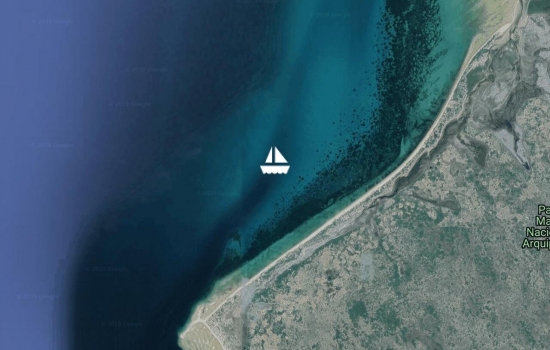
We've been hanging out in Durban for almost 2 weeks now, and there's been and continues to be no weather window on the horizon for us to continue on to Cape Town. Last Friday night, we attended a barbeque (called a braai here), and the local sailors told us that the change of seasons is very late this year, thus wreaking havoc with our plans to move on. Our friends Larry and Rox are arriving in Cape Town in late December, and we started getting concerned that if we continued to wait for a weather window, we could get caught out and miss their visit, and that would be totally unacceptable. Fortunately, we had options - we could fly or drive to Cape Town. We decided to fly, and rather than sitting here in Durban until late December, we're flying to Cape Town this week. Upon arrival, we'll rent a car for 10 days and do a road trip along the "Garden Route", which is a highly recommended scenic drive visiting several towns along the southern coast. We'll then spend Christmas and New Years in Cape Town, and fly back to Slip Away in Durban in early January. The local sailors seem to think that the weather will be much improved in early January for us to sail Slip Away to Cape Town. Hope so!!
Avg: 4.2knts
24hr: 100.4nm
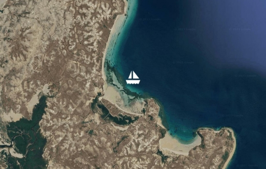
Arrived Durban at around 0930 this morning, berthed at Durban Marina, and all is well aboard. Trip down from Richards Bay went fine, but was a mixed bag. After being given the go-ahead from Richards Bay Port Control to leave our berth yesterday afternoon, we had wait inside the port but outside the shipping channel for 2 hours before we were given permission to leave the port due to cargo ship traffic. Once outside the port and on our way, there was very little wind, but the seas were pretty rolly for a few hours. The seas eventually calmed down, and at about 0500 this morning, we had enough wind (10-15 NE) to unfurl the jib. By 0800 it was 20-25, and by the time we arrived at Durban, it was blowing 25-30. Fortunately Durban Port Control gave us the OK to proceed into the port immediately upon arrival. We then called the marina, and they told us our berth was available, but when our friends Lisa & Fabio (sv Amandla) walked over to the dock to help with our lines, there was another boat in our slip! So we milled about outside the marina until that was sorted out. Fortunately, our spot in this marina is well protected from the strong winds, so docking went smoothly. We're now headed into town to complete inward clearance with officials. Happy to be here! :-)
We've enjoyed a month here in Richards Bay, but it's time to start making our way toward Cape Town. We're leaving this afternoon for Durban - just 90 miles of the 1000 we need to go to Cape Town, but the weather is in control and at the moment will only let us do a short hop. Our ETA in Durban is tomorrow (Friday) morning. We'll continue further when the weather is right, which at the moment looks to be early to mid-next week.
Avg: 6.9knts
24hr: 166.4nm
We're here! We arrived Richards Bay, South Africa, late this evening and are presently tied up to the International Jetty, awaiting clearance with authorities. We're not sure if they will do clearance tomorrow (Sunday), or if we'll have to wait until Monday. A big thank you to Dale (s.v. Sukha) and Rowan (s.v. Wakanui) who took our lines when we came in at 11:30 p.m. We're having a beer and celebrating! Cheers!
Well done and way to go!
Congratulations........Slip
Avg: 7.6knts
24hr: 181.7nm
Slip Away's motor is chugging along. Conditions are extremely calm. The air is getting cooler, so we don't mind the heat of the engine so much, but it would be nice to have some peace and quiet. (But really, no complaints!) We had another beautiful moonlit night last night. Less than 100 miles to go to Richards Bay. All is well aboard.
Avg: 6.8knts
24hr: 162.5nm
After motoring the first 36 hours of this passage, we finally were able to turn off the engine last night about midnight and sailed through the night. It was a stunning night watch with a full moon which illuminated a few puffy clouds in the sky, 10-15 knots of wind on the beam and a gentle swell. The wind died again this morning, so the engine went back on again at about 7 a.m., but we don't want to complain. This passage can be a tough one, and we'd rather motor than get our butts kicked! The forecast is for light winds today, and maybe good sailing winds again tonight (fingers crossed!). 250 miles to Richards Bay, South Africa. All is well!
Avg: 4.8knts
24hr: 115.6nm
Over 20 boats left Bazaruto Island, Mozambique, yesterday afternoon for Richards Bay, South Africa. Most of us were anchored about half-way down the island, so we needed to motor 15 miles south behind the island to the exit into the open ocean. It was quite a parade of boats, and Slip Away was the Grand Marshall (or, as another friend put it, we had pole position). It was not an easy trip to the exit as we had to pass through some shallow areas, and we had some strong currents. We cannot begin to imagine how we would have found our way without the waypoints provided folks who transited this area before us. But, Slip Away led the pack, and everyone passed through safely. Once outside the pass, faster boats passed us, but we're used to that. We've been motor-sailing because the wind is too close for us to sail, but we're making good progress, and are hoping to get a better angle on the winds when we turn a little further west tonight. Just under 400 miles to Richards Bay. All is well aboard.
After a few days of strong southeast winds here at Bazaruto Island, our weather window for South Africa has arrived. We will be leaving mid-day today. We would like to leave earlier in the day, but we need to wait for the correct tide. We are hoping to go from here non-stop to Richards Bay, which is just over 500 miles. If some bad weather comes up, there are a couple of anchorages we can stop at to wait it out. Fingers and toes are crossed - all positive thoughts and prayers for this passage are appreciated!
Avg: 4.6knts
24hr: 110.5nm
Anchored at Bazaruto Island, Mozambique. There are 17 boats in this anchorage, and we hear there are more around the corner, all of us waiting for the elusive weather window to South Africa. Bazaruto Island is a huge sand dune, and the water in the anchorage is a beautiful blue - this is a very pretty setting. We will be staying here for a few days to let some bad weather pass by. We hope to get ashore for a walk before the weather hits, which is expected to be late tomorrow night or early Sunday morning, and it's expected to be quite windy for a few days. There is no internet here. We will update in a few days.
Avg: 6knts
24hr: 144.8nm
All is well aboard, and we have 22 miles to go to entrance of the Bazaruto, Mozambique, anchorage, where we will stop for a few days for protection from some bad weather that's heading this way. We had some rough weather yesterday. We were expecting a short storm with maybe 20-25 knots of wind, but it ended up being the most intense frontal boundary of a storm that we've ever experienced with up to 40 knots of wind. Fortunately, the extremely high winds (35-40) lasted only about 30 minutes. There was also heavy rain and lots of lightning, and our iPads and phone went into the microwave in case of a lightning strike, which luckily did not happen! Glad to have that behind us! Once all that passed, we had good sailing for the rest of the day and night, although not particularly comfortable with the rough seas. We're looking forward to a few days at anchor.
Avg: 7.7knts
24hr: 184.7nm
Beautiful sailing conditions all day yesterday, and quite brisk last night with winds up to 30 knots and 2-3 meter seas. But the wind and seas were behind us so not a problem. We also had a strong current helping us, and saw a couple bursts of 10 knots SOG as Slip Away surfed down a couple of waves. The winds have abated now, but the seas have not, so it's a bit rough. It normally takes them a couple of hours to calm down. ETA Bazaruto sometime tomorrow.
Avg: 5.8knts
24hr: 138.3nm
Had good sailing winds and a favorable current for most of yesterday. The currents changed last night and the seas became lumpy and uncomfortable but we're still making good progress. Will need to stop in Bazaruto, Mozambique for a few days to hide out from a strong weather system which is expected to arrive late Saturday night or early Sunday morning. We expect to arrive Bazaruto on Friday, so should be good. 294 miles to Bazaruto. Of the three boats we left with from Baly Bay, two of them (Tereva and Rokalo) are close by - we can actually see them both this morning, and if they get out of sight, they show up on our AIS receiver within about 6-8 miles. Charlotte is behind us - neither visible, nor on AIS - but we are keeping in touch via daily email.
Avg: 7.2knts
24hr: 171.9nm
Motored a good part of the past 24 hours, but sailing now, and we've found favorable currents which has us moving along faster than expected. Nothing much to report. All is well aboard.
Hi Jan and Rich: Just
Avg: 5.4knts
24hr: 128.9nm
Day 2 underway to Richards Bay, South Africa. We had beautiful sailing conditions all day yesterday, then motor-sailed starting at sunset when the wind died, then started sailing again at about 2:30 this morning. The 3 boats with whom we left from Baly Bay all are within VHF radio range, and we can see each other's relative positions on our AIS receivers, so it's nice to have some company. We had a very close encounter with a mother and baby humpback whales yesterday - they surfaced just in front of Slip Away, and I (Jan) quickly turned off the auto-helm and grabbed the wheel to steer around them. The baby then breached right in front of the boat, and the mother flipped her tail at us at least a dozen times, as we passed by her. She was probably less than 50 feet off our port beam - it felt like we could reach out and touch her. What a rush!
Departing Baly Bay this morning, heading in the general direction of Richards Bay, South Africa. The passage is 1200 miles +/- and we would prefer to go direct, but the weather gods, King Neptune and Mother Nature are in charge and if necessary due to weather, we will stop along the coast of Mozambique.
Avg: 5.8knts
24hr: 138.5nm
Anchored at Baly Bay after a 25-hour passage from Moramba Bay. We had good sailing winds for most of yesterday, but the wind died shortly after sunset, and the southeast winds which usually arrive in the middle of the night here did not fill in, so we ended up motoring more than we would have preferred. On the bright side, we had a favorable current for most of the night, which gave us a good push. The moon set fairly early (9 p.m.), but the skies were clear, the stars were incredible, and there wasn't much fishing boat traffic during the night, which is always good. Baly Bay is often the anchorage from which boats depart on their way to South Africa, and as we arrived, there were three boats heading out on that passage. We have a few last minute preparations to do before we are ready to go, so we wished them well and pulled into the bay. There are four sailboats here now - Tereva, Rokalo, Charlotte and us - and we'll be watching the weather closely.
We had a nice stay here at Moramba Bay - met up with some other boaters and saw some Sofaka Lemurs and beautiful baobab trees ashore. Leaving here this morning and heading further down the coast to Baly Bay. Will probably sail overnight to arrive in the morning and will be traveling in company with our friends Sue & Stefan on s.v. Charlotte. We are hopeful that there may be a weather window to depart from Baly Bay to South Africa in the next few days.
Anchored at Moramba Bay. Had another great day of sailing from Nosy Lava to here, and another good day of fishing. We landed three fish - threw the first one back because he was rather small (looked like a barracuda), then landed 2 more nice ones. We're not able to positively ID the fish we've caught, but one seems to be a mackerel and the other a tuna. We had some of the mackerel for lunch, and it was delicious. Until now, we had been traveling on our own, but we've caught up with a crowd here. There are a total of 9 boats in this anchorage. Everyone seems to like it here, and we're looking forward to hanging out for at least a few days. All the boats here are watching for a weather window to sail to South Africa, and at the moment, it looks like we may be here until the middle of the month. Will update again in a few days.
Anchored at Nosy Lava. The anchorage here is bouncy, so not sure we'll get much sleep, but there isn't another good option nearby. Not finding much internet along this coast, so sending these position reports via our SatPhone. Had another nice sail today. Caught a fish shortly after we started our passage this morning. Not sure what it is - maybe some sort of jack. His remains are in our fridge and will soon be dinner. Had another strike around noon, but when we reeled that one in, we had only half a fish on the line (looked like a barracuda). Apparently something bigger got to it first! All is well aboard. Will continue on to Moramba Bay tomorrow (40 miles from here).
Anchored at Pt. Berangomaina on the northwest coast of Madagascar. We had another beautiful day of sailing today from Honey River to here but a very disappointing fishing day. We had a fishing line in the water all morning and at lunch time got a strike with a yellow-fin tuna on the line, but we lost it while trying to gaff and bring it on deck. Our steel leader broke, so we lost not only the fish, but also our lure. Very bummed. In all our years of sailing and fishing, we've never caught a yellow-fin tuna - lots of Mahi Mahi, Wahoo and Spanish Mackerel and other fish, but the yellow-fin tuna have always eluded us (and that's a delicious fish!). The fishing line and a new lure will go back in the water tomorrow. Fingers crossed!
Anchored at Baramahamay River (aka Honey River). No internet here. Left Russian Bay early this morning, and stopped along the way at Lemur Island. Did a short hike with a ranger and fed bananas to some lemurs. From Lemur Island to Honey River, we had a beautiful sail in light winds and flat seas.
Departed Hellville on Nosy Be early this morning, and motored across the channel to Russian Bay on mainland Madagascar. Will spend tonight here and continue on tomorrow. Will spend the next week or so harbor-hopping south along the west coast of Madagascar, watching and waiting for a weather window to head for South Africa.
Moved from Hellville on Nosy Be to an anchorage off the small island of Nosy Sakatia - 13 miles from Hellville and worlds different. Hellville is the "big city," and offers the opportunity for re-provisioning, as well as some nice restaurants, but the anchorage was busy and noisy, and we bounced around from all the passing boat wakes. Sakatia is flat calm and peaceful - a lovely spot. We're looking forward to snorkeling with turtles here, and fingers are crossed that the whales may come visit us here too.
Anchored at Hellville, Nosy Be, Madagascar. Enjoyed the past couple of days at Nosy Komba, but moved on late this morning to the big city of Hellville. Need to top up on diesel, get some laundry done and buy a few provisions (mostly fresh stuff). Will spend a few days here and then head out to some of the other recommended anchorages in the area.
Anchored at Nosy Komba. Had a nice slow sail for most of the way from the Mitsios. Had a couple of whales swimming along with us for a few minutes - about 40-50 feet off our starboard beam. Caught our first fish for the season (and the first in a few years now!) - a skipjack. It was his lucky day because we released him back to the sea (skipjack not our favorite fish and we presently have some other fish in our fridge which our friends Stefan & Sue on Charlotte shared with us). Looking forward to seeing the Lemur Park here.
We were up early this morning, departed the Cathedral anchorage and sailed to the Mitsios Islands (54 miles). We motored for most of the morning, but a nice breeze came up shortly before noon and we sailed the rest of the way. Seas are flat on this side of Cap D'Ambre because the ocean swell is blocked, so it was delightful sailing. We put our fishing lure out for the first time this season, and got a big hit, but it got away before we even started reeling it in. We saw a few whales along the way too. We are planning to stay in the Mitsios Islands for a few days - maybe do a bit of snorkeling and land exploring. There is no cell phone service here, which means no internet, so we are sending this position report via our satphone. We have not seen much of the news today, but are thinking of our family and friends in the path of Hurricane Florence, and sending our most positive thoughts to them.
Avg: 3.9knts
24hr: 94.7nm
Anchored at Cathedral anchorage for the night. Rounded Cap D'Ambre (north tip of Madagascar) at noon today with good conditions and no drama. Celebrated another milestone tonight with champagne. Will move on tomorrow to another anchorage.
Avg: 7.6knts
24hr: 183.3nm
18 miles to go to Cap Ambre. Wind is good, speed is good, timing is good to go around at noon slack. Fingers crossed!
Avg: 5.7knts
24hr: 137.7nm
Heading north toward Cap D'Ambre. Wind was up and down yesterday, but we sailed all day. Around midnight, the wind started getting fluky (lots of shifts in direction and varying velocity), and seas got confused and lumpy, so we motored, then sailed, then motored some more. VERY dark night last night with no moon and cloud cover obscuring the stars. Need to keep our speed up to round Cap D'Ambre at noon tomorrow (slack tide), and winds are a bit light at the moment, so we are motoring at the moment. 170 to Cap D'Ambre and will make final decision on which anchorage we're heading to once we're around the top.
Will be leaving Ile Sainte Marie this morning and heading north. Looks like we have a good weather window in a couple of days to round Cap D'Ambre at the north end of Madagascar, so we want to take advantage of that. We have enjoyed our stay in this anchorage, despite a rolly night last night. Went ashore yesterday afternoon and saw some lemurs, then had a drink at a small resort and watched the whales jumping offshore. Also, met a young American couple at the bar/restaurant, which is quite rare in this part of the world. She is working in Southern Madagascar on coral reef restoration. We meet such interesting people.
Moved further north to a different anchorage today, and enjoyed the whale show along the way. Will stay here for a couple of nights and planning to leave on Sunday to sail north and around Cap D'Ambre at the top of Madagascar.
Avg: 5.2knts
24hr: 124.6nm
Anchored off the town of Ambodifototra, Ile Sainte Marie, Madagascar. We had really nice sailing conditions last night, so arrived this morning. We rounded the southern end of the island shortly after sunrise and were greeted by humpback whales. Jan had laid down on the settee for a short nap after her midnight to 6 a.m. watch, and she thought she heard whale songs. Rich popped his head down below for something, and she asked Rich if he heard anything, and he heard it too. How cool is that?! It sounded like Dory in "Finding Nemo". We couldn't hear it in the cockpit, only down below. After hearing the songs, Jan couldn't sleep, so we both hung out in the cockpit as we sailed north toward the anchorage, and we saw several whales - one breach, a few tails, a few fin waves and lots of spouts. They were not especially close encounters, but we were thrilled to see them! Humpback whales migrate to this area from Antarctica in the Southern Hemisphere winter to give birth and mate. We're hoping to see more of them in the coming days, but for now, a nap is in order. All is well!
Avg: 6.4knts
24hr: 154.3nm
Still sailing, although winds are lighter today and directly on our stern. Seas are OK, but they are a bit too much for the lack of wind, and the sails and rigging are slamming quite a bit, so we're steering slightly off course in an effort to reduce the stress on the rig (and crew!). 125 miles to go. Should arrive sometime tomorrow - probably afternoon unless the wind picks up. All is well aboard.
Avg: 5.2knts
24hr: 125.7nm
Departure from Reunion yesterday went smoothly - after leaving our berth, we topped off our diesel at the fuel dock and then got underway (about 24 hours ago). Have traveled about 130 miles so far. Lighter winds yesterday, and had to motor for a few hours yesterday evening. Wind filled in just before midnight, and we've been having good sailing conditions ever since. Our wind instrument decided to go on strike for this passage, so we're guessing at the wind speed and setting our sails based on the wind indicator at the top of our mast, but we're having a nice wing-and-wing downwind sail. All is well aboard. 270 miles to go.
Glad all is going well!!
Heading out from Reunion this morning to Ile St. Marie on the east coast of Madagascar. If the forecast is right, this should be a nice passage - fingers crossed! The distance is 400 miles, and we expect to arrive in about 3 days.
Avg: 4.5knts
24hr: 108.2nm
Arrived at Le Port Marina, Reunion Island at noon today. Passage was relatively easy, but mostly motoring - a total of 25 hours underway, only 9 of which we could sail. Very challenging docking situation in this marina - managed to get Slip Away in the berth without hitting anyone, but we had only inches to maneuver. Not sure how we'll get out of here, but we'll worry about that later! Check in with authorities was the easiest we've experienced in 15 years of cruising. Looking forward to exploring this beautiful island!
Ready to hit the high seas again (well, hopefully not too high). We've enjoyed two weeks here in Mauritius, but it's time to move on. We'll be leaving this morning for a 135-mile passage to La Reunion Island. Weather forecast looks like we'll have lighter winds than we would prefer, so we may be motoring a bit, but the seas should be under 3 meters, which is a happy event here in the Indian Ocean. Rumor has it that there are lots of whales in this area right now, so we're excited about that. This passage should take us 24-27 hours, and we will post an update when we arrive tomorrow.
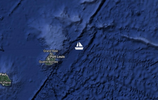
Berthed at Le Caudan Marina, Port Louis, Mauritius. Formalities are completed with officials - lots of paperwork! The marina is a small basin with concrete walls (no docks), so we are quite happy that we recently purchased some very large inflatable fenders. The main island of Mauritius is very different from Rodrigues. It has modern tall buildings, traffic, shopping malls, a wide variety of restaurants and cafes, and the local people are a mix of cultures - Indian, African, Chinese, and a few Westerners too. We expect to stay here maybe a couple of weeks.
Hey Jan and Rich:
Avg: 4.1knts
24hr: 98.6nm
Arrived Mauritius late last night and dropped our anchor off the west coast of the island just before midnight. We had a celebratory beer and then headed to bed. This is an open roadstead anchorage, but it's delightfully calm, and we both slept well last night (albeit not long enough). The Mauritius Coast Guard called us on the radio last night as we were sailing around the north end of the island (they saw our signal on AIS), and welcomed us to their island - how nice! We will head into Port Louis this morning to complete formalities with officials.
Avg: 6.1knts
24hr: 147.2nm
In the home stretch and conditions are still good. Last night was MUCH nicer than the previous one, with no squalls, a moon for a good part of the night and lots of stars. Going more slowly than we would prefer at the moment, because we need to time our arrival with an ebb tide to sail around the top of Mauritius. 88 miles to go.

Avg: 5.4knts
24hr: 130.5nm
We left Rodrigues yesterday around noon, expecting somewhat boisterous conditions, and that's what we got - 25-30 knots of wind and 4+ meter seas. But, it was a sunny day, Slip Away was handling it just fine and we were sailing quickly to our destination. We're having another sunny day today, and the winds and seas have moderated a bit, so it's more comfortable. Last night was a challenge - lots of squalls, lots of wind on the front end of the squall, then very little wind after it passed, and big wind shifts - from south to southeast to east-southeast. Glad to have that behind us and hoping that we won't have a repeat tonight! All is well aboard. Our friends on s.v. Charlotte are just 5 miles off our port quarter. 150 miles down, 200 miles to our destination (Port Louis, Mauritius).
After a very enjoyable month here in Rodrigues, we are heading out today to Port Louis, Mauritius. This is a 350-mile trip, which we expect will take about 3 days, and we'll be traveling in company with our friends Sue & Stefan on s.v. Charlotte. We will be updating our position daily (assuming that my computer/satphone connection is working), but in any event and barring anything unforeseen, we should be there in a few days.
Avg: 3.7knts
24hr: 89.7nm
Anchored at Port Mathurin, Rodrigues Island. 2000 mile passage completed in 14 days, 10 hours. Although we had a little rough weather along the way, we could not have asked for a better passage on this stretch of the Indian Ocean. Most official formalities are completed here in Rodrigues, and we are now celebrating with a beer. Looking forward to a good night of sleep!
Good show! Stay safe - miss
Yahoo! Congratulations! Will
Woo Hoo girlfriend... Mike
Wuhoo!!! Well done you guys!
Congrats! Can't wait to hear
Avg: 6.8knts
24hr: 163.1nm
Almost there! 27 miles to go. Champagne in the fridge. All is well.
Avg: 7knts
24hr: 167.6nm
Day 14 underway to Rodrigues. Moving along quite nicely, although seas are lumpy (what else is new?!). Skies have cleared up a bit. Saw some stars last night, and Rich caught a glimpse of the waxing crescent moon just before it set. All is well aboard. 174 miles to go. Still expecting to arrive tomorrow. Yay!
Hey guys;
Avg: 6.7knts
24hr: 160.4nm
Day 13 underway to Rodrigues. Fairly rough at the moment, but tolerable. Big swell on our port quarter. Long period between the swells, so not a lot of bashing, but every once in a while, we get a good roll. There's no moving around the boat without firmly holding on. 319 miles to go. If we continue at this same speed, we should get in Monday afternoon or early evening. :-) All is well!
Avg: 6.6knts
24hr: 159.4nm
Day 12 underway to Rodrigues. Grey day, with a few rain showers. Great wind so our speed is good, but rough seas. 463 miles to go. We are now over 3/4 of the way to our destination, and that's helping to keep the crew's spirits high. :-)
Avg: 8.9knts
24hr: 213.6nm
Day 11 underway to Rodrigues. Yesterday was very rainy and dreary, and the winds died in the afternoon, so we ended up motoring through the night. Winds are back now, and skies are starting to clear. The last couple of nights were VERY dark with no moon and heavy cloud cover. Spent a good part of yesterday working on a computer glitch. The USB ports on our primary laptop decided they wanted a holiday, which meant that we could not send and receive emails. Using our backup laptop for email now, and it's a bit flaky, but hopefully it will at least get us to Rodrigues. Grr.... 603 miles to go.
Avg: 5.1knts
24hr: 123.4nm
Day 10 underway to Rodrigues. Rainy day, but not squally. Computer issues today - unable to answer emails at the moment. Otherwise, all is well. 756 miles to go.
Avg: 6.7knts
24hr: 161.2nm
Day 8 underway to Rodrigues. Not much to report. Moving right along. Seas a bit rolly today. All is well aboard. 880 miles to go.
Avg: 6.7knts
24hr: 161.2nm
Day 8 underway to Rodrigues. Beautiful conditions yesterday, last night and today. Would like to put in an order for more of the same for the next week! Winds are a little lighter today than yesterday, but still good. Air and water temps have been gradually cooling off and are quite pleasant. 1026 miles to go. Will be passing our half-way point this afternoon - yay! All is well.
Glad it's going well!!!
Avg: 6.8knts
24hr: 162.7nm
Day 7 underway to Rodrigues. Seas moderated late yesterday afternoon, so the ride has improved. Also, we had no squalls last night. Both of us slept well while off watch, and attitude is much improved. Wind speed is about ideal. All is well aboard. 1165 miles to go
ok, now I've got the gouge...
just typed a message here,
Hi guys! Been watching your
Avg: 6.6knts
24hr: 159.4nm
Day 6 underway to Rodrigues. Conditions have been very mixed on this passage so far. Had a very nice day again yesterday, but then a very squally night last night. Seas became rough last night and have stayed that way today. All is well aboard, except the crew is a bit grumpy. ;-) 1308 miles to go.
Avg: 6.6knts
24hr: 159.3nm
Day 5 underway to Rodrigues. Yesterday was quite rough and uncomfortable, but the winds have moderated and backed a bit, so it's much better today. Moving right along. All is well. 1449 miles to go.
Avg: 6.9knts
24hr: 165.6nm
Day 4 underway to Rodrigues. After a pleasant day of beam-reaching yesterday in 15 knots of wind, conditions became rougher last night, with bigger winds and seas. Not a very comfortable ride at the moment, but all is well aboard. Happy Birthday to Rich! 1580 miles to go.
Happy birthday Rich from
Avg: 6.3knts
24hr: 150.1nm
Day 3 underway from Cocos Keeling to Rodrigues. Very pleasant sailing conditions at the moment with wind on the beam, moderate seas and partly cloudy skies. No squalls last night, and weather is expected to be settled, albeit windier, for the next couple of days. Approximately 285 miles down, and 1720 to go. All is well aboard.
Avg: 5.5knts
24hr: 132.3nm
Day 2 underway from Cocos Keeling to Rodrigues. We had northwest winds 15-20 all day yesterday, so ended up sailing a fair amount south of the rhumbline. We started motor sailing last night at midnight when the winds lightened up a bit and moved further west (on the nose). We motor-sailed until about 10 this morning (Cocos time) when the winds finally backed around to the south. Winds are still slightly west of south, and we are sailing with them about 60 degrees off the bow. Expecting them to back further to the Southeast today - or at least hoping that they do! All is well.
Departing Cocos Keeling this morning for our 2,000 mile passage to Rodrigues, which we expect will take us 15-16 days. Winds have been light around Cocos Keeling for the past several days due to a nearby low pressure system, so we may have to motor for a day or so before we hit the tradewinds. The weather forecast looks reasonable, and of course we're hoping for the best, but we've prepared the boat for rough weather just in case, even stowing the dinghy on deck instead of in its davits. Rich will be celebrating his 70th birthday on this passage on June 7. :-) Wish us luck!
Safe passage , we are looking
Still hanging out at Cocos Keeling, waiting on a weather window to depart for Rodrigues - probably a few more days. Weather has been quite blustery the past few days - blowing steady in the mid-20's, and squalls with winds reaching into the mid-30's. Winds are settling down from that weather system now, but another one (a trough) is expected to develop in the area tomorrow. And so we wait ...
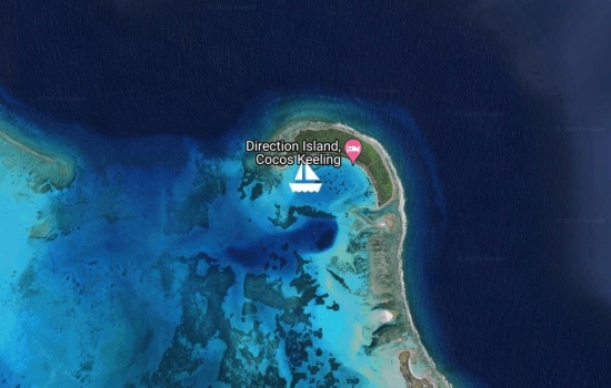
Still anchored at Direction Island, Cocos Keeling. We've been here a week now, and expect to be here for probably one more. We are enjoying the snorkeling here - the drift through "The Rip", as well as the other reefs scattered about the anchorage. The reefs are very healthy, and the fish life is good - lots of butterflyfish, parrotfish, sweetlips, surgeonfish, wrass and others, as well as the occasional black tip or white tip reef shark (which are not worrisome). We're still looking for eels, octopus, nudibranchs and other creatures - no sightings of those yet. There are some nice walking trails on Direction Island with signboards providing a bit of history. We've also visited Home Island (population of about 700 Malay Muslims) and yesterday, we went to West Island (population of about 100 ex-pats, mostly Aussie and British), as well as a couple of small hotels and restaurants. Grocery shopping is expensive here - a head of iceberg lettuce costs AUD $12. We passed on that. Internet is sparse and also expensive - the wifi hotspot on Direction Island is not working, but we have had a few hours of internet when we visited Home and West Islands - so we're pretty out of touch. (We send these updates through our SSB/Ham Radio email.) When we were at West Island yesterday, we checked our postings on this webpage and saw the comments from friends and family - so good to hear from all of you! We are watching the weather for an opportunity to move on to Rodrigues Island - possibly later this week. All is well. :)
Avg: 4.2knts
24hr: 101.1nm
Anchored at Direction Island, Cocos Keeling - our first anchorage in the Indian Ocean! As we approached the island this morning, we were escorted by a pod of dolphins, and after we dropped our anchor, a couple of small black tip sharks swam over to welcome us too. With the sun out, the water here is that beautiful iridescent blue that we have not seen for a while. It's warm here, but not too hot - the tradewinds are maintaining a very pleasant temperature. We are very happy to be here! Overall our passage was good. We mostly had steady tradewinds in the high teens, which is just about perfect, but the seas were not comfortable, with swell running in two directions, usually around 2 meters high, and sometimes up to 3 meters. But we'd been forewarned that the seas in the Indian Ocean are generally rough, so our expectations were managed. We had good weather the first three days of the passage, but then had quite a few squalls the last couple of nights. So we reefed down and sailed slowly the past couple of nights, and everything was fine. We just had some breakfast, and the officials radioed us to let us know they would come out to Slip Away to check us in after lunch, so we're going to take a nap!
Happy to see you have reached
Glad to see you made it to
Wow!!! Does this mean the
Oh, that waters sound
Jan & Rich , nice to see you
Avg: 5knts
24hr: 119.1nm
Day 5 underway to Cocos Keeling - 62 miles to go. Last night was a bit dark and stormy - not fun, but it wasn't too bad, and with our sails reefed, Slip Away and her crew were fine. But, it slowed us down a bit, which made it a certainty that we could not arrive at Cocos Keeling this evening before nightfall. Although we intended to go into the "Port Refuge" anchorage, which is supposed to be easy to get into even after dark, we re-thought that plan because we weren't sure if we might have another night of squally weather, which would add a level of stress and difficulty. So, we decided to slow down and plan to arrive tomorrow morning - better to spend another night at sea and enter safely after daylight. We've spent the day lumbering along at around 3-4 knots. Another sailboat on their way to Cocos passed us by, and we chatted briefly on the radio.
Avg: 7.5knts
24hr: 179.4nm
Day 4 Underway to Cocos Keeling. Rich had a busy watch last night with lots of fishing boats, none of which had an AIS signal. Also, seas were a bit lumpy last night, so neither of us slept well, but they moderated today and we both got some sleep during the day (at different times - one of us is always on watch). We occasionally get a hit on the AIS from a large ship, but none have been close. Looks like we will be arriving Cocos Keeling tomorrow evening. If the winds stay up, we can get in before sunset. If not, there is an outside anchorage that looks reasonable to get into after dark.
Avg: 7.1knts
24hr: 169.3nm
Day 3 underway to Cocos Keeling. Reefed down for a few squalls today, but they haven't had a lot of wind or rain in them. 330 miles to go. All is well.
Whoa...you are getting there!
Avg: 6.3knts
24hr: 152.3nm
Day 2 underway to Cocos Keeling. Making good progress. Great sailing winds. Seas a little lumpy, but we're getting used to the constant motion of life at sea. All is well aboard.
Left the anchorage near Krakatoa this afternoon, and we're on our way to Cocos Keeling. :-) Sailing wing-and-wing. Winds are a little lighter than we would prefer at the moment, but we're happy to be on our way, and the winds should pick up in about 12 hours or so. 20 miles down, 600 miles to go. ETA 12 May.
Hey guys, looks like things
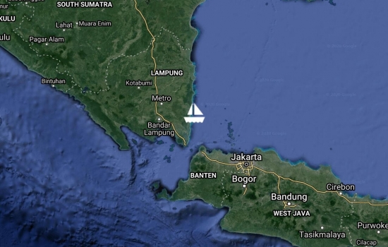
Anchored at Rakata Kecil. We had an easy and non-eventful passage through the Sunda Straits in the late afternoon yesterday, and then continued on to arrive here last night at about 7:20 p.m. We found our way in and anchored safely, but it was stressful. We arrived almost 90 minutes after sunset, so it was very dark since the moon had not yet risen. Additionally, we needed to weave our way through a number of fishing boats just outside the anchorage, and shortly before we arrived, we were hit with a squall bringing lightning, thunder and some rain. Fortunately, the squall did not have a lot of wind and rain in it, and we crawled slowly up to our anchoring waypoint, dropped the hook and thankfully it set well. We celebrated with a couple of beers, cheese and crackers for dinner, then cold showers, and then we crashed and slept like the dead last night. The views of the original Krakatoa volcano and Anak Krakatoa, which was born from a 1927 eruption of the original Krakatoa are stunning. We plan to spend a couple of days here preparing for our passage to Cocos Keeling - refilling our main fuel tank from the jerry jugs of diesel we carried on deck, preparing food, and other jobs. We'll also be keeping an eye on the weather and will leave when it looks right. All is well!
Exciting times for you two!
Avg: 7.2knts
24hr: 171.9nm
23 miles to the Sunda Straits. We have good timing in that we'll go through the Straits in daylight hours, but timing isn't perfect because we will likely have a current against us. But, there's not a good place to stop and anchor to wait for perfect timing, and if necessary, we'll crank up the turbo to give us a bit more speed. We've been motoring for 101 hours now - no good sailing winds at all. If all goes as planned, we'll get to the anchorage near Krakatoa tonight after dark, but we have an anchoring waypoint from friends, and the anchorage looks open and easy to approach.
Avg: 6.7knts
24hr: 159.7nm
Headwinds and countercurrent - clawing our way along.
Avg: 6.3knts
24hr: 150.3nm
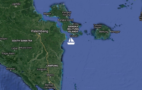
Night watch was busy but manageable. Making progress through the Bangka Straits. All is well!
Avg: 6.4knts
24hr: 152.7nm
Made good progress last night and today. All is well. Just getting to the Bangka Straits. 315 miles to go to the Sunda Straits.
Hey guys, looks like you are
Avg: 3.1knts
24hr: 74.2nm
Just crossed the equator, so we're back in the Southern Hemisphere. This is Slip Away's and our third equator crossing. Conditions were better today, so made much better progress than yesterday. Stopped and anchored last night because there was too much fishing activity to travel safely. Got underway early and with a strong counter current and 10 knots of headwinds, we were creeping along and feeling very frustrated. But conditions improved as the day progressed. The current switched and started helping us, and the winds abated in the early afternoon, so the ride got smoother. The forecast is calling for light and variable winds the next few days, so hopefully that's the end of the headwinds. We're hoping to travel all night tonight as we're further offshore than last night, but if needed, we've picked out a couple of spots to stop. 220 miles down, 450 to go to the Sunda Straits.
Crossed shipping lanes this morning - no ships at all in the northbound lanes, but southbound lanes were quite crowded. Drove along the "median" until we found a break in the traffic, and then quickly crossed over. Fought winds on the nose all day, so pulled into a harbor to wait for a break in the winds and had the opportunity to spend 2 1/2 hours with the Indonesian Navy, explaining to them what we were doing. Lots of photo taking. Winds have died down, so we're on our way again.
Finally got away from the dock at Admiral Marina in Port Dickson yesterday at 5 p.m. Did an overnight run of 109 nm to Pulau Pisang and the timing was good for us to stop and anchor for the night. Will leave again tomorrow at first light to cross the shipping lanes, and the tides should be right to give us a favorable current through the Durian Straits. Our passage last night went fine but was not particularly pleasant. We started out with a favorable current, so we were making great speed, but then the tide changed. The adverse current slowed our speed to less than 4 knots and gave us a bouncy ride for several hours. We had headwinds for the entire trip, but fortunately nothing too strong (mostly 8-10 knots). The moon was beautiful, and we love the light that a full moon provides. Lots of big ship traffic in the Straits of Malacca (at one point, we had 128 targets on our AIS), but all went well. 560 miles to go to the Sunda Straits.
Hi Jan & Rich, good to read
Arrived this morning at Admiral Marina, Port Dickson, Malaysia, after an overnight run from Pangkor Marina. Lots of big ship traffic in the Malacca Straits and especially around Port Klang, but we managed to get through it with no issues. AIS is so incredibly helpful in those situations!
Avg: 3.2knts
24hr: 77.5nm
Berthed at Pangkor Marina. Planning to spend a week here before continuing south.
Anchored at Pulau Rimau. Heading off early tomorrow morning for Pangkor Marina.
Berthed at Straits Quay Marina in Penang. Planning to hang out here for a week.
Anchored at Pulau Bunting. Heading into Penang Straits Quay Marina tomorrow. Looks like it may rain tonight.
Anchored outside Rebak Marina. Heading to the beach bar for happy hour, then dinner with friends Sue & Bob on s.v. Mawari. Leaving in the morning to sail south toward Penang.
docked at Telaga Harbour Marina, Langkawi, Malaysia
Left Krabi Boat Lagoon Marina today. Drove by beautiful Railey Beach and now anchored back at Koh Dam Khwan. Would have liked to anchor close to Railey, but very crowded with tourist boat traffic. Quieter here.
Berthed at Krabi Boat Lagoon Marina for some rigging repairs.
Anchored at Koh Dam Khwan, off the coast of Krabi, Thailand. Very scenic anchorage, and very quiet now that the tourist boats have gone home.
Will go into Krabi Boat Lagoon Marina on the morning high tide.
Berthed at Royal Phuket Marina. Greeted with a "Welcome Packet", cold towels and cold bottles of water. Very nice! Planning to stay here for one week.
Anchored at Ko Phi Phi Don, Thailand. We agree with a friend's description of this anchorage as both beautiful and appalling. It is a lovely bay and has the potential to be a fantastic anchorage if there weren't longtail boats driving by us every few minutes and techno music blasting from onshore (day and night). Just stopping here for the night before heading to Ao Chalong tomorrow. We don't feel compelled to return here.
Berthed at Rebak Island Marina, Langkawi.
Jan & Rich , nice to see you
No blogs available for this yacht.
Jan & Rich ,Merry Xmas and