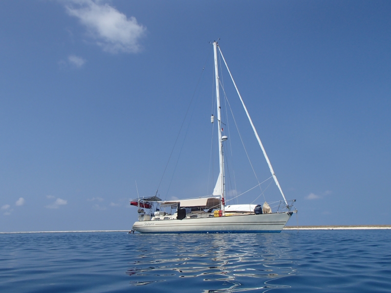
SV Stylopora
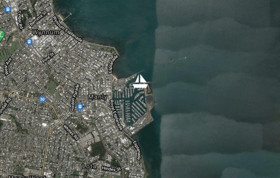
Manly Marina - home. We're now ready and available for grandparent duties. :)


Horsehoe Bay, Peel Island.
We've joined the RQYS Sail Cruising Group for this month's cruise. Lovely to catch up with friends.
After 6 months cruising in the Pacific and with no really bad weather we've had two storms in two nights. Saturday night with 40 knot winds that came around from the SW leaving us on a lee shore. Sunday night, a humdinger with NW winds. 60 knots wind from the NW and hail. This storm was something else and quite daunting. I hope it's a long time before I see those wind speeds again.


Sandhills, Moreton Island
Joined Scott & Rachel on Heemskirk and Laurie & Carolyn on Kea Lani for welcome home celebrations.
Mooloolaba
Relaxing at Mooloolaba, visiting grandchildren, swimming in the surf.


Garry's Anchorage, Great Sandy Straits
We're anchored with an armada of boats making their way south from North Queensland and the Pacific islands. Just watched the Melbourne Cup on board Phase 2 - talk about back to Australia...

Anchored just before Sheridan Flats in the Great Sandy Straits - one step closer to home. We're anchored with a group of yachts waiting to cross the flats at high tide in the morning.
Avg: 3.6knts
24hr: 85.2nm
After a last minute rush to beat a potentially nasty weather change, we arrived at the mouth of the Burnett River, Bundaberg just as the rain commenced. Out with the wet weather gear to anchor in the dark surrounded by a myriad of assorted navigation lights, shore lights and boat lights. Anchor down at 12.30am with time for at least 6 hours straight of sleep before moving to the marina and arranging for Australian Border Control for our formal clearance into Australia.


Thoroughly enjoyed reading
Yea!! What a marvellous
<p>Thanks Gayle, we're
Hearty congratulations on a
Avg: 5.9knts
24hr: 141.2nm
Motoring at 6kn, heading 217 Winds 5kn variable. Seas 1m. 1000.
Sent from Iridium Mail & Web.

Avg: 4.8knts
24hr: 116nm
Sailing at 6.5kn, heading 218 Winds 14kn ESE. Seas .5m. 1300 Very excited. Geoff turned the radio on the this morning and heard 4BU in Bundaberg. Not bad for 200NM from the coast.
Sent from Iridium Mail & Web.
Avg: 3.6knts
24hr: 85.5nm
Anchored at Bird Islet in Wreck Reefs in 15kn SE winds. Clear water 3m deep with bommies. Very beautiful. 230NM from the Queensland coast. The water 1 mile away is over 3km deep.
Sent from Iridium Mail & Web.


Hi Di & Geoff, been reading
Avg: 19.8knts
24hr: 474.6nm
Motor sailing at 5.5kn, heading 219 Winds 9kn E. Seas .5m. 1130.
Sent from Iridium Mail & Web.
Sailing at 5kn, heading 242 Winds 7kn E. Seas .5m. 1600.
Sailing with spinnaker. Catamaran Even Keels has been in sight all day. Nice to have company. Hope to be in Bundaberg over the weekend before the weather deteriorates.
Sent from Iridium Mail & Web.
Avg: 3.7knts
24hr: 88.4nm
Anchored at Chesterfield Reef Winds 20kn SE. Seas flat. 0845.
After 48 hours of large swells on our beam and 25 to 30 knot winds, we bounced tired and relieved into Chesterfield lagoon along with the catamaran, Even Keels at 1030 today. Very pretty and we can't wait to explore - after we sleep.... Sent from Iridium Mail & Web.


Avg: 7.5knts
24hr: 178.9nm
Sailing at 5kn, heading 242 Winds 26kn ESE. Seas 2m. 1700.
Tiring day battling the swell but better than yesterday, although lower speeds than yesterday's 7 to 8 knots. Not as exhilarating for Geoff but happier for me. Sent from Iridium Mail & Web.
Avg: 28.6knts
24hr: 686.4nm
Sailing at 6kn, heading 229 Winds 18kn ESE. Seas 1m. 1400.
Sent from Iridium Mail & Web.
Anchored at Ilot Huon with winds15kn E andsqually. A lovely place to catch up on some sleep. Ilot Huon is a large lagoon and just beautiful. The wind has died out and the lagoon is flat and glassy. We're surrounded by dozens of massive, amorous turtles and huge numbers of birds who are not the least bit frightened of us. As I was at the bow anchoring, a huge Booby hovered beside my head to check I was doing it correctly, then looked me in the eye and flew off. As we snorkeled this afternoon Geoff was joined by a large turtle. The birds have been taking turns at landing on different parts of the boat and posing for photos. My camera's been working non stop.. We plan to leave in the morning and if possible stop at Chesterfield Reef in a couple of days.
Sent from Iridium Mail & Web.


Avg: 6.3knts
24hr: 151.7nm
Motor sailing at 6kn, heading 190 Winds 6kn ENE. Seas .5m. Noon.
Sent from Iridium Mail & Web.
Avg: 26.6knts
24hr: 639.4nm
Sailing at 6kn, heading 268 Winds 17kn SSW. Seas 1m. Still waiting for the SE change. Still so far north that at this rate we will be lucky to hit Cooktown...
Sent from Iridium Mail & Web.
Avg: 6knts
24hr: 144nm
Sailing well at 4kn, course 270.
Winds 13kn SSW. Seas flat.
date: 10/10/2016
Avg: 4.9knts
24hr: 117.7nm
Luganville, Espiritu Santo
Ah! Back to civilisation where all we have to worry about was weather forecasts and how to get our internet working. Drinks with friends, cook more meals for the trip and in a small way, help Jim beach 'Sweet Dreams' ready for more repairs repairs. 'Sweet Dreams' is a beautiful yacht and we wish Jim and his family well with their repairs. Unfortunately though, he has to beach her in Luganville to make more temporary repairs before sailing her to Brisbane 1000 miles away where there are suitable facilities to bring her back to her former state. Then 1000 miles back to his current home in Vanuatu!
The weather reports are conflicting but in spite of a circular low forming over Fiji, none of the forecasts are predicting strong or particularly adverse weather. We've been to the markets, packed the boat and paid our tab at Aore Resort so we plan to leave in the morning for Huon Reef at the top of New Caledonia, where we'll have a nap before sailing on to Bundaberg.
Good-bye to Vanuatu and her friendly people, beautiful scenery and fabulous sailing. Hello Australia and our family, friends - home!


Sola, Vanua Lava Island
Our return to Sola to formally clear out of Vanuatu at Customs and Immigration was a reminder of the challenges of travelling in Vanuatu. We'd previously confirmed in Luganville that we could clear out of Sola. We'd vowed never again to attempt to clear out on a Monday or Friday as we've been so often daunted by the seemingly never ending public holidays. Who would have anticipated one on a Wednesday?? We chatted with Ketty, the Secretary-General of the provincial government of Torba who we ran into on the beach. She advised us that Thursday and Friday were also most likely not going to work for clearing out. The long awaited and most auspicious signing of a trade agreement between the Solomon Islands and the Banks Group was happening on Thursday and Friday on the neighbouring island of Mota Lava. The policeman who organises passport stamping was there and not returning until Monday. Perhaps we would like to clear out in Luganville? Sure, it's only a 90 mile overnight, windward sail away!!! Ketty was, in fact very helpful and, on the off chance that he could help, directed us to the customs officer who was waiting at the air strip for a flight to Luganville. Sadly not, though.
With only a small sigh (we're becoming very laid back ourselves now), we returned to the boat. On the way we stopped at a lovely yacht, Sweet Dreams as we'd heard they'd been badly damaged after an altercation with a reef. Three days earlier, their navigation software had automatically upgraded itself. Jim, the skipper and owner had followed his previous track out of the bay at night only to find himself hard on a reef. He compared the new chart with the non-upgraded version on his back-up I-Pad. Shocked, he discovered a discrepancy of around .5km in the new chart that had now put his track over the reef. After three dramatic days, he and the crew from 'Field Trip', together with a local freighter pulled his yacht off the reef. Unfortunately a large hole was torn in the hull as it came off. After numerous complications, they made temporary repairs to get them back to Luganville. With high powered bilge pumps operating continually on 'Sweet Dreams', all three boats set off on a nerve-wracking but uneventful overnight return to Luganville.
Waterfall (Leon) Bay, Vanua Lava Island
Colossal rocky cliffs indented with dark, gloomy caves and interspersed with waterfalls extend the length of the western Vanua Lava and were an amazing backdrop as we sailed comfortably along in a 15 knot breeze.
Mark and Hayley from 'Duality' were anchored on our waypoint when we arrived at Waterfall Bay with its Twin Waterfalls. We spent several happy days enjoying this idyllic anchorage with its white sandy beach, black sandy beach, and great snorkelling.
Mark and Hayley took us to an isolated, high waterfall about a mile north only to find a group of locals hunting there. We were excited to see what we thought was our first Megapode bird until we realised that it was actually dead and was going into the pot that night. The guided walk up to the pool at the bottom of the waterfall was spectacular and the locals were as usual very friendly. Afterwards, we cooled off with a game of frisbee in the pool at the bottom.
On arrival back at the twin waterfalls, Carolyne, from the local village was waiting to take us on a trek to the top of the twin falls. Ouch! Ok, we can do two waterfall walks in one day! Up and up we climbed again to more expansive views. These falls have a shallow pool at the top where one person can sit, waist deep in water and look down over the edge to the children in the swimming hole at the bottom, then over the rocky beach and way out to sea. After an exhausting hike including a visit to their irrigated taro gardens and to the new house that Carolyne and her husband are building, we paddled our kayak back to the boat only to jump off it for a refreshing swim before relaxing on the poop deck with a gin and tonic to watch the sun set on another glorious day.
This was our last village before clearing out of Vanuatu at Sola so we packaged up all of the trade goods we had left and presented them to Chief Jimmy to share amongst the villagers. He in return presented us with a farewell dinner, where as guests, we ate first while everyone else looked on. Afterwards, the family, both young and old, sang us a farewell song and waved us off for our next adventure. How easy it is to become attached to these very poor, but happy and hospitable new friends.


Sola, Vanua Lava Island
Sola is the main administrative centre for Banks Group but in reality it's little more than a village with very few facilities and unfortunately for us, another rolly anchorage. We anchored for about five minutes and then moved to the northern section of the bay where, after avoiding some unexpected large rocks, we were happier to have strong wind and a lee shore, but no swell. Not feeling inclined to leave the boat (again), we left the following morning for Waterfall Bay on the Western side of the island.
Avg: 27.5knts
24hr: 658.8nm
Lusa Lava, Gaua Island
Lusalava (also called Lesalav Bay) had a coral entry which we entered without difficulty, into a bay inundated by an uncomfortable rolly swell. Gaua has a live volcano which is inactive, but considered highly dangerous if it were to erupt. Around the eastern side is a large moon shaped lake which is luke warm towards the sea and boiling closer to the volcano. Apparently locals catch fresh water prawns in the warm section and take them to the hot water to cook. We hoped to do the three hour walk to the lake, passing the massive Siri Waterfall on the way. Large outrigger canoes would be waiting there to carry us across the lake through rare and exotic wildlife including the threatened Megapode bird, to arrive at a plateau where we would camp for the night. Neither of us were comfortable leaving the boat alone in the unprotected and uncomfortable anchorage surrounded by reef, so disappointed, we left the following morning for Vanua Lava Island.
Naone, Maewo Island.
Naone is our last stop before heading to the Banks group of islands 60NM to the north. Our plan was to anchor here overnight then leave for Gaua Island at midnight to arrive with the sun overhead at lunch time. We anchored in 10-12m of water clear enough to see the anchor chain trailing along the sandy bottom. At first glance, the land looked uninspiring and we had no information to tell us otherwise, but the first sound as we anchored was the raucous laughter of happy children. Out with the binoculars. There they were! Under the trees we found the small rocky entrance to a creek. The creek was surrounded by cascades. Playing in the cascades and on the rope that spanned it, there seemed to be hundreds of children. Wow! Of course, the dinghy which wasn't going to be launched was launched and we went in for a visit. By the time we landed, most of the children had gone for dinner. Donya, a lovely young lady with a 5 month old baby told us that all of the village children, together with the students at the local boarding school play in the cascades after school every day. You must go and see the waterfall as well, she told us. Great, a waterfall too! The walk to the waterfall the next day took us through the village gardens, all terraced and irrigated by a continuous flow of water from the falls. Growing happily were taro and coconut for export to Port Vila, yams, kumera, basil, bananas, papaya, spring onion, island cabbage; more than enough to support a sizeable village. We climbed onwards and upwards along logs over creeks, over rocks and through steps cut into the waterfall; until we stopped at a small crystal clear pool which disappeared into the base of a cave. Our guide and his three young friends told us we could swim in this beautiful oasis as a reward on our way down. A large swimming hole at the bottom of the falls looked inviting too, but we had an appointment with the view at the top. Climbing up the waterfall proper, we didn't stop to look back. The outstanding view at the top however, looked over the waterfall, into the large swimming hole beneath and then further down the mountain and out to sea where the mast of our boat was just peeping over the trees. It hit us that if we'd anchored 100m further south-west, the boat would have been framed perfectly in the photo and we'd have had the best photo of our trip. Aaagh! For those anchoring here in the future, here are waypoints that we think would put your boat in the best position. 15 0.720S 168 3.707E. We didn't move the boat and go back and check, although I wanted to...
The afternoon's shenanigans in the pool were enormous fun. An old WW2 American causeway covered by running water and slippery moss runs along the top of the cascades. Into it, the children ran squealing, then tried to slide the full width of the mossy road before falling or diving into the deeper water beyond. The only interruption was when one of the two cars in the village drove cross the causeway delivering passengers to or from the local airstrip. Later, Geoff tried to outpace a large pack of boys jumping from the cascade into the creek below. Who enjoyed it the most? Who came home starving, fell into bed and slept really well that night? Hmmm!!!


Asanvari - Maewo Island
Asanvari is a cruiser's paradise. Best of all, a straight forward entry - no coral or rocks to negotiate. Then clear, deep water where we could see our anchor eight metres down; a black sand beach to the left, a white sand beach to the right and a waterfall with swimming hole in the middle. A safe anchorage with flat water, fabulous snorkelling with deep crevasses, a lovely walk over the headland overlooking the yachts and a cave swim on the opposite side of the island - what more could we want? Well, friendly local villagers and a cafe where the set meal included fresh water prawns. To top it off, there were four other boats, all of whom we'd encountered at different anchorages previously. Hieracon (French), Bumpy Dog (Dutch and Chinese from New Zealand), Allure (Swiss-German) and Calista (Australian) provided an energetic and social gathering.
Geoff spent some time sorting out a water connection to the kitchen of the cafe and then scrounging parts for the gas hot plates of an enterprising village trying to start a new cafe. We spent five days of perfect weather relaxing and enjoying this idyllic spot before departing for the Banks Group of islands in the north.


Lolowai - Ambae Island
We sailed across a shallow rocky entry between a high cliff and several large rocks; and into the caldera of an extinct volcanoe. It was an amazing experience and after anchoring, we sat on the back deck with a drink each, trying to adjust to spending the night in a volcanoe.
On shore the next morning, we came across Shirley, a New Zealand nurse who is working with a Rotary project refurbishing the Lolowai Hospital. This is the only hospital for the three islands of Ambae, Pentecost and Maewo. Shirley showed us the work they are doing and the improvements were huge. The buildings not yet upgraded were in very poor state with holes in the ceiling, few lights, no fans, and paint that has been there since 1930. Electricity is very hit and miss and rarely operational. The dentist's chair was a nightmare. The upgraded sections had changes to the layout, freshly painted walls, lights and fans. Connection to a large bank of solar panels is nearly complete. The windows sported bright new curtains. The mood lifted dramatically. The best building seemed to be the reasonably new cafe which sits on the hillside with a lovely view over the bay. We enjoyed our teabag and cup of Nescafe with Shirley and her co workers, a wonderful group of people who were working away in very hot weather and making a huge difference. Good on you Shirley and co.


Aore Island/Ratua Island/Palikulo Bay/Oyster Island - Espiritu Santo
The great white hunter has boarded the jet en route to Australia, the fish of Vanuatu have taken a collective sigh of relief, and Geoff and I are planning the next leg of our cruise through Vanuatu.
We welcomed Ann and Bruce on board at Aore Resort and immediately departed for Ratua Island just south of Aore. Bruce is a keen fisherman and we were looking forward to picking up some tips from him. Fishing in Vanuatu is restricted by village ownership of reefs, as well as by the limited fish available in many places due to overfishing. We did our best to fish in the correct places and caught only enough fish for our meals. We did hope though, that we could catch something big to share with a local village as they catch mostly small, inshore fish and welcome yachties arriving with something bigger. We didn't manage the big one, but had lots of fun catching our daily feed.
The weather was beautiful all week and we snorkelled the reefs outside Ratua Island, Palikulo Bay and Oyster Island. Ann and I found the elusive (for us) wreck of a WW2 fighter plane at Oyster Island while Geoff and Bruce snorkelled the outer reef and the larger bay outside the island.
Another highlight was the kayak versus outrigger canoe derby. A very friendly local family in Palikulo Bay agreed to exchange their outrigger canoe for our kayak so we see how the other half paddled. The experiment was a laugh a minute on both sides. Bruce is a very tall man and he was perched on the outrigger as though it were a toy. One of the young girls sat face to face with her sister in the front bay of the kayak resulting in some shenanigans as they both tried to paddle. Geoff and their father certainly got some speed up as they sped across the anchorage together in our kayak. That night, we joined the family for some kava at a local festival and then shared lap lap, chicken and chocolate brownie on our boat the following night.
On Saturday, we were up early with our packed lunch ready for the Millennium Cave Tour and were organised to be collected at Club Nautique, near our anchorage. Club Nautique was a well-known yacht club in Palikulo Bay and was blown away by a cyclone in the 1980's. It was never rebuilt due to ownership disputes but the concrete slab is still there and everyone still refers to the location as Club Nautique. The cave tour was amazing if more demanding than we expected. Our taxi took us high into the hills and deposited us at a small village, from which we negotiated a muddy track and a high bamboo bridge to the further village of Vundspef, where the real trek began. The fit young group of young French couples with their guide were the first to leave and set a cracking pace - we didn't see them again until the end of the day. The four of us, with the husband and wife crew from the Swiss yacht 'Allure' made up the geriatric group. We followed in the young group's footsteps slipping ingloriously down the muddy slopes, climbing down steep ladders that clung to the steep cliffs, and puffing our way up steep, mossy waterfalls. The ground was brown, muddy and slippery but the landscape was green and lush, with a large variety of gingers, palms and other plants which we were shown by our guides on the way. In one of the photos you can see Ann with a 'velcro' plant stuck to her top. We scrambled over rocks in flowing water for the full six to seven hundred metres of the cave, the walls of which soared fifty to eighty metres over our heads. Bats and swallows flew overhead and crickets clung to the walls. Further on, we found prawns climbing the walls and fish swimming around our legs.
Earthquake - Once through the cave we were sitting on a rock in the sun when they put on an earthquake for us that measured 6.0 on the Richter scale. How strange to feel the earth vibrating beneath us and how unnerving to imagine the soaring stone walls beside us collapsing. After our earth shattering experience, it was into the water (not too cold) for a gentle float downstream through ravines 120 metres high on either side. Some of us thought this was the best part of the trip. It was certainly the easiest and the most fun. The climb out was short, but nearly straight up through waterfalls and very steep ladders. We returned to the village through their gardens of very healthy corn, bok choy, island cabbage, taro, manioc and numerous other exotic vegetables, and all agreed it was a day of surprises and something we'll always remember.
The week with Ann and Bruce passed all too quickly and before we knew it we were delivering them to the taxi for the airport. It was a happy and memorable interlude in our trip. Ann, I hope you get time to read your book now that you're home and as they say in the book, Hitch Hiker's Guide to the Galaxy: Bruce - thanks for all the fish!


Aore Resort, Luganville.
We're on a mooring here again while we wash, clean and restock before Ann and Bruce arrive on Tuesday. A lovely place to hang around.

Palikulo Bay, Espiritu Santo.
We're on our way back to Luganville to meet Ann and Bruce. The weather's lovely and the water here crystal clear so we've explored the bay by dinghy and the shore by foot. Uneventful but very enjoyable.


Oyster Island, Espiritu Santo.
The entry into the Oyster Island lagoon has a notoriously shallow entrance dotted with coral and is only passable (for us) on a half to full tide, so we anchored in an outer bay to await the tide. There are some 'beacons' made of pipe which lie flat on the water at low tide and these were shown on Navionics together with a series of 'virtual' marks. It was all very unclear, the coral so big and water level so low, that we took our Samsung tablet and Dad's old lead line in the dinghy to check the route first. Once that was done, the marks all proved to be perfect and with a minimum of .3m under our keel on the way through, we were soon anchored in front of a lovely sandy beach in front of Oyster Island Resort. Between this and Turtle Bay Resort, a short dinghy sail away at the end of the lagoon, I've been quite spoiled for my birthday.
We've been the only boat at most of our anchorages so far and have wondered where the other boats were. What happened to the stories of catching up with the same boats (and their crews) regularly along the way and sharing happy hour at exotic locations? Thankfully we've found them in Santo, between Luganville and Oyster Island, and we can understand why they're here - these are perfect cruising waters. Wonderful to see the crews of Big Galah, Duality, Bold Spirit and Chi with the occasional glimpse of Phase 2.


Palikulo Bay, Espiritu Santo.
We rounded the point into Palikulo Bay and searched for the buoy and stick that the guidebook said marked the two most difficult points between the coral maze into the bay. No, of course they weren't there and it was a confusing and difficult entry. The bay was lovely with white sandy beaches and local children swimming, laughing and making the most of the last day of school holidays. We snorkeled directly off the boat and found lots of healthy coral and small colourful fish.
Anchorage: Very protected once you navigate the coral. Not to be done without good overhead sun. A short taxi ride to either Luganville or Million Dollar Point.


Wusi, Espiritu Santo.
We awoke to a lovely morning and departed early for Wusi, only 16NM and just one more cape away. Once we left the bullets behind in Lisburn anchorage, the wind dropped and we motored to Wusi. A substantial swell rolled into this anchorage, knocked the boat around and then crashed onto the beach where we needed to land our dinghy. At the end of the day, we voted for wind over roll, and after visiting the village, returned to another night of bullets at Lisburn.
The people of Wusi were friendly but didn't speak a lot of English so communication was difficult. We managed to inspect a small number of pots made by two of the women and bought three. The village was fronted by a hot black sand beach and was very dry. It seemed quite impoverished and we ended up trading assorted clothes, sunglasses and other goods for some pamplemous, before getting very wet launching our dinghy and returning to our boat. Then 16NM back to Lisburn and its bullets.


Lisburn Anchorage, Espiritu Santo.
The remote village of Wusi on the rugged western side of Santo is the only place in Vanuatu making pottery, and the villagers continue to use their traditional methods. The final step sees the pots cured directly in fire rather than in a kiln. I was keen to see their pottery and Geoff suggested we sail there so we could buy some for my birthday. With a distance of thirty miles, and winds predicted at 14kn from the south east, we anticipated an easy sail. As we turned into the channel between Aore Island and Malo Island though, the waves began to grow and the boat started to roll. By the time we passed South Cape we were wondering about our sanity, but by the time we rounded Cape Mataavea we were certain we had a screw loose. The swell rolled in just behind our beam with strange in-between waves caused by currents around the capes and affected by wind gusts driven from the mountains lining up along Santo's south and eastern coasts. Finally rounding into the bay at Lisburn and expecting refuge, we were shocked to be hit by 30kn gusts and white caps right across the bay. Eventually we settled into an anchorage very close to shore where the water was quite flat, but we spent the night being hammered by 20 to 25 knot bullets.


Ratua Private Island - Espiritu Santo
Karen and Leigh spent their honeymoon here and were evacuated because of the imminent arrival of Cyclone Pam. They encouraged us to visit because of its beauty and interesting accommodation. The buildings commenced life in a small village in Bali in the early 1800's and were purchased intact, dismantled and transported here in 2005 to become a high quality, eco resport with all profits going to local education.
We'd been here for only a couple of hours when Mark and Hayley arrived on 'Duality' with friends on a two week visit from Australia. We spent the afternoon paddling through the passage between the resort and Aore Island where a very neat and prosperous Seventh Day Adventist village stands. Returning a little tired Geoff was easily talked into going ashore to watch the sunset on one of their lounges. Mr and Mrs Duality and friends arrived around five and we moved to the informal lounge area set up on the beach for a drink and catch-up. In honor of Karen and Leigh, we stayed for a enjoyable dinner serenaded by a local string band.
Anchorage: This anchorage is well protected by the island to the east, the reef to the south and Aore Island to the north. The bottom is mostly sand with some fairly visible reef and the western extremity is marked with a buoy. There are two free moorings in 10m water available for visiting yachts. The moorings are fairly close together. The lines to the bottom are fairly tight and there are no floating ropes attached, but once moored, we enjoyed our position on the southern one. The resort welcomes yachties but it's an exclusive resort and they expect good behaviour.


Aore Resort - Luganville - Espiritu Santo
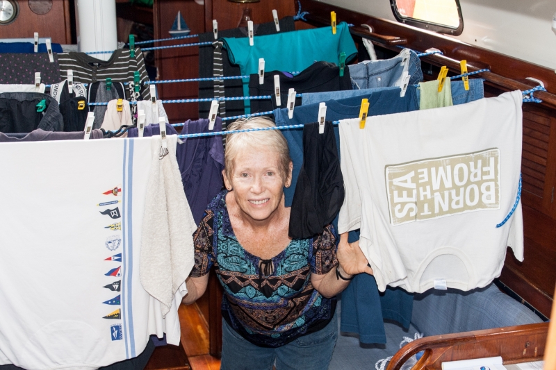
Our visit to Luganville was planned as a stopover to stock up our groceries, buy outboard fuel, dispose of our rubbish and most of all do our washing. Washing has been tricky because it uses such a lot of water and we've not really had any to spare except for what we catch in the dinghy. Sounds terrible, I know, but because the bung sits slightly above the bottom of the boat, any grit settles to the bottom and the rest actually comes out very clean. Geoff attaches a hose to the bung and drains it off into containers. I wouldn't fancy drinking it, but it's been a bonus for the washing.
Aore resort is very friendly and we picked up a mooring right out front in 25m water which fell away very quickly to a reef with poor coral but quite decent fish (for snorkeling - no fishing allowed here). We ate at the resort, used their pool and just relaxed (from our strenuous lifestyle) and pretended we were on holidays - oh, yes, we are on holidays. Unfortunately they no longer do laundry or rubbish disposal so we took our dinghy across the passage to Beachfront Resort which also welcomes yachties, although it doesn't have as nice an anchorage. It does however do laundry, take rubbish and have the fastest wifi in Vanuatu (in my opinion).
The Big Galah arrived and we had sundowners with Jim and Sharon. Thanks to Robyn Willey for letting them know to look out for us. The Galah is a big and lovely 50ft catamaran that would make for a very comfortable holiday anywhere. We have to admit to being just a little envious...
Clothes clean, rubbish gone, food stocked up and feet getting itchy, we're ready to move on. Because of the stronger winds expected over the next two weeks, we've decided to visit the western side of Santo via Ratua Island.

Lakatoro - Port Stanley - Malekula.
A beautiful spinnaker sail with 15kn winds from the SE. Port Stanley is a challenging anchorage with reefs extending for long distances straight out into the bay, but we found a nice spot not far from the village of Lakatoro which is the main administrative centre for Malekula. Our main reasons for visiting Lakatoro were to withdraw money from their ATM and refill our gas bottles. Sadly the ATM only works for local accounts and the bank couldn't help us either, so we counted our few remaining vatu, visited the market and bought enough veges, eggs and meat for a few days until we could sail to Luganville. The gas refill turned out to be an exchange; which we didn't want because we didn't want to lose our brand new gas cylinder. Geoff was happier though when he found out that they were exchanging our 4.5kg cylinder for a 6.5kg one - which luckily just fitted into our gas locker.
On our first day here we were visited by a cheeky bunch of four children in an outrigger canoe. It was mid-term break and they were looking for some excitement, so we were it. Over several days they brought us mandarins, oranges, pamplemous, paw paws, fish, bait (hermit crab bodies) and coconuts. We, in turn gave them story books, writing books, clothes and caps. Full of spirits, they were particularly keen to inspect the boat so climbed aboard, checked out their village through the binoculars, ate some biscuits and made themselves right at home. On one visit they saw me sitting on the stern from some distance and sang as they paddled - quite the comedians.
The Naiint Big Namba's first cultural festival at Mae turned out to be an event to remember. The purpose of the festival was to encourage the young people of the village to become involved in, and learn more about their heritage. Villagers not participating were encouraging from the sideline. The dances were traditional grade making ceremonies and two had apparently never been performed in public before. The devil dance had the children all screaming in mock terror. Different coloured body paint and decorations were used for different dances requiring some frantic back-stage preparations. The drummers played the tam tams until they should have been exhausted but continued on. The dancers, all strong and fit, stamped their feet and the noise from the nut pods tied around their ankles filled the air as they thumped faster and faster, louder and louder, to the beat of the drums. We were enthralled.
We tourists were obviously invited to raise funds, but because everyone in the village was there as well, we felt we were involved in an important part of their lives rather than watching a performance with the sole purpose of raising money. In between the dances we learned to weave mats, make kava (men only), make laplap and start a fire with just wood. Geoff had a go at this one and it was announced over the pa system that the Australian tourist lightem fire. Yeh! I'm starting to understand Bislama. We were warmly welcomed and we would recommend this festival to anyone visiting Malekula in August - it was certainly a highlight of our trip.


great reading about your
Peskarus Village - Uliveo Island - Maskelyne Islands - Kidnapped! Political prisoners...
As we were motoring out of the Maskelynes, we were hailed by three local men in a tinnie. Keith was hoping to be elected to a position on Malekula local government and needed a photo of himself for both ID and future advertising. Because the printer at the school was out of ink he would have had to go to Port Vila or Luganville unless we could assist. We were happy to help - hey, we don't have any appointments. Keith promised to show us somewhere good to anchor while we organised the photo, so we followed him in his dinghy; and we followed; and followed, asking each other where he was taking us. We passed several suitable anchorages and it took so long that we joked about being kidnapped. Finally we ended up back at our previous anchorage at Sakau Island. Keith and his friends came aboard and after we lent him one of Geoff's shirts, we took some photos and printed them for him. The whole process took some time and during the discussions waiting for the printer to do its thing, we agreed to anchor at Keith's village of Peskarus for a night or two. With Keith at the bow as guide (or kidnapper?), we tied his big tinny to our stern, departed for Uliveo Island and hoped he knew what he was doing. We passed close to two exposed reefs covered by breaking waves and crossed half a mile of massive rolling waves, all the time wondering whether the big dinghy would stay upright. Keith asked for our walkie talkie headsets, and installed at the bow, talked Geoff through a narrow entrance with breaking water on both sides and a minimum of 1.5m under our keel. He led us all the way into a lovely u-shaped bay enclosed by reef that we would never have found on our own. It was certainly not shown as an anchorage in any of our cruising guides, and both Navionics and our plotter showed it has very shallow at all tides.
Keith invited us home to meet his family and gave us a delicious mud crab for our help. We were taken on a two hour walk around the island and through the three villages, passing a small Chinese owned sea cucumber processing plant, a locally owned coconut oil soap factory and several groups of men making kava for the evening's session. We walked along one of the best roads in Vanuatu with no traffic - there are no cars here. The road had lush tropical gardens to the edge for most of the way around the island. Geoff was invited to the kava bar both nights and I was told quite politely that I could wait on the boat. Men only...
Did Geoff enjoy the kava nights? Here's his version:
Kava is an interesting concoction but am I about to become a raving convert? Well no. It has the consistency of muddy water, tastes like radish mixed with celery and is skulled in one not so thirst quenching gulp. It was interesting talking to the local men about how they make it from the kava plant but it's really a cordial and not brewed. Anyway that's what they have so I guess you get used to it. The Kava Bar opens at 4.30pm and closes when there is no more Kava or drinkers about. It's cheap at 100 vatu ($1US) per round but that seems to be its sole redeeming feature - at least in my experience.


Maskelyne Islands - Gaspard Bay - 2.
With a change of wind direction in the morning we motored back to Gaspard Bay to search for the elusive dugongs. This time, they were more sociable and continued to show themselves throughout the day. We quietly paddled across to the shore to get closer and I slid quietly into the water with my underwater camera, but they were camera shy and disappeared to the opposite end of the bay, not to return until I was safely out of their water and onto the boat. This was a fabulous day and an experience that we will always remember.


Sakau Island - Vanbuai Bay - Maskelyne Islands
Our next anchorage at Sakau Island was flat with no wind and because of the deep water we were anchored very close to shore - very nice! We avoided a buoy in the bay when we anchored but discovered later when it drifted closer to us that it was attached to a very long rope. A family on shore explained to us that no one lived on the island because of rising sea water, although their village's gardens remained and they paddled over in their dugout canoe daily to work them. The family was camping there overnight because the local trading boat, 'Big Sista' was due in at 3am and yes, she'd be using the errant buoy. As 'Big Sista' is a steel catamaran about 70ft long and carries both passengers and freight we thought it prudent to move further away from their buoy. With reef on both sides though there wasn't a lot of room, but we did our best and were more comfortable with our new position.
Local boats, both paddle and motor, arrived throughout the evening and partied on the beach while they awaited the arrival of the freighter. At 3am we were startled awake by bright light coming through the windows of our cabin. What the!!!! Yes, 'Big Sista' had arrived - all solid 70 feet of her and no more than 20 metres away with three monstrous spot lights aimed solidly at our boat. Once we recovered from the shock, we sat on deck and watched the proceedings, after all we had a very good vantage point. Two tinnies were unloaded by a crane and loads of people and goods went backwards and forwards for about half an hour and then it was all over as quickly as it began. 'Big Sista' threw her mooring and motored off towards her next stop and immediately every other boat in the bay either zoomed or quietly paddled off to their respective villages - all without navigation lights!


Gaspard Bay - Maskelyne Islands.
This is a pretty part of Vanuatu made up of a group islands on the southern tip of Malekula Island. The main entrance is protected by reefs and there are numerous reefs inside to trap the careless sailor.
We anchored in a recommended spot in windy Gaspard Bay with the sole aim of seeing dugongs. After a very windy night and with no sightings we gave up on the dugongs to leave for a more protected anchorage, only to have five of them surface around us as we left - how contrary! We both voted to return on our way out of the Maskelynes a few days later.
Avg: 7knts
24hr: 168.9nm
Revolieu Bay - Epi Island - revisited.
We were a little concerned about our reception back at Revolieu having left in the middle of the night when we'd promised to be ashore the following morning to prepare for lap lap. However, we were greeted warmly and everyone understood our departure as the bay was very rough on the morning of our disappearance. Ruth was the only one at home when we arrived and she told us that the five year taboo on the reef had been lifted for two weeks; and that everyone else was at the beach harvesting Trochus shells. We made our way through the large family garden to the beach and received a great welcome and an offer to stay for lunch.
The processing of these sea snails was a family event with the young men diving the reef from outrigger canoes and everyone else helping to cook, clean, eat and pack. We tried to pull out weight and got stuck into the cleaning; first banging the cooked shell continuously onto a log until the snail fell out, then removing its guts & messy bits; and finally washing the edible portion in sea water. Of course it seemed that it was one for me, one for the pot with some of the helpers but as the first harvest in five years, it was a special occasion.
There's no waste in this process - the snail is eaten, the messy bits are fed to the pigs and the shells are sold to China for a good price. There's a world-wide reduction in Trochus stocks but it seems to me that if everyone monitored their stocks the way these people do, there would be no problem. Their solution is simple. They only collect them for a short period every few years when the stocks are well up and even then they have a size restriction which we saw being complied with.
Betty and the other children were on the beach with their own little process. The young children were catching and preparing hermit crabs for bait and the older children were fishing. Between them they independently caught, cleaned and cooked their own lunch. I got to cuddle a couple of the toddlers and they loved the same teddy bear game that our grandchildren love - sniff, sniff.. One cute little boy eventually got brave enough to touch my skin and then couldn't stop doing it - very funny.
They've made us very welcome and they have so little, but whilst there are obviously things that we can and will do to help them, we haven't felt in anyway pressured. At the end of the day they gave us some more veges from their prolific garden and we gave them some clothes, fish hooks and baking powder, then exchanged contact details. It was sad to go, and we hope to see them again, but it is time for the Maskelyne Islands and then up to Luganville to meet up with Ann and Bruce.


Avg: 6.4knts
24hr: 153.6nm
Hot Water Bay - Ambrym Island.
We sailed across the top of Ambrym and stared into a massive, billowing cloud of fine ash and vapour that spread towards the southern tip of Pentecost twenty miles away and originated at the top of Ambrym's twin volcanoes. Our anchorage for the night was well protected and because of the steep slope of the shore, very close to the black sand beach. We were disappointed though that there was no view at all of the volcanoes as we'd read that at anchor we'd be able to see their glow quite clearly at night. After dinner, the half-moon lit up the sky and we almost gave up on seeing anything at all, however about 9.00pm it was all there - two deep orange glows that rose and fell in time to the volcanoes eruptions. All lights off and the boat in darkness, we sat on deck with a bar of chocolate and watched the entertainment.


Planter Point - Port Sandwich - Malekula Island.
Our stay in Port Sandwich has been quiet. The anchorage is as flat as can be, it's been overcast & rainy, and we've spent our time doing some easy jobs around the boat. This is the first time in ages we've been anchored with other boats and we have nine of them so it's been fun chatting to some other cruisers and seeing where they've been. The highlight, though has been The Rainbow Store which is a small shop at Planters Point operated by the very helpful Rock and Noella who cater primarily for the yachts who anchor here. They bake fresh bread on site every Monday, Wednesday and Friday and get eggs in from Port Vila on the inter-island trader, 'Big Sista' every second day. They will also provide fresh water when their reticulated water is working or if not you can leave your containers and they'll fill them for you when it comes on again. This friendly couple set up their shop to service visiting yachts and aim to be your on-site advisers in all things local. This is an excellent anchorage and bullet proof from any direction. If you are sailing this way, do drop in and pay them a visit.


Revolieu Bay - Epi Island.
We anchored using the most conservative waypoints in the Tusker Guide and with the gloomy, overcast weather couldn't have managed without them. We anchored in 8 metres of crystal clear water, tucked in behind a long reef in a large and pretty bay with black sand beaches.
There are numerous villages here and we found ourselves adopted by the Sarginson family who were as keen to hear about our lives as we were to hear about theirs. Weackly and Janet gave us a guided tour of their large garden and gave us samples of just about everything we passed. Weackly picked a cacao fruit off a tree for us to taste. Who knew that there are a heap of seeds inside the 5 inch fruit and if you suck them they taste like lollies?
On Friday, Weackly, Janette and their 14 year old daughter Betty joined us for lunch on the boat. Betty immediately asked if she could climb the mast so after lunch Geoff put the harness on her and sent her up as far as the spreaders. We sat around on the foredeck in the shade chatting for some time and enjoying the breeze after a very hot day and then joined Betty for a swim off the boat until the weather looked like changing and we returned them to shore with the agreement that we'd come back in at 8am Saturday to help prepare for a lap lap dinner on that night. Very excited.
The weather certainly changed and by 6pm we were rolling from gunwale to gunwale with saucepans rattling in cupboards, creaks and groans from all sorts of places and in spite of our expectations it did not get better after high tide. We discussed leaving several times but didn't want to break our promise to go ashore the next day. Eventually we faced the fact that it was not going to improve and I was seasick at anchor for the first time ever, so we decided to go around the island to Lamen Bay and then return the next day if possible. Great Plan! The swell in Lamen Bay was also atrocious and much more exposed so we sailed on for another five hours to the protected waters of Port Sandwich on Malekula Island, dropped anchor and both slept for the afternoon. We hope to return to Revolieu Bay via Ambrym later in the week if the weather permits.


Sulua Bay - Emae Island.
Anchored here on our way to Epi. It was a fabulous sail of six hours with 15 to 20kn on a reach with the sumlog showing between 6 and 8 kn for most of the trip. This is a very pretty anchorage and easy to find your way into. We had an easterly wind which should have been perfect but once the tide came in it became rolly and too uncomfortable to spend another night.
This tiny island has 5 villages and was totally decimated in Cyclone Pam 18 months ago. Some of their crops are recovering but they are still struggling - apparently a new coconut tree takes 7 years to bear fruit. We swapped some veges in exchange for some tins of chicken, packets of beans and a solar phone charger. Yes, they all have mobile phones now that Digicel has installed towers on every island and infiltrated the country with cheap phones.
On our way back we met four young girls on their way home from school and gave them the four tennis balls I had in my backpack. They were very excited but our guide insisted that they needed to bring back a gift for us the following morning. We've found the trading to be quite difficult and are never sure how much to trade and whether we're taking the food out of their mouths. Promptly at 7am the next morning, however, the girls turned up with a paw paw, bananas and some sugar cane in the company of Sophia's mother who had heard about the solar chargers and was also keen to own one. Our self-appointed guide, Esso, also ended up with a solar charger. Thanks to Kris and Darren for passing on these perfect gifts left over from their trip her last year.


Havannah Harbour, Efate
Anchored in Havannah Harbour ready for the trip north to Emae Is tomorrow.
Mele Bay - Efate.
We moved from Port Vila to Mele Bay to celebrate Vanuatu's Independence Day long weekend. It seems that music is the go for this weekend and we've been anchored in a beautiful bay surrounded by music from both the Beach Bar and Hideaway Island Resort as well as from the locals who are rightly proud of their 36th anniversary of independence and had a HUGE amplified sound system over which VERY LOUD music of all types from rap to gospel blasted on and off for 3 days, nights and early mornings. We commenced the weekend ourselves by joining Warren and Debbie on Friday night for an evening of Fire Dancing.
Independence Day has been very big here. Sadly we missed the flag raising on Sat morning because we didn't know it was on, but everyone was out in their finest with many, including Geoff dressed in Vanuatu shirts and carrying Vanuatu flags. It was quite infectious and we joined in where we could.


")


Mt Yasur Volcano - Tanna Island.
A must see experience. We wanted to sail to Tanna but the winds were not favourable and we ended up in Port Vila which is very nice, but - no volcano. Since I have never seen a volcano, I really wanted to go to Tanna. We discovered that there is a regular flight from Vila to Tanna taking in the volcano tour with an overnight stop. And yes, it was expensive but worth every cent. We departed on a 'flying coffin' otherwise known as an Islander twin engine aircraft (seats 10). Fortunately Dave, our Kiwi pilot, was very competent and quickly put us at ease. Di scored the jockey seat beside the pilot on the return trip and hasn't stopped raving about what an incredible experience that was (no she did not fiddle with the instruments).
Only 1 hour from Vila and we were flying over Mt Yasur, the Tanna volcano which was quite spectacular, before landing at Tanna airport. The airport is on the west side of the island though, a 1.5 hour bumpy 4WD ride to the volcano. The first glimpse of the volcano is through the ash plains on the leeward side which stretched for miles and to our surprise the route to the Volcano is across the Ash plains - no sign posts. At the base of the mountain we were entertained with a traditional island dance and the obligatory safety talk which is summarised as 'You be careful!' Then another 20 minute 4WD climb up the mountain bouncing around like kids in the tray of a twin cab ute.
The base camp is a short climb to the rim of the caldera & the first glimpses of the erupting volcano were breathtaking. The first thing we noticed was the eruption shock wave followed by a deep rumble and then the fiery eruption which was just spectacular. The tour guides took us to 3 vantage points offering a different perspective of the volcano but the best spot was kept till last when we stood on the southern rim peering into the 'gates of hell'. It's easy to see where the idea of Hades came from as we were treated to one eruption after the other for over 2 hours, each becoming subsequently larger until we wondered where it would end. At no time did it feel really unsafe even though at times we were showered with small flakes of ash. The experience was both mesmerising and awesome in every sense of the word. If you come to Vanuatu and don't see this, you will have really missed out!!!!


Port Vila - Efate
Our week in Port Vila has been fun. We remained moored to the wharf and on Sunday took a trip around the island with Warren and Debbie and guided by our waiter Stuart, who we met at the Waterfront Bar and Grill on Friday night. Because Monday was a holiday for Children's Day Stuart brought his wife and two beautiful daughters aged 3 and 1 with him for our tour. We jumped by rope into the lovely water of the Blue Lagoon, saw traditional dancing at Taka village, listened to a talk by the eccentric proprietor of the World War 2 museum and had an enjoyable day whilst learning a lot from Stuart's wide knowledge of the island. After such a hectic day we spent the Monday public holiday lazing around the pools at Iririki Resort and testing their cuisine, together with, it seemed, most of the families in Port Vila.
In general, we've stocked up our fruit and vegetables from the best market we've ever seen, chatted to people, taken it easy, eaten out once or twice and had an altogether good time.


Port Vila - Efate.
We arrived in Port Vila, Vanuatu at 6.30am yesterday after a 37 hour trip from Ouvea. The winds stayed between 15 and 20 knots for the length of the trip and in spite of regular mild squalls, we managed with slightly reefed sails to have an easy trip.
We arrived here to find that Warren and Debbie on 'Phase 2' had arrived the day before. Then Scott and Jasmin on 'Equanimity' arrived about 2 hours after us. Once we finalised our entry formalities with Customs and Quarantine, we moved over to a berth and 'Med moored' up to the wharf in front of the Waterfront Bar and Grill, an institution in Vila which serves good meals, drink and live entertainment every night. With Warren & Debbie and Scott & Jasmin we made the most of Vanuatu's laid back version of light-hearted civilisation mixed with excellent food and service.
We had a top night and it was fascinating listening to the conversation from three groups of people cruising in very different circumstances. Warren and Debbie sail a very nice, new Seawind catamaran and enjoy comfortable sailing with many modern conveniences. We sail a 46 ft 30 year old, cruising mono-hull with traditional lines but the convenience of in mast furling and a well protected covered centre cockpit. Scott and Jasmin sail a gorgeous 32 ft New Zealand designed and built yacht, with minimal mod cons and limited space, but good speed. They are also much younger than we are. So, who was having the most fun? Well, of course we all were. By the end of the night it was obvious that it's not the boat itself that makes the trip, but more importantly your attitude, the wonderful places you visit and the people you sail with and meet along the way.
This place has a vibrant and energetic vibe and I'm writing this to a background of ABBA mixed with numerous laughs and cheers; and looking forward to whatever tomorrow brings.


Ile Beautemps-Beaupre - Loyalty Islands
After our failure to check out of New Caledonia because of the Bastille Day holidays, we found ourselves with 3 extra days and no plan to do anything with them. Geoff suggested we visit the Daguera group of small islands on the northern reef of Ouvea which we'd heard have a good anchorage and excellent snorkelling. Oh dear, the wind and sea came up and as we approached the anchorage the waves were crashing onto the rocks at the entrance to the small bay so we couldn't be certain of the exact entrance. It was a case of, if we get this wrong, it would be very wrong and we both agreed to pass this potentially lovely anchorage and beat on for another couple of hours to Ile Beautemps-Beaupre which has an entrance on the Western side and should be more protected. The devastating thing was that above and behind the rocky cliffs we could see the perfectly still mast of a yacht already anchored in this elusive anchorage.
The entrance to the small lagoon at Beautemps-Beaupre is guarded by a motley row of large coral bommies which, as we sailed around the island appeared to be one large coral headland. By now the sun was shining weakly from behind the clouds but the wind was still quite strong and I was half way up the mast wearing a walkie talkie headset and my polaroid sunglasses ready to find our way through the bommies and into the anchorage. I imagined that once we rounded this headland, we'd find the bommies and all would become clear, but when Geoff said: 'I think we have to go through the headland - they are the bommies', my first response was a shocked 'You've got to be kidding!!', but no, he was not and he was right.
I couldn't see a potential track all the way through and had to ask whether he was sure he could back the boat up following our track on the plotter before I agreed to keep going. And so we wove our way amongst the breakers using my directions from up the mast (the plotter showed the whole lagoon as being on land), and we entered a beautiful, picture perfect lagoon with a white sandy beach, just large enough for 2 boats to anchor comfortably. There was just us though, so we had it all to ourselves. We spent the afternoon snorkelling and then next morning when the winds dropped it was back up the mast to take some photos of the entrance as it's supposed to look. Thanks to Bastille Day and the unexpected additional holiday, we've had an amazing bonus and have found our new favourite anchorage - for now.
We returned to Fayouwe on Ouvea on and Geoff flew to Noumea, staying overnigh Monday to clear Customs and Immigration.
Departed for Vanuatu on Wednesday and because of the predicted Easterly winds expect to arrive in Port Vila instead of Tanna on Friday morning.


After our failure to check out of New Caledonia because of the Bastille Day holidays, we found ourselves with 3 extra days and no plan to do anything with them. Geoff suggested we visit the Daguera group of small islands on the northern reef of Ouvea which we’d heard have a good anchorage and excellent snorkelling. Oh dear, the wind and sea came up and as we approached the anchorage the waves were crashing onto the rocks at the entrance to the small bay so we couldn’t be certain of the exact entrance. It was a case of, if we get this wrong, it would be very wrong and we both agreed to pass this potentially lovely anchorage and beat on for another couple of hours to Ile Beautemps-Beaupre which has an entrance on the Western side and should be more protected. The devastating thing was that above and behind the rocky cliffs we could see the perfectly still mast of a yacht already anchored in this elusive anchorage.
The entrance to the small lagoon at Beautemps-Beaupre is guarded by a motley row of large coral bommies which, as we sailed around the island appeared to be one large coral headland. By now the sun was shining weakly from behind the clouds but the wind was still quite strong and I was half way up the mast wearing a walkie talkie headset and my polaroid sunglasses ready to find our way through the bommies and into the anchorage. I imagined that once we rounded this headland, we’d find the bommies and all would become clear, but when Geoff said: ‘I think we have to go through the headland – they are the bommies’, my first response was a shocked ‘You’ve got to be kidding!!’, but no, he was not and he was right.
I couldn’t see a potential track all the way through and had to ask whether he was sure he could back the boat up following our track on the plotter before I agreed to keep going. And so we wove our way amongst the breakers using my directions from up the mast (the plotter showed the whole lagoon as being on land), and we entered a beautiful, picture perfect lagoon with a white sandy beach, just large enough for 2 boats to anchor comfortably. There was just us though, so we had it all to ourselves. We spent the afternoon snorkelling and then next morning when the winds dropped it was back up the mast to take some photos of the entrance as it’s supposed to look. Thanks to Bastille Day and the unexpected additional holiday, we’ve had an amazing bonus and have found our new favourite anchorage – for now…
We expect to leave for Vanuatu on Wednesday and because of the predicted Easterly winds we expect to arrive in Port Vila instead of Tanna on Friday morning.
St Joseph - Ouvea - Loyalty Islands.
The village of St Joseph is very traditional and most of the dwellings are made from thatch in either a round (Polynesian) or rectangular (Melanesian) configuration. In the centre of the village , with a beautiful view across the lagoon, is the Renaissance cathedral style painted stone church of St Joseph with its impressive spire.
We've been made very welcome here and decided that I would stay with the boat while Geoff flew back to Noumea to check us out with Customs and Immigration before we leave for Vanuatu. Geoff left for the airport this morning by the usual method here - hitch hiking. It took 2 hours to travel the 19 km so it's just as well he left at 10am for his 2pm flight. As he was congratulating himself of getting there and on time, he received a text message from a friend in Noumea advising that Customs and Immigration will both be closed today and tomorrow and wouldn't open again until Monday. After the initial shock he discovered that they're having an additional day's holiday for Bastille Day which is today. (You wont find this advice anywhere in Noonsite or cruising guides).
What to do? Return flights booked. Hotel booked. Grovel, beg and plead... He's managed to have his non refundable flights transferred and is still waiting on the outcome with the hotel. So we're both on the boat again and plan to up anchor in the morning and visit a secluded group of islands in the reef 2 hours north west from here for the weekend. Then we'll try it all again on Monday........ah, the pleasures of cruising.


Fayouwe - Ouvea - Loyalty Islands.
Yesterday we moved further up the long beach at Ouvea and anchored off Fayouwe, a very spread out village which wore us out trying to find a system in its layout. Whilst we didn't find most of the things we were looking for, we did stumble across the 'yacht club'. Beside this very orange, modern building, a group of budding sailors were putting their Optimists, wind surfers and small cats through their paces. They were having a ball and we've never seen a group of children so comfortable with their boats - check out the photo of the 2 young boys standing on their gunwales as they sail their boat to shore.


Avg: 12.4knts
24hr: 297.5nm
Baie de Mouly - Ouvea - Loyalty Islands.
As we sailed around the corner we were greeted by miles of perfect white sandy beach. We anchored in front of Hotel Paradis, which it really was and couldn't wait to put our feet on the sand. First, though we had to catch up on the news of the world so had a cup of coffee at the hotel cafe and used the free wifi. Once up to date we passed a young girl playing happily with a dog on the beach. Geoff, the inveterate dog lover, took one glance at the happy pooch and he left the girl stranded and came with us. How embarrassing.


Drueulu - Lifou - Loyalty Islands.
Our friend Robert Stead from the yacht Aurora visited the village of Drueulu on Lifou in 2012 and was fortunate enough to be invited to a local wedding. Nearly 4 years later we arrived in the village of Drueulu with the aim of delivering Rob's photos of that wedding to his host, Jean. We searched the village using Rob's Google Earth instructions and eventually, after struggling with a discussion in French mixed with local dialect we found his house with its traditional round house in the back. Sadly though it was all closed up with no one at home. We returned again that night with no better luck. With fears of failing in this important mission but with water tanks and pantry running low we up-anchored and moved to the larger village of Chepenehe on the opposite side of the bay to restock, intending to return on the weekend when we hoped Jean would be home. On Friday night, four years to the day after Rob's visit we re-anchored at Drueulu, launched the dinghy and again walked up to Jean's house. After speaking to his sister in law Lizzie, his son Jacob and his nephew, we were introduced to Jean himself and received a very warm welcome. We were immediately asked to join them for their dinner of soup, chicken and rice cooked to perfection by the wonderful Lizzie. As it turned out, there was a wedding this weekend as well and although we weren't able to attend this one, it was exciting to see a village in wedding mode. The wedding was attended by 1000 guests in a village of only 500 residents yet it doesn't seem to have stretched the capacity of the village at all as every house also has its traditional round house which sleeps around 20 people on colourful mats. We've enjoyed this pretty village, crystal clear water and lovely sandy beach, but mostly we've felt welcome amongst the friendly villagers with their ready waves an d happy smiles.


Chepenehe - Lifou - Loyalty Islands.
Anchored here for a few days to stock up on groceries before returning to Drueleu. The northern beach in Chepenehe is stunning - a long sandy beach overlooked by a massive church with spires on the top of a huge headland and beneath, miles of gorgeous coral. On the beach itself, long bamboo structures set up for selling trinkets when the cruise ships arrive - sigh!
The dinghy landing area at Chepenehe itself is a tiny natural harbour protected on all sides and entered by a narrow channel. The only negative is that a bit of a surge can run through there but all in all, it's just amazing.


Baie de Pede - Mare - Loyalty Islands.
We've finally arrived at the first of the Loyalty Islands after a long and bumpy overnight sail from the Isle of Pines with 2 other boats for company. The weather is overcast and drizzly and we ended up heaving-to to wait for a short break in the cloud cover so we could make our way safely amongst the coral and into our small, quiet haven. The Loyalties are operated via traditional methods and yachties are expected to go ashore, meet the chief and offer a small gift in exchange for being allowed to anchor in their bay and visit their sights. We've been prepared for this for some time and were looking forward to parting with our gift of some traditional fabric before visiting a natural aquarium and grotto. Sadly we walked for an hour unable to find any traditional owners to pass our gift on to. Our boat is loaded down with gifts for villagers both here and in Vanuatu so we hope it will be easier to pass them on in the other islands.


Baie de Kuto - Isles des Pins.
Upon returning to Noumea from Australia we attended to an annoying leak in the circulation pump which threatened to keep us harbour bound it pays to carry spares (thank you to Don and Robyn & Tony and Val for the refurbished spare parts). A half day and we were all good to go. Prior to departing we had sundowners with Debbie and Warren Kerswill on Phase 2 before they headed north and we went south. Weve spent the last week or so sailing from Noumea to the Isle of Pines via Amedee Lighthouse and some beautiful and rugged bays on the mainland.
Since leaving Noumea the weather's been a little less than perfect with winds over our usual 10 knots and some rain, although not enough to bring out a raincoat. Geoff and I have both caught some New Cal winter bug so we've taken it easy bunkered down in Baie de Kuto at Isle des Pins. We still can't believe that we're here and having a ball.
Here we are at a lovely anchorage at Baie de Kuto with only three other boats when we arrived. The weather blew up from the west and it was a bit bumpy for a night before the winds returned to the South and South East but there's good holding and good access to shore facilities such as they are. This is a great bay for the trade winds with a long white sandy beach. Hotel Kou-Bugny only seems to open from Thursdays in this low season but provides cool drinks, and all other resort facilities including wifi at a cost of $10 per week. A better but less convenient option is a beer or coffee at Hotel Tera Oure in the adjacent Baie de Kanumera which offers free wifi, great meals and great service. We hired bikes from Hotel Oure and a car from Hotel Kou-Bugny. The staff at both are very friendly but it does pay to brush up on your French. With the bikes we travelled to Vao, 6k away, and tried to get a local SIM card - forget it! It's just too hard! Better to use the hotel wifi! With the car we toured the whole island in under a day and visited all the other bays that seemed to be good anchorages.
The highlight was that we were able to visit two of the three cavernous grottos on this land without the accompaniment of a bus load of tourists! Another highlight was Baie d'Oro with its piscine tidal pool and the hotel Meridian (best on the island). This is low season and we have not sighted a cruise ship while we've been here but we understand they get four per week in the warmer high season - lucky us! Another definite highlight was the tour of Baie d'Upi on a traditional Pirogue - outrigger canoe which are still made in the traditional way (plus a Yamaha outboard), followed by a hike to Pic Nga (the highest point on the island). Great photo opportunities!!


Yate.
Anchored near the bridge at Yate, a very protected anchorage on the south western side of New Caledonia.

Port du Boise.
A lovely secluded Bay well sheltered from most winds with plenty of fresh water streams at the northwest end. Having so much water Geoff decided to wash this morning (not just himself but all the linen as well) - a large amount to do by hand. No doubt we'll get used to it - or not. Once the boat was strung all over with washing, the clouds came across with drizzly rain so it was all moved into the cockpit. With the boat looking like a laundry we let out another 15m of chain and went out for lunch at Kanua Tera eco lodge, a ten minutes wet dinghy ride in full wet weather gear, on the east side of the bay. Bonus - they have free wifi. Also good service, lovely meals and nice premises - a lovely way to spend a wet afternoon!
When it came time to leave the next morning the washing was still wet so it had to be moved again to the only safe place whilst sailing - the cabin. We're discussing the merits of disposing with clothes.


Port de Boise North. A very protected anchorage in most conditions, but when the wind changed to SW, we moved to the western side of the bay. This bay has you covered in all conditions.
Baie de Prony.
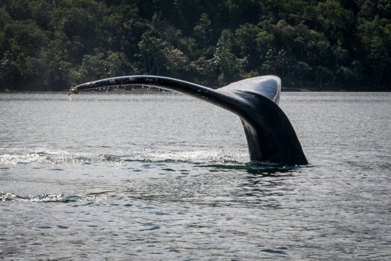
Prony Township is the remnants of the 19th century penal settlement/old logging station and well worth the visit. Whilst returning to our boat in our dinghy we encountered two humpback whales who lazed within 20m of our dinghy for about 15 minutes. Amazing!


Baie du Carenage East
We visited the not so hot natural springs and waterfalls at Le Carenage in the upper reaches of the bay after working our way through the shallows in an attempt to find a route deep enough for the dinghy to reach the landing stage.


Hi Geoff and Di,
Baie d'Ui
We tucked ourselves away at Baie d'Ui because the winds made the coral islands untenable for anchoring and we've had a surprisingly good time. The water was flat, calm and very well protected. We filled our water containers from a fresh water creek just beside the beach. The bays along the mainland south of Nourmea are long and deep, surrounded by high hills. Fortunately there were no bullets blowing down from the hills, at least while we were there. It's quite beautiful country with small waterfalls making their way down most of the valleys. The soil is orange and we managed to get it everywhere even though we had a bucket on the back of the boat for foot washing and washed everything before getting into the dinghy. The anchor brought up masses of it as well and we were still washing it off at the Loyalties.


Amedee Island
Amedee lighthouse is quite a structure and really appealed to the engineer in Geoff. At Amedee we enjoyed sundowners with the crew from Shellac who turned out to be long time sailing friends of Chris and Mike Vincent.


Back in Noumea
We had a wonderful two weeks in Australia playing with our grandchildren, going to birthday parties and catching up with Inge and Herbert from Austria.
We're now back in Noumea ready to continue our holiday and have just checked into Port Moselle Marina for a day or so for Geoff to replace the fresh water pump in the engine which had begun to leak some coolant into the bilge. Fortunately we had a spare and in spite of a few grumbles down below during installation, it seems to be working fine. Fingers Crossed. We?ll leave the leaking one here for refurbishment and collect it when we check out in about a month's time.
Berths in the marina here are hard to get so I was particularly happy to get this one because it's so close to the cafe that we can get wifi on the boat and to date we've had to take our computer up to the cafe and buy food or drink while we type. Geoff has been working on the engine - a no go area for me, while I sit in the cockpit in comfort looking at the cafe and considering going for a coffee anyway...
Last night after dinner we were discussing the things we've learned so far and this is what we came up with.
1. Checking in. On arrival in Noumea by boat you must check in at Port Moselle Marina. Don't worry if they don't have a berth for you though, or if you just prefer to anchor out as it's quite feasible to anchor in Baie D'Orphelinat around the corner from Port Moselle Marina and dinghy around to the marina for check in purposes. We also visited Customs, Immigration and Quarantine ourselves. None of them wanted to come to the boat so we went to them by dinghy. We were advised to leave someone with the dinghy - thank you Steve. They are all within a reasonable walking distance.
2. Port Moselle Marina is always busy so it's hard to get a berth for more than a day or two. Their prices are around $40Aud per day. Pontoons are all timber and have no pile at the end of each berth. The berths are all much shorter than the boats and we wouldn't want to sit out a cyclone here.
3. Tender Pass. We anchored out, because we could still get a Tender Pass for Port Moselle Marina for $6Aus per day which gave us access to the showers, Wifi and somewhere to tie up our dinghy. We've been locking our dinghy because everyone else does but we haven't actually heard of any incidents of theft. There's nowhere in Baie D'Orphelinat that seems safe for us to go ashore so the dinghy pass was great.
4. Dinghy mooring. It's a long walk from the Port Moselle Marina to either Baie des Citrons or Anse Vata in the south though and we eventually found that we could tie our dinghy to the inside pontoon at the Pacific Fuel Wharf adjacent to CNC for $3Aus per day.
5. CNC. We tried to visit CNC using our RQYS membership but were told in no uncertain terms by the Capitaine that the CNC has no relationship with any foreign yacht club, so we returned to our rightful place at the fuel wharf.
6. Twenty9 Surf and Skate Shop. Our new friend Stephen was a great help when it came to leaving Stylopora here during our trip back to Australia. We would definitely recommend his Skate and Surf shop in the Hilton complex at Anse Vata or website www.twenty9.nc Good light wetsuits for snorkelling as well.
7. Marina Pontoons. When you do come into Port Moselle Marina, the pontoons are usually MUCH shorter than your boat and have only one normal cleat at the bow. Both middle and stern cleats are actually an upside down U shaped piece of tubing bolted to the pontoon at each end - sort of like an upside down toilet roll holder. You need to thread your line through this and take it back to the boat; or at least push it through doubled to tie on quickly and then change it. It totally destroyed my instructions to 'Tie it off quickly'...
8. Shore Power. There is no such thing as an adapter which can be used on our Australian cables for shore power. After asking all around for an 'adapteur' (is there any such word?), Geoff found out that you just go to the marina office and ask for a plug. You then have to cut the end off your existing cable and rewire it from the wiring diagram on the pontoon. The easier way would be to come with a short lead rather than have to cut down your extension cable.
9. LP Gas. In spite of information otherwise, it seems that it is possible to obtain LP Gas in Noumea. There is a yacht agent named Herve who is in the second shop/building on the left at Port Moselle Marina. Herve apparently feels sorry for all of the Australian boats who can't refill their gas and will fill them for you personally and very slowly. Our empty bottle has been with him for two days now but hopefully we'll have it back on Tuesday. If not we may have to amend No. 9.
10. Boat Shopping. For chandlery and any other boat bits and pieces, Geoff is recommending Marine Corail at Nouville Plaissance. It seems they have just about everything you need, although you do need to go from one shop to the next and ask for what you need - preferably in French, although he has managed to find everything that he's needed in English. Please don't ask him about the prices.
11. Markets. The prices here are expensive, even the markets because a lot of the fruit and veges are imported resulting in very little for less than $7Aus per kilo. Some local produce is between $3 and $4 per kilo but there's not much in that range. Yams though, are VERY expensive and we can't afford to eat them - it's cheaper to buy imported potatoes. The markets are also dangerous - I was stabbed by a pumpkin on Friday morning! The store holder put my pumpkin into a small plastic bag with handles before I had a chance to put it straight into my environmentally friendly string bag; and unfortunately one handle broke straight away. Before I realised what was happening a piece of stalk off the top of the pumpkin went straight down behind my fingernail. Very ouch, but after a couple of days of home grown medical treatment it's coming good and I can even type with it.
12. Wifi. We've discovered how often we used to just pick up a phone to Google something and we're struggling to find answers without it. Wifi at Port Moselle Marina is fine although very slow especially if you think of sending photos. Apparently the wifi at the markets is faster but we haven't tried it.
Gosh, we've learned a lot already - just imagine how much we'll know by the time we get home...

Port Moselle Marina - Noumea
The trip back to Noumea was as good as the one north, although with fewer stops. The highlight for us was Isle Ndukue.
We've left our poor boat alone at Port Moselle Marina in Noumea and are back on the Sunshine Coast now for first birthday parties for our grandchildren, Amber and Alexander, as well as to welcome Austrian visitors. A holiday from our holiday no less, but we'll be back to explore the lagoon south of Noumea on 14th June.

My word you two really know
Hello Di. I have just
Thanks Lesley. It's been
Baie des Citrons.
Our last stop before returning to Noumea was Baie des Citrons, another pretty sandy beach, but this one has cafes, restaurants and bars all along so we finally found our bar on the waterfront that made cocktails and then treated ourselves to dinner out.


Anse Kuendu - Ile Nou. A short walk to Fort Tereka.
We were looking forward to our stay in Anse Kuendu on Nou Island, close to Noumea. The anchorage was as beautiful as we expected but very small with reef and shallow water all around. Coming into anchor was totally nerve wracking and we almost left rather than risk staying. In the end we anchored slightly out from the other boat already there, a steel boat called Ui with a German family of four who were very encouraging as we tried to find enough space and depth to drop our anchor.
A resort sits at the end of the bay looking beautiful with bungalows perched on stilts over the water but when we looked closer they were very dilapidated and beginning to collapse. There went our hopes of watching the sunset on their deck with a Margarita each, so Plan B was put into action - Geoff makes a mean Margarita...
We attempted another walk and this time eventually found not one but numerous tracks, but somehow found our way to the top of the hill and Fort Tereka with its cannon that have guarded the entrance to Noumea since the 1800's.


Ile Ndukue
With its beautiful circular bay, its rocky hill that we climbed and its unexpectedly beautiful snorkeling beside the rocky northern beach is one of ur favourites. We followed the advice of the guide book which promised walks through the island with lovely views at the top, and while the view was indeed lovely, the walk was a case of trailblazing. The intrepid Steve led the way through the spider webs and made enough noise to warn off any snakes that may have been snoozing in the long grass. At the top we found a navigation mark lying on the ground so we were very pleased to have been following our Garmin plotter rather than navigating by sight. Although all of the islands we visited were stunning, we usually had to share them, but we stayed at this one for a couple of days and saw no sign of civilization at all. No lights. No planes. No sound at all except for small waves breaking on the rocky wall as the tide came in; and the thousands of birds that lived there.


Ile Lepredour
We anchored beside the deer sanctuary where our guide book said we should be able to see deer. Unfortunately they were all hiding, assuming they are still there, so we didn't see any. A beautiful full moon though.

Ile Tenia - Passes des St Vincent
Wow! We've been incredibly lucky to have had such perfect weather. The winds have been light and the sun's been shining except for some stunning clouds providing the most amazing sunsets; and we've been anchored beside beautiful sandy islands surrounded by spectacular coral reefs. We left Noumea a week ago to visit the islands to the north, many of which are surrounded by coral, and whilst the coral makes for more challenging anchoring techniques, we've sat down to dinner in the cockpit each night surrounded by the most incredible views and very few people. Remember the advertisement that went something like: 'Tahiti please James!'? That explains a little of how we are feeling. Every evening we discuss the day's anchorage and activities, examine the guide book and charts; and then decide whether to stay for another day or carry on to another piece of paradise. Yesterday we chatted with a young French woman who was kite surfing across the lagoon at Ilot Tenia, a small island on the inside of the outer reef at Passe de St Vincente. She told us she was born in France but was living in Noumea because it was Paradise. Well said. We'd been snorkelling in the lagoon when we met her and have been impressed by the variety of fish and coral there and at most of the places we've stopped.
Have there been any challenges? Well, internet in any meaningful form is pretty much non-existent, I'm learning to wash our clothes in buckets on the back of the boat, and Geoff and Steve are learning the hunter and gathering skills of harvesting oysters. We won't mention the lack of suicidal fish jumping onto our fishing lines... We're at the end of our fruit and veges now and the tinned food is starting to look good so we're making our way back to Noumea via some more islands in paradise.


Ilot Moro.
A beautiful rocky island with a small sandy beach and good anchorage from the SW and SE. We launched the kayak, and Steve paddled out to investigate. He arrived back must faster than he left and the only thing he noticed was the number of sea snakes - Steve's not fond of snakes. Geoff and I thought we should check them out as well, but sadly, Steve must have scared them all away and we couldn't find one. The snorkeling was quite good here.


Ilot Mbe Kouen.
We had trouble believing it when we arrived at this absolutely stunning tiny island - beautiful white sandy beaches, lovely clear water, great snorkeling, an excellent anchorage - picture perfect!


Ilot Signal. A pretty island whose main feature is a man made navigation aid built in the 1860's from locally sourced rocks and cement; and standing about 25m tall.
Steve discovered collecting coconuts here as they had floated up onto the beach and were lying there calling to him. Once back on the boat we discovered that he was no better at opening them than we were. Fortunately though, he was more persistent and he had us drinking coconut water and eating the lovely flesh in no time.


Anchored at historic Ilot Signal.


Ilot Maitre - resort island


Ilot Maitre.
A lovely small island with a very nice resort, which of course we thought we should investigate. Their pool deck, where yachties are welcome is a top spot to have a drink and watch the sun set. To earn our drink though, we did circumnavigate the island on foot and snorkel over some quite nice coral.


Avg: 13.4knts
24hr: 321.4nm
Anchored at Noumea
We cast off our lines at the Manly marina and were on our way to New Caledonia. Our previous trips have been restricted by time and we ended up fighting strong winds and large seas to the point where we joked that we never sailed with the wind - always against. This time we were waiting for the right weather window and after only a week's delay set off in light south easterly winds. First though, we organised for Australian Border Patrol to come to the boat, go through our paperwork, stamp our passports and clear us out of Australia. After their visit we were allowed 24 hours to depart the country.
Geoff, our friend Steve Lock and I were finally on our way and the trip to Noumea was fabulous. After the first two days of perfect light weather sailing we awoke to glassy seas and no wind, motoring for a solid four and a half days until we arrived in Noumea. Before the trip Steve and I had made enough frozen meals for ten days in case of bad weather, but with the light wind, cooking was easy and we managed bacon and eggs on the barbeque one morning, roast chicken one night, sundowners with champagne one evening and sundowners with a lovely red wine (thanks Min) on another. On two days the water was so glassy we stopped the motor, took down the token sail and jumped into beautiful clear water two miles deep. Fearing the nightmare of the boat sailing off without us, we kept one person on the boat but there was no sign of it sailing off anyway.
We sailed past the Amadee lighthouse and into Noumea at 5pm on Thursday, leaving us time to check into Noumea on Friday before an unexpected three day long weekend. Checking into Noumea involved individual dinghy rides to complete the paperwork for Customs, Quarantine, Immigration and Port Control after which we celebrated with lunch at the Bout du Monde cafe at Port Moselle marina before going back to our anchorage for a night of uninterrupted sleep without the usual 2 hourly night watch system.


Avg: 6.4knts
24hr: 153nm
650 miles down and 160 miles to go to Noumea - still motor sailing and waiting for new wind


Thanks everyone for all your
Congratulations. I see on
Thanks for the recommendation
Sounds frustrating, but
Looking like the winds are
Pages
Avg: 5.4knts
24hr: 129.2nm
Nice sailing through the day in sunny skies. 119 miles achieved less than previous as wind dropped out at night and we motored all night


Best wishes on your amazing
Thanks Julie - hope to read
Avg: 6.1knts
24hr: 147.3nm
Great day with another 133 miles down, tummies settling and lovely weather. Have sighted whales

6.1 knots is hootin along,
Thanks so much. It's easy to
Avg: 5.7knts
24hr: 137.4nm
Good first day with 124 miles down, 12 knot SE winds,. Sailing and crew happy

Yeh! We have been cleared out of Australia by the helpful and patient men from Australian Border Force; cast off our lines and are heading off into the sunrise. Well, that sounds good but it is actually a bit later than sunrise because the tides have given us a very civilised 9am start. Are we excited? You bet! The boat is loaded up and the waterline is way down, but we are moving; and the weather forecasters are predicting very light winds, some of which will actually take us the way we want to go. In most of the trips we have done, we been short of time and ended up beating into strong winds so we will be very impressed if we do get good conditions and; although of course, we will need some wind. We expect to arrive in Noumea in about a week.
Whilst we are away we can be contacted by: Email svstylopora@gmail.com Text via sat phone - +88 424 211981 and Blog www.yit.co.nz/yacht/svstylopora


Bon Voyage! Smooth sailing to
Thanks Jillaine - everything
Berthed in Manly Marina.
We've ticked a lot more off our list and still hope to be ready to leave in the first week of May if the weather's good. Geoff's been inspecting the mast and its fittings, installing AIS, installing our Iridium Go satellite WIFI hub, building additional shelves in cupboards and repairing safety lines while I've been buying up enough food to stock a nuclear shelter, trying to stock the food without putting all the weight on one side of the boat, walking 5 minutes to put on a load of washing, making a new sun/rain awning and banking time with our grandchildren in an attempt to make up for the time I'll miss when we're away.
Are we enjoying it? So far - absolutely, although we're both looking forward to putting our feet up a bit more and heading out of the marina.


Stylopora is a Savage designed Oceanic 46 based in Manly, Qld, Australia. Geoff and Di live aboard full time and hope to depart in early May for New Caledonia and then Vanuatu.

You mentioned you wanted
That would be lovely. Thanks
Yea!! And looking on track
SV Stylopora - Change of Blog Setup
From now on we intend to include all of our blog entries on the left hand side of the main page where they require a step less to read and will hopefully be easier to find.
Internet access is definitely a challenge and the satellite phone connection expensive, so we'll add photos as and when we can.
")
SV Stylopora - Exploring the north lagoon
Sent from Iridium Mail & Web.
Sent from Iridium Mail & Web.
SV Stylopora - SV Stylopora - 2403 Jun 2016
Anchored flat glassy conditions at Baie during Carenage. Sent from Iridium Mail & Web.
Sent from Iridium Mail & Web.
SV Stylopora - SV Stylopora - 2202 Jun 2016
Anchored in 10m of beautiful clear water beside the Amedee Lighthouse. Sent from Iridium Mail & Web.
SV Stylopora - Back to Noumea
The trip back to Noumea was as good as the one north, although with fewer stops. The highlight for us was Ile Ndukue with its beautiful circular bay, its rocky hill that we climbed and its unexpectedly beautiful snorkeling beside the rocky northern beach. We followed the advice of the guide book which promised walks through the island with lovely views at the top, and while the view was indeed lovely, the walk was a case of trailblazing. The intrepid Steve led the way through the spider webs Read more...
We were looking forward to our stay in Anse Kuendu on Nou Island, close to Noumea. The anchorage was as beautiful as we expected but very small with reef and shallow water all around. Coming into anchor was totally nerve wracking and we almost left rather than risk staying. In the end we anchored slightly out from the other boat already there, a steel boat called Ui with a German family of four who were very encouraging as we tried to find enough space and depth to drop our anchor. A resort sits at the end of the bay looking beautiful with bungalows perched on stilts over the water but when we looked closer they were very dilapidated and beginning to collapse. There went our hopes of watching the sunset on their deck with a Margarita each, so Plan B was put into action - Geoff makes a mean Margarita... We attempted another walk and this time eventually found not one but numerous tracks, but somehow found our way to the top of the hill and Fort Tereka with its cannon that have guarded the entrance to Noumea since the 1800's.
Our last stop before returning to Nourmea was Baie des Citrons, another pretty sandy beach, but this one has cafes, restaurants and bars all along so we finally found our bar on the waterfront that made cocktails and then treated ourselves to dinner out.
We've left our poor boat alone at Port Moselle Marina in Noumea and are back on the Sunshine Coast now for first birthday parties for our grandchildren, Amber and Alexander, as well as to welcome Austrian visitors. A holiday from our holiday no less, but we'll be back to explore the lagoon south of Noumea on 14th June.
Delighted
Its wonderful to see someone else getting pleasure from cruising on Stylo. It brings a tear to my eye but its not sadness, just the emotion of seeing her doing well, exploring new frontiers and being used as she was designed; a true ocean crossing cruising vessel. She's a great boat and although the cruising life is not all gins and tonic on the aft deck, we have fond memories of our years of cruising and still dine out on some of the adventures. We look forward to more of your stories and beautiful photos.


SV Stylopora - SV Stylopora - 2502 May 2016
Back to civilization. Lots of night life on the esplanade beside our anchorage. Restaurants, bars, even a casino.
Sent from Iridium Mail & Web.
SV Stylopora - SV Stylopora - 2501 May 2016
Very pretty anchorage well sheltered from SE winds but open to the west. Great lookout but hotel is well past its prime and closed Mondays and Tuesdays. Heading back to Noumea today to Bae de Citrons Sent from Iridium Mail & Web.
SV Stylopora - Exploring the north lagoon
Wow! We've been incredibly lucky to have had such perfect weather. The winds have been light and the sun has been shining except for some stunning clouds providing the most amazing sunsets; and we've been anchored beside beautiful sandy islands surrounded by spectacular coral reefs. We left Noumea a week ago to visit the islands to the north, many of which are surrounded by coral, and whilst the coral makes for more challenging anchoring techniques, we've sat down to dinner in the cockpit each Read more...
Have there been any challenges? Well, internet in any meaningful form is pretty much non-existent, I'm learning to wash our clothes in buckets on the back of the boat, and Geoff and Steve are learning the hunter and gathering skills of harvesting oysters. We won't mention the lack of suicidal fish jumping onto our fishing lines... We're at the end of our fruit and veges now and the tinned food is starting to look good so we're making our way back to Noumea via some more islands in paradise.


SV Stylopora - SV Stylopora - 2202 May 2016
Very pretty anchorage well sheltered from SE winds. Looking forward to snorkeling the nearby reefs Sent from Iridium Mail & Web.
Sent from Iridium Mail & Web.
SV Stylopora - SV Stylopora - 2202 May 2016
heading slowly back towards Noumea. Looking for other interesting anchorages along the way.
Sent from Iridium Mail & Web.
SV Stylopora - SV Stylopora - 2002 May 2016
Another perfect anchorage. Oysters, crabs and sea snakes. A very different island. Thousands of fish to snorkel amongst . Nothing table size Sent from Iridium Mail & Web.
Sent from Iridium Mail & Web.
SV Stylopora - Arrival in Noumea
We cast off our lines at the Manly marina and were on our way to New Caledonia. Our previous trips have been restricted by time and we ended up fighting strong winds and large seas to the point where we joked that we never sailed with the wind - always against. This time we were waiting for the right weather window and after only a week’s delay set off in light south easterly winds. First though, we organised for Australian Border Patrol to come to the boat, go through our paperwork, stamp Read more...
Geoff, our friend Steve Lock and I were finally on our way and the trip to Noumea was fabulous. After the first two days of perfect light weather sailing we awoke to glassy seas and no wind, motoring for a solid four and a half days until we arrived in Noumea. Before the trip Steve and I had made enough frozen meals for ten days in case of bad weather, but with the light wind, cooking was easy and we managed bacon and eggs on the barbeque one morning, roast chicken one night, sundowners with champagne one evening and sundowners with a lovely red wine (thanks Min) on another. On two days the water was so glassy we stopped the motor, took down the token sail and jumped into beautiful clear water two miles deep. Fearing the nightmare of the boat sailing off without us, we kept one person on the boat but there was no sign of it sailing off anyway.
We sailed past the Amadee lighthouse and into Noumea at 5pm on Thursday, leaving us time to check into Noumea on Friday before an unexpected three day long weekend. Checking into Noumea involved individual dinghy rides to complete the paperwork for Customs, Quarantine, Immigration and Port Control after which we celebrated with lunch at the Bout du Monde café at Port Moselle marina before going back to our anchorage for a night of uninterrupted sleep without the usual 2 hourly night watch system.
We are enjoying your blog .... and taking notes for the future!
Congratulations guys .... bet you would be missing the 8C temp this morning, at Manly Q!!
Well done!
So glad you had an easy and enjoyable passage. Now you can relax and enjoy. Love the photos – you both look so happy and fit – and look forward to more as you explore the islands.
Take care and have fun,
Carolyn and Laurie
You arrived!
Hi Di and Geoff!
So glad to hear that you have all arrived safely and that the waters were perfect for sailing (except for the lack of wind!). The photos looks great and I hope you have a great stay in my home town.
Stay safe!
Peggy


SV Stylopora - SV Stylopora - 1101 May 2016
Third blog- In praise of diesel 650 miles from Brisbane surrounded by a totally flat sea, which of course is much better than a stormy sea. Seems like we asked for a calm passage and certainly got one. Thankfully we carry 500 litres of diesel. As we are approaching Noumea and seas are calm we are feasting and trying to consume our food stocks so we dont hand too much to quarantine on arrival. Its tough but some one has to do it. We stopped briefly yesterday in a particularly flat sea and Read more...
0
SV Stylopora - SV Stylopora - 902 May 2016
Nearly half way 365 miles from Brisbane and nearly half way to Noumea. We will cross the half way point today and celebrate accordingly. Great sailing conditions so far but lighter winds are expected today and tomorrow so motor sailing at present. Had an unexpected visit from Dolly the booby (it's a seabird) who perched on the bow of our boat from dusk to dawn and enjoyed a free ride part way to Noumea. Crossed paths and made contact with Tony and Vicki on L'attitude this morning. They departed Read more...
SV Stylopora - Leaving Manly.
Yeh! We have been cleared out of Australia by the helpful and patient men from Australian Border Force; cast off our lines and are heading off into the sunrise. Well, that sounds good but it is actually a bit later than sunrise because the tides have given us a very civilised 9am start. Are we excited? You bet! The boat is loaded up and the waterline is way down, but we are moving; and the weather forecasters are predicting very light winds, some of which will actually take us the way we want Read more...
Whilst we are away we can be contacted by: Email svstylopora@gmail.com Text via sat phone - +88 424 211981 and Blog www.yit.co.nz/yacht/svstylopora


SV Stylopora - Still in the marina - crossing jobs of our list.
We've ticked a lot more off our list and still hope to be ready to leave in the first week of May if the weather's good. Geoff's been inspecting the mast and its fittings, installing AIS, installing our Iridium Go satellite WIFI hub, building additional shelves in cupboards and repairing safety lines while I've been buying up enough food to stock a nuclear shelter, trying to stock the food without putting all the weight on one side of the boat, walking 5 minutes to put on a load of washing, making Read more...
Are we enjoying it? So far - absolutely, although we're both looking forward to putting our feet up a bit more and heading out of the marina.


SV Stylopora - RQYS Marina, Manly, Qld
Geoff and Di moved out of their house and onto their boat on 12th December 2015.
The house has now been sold and we're busy working on 'our home on the water' to make it comfortable for the gypsy life, for the next few years. Eventually we plan to live in our apartment at the Mirage at Alexandra Headland, Sunshine Coast, but in the meantime hope to leave Queensland at the end of April 2016 en route for New Caledonia, Vanuatu and perhaps other Pacific islands. The return date is sometime Read more...
Thats the life
Hi Geoff
Hope its all going well - you look very relaxed!
Enjoy the extended break.
Jon


Welcome back! have loved
<p>Thanks Kay - see you soon.