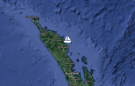
Westward II

Sat Feb 4 18:41 2017 NZDT
Speed:
5
knts
GPS: 35 28.107s 174 32.502e
Run: 180.6nm (326.9km)

Calm conditions for WW2 last leg to Auckland. Motoring along, hoping for some wind tomorrow.


Thu Feb 2 18:20 2017 NZDT
No position sent.

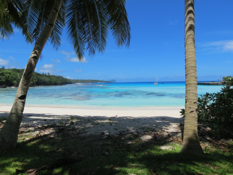
Westward is cleared by customs and officially in New Zealand! After 17 days at sea, our priorities are a shower, a beer and a meal - thankfully the local yacht club all three.


Wed Feb 1 6:11 2017 NZDT
GPS: 34 00.94S 171 53.91E
Run: 94.7nm (171.4km)
Avg: 4knts
24hr: 95.7nm

COG 110

SOG 4.

NO WIND. MOTORING.

NOT STOPPING AT 3KINGS.

MOTORING TO OPUA


Tue Jan 31 6:25 2017 NZDT
GPS: 33 19.7S 170 28.4E
Run: 92.8nm (168km)
Avg: 3.9knts
24hr: 94.2nm

COG 116T 4.5 KTS MOTOR VAR WIND 5 EAST


Mon Jan 30 6:47 2017 NZDT
GPS: 33 57.0S 169 02.59E
Run: 109.2nm (197.7km)
Avg: 3.2knts
24hr: 77.4nm

COG75


SOG3.5


TACKING SLOWLY AGAINST WIND & CURRENT.


217 TO CAPE


Sat Jan 28 20:55 2017 NZDT
GPS: 33 16.0S 167 20.0E
Run: 63.8nm (115.5km)
Avg: 4.4knts
24hr: 105.2nm

WE 70M STH OF RHUMB LINE.

Light wind

Motor sailing


Sat Jan 28 6:22 2017 NZDT
GPS: 32 21.09S 167 11.29E
Run: 83.6nm (151.3km)
Avg: 3.7knts
24hr: 88.4nm

COG 160

SOG 5KT

SE 20

15-20 KT WIND

SAILING


Fri Jan 27 7:40 2017 NZDT
GPS: 31 37.49S 166 02.93E
Run: 110.9nm (200.7km)
Avg: 4.5knts
24hr: 108.4nm

COG 105

SOG 3.5

NIL WIND MOTORING.

CTR CURRENT 1KN.

390 TO GO TO WAIKUKU POINT.


Thu Jan 26 7:07 2017 NZDT
GPS: 30 54.93S 164 21.88E
Run: 113.6nm (205.6km)
Avg: 5.5knts
24hr: 132nm

COG 103

SOG 4.

NO WIND. MOTORING.

485 TO GO


Wed Jan 25 10:28 2017 NZDT
GPS: 30 08.47S 162 40.92E
Run: 21.9nm (39.6km)
Avg: 5.5knts
24hr: 132.6nm

COG 104

SOG 5

WINDS CALM. MOTORING.

580 TO GO.


Wed Jan 25 6:30 2017 NZDT
GPS: 30 00.43S 162 20.96E
Run: 149.4nm (270.4km)
Avg: 6.5knts
24hr: 155.6nm

COG 104

MOTORING 5KT WIND VARIABLE 5NE


Tue Jan 24 7:27 2017 NZDT
GPS: 28 54.33S 160 12.79E
Run: 67.7nm (122.5km)
Avg: 3.2knts
24hr: 76.5nm

COG 110

SOG 4.

WIND 5 NE.

CALM SEAS. MOTORING AGAINST STR CURRENT.

CREW GOOD


Mon Jan 23 10:12 2017 NZDT
GPS: 28 11.25S 159 27.21E
Run: 74.1nm (134.1km)
Avg: 3.1knts
24hr: 74.4nm

COG180

SOG 4.5

WIND STILL SW.

SEAS REDUCING AFTER HEAVY NIGHT.

790 TO GO


Sun Jan 22 10:17 2017 NZDT
GPS: 27 15.75S 158 50.51E
Run: 26.1nm (47.2km)
Avg: 8.2knts
24hr: 196.6nm

COG90


SOG 4.5


CLOSEHAULED 2OKN HEADWIND HEAVY SEAS.


CREW GOOD.


845 TO GO


Sun Jan 22 7:06 2017 NZDT
GPS: 27 08.85S 158 26.26E
Run: 107nm (193.7km)
Avg: 4.6knts
24hr: 109.3nm

COG90

SOG4

CLOSEHAULED 2OKN HEADWIND HEAVY SEAS.

CREW GOOD.

865TOGO


Sat Jan 21 7:36 2017 NZDT
GPS: 26 27.27S 156 53.24E
Run: 119.9nm (217km)
Avg: 7knts
24hr: 167.5nm

SOG 6

COG 90

Wind 20Kn NW since 2300

All good only 960 togo


Fri Jan 20 14:26 2017 NZDT
GPS: 25 45.19S 155 07.21E
Run: 106.8nm (193.3km)
Avg: 4.2knts
24hr: 100.1nm

Report form 07.30 today

COG 110

SOG 4

No wind been motoring since 04.30 this morning only 1060 Nm togo all well and having fun


Thu Jan 19 12:50 2017 NZDT
GPS: 24 42.17S 153 51.97E
Run: 122.2nm (221.2km)
Avg: 4.8knts
24hr: 115.5nm

COG 100

SOG 5 Kn

1155 Nm to go

Alls well having a good sail


Wed Jan 18 11:26 2017 NZDT
GPS: 24 06.43S 152 02.32E
Run: 53.6nm (97km)
Avg: 2.8knts
24hr: 67.2nm

COG 105


4 SOG


Started motor as wind has dropped seas are clam.


Crossing Hervey Bay


Crew all good and enjoying them selves


Tue Jan 17 16:18 2017 NZDT
GPS: 23 49.87462S 151 14.71123E
Run: 227.7nm (412.1km)

Departing Gladstone next stop Auckland NZ


Thu Dec 15 16:06 2016 NZDT
GPS: 21 06s 149 15e
Run: 202.1nm (365.8km)

Departed Mackay today. I sheltered there for 5 days to avoid a series of storms. Next destination is Rockhampton, where I hope to arrive on Monday.


Tue Dec 6 14:38 2016 NZDT
Speed:
4.6
knts
GPS: 19 13s 146 52e
Run: 86.2nm (156km)

Departed Townsville at 1030 with new gearbox installed. Stiff on shore breezes promise good sailing once I get out of the bay. I intend to day sail down the Queensland coast, next main stop is Rockhampton.

-jase


Wed Nov 23 0:00 2016 NZDT
GPS: 18 02S 147 17E
Run: 123.6nm (223.7km)
Avg: 4.7knts
24hr: 113.4nm

Heading to Townsville gearbox making a knocking sound


Mon Nov 21 21:50 2016 NZDT
Speed:
4.5
knts
GPS: 16 50.0s 145 53.67e
Run: 9.4nm (17km)

Departed cairns this afternoon. Strong SE winds means we'll head E out through the Barrier reef before turning south and coming down past the Whitsundays in a couple of days


Tue Nov 15 18:09 2016 NZDT
GPS: 16 55.05802S 145 46.95659E
Run: 79.2nm (143.4km)
Avg: 2.5knts
24hr: 60.6nm

In Marlin marina for a couple of days


Mon Nov 14 10:47 2016 NZDT
GPS: 15 54S 146 20E
Run: 140.1nm (253.6km)
Avg: 7.4knts
24hr: 177.9nm

Underway to Cairns. 2130 UTC 11/13 (Monday 11/14 local)


15-54 S / 146-20 E, motoring 205 T @ 5.0 knots. Westerly wind. 60 nm to Cairns. All was well aboard. Is trying to get information from Customs on an acceptable quarantine anchorage.


Sun Nov 13 15:53 2016 NZDT
GPS: 14 20S 147 40E
Run: 332nm (600.9km)
Avg: 4.7knts
24hr: 113.7nm

Underway to Cairns. 2130 UTC 11/12 (Sunday 11/13 local)


Motoring 210 T @ 6.0 knots. No Wind. 180 nm to Cairns. All was well aboard.


Thu Nov 10 17:47 2016 NZDT
Speed:
5
knts
GPS: 10 23s 150 28e
Run: 70.7nm (128km)

We are departing Alotau today, with a new alternator and a bunch of repairs and refinements done. Light and variable winds in the Coral Sea and Pacific means our next port of call will be Cairns in Queensland. We'll be dating Steve via HF radio contacts with our sailing friends SV Carina, who are in Micronesia, on our progress.


Wed Oct 26 13:58 2016 NZDT
Speed:
6.5
knts
GPS: 10 03s 151 27e
Run: 99.9nm (180.8km)
Avg: 3.7knts
24hr: 89.2nm

Wind SE 15

Day sailing to Alotau


Tue Oct 25 11:05 2016 NZDT
GPS: 08 57.93S 152 25.18E
Run: 21.2nm (38.4km)

Anchored Nice spot. Village for trading. School. Getting stocked up by trading and visiting school with donations today. Planning on leaving tomorrow headed to Alotau.


Mon Oct 24 13:34 2016 NZDT
Speed:
6
knts
GPS: 08 43s 152 36e
Run: 182.9nm (331km)
Avg: 3.7knts
24hr: 87.7nm

20nm to Woodlark island

Had some fuel issues over night


Sat Oct 22 11:32 2016 NZDT
Speed:
3
knts
GPS: 06 07s 153 06e
Run: 91.7nm (166km)
Avg: 4.6knts
24hr: 110.8nm

Winds unreliable


Fri Oct 21 15:39 2016 NZDT
Speed:
5.5
knts
GPS: 04 54s 152 34e
Run: 63.8nm (115.5km)

Sailing in 10 to 15 from the south 100% cloud cover


257 to Woodlark island


All well on board


Mon Oct 17 18:10 2016 NZDT
Speed:
6
knts
GPS: 04 02s 152 15e
Run: 170.3nm (308.2km)

Wind 10 to 15 clear sky's

15 nm to Rabaul


Mon Oct 10 12:00 2016 NZDT
Speed:
5
knts
GPS: 02 25.3s 150 23.0e
Run: 52nm (94.1km)

30 NM to Kavieng

Motoring into Isabel passage


Sun Oct 9 9:00 2016 NZDT
Speed:
4
knts
GPS: 02 21.3s 149 38.0e
Run: 109nm (197.3km)
Avg: 6.4knts
24hr: 152.5nm

Wind SE10

Clear sky's

80 NM togo


Sat Oct 8 15:51 2016 NZDT
Speed:
4.5
knts
GPS: 00 47.1s 149 29e
Run: 108.8nm (196.9km)
Avg: 4.6knts
24hr: 111.2nm

Wind SE 15 -20 knots

Kavieng 120 nm rhumba line distance motoring into a 2 knot current

All well on board caught 15lb albacore tuna delicious


Fri Oct 7 16:22 2016 NZDT
Speed:
5
knts
GPS: 00 41.0n 148 55e
Run: 138nm (249.8km)
Avg: 5.7knts
24hr: 137.9nm

Motoring no wind

220 NM to Kavieng


Thu Oct 6 16:21 2016 NZDT
Speed:
6
knts
GPS: 02 21n 147 49e
Run: 158.1nm (286.2km)
Avg: 5.9knts
24hr: 142nm

motoring, no wind, calm seas,

50% cloud cover, 345 nm to go.  Still hoping to arrive Kavieng by Sat PM.


Wed Oct 5 13:38 2016 NZDT
Speed:
6.3
knts
GPS: 03 52.0n 146 06.1e
Run: 168.7nm (305.3km)
Avg: 6.9knts
24hr: 165.6nm

Motoring no wind

470 to Kavieng

All well on board


Tue Oct 4 13:10 2016 NZDT
GPS: 05 00N 143 56.0E
Run: 138.6nm (250.9km)
Avg: 6.4knts
24hr: 153.1nm

Good copy on 10 mhz again today. 115T spd 5.5kts, wind NW 6kts, light wind and storms, 600 nm to go. Hoping to arrive Kavieng by Sat PM. All is well aboard.


Mon Oct 3 15:27 2016 NZDT
Speed:
5
knts
GPS: 05 36.9n 142 01.0e
Run: 116.4nm (210.7km)
Avg: 3.9knts
24hr: 93.8nm

Motoring in the rain 700 NM to go


Sun Oct 2 9:40 2016 NZDT
Speed:
5.5
knts
GPS: 06 14.35n 140 26.64e
Run: 206.1nm (373km)
Avg: 11.7knts
24hr: 280.4nm

Sailing in very squalls conditions

All OK


Sat Oct 1 16:01 2016 NZDT
GPS: 06 27.0N 137 27.1E
Run: 90.8nm (164.3km)
Avg: 3.7knts
24hr: 89.3nm

Sailing @100T 7knots All Ok


Fri Sep 30 15:37 2016 NZDT
GPS: 06 57.1N 136 13.7E
Run: 124.6nm (225.5km)

Motor sailing at 5'5 to 6 knots all well on board


Fri Sep 23 16:59 2016 NZST
GPS: 7 20.28407N 134 27.17510E

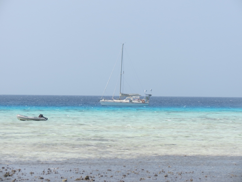
Still moored off Sam's in Koro Palau


Sams Yacht club
Koro
Wed Aug 31 14:38 2016 NZST
GPS: 7 20.28407N 134 27.17510E
Run: 93nm (168.3km)

Anchored at Sam's for a couple of days


Mon Aug 29 12:02 2016 NZST
GPS: 06 43N 133 15E
Run: 99.8nm (180.6km)
Avg: 2.8knts
24hr: 66.5nm

Sailing along at 3.6 Knots and should arrive Palau tomorrow morning


Sun Aug 28 0:00 2016 NZST
GPS: 06 37N 131 48E
Run: 76.4nm (138.3km)
Avg: 3.2knts
24hr: 76.4nm

COG 085 at 3.5 Kn

All is well onboard


Sat Aug 27 0:00 2016 NZST
GPS: 5 51.38847N 130 59.59511E
Run: 124.4nm (225.2km)

Wed Aug 24 0:00 2016 NZST
GPS: 5 36.95915N 129 12.06642E
Run: 217.1nm (393km)

Motor sailing


Wed Aug 3 0:00 2016 NZST
GPS: 6 3.51743N 126 4.47315E
Run: 82.6nm (149.5km)

Leaving Davao gulf


Thu Jul 28 0:00 2016 NZST
GPS: 7 11.88384N 125 42.66917E
Run: 0.1nm (0.2km)

Leaving Oceanview


Oceanview
Mon Dec 22 11:08 2014 NZDT
GPS: 07 11.842N 125 42.651E

Visiting NZ for Christmas


Tue Jul 22 15:53 2014 NZST
GPS: 07 11.842N 125 42.651E
Run: 62.9nm (113.8km)

At Oceanview Marina


Oceanview Marina - Samal Island
Thu Jul 17 0:00 2014 NZST
GPS: 06 23.419N 126 07.999E
Run: 29.3nm (53km)

Rollie anchorage


Wed Jul 16 0:00 2014 NZST
GPS: 06 47.428N 126 16.376E
Run: 24.1nm (43.6km)

Anchored at Pujada Island


Tue Jul 15 0:00 2014 NZST
GPS: 07 04.762N 126 28.177E
Run: 16.5nm (29.9km)

Anchored at Yaco Point


Local fishermen
Mon Jul 14 0:00 2014 NZST
GPS: 07 17.382N 126 34.991E
Run: 102.4nm (185.3km)
Avg: 4.3knts
24hr: 102.4nm

at anchor caraga bay, mindanao


Sun Jul 13 0:00 2014 NZST
GPS: 07 40.434N 128 01.617E
Run: 134.3nm (243.1km)
Avg: 5.6knts
24hr: 134.3nm

underway palau to davao, midnight position


Sat Jul 12 0:00 2014 NZST
GPS: 07 46.825N 129 59.100E
Run: 141.6nm (256.3km)
Avg: 5.9knts
24hr: 141.6nm

underway palau to davao, midnight position


We are 180Nm from land and this guy comes passed for smokes
Fri Jul 11 0:00 2014 NZST
GPS: 08 02.508N 132 02.186E
Run: 126.2nm (228.4km)
Avg: 5.3knts
24hr: 126.2nm

underway palau to davao, midnight position


Thu Jul 10 0:00 2014 NZST
GPS: 07 46.201N 133 51.595E
Run: 50.3nm (91km)

underway Palau to Davao, calm seas, no wind. midnight


3 day of this No wind or waves
Wed Jul 9 0:00 2014 NZST
GPS: 07 20.372N 134 27.147E
Run: 178.2nm (322.5km)

Koror, Palau


Sun May 4 0:00 2014 NZST
GPS: 07 39.9N 137 01.9E
Run: 127.9nm (231.5km)
Avg: 5.3knts
24hr: 127.9nm

underway sorol to palau


Sat May 3 0:00 2014 NZST
GPS: 07 53.0N 138 53.2E
Run: 104.8nm (189.7km)

underway sorol to palau


Wed Apr 23 0:00 2014 NZST
GPS: 08 07.5N 140 23.9E
Run: 49.5nm (89.6km)

Anchored at Sorol Atoll in Yap State, FSM, an uninhabited atoll


Tue Apr 22 0:00 2014 NZST
GPS: 07 58.2N 141 06.3E
Run: 131.1nm (237.3km)
Avg: 5.5knts
24hr: 131.1nm

underway from woleai to sorol atoll


Mon Apr 21 0:00 2014 NZST
GPS: 07 37.6N 142 59.3E
Run: 232.2nm (420.3km)

underway from woleai to sorol atoll


Mon Mar 31 0:00 2014 NZDT

Anchored in Woleai Atoll in Chuuk State, FSM


Sun Mar 30 0:00 2014 NZDT

Underway to Woleai Atoll in Chuuk State, FSM,


Wed Mar 26 0:00 2014 NZDT
GPS: 07 27.4N 146 22.4E
Run: 79.8nm (144.4km)
Avg: 3.3knts
24hr: 79.8nm

Anchored in Lamotrek Atoll in Yap State, FSM,


Tue Mar 25 0:00 2014 NZDT
GPS: 07 24.0N 147 32.2E
Run: 113.1nm (204.7km)

Underway to Lamotrek Atoll in Yap State, FSM,


Sun Mar 23 0:00 2014 NZDT
GPS: 07 21.2N 149 11.2E
Run: 179.7nm (325.3km)

Anchored in Palawan Atoll in Chuuk State, FSM,


Thu Mar 20 0:00 2014 NZDT
GPS: 06 18.8N 151 35.2E
Run: 93.4nm (169.1km)
Avg: 3.9knts
24hr: 93.4nm

underway from Mortlock to Palawan in Chuuk, FSM, wind has dropped away but backed a little, so now on broad reach, slow progress


Wed Mar 19 0:00 2014 NZDT
GPS: 05 47.4N 152 50.4E
Run: 53.1nm (96.1km)

underway from Mortlock to Palawan in Chuuk, FSM, have 15knots wing on wing downwind sailing, all well


Tue Mar 18 0:00 2014 NZDT
GPS: 05 29.405N 153 33.085E
Run: 16.4nm (29.7km)

Still in the Mortlock Islands, now at Mor Island, absolutely beautiful!


Mon Mar 17 0:00 2014 NZDT
GPS: 05 20.004N 153 43.878E
Run: 13.1nm (23.7km)

Still in the Mortlock Islands, now at Satawan/Namoi Island. Nice calm anchorage and friendly village ashore


Tue Mar 11 0:00 2014 NZDT
GPS: 05 30.237N 153 48.807E
Run: 71.5nm (129.4km)
Avg: 3knts
24hr: 71.5nm

Lukunor Atoll Mortlock Is FSM


Mon Mar 10 0:00 2014 NZDT
GPS: 05 44.650N 154 49.480E
Run: 143.2nm (259.2km)
Avg: 6knts
24hr: 143.2nm

Underay to Lukunor Atoll Mortlock Is FSM


Sun Mar 9 0:00 2014 NZDT
GPS: 06 24.287N 156 48.007E
Run: 86.4nm (156.4km)
Avg: 3.6knts
24hr: 86.4nm

Underway to Lukunor Atoll Mortlock Is FSM


Sat Mar 8 0:00 2014 NZDT
GPS: 06 45.715N 158 00.324E
Run: 5.2nm (9.4km)

Ant Atoll, eastern end


Fri Feb 21 0:00 2014 NZDT
GPS: 06 43.750N 157 56.215E
Run: 5.2nm (9.4km)

Ant Atoll, western end


Tue Feb 18 0:00 2014 NZDT
GPS: 06 45.715N 158 00.324E
Run: 20.2nm (36.6km)

Ant Atoll, eastern end


Thu Jan 30 0:00 2014 NZDT
GPS: 06 58.700N 158 12.189E
Run: 350.1nm (633.7km)

Pohnpei harbour


Mon Jan 13 0:00 2014 NZDT
GPS: 05 19.822N 163 01.270E
Run: 89.1nm (161.3km)
Avg: 3.7knts
24hr: 89.1nm

In Pt Lelu, Kosrae, FSM. Arrived early afternoon, have cleared in, and about to start exploring.


Sun Jan 12 0:00 2014 NZDT
GPS: 05 32.000N 164 18.000E
Run: 129.5nm (234.4km)
Avg: 5.4knts
24hr: 129.5nm

4th night out, looks like we will arrive tomorrow


Sat Jan 11 0:00 2014 NZDT
GPS: 06 05.000N 166 06.000E
Run: 243.1nm (440km)
Avg: 10.1knts
24hr: 243.1nm

Sailing 5-6 knots, following seas, all good


Fri Jan 10 0:00 2014 NZDT
GPS: 06 51.060N 169 33.290E
Run: 91.9nm (166.3km)
Avg: 3.8knts
24hr: 91.9nm

Confused seas, averaged 5-6 knots, all is well


Thu Jan 9 0:00 2014 NZDT
GPS: 07 12.000N 170 50.900E
Run: 29.9nm (54.1km)

Underway, downwind, wing on wing, all is well


Thu Jan 9 0:00 2014 NZDT
GPS: 07 08.871N 171 16.893E
Run: 6.9nm (12.5km)

have cleared out of Majuro, leaving for kosrae, have a nice sunny day, trade winds are here, so so far so good


Fri Oct 25 0:00 2013 NZDT
GPS: 07 06.213N 171 22.350E

back in Majuro


Fri Oct 25 0:00 2013 NZDT
GPS: 07 06.213N 171 22.350E
Run: 138.7nm (251km)

back in Majuro


Tue Oct 22 0:00 2013 NZDT
GPS: 08 34.413N 169 59.597E
Run: 114nm (206.3km)

midnight, underway to majuro, slow trip as engine out


Tue Oct 15 0:00 2013 NZDT
GPS: 10 13.399N 169 58.610E
Run: 15.4nm (27.9km)

Ailuk Island, Ailuk Atoll


Sun Oct 13 0:00 2013 NZDT
GPS: 10 26.729N 169 57.257E
Run: 3.7nm (6.7km)

Enejelar Island, Ailuk Atoll


Thu Oct 10 0:00 2013 NZDT
GPS: 10 23.549n 169 57.862e
Run: 2.2nm (4km)

eneneman island in ailuk atoll


Mon Oct 7 0:00 2013 NZDT
GPS: 10 21.656n 169 58.079e
Run: 9.5nm (17.2km)

aliet island, ailuk atoll


Tue Oct 1 0:00 2013 NZDT
GPS: 10 13.442n 169 58.607e
Run: 27.4nm (49.6km)

ailuk island in ailuk atoll, nice calm anchorage, beautiful island


Mon Sep 30 0:00 2013 NZDT
GPS: 09 51.267n 169 49.788e
Run: 23.2nm (42km)

underway to ailuk atoll, no wind and clear skies, motor sailing


Sun Sep 29 0:00 2013 NZST
GPS: 09 31.276n 169 52.592e
Run: 6.3nm (11.4km)

goat island in wotje atoll


Sat Sep 28 0:00 2013 NZST
GPS: 09 30.710n 169 58.084e
Run: 18.3nm (33.1km)

kinaja island, wotje atoll


Tue Sep 24 0:00 2013 NZST
GPS: 09 27.311n 170 13.857e
Run: 16.4nm (29.7km)

wotje island in wotje atoll


Mon Sep 23 0:00 2013 NZST
GPS: 09 14.166n 170 19.431e
Run: 56.7nm (102.6km)

underway to wotje, midnight, trying to sail in light winds


Sun Sep 22 0:00 2013 NZST
GPS: 08 51.486n 171 03.685e
Run: 10nm (18.1km)

tjan island, maloelap atoll


Sun Sep 22 0:00 2013 NZST
GPS: 08 45.854n 171 10.420e
Run: 2.2nm (4km)

ollot island, maloelap atoll


Sat Sep 21 0:00 2013 NZST
GPS: 08 44.354n 171 11.618e
Run: 12nm (21.7km)

pigeeyatto island, maloelap atoll


Fri Sep 20 0:00 2013 NZST
GPS: 08 34.052n 171 10.277e
Run: 5.1nm (9.2km)

kemar or kumaru island, maloelap atoll


Thu Sep 19 0:00 2013 NZST
GPS: 08 29.690n 171 11.066e
Run: 13.5nm (24.4km)

airik island, malaelap atoll


Tue Sep 17 0:00 2013 NZST
GPS: 08 21.344n 171 02.693e
Run: 16.2nm (29.3km)

bigen island in aur atoll


Sat Sep 14 0:00 2013 NZST
GPS: 08 09.216n 171 09.833e
Run: 10.9nm (19.7km)

aur island in aur atoll


Wed Sep 11 0:00 2013 NZST
GPS: 08 18.671n 171 09.027e
Run: 12.9nm (23.3km)

tabal island in aur atoll


Sun Sep 8 0:00 2013 NZST
GPS: 08 29.701n 171 11.034e
Run: 14.6nm (26.4km)

airik island in maloelap atoll


Thu Sep 5 0:00 2013 NZST
GPS: 08 42.201n 171 13.248e
Run: 37.7nm (68.2km)

taroa island in maloelap atoll


Wed Sep 4 0:00 2013 NZST
GPS: 08 13.049n 170 58.208e
Run: 78.8nm (142.6km)
Avg: 3.3knts
24hr: 78.8nm

underway to maloelap atoll, is midnight and are motor sailing in glassy seas


Tue Sep 3 0:00 2013 NZST
GPS: 07 07.713n 171 18.554e
Run: 4.1nm (7.4km)

enemanet in majuro lagoon


Mon Sep 2 0:00 2013 NZST
GPS: 07 04.251n 171 17.904e
Run: 5.5nm (10km)

wallaby downs, only good for calm seas and wind!


Thu Aug 15 0:00 2013 NZST
GPS: 07 06.427n 171 22.161e
Run: 49.5nm (89.6km)

majuro, north mooring field


Wed Aug 14 0:00 2013 NZST
GPS: 07 36.449n 170 51.221e
Run: 124.2nm (224.8km)
Avg: 5.2knts
24hr: 124.2nm

underway to majuro, sailing in 10-15 knots, great sail


Tue Aug 13 0:00 2013 NZST
GPS: 09 06.111n 169 50.668e
Run: 62.2nm (112.6km)

underway to majuro, sailing in 15 knots, great sail


Sat Aug 10 0:00 2013 NZST
GPS: 09 49.598n 169 18.250e
Run: 9.9nm (17.9km)

likiep island, likiep atoll


Wed Aug 7 0:00 2013 NZST
GPS: 09 55.526n 169 11.880e
Run: 10nm (18.1km)

enej island, likiep atoll


Wed Jul 31 0:00 2013 NZST
GPS: 09 49.566n 169 18.229e
Run: 46.2nm (83.6km)

anchored off likiep island in likiep atoll, beautiful calm anchorage off village


Tue Jul 30 0:00 2013 NZST
GPS: 10 14.391n 168 46.194e
Run: 65nm (117.7km)
Avg: 2.7knts
24hr: 65nm

underway from rongerik to likiep, still no wind, slow going


Mon Jul 29 0:00 2013 NZST
GPS: 10 40.846n 167 55.529e
Run: 54.1nm (97.9km)

underway from rongerik to likiep, no wind, slow going


Fri Jul 26 0:00 2013 NZST
GPS: 11 20.376n 167 29.672e
Run: 2.8nm (5.1km)

low sand island in rongerik lagoon, not much protection, okay for day anchorage


Fri Jul 26 0:00 2013 NZST
GPS: 11 18.196n 167 28.635e
Run: 5.5nm (10km)

eniwetak island in rongerik atoll, great beach-combing


Wed Jul 24 0:00 2013 NZST
GPS: 11 22.608n 167 30.574e
Run: 34nm (61.5km)

rongerik island in rongerik atoll, we are the only people in the whole atoll


Sun Jul 21 0:00 2013 NZST
GPS: 11 22.969n 167 00.486e
Run: 10.2nm (18.5km)

labavedj island in rongelap atoll


Sat Jul 20 0:00 2013 NZST
GPS: 11 17.609n 166 53.307e
Run: 8.8nm (15.9km)

eniaetok island in rongelap atoll


Fri Jul 19 0:00 2013 NZST
GPS: 11 09.938n 166 53.472e
Run: 28.3nm (51.2km)

rongelap island in rongelap atoll, only boat here, nice and calm anchorage


Thu Jul 18 0:00 2013 NZST
GPS: 11 06.102n 166 28.696e
Run: 68.7nm (124.3km)

underway to rongelap atoll, is midnight and starting to loose protection of ailinginae


Mon Jul 8 0:00 2013 NZST
GPS: 11 31.583n 165 33.706e
Run: 6.8nm (12.3km)

enyu island, bikini atoll, waiting for weather window to head to rongelap


Sun Jul 7 0:00 2013 NZST
GPS: 11 37.393n 165 32.548e
Run: 6.9nm (12.5km)

bikini island, bikini atoll


Sat Jul 6 0:00 2013 NZST
GPS: 11 31.514n 165 33.709e
Run: 14.7nm (26.6km)

enyu island, bikini atoll


Fri Jul 5 0:00 2013 NZST
GPS: 11 41.376n 165 25.493e
Run: 9.3nm (16.8km)

lomlik or romurikku island? big bunker ashore from atomic testing days in bikini atoll


Sun Jun 30 0:00 2013 NZST
GPS: 11 37.342n 165 32.605e
Run: 6.8nm (12.3km)

anchored off bikini island in bikini atoll, ready for diving


Sat Jun 29 0:00 2013 NZST
GPS: 11 31.495n 165 33.579e
Run: 30.3nm (54.8km)

enyu island, bikini atoll, beautiful anchorage, nice to be in calm seas


Sat Jun 29 0:00 2013 NZST
GPS: 11 05.375n 165 36.510e
Run: 30.6nm (55.4km)

underway to bikini atoll, huge storm, big seas, winds 30-40 knots, not nice


Fri Jun 28 0:00 2013 NZST
GPS: 10 40.563n 165 46.170e
Run: 36.6nm (66.2km)

underway to bikini atoll, light winds


Fri Jun 28 0:00 2013 NZST
GPS: 10 10.260n 165 55.939e
Run: 5.3nm (9.6km)

medyeron is, wotho atoll, day anchorage to look at island


Wed Jun 26 0:00 2013 NZST
GPS: 10 09.632n 166 00.579e
Run: 37.3nm (67.5km)

wotho atoll, beautiful lagoon with water blue and green contrasts amazing, it is how you imagine a atoll lagoon to be like


Tue Jun 25 0:00 2013 NZST
GPS: 09 48.907n 166 25.812e
Run: 76.7nm (138.8km)

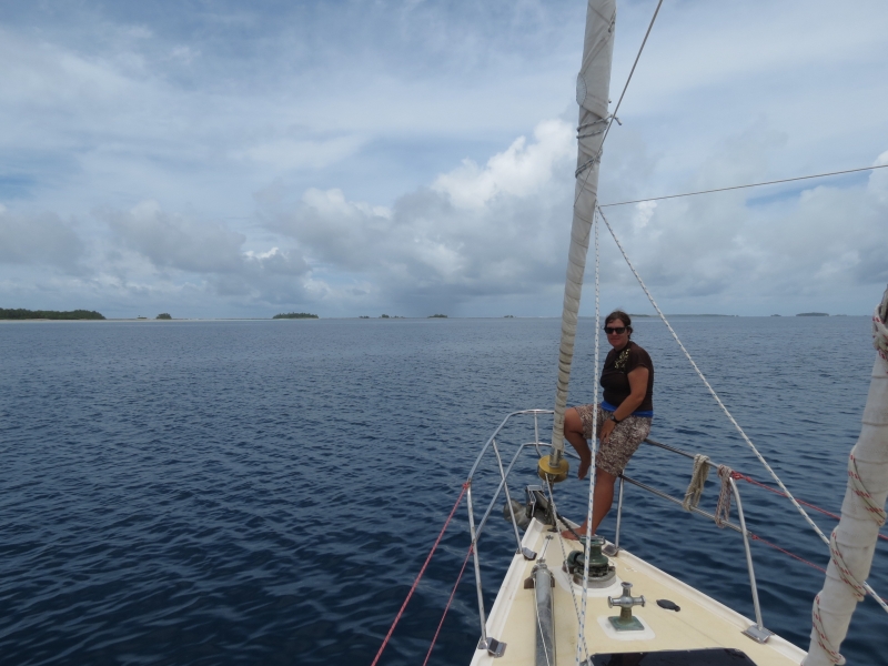
underway to wotho atoll, beam reach, great sail


Sat Jun 22 0:00 2013 NZST
GPS: 09 23.619n 167 28.273e
Run: 4.8nm (8.7km)

roi-namur, kwajalein atoll,


Sun Jun 16 0:00 2013 NZST
GPS: 09 19.995n 167 30.414e
Run: 34.7nm (62.8km)

edgigen island (sixth island), kwajalein atoll


Sat Jun 1 0:00 2013 NZST
GPS: 08 54.174n 167 46.100e
Run: 9nm (16.3km)

bigej island


Fri May 31 16:13 2013 NZST
GPS: 08 46.584n 167 44.135e
Run: 5.2nm (9.4km)

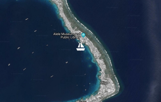
we are anchored at ebeye island, kwajalein atoll - in the marshall islands.


Fri May 24 0:00 2013 NZST
GPS: 08 51.090n 167 44.226e
Run: 54nm (97.7km)

squally with rain


Thu May 23 0:00 2013 NZST
GPS: 08 16.602n 168 16.339e
Run: 62.5nm (113.1km)

comfortable conditions


Thu May 23 0:00 2013 NZST
GPS: 07 34.728n 168 51.204e
Run: 11.6nm (21km)

near ailinglaplap, changed course ebeye


Wed May 22 0:00 2013 NZST
GPS: 07 37.961n 169 00.818e
Run: 63.8nm (115.5km)

mid-night squalls rain


Wed May 22 0:00 2013 NZST
GPS: 07 27.670n 169 55.759e
Run: 60.3nm (109.1km)
Avg: 2.5knts
24hr: 60.3nm

midday


Tue May 21 0:00 2013 NZST
GPS: 07 18.581n 170 47.707e
Run: 31.4nm (56.8km)

bobbing along


Tue May 21 0:00 2013 NZST
GPS: 07 08.682n 171 13.289e
Run: 10.8nm (19.5km)

underway to namu


Mon May 20 0:00 2013 NZST
GPS: 07 06.171n 171 22.364e
Run: 4.7nm (8.5km)

majuro


Sun Apr 21 0:00 2013 NZST
GPS: 07 07.713n 171 18.554e
Run: 8.7nm (15.7km)

on mooring at enemanet island, majuro lagoon


Sun Apr 21 0:00 2013 NZST
GPS: 07 08.926n 171 11.078e
Run: 25.1nm (45.4km)

coming into the lagoon through majuro channel


Sat Apr 20 0:00 2013 NZST
GPS: 06 57.828n 171 29.935e
Run: 57nm (103.2km)

underway mili to majuro


Sat Apr 20 0:00 2013 NZST
GPS: 06 14.141n 171 53.349e
Run: 20.2nm (36.6km)

jobenor island


Mon Apr 15 0:00 2013 NZST
GPS: 06 02.033n 172 06.123e
Run: 4.3nm (7.8km)

enedoul is


Sun Apr 14 0:00 2013 NZST
GPS: 06 05.726n 172 06.227e
Run: 11.7nm (21.2km)

near wau island, old clam farm


Thu Apr 11 0:00 2013 NZST
GPS: 06 12.464n 171 58.592e
Run: 6.3nm (11.4km)

enejena island


Mon Apr 8 0:00 2013 NZST
GPS: 06 14.130n 171 53.348e
Run: 6.2nm (11.2km)

jobenor island, mili atol


Sat Apr 6 0:00 2013 NZDT
GPS: 06 13.136n 171 47.986e
Run: 1343.6nm (2431.9km)

tokowa island, mili atoll


Thu Nov 15 1:00 2012 NZDT
GPS: 12 29.243S 177 07.256E

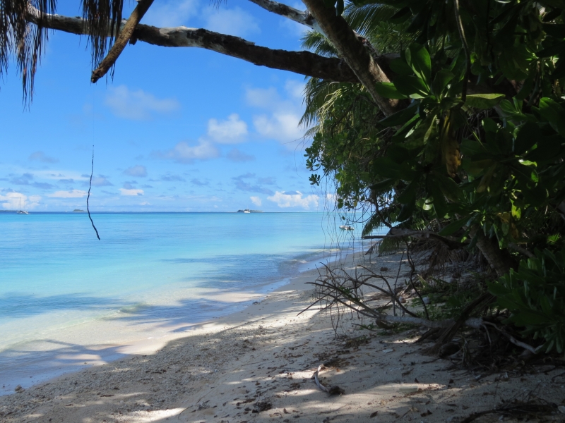
Rotuma Is Fiji 4mtr anchorage


No blogs available for this yacht.

Loading map and updates ....
Loading track, please wait ....