Legacy
Just returning to Nelson after ten wonderful, peaceful days at D'Urville Island.

We finally made it to Nelson after waiting and waiting for weather to get here. We had a nice, non-stop, 42 hour motor-boat ride go get here. Lyttelton and Christchurch were great and we were very sad to leave. That said, we do love Nelson too
We'll hang out here for a while before heading off to Australia in January or February.
Greetings from the Canary
We're back in Lyttelton and it's nice to be on Legacy again. We'll hang out here for a month or so, before moving north to Nelson. Hi Y'all.

Avg: 20.2knts
24hr: 485.1nm
We made the 2400 mile passage from Los Angeles to Kona, Hawaii in just over 5 hours. Eat your hearts out Transpac boats (who are now arriving in Ohau). I love airplanes!
Avg: 2.7knts
24hr: 64nm
Perhaps you've heard about the massive food shortages in Los Angeles? Yep, our bad! We've eaten everything.
It's been a productive visit but there's nothing like two weeks in LA to make every the worst passage look good by comparison.
We'll fly back to Hawaii in a few days. Happy sigh.
Avg: 4.2knts
24hr: 99.9nm
24 Hour Run: 4221nm Average Speed: 574 knots. Yep, that's right. No, not on Legacy, we flew - to Hawaii for a vacation from our cruising lives. It's been seven years and we felt like a rest. We'll stay here four months.
That was our easiest passage ever!

Avg: 5.7knts
24hr: 136.6nm
We're back in the wonderful Lyttelton (The Ana) Marina after a really nice, 32 hour motorboat ride. We'll hang out here for bit while we try to figure out the meaning of life. Yeah, I know. 42.
It's cold here in Whangarei..
Leaving today for Christchurch (Lyttelton) after another nice stay in Dunedin. We visited Milford and Doubtful Sounds by tour boat during a four day road trip. That was wonderful and made us glad we didn't do it on Legacy. From Lyttelton, who knows?
Avg: 3.2knts
24hr: 75.8nm
Back in Otago Harbour, waiting for high tide to move to the Otago Yacht Club. We'll spend some time here and see some more of the South Island by car.
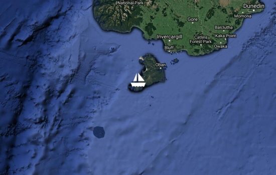
Maybe, after going to Stewart Island, we should call this "the middle island?"
We're anchored in Halfmoon Bay, right outside the town of Oban. We'll spend the night here and if the weather forecast doesn't change, leave for Dunedin tomorrow morning (24 hour run).
There's not much room to anchor here as most of the bay is taken up with moorings, but we found a nice corner here in 40 feet of water.
We're back at Whalers Base to sit out the bad weather that's due over the next couple of days. There's a monster low that Oz is sending us and forecasts call for gusts to 50.
We went on a walk last night to see Kiwis on the beach and we were successful. Mostly. We did get chased off the beach, but not until after we saw some kiwis. It seems that no one is allowed in the Kiwi protection area between 6pm and 6am without some kind of special permit. The guide who kindly escorted us off the beach and back to the jetty ended up giving us quite a tour on the way back. Some would say that the way to do this is to scope out the trail and beach before 6pm, and then go back after the tour boat leaves at 10:30pm.
We moved away from town to a better anchorage for the blow. It got bad where we were when the wind went further south than advertised. This is one of the most beautiful anchorages we've been in. Stunning! There are a lot of tiny Islands all around us. It's kind of a roaring forties Palau.
We made it to the big city! Well, I guess it has about the same population, not including tourists, as our dock back in Tauranga, but after a couple of weeks in the wilderness, it's a big city for us.
What did we do there? Got lunch of course, and shopped at the Four Square. It's a bit of a trek up and down a hill to get to Oban, especially carrying eight bottles of wine, but we needed the exercise.
Oban is a cute little town. We didn't get to explore much. We got a break in the rain and took off for home. Maybe tomorrow as it looks like rain and wind today.
By the way, there's plenty of room to anchor here. We were needlessly worried about that.
We took a tour in Legacy of Port Adventure yesterday and ended up in the Heron River for the night. Nice spot. We"re anchored in a small, deep hole (7 meters deep) and tied to a tree on shore. "Did you get more Paua?" you ask. Why, yes we did. This time, just wading ankle deep at the rocky end of a beach. "Haven't you had enough yet?" you ask. NO! For us, there's no such thing as enough, and there are plenty here.
Avg: 141.4knts
24hr: 3394nm
We moved to a nice anchorage in Port Adventure that's called Abraham's Bosom or Redsand Cove depending on where we look. There's a mooring buoy in the middle of the most ideal anchorage area but there's still room around the edges. A tale of two abalone: Yesterday morning at low tide, while we were still in Lords River, we took the dinghy to a kelp bed. I took off my jacket and shirt, put on my mask, and was able to get two abalone by just hanging my head and arms over the front of the dinghy (Cyndi sitting on my legs as a counter balance). What a dinner! This place is paradise!
Avg: 129.5knts
24hr: 3106.8nm
We were expecting some wind last night so we tucked into a spot the Mana Cruising Guide for Stewart Island calls "The Nook". We had some shallow water getting here but we anchored (and as usual, tied back to a line already here) in 17 feet of water (5 meters). It's another great spot. For future reference of those using YIT's incredible Destination Planner, I'll say that The Nook is a Stewart Island must-do.
The sun came out yesterday in it was warm! We sat around in tee-shirts and shorts... And bug spray, although they don't seem to like the sun. When it comes out, they disappear. It got to 77f in the cabin (25C). It was like being back in Fiji again! Well, I guess it wasn't quite that warm.
We might move on to Port Adventure today. The name certainly sounds intriguing.
We moved from Port Pegasus to Lords River, about 12 miles east. What can I say... another day, another beautiful bay. A beautiful bay with a bonus: as we were coming in, we slowed down to talk to three guys on a little tinny. They asked if we'd been getting any fresh fish. "No, we're not doing very good in the fishing department" I said. "How'd you like a feed? When you get settled, I'll bring you some fish. We've got tons!" And an hour later, he dropped off a bag of trumpeter and two abalone (don't know how to spell paua?) Wow, what a dinner. People are so nice here!!! I love you New Zealand!
Yesterday started with heavy cloud cover and some fog that turned into a glorious, sunny afternoon. We took the dinghy across this little bay (twice) to find Smuggler's Cove. Our first pass was unsuccessful. After reviewing satellite images, we went on another search. First, we found a great cave. I thought that was it. Cyndi said it didn't match the pictures she'd seen. Then, around the corner, we saw the opening. Wow, what an amazing little keyhole bay (well, pond, really). Inside a narrow opening, there's a sand beach, all flanked by 15 meter tall vertical rock walls and covered by trees growing over the top.
Back at our bay, there were two big pinnipeds relaxing on the beach. (I say pinnipeds because our id skills are somewhat lacking. We think they were NZ sea lions. Once we have internet again, we can use the thousands of pictures we've taken of them to make a more exact id.) Another dropped by to swim around our boat for a few minutes. The background music was a beautiful chorus of bird song. Yep. Doesn't suck to be us right now!
Another day, another beautiful bay, what we saw of it, that is. We mostly had an indoor, rain day in pretty constant drizzle. Our heater is getting a pretty good workout here, but it's keeping us toasty and warm.
Note on the bay: there's room to swing here. There is a buoy that can be used to pull your boat closer to shore, but with the way the sandflies have been the last couple of days, we decided not to use it. We're anchored in about 4 meters with what seems like good holding.
We're anchored off a tiny but beautiful white sand beach in about 4 meters of clear water. So far, of the five nights we've been here, all but one time we've had to stern-tie to a buoy, line or tree or stern anchor. The water is pretty deep and the bays we've been in are pretty small. Most of the time, there are lines with buoys on them that you can tie to. Here, we had to put out a stern anchor. Up until yesterday, we didn't think bugs were a problem. Yesterday, the sand flies appeared. We are each nursing a couple of itchy bites. This must be unusual here as someone even said something about it on Meri Leask's radio net (Bluff Fishermans Radio).
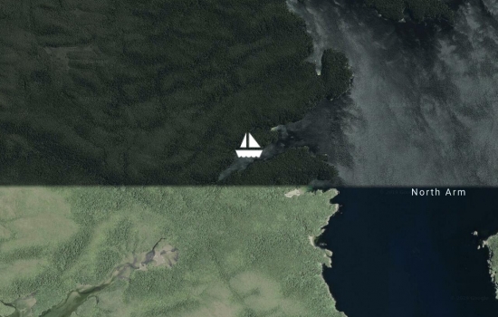
We're off to explore the north arm of Port Pegasus today. Happy travels, boat work and sailing everyone.
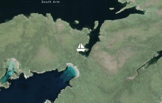
We're still way down in Port Pegasus, about thirty miles south of Oban. We saw one yacht leaving the area as we entered the other day. They'd been here for five weeks (Night Music). There are a couple of people in tinnies camping about two miles north of here. And of course, the one fishing boat that threw a crawfish into our cockpit. Literally. He told me to stand back and made a perfect toss. I tried to call Meri Leask from Bluff Fishermans Radio but couldn't get through. We really are totally isolated.
Yesterday, right after we anchored where we are now, we threw some less-than-fresh blue cod to what we think was a fur seal. She was skeptical at first, and kept her distance. Then she smelled it and came in to investigate and chow down. After that, she was our best friend. She put on the most amazing acrobatic swimming display right next to our boat. It went on for an hour or so. We giggled, oooh'd and aaah'd the whole time. We got some video that we'll post when we can.
This place where we're anchored/tied up now is really beautiful. Then again, all the places we've been here are really beautiful. We're using the Mana Cruising Guide for Stewart Island but it's not great. It seems there are a lot of places here the author hasn't visited. It does give us a starting point so we still view it as essential. The Navionics charts aren't great for this area either. According to them, we crossed over an island yesterday. It wasn't even bumpy. I'm glad I made satellite charts and it's so handy to be able to display them on our chartplotter (Navico brands).
Really impressive. I admire
Wow. I'm tempted to leave it at that, but... We're anchored/stern tied in Disappointment Cove and it's not at all. It's beautiful. We took an arduous hike over the hill to the furthest south white sand beach in NZ. Beautiful. There were NZ sea lions (we think that's what they were) on the beach and they didn't seem to care too much about us. The hike was mostly a game of "which way do you think the trail goes?" and we're sore today. Later in the evening, we had a sea lion playing under Legacy. It's cold here and I play "the air is acid" every morning, trying to keep all my skin under blankets to escape the "acid" cold. Cyndi ran up to turn on the heater this morning. Much appreciated. It does warm up during the day. We had an hour of sitting in the cockpit in tee-shirts yesterday afternoon.
Avg: 3.2knts
24hr: 76.6nm
We made it: Port Pegasus on Stewart Island!!! We had a really nice downwind passage (if you don't count the brutal beat to get out of Otago Harbour and the two hours we spent beating the final 5 miles into Port Pegasus when the wind turned noserly!). At times the wind got to 33 knots, but with it behind us, it was still very pleasant.
I've heard from life-long cruisers that this is one of the most beautiful places on earth. I guess that's not a first impression type thing. It's pretty but so are so many other places we've been. We'll see if this grows on us, and give it every opportunity to do so.
Congratulations on making it
After 28 days in Dunedin, we are finally on the move again. We left the marina on high tide and motored a little over half way out the 12 mile channel where we'll anchor for the night. Tomorrow, we're off to Stewart Island.
Cyndi said that she feels like a fan worm that attached itself to Dunedin and has now been set adrift. We really did get attached to the place. It's a wonderful place to stay for a while.
We're all tied up at the Otago Yacht Club and have had our first excursion into Dunedin. It looks like we'll be very comfortable here for the next week or two - until we get a weather window to sail to Stewart Island.
Oh well done guys, soooo cool
Avg: 5.9knts
24hr: 142nm
What a welcome we received on our entry into Dunedin Harbor (Otago Harbor). The crew of a dredge all gave us a great big wave while they honked their horn, albatross circled and seals swam by. The 12 mile ride up into the town basin was beautiful and at the dock, we were greeted by 10 local kids doing synchronized, wave-style back flips into the water. Barry, the manager from the Otago Yacht Club was here to show us our temporary spot for the night and help us tie up. We'll move into the club's basin tomorrow morning. We already love this place!
After a really nice stay at the beautiful new marina in Lytelton, we're off, bound for Dunedin.
After 300 miles and change and two days and change, we're in Lyttelton, near Christchurch, way down here in the roaring forties! It's a brand new marina that doesn't even show up on Google Maps yet. We'll hang out here for a while and from there, who knows what we'll do???
We made it to Napier and had a wonderful greeting at the Napier Sailing Club. It made up for the last 6 miles, beating into 27 to 30 knots. It's so nice to be in. We'll stay here for a week or so before heading to the South Island.
Hi guys
We made it to Gisborne on our half-hearted quest to circumnavigate the South Island. We might leave as early as tomorrow, bound for Napier.
Hi Guys, We're getting ready
Okay, my bad - I neglected to
Glad to finally see a post
Avg: 3.7knts
24hr: 88.2nm
We're in and tied up but I have to say, we're not happy to be back in New Zealand! We had the worst customs experience ever. This lady just seemed to have it in for us.
New Zealand, what's up? You seem determined to make it harder for cruisers to visit (and spend their money here) while Australia is opening the welcome wagon. I am regretting the decision to come back to NZ (a place we have always loved!).
And what a horrific passage. Yep, there were five nice days off motor sailing but the last three days were really terrible. As weather windows go, we choose poorly! (And to make all that effort to get here, only to be treated so incredibly bad by the customs official!)
There, there . . . . Take a
Hopefully things feeling
Avg: 4.8knts
24hr: 114.1nm
Sailing Sucks!!! I hate boats!!!
Hi Guys, welcome back? let us
Avg: 6.6knts
24hr: 157.9nm
It wasn?t my best Christmas ever. Maybe worse than the time I got a turtle-keck sweater from my parents instead of the erector set I wanted! It seems to be getting better now with the wind dropping and the seas confused but calming a bit. We have 137 miles to go to the Bay of Islands area.
Avg: 6.3knts
24hr: 151.4nm
Merry Christmas Everyone!!! Well, our days of pleasant motor sailing are over. We had about eight ours of pleasant sailing yesterday, then the front crossed us. Wind went form 20 knots from the north to a 20 knot southerly within about 5 mintues. This made for interesting seas! Flying along now in very uncomfortable seas, heading for North Cape to try to get in the liegh of some of the wind and seas. It?s 220 miles ahead still. We hope to make Opua the morning of the 27th. We?ll see if that happens.
Avg: 6.8knts
24hr: 162.4nm
Still motor sailing even though the wind is up a bit, but it?s right behind us. It?s clouded up and been raining quite a bit the last few hours. It?s a little rolly with the still small swell right behind us. We could probably gybe and sail but we have the fuel to motor sail and it?s nice to keep our speed up. We will be glad to have some quiet once we finally turn the engine off though.
Merry Christmas!
Avg: 24.9knts
24hr: 597.7nm
Another nice passage day motor sailing in light wind and calm seas. It?s getting a little rougher now as the north swell has built a bit. We?d probably be sailing if it wasn?t for the rolling around that dumps the air from the sails. I thought the sky was clouding up last night in advance of the front ahead but it?s cleared this morning. The full moon has been amazing ? as bright as I?ve ever seen it. We?re making great time. It looks like we might be in late on the 26th or early the 27th. Fingers crossed.
Avg: 21.6knts
24hr: 518.6nm
Still motor sailing in very nice conditions. Passed the Tropic of Capricorn so maybe it?ll be little cooler today (it was hot yesterday). We?re making very good time with almost a six knot average for the trip so far. Helped out by a nice current yesterday that turned a bit against us this morning. Oh well. We?re doing very well on fuel making over 11 nautical miles per gallon (sorry metric people!). We can?t motor all the way to Opua, but we won?t need to ? wind is coming, maybe tomorrow.
Avg: 6.7knts
24hr: 161nm
Still motor sailing in really pleasant conditions. The sky has cleared quite a bit, the sun is warm but not too hot (yet) and the seas pretty flat. Request: Lets just leave the conditions like this for the rest of the passage, but maybe with 15 knot winds so we can turn off the engine!
You were supposed to stock up
Avg: 5.6knts
24hr: 135.4nm
This was a really nice start to the passage. Last night we motor sailed in light winds and we?re still at it this morning. So far, we managed to miss the SPCZ that was descending down on Fiji, with only a few drops of rain and occasional lightning far off in the distance over Viti Levu.
Bula from Fiji, and "from" Fiji we shall try to go. We are leaving tonight around 5 PM local time, bound for Opua, New Zealand. Good bye Fiji. We love you!
Well, we're back in Pacific Harbour. Back and forth we go: Suva, Pacific Harbour and not New Zealand 'cause we just don't see weather we like for the passage. Someday, I guess we'll get there (or maybe Oz!).
We're still waiting for a weather window that will satisfy the reluctant sailors on Legacy. Maybe Friday or Saturday of this week will shape up into something good.
In the mean time, it's HOT here and only getting hotter tomorrow so we did something crazy. Instead of sitting for two hours inside an air conditioned movie theater (has we have the past two days), we moved about 5 miles to a bay just west of Suva.
It's really nice here. For those of you who know Fawn Harbor, it's a lot like that. We're anchored inside the reef, just a little ways from a small island (we didn't want to get too close to the island as it might have blocked our precious breeze.
Not only did we get a little breeze - 17 knots SE for a while - but we also had a wonderful thundershower with torrential but short-lived rain. We'll hang out here tomorrow or maybe a couple of days before we go back to Lami.
Lami Bay, Suva - again! We'll hang out here and get ready to head south when the weather cooperates. Same old story. You know the drill.
We're back in Malumu (at Beqa) for about the tenth time. This is a beautiful bay. We'll head to Suva soon and start thinking about a passage south.
Hi guys, we just saw you sail
We're back in at Yanuca and enjoying the first few days of sun in what seems like a long time. We're not complaining about the rain though - it's been keeping it nice and cool here.
We're looking for a weather window to get to NZ, but as usual, Legacy is tiger bait again. We feel like the last boat left in Fiji. I know that's not true, but we've been away from the "pack" this season - mostly off on our own. Now it seems like the "pack" is in NZ We'll get there eventually.
We're just hanging out in Pacific Harbor (again) while the wind blows (again). We'll go back to Beqa (again) and then back here (again) until it's time for the slow pokes of Legacy to head to NZ (again).
We did it! We just completed our circumnavigation! (Of Viti Levu!) We're anchored at Yanuca, which completed the 250 or so mile loop. I know: Small potatoes, but we had fun.
At Robinson Crusoe for the night on the way back to Beqa and Pacific Harbor.
We made it out of Denarau Marina. Not very far out of Denarau, but we cut the cord, and after only 8 days!
During that time, we replaced our cap and intermediate shrouds and cleaned and waxed the hull. Not bad I think.
It was hard to make the break. Marina life is so easy, even with all the boat work. We especially like Denarau with all the great places to eat.
We're going to cruise around the west side for a few days and then head back to Beqa.
Boat work and restaurants in Denarau, oh boy! We'll be here for about a week.
Volivoli is a lovely, cruiser-friendly resort with great food and really nice people. We're going to hang out here and go diving with them later in the week.
We've been covering some ground the last few days on our way, eventually, to the west side. We are really having a great season.
We went to Lami and only stayed a few days. We were uncertain about the mooring buoy we were on and with the very heavy rain, the water turned to mud so that we couldn't make water. We decided to move back to Pacific Harbor. Here, we're tied up in a berth with a hose right at our bow. Fresh water and security, what more could we want? OK, the great restaurants nearby are a nice bonus!
Hi Legacy crew from an absent
We're back at Lawaki Resort's mooring for our last night at Beqa. Tomorrow we're heading back to Suva, then up the east side and over the top of Viti Levu.
We've had an amazing time at Beqa and especially at Lawaki. Highly recommended.
We're tired up at a berth in Pacific Harbour in front on the Pearl Resort. Interesting. We'll update you as we learn more
Wow, what an incredible little resort here! We might stay the rest of the season ;-)
Having a nice, relaxed time at Beqa. Two really peaceful anchorage so far. We hope to do some diving while here, just not with their famous sharks.
We're in Beqa! After about a week in Suva to resupply boat and bodies, we left this morning on phase seven of our Fiji season - the Beqa area. So far, all I can say is beautiful!
Still having an amazing time in the Kadavu area. We posted a video of our manta adventure here: http://twoatsea.com/mantas-at-vurolevu-island/
Back in Kavala for a wind shift tonight. We have had the most amazing time in the Kadavu area! This morning, we dove Alacrity Rocks. Yesterday we snorkeled with 5 mantas including one GIANT one. Sometimes, we really are living the dream!
Hi Guys, yes it really is a
What a beautiful place this is! It's sad to leave after only a night but we're moving up Kadavu this morning.
Continuing to explore Kadavu and having a great time doing it.
Anchored of Yabu. Beautiful. This should be the quiet anchorage I've been craving for a while now.
We're in Suva! Food! Dentist! Yay! We recently found out that there's a Fat Burger here. That's a favorite of ours from Los Angeles. Here we come!
Tried to go to Wakaya and were chased out of the bay by resort staff. They said it's a protected bay and there is no anchoring. I don't believe them, but it isn't a very pretty bay anyway and we were happy to leave.
We're now anchored in the noise and fish smell at Levuka and it's actually nicer than Wakaya! Less rolly too! Tomorrow maybe Leluvia if the wind's not to strong.
We had dinner at the private island resort on Matagi last night. Very nice. We were going to head for Wailagilala today but it looks like the wind will be up too much over the next few days so we'll do who knows what instead. Wow, I love the freedom out here!
Nice anchorage for the conditions. The swell is a little north of east so it's a little hard to find something out of the roll. The reef here blocks it nicely. We'll probably spend a few days here.
Hanging out in paradise for a while (Paradise Taviuni Resort). It's wonderful here.
We got out of Savusavu yesterday bound for Eastern parts of Fiji. Spent last night at Cousteau and are in Fawn harbor tonight surrounded by turtles. Had a humpback next to legacy this morning. Life is good.
Avg: 6.3knts
24hr: 150.1nm
We did it! We're in Savusavu at a mooring, waiting for a visit from the Fiji officials for clearance. It was our fastest passage yet with an average of just over six knots since leaving Tauranga. That's flying for our little boat! It would have been nice to arrive to bright sun and warm tropical breezes but it was not to be. Instead, we arrived in squalls with winds up to 35 knots and cold, pouring rain! We don't even have any alcohol aboard to ease the pain!
Avg: 7.1knts
24hr: 170.5nm
Plugging away. Not exactly comfortable but far from bad. We expect to be in Savusavu tomorrow morning about 8 AM if all goes well.
We left Minerva Reef yesterday morning about 9 am and have had a pretty nice day at sea. When the winds clocked and dropped a bit, we had to roll the headsail and turn on the engine as the seas were too rolly to keep the sail filled. We've been motoring since about midnight. We're hoping the wind comes up a bit and we can sail today. With any luck, we'll be in Savusavu Friday morning. All's well on board Legacy.
Spent a nice day here at Minerva with a short walk on the reef and some snorkeling, but alas, no lobster (cray fish). We're planning to head off to Fiji on Tuesday morning, weather permitting. I think there are about 10 boats here now and it sounds like at least a few are planning on a Tuesday departure.
Hi Guys, what a great break
Awesome going guys!! So
Avg: 3.6knts
24hr: 86.4nm
1021 We're hook down at Minerva Reef. We arrived at first light this morning and anchored amongst about 10 other boats. Kozmo got here at the same time we did. We both made it from Tauranga in six and a half days. Not bad. It's beautiful here! The color of the water is spectacular.
Avg: 7.7knts
24hr: 185.1nm
oops, meant SSE winds on my last post. I have Passage Brain!
Avg: 6.2knts
24hr: 149.4nm
Getting close to Minerva where we'll stop for a day or two or six. Life is much nicer on Legacy today. Yesterday was rough, noisy and hard.
Avg: 6.6knts
24hr: 158.9nm
Saw gusts to 40 knots just an hour ago but they didn't last long. It was behind us so not too bad. It's kind of a rough ride. We're hoping it's a lot better in the morning. We should be at Minerva sometime during Thursday night or in the wee hours of Friday morning.
Talked to Kozmo on the radio today. They were 30 miles due west of us at about 2 PM. They're hand steering but Pam sounded great.
Avg: 6.9knts
24hr: 165nm
At 2:17 PM NZST, Legacy crossed the Tropic of Electromotive Convection. This is the magical line where Cyndi and I simultaneously exclaim "It's hot in here" and turn on the cabin fans. This year the TEC was located at 29° 05.091 South.
All is well aboard (if a little warm).
Nice work guys, must be
Avg: 6.6knts
24hr: 158.9nm
Ruff, ruff! Oh wait, that's "rough, rough" in human-speak. I guess I'm getting a little (more) punchy out here. The wind's up but we're grateful that it didn't go as far north as predicted (yet?). We've been making good progress towards Minerva and still have room to turn down wind a bit more if we need to.
Thanks to Bob McDavitt for the great weather advice!
Avg: 6.7knts
24hr: 161.2nm
Just turned off the engine after 48 hours of motoring. It's been a great ride so far. Heading due north now so we can fall off as the wind heads us later today and tomorrow.
Avg: 6.3knts
24hr: 151.7nm
Nice first day of our passage, motor sailing in pretty light winds with diminishing seas. Cold though!!! We've been running our hydraunic diesel heater almost full time.
Kozmo is right behind us. Last we talked (9 this morning), they were doing well. So are we.
We're ready to get underway for Fiji, probably with a stop at Minerva Reef. It's been a great stay in NZ!
About a month ago, we moved a few docks north. That's our big cruise for this cyclone season. We're enjoying "land life" in NZ with the purchase of a nice used car and a gym membership.
Eventually, we'll head to Fiji. That might not happen until mid June.
We're home! We're in a berth at Tauranga Bridge Marina for the cyclone season. We've been going, and going, and going, for so long! It'll be good to get a break. For the next five months, it's not a boat, it's an APARTMENT!
We had a long motor today - about 75 miles from Waiheke island to a little island just off Slipper Island. We'll head to Tauranga tomorrow! It's been a nice mini-cruise getting here.
A couple of hours ago, we left a great little anchorage on the back side on Kawau, bound for Waiheke, and wine!
We rode out the blow just fine here in Whangaruru. We saw 44 knots last night but I suspect there we're gusts to 50 when the instruments weren't on. We'll head forget south on Sunday.
Thinking about you two when
We made it out of town only five days after arriving from New Caledonia. Not bad, especially considering our track record ;-)
We'll hold up here in whangaruru until the strong low passes and continue on to Tauranga when the seas settle.
Avg: 5.7knts
24hr: 136.8nm
We just got tied up to the Q dock. To tired to write more. Going to go get rumfortable now! (Not a typo,)
Avg: 5.5knts
24hr: 132.7nm
Wind went a little west of south and so we're able to easily motor-sail direct to Bay of Islands. What a nice break! Seas are blocked by NZ. Cyndi said something I found funny after we turned the corner at North Cape: "Well, I guess we're going to New Zealand!" We weren't sure it wouldn't be Oz until about that point.
It's been a very long trip!!! (Sorry about the excessive use of exclamation points!) Nine days right now and we still have about 12 to go before we're tied up at the Q dock. We went the long way around and we consistently had strong current against us - usually 1 to 2 knots. We estimate that we traveled an extra 250 miles due to adverse current.
More when we get tied up (hopefully that'll be in NZ!)
Avg: 6.4knts
24hr: 153.2nm
Aaaargh! Uncomfortable! (So what's new?) At least we're getting close.
Avg: 5.7knts
24hr: 136.8nm
Back to sailing as the southerly fills in. We'll turn due east when we get to the latitude of Cape Reinga. The barn may not be in sight, but it's feeling closer.
Merry Christmas!!! All's well on Legacy on this beautiful Christmas morning. For more details, see www.twoatsea.com (It may take up to an hour for our update to appear there.)
Avg: 7.9knts
24hr: 189.5nm
Yea, we're beating. All this way to come, just to beat! I guess the good news is that the wind's not as strong as it would have been beating from Noumea, but it still sucks.
Have I ever mentioned that I hate sailing!?
Avg: 5.1knts
24hr: 121.6nm
Nice day again yesterday. Not so much this morning but I think it's just the squalls that are around. Nothing serious.
Avg: 4.7knts
24hr: 112.4nm
Wind died mosly but what there is makes it hard to motor (with no wind assistance) in the direction we'd really like to go. Still very nice out here, just not sure how we'll get there?
Avg: 6.9knts
24hr: 165.7nm
Wow, this is what sailing should always be like! It reminds us of the days on passage between Hawaii and California that were so good, we'd fantasize about spending a month at sea just to sail around the Pacific high. I hope this lasts.
Avg: 7.1knts
24hr: 170.6nm
New Zealand (we think). We're just going the long way. We're heading SSW to go around the back of a high that will hopefully be there when we are. Then we'll head towards NZ. At least that's the plan. It'll make a longer trip but we'd take 8 really nice days over a six day beat.
And it has been really nice. Yesterday was smooth and fast. Today is slower and very comfortable.
s 165 25.063e "Where the heck are those idiots going!?"
Legacy is finally underway for NZ!!!
Maybe there's weather on the horizon next week that'll get us to NZ? Fingers crossed!
Just read the last six posts... Still waiting for weather to go south... Anywhere south!
Still waiting for weather to go to NZ, or Oz, or???
Just enjoying ourselves while we continue to wait for weather that'll get us to NZ.
Rich, the yacht “ Distracted”
We're out cruising around a bit while we continue to wait for weather to get to NZ. We were all set to check out yesterday and leave Monday, but things changed again. Cyndi says she's suffering from "window whiplash."
Maybe in a week or so it'll really happen. Don't worry, we'll turn the lights off when we leave!
Last night: Chateau Mouton Rothschild Pauillac ($5 a bottle here!) and a nice Chevre Premier De Moulis.
Just hanging out, waiting for passage weather that'll make the whiney little girls on Legacy happy.
We're just out for a little change of scenery for a couple of days before going back to Noumea for the stronger wind late this week.
Still looking for a good weather window to go to NZ.
Legacy is in Noumea at the dock while Cyndi and I are anchored in oceanside chairs at Le Meridien waiting for their amazing fish burgers!
Avg: 3.3knts
24hr: 78.3nm
Anchor down in Port Boise! Didn't quite make it to Noumea yet, but we'll get there.
What a nice passage!
Avg: 6.3knts
24hr: 150.2nm
About 18 miles from Havannah Passage. Nice ride thus far. We've had to slow down over the last six hours or so to try to make slack tide at Havannah.
Avg: 6.5knts
24hr: 156.7nm
Very nice passage so far with light wind, motoring last night but a good sail yesterday.
Leaving Port Vila bound for Noumea.
Back in Port Vila, waiting for weather to go to New Caledonia. Maybe Thursday? It's nice to be in town. All that wonderful dining! We had incredible steaks yesterday at Chill for less than $15, including a Tusker beer each.
(Some may get the idea that we cruise to eat. I guess that wouldn't be a totally inaccurate characterization.)
Pizza! Wood fired!
Avg: 52.7knts
24hr: 1265.7nm
We're anchored in our second stop on the Havannah Harbor dining tour - near the Wahoo Bar - that's tomorrow's lunch.
Quick stop for lunch at The Havannah. Great lunch. Tough anchorage as it's really deep right next to shore. If the wind had turned SW, Legacy would have ended up in the dining room. Room service? ;-)
Playing hide-n-seek from the wind. Backed through a bunch of degrees today. Made our last anchorage pretty bad. This is flat, calm and very nice. We're anchored in about 18 feet on sand.
Anchored near Efate off Nguna and Pele islands. We took advantage of the change in weather to dart south.
Speaking of weather, I have never seen the weather models so wrong, so consistently for any other place we've been. We look at GFS, ECMWF, and the PredictWind wind versions of these and not only do they usually disagree and diverge, but none have really come very close to reality here. Could it be the lack of reporting stations in Vanuatu that causes this?
Still speaking of weather, what a great lightning show last night!
Anchored in Foreland Bay on Epi Island. We thought the smoke we were in on Embrym was from the volcano but it's just as bad here. Inversion layer?
Didn't plan to come here today but we also did not plan on 20 knots NNE!
Good news: the fly population is VERY healthy on Ambrym!
Anchored in Loltong Bay on Pentecost Island. All I can say is this...
Dear Vanuatu,
I love you!
Rich
Anchored at Asanvari. Wow! Another beautiful place. We spent the evening at the bar right next to a wondrous waterfall. They were out of beer but offered us a place to sit if we wanted to bring our own. Two other yacht crews were in our company - a French couple and another yank couple, and of course, Alex who built this amazing bar.
We'll head south to Pentecost tomorrow while the wind's still light. Today: Snorkeling.
Anchored off Maewo. Nasty southerly swell, some of which is making it into the bay.
Last night, we anchored near the eastern tip of Ambae. No volcanic action other than steam and clouds. Couldn't see any red glow at night. Maybe people will be able to come home soon?
Finally an opening at an Aore Island mooring this morning so we dashed over. We're now on one of Aore Adventure Sports moorings. Much calmer than over at Beachfront.
We'll hang out here a couple of days until we get weather to get to islands to the east.
Made it to town today, anchored of Beachfront resort. Good pizza!!!
We're anchored of Aese Island and it's very nice. We had some very good snorkeling yesterday on the little reef just outside us. The rock formations weren't interesting but there were a lot of fish and colorful hard coral.
It was a little hard to find a clear spot in between the bombies but we managed. We're a little short-scoped but it's calm.
We'll go into Luganville soon to resupply. We might do it from Surrunda or we might take Legacy back to Aore Island across from town. We'll see.
We're back from the Gimme Islands... Give me some batteries, gimme some fish hooks, gimme some cookies, some sugar, flour, wine, cash! While we saw some very pretty stuff in the Banks Islands (their real name), the canoes swarmed is endlessly with requests and very few offers of anything in return. Somehow, they seem to have lost the concept of trade.
It's also a very windy place with more than a few rolly anchorages. All in all, it wasn't really worth it for us, but your milage may vary.
Anchored in Waterfall Bay on Vanua Lava Island. Wow! (Seems I say that a lot here! I guess I also use a lot of exclamation marks!) Yesterday we visited the twin waterfall just south of where we're anchored and a really, really high waterfall about 2.5 miles north of here. Wow! It's kind of windy this morning so I think we might be staying put for a few days. There's a little roll in this anchorage but not bad as it's really only open from a little more that the western quadrant.
Anchored in Matanda Bay. Lovely. Not room for too many boats though and we're short-scoped to avoid bombies.
We're in 14 degree latitude land and can you believe it? We had to use a blanket last night.
Heading North to Vanua Lava this morning. We are having a GREAT time in Vanuatu. This is a magical place!!!
Anchored I'm beautiful Port Olry, waiting for weather to go the 50 miles or so to the Banks Islands. This is a really nice place to be "stuck" waiting for weather!
We've been in Hog Harbor for five or six days and it's been wonderful. There's really good snorkeling, access to town and the great little Lonnoc Beach Bungalows Resort where we've had a few meals. (Yes Dean, hanging out at a resort again!)
We're off today for Port Olry. Wish us luck with this grueling 8 mile passage.
Another beautiful bay and a great anchorage!
After almost three weeks at a Aore Island Resort mooring, we finally got out cruising again, kind of. We've moved all the way around to the other side of Aore Island (10 miles) to a Ratua Island Resort mooring! Life is good.
Sipping coffee across the channel from Legacy (at an Aore Island Resort mooring). We've been in Luganville, Santo Island for about a week and love it here. See what we've been up to at twoatsea.com.
It's been a long time since we've updated our position on YIT, mostly because of poor internet but also because we've been having too much fun to spoil it by sitting at the computer. We are really loving Vanuatu - the people, the scenery, the water! All wonderful!
We're in Port Vila and anxious to explore the city.
We left Tanna today and are now at Erromango.
After a WONDERFUL time in Anietyum, we changed our address today to Tanna where we hope to go to the volcano. I'm a little worried: I was never very good at dodgeball!
Avg: 3.5knts
24hr: 82.8nm
Anchored at Aneityum, Vanuatu! We got in at 9:00 this morning and we were cleared in withing a couple of hours. It was a good passage (for those of us who don't mind using our engines!)
We left Noumea, bound for Anietyum, Vanuatu with a stop somewhere along the way tonight before heading out the Havannah Pass tomorrow.
We're sad to be leaving New Caledonia but it feels good to be underway again.
We're still in Noumea rotting, ah, I mean resting! We've been on the go so much that it feel great to just hang out for a while.
That said, if the GRIBs can be believed, we might be leaving for Vanuatu on Monday or Tuesday.
Legacy is all tied up in a berth at Port Moselle Marina. It's so good to be in! Let the drinking and dining begin!
Avg: 6.6knts
24hr: 157.9nm
Almost there! About 8 miles to the pass and then another 15 or so inside to lagoon to Noumea. Nice day today with good conditions. Anxious to be in!
Avg: 6.4knts
24hr: 154.1nm
Really bumpy yesterday so that the slight knocking around we're getting now is relatively pleasant. Swells still have a pretty short period, but they aren't very big. We have about 225 miles to go to New Caledonia. Still heading a bit east of Noumea so that as the wind backs, it won't be as far ahead of the beam as it would otherwise.
Did I mention that I really hate passages?! -Rich
Avg: 6.1knts
24hr: 145.5nm
Really pleasant sail yesterday and not too bad a ride tonight. All's well (except for losing a great big mahi yesterday!)
Avg: 6.3knts
24hr: 151.2nm
461 miles to go to New Cal, motor-sailing in pretty nice conditions. We could be sailing, but we want to keep our speed up. Seems we're always trying to beat something into port. This time, it's just winds forecast to get a little stronger and a little more on the nose.
Avg: 8.6knts
24hr: 207.5nm
Left Middleton Reef this morning bound for Noumea. Motoring so far in very light wind.
Avg: 5.7knts
24hr: 136.3nm
Moved to another great anchorage spot at Middleton Reef, just because we wanted to explore a bit. Did some snorkeling until a bull shark (we think) decided it was time for us to leave the water (we are cowards, you know?).
We think we'll head on to New Caledonia tomorrow.
swells Still anchored at Middleton Reef. Pleasant!
Avg: 3.4knts
24hr: 81.2nm
Legacy is anchored on the northwest corner of Middleton Reef, in about 30 feet of water. The anchorage is well protected by this MASSIVE reef. Even during squalls with 20 knots of wind, there's nothing more than a little wind chop on the water. There is a lot of room to anchor in this area in nice sand with few rocks or bombies.
Leaving Lord Howe in a few minutes for Middleton Reef. We don't like the weather going to New Caledonia right now, so we'll try to hold up at the reef for a week or so. It'll be an adventure!
Oops. Just realized I queried
Middleton sounds amazing!!!
Still moored at Lord Howe Island, waiting for weather to head to New Caledonia. Looks like maybe we'll get it Thursday (18 May). Not a bad place at all to wait, though we're a little nervous about the low passing our way.
For a bunch of pictures of Lord Howe Island, see twoatsea.com.
I looked over your posts and
I saw your comment where you
Great blogpost and pix guys!
My last few posts didn't seem to make it to the pages of YIT. That's a shame as they were very entertaining and beautifully written. They were pretty much all about how bad our passage sucked.
Oh well, we're in now, at a mooring in the lagoon at the amazing Lord Howe Island. Stunningly beautiful!
Avg: 5.5knts
24hr: 131.9nm
d: 04/05/17 15:00 AEST
Avg: 6.1knts
24hr: 145.7nm
ECMWF, PWE, GFS and PWG: They might as well adorn the pages of Sports Illustrated wearing skimpy swimsuits because these models don't work for predicting weather! The wind for this entire passage has been significantly stronger than advertised. We've had 23 to 30 knots the entire time with the exception of a brief period last night. The swells have also been larger than advertised.
And don't get me started on current! Let's just get real and admit that humankind doesn't have the ability to predict ocean currents and those who say they can are nothing but this eras snake oil salesmen! We were supposed to have current with us now, but it's 2 knots against us.
All in all, this passage sucks!
Excellent! Your broccoli
Avg: 7.3knts
24hr: 176.2nm
Rough! Fast! Rough! We'd sure trade some of our extra fast for a little smooth right now. Have I mentioned that I hate passages?! (Bound for Lord Howe Island - ETA Thursday before noon.)
Departed Sydney for Lord Howe, ETA Thursday noon or so.
We had a great time in Oz. Sad to be leaving.
Fair winds, guys". Hope to
Avg: 4.8knts
24hr: 114.7nm
We're in Sydney, four days and change after leaving Stanley, Tasmania. Now we need to get over this passage and get ready to head for New Cal. Our Aussie visas expire in early May.
Avg: 6.1knts
24hr: 146nm
Still underway, and where she stops, nobody knows! Maybe we'll go all the way to Sydney but the thought of doing for a night sure it's tempting. I'll ask the boss when she wakes up. Those decisions are above my pay grade!
Avg: 6.4knts
24hr: 153.6nm
Good passage so far. We're about 40 mile from Gabo Island but will keep heading north as long as the weather cooperates. We're kind of hoping to get to Sydney. Two more nights at sea. I think we can do that!
Underway, bound for Eden from Stanley (or somewhere on that big island to our north!).
Avg: 2.5knts
24hr: 60.8nm
We're tied up in Stanley on the North coast of Tasmania. It's not where we set our to go. We we're heading for somewhere on the south coast of mainland Australia. Until half way into the 36 got boat ride, I'd never even heard of Stanley. Fortunately, Cyndi had. Our beautiful weather window slammed on us and now, here we sit.
Will probably be sitting here for up to a week. Oh well. Another town to explore!
And now you get to climb The
I see two cars at the
Anchored Sunday night in Kelly Basin. Great walks through the ruins of an old town, as well as through this really pretty temperate rainforest.
Now we're back in Strahan (pronounced Strawn) getting ready to head up to the big island. We hope to make about a four day passage and end up somewhere around Eden as our visa time is running out and we've lingered too long in Tassie.
We've had an amazing trip up the Gordon River, as far as Sir John Falls.
We're in Macquarie Harbour. Made it here before the big blow that hit today. PredictWind called for gusts to 51 knots. I'm not sure we've seen quite that here, but it was really blowing. We're in a great spot, and at a mooring another wonderful Tasmanian offered us. These are truly great people here!
Moved pretty much as far as we can go in Bathurst Harbor after a stunning walk up the mountain next to last night's anchorage. This place is really beautiful. Sorry keep droning on about that, BUT IT IS!
We've been in Port Davey for a couple of days. Today was very eventful but you'll have to wait for us to get internet to read it in our blog where we'll confess all our sins. The short story is that all's good aboard Legacy! Port Davey is amazing.
Slow day... Only two anchorages. We had a nice time in Dover. Great wine tasting at Imre.
It was a four bay day today. Reasons: there were places we just wanted to get a look at, we wanted to make a little progress towards the bottom of the island (we're hoping to go around to Port Davey Saturday), and we wanted a good place to hide from tonight's front. All missions accomplished.
Got out of Hobart yesterday after three wonderful weeks. We're heading south (slowly) and then (hopefully) up Tasmania's West coast.
Legacy is tied up to Constitution Dock And we're exploring Hobart and getting some annoying boat chores ticked of the list. We're waiting for some parts from the US so we might be here another two weeks. No worries. We're loving Hobart and Con dock is a great place to be.
We made it to Hobart today. Look out pizza, here we come!
We finally pried ourselves loose from Port Arthur for the 20 some mile trip to a bay outside of Nubeena (I don't name the bay here as it has about seven different names - all depending on what chart you view). Now we're only about 30 miles from Hobart, but we think we'll stay here for a few days.
We went much further than we'd planned to... all the way from Maria Island to Port Arthur. That even included a stop for a two hour walk in Pirate Bay (and two amazing lunches at Doo-licious - it was too good to only have one lunch!).
Now, we're anchored in a beautiful bay with no wind, despite the forecast 30 knots in the vicinity. Life in Tasmania is very good!
well you guys are certainly
Hi Legacy. Keep spotting you
After a beautiful stop in Cole's Bay, we've spent a few days now anchored at Maria Island. We had an amazing wildlife adventure up in Darlington with sightings of wallabies, kangaroos, wombats, Cape Barren geese, and even a Tanzanian devil!
gday to both of you,well its
We're anchored off Swansea and it's not only a nice anchorage, but a nice little town. None of our guidebooks mention this place! We picked up some fuel yesterday (in jugs), had a nice walk and a good lunch. Life is good on Legacy.
Anchored in Wineglass Bay. Pretty spot.
We're hook down on the South tip of the Freycinet Peninsula. That's not where we thought we'd be tonight but in the great game of weather chess, the wind moved Queen to King's Rook 5 and Wineglass Bay was too rough to anchor. Oh well. It's not checkmate yet!
hi Rich and Cindy look at the
We're in St. Helen's, tied up at the wharf. We made it with only one bump on the bottom at Pelican Point. We just kind of bounced off and kept going.
We made it. We're in Tasmania!
We mostly across the Bass Strait, anchored at Prime Seal Island just of Flinders Island. It was a nice motorboat ride last night.
We're tired up at Lakes Entrance, waiting for weather to head south. It could be a week or more in coming. Who cares? It's nice here.
We're in the tiny holiday town of Matung. Dinner tonight at the yacht club then off to explore more of Gippsland lakes.
We just took a trip up a channel where our depth sounder read 3.5 feet at times. Neat trick since we draw 7 feet! Either it was a miracle or it was reading grass.
We're moored in Paynesville, hanging with our friends, the koalas. More here: http://www.twoatsea.com/koala-day/
We're twelve miles further into the lakes today. This place is beautiful! We're on yet another free mooring with a little cove to ourselves. We may spend a while here.
Avg: 3.1knts
24hr: 75.6nm
We're in the lakes. Beautiful! Merry Christmas!
Anchored in Eden, Australia on our way to Tasmania. If the weather stays as predicted, this'll just be a one-night stop.
At a berth in Bermagui (I just love that name!). We'll be here for about a week doing small boat projects and investigating all the local restaurants. Then we'll keep heading south a small hop at a time - destination: Tasmania.
We're in Jervis Bay. We just got out of Port Hacking before they were hit by a storm with 50 knot gusts. That storm is rumored to have blown trampolines (pleural) into power lines, according to the local news ;-)
It looks like there's a lot to explore here. What little we've seen so far is very pretty. We may be here for a week or so.
We're so happy to see you in
On our way south a hop at a time. We had a GREAT time in Sydney!
Does anyone know where I can buy a good, used piano crate? I'll need to be buried in one if I keep eating like this. The food is so good in Sydney!
We're at a mooring in Lavender Bay (Sail Corp "Marina"). More at www.twoatsea.com.
Started out for Broken Bay but we were having such a nice ride that we made it all the way to Sydney. We'll hang out here for a week or so and then continue south.
Started out for Broken Bay but we were having such a nice ride that we made it all the way to Sydney. We'll hang out here for a week or so and then continue south.
Avg: 7.5knts
24hr: 179.8nm
Normally, I'd say "Hook down, Coff's Harbor" but since we're on a courtesy mooring, waiting for clearance, I think we'll say "Looped Up!" Six days, two hours from Noumea to Coffs. Not to shabby for us. So good to be in!
Avg: 5.9knts
24hr: 140.5nm
What we always try to avoid on passages, beating, happened yesterday. We spent most of the day going into southerlies, to around 20 knots. That was enough to get me (Rich) seasick, despite it being our fourth day on this passage and even some help from Meclizine. Who knows, could have been bad eggs, I guess. Today is much nicer, motoring in light wind and confused but small seas. Should make Coffs tomorrow before noon, we hope. We gave up on Newcastle. There are southerly gales expected there Saturday noon and we wouldn't make it by then. No more beating!
Avg: 6.6knts
24hr: 157.6nm
Rough ride last night with gusts to 33 knots, squalls, and a brief period of HUGE seas. I felt like George Clooney trying to make the final turn in Perfect Storm! Enough of this. We're heading to Coffs! Should be in Friday morning.
Avg: 6.4knts
24hr: 153.6nm
It would have been a very fast day if the current hadn't robbed us of about 20 miles! Still, 135 miles isn't bad for us. Motor sailing most of the day.
Avg: 6.9knts
24hr: 165.7nm
Motor sailing, trying to keep the speed up to get into Newcastle before a front on Saturday night. It looks possible. Good day's run of 144 miles - lost 9 miles to adverse current just since midnight. That will hopefully turn around soon and be with us down the Australian coast.
I see you are heading to
Nice ride so far, and a fast ride for us with 155 miles in 24 hours. Still don't know if we're going to Brisbane or further south. It may be a couple of days before we decide.
In town for a while, then???
Working out way back to town.
Visited the wild horses today. BEAUTIFUL!!!
A nice place but not as special as some others. (How's that for diplomatic?)
Nice place for the morning and a walk around the island but afternoon winds are making it a little uncomfortable. If we go!
We're now back in Mexico... Baja California to be exact. At least that's what it looks like. Now if we could just find the street tacos!
Clear blue water, pretty beaches and five bars of 3G... What more could we want?
In search of the rumored dugongs that live here. So far, it's an unsubstantiated rumor.
In keeping with BAD boating practices (Bay A Day), we've moved again! This is another nice place with good protection.
Got out of town for a while. We think we'll spend a few weeks exploring north of Noumea, until the crowds start to thin out.
Back on the big city! We'll restock, eat, rest, eat some more and then in a week or so, head back out to who-knows-where.
Hiding from the westerlies. Gusts to 17 already this morning (but this bay could be a bit of a wind funnel).
Ever been to Moab, Utah?
Just chillin' at Ilot Brosse.
Ilse de Pins (Idle of Pines) today. We've been here before but on arrival, we're still stuck by how beautiful it is. Bright Angel is anchored next to us. I mention this in case their YIT updating negligence continues ;-)
Thank you for the Bright
Moored in Prony at Ile Casy. It's beautiful here today and almost completely out of the wind.
Made it further than we thought today, all the way in through the pass.
On our way back to Noumea, or ???. Plans are fluid these days. By the way, this is one of the first bays we've been in with no cellular service.
I love sailing, I love sailing, I love sailing... I'll keep saying that over and over until either I believe it or it kills me! Rough day. Could you tell?
What a day! A whale sendoff early this morning. A one hour fight with a fish that we think a shark finally took. A very windy ride and now we're anchored of a very windy beach. Pretty though.
Another day, another bay! Tomorrow, another island: Ouvea.
Just anchored in Doking Bay after a week in Wè. Just a little rolly here but not bad. The water is beautiful!
Avg: 4.9knts
24hr: 118.1nm
We had a nice overnight passage and are now tied up in the Wè Marina on Lifou. Life is good!
Leaving for Lifou in a couple of hours, probably. We'll see what the wind does.
We're in Port Boise and maybe going in to the resort for lunch is this squall passes by then. It's clouding up... The front's a coming!
This is our second day (and second bay) anchored up at the top of Baie du Prony. It's been a great place to hide from the wind, but little progress is being made towards our NC circumnavigation. Oh well, maybe next season!
Yep, another ten miles today. This is getting to be a kind of nice habit. We're anchored in a really nice little bay (Pilote). It's been a beautiful day here.
Well, we made it another ten miles today in our quest to circumnavigate New Cal! I did the math... 2 + 3 is 5, carry the 1, that's 51, times two for gravimetric factors, that's 102 days to make this trip, or 3.64 lunar months. I think we're going to have to pick up the pace a bit.
After only six days in Noumea, we headed out. We didn't get very far. Noserlies came up at 17 to 20 knots and we tucked in to a marginal little anchorage for the night. We'll head out again tomorrow. Maybe we'll make it another 10 miles! While we really love Noumea, we're really loving being out, away from town. We're hoping to circumnavigate New Caledonia on this outing.
We'll see what the weather has to say about that plan!
Avg: 2.7knts
24hr: 64.5nm
We're in! We anchored in the harbor last night about midnight. Not a bad passage, all in all, and we made it in seven and a half days.
Well done guys! I am guessing
Avg: 5.9knts
24hr: 141nm
Headin' fo da barn! We're about 24 miles from turning in Passe Boulari. From there, it's about 15 miles to Noumea. We'll go in at night and anchor. Tomorrow morning, we'll check in. At least that's the plan.
Avg: 6.4knts
24hr: 152.6nm
We just had us a real gullywasher, by golly! And while it's pretty warm here, or at least comfortable, that rain was COLD! 145 miles to go. We don't know if we want to try to get in Sunday night or slow down and go in Monday morning. We'll see.
Avg: 6knts
24hr: 144.1nm
Motoring along in about 3 or 4 knots of wind with pretty flat seas. A couple hours ago, a larger, long period swell from the SE replaced our SW swell. We're 277 miles out from entering Boulari Pass (north) to head the final 12 miles to Noumea. Boat and crew are doing well (though I really would like a milkshake!)
Avg: 5.9knts
24hr: 140.6nm
Wind is getting lighter as we head into the STR. We're expecting to motor for a couple of days. Mr. GPS says we have 401.2 miles to go to the pass.
Avg: 6knts
24hr: 144.9nm
We're moving along nicely, if not in the exact direction we'd like to travel. We're keeping the wind on the beam and counting on it to back so we can head to Noumea.
Avg: 5.6knts
24hr: 135.6nm
This has been a pretty nice boat ride so far. We're motor sailing into light WNW winds and small swells from AAD (Almost All Directions). It's getting warmer!
Avg: 6.8knts
24hr: 164.4nm
Having a pretty nice sail today and making very good time. I think it's already warmer (or is that just what we want to believe?!).
Leaving Opua bound for Noumea (probably!). We'll miss you NZ.
Excellent!!!
We're in Opua, waiting for weather to go to New Caledonia, or maybe Vanuatu, or maybe Minerva, Tonga or Fiji. At this point, we'll be happy to go where the wind blows, that is, if it ever quits blowing from the North.
Now we're looking at the 16th maybe. Who knows. We're in no hurry and we're willing to wait for a really good window. It has to happen someday, right?!
David and Patricia, thanks so much for your GHR internet radio! We've been listening every day. What a great service!
Avg: 6.6knts
24hr: 159.4nm
Not far from Opua (and pizza) now. We'll slow down a bit too try to make the non slack tide while pulling into a berth.
Avg: 5.5knts
24hr: 132.3nm
So far, a mostly pleasant power boat ride. Wow, who knew NZ was this long!
On our way from Gisborne to Opua - hopefully to find a better weather window there for the trip to New Caledonia.
Avg: 5.2knts
24hr: 125.1nm
Arrived at a berth in Gisborne this morning and will wait for weather to continue moving north. We gave up on trying to get a weather window from Nelson to New Caledonia.
Where the heat comes from...
Good luck guys. We are still
We decided that we'd never get a weather window from Nelson to the tropics so we're working our way up the east side of North Island. This jump we'll probably only get as far as Napier, but who knows. We'll go as far as we can. Wow, gotta love the current in the Cook Strait - we've been making this speed for a couple of hours.
We're in Nelson, doing boat work and getting ready for the trip north to New Caledonia then Vanuatu. Nelson is turning out to be a wonderful city with good facilities, great food, and like the rest of New Zealand - incredible people!
Heading for Kaiteriteri, probably out last stop before Nelson
Anchored right next to a seal rookerie. Magical!
At anchor in Golden Bay at the Tata Island. We're not in the only protected spot as that's taken up with one anchored boat and several empty moorings (like so many bays here). We think we'll call this spot Sea Legs Bay!
What happened to Nelson?
Sitting at anchor in Port Ligar, waiting for tomorrow's weather to go through French Pass and on to the Abel Tasman.
Avg: 8knts
24hr: 192nm
Heading into Kenepuru Sound, hopefully to have dinner at Portage Lodge.
Heading into Kenepuru Sound, hoping to have dinner tonight at Portage Lodge.
Hunkered down in World's End, waiting for a blow to pass. Wow. Beautiful! Stop it New Zealand! Save some beauty for other places!
Let the fun in the Pelorus Sound begin! What a nice ride today with flat seas and light wind from behind us.
This morning, we're anchored in Ship Bay, about to leave the Queen Charlotte Sound and head into the Pelorus Sound. Sad to leave... Excited about what's next. Eventually, we'll get to Nelson and get ready for the passage north to New Caledonia in May.
Anchored off the Punga Lodge in Endeavour Inlet in Queen Charlotte Sound. The sounds are BEAUTIFUL! We're having a great time here. (This is starting to sound a lot like a letter home from summer camp!) We're slowly making our way to Nelson, but at the rate we're going, it might take three more weeks!
At a berth in Picton! What a beautiful place! (Come on New Zealand... save some pretty for other places!)
Hi there Legacy, we are
Hi there, Dani from the yacht
Still cruising the Sounds. WOW! This place is amazing. We're anchored in yet another too-good-to-be-true bay with incredible views, flat water and perfect quiet. We have yet to share a bay with anyone. There are a few boats out running around, but mostly work boats. We're working our way to Picton, but no telling how long it'll take us to get there.
Anchored in Jackson's Bay in the Marlborough Sounds after a harrowing trip across the Cook Straight in only about 7 knots of wind. That's right! Seven knots. The occasional 20 foot swell, rolling along and pumped up by the contrary seven knot current kept things a little too interesting for our tastes.
Tucked in at Chaffers Marina, drinking wine and watching bad movies (San Andreas). Does life get any better?
Anchored off the south end of Somas Island in Wellington Harbor. Weather was looking bad for crossing the Cook Straight so we did our usual cowardly thing and ducked in to a safe harbor. Now that we're here, we think we'll stay a week or so.
We just arrived in Napier and are tied up at a guest dock at the Napier Sailing Club. We're more than half way on our trip from Tauranga to Marlborough Sounds on New Zealand's South Island. We motored all the way in very calm conditions. Those that know us know that's the way we like it (ah huh, ah huh).
Departing Tauranga for Napier. It'll be nice to have the boat moving again after almost two months in Tauranga, but we'll really miss this incredible place!
Long time - no update. Sorry. We've been in the Tauranga Bridge Marina for about five weeks now. Currently, Legacy is on the hard getting her bottom done. We hope to be in the water and heading south in a week or so.
On the move again, this time, heading south along the east coast of NZ, eventually towards Wellington, and then Nelson.
Avg: 3knts
24hr: 72.6nm
Arrived and in a berth in Opua after a great passage. Thanks Bob McDavitt! Thanks weather gods. Thanks Legacy. Thanks Gulf Harbor.
Avg: 6.6knts
24hr: 158.7nm
22 miles from the entrance to Bay of Islands!!! Nice day yesterday, though motoring the while day. The current giveth and the current taketh away. We were gifted 74 miles by the current this trip. Today, it's taking a little of that back: 4 miles. Oh well. The current in our favor was wonderful while it lasted, and it lasted a long time. We hope to clear in today. Oh joy... restaurants!!!
Avg: 6.9knts
24hr: 165.1nm
Motor sailing with a great current behind us. It's pushed us 64 miles in the right direction so far, this passage. (Why is all the water from the South Pacific going to Antarctica? ;-) What a great passage! I know I shouldn't say that yet, but I've knocked on wood, so it's OK. We've run the engine very little. Even the light winds seem to push us along magically. If we forget the bad day at the beginning (and I pretty much have), this has an incredible ride. We're only 163 miles from the barn! ETA: Friday evening (probably after customs closes).
Avg: 6.6knts
24hr: 158.5nm
What a great passage so far! (If we forget about the bad bits at the beginning!) We're moving along nicely in light air. We should be at the Opua Q dock at 9PM or so Friday. I don't think we can clear customs until Saturday (gee, I hope they work weekends!)
Avg: 6.9knts
24hr: 166.4nm
We haven't touched any of those rope/line thingys in two days. I like set-it-and-forget-it sailing!
Avg: 7.3knts
24hr: 175nm
Yesterday was one of the nicest sailing days we've ever had. Legacy just moved along effortlessly in flat seas, light winds and a strong current pushing us. It doesn't get any better. Today, a small tragedy: we had to use a blanket!!! It's still pleasant, but a blanket? Really?!
Avg: 6.1knts
24hr: 147.1nm
Finally, a nice ride. The last 36 hours were terrible. This is wonderful. The boat has a gentle movement and we are making good progress. The conditions started to get better last night about 3AM and have been steadily improving since. I guess we're out of the trough! Maybe we'll even put out a fishing line today.
If the early conditions of
Avg: 6knts
24hr: 144.4nm
We're telling ourselves over and over that we do this for fun, but it's not helping. All's well, but we're not having fun! Looks like the winds we had last night (about 26 knots, starting south and then backing) are dying down a bit. We're waiting for the choppy seas to get the message.
Avg: 5.9knts
24hr: 142nm
Beautiful morning. Motoring in pretty calm seas. Had a boobie passenger last night. Had a boobie mess this morning! Oh well.
Safe travels! I've been
On our way south. Got out of Vuda at about 10:30 AM. We are so sad to leave. See you in 8 days or so, New Zealand. (Nero is hot on our heals, just 1.9 miles behind us.)
Getting ready to head to NZ (Opua) tomorrow. We're sure going to miss Fiji! We're sure going to be glad to be back in NZ! Nice life!
Safe travels guys. Once you
We will bring you fresh fruit
Looking forward to seeing you
We're came here from Vuda Marina (Wonderful!!!) for a few days getaway. It's nice and quiet here.
Anchored off Likuliku resort on the northwest corner of Mololo island after almost a week at the hit-and-miss Musket Cove. It was fun to get to meet the rudest woman in Fiji though! ;-)
It was hard to leave wonderful, beautiful Vuda Marina, but leave we did on an arduous ;-) 16 mile journey to Musket Cove, fighting 7 knot head winds for at least part of the way. We're on a mooring - peaceful, under a starry sky.
Avg: 4.5knts
24hr: 107.1nm
We are at the quarantine mooring off of Vuda Point Marina. Yay! We are alive and well... well, alive anyway! Not a bad passage compared to what it could have been, but I'm still not a happy camper. Search for the words "flu passage" on our website at www.twoatsea.com to see what I think of passages.
Avg: 6.7knts
24hr: 161.4nm
I guess we're lucky with the weather we got on this passage. The true wind, so far, has never been forward of the beam and I guess the seas could have been worse, but I'm sure glad it's almost over (with just 76 miles to go to the pass)! It's one of those hold-on-tight rides today.
Well done on getting to Fiji!
Avg: 7.1knts
24hr: 169.4nm
Not a bad day... better than expected with lighter wind than called for and a pretty comfortable ride. We're 217 miles out from the Navula pass. We still have some room to turn north when the trades come up.
Avg: 6.2knts
24hr: 148.8nm
Not too bad... kinda like a pleasant visit to the dentist for a root canal. The wind went just a little west of south and that was nice. We'll make a slight left in another 60 miles or so and that will hopefully keep the wind at or behind the beam.
Avg: 6.3knts
24hr: 151.2nm
Yesterday was great. Today, not so much (but not so bad either). Seas are pretty confused with left over swell from the east and building from the south. Wind is still on our beam. Gusts to about 25. All's well.
Avg: 4.7knts
24hr: 111.8nm
This has been a nice start to a passage. Calm last night - motored. Not bad this morning - motor sailing still but we may furl the engine soon. Staying south so we can fall off when the trades come up near Fiji.
Departing Noumea for Vuda Point Marina, Fiji in a couple of hours. Crazy? Yea, we know. Wish us luck. Will update here while underway.
Guess I forgot to update YIT when we got back to Noumea - so busy with French wine, French cheese, French food! We're at Port Moselle, tied up to the dock. Squally and windy tonight.
Well, that didn't work out so well (Ilot Mato). We stayed about two hours and it looked like it could get very rough as the wind backed, so off we went, for our second anchorage of the day. Now, we're on a mooring ball at Ile Casy in Prony Bay. Much better. It's still here and very protected from the south.
Anchored at Ilot Mato after running from wind chop this morning as the wind backed. Another pretty place.
We are anchored at Ilot Kouare in the lagoon at New Caledonia. Wow! Beautiful! And what a nice trip down. The worst was when we turned south for the last two miles and had to beat into almost 6 knots of wind. The rest of the trip was 6 or 7 knots on the beam and a comfortable swell.
Local Talent is departing
We're anchored in Kuto on Ile des Pins, New Caledonia. We'll post more after we've had a chance to explore a bit.
We're anchored in 9 feet of water in Baie de Gadji. It's windy but flat calm in here. Sitting in the most beautiful, powder-blue water amongst three small islands for protection. (Hey, it's OK, we have a few inches under the keel at low tide!!! Haven't bounced on the bottom yet.)
Trades seem stronger than advertised, but there wasn't much swell for the short downwind trip yesterday. We posted some pictures here: www.twoatsea.com
Avg: 2.5knts
24hr: 60.3nm
Hook down on Ile des Pins near L'Maridian Hotel. Wow!!! This is beautiful. We left Proney at 4 AM and arrived here before noon - a beautiful broad reach almost all the way. The wind's supposed to back. That's why we started on this side of the island. We'll post some pictures later: www.twoatsea.com. (Yea, we have internet!)
Heading out to Ile des Pins today, via Prony Bay. We hope to stay out at the island and in the lagoon for two or three weeks. The fridge is packed and we're ready to go!
Avg: 3.1knts
24hr: 75.6nm
We're tied up to the dock in Noumea and already through our first bottle of champagne! It's so good to be in. And we beat the swell!
Congratulations on another
Avg: 6.1knts
24hr: 145.7nm
Well, the big swell must have stopped for a long black on the way up 'cause they ain't here yet! We're motoring in flat seas and are 10 miles from the entrance to the lagoon at Passe de Dumbea (Thanks Patricia and David for the recommendation!). We're not alone. There are 6 ships waiting for dawn to enter.
Avg: 22.2knts
24hr: 531.8nm
Choppy. Bouncy. Slow. We're motoring. Sailing. Motor-sailing. Nothing works. We're 137 miles out from the reef passage. At this rate, we'll be lucky to get there within our lifetimes! OK, seriously, still hoping for Friday morning.
You're missing an invaluable
Avg: 14.5knts
24hr: 347nm
What a nice motor boat ride we're having. We motored almost all of yesterday and looks like we'll motor the rest of the way. We'll keep going slow and try to get in Friday morning.
Hi Cyndi & Rich, nearly
Please contact us as soon as
Avg: 7.1knts
24hr: 171.5nm
Wow, nice sail. A little rolly, but nice - and fast! We flew for a while yesterday. But the current is taking its toll on this passage. We've lost 72 miles to current in the 700 miles we've covered. We have 340 to go to Noumea.
Avg: 5.6knts
24hr: 135.4nm
Surprise northerlies last night - no fun at all, but not too strong. Now, we're sailing along nicely in the 17 knot westerlies. Still 1.7 billion miles to go! (478 actually - I never exaggerate!)
Avg: 5.1knts
24hr: 122.9nm
Nice motoring conditions. Wind played with picking up but as soon as I set some more sail, it died again. Big, slow swell. In the last gribs I got, I don't see the westerlies that I thought might get us all the way to Fiji so for now, we'll keep heading to Noumea.
Avg: 5.8knts
24hr: 140.1nm
Motoring in light winds. No help from sails this morning. Pretty nice ride. 688 miles to Noumea, but looking at turning towards Fiji. Stay tuned.
Avg: 7.1knts
24hr: 170.6nm
Rough ride last night but OK. What the current taketh away, the current givveth back, it seems. We lost 42 miles to current our first day and gained 25 of that back last night with 3 and 4 knots with us. Yea!
Avg: 4.6knts
24hr: 109.9nm
Nice motorsailing yesterday in light wind. Rough sail last night.
Departing Sydney for Noumea this morning. Warm air, warm water, here we come! We'll check in here daily (communications permitting) and report weather along the passage.
Sittin' in Sydney, waiting for weather. We're looking at Wednesday (5 May) now for our passage to Noumea. Fingers are crossed. Boat is mostly ready.
After an overnighter, we're tied up at the Southport Yacht Club just across from Surfer's Paradise. It wasn't a long trip, but what it lacked in excruciatingly long hours, it made up for in rough, uncomfortable seas! I just love sailing ;-)

We're tucked in a berth in Mooloolaba (ma-loo-la-Baahr). Weather permitting (as always), we'll head south on Friday - Southport hopefully.
Happy New Year!! (the photo is from the show just a two minute walk from our berth).

Avg: 5.2knts
24hr: 125.5nm
We're at anchor in the river in Bundaberg. We'll clear customs tomorrow. Rough day today. Don't want to think about it now. Want to drink and then sleep!
Avg: 7.9knts
24hr: 189.8nm
We've had a strong current (two knots) pushing us north all night. See more on Passage Brain at www.twoatsea.com. We're 34 miles out from our turn north of Sandy Cape. Then it's about 50 miles to port. With luck, we'll make it in before dark today. Rough with sails doin' fill-n-dump all night in 6 second period swell. Major swells from E, SE, and ESE, all about 1.5 meters. OK, enough complaining. More after we get in.
Avg: 7.5knts
24hr: 180.1nm
The wind filled in yesterday morning and we're having a great sail - flying along. The wind's been mostly 15 to 20 and is down a bit now.
We did a 158.8 mile run in 24 hours. That's fast for us. (Any mistakes here are the result of Passage Brain Syndrome - PBS. I wrote about it here: www.twoatsea.com.)
Avg: 5.8knts
24hr: 139.9nm
Motoring in almost no wind and glassy seas. Sky is clearing a bit. We thought we might have some rain last night but it didn't happen. It's so nice out here. I love it like this. In about 20 miles, we'll turn to lay the top of Frasier Island. We have 387 miles to go. I can hear the dingoes howling!
Avg: 7knts
24hr: 167.7nm
Wind's dropping off as expected and the motor is running. Seas are getting pretty calm. Sky is mostly clear but we're expecting it to cloud up as we enter a trough/low/front? but no real wind expected. To avoid the strong counter current that Bob McDavitt warned us about, we're heading to 24 30S, 159E (Thank you Bob, not for the current but for the warning!!!). From there, we'll head mostly due west to Bundy (Thank you Tuuletar Mark for the Ozzy slang lesson!). Kangaroos (or is it Kangarai?), here we come.
Avg: 4.4knts
24hr: 105nm
We're having a really nice ride (knock, knock, knock - sound of knuckles meeting kwood ;-). We've motor sailed all but three hours of the last 24 and have made 145 miles. I might not hate sailing so much if all passages were like this one has been so far (wow, have I ever jinxed this!?).
We're in Noumea, leaving for Bundaberg tomorrow at first light. We're looking forward to what looks to be a mostly windless, calm passage. Oh no, have I gone and done it now?
We're in New Caledonia! We're sitting here with our Q flag flying, sipping a nice white wine. Hopefully we'll get checked in tomorrow.
Avg: 6.6knts
24hr: 159.5nm
Wind's still been up around 17 knots and now, instead of trying to squeeze every last fraction of a knot out of Legacy, we've been trying to slow her down to make the flood tide at Havannah pass. We're now 13 miles from that pass and we need those miles to take three hours. That's my long way of saying, "It's 8 AM Fiji time (we haven't changed) and we're almost in!"
Avg: 6.6knts
24hr: 159nm
Quiet out here with just us and a few thousand of our closest friends (I hope the picture of the cruise ship shows up on this post). We're motor-sailing to try to keep up the speed so that we can make Havannah Pass on the flood tide tomorrow. The wind has dropped but the seas are still pretty big with a major swell from both SSE and E. We're rolling but comfortable.
Avg: 7.9knts
24hr: 190.3nm
Squally night last night with the wind up and down. We ended up motor sailing to make life simpler. This morning, the wind is more steady and the sky more clear. We have 302 miles to go to Havannah Pass. We're trying to make low tide on Monday at 10AM (boat time - which hasn't changed since Fiji). To do that, we'll have to average 5.81 knots. A little high for us but still doable.
Avg: 7.1knts
24hr: 171.3nm
Seas are moderating and it's getting to be less uncomfortable. Making great speed. Burnin' up the miles and the Mecklezine. Can someone please remind me why we do this!?
Avg: 6.3knts
24hr: 150.3nm
Not the most comfortable passage so far, but not too bad either. We're making good speed.
Departing Suva for Noumea, New Caledonia in a few minutes. ETA, Monday sometime.
Sitting in Suva, waiting for weather to head to Nelson NZ
Legacy - Still in Suva
We're still in Suva, but we have a plan. We are hoping to leave for New Caledonia on Wednesday. From there, Nelson or somewhere in Australia, who knows. -Rich
Legacy - Sitting in Suva
Cyndi and I are sitting in Suva, waiting for weather to sail to Nelson, NZ. You can find out more about what we're up to on our blog at www.twoatsea.com.