Ranganui
Hiding from the wind.
Out over the Waitangi Day weekend
Avg: 5knts
24hr: 120.9nm
Passing Nine Pin and heading for the customs dock at Opa
Thanks - now the clean up of
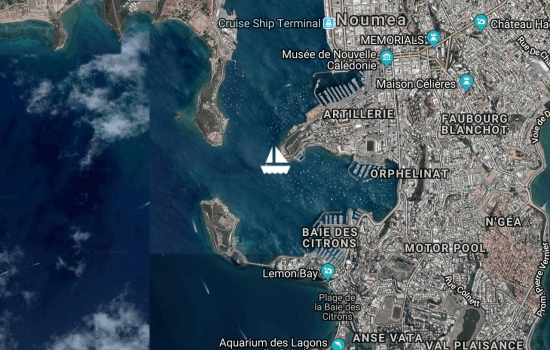
Back in Noumea for crew collection and final arrangements.
3 turtles at once! Another mooring at a marine reserve

A bit rolly due to the wind direction and strength.

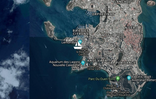
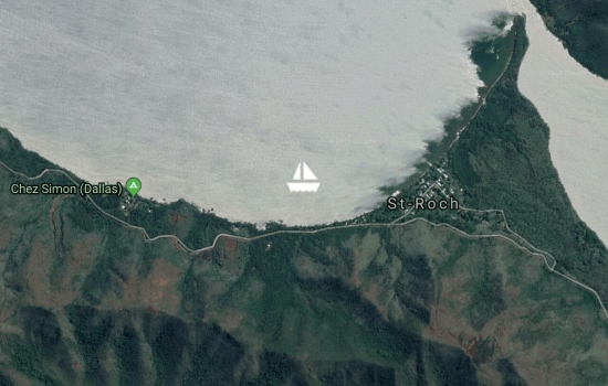
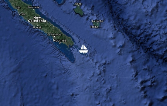
After a quick stop off Noumea for fresh fruit and to top off the water, headed out to commune with the turtles, sharks and sea snakes in Amedee Island.
Hiding out from the reinforced trade winds in Baie Maa. Outside blowing 25-30kn. In here, behind a big hill, about 5kn.
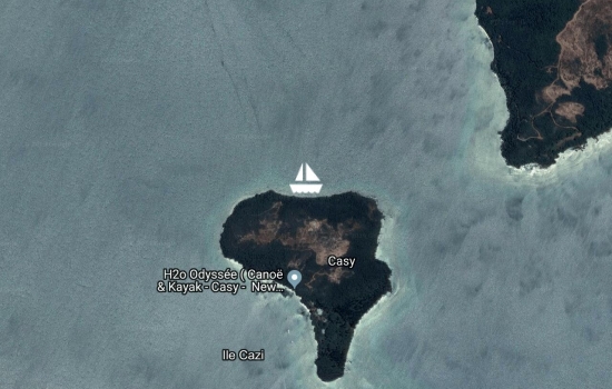
Picked up a free park mooring in Isle Casy after scuba diving on the Prony Needle
Returned to the mainland and gradually heading back to Noumea. Have caught up with the Island Cruising 'flotilla'

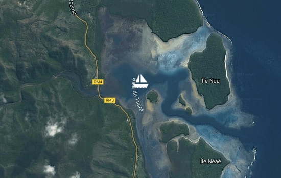
Anchored in 3.5m on sand off the hotel Paradis d'Ouvea.

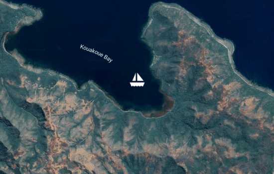
Overnight stop on the way to Ouvea. Great snorkeling in 30m + vis water. Can see the anchor on the bottom in 17m.

In We marina after overnight sail from the mainland
Really isolated spot. About to head to the loyalties but waiting for weather.
Tucked into a good spot behind the reef but still there is a bit of wind

Anchored in Port Boise sheltering from the strong westerlies. Trip out to the Loyalities is being delayed by the weather

Escaping the coming westerlies by heading to a sheltered bay near Noumea.
Saturday market and provison restock visis to Noumea. Was a 14hr downwind sail from Kotu
Anchored in Kuto, Isle de Pins. Lovely spot.
Anse Majic. On a public mooring put down to protect the coral. Track up the hill to the lighthouse and whale watching station.

Visited the hot pools and the rapids. Interesting place. Very sheltered and remains of iron mining & prison camp.
Apologies to all those that got worried with the lack of updates. I had enabled automatic tracking using our AIS through satellite but it did not seem to work. Let's just say it was an eventful trip! The boat looked after us and we did OK- even though on a few occasions we were heading more for Fiji than Nouméa!
Have returned to Noumea to do Immigration and am now sitting in the Port Moselle cafe enjoying the 'atmosphere'.
Will get a local phone number soon but if anyone needs to contact us Janet has her NZ number still. Just text- the roaming rates are extreme!
Well done guys. Have been
After an hour long wait in
Cleared customs through the marina office on Friday. Quarantine man came down very promptly and left us eggs and bacon for breakfast. Then discovered that is was a public holiday and immigration was closed! Decided to head out to a local Island and chill for the weekend. Great spot. Swimming with turtles.


Avg: 3.5knts
24hr: 84.7nm
Tied up at Port du Sud. Have arrived on a public holiday so everything shut so just tied up at the marina amoung superyachts. Start the clearance tomorrow. Now beers and a good sleep!
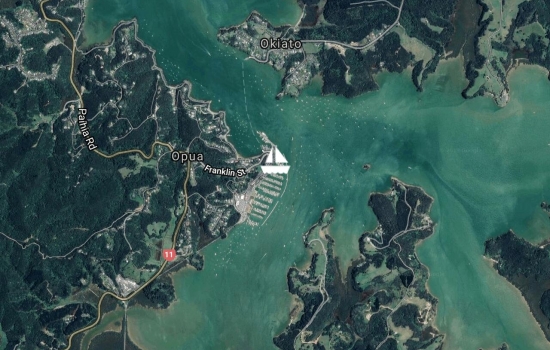
Tied up in Opua Marina after a boost up the coast. 30kn+ winds but sheltered from most of the swell by the land. Exciting time getting around Brett and motored through the islands. Good to be here. Now waiting for a weather window to head north.
Not sure if you have left but
Has anyone heard from them?
Just hoping you guys are
Hi Spencer, I am watching
Will follow you all the way
Pages

Avg: 2.6knts
24hr: 61.3nm
Good wind to sail north, but a lot of wind to contend with. Dinghy decided to leave us as we passed the Hen and Chicks so the crew had man OB practice to get it back. A really good intro to the boat for the team. Now anchored up in Tutukaka and having a nice dinner.
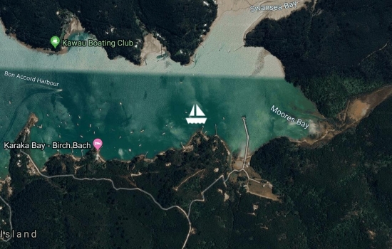
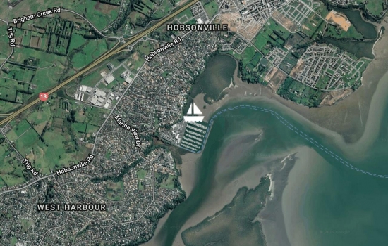
Departed Hobsonville at 1500hrs heading north. Anchored in Bon Accord for the night.
In the final stages of getting ready before our trip north.
Out for the weekend. First bit of nice weather this winter.
Anchored in Hooks Bay.

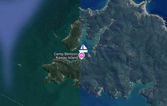
At Kawau for the annual CYCC Fred Lidgard race. Due to the weather it as been postponed until Monday. Took the opportunity to visit South Cove for tha first time.
Back on the marina after a great (and hot) classic yacht Anniversary Weekend at Mahurangi.
Flags flying ready for the Classic Yacht Festival tomorrow. Should be a great day.

Back on the marina
First weekend expedition from Gulf Harbour. Much more convenient than Herald Island! Seems like everyone else from the marina is out here. Water warm for swimming.
In a borrowed berth at Gulf Harbour for the rest of the summer.
Back from the Barrier as storm coming. Tucked at the end of Bon Accord harbour.
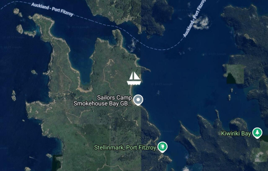
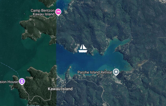
Anchored in Smokehouse Bay after trip across from Mansion House.
Passing little barrier
Back on the mooring. Perfectly flat calm. A lovely winters evening (except for the jet skiers!)
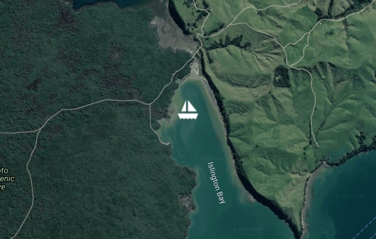
Celebrating Queens Birthday by a trip out to Islington Bay. Weather not so great yesterday but today has been fine and clear.
Back on the mooring after a great few days away
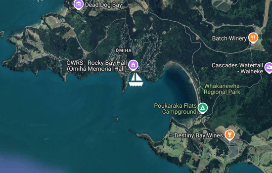
Moved to Rocky Bay for the Jazz festival. Friends on 'Audrey' have also shown up.
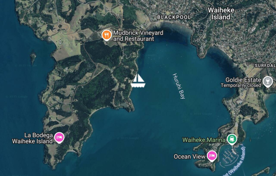
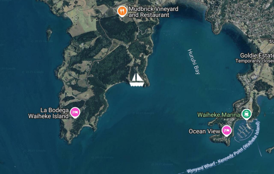
Moved around the corner and parked up next to a couple of superyachts. Their owners are probably up the hill at Mudbrick!
Late start after waiting for ex-tropical cyclone Cook to pass by. Now beautiful blue skies in Auckland while the rest of NZ gets hammered. Anchored in Te Wharau Bay sheltered out of the wind.

Back on the mooring after a very wet trip back - although the wind was blowing from the right direction!
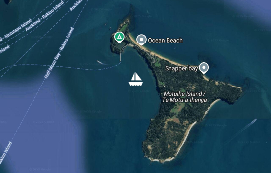
Anchored off Motuihe Island listening to the birds. Very nice. What was not very nice was discovering the gouge in the topsides left by something or someone over the past week. Out with the filler tomorrow! Should be a magnificent day in the gulf and heading back in on Tuesday as one of us has to work! Flat calm at the moment and have the Hauraki cruise ship and a Canadian yacht 'Island Prism' anchored up next door. Hopefully both will be quiet during the night.
Back at the mooring after a motor back from Kawau as no wind
Hi Janet and Spencer,
Moved around to Bon Accord Harbour to join up with other members of Clearwater Cove YC. This weekend is a series of races in honour of the Lidgard family who have strong ties to this bay and our club.
Good sail over from Great Barrier this morning. Was going to wait until tomorrow to head back, but the wind is turning unfavourable. Anchored in North Cove off the Pardeys place waiting for the rest of Clearwater Cove Yacht Club to come up for their annual 'Fred Lidgard' race.
After a walk up to the hut, and a shopping expedition to Port Fitzroy, have anchored in Karaka Bay out of the north westerly. Still a beautiful day
Great to hear of your
Moved around Kaiarara Bay to get away from the crowd (10 yachts!) at Smokehouse. Tucked in behind the mussel farm. Perhaps fishing tomorrow morning.
Avg: 3.6knts
24hr: 86.6nm
Anchored up in Smokehouse Bay enjoying the great barrier weather- been walking on the hills and see clouds over 'New Zealand'.
Heading for Great Barrier after the Mahurangi Regatta
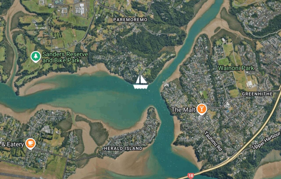
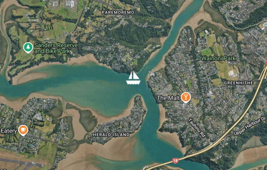
Back at the mooring in Herald Island

Good sail back to Hobsonville for some maintenance.
In West bay. Not the best weather and difficult to set the anchor. Walk ashore to listen to the birdlife
First sail of the spring
Back om the mooring. Great autumn day.
Was trying for Te Wharau Bay but the wind was blowing straight in, so ended up at Ocean beach. A lot calmer - except for the roll from the ferry's
Man O'War Bay for a visit to the winery!
Hooks Bay. Great settled weather and water very clear
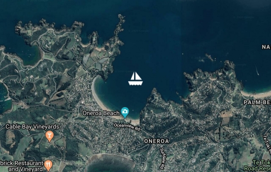
Easter cruise. Anchored at Oneroa, Waiheke.
At Hobsonville Marina for a few weeks to catch up on maintaince.
Tucked up next to the coastguard mooring for Anniversary weekend
Back on the mooring. Huge walk yesterday. Did not help we got lost!
At Te Wharau Bay to recover from Christmas celebrations! Planning long walk tomorrow.
Back on the mooring. A bit wet getting back!
Anchored in Issy Bay to recover from a busy 2 weeks at wirk
Back on the mooring. Now comes the work fixing her up after our winter in the sun!
Avg: 3.8knts
24hr: 90.1nm
Long day but got to Kawau passing the Coastal Classic yachts heading north
Back on the boat. Heading south to Auckland after an overnight stop. In the Bay of Islands
Avg: 4.1knts
24hr: 98.1nm
Back on the mooring at Opua on a beautiful spring day. makes us realise just how wonderful NZ can be!! Ranganui will be staying at Opua for a few weeks until we can bring her back to Auckland. Thanks to all who assisted on the journey. It was great to read all the comments.
Arrived in Opua just ahead of the storm. Customs will come tomorrow morning.
Well done. Pleased to se you
Avg: 7.1knts
24hr: 171.4nm
Blue Skies but the wind has dropped. Still aiming to arrive in Opua Friday evening but may be too late for customs so will clear Saturday morning
Can you see a long white
Avg: 9.8knts
24hr: 234.2nm
In GHR skip zone so this is from relay from Sweetwaters
Avg: 4knts
24hr: 95.8nm
Approximately 341 miles to Opua. Yesterdays run was 180 miles but wind dropping. Still hope to arrive Friday.
Nearly there, keep paddling.
Avg: 8.8knts
24hr: 210.1nm
Still have eta noon friday which is good!
Which marina are you heading
Hi Janet and Spencer, I’m
Avg: 6.3knts
24hr: 151.1nm
New daily run record for us on Ranganui 190 miles.Crew rewarded with a mintie
Avg: 8knts
24hr: 192.4nm
bumpy seas
Avg: 7.2knts
24hr: 171.6nm
Making good progress now that the wind has gone more to the east and increased. Sea a bit jumpy. Crew demanding Rod Stewart on the stero
Great going guys. I am
Avg: 6.2knts
24hr: 149.2nm
Avg: 14.9knts
24hr: 357.5nm
Motor sailing at 5Kn into a south breeze hoping change to south east we can go straight o NZ. Listening to Amy Winehouse on new cockpit speakers.
Flat Seas and no wind. Motoring. Fresh fish for lunch. Whale close to us this morning. Possible sperm- not humpback. All good but hot!.
Avg: 4.2knts
24hr: 100.9nm
On passage to opua with hopefuly eta Friday as front comes saturday am
now heading east as wind has moved to the south.
About to clear with Customs here at Vuda Marina and if that goes OK, will be departing about mid-day towards New Zealand.
Safe travels home to you both
For Guenther, hi mate see you
We have been at Vuda Point Marina since Friday. The original plan was to depart for NZ yesterday (Monday) but the weather was predicted to be unhelpful approaching NZ, so we are hoping for a Thursday departure.
partying at CloudNine a floating bar moored at tbe outer reef
Hi guys any updates from your
It was measurable here in
Spencer had a great night celebrating his 50th birthday with 250 other yachties 3 bands and a fully catered meal- it was also the regatta prizegiving
Happy Birthday and congrats
Spencer won the 'Mr Bicepts' contest, we are through to the quarter finals of the Hobie Cat racing, and went to a sandbank party today. The regatta is great fun!
Sounds like you are
Musket Cove for the regatta.
Just arrived in Denerau marina and hooked up to a mooring buoy. Very busy (and full) with about 10 yachts also anchored outside the entrance. This morning up very early at dawn to see the manta rays swimming through the passage next to the anchorage. They come a specific part of the tide to feed on plankton. Our individual total was 8 manta's as we took turns. Amazing to see these huge fish swim towards you and then turn at the last minute. It started off as a good sail south but the wind died and so we had to motor for about 6 hours to get here before dark. Will be here for a week doing family stuff and people watching.
Hi Guys,
Thanks for the positive
Understand your pain totally!
Great stories guys. Meanwhile
Thanks Linda. We plan on
After a very rolly night, moved south intending to swim with the manta rays. When we got to the (rolly) anchorage were most yachts moor we learnt that the rays where there at 0700hrs so we kept on going to Cuvu Bay which is a bit more sheltered and still close enough so we can see the rays in the morning before we head to Denarau.
Finally managed to leave Blue Lagoon after a very enjoyable stay. Great to sit on the beach and watch all the fish. Spent time with Pete and Di from 'Bonaparte', and even managed to have a look through two Amiels (French made cruising yachts) that are on my 'dream list'.
It managed to rain very briefly on our way south, and it was overcast for the first time in a week, but we managed to get the anchor down in Naatuvalo Bay. Nice anchorage with only a sight roll. From here we are moving to Denerau to meet up with the family.
Lovely to have drinks on
at Blue Lagoon which seems to be a congregation point for yachties. nice and sheltered with a resort we can go to dinner at!
this mornong visited flooded limestone caves. hoping that tonight this anchorage less rolly than the past 3 ones! heading soutb to Blue Lagoon tomorrow.
Anchored Narawa Bay, Yasawa Island, after a good sail across Bligh Water. This area is also known as Chanpagne Beach and is very pretty. Very exciting coming through the narrow pass at the top of the island with big standing waves.
Avg: 4.2knts
24hr: 100.5nm
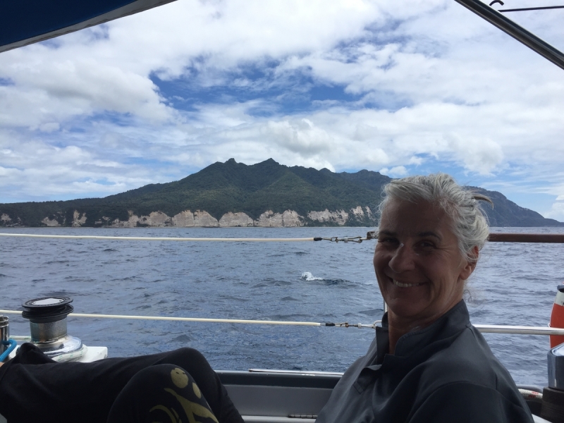
Anchored in Cukuvou Harbour, Yandua Island. Been for an excellent snorkel off the western side of Yandua Tamba which is a nature reserve and landing is not permited (like Little Barrier in the Hauraki Gulf). Land is a lot drier than the east side of Fiji.
just arrived Bua Bay after departing from the anchorage near Savusavu this morning. Has been overcast with occasional rain which makes going through the reeefs exciting- managed to hit the bottom anchoring here. if weather better tomorrow heading to Yadua island, and then onto the Yasawa's.
Still tied up at Savusavu Marina's wharf for a few reasons. One is that both Janet and Spencer ave been sick - Janet picked up a sinus issue, and Spencer got a bad dose of the flu which he is finally getting better from after 5 days. It was probably being back around so many people (and germs) after being in 'isolation' on the yacht. It also has not helped that the weather in Savusavu has been 'c**p' with heavy rain and overcast. Today is the first day of blue sky for over a week. Yesterday we managed to escape by hiring a car and driving to Labasa on the leeward side of the island - warmth!! Scored a private tour of the sugar cane factory there and did some clothes shopping. Boat jobs gradually being done with replacement microphone for the long range radio sorted so now we can talk as well as listen. Once we are both well we will be departing for the west.
Humpbback whales swimming just past the back of the boat today. Really cool!!!!!! Off to Savusavu tomorrow morning.
At a free mooring of Paradise Taveuni resort. all we have to do in return is buy the occazional beer as we sit by the pool! amazing night sky at the moment with shooting stars, Venus and a near full moon.
still at Viani Bay but moving on soon. Have been watching with concern the out of control bush fires that are all around the bay. some have gotten close to the water. caused by the local farmer burning off old grass for his cows. some of the boats in the bay have been covered in ash but we have been ok up till now. hopefully a wind change will dampen the fires down.
Still in Viani Bay. Diving almost every day using a local Jack Fisher as our guide. Going out on a long boat with yachties from 'Silver Ruffian', 'Tiger' and 'Bonaparte'. Water holding up OK, but just about out of cooking gas so will be heading to SavuSavu towards the end of this week. Looking for crew for the trip back to NZ late September, so if anyone knows someone who would be interested let us know! Best contact is ranganuik3831@gmail.com as we have excellent cell coverage here in Viani so can keep up with the All Black victories!
2 dives on Rainbow Reef this morning. Anchored Viani Bay. strange to see motor vehiles, supermarkets and cellphone coverage after so long in the Lau Group.
anchored Matei north Taveuni. Sightseeing to waterfalls tomorrow, then move to Viani Bay for more diving
Avg: 8.4knts
24hr: 200.9nm
anchored Matagi Bay. getting ready to do some dives in the 30m+ vis
Sad to say goodbye to the Lau Group but looking forward to some scuba diving around Taveeuni Island and then the supermarket and restaurants in Savusavu. Love Spencer and Janet
Try not to over indulge guys
Back in cellphone range at least for a few hours as we sail past!. Heading back to Bavatu Harbour after a few island stops after we left Fulaga. Will be going to Tavanui island in a few days.
Departed Fulaga Island this morning and now anchored a Nameka. We've had an amazing time.
Looks like an amazing place
anchored at Fulaga Island after long sail south. Very pretty here.
Happy birthday Janet. I hope
JULY 7th HAPPY BIRTHDAY JANET
Anchored in the beautiful Bay of Islands in Vanua Balavu. Spent 2 days at Daliconi Village having a feast and going to church. There have been 32 yachts here as we have combined with around the world rally. have met some really interesting people. Will probably stay here for about a week as some strong winds forecast. All good on board.
Hello there Janet ......
had to move to lomulimu harbour due to beaucracy but all cleared in now. went ashore to send postcards and SIM card. thanks to all who have been leaving comments. it was good to read then. soon back ti batavu harbiur harbour an
Been following you with
Avg: 5.7knts
24hr: 136.5nm
Speed 0 kn because the anchor is down! YAY! Arrived Bavatu Harbour at 1130. First boat here so waiting for customs. Swimming and eating frsh tuna.
Congratulations Dean and Team
Fantastic! Wonderful news!
Avg: 5.6knts
24hr: 133.7nm
Ranganui heading due north at 5kn with following 10-15kn winds. Just seen first land since nz. Crew very excited! 122 mils to go.
Avg: 5.4knts
24hr: 129.2nm
Wind is 10kn from NW. We are heading north at about 4kn. Warm and sunny. Lasanga for dinner last night and looking forward to chocolate pudding.
Hi Dean, I am following you
wow what a detour you guys
Looks like you are on the
Hi Team, from my Arial view I
The meals sound amazing,
Avg: 5.4knts
24hr: 129.3nm
heading north@6 in NE wind 20kn. overcast sky but getting warm. Bypassed minerva reefs last night as wanted to check in before weekend. All ok.
Avg: 7knts
24hr: 168.3nm
Speed 6kn motoring as light winds. Blue sky. Wind expected to rise and come around to the north on Monday. We are not stopping at Minerva.
Great to get the updates each
Avg: 9knts
24hr: 216.9nm
Finally blue sky but not much wind so having to use the motor to keep going. Crew have started quoting the rhyme of the ancient mariner
Weather slowly improving Damaged 2 sails in storm. Crew also have a few cuts and bruises but all feeling better. Enjoying bacon and egg pie and cake.
We have had loads of rain and
Sounds like you are on ya why
Avg: 6.8knts
24hr: 162.3nm
SSB only works on RX so no info except via sat phone. This position is noon Thursday
Avg: 2.8knts
24hr: 67.2nm
Course 017t speed 6 wind 20-30 SW. Difficult part 3 days with head wind but this seems to have changed. crew says YAY!
Hi Janet, Spencer and crew,
Hi Dean and Crew
Hi Dad Big Thunder and
We're happy you are now
To dean and crew, Thinking of
Pages
Avg: 10.6knts
24hr: 253.2nm
shitty weather
Hey Dean, Hope all is going
Avg: 4.2knts
24hr: 99.9nm
Course054t wind NE 1.5 kn. we can see the next front approaching so expecting wind to increase. Will then try to head north. all ok on board.
Hi Team, I can see the winds
Well done Janet. Rodger's
course 005t speed kn wind 15_20kn NE all men seasick but Janet is ok, hoping for windshift soon to head to fiji. Rough last night with heavy rain
Hi Guys, Great to receive
Avg: 5.1knts
24hr: 121.8nm
We r in our way! Not the best weather but we will cope!
Good luck. Have fun.Hope no
Bon yoyage, to dean and crew
Planning for a Sat departure. Needing some warmth!
At (Hobsonville) Westpark Marina waiting for a weather window. Hopefully later this week.
Back in the water. One less job before Fiji!
on the hard for cat one inspection and antifoul
Back at home mooring after a rapid return from waiheke today with 40kn gusts
about to head out for weekend
No blogs available for this yacht.