Kailani
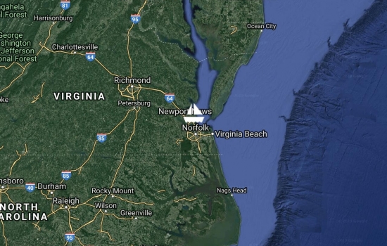
On dock, downtown Gloucester, VA. Moved the boat 30 nm up the York River across from Yorktown, VA. Here we will leave Kailani for the winter months, taking advantage of dockside living to do a full spring cleaning before flying to Idaho for winter. Mixed feelings as we watched the cruisers streaming past in the opposite direction, all headed for the islands for winter. But then again, we are the Earls - we never do anything the conventional way! So Idaho here we come!
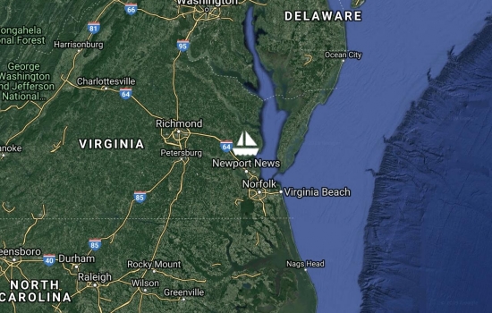
On dock, downtown Norfolk! Moved the boat 10 nm to the S to a dock in downtown Norfolk. A very interesting trip along the channel with the military and commercial ships docks all busy with activity. First time we have ever seen a completely "hot pink" container ship with coordinating pink containers. We will enjoy this slip with the ability to walk to numerous downtown amenities.
Avg: 7knts
24hr: 168.7nm
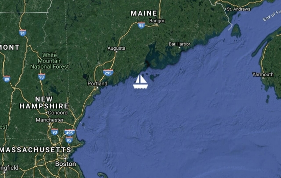
Day 3 - 0015 local 27 Oct, anchor down, Old Point Comfort, Fort Monroe Anchorage, Norfolk VA. The wind filled in nicely for us to sail for the final 12 hours of this passage on a broad reach with full main and jib. All day long the USCG was putting out pon-pon notices about a single handed sailor who is overdue here in Norfolk, and listening to all the activity related to the search for him/her made for a somber afternoon. Other strange notices were about an injured humpback whale in the vicinity (no, we did not hit it) and we were all startled when a land bird who had lost its way flew down below. We chased him up top, but he hitched a ride under our dinghy until land was near again. Arriving in this very busy port at night was somewhat challenging, and being passed by a 297m container ship going 16kts in the confined channel gave us a HUGE 12foot wake to deal with, thankfully just after we had dropped the main and were under power. It is supposed to blow and rain pretty hard tomorrow, so we may re-anchor in the morning when we can get a better lay of the land. For now it it stow and go to bed, thankful for another safe journey.
Avg: 7.6knts
24hr: 182.9nm
Day 2 - 89 nm to Norfolk VA. Motorsailing main only, 8.2 kts at 214T. Yesterday morning we had a fabulous time motoring along the East River of Manhattan, particularly enjoying the view from the water of the iconic Chrysler and Empire State Buildings. Of course the highlight was the southernmost end, seeing old Lady Liberty, her statuesque coppery turquoise and gold torch reflecting the brilliant morning sunshine. We timed the tides right, and whipped along at 12+ knots under a total of 8 bridges, the air, sea and land around us a constant hum of noise from helicopters, planes, trains, ferries and cars all hustling to their Friday morning destinations. We totally understood why the northernmost cut is called "Hell's Gate", wicked if one timed it wrong or had major shipping traffic. Once again, it being late in the season and a weekday helped us miss most traffic situations, but we sure did enjoy looking up at all those magnificent buildings and being so close we could see people at their desks working away. In terms of sailing, we have done very little, only about 5 hours last night as we weaved through many anchored container ships outside the Delaware port. The chart is littered with markings of wrecks, a reminder of how this shallow coast with depths ranging from 10-50 feet, would be treacherous in big winds. The wind should fill in nicely from the north shortly, hopefully allowing us to sail the remainder of our miles and get the hook down in the wee hours tonight.
Day 1 - off the mooring early for the beginning of our 303nm sail down through New York City then out and along the NJ coast and the Delmarva Peninsula for a coastal passage to make landfall in Norfolk VA, which we anticipate taking just under 48 hours. Weather forecast is for light winds hopefully filling in from the N tonight at 2200 local, so it will be a motorsail for at least 1/3 of the trip. All well on board, excited about sailing along Manhattan.

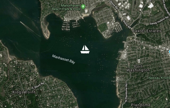
On mooring, Port Washington, Manhasset Bay, NY, USA. We bid adieu to Black Rock YC and Fairfield CT today, taking advantage of a great NNE wind to sail further down Long Isl Sound, 35 nm closer to NYC. We had a lovely stopover in CT, catching up with friends and making new ones. Due to the extraordinary generosity of our friends we were able to leave Kailani on a mooring while we made major memories by taking Sophia to NYC for the first time via train. We will supplement her view of this iconic city by sailing down along Manhattan on Friday, weather permitting. We felt like the last cruisers up this far north until arriving here today, where there are a handful of cruising sailors waiting anchored out. For today it was all cold and rain, but the lovely wind and lack of traffic were fabulous! Kettle is on and tomorrow should be another Indian Summer sunshine day.

On mooring, Black Rock Harbor, Fairfield, CT, USA. Another 58 nm of sailing SW today along the CT side of Long Isl Sound. A very sporty beam reach sail with a single reefed main and staysail, winds of 25-30kts and constant rain were a surprisingly welcome relief from our long night in a very rolly anchorage! We are tied up to a friend's mooring bouy at the yacht club here, and will stay for about 10 days as we visit with friends and relations here and in NY. For now we are taking advantage of a brief break in the rain to tidy up Kailani's topsides in prep for further big winds and rain over the next few days.
Still following you with

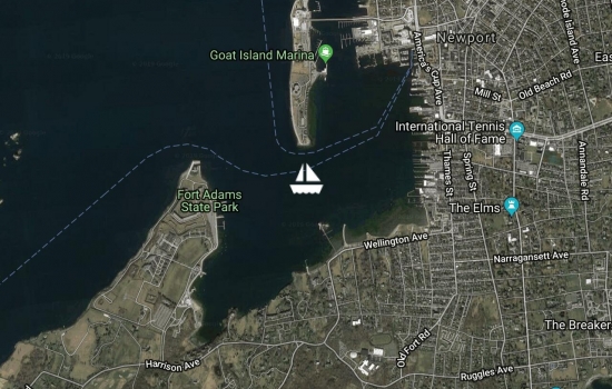
Anchored, Niantic Bay, CT, USA. Great seven hour beam reach sail from Newport today. Cold and grey days of fall are upon us and this current NE wind will continue for the week with some rain moving in tonight. We have set the hook for the night and will set sail at first light to move on from this rolly anchorage. Today we were constrained by having to time the current for entering Long Island Sound at place called "The Race" where a 5kt outgoing current against the 20kts of opposing wind would have been a problem. With that behind us, tomorrow's sail to Bridgeport should be a straightforward run down along the CT shore. It is supposed to crank up to some big winds tonight and tomorrow, but still from a favorable direction for our continued SW passage. We had 3 busy and wonderful days touring Newport RI . We will update our website with details once we are hanging out down in our next port.
Avg: 14.3knts
24hr: 342.1nm
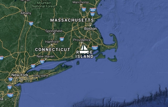
Anchored, Newport, Rhode Isl, USA. Had a glorious 46nm downwind run from Marion today, taking about 6 hours to arrive here in Newport RI. NE winds between 15-20kts kept us togged up in our foul weather gear, with a steady flow of hot drinks to the on watch crew in the cockpit. It is hard to believe that just yesterday in Marion it was 80F and so humid we almost ran our aircon! Today it is a cold and windy 50F and there is a definite feel of fall in the air. The anchorage is much emptier than when we departed just under 4 months ago for our New England and Nova Scotia cruising season, and we appear to be one of the only cruisers still lingering this far north. Here we will wait some weather out, see some museums and sites, then start making our way toward New York in the next favorable sailing wind.
Anchored, Newport, Rhode Isl, USA. Had a glorious 46nm downwind run from Marion today, taking about 6 hours to arrive here in Newport RI. NE winds between 15-20kts kept us togged up in our foul weather gear, with a steady flow of hot drinks to the on watch crew in the cockpit. It is hard to believe that just yesterday in Marion it was 80F and so humid we almost ran our aircon! Today it is a cold and windy 50F and there is a definite feel of fall in the air. The anchorage is much emptier than when we departed just under 4 months ago for our New England and Nova Scotia cruising season, and we appear to be one of the only cruisers still lingering this far north. Here we will wait some weather out, see some museums and sites, then start making our way toward New York in the next favorable sailing wind.

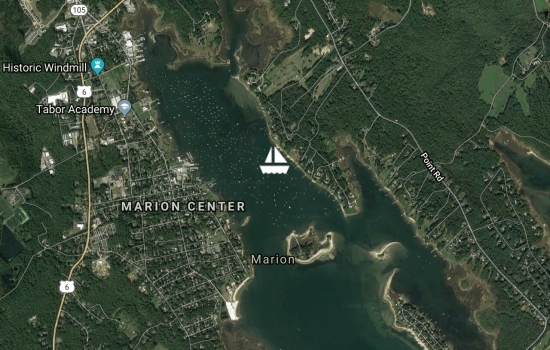
On mooring, Marion, Mass, USA. A quick morning motorsail from Phinneys Harbor this morning to Marion, where we will linger for a few days to pick up some parts and shelter from the SWly winds and rain the next few days. We had a nice time in Monument Beach at Phinneys Harbor, visiting with friends and catching up on work and school. Completed our time yesterday afternoon with a lovely town walk, a quiet meal ashore and a final meandor in the chilly wind along the railroad as the glorious sunset was an orange beacon calling us home to Kailani.
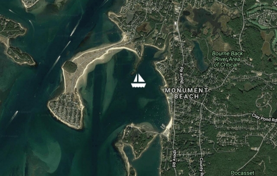
Anchored, Phinneys Harbor, Cape Cod, Mass, USA. Gorgeous day on the Cape! We up anchored at 0730 to make it to the Canal by 1030 and enjoyed our transit through the Cape Cod Canal without any other traffic and max speed of 10.8kts. Saw some interesting shark or ray fins 5 different times, lots of cormarants and other sea bird life, along with a host of locals fishing, running and biking along both sides and enjoying oerfect sunny weather. We will stay here for a few days, visit with friends, then head out to Marion for the weekend.
Enjoy the cool weather and it
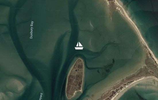
Anchored, Duxbury Bay, Clarks Is, Mass, USA. After 5 very full days exploring historic Boston, we departed at 0915 this morning for a 50nm sail south toward Cape Cod. We enjoyed light and favorable winds for a lovely beam reach sail here, and are delighted to be in this quiet little bay, worlds away from chaotic Boston harbor. In Boston our mooring allowed us to enjoy planes, trains, ferries, and all manner of pleasure craft zooming around us quite literally, since the mooring field was atop the subway lines and just west of the airport runway. That being said, we barely spent any time aboard Kailani as we daily embarked on touring historic sites, museums, and fabulous meals out in "little Italy" of the North End. Boston did not disappoint, but everyone is pleased to be back on the hook in the peace and quiet. We will rest up tonight, then it is anchor up early to make the favorable current for our Cape Cod canal transit tomorrow.
On mooring, Boston Harbor, Boston, Mass, USA. We took advantage of the strong NEly generated by Hurricane Humberto off toward our east in order to sail 63nm to Boston from Pepperrell Cove this morning. Tonight is the first frost advisory for southern Maine, so it is time to get "where the weather suits our clothes" so to speak. Had a fast, feisty and COLD time sailing under a single reefed main and jib, enjoying the fact that the density of lobster pots have diminished. Highlights of our last days in the Portsmouth NH area were Sophia getting to go out with a local fisherman to bait and pull lobster pots (thank you David!). We also visited with many local land friends and yachties to round out school days and enjoying what seems like the last warm days of summer in Maine. The trees have started to turn to gorgeous fall spectrum, and our heater aboard is getting frequent use. We are excited to have a mooring right downtown in front of Fanneuil Hall and easy walking access to all the historical sites we will adventure to during our stay.
On mooring, Pepperrell Cove, Kittery Point Harbor, Maine, USA. Departed in cold cloudy weather 68nm to our north this morning to start our southward journey back down along the coastal US. We arrived at 1700 local to lots of fishing and yachting activity as everyone here is wrapping up their Sunday afternoon of fun in the sun. It was mostly a motorsail, but the wind filled in for the last 2 hours to make it fun to sail under jib alone. First stop of our sojourn southward is here on the border between Maine and New Hampshire, where we started our Maine cruise less than 2 months ago. We will linger here possibly for a few days, visit friends and wait prepare for our next leg onward to Boston Mass.
Avg: 4.8knts
24hr: 116nm
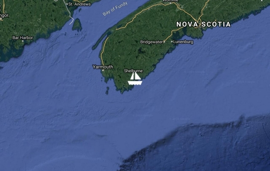
On mooring, Orrs Cove, Quahog Bay, Sebascodegan Isl, Maine, USA. 248 nm in our rear view. We mostly motored on this passage, sailing when we could, and especially had a fun sail up this tiny inlet to tuck away in a quintessential Maine cove. Lots of lobster pots to dodge, and even a submerged red nun buoy required all three sets of eyes to safely navigate and tie up before sunset. Here we will sleep well. Kailani is put to bed, ready for lots of rain starting tonight, with winds forecast to be 20kts from the North at the peak of Dorian's pass to our East. Looking at where we departed, Shelburne, Nova Scotia, the wind and sea forecast is simply scary. They are expecting up to 80mph winds when Dorian makes landfall tomorrow in Nova Scotia. We cross our fingers for all the people we met there, especially the handful of cruisers who chose to stay there instead of run.
Avg: 7.9knts
24hr: 189.3nm
Day 2. 41 nm to Maine, USA. Sailing 6.2kts at 274T, main plus jib. Mostly been a motor sail until an hour ago, as winds have been light and the seas eerily calm. Last night the sunset was a weird salmon orange haze full of wispy high level clouds and this morning the sky was the exact image of "red sky in the morning, sailors take warning". Our objective is to make landfall before sunset, and we have found a place we think will provide good protection for the storm. We have entered the Maine waters and today will be back to the "lobster pot boogie", dodging the multitude of buoys large and small. We are thankful for the calm seas, no fog, and rain free weather to make our final approach.
Day 1. 223 nm to Maine, USA. MS 1rM , 8.4kts at 201T. After only 3 weeks cruising here, we are departing Nova Scotia this morning as Hurricane Dorian is due to strike as a Cat 1 here on Friday night , Sat morning. Without any real good harbors to secure from the anticipated potential 19m sea surge we are out of here. Anticipate arrival tomorrow late afternoon, some place near Portland Maine, but that destination may change as we continue to watch the weather.
Avg: 7.3knts
24hr: 176.3nm
Day 5 Anchor down at 0830 local, Brenton Cove, Newport RI. 650nm. Arrived in the USA! Yesterday right after our noon update, Sophia came down from her scope of the horizon with the notice "we have FOG!". Not really surprising, as of course the New England waters are infamous for it, but believe it or not, this is the first fog we have ever encountered while sailing Kailani. This includes sailing her from Turkey across the Med , across and up to SF, then around the world and up here to the east coast of the US. Our radar, like most of Kailani's electronics, is vintage 1989. OLD. In addition, upon our last inspection while repairing the hole in the fabric radar cover, we noted a new crack in the housing. We have no idea how much rain might have seeped into all of its radar emitting electronics. In fact the only time we have turned this radar on to aid in navigation was in 2015 in Indonesia due to their seasonal practice of palm oil field burning, which causes debilitating visibility and air quality with rancid smoke. While it "worked" then, it never really did so in a manner to effectively pick out the hazards there, like the little old man we almost ran over, sitting in his wooden dugout canoe holding simply a bic lighter for his running light when we neared. So, this is a long way of saying, it was with a bit of trepidation and a lot of hope that we fired up our c. 1989 Raytheon radar, wishing mostly that it actually worked, and more importantly that if it malfunctioned that we would not start a fire, or something worse. Anyway, to our delight and amazement, it worked. We quickly went through the motions of "dialing down the clutter" etc on our giant cathode ray tube screen down below, and boom, we could see all the upcoming fish buoys! Good, but yikes, they were seemingly everywhere, and we could not see them visually as the fog was to the deck. Next was a lesson for Sophia about sea clutter (Jen reaching back to her days of designing guidance systems on radar guided missiles, noting of course that this actually was a time period a few years AFTER the date of our radar) so that Sophia could help tune the radar to separate hazards like buoys from returns like rain clouds and waves, and be our key assistant during our helm watches. Let's just say the next 19 hours of our motorsail into Newport was exhausting. The radar transmit had to happen every 5 mins, and Jen and Harley took turns running up on deck to maneuver as needed around pots, fishing vessels, buoys, etc. And it was COLD. But arrive we did, and exhausted we are. Unable to raise the harbor master we sought out an anchorage and dropped the hook (technically not really approved protocol). Harley completed our immigration and customs clearance into the USA online (cool!) and the delightfully friendly harbor master Steve just dropped by to give us the skinny on local knowledge we need e.g. where we can dinghy in etc. So here we sit, watching geese and kids in sailing dinghies cruise around, every manner of boat out and about, and the nearest channel buoy's brass bell clanging away as it rocks in the waves. A very busy harbor. We have to put the boat to bed now, so it is definitely a second POT of coffee day. To be followed by food, beer, champagne and some sleep (not necessarily in that order!).
great to hear the update!
Congratulations on landfall
Hazzah! Well done all.
Glad to hear of your safe

Avg: 9knts
24hr: 215.8nm
Day 4 159nm to Newport RI USA. Motorsailing, full main, 7.7kts at 335T. Soon after our post yesterday at noon, the wind kicked up and the seas got very messy. We were sailing on a close reach into 8-9ft seas that were 5-6 secs apart, and adding to it there was a remnant swell from the NW coming in to hit us and generally add an extra bounce to anyone transiting the cabin. All in all it made for a very uncomfortable ride. 27T of boat going up a wave then slamming down into the trench, to slam hard again into another wave, repeat, repeat, repeat. It is in these times we take great stock in what a well built boat Kailani is, fast yet stout when we need it most. We were all fairly tired and gulping down the the seasick meds, until all of a sudden by 5pm the seas seemed to cease. The wind was still at about 20kts from the SSW, but we had crossed into the gulf stream, way ahead of where we thought we would. The gulf stream current, running with the wind, had the wonderful effect of flattening those waves. Yay! So on we sailed and we all got a reprieve from the slamming motion, the barometer dropped, from its high of 1023mb to 1017mb, in 4 hours confirming we were out of the H that has dominated this trip so far. The gulf stream current set us a bit east, but that was ok since the forecast said we would get winds from the E and NE after the H passed as the new dominant wx would be a low up near 46N. The wind died by 0130 this morning, and we have been motoring since. Morning broke with us under squally skies, and we were greeted with rain, thunder and lightning around us. In the list of things we sailors worry about out at sea, a lightning strike is right up there. As we breakfasted on warm scones, peaches and coffee (upon each lightning burst each of us counting to ourselves "one-one thousand, two-one thousand...") the storm passed us by, but not before the nearest strike was right behind our boat. We didn't need a second cup of coffee this morning to be alert! We are now technically in US waters, being within 200nm of shore, and all aboard are getting excited about landfall tomorrow afternoon. Ironically, the latest forecast has now come back to what it was when we departed Bermuda, that is, no wind for the remaining miles in to RI. Good thing Harl threw the right engine room words at that engine back on Day 1, as she is running fine.
Way to go Kailani and crew!

Avg: 8.3knts
24hr: 198.7nm
Day 3 339nm to Newport RI USA. Port reach single reef main and staysail, 7.7kts at 340T. Wind veered and increased last night and we took advantage of the lagging sea state to make some miles at 9.5 to 10 kts with the apparent wind aft of the beam. At breakfast we reefed down and changed out the headsail for the staysail to make it a little more comfortable. Our two wx models have a conflict with one showing a low passing about the time we pect to encounter the Gulf Stream tomorrow, not what we want experience. Weare watching closely and will heave to if necessary to allow what looks to be fast mover go through. Last night we found ourselves on the opposite heading of a Bermuda ocean race with a half dozen smaller boats bashing their way south just off our starboard. Seems like a lot of misery for a dubious honor and a few complimentary dark and stormy rum drinks.
Avg: 6.3knts
24hr: 150.6nm
Day 2 518nm to Newport RI USA. Stbd close reach full main and jib, 5.8kts at 336T. Been mostly a light air sail so far, with the exception of a few hours after sunset when we got a lift by skirting between squalls, allowing the Kailani "hum" to happen as she cooked along at 9.5kts with minimal seas. In typical Kailani fashion, the most "exciting" thing to happen yesterday was losing our engine while exiting through the Town Cut from St George's harbour. Thankfully there was no major traffic, we were able to flip back around to the bay and we ghosted around with full main and 4 kts of wind, giving Harl time to go down and use some engine room words. Pretty sure it is just a bad fuel / clogged filter issue, and we will address it further today during our light air times. Winds are continuing to veer as this H moves E, so we will eventually motor for a few hours and then flip over to port tack. For now enjoying less humidity and cooler temps!

Day 1 637nm to Newport RI USA. Checked out and in the final throws of stowing the dinghy and kayaks, then we anticipate up anchor by 1600 local. Will post an update to our website when we make landfall in the US, but in a nutshell we really enjoyed our time here in Bermuda: forts, batteries, museums, beaches, long walks, ice cream, etc. We have been watching for a wx window for the past week and are amazed at how much the predictions vary every 6 hrs. So altho not as great a window as it originally looked, it at least has some favorable winds. We are going to skirt the backside of this H that is passing through Bermuda at the moment, which will give us light westerly winds, but hopefully enough to sail until the wee hours. We will likely motor for half of this passage, but at least the winds that are forecast will get us across the gulf stream without wind against tide. So that's our main objective - to cross the gulf stream without getting caught in a NEly. But every time we check the wx it changes pretty dramatically, so we are readying for whatever may come, rigged and ready for all points of sail.

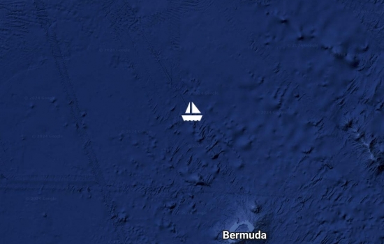
Anchored, Convict Bay, St George's Isl, Bermuda. Our plans are to stay here in Bermuda and catch the first wx window after 7 June for the 650 nm run to Newport, RI. For those following us our website, www.laughterjourney.com, has been updated with narrative and photos from Antigua and our first couple of days here in Bermuda. We will resume updates on YIT when we put to sea again.
Avg: 6.5knts
24hr: 154.8nm
DAY 8 Anchored, Convict Bay, St George's Isl, Bermuda. Yesterday was a long day beating hard to weather close-hauled on starboard, against the confused seas remnant from TS Andrea. Kailani and crew took a beating. The wind died around 9pm local, then it was squally for a few hours so we sailed when we could, and motored on and off as necessary. Finally, the wind just died completely so we had to motor the last 6 hours, making the Town Cut entrance at about 0730 local. We are all checked in, and now anchored amongst many cruising yachts. A big breakfast is brewing and we are happy to be here!

DAY 7 119 nm to Bermuda. After 16 hrs hove to waiting for the strong Nly to get some E, we set sail this morning at 0715 local. We have a 24 hr window to make landfall before the wind dies completely. We are pounding to windward stretching Kailani and crew limits with the associated pounding thru confused 2m seas.
Avg: 8.1knts
24hr: 195.4nm
DAY6 130 nm to Bermuda. Hove to. Just after posting our noon update we passed through the "Post Tropical Cyclone Andrea" , essentially just a few squalls and gusty variable winds. Coming out the other side, the Nly winds increased and we have decided to heave to hoping wind goes to NE sooner than forecast.
Avg: 8.1knts
24hr: 193.4nm
DAY6 144 nm to Bermuda. Port beam reach 1st reef main plus staysail, 9.5 kts at 022T. The winds died as forecast and we motored 7 hrs yesterday until they filled in from the SSE. Tropical Storm Andrea at first strengthened and changed heading toward us, but then dissipated in the night. Now our dominant winds are being created by the H to the N of us, and as predicted the wind continues to build and veer. By this evening it is anticipated to be 25-30 from due N, so we will heave to then and wait until there is more E and we can sail again (12-14 hrs). Our arrival ETA is still Friday unless we have to stay hove to longer.
Greetings! Wanted to update:
Avg: 7.3knts
24hr: 175.5nm
DAY 5 310 nm to Bermuda. Port beam reach main plus jib, 5.0 kts at 310T. As forecast the winds have been waning as a L 300nm off to our NW strengthens. This low has been upgraded to Tropical Storm Andrea, and is headed right for Bermuda, but it is anticipated to dissipate within 48 hrs, which will mean we will extend our arrival ETA to Friday subject to change based on the changing forecasts. Once it passes a H to the East will dominate, giving us wind on the nose for the last leg into Bermuda. We are tracking this TS closely, and will alter sail plan as needed. For now, the humidity has kicked up, the skies are gloomy looking, and the winds are anticipated to strengthen and veer this afternoon.
Stay safe out there. Sending
Watching your progress with
Avg: 7.8knts
24hr: 187.4nm
DAY 4 463 nm to Bermuda. Stbd beam reach main plus jib, 7.0 kts at 001T. Just passed the half way mark, which usually calls for celebration. Maybe a cake, but it is still very hot despite our steady sail north. We motored 6hrs yesterday until the winds filled in just before sundown, and all on board, even our "Elf on the Shelf" (Bill's self proclaimed nickname referencing his high side bunk in the 3rd cabin) finally got restful sleep as Kailani sailed along at 5-7 kts thru the calm night.
Avg: 7.4knts
24hr: 176.7nm
DAY 3 623 nm to Bermuda. Motor sailing, 7.5 kts at 355T. Winds have been less than 15 kts and this morning veered aft and dropped to 8-9 kts. We are motorsailing on course but the prospect for better winds anytime soon is poor. The forecast for later in the week is for 15-20kts on the nose so it looks like we will be battling upwind to make Bermuda by the weekend. We'll see as the weather has a way of changing, particularly when you consider that none of this was in the forecast 2 days ago!
Avg: 27.9knts
24hr: 668.5nm
DAY 2 777 nm to Grenada. Stbd beam reach run sgl rf main and jib, 6.8 kts at 355T. We upped anchor yesterday afternoon at 1600 local, departing Falmouth Harbour in light winds. The wind settled in for great sailing once we were headed north along the west side of Antigua, and it has steadily veered to allow us to be close to the rhumbline humming along. Our stopover in Falmouth Harbour was great for rest, the usual ashore food breaks, and we really enjoyed visiting historic English Harbour and Nelson's Dockyard. Jen and Sophia are both reading Patrick O'Brian's Aubrey Maturin series for the first time so exploring the museum, seeing the old forts, walls, careening pillars, cannons, sail loft, etc made the stopover particularly fun.
Keeping an eye on you all.
Day 1 - 937nm to Bermuda. Sailing 1RM plus Jib. Under way from Antigua! Sorry for no updates here. Jen's hand injury has tightened up our crew situation so no updates until she can type roughly now. Thank goodness our friend Bill has been aboard for our sail since Grenada. We as a family spent about a month in Grenada and St Vincent and had to haul out just the day before departing northward to Antigua. We had a short 36 hour sail to Antigua and awaited arrival of good wx window for this leg to Bermuda. Wish us luck as we head into the TRIANGLE:). If you want to read more of our time in Grenada check out our website Travels and Photo pages LaughterJourney.com. Great to be back to sailing north!
We are back aboard after an 11 month hiatus taking care of family back home. Anchored in Tyrell Bay on Carriacou, Grenada West Indies. Will be gunkholing around the Grenadines for a month before heading north to Newport via Bermuda.
Best wishes for the rest of
YEAH! Great to hear of you
Hauled out, St Davids Harbour, Grenada. Since arriving 7 days ago we have been working steadily to get Kailani ready to be hauled out and on the hard for the impending 6 month hurricane season. The travel lift has been going non-stop with boats all getting lifted, cradled and strapped for what all hope will be a kinder hurricane season for the Caribbean. We are one mile south of the latitude acceptable by our insurance for being out of the hurricane belt. Making it into the cradle yesterday was moderately dramatic, having to be towed in with a cross breeze, a very narrow slipway with zero depth to port, a steady 15 kts from starboard. The real interesting part was the Caribbean engineering used when it was time to have the lift drive away from our cradled boat. Our radar tower stuck up about 6 inches too high for the lift to clear, so the guys piled up various pieces of wood scraps for the lift to drive up and over to clear Kailani. The lift backed up, the wood cracked, we cringed, the lift settled too low, the lift drove forward, and the process was repeated until there was a big mess of wood, but eventually the lift cleared. Now she is set, and we are putting the last bits to bed for Kailani to rest comfortably. It was a VERY short season for us, most of our time getting ready for and making passage, with the highlights of cruising being our week in St Helena and those sweet days and nights of S Atlantic sailing. We fly back to the US in 6 hours, and will enjoy summer in the northern latitudes visiting family and friends, with an ever watchful eye on the weather down here in Grenada.
Avg: 6knts
24hr: 145.2nm
DAY 28 arrived Grenanda! At anchor, St Davids Harbour, Grenada. The wind started to die off and veer last night, making it hard to maintain speed in order to make our arrival in Grenada in a timely manner (ie after sunrise, before customs and immigration quit at 1200 hours). We went wing and wing, then found ourselves in the wee hours making too fast a time at 11 kts of boat speed, so it was time to furl the jib, put in a second reef and run. Still we had to heave too, and at 0630 local we decided it was time to make our run in to shore. A very scary entrance, as this bay is simply a narrow cut between two hills, not wide, and fringed with breaking waves and reefs to windward. Under a dbl reefed main alone we inched forward through the channel, found a spot to anchor, headed up, dropped sail and anchored. As we feared, the anchor chain had castled, but we anticipated it this time and managed to get enough scope down in time. It helped that there was only about 10kts of breeze inside the harbor. We were greeted by a local cruiser who came alongside in his dinghy, having heard that we were the boat coming in without an engine, and he kindly offered to bring us ashore so we could skip the whole dinghy unraveling process and make it to clear into the country before officials were gone (they only work on Tue and half days on Thu, and if you miss check in it is a $1000 fine!). So, 5 hours later, we remembered in fact we were back to island time ... finally got checked in by immigration, but it was not a challenging wait as we were able to spend our wait at the bar/cafe relaxing and imbibing. So relieved to be here safely. This was Kailani's 2nd longest passage at 4250nm and 28 days, and our longest as a family. Kailani performed admirably, but the star of this passage was Sophia. She stepped in to help rig the spin pole, furl sails, drive the boat, and even stood a 3 hour watch every evening from 7-10pm. All of this and she even managed to do 17 days of school work! Wow. We are back in the NW hemisphere, and feel lucky and blessed to have this ocean crossing safely behind us.
Congratulations on a tough
Yeah team! So glad your
Student and Sailor of the
Glad you made it without
Avg: 7.7knts
24hr: 184.3nm
DAY 27 137 nm to Grenanda. Stbd run sgl rf main and jib poled out to windward, 7.2kts at 290T. With 140 nm to go it is time o start planning our arrival. If the wind holds as forecast we should arrive just outside St David's Bay shortly after sunrise tomorrow. Without the use of our engine, however, getting to the anchorage is going to require a bit of tricky sailing. The half mile long bay itself is on the southeast part of the island and trends NNW. The channel is only about 500 feet wide and is lined with reefs on both sides. Once through the relatively short channel the bay opens slightly but with other anchored vessels, a mooring field and the ubiquitous reefs along the margins there is not much room for error. But even before we sail into this mish mash of hazards we have to get the main down outside. With no engine this means hardening up to a close reach into the 7 foot 7 second swell under the staysail alone and then letting go the main halyard and hoping the sail drops of its own weight. And finally, once we are in we have to pick a spot, bleed off our speed and drop the hook. One way or the other it is cold beers and lunch ashore. The only person that is more concerned that we are is the underwriter at Lloyds.
Surviving the dream!
Avg: 8.5knts
24hr: 203.1nm
DAY 26 299 nm to Grenanda. Stbd run sgl rf main and staysail, 6.5kts at 285T. For the first time in more than a week we have been able to open a few hatches and get some air flowing through the boat. While it is still warm air, the movement makes all the difference. This point of sail, virtually dead down wind with a beam on swell, makes for quite a roll. We got out the travel Scrabble board yesterday and Sophia used her engineering skills (no doubt acquired from her mom, the rocket scentist) to design a system of lines strung about below so none of the players had to leave the comfort of their day bunk to stagger across and deliver the board to the next in line. Using gravity, Kailani's roll, a carbineer and a bag, when you finish your turn you simply put he board in the bag, clip the bag to the right line and send it on its way. Voila...Zip Line Scrabble. (patent pending).
Avg: 10.1knts
24hr: 241.8nm
DAY 25 483 nm to Grenanda. Stbd broad reach sgl rf main and staysail, 7.5kts at 300T. You know it's a long passage when you are twice passed by the same tanker. Ten days ago the Malta flagged tanker Brighteagle passed us northbound headed for Aruba. Last night she passed a mile to our starboard headed south bound for Buenos Aires. A big ocean it may be, but apparently it's not hard to encounter people you already know. We are now starting to think about slowing down so as to arrive at daybreak on Thursday but we push thoughts of landfall out or our minds for now to avoid jinxing the outcome. Speaking of jinxes, no bread was baked this morning and no problems arose. Sophia's logic course says that this is not good logic, but we are sticking with it.
Avg: 9.9knts
24hr: 236.7nm
DAY 24 677 nm to Grenanda. Stbd broad reach sgl rf main and jib, 8.5kts at 295T. So once again the bread goes in and ...our peaceful morning routine is rudely interrupted by the fire alarm in the engine room. It seems the impeller on the generator chewed itself to bits, the engine boiled off the coolant and burning coolant gas set off the alarm. Considering the impeller had been replaced a week ago, Jen immediately put the crew on strict electricity and water rationing since it was not clear the generator on which we depend could in fact be repaired. But after spending four hours tearing down and rebuilding the cooling system while fighting the roll and the heat...Fixed. The batteries are full, everyone has showered and the water tank is almost to capacity. Now we are trying to figure out if our penchant for fresh baked bread is some how triggering suicidal flying fish and bizarre system failures.
OK, but only 677 nm to go!
Maybe switch to muffinsl for
Avg: 9.8knts
24hr: 235.5nm
DAY 23 898 nm to Grenanda. Stbd broad reach sgl rf main and ataysail, 9.2kts at 290T. Early this morning the wind picked up to 25-28 kts and Kailani got to barreling along at 10-11 kts with surfs up to the mid teens. We received an email notifying us that the Volvo Ocean Race Boats were a few hundred miles behind us making speeds in the mid teens. In order not to show them up we decided to reduce sail a bit so shortly after dawn Harley and Sophia brought in the jib and flashed out the staysail to give the VOR boats a chance to catch us. After all, how humiliating would it be to have our 27 ton cruising boat crewed by three including one ten year old out run the 8 burley guys (and ladies) on their hi tech light weight race boat. Bet you they don't get fresh bread for breakfast either or a shower before going off watch. Eat your heart out VOR crews.
Well, they are “only” sailing
where in Grenada are you
Avg: 9.2knts
24hr: 220.1nm
DAY 22 1108 nm to Grenanda. Stbd broad reach sgl rf main and jib, 8.2kts at 290T. Each morning at the tail end of his wee hour watch as the sun comes up Harley puts into the oven our daily loaf of bread to be baked. This gets the heat of the baking out of the way early and allows the off watch to awake to the the sweet, wonderful smell of fresh baked bread to be soon followed by freshly brewed coffee. This morning after sliding the loaf in and closing the oven door, all hell broke loose. A cacophony of rattling and thawcking metal erupted. Harley immediately went into captain mode thinking the boat was sinking or the oven was about to explode. After a quick inspection of the oven he determined the oven was fine and in fact the noise was coming from the nav station, the heart of all our electronics. He quickly moved to the nav station whereupon the problem became obvious. The distinct and pungent odor of fish made it clear what had happened: a flying fish had launched itself into the dorade and down into the dorade box where it proceeded in its efforts to escape to dismember itself. Those of you perhaps not familiar with a dorade, it is essentially a metal wind scoop where the wind and not the water (or fish)is routed below, and under current conditions it is the only ventilation available to us. It did not take long for the overpowering odor of dying fish to supplant the sweet smells of bread and coffee. As captain Harley was then tasked with cleaning out the remains and attempting to eradicate the odor lest we spend the remaining days on passage gagging on the smell of decaying fish. A half bottle of the French equivalent of febreeze seems to have solved the problem, although now it is as if we are sitting in a dry cleaners shop. Meanwhile surfs up, the rogue waves are keeping us honest and we are planning tomorrow's under 1,000 miles to go celebration.
Avg: 8.3knts
24hr: 200.3nm
DAY 21 1301 nm to Grenanda. Stbd broad reach sgl rf main and jib, 6.2kts at 285T. To mark yet another milestone, we are now further north than we have been since 2012. We have sailed almost 15,000nm in less than a year, and our hope after all this sailing was to be spending some time in the US with easy access to both Kailani and family. We are still trying to digest the changes in our cruising plans for this season being cut short, trying to look for the bright side, but morale is tough when looking at the added expense and work of it all. We will now have to leave Kailani out of the water, on the edge of the hurricane belt for 6-8 months, with expensive repairs to be done, and expensive flights to come and oversee it all. Meanwhile, on the sailing front, having added another 130nm to to this passage, we had overnight conditions much the same as the last four nights, squalls, rain, big wind shifts and increases. To add to the fun of it all last night we had two more elements to keep the adrenaline running, lightning and two unmarked ships. All the things that work like caffeine in the system to keep us awake in the wee hours. We are still under clouds, with some sun poking through every now and then to tease us. The seas are covered in sea weed, patches of which are bigger than Kailani. We might try fishing, but the extensive seaweed in the water would just mess with our tackle. Besides, it seems like everywhere so far in these last few years, the fish are few and far between as the world's oceans are overfished. Otherwise, we are working on 80% humidity, closed up down below. There is a reason that some people say blue water sailing is like prison, with the opportunity for drowning. The crazies are the ones like us who have chosen this lifestyle.
Avg: 9.2knts
24hr: 220.2nm
DAY 20 1483 nm to Grenanda. Stbd broad reach sgl rf main and stay sail, 7.5kts at 275T. We think we celebrated clearing the convergence zone a bit early as the sea, sky and wind look pretty much the way they did 2 days ago despite forecasts to the contrary. As noted above we are now headed to Grenada, the southern most island in the windward island chain. They have he ability to haul us out and repair the gearbox there but given the imminence of the hurricane season it is unlikely we will be able to leave and still make our east coast arrival this season. Grenada is south of the hurricane belt for insurance purposes so we will be leaving Kailani there on the hard for several months. Such are the plans of cruising sailors. All well on board.
Whoa. What a difference 24
Bummer about the gearbox
Avg: 7.4knts
24hr: 177.8nm
DAY 19 1560 nm to Barbados. Stbd broad reach sgl rf main and jib, 7.1 kts at 285T. Fingers crossed, the ITCZ and its nasty weather are in our wake. The NE trades still have a lot of north in them but are expected to veer and strengthen a bit over the next few days. Meanwhile we are making good progress toward Barbados and are taking advantage of the comparatively smooth sailing to grab a little relaxation. Boat school is back in session.
Avg: 7.4knts
24hr: 177.4nm
DAY 18 1724 nm to Barbados. Stbd beam reach sgl rf main and jib, 8.6kts at 275T. This convergence zone still has a mighty strong hold on us, as we have battled high winds and seas for 42 hours now. We look out on the horizon and all we see is angry seas and dark skies, a seemingly impenetrable wall of dark grey standing between us and clearing this ITCZ. We have been taking a lot of seas over the deck alternating with torrential downpours. Aa such, we are all buttoned up down below, kind of a tropical sauna with an added roll and bang. We are hanging on as Kailani soldiers seemingly effortlessly through the confused seas averaging 8-9kts. Good news is we are making good DMG toward our destination, and forecast indicates that sometime before midnight we will have clear skies again.
Avg: 5.7knts
24hr: 138nm
DAY 17 1863 nm to Barbados. Stbd broad reach sgl rf main and jib, 15kts at 100T. As promised we three spent a celebratory afternoon in the cockpit soaking up the sunshine and light SE winds while enjoying cold beverages and freshly baked chocolate peppermint cookies along with a game of Scrabble. All the while we kept an eye on a line of black clouds off the bow which we hoped would mark the change to the elusive NE wind. Last night after several false starts in squalls and between the first and second bites of an omelet at supper time the long awaited wind shift occurred. In a matter of seconds the wind backed 100 degrees, the jib back winded and after wrestling Kailani back on starboard we were actually headed on course for Barbados. Unfortunately the new track put the St Paul and St Peter Rocks directly in our path. The only hazards for 1,000 miles in any direction and we had to avoid them in light winds. We rejected shooting the ten mile gap between them and trying to leave them to windward wasn't feasible as the apparent wind would have dropped to naught. So we sheeted in and pinched up and in the wee hours cleared them by almost 9 miles. All we saw was the glow of the light on St Paul. But with the hazards behind us and 1900 miles of open ocean before us we had a leisurely few hours of on course sailing as the wind began to build, albeit with a little more north in it than we would have liked. Well we may have found the north easterlies, but we were not yet out of the ITCZ. Taking advantage of the relatively smooth ride this morning we took down the Code 0 and stowed it in the hold all he while keeping a wary eye on the dark line of rain clouds off the bow. For the past two hours we have battled through 60 degree wind shifts, up to 40 kts of wind and rain so thick that the bow was virtually invisible. But we were going fast, mostly in the right direction. The wind has gone light and veered back around but there are still clouds all about and we guess that the ITCZ has not quite released its grip on Kailani. All well on board.
Avg: 3.8knts
24hr: 92nm
DAY 16 1991 nm to Barbados. Stbd beam reach sgl rf main and Code zero, 5.3kts at 015T. After a little over 4 hours of battling with the Code zero sail, we finally got it deployed late yesterday afternoon. We managed to detangle the top and bottom ends of the sail, completely unfurling the sail along the deck so that we could get to the luff and untwist it. This was a major task from the standpoint of the fact that it is a HUGE sail, with a luff much longer than Kailani's deck, and a constant worry that with so much sail area all over the deck, any puff of wind could take it all overboard. We decided to hoist it without refurling it, so much like a race crew (minus about 6 burly dudes) we hoisted the fully unfurled Code zero behind the jib while on a beam reach. Jen hauled the halyard up, Harl worked to keep the sail from flying off the deck (and to keep himself on board). Once fully hoisted, Jen ran back to the cockpit and sheeted in the clew, at which point Jen and Soph furled the jib. Done! The "whomper" as we call the Code zero, started drawing on the very light winds and Kailani was sailing along in 7kts of breeze with a speed of 4kts. Throughout the night we vigilantly chased puffs of winds associated with many squalls, keeping that Code zero full with winds from 4 to 11 kts. We crossed into the Northern Hemisphere just at sunrise, and have been sailing along sweetly since. Only problem is that here, north of the equator, we have found SE winds at 10kts. Regardless, we are pleased to have wind moving us along, and know eventually those NE trades will fill in. Meanwhile, we are making plans for a DOUBLE celebration. We are under 2000nm to go, and we crossed the equator. This marks the third time as a family we have crossed the line, and three being our favorite number, we will celebrate accordingly.
Avg: 7.5knts
24hr: 179.8nm
DAY 15 2047 nm to Barbados. Stbd beam reach sgl rf main and jib, 3.8kts at 318T. After motor sailing for 20 hours starting yesterday afternoon, 8-10 kts of wind filled in this morning so we decided to shut the main down in order to give her a rest and check the oil/etc. Unfortunately, upon restart, the transmission was stuffed, clutch is gone. No go forward, which equals no go, and not fixable until we can next haul out. So, here we are in the doldrums, about 60nm south of the equator, with little to no wind. But we are a sailboat, we have been through worse, and we will eke our way through this. Light air sailing requires us to deploy our Code zero sail again. We have been working on the deck for an hour or so trying to deploy the Code zero sail, but the equatorial heat and sun being what it is, we have had to take a break for some lunch and shade. We have a bit of a problem with the Code zero. When last furled up a week or so ago, it did not get furled tightly enough and so the top half of the sail came unfurled in a squall at night, hourglassed, and generally mucked up the whole self furling system. Basically, the top of the sail is partly deployed and furled one way, whereas the bottom is furled up the opposite, and tightly. At the time Harl managed to single-handedly drop the sail and get it all on deck without any complications, and when the sun rose on that day we felt victorious just to get the whole mess of a sail back in the bag and stowed below in the locker, to be sorted out while next peacefully at anchor. Except now we need that sail, with winds to be between 2-8kts for the next few days. So it is back up top to work it all out. On the positive note, our slower progression toward the northern hemisphere means Harl has the potential to pass by the St Peter and St Paul rocks during the daylight hours, a famous navigational landmark used by sailors of old, and often talked about in the fabulous Aubrey Maturin book series.
Central Idaho is now
Avg: 5.4knts
24hr: 128.6nm
DAY 14 2201 nm to Barbados. Stbd wing and wing DDW sgl rf main and poled out jib, 6.0kts at 318T. We've benefited from squalls starting early this morning which gave us both favorable wind of 18-20 kts from behind, as well as a cooling and cleansing boat rinse. We are on the edge of the doldrums now, and will make a more direct northward route to cross them. As long as the wind can fill the sails we will eke out the miles, and will likely gybe the jib after lunch, sailing a reach as the wind backs to the E / NE as we gradually make north. Meanwhile, we prevailed in the battle of the birds last night. Counting on their "bird brains", once the slightly waxing moon set, we sailed in complete darkness - ie no running lights, and all instruments lights covered, minimal lights down below. We had really light winds from midnight to dawn, making us a real sitting target, yet no birds found there way to us! Vicimus!
Avg: 5.8knts
24hr: 140.1nm
DAY 13 2300 nm to Barbados. Stbd wing and wing DDW sgl rf main and poled out jib, 6.0kts at 318T. The bird battles continued last night, with renewed intensity by both sides. The birds increased their numbers and expanded their roosts, lining up on the spinnaker pole and atop of the kayaks, in addition to their previously claimed perches of the bimini, dodger, etc. Harl resorted to physically yanking some off the the boat by their tails, flinging them back into the water. To no avail, really, as they were stubborn and loud in their intent to maintain rest aboard Kailani. While we are not opposed to birds in general, they can do a fair amount of damage with their acid like droppings, especially on our solar panels. At this point we just hope that tonight there is not encroachment to our down below. Meanwhile, we continue with light winds, and at this point it seems we will hit the doldrums tomorrow some time, when we will cease to sail and have to motor. This section, also referred to the ITCZ, is where the southern hemisphere SE trades collide with the northern hemisphere NE trades, typically resulting in confused and light winds, and sometimes squalls. Its forecast location and span varies daily, but at this point it appears our transit under motor will be somewhere between 400 and 700nm.
Avg: 5.3knts
24hr: 127nm
DAY 12 2415 nm to Barbados. Stbd wing and wing DDW sgl rf main and poled out jib, 5.0kts at 335T. Well, our love affair with the stargazing was rudely interrupted last night when some sea birds decided Kailani would make a good overnight roost. We had noticed a few days ago one or two black birds coming by, checking out our fishing tackle. They must have been scouts, because last night we had 20-30 birds settle on our bimini, dodger, radar, wind generator, outboards, and even the boom! Harley battled them valiantly, sweeping the boat hook under their feet to attempt to encourage displacement. But they were persistent, and all one could hear was a cacophony of cackling accompanied by pitter patter sounds as their feet moved back and forth to adjust to the movement of the boat. As aforementioned, it made for a less than peaceful watch keeping while sitting up in the cockpit, and was equally ironic due to the fact that Harley was attempting to watch the movie "One Flew Over the Cuckoo's Nest". Hah!
Thankful that he wasn’t
Avg: 6.3knts
24hr: 152.3nm
DAY 11 2525 nm to Barbados. Stbd wing and wing DDW sgl rf main and poled out jib, 7.0kts at 300T. We are absolutely loving these fabled "fair winds and following seas" ... such rarefied conditions, allowing us to make our best 24 hour DMG so far on this passage. The clear trade wind conditions are also allowing for some spectacular star gazing at night as we bid farewell to the southern hemisphere constellations that have been with us for so long. Meanwhile, our website has been updated to include our summary of impressions and adventures in St Helena. Pictures will have to wait until Barbados where we hope internet will be improved. St Helena is a truly unique and isolated destination, and highlights for us were whale sharks, vertical ascents, rich history, and of course the warmth of the local "Saints". Check it out at www.LaughterJourney.com Travels page. Thx A.
Loved your piece on St Helena
Wow! Great progress in the
Avg: 6knts
24hr: 144.3nm
DAY 10 2654 nm to Barbados. Stbd wing and wing DDW sgl rf main and poled out jib, 6.3kts at 296T. Loving making some miles. A slight waning in the wind in the wee hours made us a little worried, but the sun came up and the wind is strengthened to a steady 12-14kts. Culinary highlight today are some homemade frozen fruit popsicles in the cockpit. Still no fish...
Avg: 3.6knts
24hr: 85.9nm
DAY 9 2782 nm to Barbados. Stbd wing and wing DDW sgl rf main and poled out jib, 5.8kts at 297T. Beautiful light wind sailing last night, and we took delight in the stars, even though on one tack we had the Southern Cross off our port bow, and the other tack had the Bid Dipper off our port bow. Since our destination is to the NW, this meant that our 5 kts of boat speed gave us very little DMG, less than 15 nm in 12 hours. But it was still sweet sailing with beautiful skies to keep us company. This morning we have had a slight increase in winds, more or less steadily 10-12kts (as opposed to 6-8kts all night) so we decided it was enough to fill our sails under a wing and wing configuration. So now we are moving along with 100% of our speed going toward VMG. Yeah! Forecast looks optimistic for these settled trades above 10kts so we are optimistic. Any way it shakes out, we are enjoying the warm tropical sailing the likes of which we have not had for years.
I believe, Capt Earl, it was
Avg: 3.2knts
24hr: 76.6nm
DAY 8 2852 nm to Barbados. Stbd beam reach sgl rf main and jib, 4.3kts at 346T. Another gorgeous day, hot and very little wind. We "chased" comfort for the last 24 hours, foregoing VMG, instead sailing a beam reach to make for a more comfortable ride in these light winds. Winds have been between 2 and 10 kts, with our VMG lingering in the 2-4kt range. From the latest weather reports, the doldrums are about 800nm further from here, so we need to save our diesel for then. So, as long as we can fill our sails we quietly ghost along, making the most of our floating tropical island by spending much more time in the cockpit playing card and board games, making smoothies with our quickly ripening mangoes, and downing heaps of sun tea.
Yea for sun tea! Could you be
Avg: 5.8knts
24hr: 139.2nm
DAY 7 2913 nm to Barbados. Port beam reach sgl rf main and jib, 5.5kts at 258T. Gorgeous weather here in the light trade winds. Celebration today for going under 3000nm to go - mango lassie and fresh baked cinnamon rolls for the crew! Meanwhile, found out some of our posts have not gone through, specifically at least Day 5, which had more intel about that flare we saw a few nights back. First let us say, it was a green flare. While we know red flares are the sign of distress, we still reacted as if it was a distress signal simply because, what if? What if, they had old flares, and what if, old flares lose their "red" over time? Go easy on us, it was the middle of the night... What if, it was some type of explosion causing a green projectile? Mostly, we were clear, there was someone out here, sending up a signal. For what, that was the ultimate question. We put an inquiry into our resources at home, and they came back with something that confirmed a thought Harley had from his old Coast Guard exam days- it was a flare issued by a submarine. A submarine!? Hmmm ... yes indeed "A green flare is used under training exercise conditions to indicate a torpedo has been fired or simulated to have been fired." Well, that makes it the SECOND time in our sailing history when we have been the target of a military exercise. Truly, what are the odds? Sort of like the odds of the fact that both times we crossed the Indian Ocean we hit a whale?
Meanwhile, back in McCall...
Wow. There is never a dull
Avg: 6.2knts
24hr: 149.7nm
DAY 6 3044 nm to Barbados. Sailing port broad reach, Jib only, 6.5kts at 279T. Wind settled in at a more steady 15-20kts last night so we doused the Code zero and deployed the jib. Running with the single headsail in heavier seas we have the washing machine motion, but increased VMG. Today we are passing Ascension Isl to our north 170nm, which could have been a stop on this long passage if not for the fact that it is an open roadstead anchorage and reports are there have been many shark attacks lately, and all the beaches are closed. As such, it is nothing but open blue for the next few thousand miles. Planning to celebrate turning over 3000 nm to go with something culinary this afternoon.
Avg: 6knts
24hr: 143.4nm
DAY 4 3302 nm to Barbados. Sailing stbd broad reach, Code Zero 5.8kt at 298T. Just easing our way along, non eventful and peaceful sailing out here in the S Atlantic. As we approach the equator it is getting noticeably hotter, and our plans for a swim in the big pool are emerging. But for now, we cruise along, fishing, eating fresh baked bread, and enjoying our mangoes from St Helena which are coming ripe.
Avg: 5.2knts
24hr: 125.6nm
DAY 3 3418 nm to Barbados. Sailing stbd broad reach, Code Zero 4.8kt at 295T. Yesterday afternoon the wind filled in to 8kts from the SSE, allowing us to go back to Code zero sailing. Sophia took advantage of the relatively rare moonless, cloudless and gentle conditions to spend the first part of the night watch stargazing with Jen on the fore deck. As often as we are out under this canopy of stars we are still in awe. Had some activity at 0300 when we sighted a flare on the horizon off our starboard bow. We gybed over to head toward it, hailed on radios, and kept a keen watch for the next hours but never saw any other signal. Tough going to sleep thinking possibly someone is out here needing help, but we've done all we can. For now we are back to trade wind conditions, fresh chocolate cake is coming out of the oven, and fishing gear goes in after lunch.
Avg: 5.4knts
24hr: 130.5nm
DAY 2 3533 nm to Barbados. Motorsailing at 8.5kt 290T, no sails. We tried and we tried to sail last night, and at 0400 this morning we finally had to succumb to motor as the 5kts of wind was having us flog our code zero and our 1kt speed was less than inspiring at the start of this long passage. We did take on 300L of diesel in St Helena at a pretty penny (pence?) so we have a bit more range, but knowing that we must cross the doldrums where motoring is a necessity, we need to be conservative on fuel. So we start this passage much how we arrived in St Helena, with an encroaching H pressure system from the south dissipating all the SE trade winds away, and us crossing fingers that the wind fills in as forecast this evening. We passed "Mount Bonaparte" in the wee hours, a sea mount named after St Helena's most famous former resident in exile. Aptly named, it is a massive sea mount, its uppermost area larger than St Helena, but relatively "short" we may say, coming up only to a depth of 350ft. Hah! The things we entertain ourselves with while sailing along at 1.2kts under a starlit sea here in the S Atlantic!
DAY 1 3645 nm to Barbados. We dropped our mooring at 1000 and sailed over to a sea mount to check out the whale sharks. We had one swim directly from stbd to port under our bow about 10ft below the surface - very cool! With that we felt our visit to St Helena was complete and by 1200 local we deployed our code zero and shut down the engine, starting day 1 of many more to come on this, our longest leg to crossing the Atlantic. All well on board.
Fair wind, easy seas and good
Bon voyage. Time for some
Avg: 8knts
24hr: 191nm
On mooring, James Bay, St Helena. Arrived late afternoon and tied up to a mooring buoy by sundown, helped by our friends from SY Carpe Diem. On the way in along this very impressive rock of an island, we saw a whale shark and tons of fish and sea life. Very excited about the possibility of swimming with the whale sharks while here! For now, it is dinner, some beer and early to bed. All well on board!
Well done. Hope you have some
Enjoy the swimming, etc. and
Such an impressive
Avg: 21.5knts
24hr: 516.3nm
50 nm to St Helena. 8.4 kts at 315T, motoring - no sails. Just noticed that the last 2 noon reports had position errors with E as opposed to W longitude - sorry about that! A decided "LAND HO!" was called out by Sophia on one of her morning deck checks, as the massive rock of St Helena is visible 60nm away on a calm day. We were able to enjoy a delightful 4 hours of sailing under Code 0 last night, ghosting along at 4 kts in an 6-8kt breeze. The moon almost full, constellations and planets all around, the sea calmly passing by, it made for a perfect last night of passage. Our gift of wind was short and sweet, then it was back to the motor. With that we anticipate landfall by sundown. Beers are chilling down in the fridge!
Avg: 12.2knts
24hr: 293.2nm
230 nm to St Helena. 7.6 kts at 315T, motoring - no sails. Yesterday afternoon we rigged the Code 0 (light air sail), preparing for the wind to decrease. We pulled in the jib and lowered the main, and sailed along nicely as the wind kept dropping and dropping. While we had hoped for enough wind - we need about 8 kts steady - to keep going, the wind went to ZERO, as in ZERO, at 2100 local, so we had to start motoring. The forecast is literally for zero wind for the next 3 days, so we chose to not be becalmed. Anyone who has been becalmed knows - while the ocean is gorgeous, deep blue, calm, not a ripple on the surface, there is a steady up down from the ever-present ocean swell. That makes it anything but calm, as the boat will roll from gunnel to gunnel, tough on gear, tough on crew. So here we are, 14 hours into motoring, hoping for a little steady wind again to deploy our sail. For now, the fishing tackle is deployed, hatches are open, and we are enjoying the tropical calm, accompanied by the steady roar of our main engine.
390 nm to St Helena. 7.0 kts at 315T, stbd beam reach, sgl reefed main plus jib. Gorgeous day here in the S Atlantic, following a mostly uneventful nightwatch. For the first time in 5 nights we had no major squalls and wind shifts, and we could see the stars. Good to see our friend the Southern Cross again. We are enjoying true trade wind conditions and everyone, especially the crew, are quite pleased. We three took an extended deck walk this morning and lingered for about 30 minutes enjoying the gentle motion, flying fish, sunshine, blue blue seas. After lunch we plan to put the fishing line in to see what's up below the surface. Crossing fingers this wind holds for a bit more.
Avg: 8.2knts
24hr: 195.9nm
527 nm to St Helena. 9.0 kts at 302T, stbd beam reach, sgl reefed main plus jib. Yay - this morning we took down the pole and gybed to a beam reach, ending over 60 hours of wing and wing sailing which was a bit exhausting. The motion down below is back to a steady uneven keel allowing us some latitude to relax and begin some chores. We did some gardening, shopping, sewing, and are about to do some baking. Sound domesticated enough? For you landlubbers, our "gardening" consists of checking all of our fruit and veg that is stowed throughout the boat, triaging that which must be discarded, that which must be eaten right away, then moving some into the fridge as space allows. "Shopping" means going into our various deep food storage lazarettes and refilling our easy access lazarettes with staples. "Sewing" is the beginning of make and mends - whip finishing some lines, and repairing some clothing items not yet ready for the bin. Two hours from now marks 7 full days of sailing so far on this passage - while we have sailed 1434nm , only 1177nm of it has been DMG. In 50nm we will cross over into the Western Hemisphere for the first time in 6 years. Definitely cause for celebration, which we will squeeze in between some much needed afternoon napping.
Avg: 8knts
24hr: 191.5nm
688 nm to St Helena. 6.1 kts at 302T, port dead down wind, sgl reefed main plus poled out jib. Lots of overnight squalls again, shifting and altering wind strength throughout. We are sailing as aggressively as we can as it looks like we will be becalmed in 2 days. Because we need to save our diesel for the remaining legs across the Atlantic we will not be motoring. Lots of make and mend days ahead for us!
Avg: 8.6knts
24hr: 205.8nm
852 nm to St Helena. 8.4 kts at 311T, port dead down wind, sgl reefed main plus poled out jib. An hour before sunset last night we decided to rig wing-and-wing with a poled out jib, trying to sail more directly toward St Helena. The wind has been light and backing, then veering, and then backing again. We chased the wind to maximize VMG which put us on a course passing directly over the Valdivia banks during the night hours, when we registered the seabed at 300ft below us. Light winds meant even the confused seas could not cause problems for us (thankfully!). Feeling warm and tropical we are running with the hatches open and giving the down below a bit of a freshening. We may even split a beer at lunch time to reward ourselves for the fairly tiring short-handed deck work involved with gybing wing and wing. Sophia has been busy playing chess (against herself) and we are all feeling more well rested and into the passage-making routine. Good thing, since although this morning marks the half way point, the light wind forecast means our last half of the miles will be slower.
Avg: 7.9knts
24hr: 189.2nm
1017 nm to St Helena. 7.5 kts at 354T, stbd broad reach, sgl reefed main plus staysail. The fresh water rinses have continued as have the continued 20-25 kt winds. We stayed on port tack for as long as we could, it being the favorable one, but at 0530 this morning local we gybed over since we were no longer making good vmg. As the wind has backed to more SE / ESE the seas are confused, with SW swell colliding at the most inconvenient times with the changing wind waves. Pretty much the washing machine motion down below. Once the wind goes steadily below 20kts we plan to rig DDW, but until then we are satisfied with sailing almost due north. In a bit over 100 nm north from here on our current rhumbline we will cross the Valdivia banks, containing sea mounts that rise to a depth of 120 ft from over 16,500 ft deep. Depending on the wind and current state when we are near there we may have to maneuver appropriately to avoid passing nearby as freak waves are not something we wish to deal with. Of course, at this point we will be transiting that spot in the ocean in the wee hours of total darkness, so no, we will not be throwing a lure out (no doubt much to the disappointment of our fishing friend enthusiasts in NZ)!
Great to be following you
Avg: 8knts
24hr: 193.1nm
1180 nm to St Helena. 10.0 kts at 284T, port broad reach, sgl reefed main plus staysail. Yesterday afternoon it was so lovely and calm with no real seas, meaning Kailani was sailing along at 4 kts in an 8kt breeze. More comfortable than our berth in Simon's Town with the constant gale force winds! We took advantage of the calm to actually spend some time out on the deck, and Jen even lounged a bit atop a sail bag soaking up the sunshine and beautiful view of 360 blue. (hi M&A) That hasn't happened in a few years of sailing! As the sun set, dark clouds on the western horizon spelled change, and the weather turned to squalls last night. We sailed hard in 25-30kts of wind and got a good rinse on the boat from the rain. Nice to have the fresh water rinse after the water restrictions in S Africa made it difficult to clean topsides. Good for the topsides, tiring for the crew. All resting for now, and once the off watch is up we will gybe to get more VMG toward St Helena. All well on board. PS Happy Birthday MOM/Grandma in San Diego!
I envy your solitude!
Avg: 7.8knts
24hr: 187.7nm
1350 nm to St Helena. 6.0 kts at 277T, port close reach, sgl reefed main plus jib. Sure is peaceful out here in the Atlantic. We entered solid cloud cover last night, and since then the wind has varied from 8 to 20 kts. We are just sailing what we get, sometimes really slowly, sometimes at a nice even 9kts. Only a single ship in the last 24 hours, we have likely cleared most traffic. All well on board.
Avg: 9.6knts
24hr: 230.2nm
1512 nm to St Helena. 8.3 kts at 300T, port broad reach, sgl reefed main plus jib. We cleared Cape Town harbor at 1500 local time yesterday afternoon, and began the first night of our Atlantic Ocean crossing. Winds were 20-25kts out of the S once they settled in, so Kailani clipped along nicely with the wind just aft of the port beam. The night sailing was tiring as we encountered many fishing boats which we had to maneuver around. The most challenging were the Chinese, whose tactic seemed to be to wait until they had an approaching yacht, then turn on their lights/AIS, giving us just barely enough time to alter sail plan to weave between a seeming pop-up game of ships appearing one after the other. Trying to confirm their course and speed, and whether they were actively fishing, was aggravated by the fact that none of them would answer their VHF. One group appeared to be fishing around a "mother ship" who was stationary, and we barely cleared this ship, who used his VHF to scream "sea anchor! sea anchor! sea anchor!" at us. We are tired and resting up this morning, and after lunch will get Kailani optimized for the wind which is backing more to the SE and weakening. For now it looks like we may be clear of the fishing shoals. All well on board.
1700 nm to St Helena. Throwing off the dock lines here at the V&A Waterfront, and once we clear the two bridges that need to be raised, we are ocean bound for St Helena. All well on board.
The best laid plan is the antithesis of ocean sailing. We made good time around the Cape of Good Hope under sail before the wind died off completely. When we began to motor sail the seal on the prop shaft began to leak and at anything over 2000 rpm (about 5 kts in boat speed) the leak went from a drip to an open faucet. This gave us no option but to limp into Cape Town Harbour where we are now alongside at the VA Marina. We have determined the problem is in a rubber damping disc in between the shaft and the gearbox but it cannot be safely fixed with Kailani in the water. So tomorrow at the crack of dawn we motor over to the Royal Cape Yacht Club where there is a slip way big enough to take Kailani. She will haul in the morning and hopefully go back in late afternoon with the problem sorted. Unfortunately with a big 1033mb high coming through on Thursday our departure will be delayed until the weekend. This further delay means that Namibia is off since we are running out of time if we are going to be north of the northern hemisphere hurricane zone by late May.
I know this is a bummer, but
On the dock, False Bay Yacht Club, Simon's Town, South Africa. We have been here 3 weeks - prepping Kailani and waiting for the wind to calm down so we can make it around the Cape of Good Hope. After almost steady 30s gusting to 40s for 3 weeks, we have calm to the point of no wind. Sailors, are we ever happy with the wind?! We hoped to leave earlier this week, then we thought we could leave yesterday, and then thought again for today. Tonight we have decided we will motor out around tomorrow morning and maybe anchor up on the west side of Africa to wait for some wind for our passage up to Namibia. We got up this morning thinking we would be throwing off the dock lines by noon. So up early we went for a walk to see the penguins one more time, and we were greeted by a peloton of bikers. Although we had heard there was a planned road closure due to "the race" we had not quite sorted it out that it was the "Tour de Cap" or Cape Town Cycle Tour, the largest timed cycle race in the world. Over 40,000 riders took part, and we learned cyclists come from all over the world to participate. Wow. Turns out the only wind we had today was the "whoosh" we felt whilst standing as spectators when a peloton of riders zoomed past. Impressive! We have met many delightful people here in Simon's Town, and accomplished great refit work on Kailani both by ourselves and the vendors here. We leave with 3 working autopilots, new running rigging, repaired sails, a host of electrical and hydraulic repairs, and happy hearts. As ever, we have been inspired by the the many sorts of folks that have crossed our gunwales while here, as well as with the spirit of the Africans we have met about town. To read about our adventures in Cape Town, down to Cape Point, visits with penguins, etc, see our website www.LaughterJourney.com.
We will send an update once we are at sea and have started our first leg of many to cross the Atlantic.
Good on you to wait for
After 27 hours of air flying time and 11 hours of driving and transit time in airports, we arrived here in the US a week ago. Since we flew from S Africa via westbound flights, our arrival back in the US this time means we completed an air/sailing circumnavigation of the globe in less than 6 months! We left Simon's Town as it was welcoming the arrival of its summer weather with SE winds of 50kts, and have arrived back in ID with snow on the ground, the onset of its winter weather imminent. We will go "dark" here on YIT until we return to the boat in Feb, when we will ready Kailani for sailing across the Atlantic in 2018. Until then, anyone interested can follow our land travels on our website - www.LaughterJourney.com

On the dock, False Bay Yacht Club, Simon's Town, South Africa. So, we made it. Concluding over 7500 nm of hard sailing in the last four-and-a-half months, we tied up Kailani yesterday morning at 1015 local to the slip where we will keep her while we travel back to the US for a few months. There was a saying going about in the NZ cruising community back when we were with the fleet there going up and back to the S Pacific - "don't leave when Kailani leaves" - this because we seemed to attract bad weather routinely upon departing for passage. We think after this last 7500nm of crossing the Indian Ocean, we may have to ammend it to "don't arrive when Kailani arrives". Our arrival here in False Bay was without a doubt, the most difficult in all our years of blue water sailing.
A short recap of our last day at sea on this final, short, 400nm passage. We started motoring in order to make it around Cape Aguhlas in the daylight hours, enjoying relatively calm and mild conditions for 7 hours until the wind filled in from behind and we opted for a sail plan of the dbl reefed main alone, no poled out jib, as the wind was meant to build. Once we started sailing we realized that the clutch to lock our wheel, and thereby engage our autopilot, was no longer working. Either there is a hydraulic leak or an electrical fault, neither of which was ascertainable as a diagnosis when Harley inspected the steering cables. Not a big deal, as we accepted that we would need to hand steer the final 60nm or so into port.
Sailing into False Bay (so named because it does not really provide shelter from the prevailing SEly winds that blow here at the "Cape of Storms"), the wind kept us sailing along with a boat speed of 10kts. With a night time arrival we were going to have to anchor outside of the marina in the lee of the large naval base. Because of the military base, the anchorage is limited in size and its boundaries are marked by small buoys lit with white flashing lights. A night time arrival in a busy town with lights all around on land as a background to maritime markings in the foreground in the water is challenging anywhere. We knew there would be a whole host of local yachts crowding this anchorage, and of course, they would be unlit since it is a known anchorage. Finding a big enough spot for Kailani, with enough scope for the 45 foot depth, was going to be a challenge any way we approached it. The wind started to build, and now we were in 40-45kts.
We figured out our spot to drop on the edge of the anchoring field and dropped the anchor. So began problem #1. Because the previous day we had spent 2 hours pounding violently directly into 3-4m seas while effecting the main halyard repair, the anchor chain had castled, making it jammed and unable to run free. This delayed the spot where the hook did get down and set, so during our set we almost came down on top of two boats. Engaging full throttle against the 45kts and now set anchor, we maneuvered Kailani up wind to up-anchor and try again. So began problem #2. Putting out the anchor the second time, with the chain coming out at record speed now as we were blown down, Harley just got the chain stopper thrown down when there were only 3 chain links left - and the line attaching our anchor chain to Kailani had busted. So here we were, a chain stopper holding only 3 chain links against all our chain out and Kailani's 27 tons in 45kts of wind. Yikes.
Next we had to motor up enough to hand pull in at least 10 feet of chain, re-reave it through our windlass, and not drive over the chain in the process and foul our prop. This would have been difficult enough but with the howling of the wind communicating by voice or hand signals was impossible. Jen could not even hear when the shouting was coming from the dodger, catching only portions of communication when her ears were directly down wind of any words coming from only 6 feet upwind... The sound of the wind was then augmented by a tearing and flapping. One of our flexible solar panels violently ripped off of the bimini, held only by its wiring as it flailed around. Miraculously, we nabbed it and stuck it into the cockpit, dangling by its electrical connections and completely trashed, but at least no longer a flying object which could cause injury. Motoring up, we got enough slack to get some chain in the windlass, but by the time Jen could here the "stop" call from the bow, we had almost driven up over the chain. A huge hard turn to the left, and we just cleared it. Finally, Kailani was anchored. We tied down the main sail with some line, and got down below for a long night of anchor watch.
It blew hard until 0500 when it abated to only 25kts, so the captain called off anchor watches (of course keeping the anchor alarm on) and everyone snatched a few hours of sleep. We woke at sunrise thinking it had all been a dream - it was calm and beautiful, with less than 5kts of wind and full sunshine. It was forecast to blow through early afternoon, so we happily accepted the light winds, pulled up the anchor and moved Kailani to the marina. Phew. Needless to say, we spent yesterday trying to recover ....
So here we are, on Halloween, and about to get Sophia out as a pirate around town. Who knows what fun awaits us as we enjoy the many splendors of LAND and all of its safety!
You folks are amazing! So
Well done guys! Soon time to
colorado in your future? date
SO look forward to having you
Avg: 7.7knts
24hr: 184nm
Anchored in the lee of the naval base in Simons Town, South Africa. It is 0130 local and we'll post a more detailed entry tomorrow after we are tied up at the dock but suffice it to say that this was the most harrowing anchoring experience we have had in over 60,000 miles of sailing: forty five knots of wind in a crowded anchorage at night with a castled chain. But we are here and the skipper is on anchor watch. Sleep well all and remember that God looks out for fools, drunks and sailors.
Yikes! Anything that falls in
Avg: 6.9knts
24hr: 166.4nm
89 nm to Simon's Town, SA. Motorsailing 8.4kts at 275T, dbl reefed main. Well perhaps it was a bit naive (or optimistic?) that we could make this final 400 nm passage without any drama ... At 1315 yesterday afternoon, we gybed our main and snapped the main halyard. The halyard and block got wrapped up toward the top of the mast, with the sail only one third of the way down, making dropping the sail all the way down impossible. So it was up the mast 2 separate times to cut it loose and re-reave the spare main halyard. All of this while in 25-30kts of wind, 3-4m seas, pitching and rolling as we motored during this repair to keep the sail from flogging all over the deck. We had to issue a "PAN PAN" on the radio since we were approaching an offshore oil platform, in the the middle of the shipping lanes, and had limited maneuverability. Three hours after it snapped we could only hoist the main sail with a second reef as we were unable to get the halyard fragments unwrapped from the top of the mast, around the running backs, the top of the sail and the spreader.
We got back under sail on course moving away from the oil platform and shipping traffic, as evening approached and the red sky to the west greeted us. At this point Harley pondered out loud, "does 'red sky at night' actually mean the opposite in the southern hemisphere?" ... We re-grouped, had some hot beverages and showers, nursed various mild contusions, and resumed our night watches. Just when all was calm and going well, we were in for another adrenaline rush when, at 0115 this morning, we hit a whale. Seriously, we can't make this stuff up! Rushing topsides, we inspected everything and cautiously concluded that Kailani did not suffer any damage (no word from the whale...). The wind went very light early this morning, so after daylight, breakfast and coffee, and after much cautious contemplation, we decided it was best to motor for a few hours to get around Cape Aghulas before nightfall, when the wind should fill in enough that we can make way DDW with only a dbl reefed main. We are reluctant at this point to rig a poled out headsail, suspicious a bit of what may come our way. We hope to make it in tonight by midnight local.
Avg: 6.9knts
24hr: 165.5nm
233 nm to Simon's Town, SA. Sailing DDW with sgl reefed main only, 253T at 12kts. Cleared Port Elizabeth port yesterday afternoon at 1550. Have had lovely conditions - nice to sail in a high pressure system for a change! We did have to motor last night for a little over 8 hours, but were able to start sailing down wind in the wee hours, letting Kailani stretch her legs for the final leg along this coast. Coming up to a series of off shore oil platforms and shipping traffic, so may have to modify our gybe plan accordingly. The sunshine is glorious, the wind is generally keeping civilized at 20-25kts, and all well on board.
391 nm to Simon's Town, SA. We are off the dock today in about 3 hours at 1500 local, with a good wx window to ride the back side of a H pressure system moving to the south of us. Planning for slightly less than 2 days to get there, and this is truly our final passage for 2017!
More Sophia's place!
YEAH!! Hockey practices are
Avg: 3.4knts
24hr: 80.7nm
Tied up to the concrete work dock, Port Elizabeth. We arrived last night by 2000 local and were tied up with the help of some local friends by 2130 onto the local haul out dock. Lots of concrete and surge to contend with. Our afternoon was mostly motoring, but we spent it in the cockpit watching for hours as countless humpback whales breached, dove and slapped their pectoral fins all around. It was so wonderful to see the ocean so full of life with seabirds diving all around too. We are now awaiting the arrival of the first of two 35-40 kt SWly blows that will be interesting in our current tie up arrangement. After that we have a window next Saturday to sail southwest for our next SA port, False Bay.
Congrats! Well done! Yippee!
Avg: 10.2knts
24hr: 245.2nm
70 nm to Port Elizabeth. Motorsailing, sgl reefed main, 243T at 7.8kts. The wind filled in a bit yesterday afternoon, 20 kts from the NNE, allowing us to sail for 16 hours. As predicted, the wind has now died and veered to the S, and the barometer has started dropping as a SWly is due in tomorrow. We are pedal to the metal motoring to make it to PE now, and having forsaken the aid from the Augulhas current, are instead heading more in shore for a direct rhumbline to PE. Anticipating arrival early this evening.
how much longer.....are we
Avg: 8.5knts
24hr: 205nm
298 nm to Port Elizabeth. Motorsailing, sgl reefed main, 220T at 8.7kts. Except for a brief few hours yesterday afternoon, we have been motoring since departing Richards Bay at 1300 local yesterday. We lost the helpful 3-5kt Agulhas current north of Durban as it went closer to shore and we stuck to our rhumbline, but we picked it back up about 25nm south of Durban. We have been slowed a bit by having to run directly into the 1-2m S swell. Otherwise, glorious sunshine and calm conditions. We are anticipating the wind strengthening from the NE enough to sail later this afternoon.
492 nm to Port Elizabeth. Our stay here in Richards Bay has been great - made some wonderful new friends, got a lot of boat repairs completed, and rested up from our last passage. Yesteraday a nice SWly "buster" went through, providing a good weather window for us to get south to our next and final port for this year - Port Elizabeth. We have about 36-48 hours to make it before the next SWly gale comes up, and once in the Agulhas current we should make some good speed toward our destination. We anticipate throwing off the dock lines in less than hour after finishing an early lunch.
Avg: 4.6knts
24hr: 110.1nm
On the International Yacht Dock, Richards Bay. Arrived! We played the cards we were dealt and we didn't lose our shirt, survived a blow that destroyed a port, and feel lucky and blessed to have completed this passage safely... Anyone watching our landfall would surely think we were very anxious to arrive. Landfall was mildly tricky, as our engine decided to give us some problems, but not in our usual "it won't start" Kailani way though. She started and ran in forward just fine, but when it came time to try to slow down upon arrival in the marina, with 20kts from behind, reverse made the engine rev down and go to neutral, and BAM! Kailani ran straight into the concrete dock. Head on. T-Boned. A full bar to the right, and a dock with tug captains to the left, we provided quite the entertainment. Minimal physical damage to Kailani, and the ever resourceful Harl got reverse to engage properly so we could slowly back away from the scene ... of course it may take quite a while before his girls stop calling him Capt. Ron.
Amazing! Nice work Kailani!!
Ok. Now I have to rent that
Hallelujah! So pleased you
Wow guys...drama to the very
Avg: 7knts
24hr: 168.6nm
35 nm to South Africa. Motorsailing sgl reefed main, 240T at 9.4kts. Land Ho! We have a visual on the great African continent off to starboard, and are presently sliding along in the Agulhas current. We sailed out of our heave-to position earlier than planned yesterday, as the winds never seemed to want to abate. So with a staysail only we sailed hard into the SW 20-24kts of wind and 2-3m seas, pinching as much as possible to keep to our rhumbline to Africa. Once the wind came steadily under 20kts we added our dbl reefed main to add some speed, and arrived near the Agulhas current with the wind backing to the east - perfect! We just started motoring to make time while we wait the 2 hours or so for the wind to back to the NE, when it should fill in to 20 kts from behind us. Having completed lunch, we will now go up top to get out dock lines and inflate fenders, readying for arrival to Richards Bay this afternoon. Spirits are high aboard the Kailani!
Great to hear you are almost
181 nm to South Africa. Hove-to, staysail only, 334T at 1.8kts. We have been hove-to now for almost 22 hours, and hope to set sail early this afternoon once the winds stay steadily below 20kts and the seas moderate accordingly. We hove-to early yesterday afternoon, once again taking in the nice weather of sunshine and light winds to work the deck. We have been fortunate on this passage to make all of these major sail changes in the daylight hours. As there were no noted birds seeking refuge this time, we hoped for the best! Indeed, it was a good night, with winds generally below 30kts, spiking into the mid 30s for only a short while in the wee hours. The L pressure system passed further south than originally forecast giving us the reprieve from big winds. With Kailani parallel to the seas we are rolling a bit uncomfortably, but as we both commented this morning, still not as bad as the Fiji Navadra Isl roll - our benchmark for bad rolly anchorages. Amazing, considering we are in the open ocean.
Avg: 8.7knts
24hr: 209nm
192 nm to South Africa. Sailing dbl reefed main plus staysail, 323T at 5.6kts. Just after sending in our update yesterday we "sailed into the hole" of the L, meaning the wind went to less than 5kts, the sun was out all around, and it felt refreshing to be outside. We decided we would press on and sail once the L passed, and while walking the decks to rig for a port tack, we found 2 little swallows taking refuge on the deck. Again? Harley tried to coax them to move to under the dodger or even down below, knowing that riding on Kailani's decks in 35 kts, no matter where the little guys tucked themselves, would not be rest at all. The wind started to fill in after only about an hour, and within 20 minutes we had 35 kts out of the SSW. We sailed through the night, with winds between 30-35kts, slowly decreasing after about 9 hours to the 20 kt range. Kailani flew along, and we made a new family passage speed record by doing a "double surf" - catching a second wave while surfing the first - 23kts! Wow! The night progressed well as we were blessed by no squalls, and we both got great sleep on our off-watches. So here we are now, just under 200nm ENE of Richards Bay. The wind is dying, and the forecast says the next L will not be as bad for us, as it will pass much further south. Regardless, since we are now N of Richards Bay, we will heave-to for about 18 hours, or until we can sail directly for the coast and safely cross the Agulhas current for landfall at Richards Bay. There we will wait for the next available wx window to go further. While on deck readying Kailani to heave-to, we will be looking out for birds taking refuge for further forecasting advice...
While we were a bit disappointed that we have had to delay landfall and could not indeed lay Durban as planned, we just received news that Durban is no longer an option for landfall. The storm we just sailed through hit Durban hard 2 days ago, completely wiping out the marina there, and destroying over 100 boats. Whatever we just experienced on the open ocean was probably nothing compared to being in that harbor with boats ripped from docks, docks ripped from land. Once again, we feel lucky and looked out for by the man upstairs.
Hard to heave-to when you are
Avg: 8.7knts
24hr: 209.8nm
351nm to South Africa. Sailing sgl reefed main plus staysail, 220T at 7.6kts. We had a long night sailing through 7 hours of lightning and rain, with scary lightning strikes all around us, the closest less than a mile from us. We had fortunately gotten our 2nd reef in the main in advance of the oncoming low, and while putting in the reef we noted that there were a few birds trying to take refuge on Kailani - this has happened to us before, and has been an indication of a really bad storm ahead. So far on this run to S Africa our forecast model data (we get the GFS and European gribs) have not agreed with each other, nor with reality. Reality has been consistently harder than forecast, not just because it always feels worse when the wind howls and skies open up at night! The L ended up forming and strengthening upwind of us, ahead of predicted as we were due to pass through the center before it really consolidated. Therefore, we ended up intersecting the L on its leading edge, making for 30-35 kt winds all night, with some higher gusts during the embedded squalls. Even with all the fancy computer generated wx models and ability to get more wx data than ever before, turns out the birds were the best forecasters! The L is predicted to move SE through our course line over the next 6 hours, and based on the decreasing winds we are currently experiencing, this is happening quicker than predicted. Now we just hope that the winds on the back side are as predicted, less those on the leading edge. We should have about an hour as the L passes with relative calm winds (albeit still the residual confused seas) during which we can get rigged for a port tack, or potentially to heave-to and get some rest before we have to deal with the next L, forecast for tomorrow afternoon. The heave-to call is dependent upon the wx and our overall endurance levels after another 8 hours or so of battling the elements. We are hanging in there. All well on board.
As I climb under my down
Stay strong! “Surviving the
Avg: 8.1knts
24hr: 194nm
508nm to South Africa. Sailing sgl reefed main plus jib, 260T at 7.6kts. After motoring for 21 hours the wind started to fill in allowing us to throw out the jib and start sailing again late this morning. We spent the morning doing a deck inspection, the proverbial pre "battening down of the hatches". Latest weather shows that we are going to be hit by two separate low pressure systems separated by less than 12 hours. The first is forming up in the Mozambique Channel right now, and is building in strength and moving SE, when we expect to intersect it roughly 20-24hours from now. When it hits, the wind will shift almost 180deg and blow 30-35 kts with higher gusts out of the S/SW. Our strategy is to intercept the center of the low thereby sailing out the back side with the wind on or slightly aft of our beam. The winds should then decrease after 12 hours and eventually disappear, only to have the 2nd low hit along the coast of Africa, with 35-40kts prior to our arrival. At this point we are likely to have to heave to E of the Agulhas current and wait for 24 hours for that front to pass and then we may head for Durban instead of Richards Bay since there is a 3rd low predicted for Sunday night arrival, and we will be potentially "stuck" at Richards Bay for a week with that one. Any way you shake it, it's going to be a rough ride. But we are prepping as much as possible, watching the weather like hawks, and getting rest at all opportunities. All well on board.
Best of luck, Kailani!!
Avg: 8.8knts
24hr: 212nm
666nm to South Africa. Motorsailing sgl reefed main plus jib, 270T at 6.5kts. Yesterday and last night we enjoyed sailing at a pretty good clip with the apparent wind about 120 deg off to starboard, with winds all night between 25-30kts, gusting to 35kts. Thankfully, that makes 2 nights in a row with no squalls. Just after lunch we had to start motoring as the wind has fully backed to the N and diminished to 8-10kts, with the forecast for less wind over the next 24 hrs as the "calm before the storm" settles in. We have decided on landfall at Richards Bay, 50nm shorter than Durban, as we think we can make it across the Agulhas current by early Friday, in time before the big L with its 35kt SWlys fills in along the coast. But it all about maximizing our DMG to Richards Bay between now and then, so motoring to windward we go.
On the chart just offshore of the SA coast the chart notes "ABNORMAL WAVES of up to 20m in height, preceded by a deep trough, may be encountered to the seaward edge of the Continental Shelf" ... these waves are caused when the L pressure SWly winds go up against the up to 6kt S-Swly Agulhas Current. This is why we have to be so careful about timing our crossing of the current and make it safely to the 100 fathom line along the coast before the heart of the SWly hits. Right now it is forecast to hit early Friday morning. We are aiming to arrive in the wee hours of Friday morning too. Oh yeah, did we mention that Friday is the 13th? Good thing we aren't superstitious aboard Kailani!
Avg: 9.1knts
24hr: 218.2nm
915nm to South Africa. Sailing sgl reefed main plus staysail, 250T at 10.8kts. Once the sun was up this morning we gybed over to starboard and are now happy to be making all of our miles directly on the rhumbline. Wind should die down within 24 hours, at which point we will likely motor for a day before it fills back in. At this point the weather forecasts have conflicting data and we are unclear as to whether we will be encountering a huge L pressure system as we approach Africa. For now, enjoying the new ride and catching up on rest.
Avg: 9knts
24hr: 215.1nm
1067nm to South Africa. Sailing sgl reefed main plus jib, 195T at 8.0kts. Been clear sailing as we keep turning Kailani more S and SE to keep her sails full as the wind has backed to the E over the last 24 hours. We will flip over to starboard tack once we can make a clear run along the south end of Madagascar. We need to clear the southern tip of Madagascar by 100-150nm as the weather there is often unsettled, and combined with its extended continental shelf can make for some "freak waves". Also, this is where the S Equatorial current splits, half going southward to join the Agulhas, the other half flowing northward along the Mozambique Channel - we don't want to get caught up in the northward bound one. All of this abundance of caution is due to the frequency of strong low pressure systems that happen every 3-4 days between Madagascar and the S African coast - we need to allow enough sea room to deal with all the variables that may come our way. All well on board.
YIT updates are such a
Thanks for the great report
Avg: 8.5knts
24hr: 203.2nm
1230nm to South Africa. Sailing sgl reefed main plus jib, 210T at 7.8kts. Last night we decided to run off before the wind and sacrifice DMG for a more comfortable ride to get some rest. What a relief to stop rolling off those big waves and instead surf the following seas every once in a while. It was a relatively mild night, and we could enjoy the light of the full moon, highlighted by only a few clouds here and there. A couple of squalls with wind to 38kts kept us honest, so although the wind started to decrease and overall conditions got milder, we maintained a shortened sail plan. Once the day dawned and clouds cleared we shook out the 2nd reef in the main, embracing the settled 15-20kt range as forecast. Just after lunch, we have thrown out our jib too. We picked this weather window because although there would be a lot of wind at first as we rode the edge of a passing high pressure system to the south, the winds and seas forecast for our run from Madagascar to S Africa are supposed to be reasonable. This was anticipated presumably because the high pressure system was pretty strong and sucked a lot of energy with it. Most importantly this wx window was chosen for no major low pressure system developing on our S Africa coastal arrival. So here's hoping that the forecast is close to predicted! Meanwhile, today we will catch up on rest. A testament to the exhaustion out here is last night Harl hallucinated a submarine surfacing next to our boat, and then an albatross diving to our stern. Thankfully he has enough sea miles to recognize neither of these were a "factor", so he did not wake the off-watch! Thanks to all who have sent well-wishes and notes of encouragement - it really helps to know you are "with" us out here in the big blue.
I have decided I don't want
Avg: 9.2knts
24hr: 219.9nm
1415nm to South Africa. Sailing dbl reefed main plus staysail, 220T at 10.8kts. A long gnarly night of winds 30-35kts, 50-60 deg off our port bow. Confused seas as we hand steered and changed sail plans to deal with squalls with wind gusts to 40kts and lots of rain and darkness. This required all 3 of us - Sophia down below turning on and off our autopilot as we danced in the cockpit managing sail plan. We still have no AP remote in the cockpit, so to turn on and off the AP we have to have one person on the helm to lock the wheel, and one person down below at the chart table, which is a good 20 foot distance. Sophia did a great job in big seas and motion to man the chart table job. By morning we could crack off a bit as we had cleared La Reunion island so we are now headed toward a wayptoint 100nm south of the Madagascar coast. Still sporty but winds should back and lighten over the next 24 hrs.
1580 to South Africa. Well, the time has come. The 4th and final leg of our Indian Ocean crossing. This is the passage we have been building up to since deciding to leave Malaysia and cross the southern Indian Ocean again. We have had some trepidation thinking of this 4th leg as last time we did it in 2005 it was a serious pucker factor. But this time we are armed with lots more weather data and knowledge (thank you David and Patricia for years of education!), and we have dutifully prepped Kailani as we watched weather to try and pick the optimum weather window. The meals are stacked in the freezer, the foul weather gear and fleeces are out for the first time in 2 years, blankets are on the seaberths, and Kailani and crew are ready. We will cast off our dock lines at about 1730 local, in about 30 minutes. At present our plan is to make landfall at Richards Bay, but if the weather is right we may make for Durban. For our summary of our delightful time in Mauritius check out our website - www.LaugtherJourney.com
Thinking of you guys - safe
Thinking of you and wishing
Good luck with this leg! Love
Anchored Gran Baie. Waiting on wx window to Africa. Plan Tuesday departure with 8 days on passage to Durban or Richards Bay, RSA.
At La Caudon Marina, Port Louis, Mauritius. We have decided to extend our stay here in Mauritius for another week. We will also skip La Reunion and instead ready Kailani here in Mauritius for our next passage to S Africa, so we'll move up to Grand Baie is afternoon for this. Meanwhile, we have finally had enough internet bandwidth to post photos from our time in Cocos, Chagos and Mauritius on our website for those interested - www.LaugtherJourney.com
Avg: 5knts
24hr: 120.5nm
On the dock, La Caudan Marina, Port Louis, Mauritius. The wind resumed last night, filling in from the west, which meant our plan to anchor off of Port Louis until sunrise was void. It is a very busy port and anchoring out would have put us on a lee shore. So we sailed Kailani with a single reefed main on starboard tack for the last 9 hours while watching the increasing traffic all around us and the "glow" of civilization on the horizon. We arrived into the port this morning to much "busy ness". Since we were here in 2005 things have changed quite a bit. It appears, like Fiji and other countries, the fishing rights to these waters have been bought by the Chinese, as there were almost 50 Chinese fishing boats tied cheek by jowl to each other, most of the time at least 10-15 to a single mooring. All the traffic made for a busy entrance made even more interesting by a 2 m swell from the open ocean providing a following sea... (and not the kind we sailors cavalierly wish for!) But helped onto the dock by some other cruisers, we were able to safely tie Kailani alongside the concrete dock here at La Caudan Waterfront Marina. Within minutes of arrival we met someone who will take all of our laundry, a taxi driver offering his services, and photos of Jen and Sophia are certainly already posted on facebook by the many tourists who came by with so much enthusiasm wanting photos of foreign yachts (we even met some of those Chinese fishermen!!) ... Harl was able to procure lattes, pastries, and wonderful fresh sandwiches on his walk to the Customs office, all before we have even checked into the country! Feels good to be back in civilization.
Phew! So very pleased to see
Avg: 9knts
24hr: 216.3nm
118 nm to Mauritius. Well, last night at o-dark-thirty, with 190 nm to go to Mauritius, the wind died. About 24 hours sooner than anticipated in the gribs, but that's how it goes. We have been conservative with our diesel since last filling up in Singapore in June, and thankfully got an additional 100 liters during our stopover at Cocos Keeling (not a simple process, involving dinghying 3 nm into 25 kts, hitchhiking / walking to and from the fuel station, that was, incidentally, only open for 1 hour two days a week, and then dinghying back with two jerry cans ready to be dumped into our tanks). Anyway, we have been conservative, and with the promise of more diesel to be had in Mauritius, we turned on our engine and have been motorsailing for 9 hours. We have another 12-14 hours to go, at which time we will anchor off of Port Louis in Mauritius as the port captain does not allow ships to enter at night. For now it is like a spring day down below, hatches open, sun's out, fresh air is moving through the boat and there are calm seas. Who could ask for more?
At the moment we are motoring over a very impressive sea mount - the Soudan Bank - where the sea floor rises to a depth of only 100 feet from 9,000 feet, sure to be rich with fish. So to keep our smallest sailor (who is also quite the fisher-girl) happy, as well as to not disappoint our kiwi friends, we have thrown out a lure. Meanwhile, just before approaching the sea mount, we had to divert our course for a container ship. We came upon him on our rhumbline, and the AIS info said "Cargo Ship. Not Under Command" moving at 1.4kts, clearly just drifting northward ... Hmmm, what does that mean exactly? Pirates? Disabled engine? Out of fuel? We considered calling them up and offering to see if they needed assistance, or perhaps some provisions - after all, we have 1 cabbage leaf, 3 carrots, 2 onions, 6 garlic cloves and 4 eggs left, and could even spare about 5 liters of diesel ... hah!! Our considered opinion, however, is that the ship, out of France and bound for Reunion, has a specified ETA and needs to wait it out to time his arrival. So many times we have done the same thing!! But alas, we are not a 334m long hunk of metal in everyone's way!
Anyway, it is either fresh fish or spaghetti carbonara for our last dinner at sea (note, we did not even consider offering up our last 1/4 kilo of bacon to the cargo ship...).
"Flat Island" and "Round
Avg: 10.1knts
24hr: 242.3nm
309 nm to Mauritius. A long night of squall on squall wind shifts, we saw lots of rain and winds sustained at 38kts for a while. We have been pushed a little west of our rhumbline so will be pinching to windward as much as possible today to keep us clear from the shoals to the west of us. The weather is cooling, relatively, as we finally had temperatures just under 80F down below this morning, first time since leaving New Caledonia back in 2015! Great to be getting further south!
get those fishing lines out
Keep safe! Sounds like a
Avg: 9.3knts
24hr: 223.3nm
516 nm to Mauritius. Waiting for the wind to back a little which should happen sometime this afternoon. Last 12 hours has been a bucking bronco ride into the seas but thankfully squall free. Yesterday afternoon we crossed paths with a huge offshore oil rig being towed by a tug boat. It looked like a giant 5 turreted castle being pulled by a mouse! Hailing from the Netherlands, and bound for Singapore, a long way for it to travel at 4 kts ... What a strange sight on the open ocean ...
Looking forward to hear about
Avg: 8.4knts
24hr: 201.1nm
708 nm to Mauritius. Wind has veered and strengthened, making it more of close reach, with all of its "sporty" riding aspects in play .. . May put in a 2nd reef if the wind keeps up to prioritize comfort. Saw our first ship last night on AIS - 24 nm away. Otherwise, just us and the seabirds out here ... All well on board.
Avg: 9.1knts
24hr: 218.1nm
884 nm to Mauritius. A beam reach ... sailor's dream. Seas are less confused so the ride is pretty comfortable. Dare we say that? We are still maintaining a shortened sail plan (1st reef main + staysail) to keep things comfortable. All well on board.
Avg: 7.5knts
24hr: 181nm
1070 nm to Port Louis in Mauritius. Close reaching through a slightly confused sea with a southerly 2m swell and SE wind waves which makes our motion a bit uncomfortable. We shortened sail last night furling the genoa and deploying the staysail which has cost us a couple of knots in boat speed but it no longer feels like we are holding on to a running horse that smells the barn. Even with a single reef in the main and the staysail we are making 47 nm every 6 hours which still works out well for an early morning arrival next Saturday. All well on board.
"And if I had a boat
Trying to optimize our wx window, we have delayed a couple days from our planned departure of Thursday. However, the time has come, so today in 3 hours we will up anchor and exit the lagoon on the rising tide, bound for Mauritius. Yesterday we moved back up to Ile Fouquet, as once the wind filled in we were not feeling too comfortable on the mooring at Ile Boddam (... surrounded by reefs, not much room to remedy a broken mooring line) and consequently we did not sleep too well. So after one last kayak of the bathtub like low tide waters between Ile Poule and Ile du Sel, it was off the mooring and back to the lovely Ile Fouquet anchorage. On the way up the lagoon, we were greeted by a large pod of dolphins that played on our bow - we drove around in circles to extend their stay as Sophia declared this the "best thing that has ever happened!". An afternoon of beach play wrapped up our time here, and now we are in the final efforts to ready Kailani down below and topsides for our 1250 nm beam reach / close reach passage.
I hope the next leg is an
At anchor Ile Boddam, Salomon Islands, Chagos Archipelago. The beauty of this place is certainly in its isolation. We have now been here two weeks, getting to know the "rhythm of the reef", so to speak. We have snorkeled the same spots so frequently that we felt we were getting to know the moods of the fish, which bommies had resident turtles or rays, etc. One day we noticed that the fish seemed "jumpy", and then a black tip reef shark appeared and was quite aggressive in his behavior. Looking off toward the deep we could see 4-5 more sharks lined up facing the reef ... a glance at our watches and we realized it was indeed "shark o'clock"- too late to be out on the reef! We had just seen our Oriental Sweetlips, and Harl spotted a juvenile Oriental Sweetlips doing its "hula", so we were excited to continue, but we decided the pool was closed for the day for us ...
Two days ago we had the most glorious weather when the sun came out full strength, the seas calmed down, and we supplemented our typical daily snorkel and kayak with a full afternoon of tropical beach "r&r" - eating coconuts, riding the incoming rip between Ile Fouquet and Ile Takamaka, relaxing in the shade of palm trees, and taking a ride on a very dynamic tree swing. The wind went light two nights ago, making our anchorage extremely rolly with exposure to an uncomfortable SW swell, so we have taken advantage of this light wind situation to move south to the Ile Boddam anchorage, where we are on a mooring. Anchoring is prohibited in this section of the lagoon as it is all coral bommies, so cruisers have developed moorings over time - a mixture of chain, line, shackles, mooring balls - all attached to pieces of coral. Compared to where we were at Ile Fouquet, there is relatively little current (and no roll). This makes for the perfect weather to further explore, but more importantly, finish our various sail repairs and boat prep prior to passage. Off we go to clean the bottom, a welcome relief from the heat and humidity ... We are looking at departing in 4 days (Thursday) for our passage to Mauritius.
At anchor Ile Fouquet, Salomon Islands, Chagos Archipelago. Since arriving we have had mostly rainy, windy, cloudy weather, with the occasional side of sunshine. We have taken full advantage of any positive weather swings with dinghy and kayak rides to explore, exercise and access great snorkeling. It is wonderful to be in a place where the marine life is abundant again. Snorkeling visits to the reef we see rays, turtles, sharks, unique brain coral and even some fish we have never seen before - an Oriental Sweetlips graced our presence the other day -look it up! Spectacular outfit for a fish!! We take particular pleasure in kayaking the island shore at high tide, as there is no real beach then, and instead we kayak through the tops of leaning palm trees and find ourselves staring eye to eye with boobies and their young chicks, their nests only a couple feet from the surface of the water in this land of no predators. During one morning kayak we were graced by a pod of 80-100 feeding porpoise, making their way through the lagoon as we made our way through the pouring rain. Felt more like the Pacific Northwest than the tropics though considerably warmer.
A couple days ago we took our big dinghy down to Ile Boddam, to the old settlement of Chagosians who were evicted ... there is now a "yacht club" of sorts, each passing cruiser leaving its mark by readying a shelter and organizing the various plastic trash so prevalent on every windward shore. There was a wheelbarrow made from plastic jugs and flip flops ... mostly it was a bit spooky, not much left of the former islanders except some old structure walls and a memorial placed by some Chagossian descendants who were granted permission by the BIOT to come place a memorial for their loved ones that they had to leave behind at rest. We spent a quick morning there as the weather changed dramatically and a frontal system moved in 6 hours ahead of the weather forecast ... (generally true here, weather has not been as forecast... not even close!) . We sheltered on the beach for one downpour, then in the yacht club shelter for the next, before we thought we had a clear enough window to make it back the 3.5 nm north to Kailani. Home never felt so good than that day arriving back safely to Kailani.
We have been the only boat here now for the last 6 days - glorious! We are extra careful with all things we do, as the nearest people are 100+ miles to the south, our "lee shore" in the SE winds is an open ocean cut, and when the wind shifts we have lee shores all around with the tiny sand spit just enough for us to have comfortable 360 degree swing room. We are humbled by the many many shipwrecks surrounding us (so far we have snorkeled 2 submerged ones, explored 2 beach bound ones). Today at low tide we are venturing to do a hike around the entire island of Ile Fouquet. At high tide most islands in this group have no real beach - just lush dense jungle, mostly coconut palms and mangroves. When we are near land, it sounds like Jurassic Park with all kinds of crazy and exotic bird (and other??) sounds emitting from the dense woods, with occasional movement in the lower fronds seemingly (hopefully?) linked to the wind moving across the island. Basically, hiking ashore here is the kind of place one needs a machete and an epi-pen to traverse. So off we go, machete & epi-pen packed, to explore for the day.
Avg: 5knts
24hr: 119.5nm
At anchor Ile Fouquet, Salomon Islands, Chagos Archipelago. At last ... Yesterday when we wrote we talked about needing to slow down to make it here in the daylight hours ... well Mother Nature took care of that for us, as no sooner had we sent that update that it seemed we had arrived in a trough of no wind, lots of rain. Bound and determined not to use any of our precious diesel, we broke a new passage record for Kailani under sail - 1.2kts. We had carefully decreased the sail plan for the remaining 120 nm to slow the continued rocket ride, but instead started to wonder if we would make it by sundown the next day!! Well, wind filled in last night with some squalls, so we chased it around and had almost constant rain. The day dawned with some sun, and a light SE breeze, and we pulled into the lagoon pass by 1200 local. We were greeted by a huge 30kt squall bearing down from windward. But this time we had a working engine and confirmed waypoints! So we did not hesitate, once the sails were down, Kailani turned into the downpour with no visibility ahead, and we threw out the fishing line! Thirty seconds later we had a nice tuna on the hook. Anyway, all turned out well as we navigated to the anchorage. Two other boats are here, so within 20 mins of our hook down they were over here to chat. One leaves this afternoon on passage to Mauritius, but has not been able to pull gribs, so we downloaded wx for them. The other are some friends from Cocos who wanted to share their harrowing passage stories... Anyway, here we are, finally. We sailed just under 1,800 nm to go 1,500 on the rhumbline. The repair list is long, but we are all well on board and can't wait to see what this place looks like in the sunshine.
Yippee! Well done all!
We'll done guys. Another fast
Avg: 9.9knts
24hr: 237.7nm
120 nm to Chagos. This morning we furled our jib without event and are sailing with the single reefed main hard on the wind to Chagos. Wind is supposed to lighten, but if not we will have to further reduce sail to slow down to time our arrival for sun up.
Avg: 10.1knts
24hr: 243nm
305 nm to Chagos. We are surfing our way down the waves with a steady 20kt SE wind that settled in around midnight last night. The previous 56 hours or so of squalls, wind shifts, wind speeds ranging from 4 kts to 35 kts, took its toll on our rig. Yesterday at dusk, the jib sheet parted at the spin pole, leaving our jib flying out forward ... we quickly furled the jib, then unfurled a little bit to starboard so Harl could reattach a new port side sheet, furled it up again; lowered the spin pole, attached the new sheet, unfurled the jib - then the furling line started to chafe. It snapped off its cover, we managed to get the sail all the way out and now are just praying we can furl the headsail without incident when needed with that partially chafed furling line. Sophia was down below at the chart table, as this was an "all hands on deck" situation, and she stood by to turn our AP unit on and off as needed so that Jen could steer Kailani through the seas and wind shifts and Harl could work the foredeck. All of this took about 1 1/2 hours, and of course while the wind was building to 35kts and another squall was coming from behind. But, we got it all settled and looked off to the west and could see the sky & clouds all turning red with a sunset... Down below as we regrouped (aka de-stressed), Sophia reminded us: "Red sky at night, sailor's delight..."...
I think I am glad that I don
Avg: 8.8knts
24hr: 210.3nm
512 nm to Chagos. Yesterday afternoon for a brief bit we saw a small blue hole in the otherwise grey and dismal sky - a fleeting glance of sunshine ... Not to last though, as we have had almost constant deluges of rain with wind shifting squalls for the last 18 hours. But the miles are ticking off ...
Avg: 8.8knts
24hr: 212.2nm
693 nm to Chagos. A long night of constant wind-sucking squalls made for s slow night of sailing, with us driving around in circles to keep the main and jib full. We spent a lot of time with a NE wind which made for especially rolly times since we were side on to the otherwise surf-providing swell. But the sun always comes up in the morning when things look better! We are now back more or less headed directly to Chagos, making good speed and riding with the waves. Yesterday afternoon Kailani hit her passage surf record of 18.7kts - woohoo! Altho it is only noon local now for us, feels like first light of morning - fresh bread in the oven, and all well on board.
Avg: 9.9knts
24hr: 237.1nm
872 nm to Chagos. We are riding the top edge of the southern ocean high below us, and have a low that has developed to the north of us, feeding the winds (otherwise known as a "squash zone"). The weather is a constant grey with rain and wind squalls providing variable wind direction and wind speeds from 10 to 35 kts. The seas have increased in size and frequency, making it one surf to the next. Hit 16.4 kts last night, but in truth, it is a bit on the scary edge.... at 0530 this morning our autopilot stopped working. The main got backwinded, we had a heck of time turning Kailani back to DDW, but did, then quickly furled the jib, hove to with the staysail, and started to work the problem. With some coordinated US shoreside support through sat phone texts (thank you Ann and Bill!!) the manufacturer was able to relay some suggestions for a fix (love that Will Hamm @ WH Autopilots answers his cell phone from 6am to 12 midnight 365 days a year!!). Turns out it was our new remote for the system, sending wonky signals to the AP unit ... when we disconnected it, the problem was fixed. Now she is back to running with the autopilot working. Only challenge now without a remote in the cockpit is that we can steer only from down below, and to turn on or off the AP, one person has to be at the helm, and one person has to be down below, 20 feet and 7 companionway stairs away. With Jen's knee replacement too fresh, she is in a knee brace for added stability, but it is a bit of dance in these sea states. The sun came up, there was a tiny hint of rainbow off to the south, and the whole thing took less than 2 hours. Jen got back to the rack to finish her off-watch, and we thanked the spirits once more for looking out for we sailors on the high seas. All well on board.
Avg: 9.8knts
24hr: 235.1nm
1080 nm to Chagos. Still poled out wing and wing on port tack, making our DDW run much more on the rhumbline. Last night was a long rough one constant rain and squalls, with winds gusting to 35kts ... we had decided NOT to shorten sail before sun down as we wanted to make some speed. Well, we did, surfing the waves and generally running down wind at high speeds. Hit 15.5kts on one surf! It was a constant helm management situation to keep from rounding up or back-winding the main when we rolled off of these giant S Ocean swells every 10 secs or so. We had had constant rain, squalls and cloud cover for almost 24 hours, but this morning it dawned blue as we are getting more northerly, riding the top of that high... all in all, it is a much smoother ride today, still the wallowing DDW motion, but manageable and consistent winds. Fingers crossed, now it looks like we should be able to maintain this sail plan and heading with weather consistently in the 15-20 kt range.
Avg: 7.4knts
24hr: 178.3nm
1254 nm to Chagos. This morning at 0900 we modified the sails to turn and go DDW - at first a great 9.5 kt ride directly on the rhumbline ... alas, that only lasted for about 30 mins. Many many squalls for the last 12 hours sucking most of the wind out and making us chase it so we did not have to laboriously change our sail plan ... The seas are up and now and the winds are down so the ride is rough and wobbly. But the rain has stopped now and we anticipate wind filling in by evening to make the ride smoother.
Avg: 5.3knts
24hr: 126.1nm
1379 nm to Chagos. Yesterday afternoon a commercial airplane dropped down and buzzed our mast - then flew off, banked left and up ... weird! We suppose it might have been the air freight plane departing Cocos Keeling and returning to Perth, and since we have known some air freight pilots we know they might have done it just for the fun of it! Anyway, that was the most exciting thing in the last 24 hours, as we continue to sail SW to make it to the top of the High pressure system south of us that will give us favorable wind so we can turn NW toward Chagos ... all well on board
1436 nm to Chagos. With all requisite repairs done to Kailani, we were ready to leave Cocos ... we further delayed departure for a few more days however due to a gorgeous change in weather and the arrival of a kid boat. Sophia was delighted to play with Paul and Antoine from Toomai for a few days. We up anchored yesterday at 1630 local, and have been rolling along between DDW and now off the wind but significantly south of our rhumbline, as the winds have gone lighter than expected. For now, enjoying the relative calm, which is easing us all into our sea legs. To read more of adventures on Cocos Keeling, go to our website LaughterJourney.com
Fixed engine with part from mainland Aus but now waiting on watermaker part that should arrive today. If all good, we will leave on 1500 nm passage to Chagos on Thursday.
Ha! I am reading your latest
Still anchored upo at Direction Island where it has been blowing a steady 25 with gusts to 30 which has kept us hanging on the boat for the most part catching up with school and making some repairs. Diagnosed the engine problem and ordered the necessary part from Australia that should be in Saturday post which we can pick up next week when we can get to Home Island 1.5 nm directly upwind. Managed to temporarily fix it by borrowing an aux fuel pump from a fellow cruiser in case we need to move in the meantime. Looks like the winds will begin to moderate this week before spiking next weekend and then dropping the following week so we are making our plans to enjoy the island and local water accordingly.
Avg: 8.3knts
24hr: 199.7nm
Arrived Cocos Keeling at 0700 local after a night of lots of squalls. But the fun was just beginning as our engine failed, it was blowing 30 kts and the sun was rising in our eyes. It was all hands on deck for this one! Thankfully, we had the tide in our favor as it was high at 0730 local. We anchored up just outside the main island group to attempt a repair. After no quick solution found after an hour we took advantage of the high tide, upped anchor against 30 kts, short tacked with our staysail only, dodged bommies, and crossed a bar with only 2 feet clearance at one point. Managed to tack up into the wind, drop the hook in a patch of sand, and then 5 mins later customs arrived... We are now checked in, getting our heart rates back to normal, and will diagnose after some coffee...
Once again adapt and overcome
Avg: 10.8knts
24hr: 260.2nm
163 nm to Cocos. Another great day of trade wind sailing! Winds are coming down and backing, but should pick up this afternoon. We anticipate anchor down in Cocos early a.m. tomorrow. All well aboard
Avg: 9.3knts
24hr: 224nm
388nm to Cocos. The hurlin' and curlin' Earls are off! We've had a wet & "sporty" ride to windward, starting sailing 60 deg off our port. Wind has been backing starting his morning, allowing for a bit more comfort for all. Kailani is loving the big blue, stretching her legs a bit out here - we shortened sail overnight for a more comfortable ride, altho hard for it to be comfortable with the giant S Ocean swells on our beam. But all is well aboard, most over their seasickness ...
Planning to anchor up today at 1200 local for Cocos. Only 3.6 nm from this anchorage and we are on our rhumbline sailing in the big blue!!
Anchored at P. Peucang, a bay off the NW tip of Java Isl... A 46 nm sail / motorsail from Krakatoa this morning, into the wind allowed us to anchor down at 1640 local. Here we can wait for a better wx window for Cocos, letting the swell die down a bit offshore. By starting from here we have cut the sailing distance to Cocos down by 40nm, as well as got a little more easting, which will give us a better sailing angle for Cocos.
So happy to be able to follow
Avg: 5knts
24hr: 120.5nm
Anchored at Krakatoa at 0915 local ... long 2 overnights of Indonesian coastal "bob and weave". Now we will eat a big breakfast, rest up for at least a night and wait for a good weather window to head onward to Cocos Keeling.
Thinking of you. Be safe and
Avg: 3.9knts
24hr: 93.7nm
After about 430nm of motorsailing into the wind since leaving Singapore, last night at 0045 local we were able to transition to true sailing... it had been over 14 months since Kailani has been out on the water, and even more since actually sailing, since our 2015 was mostly a motorsailing cruise through Indonesia / Malaysia & Thailand. She and we can definitely feel the pull of the open water and are excited to be in the SE trades again. But we can't let her run just yet, as we are trying to slow Kailani down to time our arrival at the Sunda Strait for dawn tomorrow morning. Our overnight promises to be more coastal "dodging" as the water narrows as we approach Sunda Strait
Anchored at Palau Panjang.Still motorsailing against SE wind. Hope to be able to crack off tomorrow and sail!
Anchored north shore of Bangka. Planning to resume passage tomorrow to Sunday Strait with light easterlies scheduled to fill in so we can turn off the engine for the first time in several hundred miles.
Bon voyage! Will be following
Hanging out in Singapore prior to ETD 25June for IO crossing. Weather: hot, humid.
Final prep for departure to Singapore and on to Indian Ocean crossing
Best wishes to the three of
Thinking of you, have a safe
exploring Phang Nga Bay - limestone cliffs and lots of hongs to kayak
checked into Thailand - love the sailing directions into Phuket: "head toward the giant Buddha statue on the hill ..."
en route to Thailand! bye bye Malaysia
en route to Thailand! bye bye Malaysia
overnighted from Pangkor Marina - anchored in a lovely bay in near Langkawi
Avg: 4knts
24hr: 95.4nm
got in yesterday afternoon to Pangkor marina - hard to find an appropriate sized slip, but ok for now ... Lots and lots of rain today as we start the major job of tearing out one of our fuel tanks to see if we can get the leak fixed here.
back on the move ! anchored for a rest off Pulau Tunda in the Malacca Straits, will move off early in the morning for 246nm run to Pangkor Island
on dock at Puteri Harbour, Johor, Malaysia. Exciting 45 nm/6 hours through Singapore Strait and surrounding anchorages with dozens of commercial ships vying for limited seaway with visibility less than 1/3 nm in smoke and haze.
Avg: 6.6knts
24hr: 159.1nm
on dock Nongsa Marina - Sophia crossed the equator for her first time last night! She dressed to honor Neptune and ate the last oreo cookies to celebrate new status as shellback!
Avg: 6.2knts
24hr: 149.6nm
anchored Belitung I - hoping to snorkel after weeks with no clear water
anchored Kumai, Kalimantan - off to see orangutans tomorrow
anchored Gili Banta
anchored Loh Gebah, Komodo I
anchored Gila Banta - dragon tracks on the beach!
anchored Komodo Isl - moving west
anchored Komodo Isl - Komodo Natl Park; saw 14 dragons this morning!!
anchored Rinca Isl - Komodo Natl Park; seaking dragons ... found monkeys
anchored Waecicu - LBJ , Flores I
Avg: 2.6knts
24hr: 62.5nm
anchored Pulau Sabibi - monkeys on the beach!
anchored Pulau Rutong, enjoying some snorkel time
Anchored in Tanjung Gedong
The Reich's sending you all
Hello from the ranch. We've
MS waiting for wind to fill in
on anchored Darwin. Rally left today, we'll leave with wind on Monday.
Glad to here the beer is
on overnight 250 nm sail to Mt. Adolphus Isl.
Loving the commentary on the
making our way up the crocodile coast! haven't been able to pick up GHR ... ETA Darwin 16 July. You can track us at http://forecast.predictwind.com/tracking/display/kailani
Avg: 8.2knts
24hr: 195.9nm
anchored Magnetic Island, Austrlai. Will formally check in tomorrow
Avg: 5.3knts
24hr: 127.9nm
ETA at the Great Barrier Reef 0900 local
Avg: 8.1knts
24hr: 193.8nm
DDW doubled reefed main trying to slow down to arrive at Great Barrier Reef tomorrow am
Avg: 4.4knts
24hr: 105.8nm
MS in light air
evaluating departure today or tomorrow
leaving for Townsbille tomorrow, Friday
Anchored Chesterfield Reef. Going back to bed.
Avg: 7.7knts
24hr: 185.4nm
9 nm from NE entrance to Chesterfield Reef. Trying to slow down for daylight but even with reefed main making 8 kts.
Avg: 8.2knts
24hr: 196.8nm
Still DDW but faster
Rolling along slow DDW. Wind slackened last hour from 20kts.
Anchored up waiting for seas to calm before heading to Australia
our New Cal report
Anchored up Ilot Mbe Kouen
Avg: 3.4knts
24hr: 81.1nm
After 4 days in Port Moselle returning Kailani to some semblance of our home we are ready to get out of town. Tomorrow we move out into the lagoon for a week before checkoing out for Townsville with Port Captain permission to stop ove for a week or so in Ile Chesterfield. Celebrated our 12th anniversary tonight and Mothers Day back in the US. Will listen in to GHR beginning Tuesday.
Avg: 9.9knts
24hr: 238.5nm
rough but ophia in great form!
anchored Izzy Bay, waiting on high to leave for New Caledonia
GH Marina
Anchored Islington Bay
We're back!! Hauling out Gulf Harbour 2/3/15.
Avg: 7.3knts
24hr: 174.1nm
In a berth in Marsden Cove, NZ
Avg: 8.7knts
24hr: 208.4nm
Avg: 8.7knts
24hr: 208.5nm
Avg: 8.7knts
24hr: 209.6nm
ETA Marsden Wed afternoon 19 Nov
Avg: 8.9knts
24hr: 213.8nm
course 160T 7.8kts
Avg: 5.4knts
24hr: 128.6nm
Boat spic and span! ETA Wed 19th night
Anchored Kuto. Assessing departing today 1200 or tomorrow 0700
Anchored Kuto, Ile des Pins Expected ETD for NZ tomorrow (Friday local) 1200
Anchored Ouen Isl, Ire bay
In Port Moselle checking out for New Zealand tomorrow. Expect to leave from either Prony or Ile des Pins on Friday
Anchored Oliphant waiting on a berth in Port Moselle
headed to Noumea to drop girls for flight to USA. Will await crew for departure first wx window after 11 Nov
anchored Baie Maa, New Caledonia. A unicorn was sighted on Halloween in the anchorage.
anchored behind Ilot Mbe Kouen, New Caledonia
anchored Baie Maa, New Caledonia;
moored Ilot Casy, Bai du Prony
moored Ilot Casy, Baie du Prony
moored Ilot Casy, Bai du Prony
moored Ilot Casy, Baie du Prony
Avg: 2.8knts
24hr: 66.5nm
MS 50nm from Havana Pass
anchored Ouvea departing for Prony 1200 today
anchored Ouvea
anchored Ouvea
anchored Ouvea
anchored Ouvea
anchored Ouvea
anchored Ouvea
Avg: 3.4knts
24hr: 81.4nm
on passage to Ouvea. Motorsailing. 35 nm from Ouvea @0645 NZT
anchored Baie du Prony, New Caledonia; departing for Ouvea 1400 today
anchored Baie du Prony, New Caledonia; Bound for Ouvea overnight Thursday.
anchored Baie du Prony, New Caledonia; Bound for Ouvea overnight Thursday.
In Noumea.Moving to lagoon and Loyalties starting Monday. Can't hear GHR in marina.
Noumea, New Caledonia
anchored Baie deI'Orphelint, Noumea, New Caledonia
Avg: 5.7knts
24hr: 137.1nm
anchored Baie deI'Orphelint, Noumea, New Caledonia
Avg: 9.9knts
24hr: 238.2nm
no miles from Havana Pass
Avg: 6.6knts
24hr: 157.2nm
226nm from Havannah Pass
Avg: 6.8knts
24hr: 162.5nm
light air sailing; engine quit, still diagnosing it;, but so far no more snakes.
Avg: 135.5knts
24hr: 3252.1nm
motor sailing on route to Noumea; all well on board
eta Suva 1200
departing for New Cal @ 1200
Vuda
moored Vuda Marina; Captain recovering from sudden onslaught leg infection; now planning on departing for New Cal 1200 10 Sept Wed
anchored Likuri Harbour; planning on departing for New Cal 1200 Monday
anchored Likuri Bay
Avg: 3.5knts
24hr: 83.4nm
eta Suva 1200
Arrived Fulanga 1300 6 Aug
Avg: 5.3knts
24hr: 127.2nm
Pushed west of rhumb line. Will tack over 0630. ETA Fulaga pass 1200
Still in Vanua Balavu. Leaving for Fulaga 1300 today.
Anchored BOI Vanua Balavu, Fiji
Avg: 2.8knts
24hr: 67.2nm
ETA Vanua Balavu 1200 22 July
Finally! Fiji Post to deliver tomorrow (we hope) and we are out of here to Fulanga on wx window rapidly closing.
returned to Savusavu for parts
Avg: 11.2knts
24hr: 267.7nm
In Northern Lau
In Naiviivi Bay, Qaema waiting on wx to Lau
Avg: 5.1knts
24hr: 121.9nm
In Matangi
In viani Bay

Avg: 31.6knts
24hr: 757.9nm
Avg: 4.5knts
24hr: 107.8nm
ETA Savusavu 27 May 0600 local. Winds picked up a bit during net time so speed was 8.8kts to keep ahead of competition
Avg: 6.2knts
24hr: 148nm
In N Minerva, leaving tomorrow. Beautiful today. For a change.
anchored in N Minerva and leaving Sat
Kailani - Kailani's ongoing blog
An ongoing narrative and photos are available at www.laughterjourney.com
YEAH for Idaho!!! See you