The Southern Cross
Sadly, this is our final post as we have sold The Southern Cross to new owners Deborah and Rusty. We wish everyone save and happy travels.

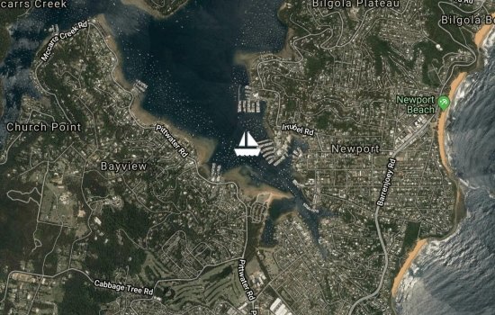
Report at 0830 EDT. Moved two nautical miles from Morning Bay to Newport, Pittwater.
Avg: 5.5knts
24hr: 132.6nm
Report at 1400 EDT. Just anchored at Morning Bay, Pittwater, NSW after a day and a half sailing down the coast from Camden Haven. A wonderful 150 nautical mile trip, with wind from behind, moderate seas, and a stellar night sky.
Well done guys, kind of a
Report at 1800 EDT. Currently underway on passage from Camden Haven to Pittwater. Dolphins and hundreds of birds nearby. Just passing Seal Rocks with 93 nautical miles to run. Had a delightful six days in Laurieton, Camden Haven with easy access to shops, some wonderful walks and socialising with the natives and other boaties.

Avg: 5.4knts
24hr: 129.2nm
Report at 1230 EDT. Tied to a jetty in the town of Laurieton, Camden Haven. An easy passage of over 200 nautical miles with up to two knots of helpful current. Crossed the bar into Camden Haven inlet just before 1000 this morning, escorted by dolphins. It is a pelican haven here.
Report at 1600 EDT. Underway heading southwards along the New South Wales coast. Departed the Gold Coast yesterday after spending a week at Paradise Point. Currently off the Solitary Islands. Have seen a number of whales and one turtle.
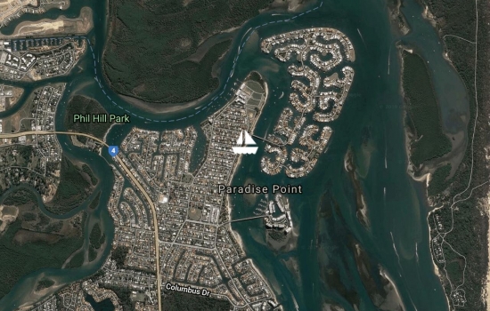
Weather report at 1740 AEST. Anchored at Paradise Point on the Gold Coast. Today we had a 20 mile trip zigzagging through shallows from Russell Island. It seemed that almost everyone in the Gold Coast was out on the water today. We saw hundreds of power driven boats en route, and their wakes created a washing machine like sea.
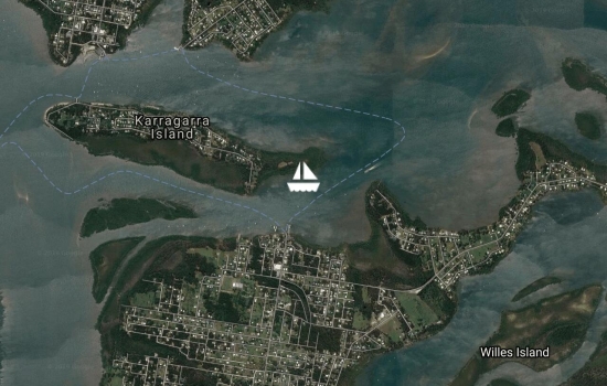
Weather report from 1130 AEST. Anchored on north side of Russell Island, near Karragarra Island, Moreton Bay. A 16 nautical mile run from St Helena's Island.

Weather report from 1)30 AEST. Anchored on western side of St Helena's Island, Moreton Bay. Enjoyed this afternoon and evening with our friends, Alison and Geoff. While walking ashore we saw Agile Wallabies and Rainbow Bee-eaters, spectacular birds with green, blue, chestnut and yellow plumage.
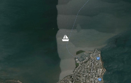
Weather report from 1230 AEST. Anchored outside Scarborough Marina, Moreton Bay. An easy 8 nautical mile sail this morning from Bribie Island. It was lovely to catch up with Kath and Rodney on Double Bubble this afternoon.
Avg: 4.2knts
24hr: 101.8nm
Report at 0645 AEST. Anchored at Bongaree Beach, Bribie Island. Moreton Bay. An easy sail yesterday and overnight from Double Island Point.
Report at 0945 AEST. Anchored at Double Island Point. Crossed the Wide Bay Bar in benign conditions around 7.30am this morning. Winds were on the nose, instead of forecast northerlies, so we stopped at Double Island Point, hope to move off again soon.
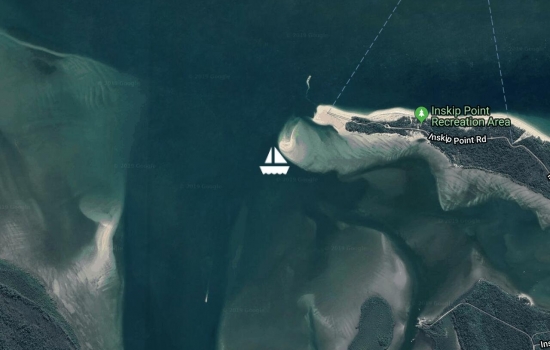
Report at 1115 AEST. Anchored at Inskip Point, near the southern end of Fraser Island. Motored southwards along Fraser Island for 30 nautical miles, with up to two knots of helpful current.
Report at 1530 AEST Thursday 26 September. Anchored off Bennet Creek, on Fraser Island. Sun is about to set. Very pretty spot. Sailed and motor sailed in winds which varied from ESE to NE.

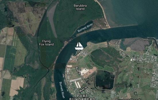
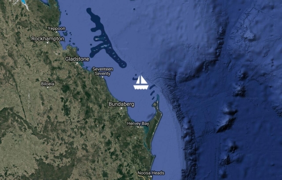
Report at 1130 AEST Tuesday 24 September. Spent a pleasant week in Bundaberg Port Marina, and departed from there this morning. Motored one nautical mile upriver. Currently anchored near Bundaberg?s Sugar Mills, hiding from south-easterly winds. Will head southwards towards Fraser Island in the next few days, as the wind allows.
Avg: 4.2knts
24hr: 100.9nm
Weather report at 1000 AEST Austalia Tuesday 17 September. Arrived safely in Bundaberg Port Marina after a wonderful trouble free passage. We even managed to see two whales yesterday.
By 1300, we have cleared with customs and biosecurity. Still have the Q flag flyng as the flag will not come down. It has tangled in its halyard in the strong winds.
Thanks to Geoff and Alison, Patricia and David who supported us with weather reports en-route. It is wonderful to be back in Australia.
Welcome back to Oz. What are
Welcome back to Aus! Happy
Avg: 7.1knts
24hr: 169.8nm
Report at 0430 AEST Austalia Tuesday 17 September. A fast sail towards Bundaberg, 27nm to go.
I see you will have Southern
I can so appreciate the
Avg: 6.7knts
24hr: 160.7nm
Report at 0415 AEST Austalia Monday 16 September. Motor sailing with 182 miles to run to Bundaberg.
Great going guys, my

Avg: 5.5knts
24hr: 132.8nm
Report at 0530 AEST Austalia Sunday 15 September. Motor sailing in light winds. The full moon is still up and the sun has just risen. 314 miles to run to Bundaberg.
Avg: 5.9knts
24hr: 140.6nm
Report at 0500 AEST Austalia Saturday 14 September. Wonderful sailing on gentle seas. The almost full moon is about to set in the west and the eastern sky is lit in apricots heralding a new day. 430 miles to run to Bundaberg.

Avg: 6.9knts
24hr: 165.5nm
Report at 0400 AEST Austalia Friday 13 September. Continue to sail, albeit at a slower pace. The sea has died down but still has some bounce. Saw one gannet. Squall with rain came through at 0200. 550 miles to Australia.
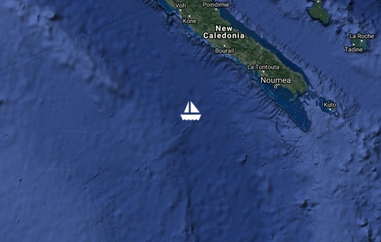
Report at 0400 AEST Austalia Thursday 12 September. Departed Noumea, New Caledonia yesterday at 1pm. Have travelled 82 miles from Dumbea Pass, where we exited the Southern Lagoon and were greeted by 2 to 3 metre swells. The seas have calmed a little, and the wind has shifted from SSW to a more helpful SE. Approx 695 miles to run to Australia.
Report at 140 local time Sunday. Anchored in Petite Rade, Noumea Have been ashore to buy fresh produce, including bananas.
Report at 1030 local time Friday. On a mooring at Ilot Maitre. It is a beautiful day.

Report at 1515 local time Thursday. Anchored at Ilot Bailly. A very civilised motor on flat water around Ilot Nde to this anchorage to gain better protection from the wind and seas. Beautiful mountainous scenery.

Report at 1200 local time Thursday. Anchored in Ilot Nde. The memories of bouncing on short sharp seas resulting from wind against tide exiting Canal Woodin will linger. We had a sporty sail across the bay to this anchorage.
Report at 1500 local time Friday. Anchored in Rade du Nord, Baie du Prony. Moved this morning from Anse Majic to gain protection from westerly winds. It is Peter's birthday today. The grey skies and rain have blown away, first time we have seen blue sky for five days.
Happy Birthday Peter, hope
Report at 0915 local time Friday. On a mooring at Anse Majic (Magic Bay), in Baie du Prony. Too wet to go for a walk today.
Report at 1345 local time Tuesday. On a mooring at Ilot Casy, in Baie du Prony.
Report at 1615 local time Monday. Anchored in Baie du Carenage yesterday. Land locked,surrounded by tree covered hills of red soil. Went up the nearby creek by dinghy and then foot to see a waterfall and a tepid spring.
Avg: 33.4knts
24hr: 802.3nm
Report at 1500 local time Saturday. Anchored in Baie de La Somme, Baie du Prony. Yesterday, we had a quick and comfortable sail with 20 knots from the North-west, gusting to 33 knots, and a two metre following sea

Report at 1800 local time Thursday. Anchored in Baie St Marie, near Noumea. Unexpectedly we were able to sail about half the way back from Mathieu Island to Noumea (total distance 30nm) and motor sailed the rest of the way. Glorious conditions, flat water, blue skies, sailing at wind speed. Arrived in anchorage mid afternoon and have been ashore to buy bananas and petrol.
Report at 0800 local time Wednesday. Anchored at Mathieu Island.
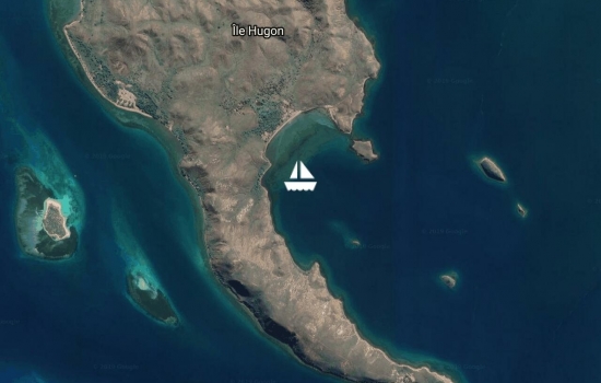
Report at 1640 local time Tuesday. Anchored at Hugon Island. Enjoyed our stay at Tenia Islet, lovely clear water and some good coral. Have sought refuge here from tonight's forecast strong westerlies.

Report at 1640 local time Friday. Anchored at Tenia Islet. Wind gusting to 20 knots. We can see surf breaking on the outer reef which is nearby. Wind is forecast to drop overnight and we hope to snorkel tomorrow.
Avg: 28knts
24hr: 672nm
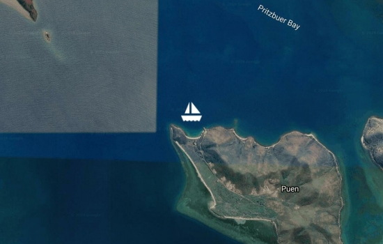
Report at 1600 local time Wednesday. Anchored at Puen Ilot. A short sail here where the water is flatter.

Report at 1130 local time Wednesday. Anchored for a few hours at Lepredour Island. Had a short walk ashore on Grande Terre.
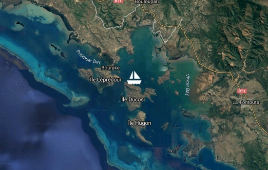
Report at 1545 local time Tuesday. Anchored along north coast of Ducos Island.

Report at 1545 local time Sunday. Anchored in Mosquito Bay, Ducos Island, after four attempts ? the first three the anchor was in rock. Motored here in no wind early this morning to seek shelter; the forecast for this afternoon was for winds gusting to 40 knots. Maximum wind so far 21 knots. Water tanks full now thanks to four hours of rain. Saw one mosquito as we entered the bay, and none since then.
Report at 1645 local time Saturday. Anchored at Moro Islet. Easy 12 mile motor in no wind to this peaceful anchorage. It is very beautiful here.

Report at 1415 local time Friday. Anchored at Baie Maa. Easy 9.5 mile motor in no wind to this peaceful anchorage.

Report at 0830 local time Friday. Anchored at Baie de Orphelinat, near Noumea. Spent four nights at Ilot Maitre and enjoyed snorkelling with turtles and watching them from the deck. Moved across to Baie de Orphelinat on Wednesday to catch up with our new friends on Emotion and to welcome our old buddies Jo and Arnold, aboard their boat Black Star, who have just sailed here from Australia. A front came through this morning with winds gusting over 30 knots. Later today we will head northwards, and find a nice anchorage just up the coast.

Report at 0615 local time Sunday. At Maitre Islet. 24 hours ago we departed Signal Islet after a bouncy Friday night with swell wrapping around the islet from two directions. We motor sailed 7 nautical miles in NE winds to Maitre Islet, arriving at 0800 yesterday. Despite winds gusting to 20 knots the water has been flat.
Happy Birthday to our granddaughter Lucy who turns 3 today.
Report at 1745 local time Friday. At Signal Islet. Easy sail with the wind behind us from Baie de Orphelinet. We had planned to stay near Noumea for a few days, however, friends on 'Emotion' suggested we join them out in the lagoon and after a visit to the market this morning we joined them here at Signal Islet. Walked around the pretty islet this afternoon spotting reef sharks, turtles, sea snakes, and osprey.
Report at 12 noon local time Thursday. Anchored at Baie de Orphelinet, near Noumea. A quick sail from Ilot Amedee with winds from behind up to 24 knots. After three weeks without a supermarket, we have been ashore to buy provisions, including bananas. Plan to be here for a few days.

Avg: 2.7knts
24hr: 64nm
Report at 1500 local time Tuesday. On a mooring at Amedee Islet. After snorkelling at Recif Tabu, we motored one nautical mile to Amedee Islet where we will spend the night.
Report at 1215 local time Tuesday. Anchored off Recif Tabu. Sailed and motor sailed over 20 miles from Ilot Ua this morning. Overcast with periods of rain. Lots of rainbows. Saw a waterspout whipping the seas into a frenzy about half a mile away. It had largely dissipated by the time it reached us. Recif Tabu was recommended to us by friends Alison and Geoff. Snorkelled along the reef and over bommies. Saw numerous large fish, a white tipped reef shark and a brilliant blue fish previously not known to us.
Report at 1730 local time Saturday. Sailed to Ilot Mato today from Ilot Ua. Had a great time at Ilot Ua, clear water and extensive coral. Now in another beautiful setting at Ilot Mato. Climbed to the top of the islet and looked down upon the numerous reefs. Spotted osprey and a sea snake near the top of the climb.
Report at 1445 local time Wednesday. Moved to Ilot Ua today. Beautiful sailing across the lagoon from the Isle of Pines, where we spent two idyllic weeks. Hope to snorkel here tomorrow.
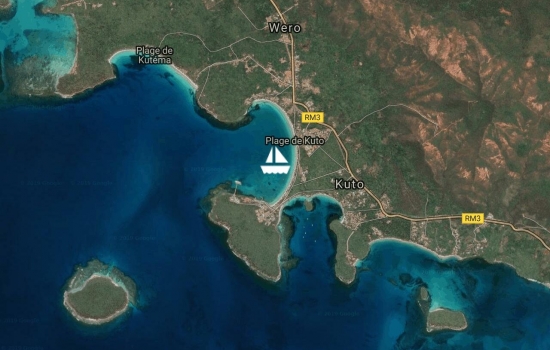
Report at 5pm local time Wednesday. Still in Kuto Bay on Isle of Pines. Tucked in a little closer to the shore to shelter from the swell. Earlier today we walked to the top of the highest point on the island, Pic Nga, which gave us splendid views of this beautiful island. Got to the shop, after a long hike up and then downhill. They had sold out of baguettes.
Report at 4pm local time Thursday. Anchored in Kuto Bay, Isle of Pines. Enjoyed yesterday, went for a walk around Casy Island in Baie du Prony. Departed at 6am this morning and motor- sailed into moderate winds and a bouncy sea.
Good to see you're now
Report at 4pm local time Tuesday. On a mooring at Ilot Casy, in Baie du Prony. After a mercy dash to the market for bananas early this morning, we motored 30 nautical miles in calm conditions. Views of verdant Grand Terre and Ouen Island along the way. Made water and did laundry underway.
Report at 4pm local time Monday. Anchored at Baie de Orphelinet, near Noumea, where we have been able to access the supermarket after two weeks away from town.
Anchored at Uere Isle, Friday noon local time. Sailed in very light winds from Ilot Amedee, taking four and a half hours to travel 9.5 nautical miles. Saw dolphins while underway.
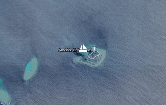
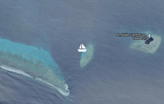
On a mooring at Ilot Amedee. The past few days have been splendid thanks to light winds and fine weather. This morning we motored from Ilot Maitre to Ilot Amedee. We climbed the impressive Amedee Lighthouse (cost 300 francs per person and opening hours when Mary D is in 'town' 9.30 to 11.30 and 1.30 to 3.30). Snorkeled in clear waters and saw lots of fish including anemone fish, a large lobster and a turtle which was asleep in the coral. Very happy to be here.
On mooring in Ilot Maitre. Spent five nights in Baie Maa which gave us good protection from moderate to strong southerly quadrant winds. The wind dropped out overnight and we motored 9 nm to Ilot Maitre. After a week of overcast and rainy weather, the sun is shining. We've been in the water and swam with the fishes and one turtle.
Anchored in Baie Maa. We spent two busy, wet days in Port Moselle Marina, Noumea: checked into New Caledonia, bought fresh food and baguettes, met a number of cruisers, made boat repairs and did laundry. Departed the marina yesterday and after a short sporty sail we arrived in Baie Maa where we hope to have good shelter, from the forecast strong southerly quadrant winds, over the next few days. Anchored near friends on Ganesh, and caught up last night with Fatty and Carolyn when we reminisced about our travels together up the Red Sea and around the world.
Avg: 4.1knts
24hr: 98.5nm
Arrived Port Moselle Marina, Noumea, New Caledonia at 1100 local time. It has rained steadily since our arrival in New Caledonia. Glad to be here. We will be in the marina for a few days.
Howdy guys, congrats, nice to
Avg: 5.1knts
24hr: 121.6nm
Six nautical miles to enter the pass into New Caledonia's southern lagoon. We are back in the tropics after 22 months and 5000 nautical miles. A gannet has been perched on the starboard lifelines for the past 12 hours. All well on board and looking forward to arrival.
Avg: 6.5knts
24hr: 154.8nm
Scooting along under jib. 105 nm to reach New Caledonia's lagoon. ETA tomorrow (Monday). All is well. Our oldest grandchild turns 14 today. Happy birthday Cooper.
Avg: 5.1knts
24hr: 122.5nm
Motoring in calm conditions. We still have plenty of apples and bananas. However, our fresh vegetable supply is dwindling so we will have to be inventive with our menu. Lots of tinned food, so we won't go hungry. We continue to travel south of a direct line to New Caledonia, in case we get head winds prior to arrival. 555 nm from Australia, 235 nm to go to New Caledonia. ETA NC Monday. All is well on board. Thanks Alison and Geoff for your support via the SSB.
Avg: 6knts
24hr: 144.7nm
Experienced squally conditions just east of 160E. For past 24 hours the wind has been from the E to SE. Currently under another squall and the wind has changed, it's coming from a northerly quadrant. 445 nm from Australia, 340 nm to go to New Caledonia. ETA NC Monday. All is well on board.
Avg: 10.9knts
24hr: 262.2nm
A slow and comfortable sail yesterday with light winds from the SW. Around sunset the wind backed to the south and the boat speed has increased. We are sailing south of a direct line to Noumea. 325 nm from Australia, 465 nm to go to New Caledonia. All is well on board.
A comfortable ride under reefed main and jib. 220 nm from Australia, 565 nm to go to New Caledonia. All is well on board.
Ganesh ex Wild Card, heard
Avg: 5.6knts
24hr: 135.1nm
Departed Southport Seaway at 10am yesterday. Smooth sailing initially, then a jolty ride through the area affected by current. Full moon aided nightvision. A comfortable ride at the moment under reefed main and jib. 100 nm from Australia, 750 nm to go to New Caledonia. Just crossed the Queensland seamounts. All is well on board.
report at 0810 local time Monday. On Quarantine dock at Southport Yacht Club. Just been cleared by Australian Border Force. We will soon be on our way to Noumea.
Hi there. Although I haven’t
report at 1830 local time Sunday. This morning, we moved two nautical miles to an anchorage off Australia Fair Shopping Centre. We are ready to depart Australia tomorrow morning, after refuelling and a last provision today to ensure that we have a week?s worth of bananas. We will meet with the Australian Border Force tomorrow morning before heading off to New Caledonia. Lightning display late this afternoon and then a full rainbow over the Gold Coast. Quiet now.
Safe travels to NC guys, we
report at 1115 local time Friday. We returned to Wave Break Island anchorage earlier in the week as there is less wake from passing traffic here. We are monitoring the weather forecasts closely and hope to depart for New Caledonia in the coming week.
report at 1500 local time Sunday. Moved just over one nautical from Wave Break Island to Crab Island to comply with local regulations. More passing traffic here and vessels going at high speed. Plan to return to Wave Break Island tomorrow.
report at 1900 local time Monday. Yesterday, we moved 2nm from Southport to anchorage north Wave Break Island. Fewer jet skis and helicopters.
Avg: 5.7knts
24hr: 137.5nm
report at 1930 local time Saturday. Just anchored in Southport, Gold Coast. Challenging coming through the Seaway in the dark particularly as there were poorly lit vessels anchored in the narrow channel to fish. Fireworks have heralded our arrival.
You made good time to
Avg: 4.9knts
24hr: 117.9nm
report at 0545 local time Saturday. In past 24 hours we?ve motored in no wind, and sailed with 4 to 14 knots of winds from the west through to the south. Currently off Evans Head. All is well on board.
we notice you are heading our
report at 0600 local time Friday. Departed Port Stephens at 0700 yesterday. Currently off Scotts Head. Experienced strong winds up to 33 knots yesterday with maximum boat speed 16 knots while surfing down waves. Smoke haze and choking smoke 7 miles out to sea. Saw two shooting stars overnight. All is well on board.
report at 1545 local time Tuesday. Moved The Southern Cross to the western side of Shoal Bay yesterday morning to sit out strong winds. Yesterday the wind gusted up to 37 knots, today it is gusting to 25 knots. More strong wind forecast for tomorrow. Today we walked to the top of Tomaree Head Lookout and gained great views over Port Stephens.
report at 1930 local time Sunday. Departed Pittwater this morning and sailed with winds up to 25 knots from the west. A sporty sail of 75 nautical miles. Weather looked unfavourable to continue so we have made landfall in Shoal Bay, Port Stephens. May be here for a few days.
Anchored in Morning Bay, Pittwater. Hope to catch up with friends over the next few days and then sail northwards when the southerlies or westerlies begin to blow.
report at 1230 local time Wednesday. Motored less than 2 nautical miles from Pinto Bay to Halletts Beach, and went for a stroll on the small beach. Beautiful setting. Planning to anchor in Pittwater tonight.
report at 2000 local time Wednesday. This morning we motored 4 nautical miles upstream to Jerusalem Bay. We have picked up a mooring in Pinta Bay, Broken Bay. Some smoke haze due to controlled burns. Went for a 2 hour walk from Jerusalem Bay to the hamlet of Cowan, walking through rainforest in the Ku-ring-gai Chase National Park.
report at 1130 local time Monday. Motored 4 nautical miles this morning further into Broken Bay. We are up Smith?s Creek with two paddles stowed in the dinghy. Isolated pristine beauty reminiscent of Port Davey.
report at 1130 local time Monday. Motored 4 nautical miles this morning further into Broken Bay. We are up Smith?s Creek with two paddles stowed in the dinghy. Isolated pristine beauty reminiscent of Port Davey.
report at 1100 local time Saturday. Moved this morning one nautical mile from America Bay to a spot in Cowan Creek, called Cottage Rock, where we have internet coverage which enables us to follow the Australian election. Beautiful spot.
report at 1730 local time Thursday. After a week in Pittwater, where we caught up with friends and spent money, we've returned to Broken Bay where we are surrounded by Ku-ring-Gai National Park's hills and bush.
Weren’t we there in 42 deg
report at 1730 local time Thursday. After a week in Pittwater, where we caught up with friends and spent money, we've returned to Broken Bay where we are surrounded by Ku-ring-Gai National Park's hills and bush.
report at 0815 local time Tuesday. Departed Castle Bay, Cowan Creek yesterday. Moved to Salt Pan Point, Pittwater.
report at 1330 local time Saturday. Departed Manly and Sydney Harbour this morning. An easy sail under jib up to Broken Bay. Then a motor into wind on the nose to Castle Bay, Cowan Creek. On a mooring surrounded by beautiful Ku-ring-Gai National Park.
report at 0645 local time Friday. Moved from Athol Bay yesterday, where according to our AIS system we had 135 targets. Avoided all vessels out on the water to travel four nautical miles to Manly. Sitting on a mooring just off the Manly Pavillion. Hope to sail northwards to Broken Bay tomorrow.
Enjoyed our two weeks in Blackwattle Bay. Weather was superb: warm with light winds. Departed this morning, after voting yesterday in the Federal Election. Now on a mooring in Athol Bay adjacent to Taronga Zoo. Beautiful views. Ferry wash creates an onboard jiggle.

Excellent view, enjoy the
report at 1045 local time Thursday. Enjoyed a week in Manly, although the Store Beach anchorage was very busy on the weekend with up to 30 boats nestled around us. Departed this morning and 7 nautical miles and two hours later we?ve arrived in Blackwattle Bay, near the Fish Markets at Darling Harbour. Iconic sites along the way included the Opera House and sailing beneath the Sydney Harbour and Anzac Bridges. Last anchored here 12 years ago.
Well done guys, I was born in
Remember I saw you there from
Avg: 6.4knts
24hr: 152.8nm
report at 0745 local time Friday. Anchored off Store Beach, near Manly, Sydney Harbour. Departed Eden at 2pm Wednesday. An uneventful sail along the NSW coast. Entered Sydney Harbour heads at first light alongside our friends on the sailing vessel Sol. We'd hoped to find some warmth and sunshine, anchored in pouring rain. At least the salt from a bouncy sea in Bass Strait is being washed off.
report at 1000 local time Thursday. Departed Eden at 2pm yesterday. Sailed overnight hugging the NSW coast. Plan to continue on to Sydney Harbour with arrival tomorrow (Friday).
Avg: 3.8knts
24hr: 90.8nm
report at 1600 local time Tuesday. Arrived safely in Eden at 1515 In 54 hours we travelled 325 nautical miles with some sporty sailing and mundane motoring.
Avg: 6knts
24hr: 144.8nm
report at 0715 local time Tuesday. Motoring around Gabo Island, Victoria in light conditions. Heading towards Eden, New South Wales. Sun just rising out of cloud on eastern horizon. All is well on board
Avg: 7.3knts
24hr: 174.7nm
report at 0945 local time Monday. Departed Port Sorell, Tasmania 25 hours ago. Had a feisty sail yesterday with winds reaching 33 knots and boat speed 12 knots. White water in the cockpit and plates flying around the galley. Wind has gradually abated from 25 knots at 8pm, to under 20 at 2am. Seas and swell have reduced making a much more comfortable platform on which to live. Barometer has risen from 1003 to 1023 in 25 hours. Have sailed 165 nautical miles.
report at 0845 local time Sunday. After spending over a week anchored off Baker Point, Port Sorell, The Southern Cross?s crew are preparing to cross Bass Strait. Have enjoyed our time in this beautiful spot: walks on beaches, catching up with old friends and making new ones. Easy access to supplies.
report at 0930 local time Saturday. Thursday around 10pm The Southern Cross refloated on the rising tide. Re-anchored in six metres, 100 metres off Bakers Point.
On Thursday we beached The Southern Cross at Baker Point, Port Sorell to remove fish farm line from around port saildrive shaft. Many thanks to our friend Tim, ex Rubicon Star, for his invaluable assistance.


report at 1900 local time Wednesday. This morning moved 5 nautical miles from outer anchorage off Port Sorell into the Rubicon River. Anchored by 10.30am.
Avg: 2.6knts
24hr: 63.6nm
report at 0700 local time Wednesday. Departed Coulomb Bay, Three Hummock Island at noon yesterday. Motored overnight in light winds, with some soft rain. Unable to see the near full moon due to cloud cover. Have anchored off Port Sorell for a few hours awaiting a favourable tide to move into the Rubicon River. We were accompanied by dolphins into anchorage as the day dawned.
report at 1900 local time Monday. Departed Ann Bay, on north west coast of Tasmania this morning and sailed up past Cape Grim and the Doughboy Islands. Zigzagged around Brown Rocks, Bird Island and up through Hunter Passage assisted by engine and sails. And then a rollicking sail northwards to Coulomb Bay, Three Hummock Island. Glorious scenery along the way on a bright sunny day.
report at 1000 local time Sunday. Departed Strahan yesterday morning after buying the weekend newspaper and bananas. Passed through Hells Gates and out of Macquarie Harbour before noon. Sailed overnight under a waxing gibbous moon, until it set at 0200, and then a galaxy of stars. A comfortable dry decks passage to Ann Bay, just south of Cape Grim. We?ll wait here for a few hours, or perhaps overnight, and then head around Tasmania?s north western cape.
report at 0910 local time Tuesday. Departed Birch’s Inlet three days ago on light southerly winds and motored to the town of Strahan. A series of cold fronts bringing rain and moderate to strong winds continue to blow through. During dry spells we have stretched our legs ashore, provisioned and purchased fuel. We are enjoying catching up with fellow cruisers while we wait for a good opportunity to head further north.
report at 1530 local time. Early this morning, we motored 7 nautical miles across the southern end of Macquarie Harbour to Birch's Inlet. Another beautiful spot where the wind blows and the rain falls.
report at 1300 local time Wednesday. The Southern Cross remains in St Leger Point, Kelly Basin while her crew explore more of this area on foot or hide on the boat from inclement weather. Today we have experienced rain and hail. Midday temperature 14°C inside the boat. Fortunately snow is predicted only to fall on the high country and not at sea level.
Left Kelly Basin at 0700 and the above report was written at 0815 local time Monday while moored at Sarah Island. Walked around a deserted Sarah Island on our own looking at the remains of a convict settlement, and undertook a second lap tagging along on a tour of the island with 40 other people who arrived on a tourist boat. At noon we returned to St Leger Point in Kelly Basin, as per Saturday's position report. In the afternoon we hiked through lush rainforest for 11 kilometres along the Bird River Track.
report at 1730 local time Saturday. Enjoyed three days 20 miles up the Gordon River. Mirror smooth waters with wonderful reflections, including the stars at night. Reached the first rapids in the Franklin River via dinghy. Walked through dense rainforest where we spotted a Boobook owl who posed for us. Now anchored off beautiful St Leger Point in Kelly Basin, Macquarie Harbour. Peter has made arancini balls for tonight's meal. It doesn't get any better than this.


report at 1930 local time Thursday. Departed Strahan this morning and travelled 18 nm up the Gordon River to Warners Landing where we are rafted up to SV Sengo. You can feel the serenity. (Tried to send Thursday evening but not able to connect)

Avg: 3.2knts
24hr: 76.1nm
report at 1930 local time Tuesday. Departed Port Davey at 1900 last evening in misty conditions. Southerly winds built overnight and we had an easy sail with up to one metre following seas for 100 nautical miles to Macquarie Harbour. Came through Hells Gates at noon with up to three knots of negative current. Bananas have been sourced from the IGA at Strahan.
report at 1600 local time Monday. Motored four nautical miles from Schooner Cove, Bathurst Channel, to Spain Bay, Port Davey. Enjoyed a three hour return walk across the headland to Stephens Bay which faces the Southern Ocean. The weather cooperated, and the rain started as we returned to the dinghy. Currently, sharing the anchorage with seven boats including Crusader (met in Ikuka NSW, 2007), Pampero (met Indonesia, 2008), Kosa (met Turkey, 2010) and Jigsaw (met Bundaberg, QLD, 2017). Ran out of bananas yesterday. Hope to use the forecast southerlies to push us northwards to Macquarie Harbour.
report at 1600 local time Sunday. This morning we moved The Southern Cross two nautical from Bramble Cove, Port Davey, to Schooner Cove, Bathurst Channel. Went dinghy exploring for four hours, peaking into bays and coves, admiring the views.
report at 1800 local time Saturday. A beautiful sunny day, spent sailing around Bathurst Harbour admiring the views and then motoring westwards down Bathurst Channel to Bramble Cove, where we climbed Mt Milner.
report at 1900 local time Friday. After three boat bound days the wind settled and the rain became showers. Thursday afternoon we dinghied 5 nautical miles up to Meleluca Lagoon. From bird hides we saw the critically endangered Orange-bellied parrot. Meeting two hikers, who had walked for 10 days through hail and rain, helped us realise that sitting on our boat for a few wet days wasn't so bad after all. Earlier today we hiked up Mount Beattie to gain views across Bathurst Harbour, Mount Rugby, along Bathurst Channel and towards the distant ocean.
report at 1430 local time. Went ashore and explored Claytons Corner on the weekend before the wet and windy weather started Monday. Have been boat bound for two days. Hoping that the weather will fine up and enable us to climb a hill or two.
report at 1100 local time. Departed Recherche Bay at 6pm last night. Sailed and motor-sailed overnight with favourable winds, passing Maatsuyker Islands at 0100 as the moon was setting. Arrived in Port Davey at 0800 where we were greated by misty grandure. Spent three hours tooting upstream to Kings Corner in Bathurst Harbour, bedazzled by the scenery including reflections on mirror smooth water.


report at 1630 local time. Departed Alexanders Cove, Barnes Bay at 8 o'clock this morning. We sailed and motor-sailed 30 nautical miles down the D'Entrecasteaux Channel to Coalbins Bay in Recherche Bay. Maximum gust 28 knots and maximum boat speed 9 knots. We pushed into 23 knot winds to enter the bay. The wind dropped soon after we anchored at 4pm.
report at 1630 local time. Departed Prince of Wales Bay Marina this morning after a pleasant stay in Hobart. After a 20 nautical mile trip, in which we experienced winds from all directions save easterlies, we have anchored in Alexanders Cove, Barnes Bay.
report at 1000 local time. This morning The Southern Cross motored 3 nm up the Derwent River and is now berthed at Prince of Wales marina. We plan to stay here for two weeks: to sightsee in and around Hobart, catch up with friends, attend the Wooden Boat Festival and buy boat parts.
The Southern Cross was relaunched on Friday 25 January. Pleased with our haulout experience thanks to the expertise of the marina staff in operating their hydraulic trailer.
Currrently in pretty Cornelian Bay, Hobart, on a mooring.
Report at 2000 local time. On the hardstand at Margate Marina after being hauled out on a hydraulic trolley. Staff have been professional and friendly. Hulls are in good condition. Plan to work on engines and apply anti-fouling paint before returning to the water.
Ahoy from Soggy Paws, a SF 44
Avg: 31knts
24hr: 744nm
Report at 1715 local time. Arrived Margate Marina this afternoon in preparation for the boat's haulout tomorrow morning.
Report at 1345 local time. Moved 1.5 nautical miles in Barnes Bay from the Duck Pont to Quarantine Bay. Visited the Bruny Island Quarantine Station, tying the dinghy up to their pontoon.
Report at 1100 local time. Departed Nubeena on the Tasman Peninsula yesterday and motor-sailed 25 nautical miles to the Duck Pond, Barnes Bay, North Bruny Island An electrical storm blew through briefly last night. Plan to remain here, in this quiet pretty spot, today and haul out at nearby Margate Marina on Friday 18 January. Tasmania is recording record high temperatures. We are wearing fleeces, trackpants and ugg boots.
Report at 0815 local time. Departed Port Arthur at midday yesterday. A rip roaring sail out of the harbour to the Southern Ocean. A slow sail around the stunning cliffs at Cape Raoul where pods of dolphins flocked to play with The Southern Cross. The wind dropped out and we motored into Wedge Bay where a curious seal came up to our stern to say hello. It was a 20 nautical mile journey to Nubeena on the Tasman Peninsula, only 6 nautical miles across land from our previous anchorage. We went ashore last evening and bought provisions from the small grocery store.
Report at 0645 local time. Moved to another anchorage near the Port Arthur Historic site late yesterday because the overnight forecast was for winds up to 25 knots from the north, and our spot in Carnarvon Bay was unprotected. Motored 1 nautical mile in winds gusting to 15 knots. As soon as we anchored the wind dropped and overnight it was calm.
Report at 0745 local time. Maximum wind we saw in Stinking Bay yesterday was 21 knots. At Tasman Island, 8 nautical miles away, the wind gusted to 47 knots. Moved 2 nautical miles this morning to Carnarvon Bay, near the historic Port Arthur site.
Report at 0800 local time. Departed Maria Island before sunset. An uneventful overnight passage around Tasman Island to Stinking Bay, Port Arthur. Despite its name, this is a beautiful cove. We hope it provides good protection from this afternoon's forecast strong NE winds. Plan to explore ashore tomorrow.
Report at 1745 local time. Left Orford anchorage this morning and sailed down Mercury Passage. Saw a seal sunning itself in the waters near Lachlan Island. Anchored in Chinamen's Bay, Maria Island. Went for a walk around Point Lesueur peninsula. Saw convict ruins, eucalypts, butterflies, locusts and scats (possibly wombat). A beautiful day.
Avg: 3.1knts
24hr: 75.2nm
Report at 1830 local time. Left Shelly Beach this morning and motored less than a mile to anchor off the town of Orford. Despite small surf running it was easy to land and launch the dinghy off the nearby beach which has firm white sand. It was an easy walk into town where the small grocery store sold all that we needed. The Pop Up Book Stall, held in the local primary school, sold a wide variety of books. Peter bought two on Winston Churchill. We have stunning views of Maria Island to our east and plan to head across to the island tomorrow.
Report at 12.45 local time. Sailed overnight southwards down Tasmania's east coast from Skeleton Bay to Shelly Beach near Orford.
Avg: 3.3knts
24hr: 78.5nm
Report at 0600 local time. Sailed overnight from Tamar River on the northern coast to Skeleton Bay, north of St Helen's on Tasmanian's east coast. We had a fast wild ride yesterday covering 80 miles in 12 hours. The last 12 nautical miles took 8 hours as we drifted waiting for light to enter this anchorage. After today's forecast southerlies we aim to set sail once more.
Report at 1015 local time. Departed Tamar River soon after dawn and now we are a little under halfway from Tamar River to the NE corner of Tasmania. Aim to sail overnight down the east coast of Tasmania, on our way towards Hobart. Maximum wind so far 31 knots. The wind is from behind so it is a comfortable ride.
Avg: 4.8knts
24hr: 114.1nm
Report at 1230 local time. Arrived at the entrance markers to Tamar River, which leads to Launceston, Tasmania, at 0530. With the current we traveled upstream to a delightful anchorage in West Arm. It took us 48 hours to travel 275 nautical miles from Port Fairy to the Tamar River. The westerly quadrant winds, which blew up to 27 knots, kept us sailing happily for three quarters of the trip. Around midnight last night the winds, as forecast, came up from the east and we were hard on the wind on a lumpy sea for the last few hours of this journey. We are now in a haven surrounded by verdant hills and bird song, reminiscent of the Chesapeake in the USA.
Avg: 6.3knts
24hr: 150.2nm
Report at 1600 local time. Sailed past the northern tip of King Island under clear starry skies. Currently 30 nautical miles north of the north coast of Tasmania. Apart from ourselves, we haven't seen anyone else this year. A fast rollicking ride at the moment.
Report at 1600 local time. Enjoyed a two day stay in Port Fairy: walks on the beach, laundry, hot showers, provisioning, engine maintenance and the Port Fairy New Year's Eve street parade. Departed this morning heading towards Tasmania. Westerly winds are pushing us along nicely. Currently 20 nmiles south of Cape Otway, entering Bass Strait.
Avg: 4.4knts
24hr: 105.1nm
Report at 1430 local time. Departed Southend yesterday morning. Overnight trip crossing from South Australia to Victoria around midnight. As advised we stayed outside the 150m depth line in SA and the 100 metre line in Victoria during the night and had no issues with craypots. Once we crossed into Victorian waters, the winds came up from a useful direction and we had a fast sail to Port Fairy. We have tied up to the town dock in this popular seaside town. Can't wait to have a shower, go for a walk and buy bananas.
Report at 1600 local time. Departed Southend this morning. Slow motor or motorsail down the South Australian Limestone Coast. Just crossed the 100 metre depth line; have been advised that we should not see craypots beyond the 200 m line. Plan to sail, or motor, overnight, for arrival in either Portland or Port Fairy tomorrow.
A seven hour motor sail on flat seas and a gentle 1 metre swell from the south-west took us from Robe to Southend in Rivoli Bay. Now anchored behind the fleet of fishing boats in 4 metres. Managed to dodge all the craypots but picked up kelp on approach to the anchorage. Post anchoring Peter dived in to cut kelp off the starboard rudder. The port engine is now behaving well.
Avg: 3.5knts
24hr: 83.8nm
Arrived safely in Robe this afternoon (Monday) and have tied up in the marina. It was a lovely sailing day with northerly winds from 8 to 12 knots. Came across craypots only once we were south of Cape Jaffa; and only a few in number. It looks like we may have to enjoy the delights of Robe for a couple of days while the southerlies blow. Currently working on the port engine, in the hope that this time we fix the overheating issue.
Well done guys. Hope you can
Avg: 4.5knts
24hr: 108.3nm
Came through Backstairs Passage with the tide late morning yesterday. Motored overnight in calm conditions. Now sailing under jib and reefed main. No craypots sighted yet. Planning to make landfall later today, at Robe or Cape Jaffa, to hide from tomorrow's forecast southerlies. All is well on board.
Avg: 3.7knts
24hr: 88.4nm
Departed Port Adelaide at 9pm local Saturday 22 December. Port engine overheated. Sailed overnight on a lumpy sea. Pulled into Second Valley at dawn to deal with the engine issue. Problem solving involved Peter diving into the sea to check inlets, removing raw water pump and using the Pilot Bob method which involved using the deck wash to flush sea water back through the saildrive and clear the blockage. After two and a half hours, the issue is resolved and we are ready to head off once more. Would like to stay and enjoy one of our favourite places but the wind is right to go.
Making final preparations to depart after a year of shore leave. Hope to set sail late this evening and head towards Tasmania. Will stop along the way as dictated by the winds.
Hi guy's
Avg: 2.7knts
24hr: 64.6nm
Departed Spalding Cove, near Port Lincoln on Monday morning. Travelled non-stop through to North Haven Marina, in Adelaide. The 155 nautical mile trip took 32 hours. Just as we were coming into the marina, the steering cable broke. We narrowly missed hitting the breakwater on the port and then on the starboard side as the boat veered out of control. Anchored in the middle of the entrance while a temporary repair was done, enabling us to enter the marina safely. After 10 and a half years The Southern Cross is back in her home port. We are grateful to Kath and Rod for their assistance and warm welcome. A big day for us, our ninth grandchild Addison Faye was born this morning here in Adelaide.
Welcome back to Adelaide..
Departed Port Lincoln this morning and popped back to Spalding Cove for this evening.
A pleasant 7 nautical mile sail under jib on flat water from Spalding Cove to Port Lincoln. Anchored off the town and looking forward to buying bananas.
Pleasant sail under jib on flat water from Williams Island to Boston Bay. Now anchored off Spalding Cove, approximately 5 nautical miles east of Port Lincoln. Last time we anchored here was in February 2007. A good place to rest; lovely still water beneath the boat.
NB We picked up a sunken mooring on our anchor. So best not to anchor in exactly this spot.
Congratulations on an epic
Anchored in the shelter of Williams Island, which lies off the southern tip of Eyre Peninsula, near Cape Catastrophe. Instead of contending with large lumpy seas, we are sitting on gently rolling waters. It is a relief to have crossed the Great Australian Bight. We are five miles away from completing our circumnavigation of mainland Australia. Plan to raise the anchor later this morning and head towards Port Lincoln.
Avg: 7.1knts
24hr: 170.4nm
Bouncy seas continue. Some blue sky can be seen through grey clouds. Landfall not far off now. All is well on board
Avg: 7.8knts
24hr: 186.9nm
Bouncy sea with up to 2 metre swells coming from 3 directions. Reefed down for the night with three reefs in the main and the jib. A uncomfortable sail. All is well on board.
Avg: 7.5knts
24hr: 179.2nm
Bouncy sea with up to 3 metre swells coming from 3 directions. Three reefs in the main and a partially furled jib. A very uncomfortable sail. All is well on board.
Oh, how many times does the
Avg: 5.2knts
24hr: 123.9nm
Comfortable motor-sailing on long period swell. All is well on board.
Departed Arid Bay, Cape Arid this morning (Sunday 12 November). Now clear of the Recherche Archipelago. Seas 1 to 2 metres. All is well on board
Still anchored in Arid Bay, Cape Arid waiting for a weather window to head across the Great Australian Bight. Went for a hike today. The scenery is spectacular. The sand is fine like icing sugar, but firm when wet which makes for great walking along the beach.
Sailed eastward from Lucky Bay to Arid Bay, Cape Arid in vigorous easterlies. We put in 16 tacks to sail 75 miles, and travelled 46 miles as the crow flies. Enjoyed beautiful scenery along the way and, after nearly 14 hours at sea, the delight of finding a safe haven just as the sun was setting.
3 hour sail from O'Briens Beach at Cape Le Grand to Lucky Bay, which is 7 miles east as the crow flies or 15 miles when you are tacking into the wind. And what a pretty spot this is, aquarmarine seas roll onto pristine beaches and lap around rocky outcrops.
Avg: 5.9knts
24hr: 142.1nm
48 hour sail from Albany to O'Briens Beach at Cape Le Grand, which is approximately 12 nautical miles east of Esperance. A good passage with wind on the starboard beam most of the way. We seemed to have helpful current with us for the last 24 hours. Maximum depth 3,000 metres. Saw many albatross and shearwaters. On approach to the anchorage we saw surf exploding over rocky islets and reefs of the Archipelago of the Recherche.
Spent five days in Albany, enjoying the scenery and friendly locals despite gale force winds on Thursday and Saturday. Departed yesterday (Monday) afternoon. Currently headed towards Esperence. Exact destination to be determined. Relatively easy conditions. All is well on board.
Avg: 4.3knts
24hr: 102.8nm
Arrived Albany at 6pm WST last night. From Cape Leeuwin it was a comfortable fast ride on winds from astern: 20 to 30 knots, gusting to 40 with seas up to three metres. With only a scrap of jib out we surfed down one wave at over 16 knots. Saw a number of birds including albatross. Plan to stay in Albany for a few days while gales rage.
Avg: 2.9knts
24hr: 68.9nm
Departed Bunker Bay this morning. Travelled southwards from Cape Naturalite to Cape Leeuwin through a stretch of water called 'Other Side of the Moon' on our chart. Rounded Cape Leeuwin this afternoon and we are now in the Southern Ocean for the first time since 2007. Smooth sailing on 2 metre seas. Destination is Albany. All is well on board.
Departed Geographe Bay late this morning. Pleasant sailing on flat water. Now tucked up in Bunker Bay, near Cape Naturaliste. Whales breaching nearby. Planning to round Cape Leeuwin tomorrow.
Spending time with old cruising buddies has made our stay in the Busselton area very special.
Another fabulous sail, this time from Bunbury to Port Geographe, near Bussleton. Sailed at 7 to 9 knots and covered 26 miles in 4 hours.
Great to follow your trip,
Avg: 2.6knts
24hr: 61.3nm
A delightful sail from Mandurah to Bunbury on flat water. Sailed 50 nautical miles in seven hours; maximum boat speed was 10 knots. It is the best sail we've had in a long time. Heading off to catch up with friends, who live in Bunbury: we first met them in Darwin and last saw them in the Kimberley.
Had a walk around town, and then took the boat back downstream outside the entrance to the Mandarah canal. Currently on a courtesy mooring, ready for an early departure tomorrow. Rolly conditons.
Berthed at a visitor jetty in the heart of Mandurah, after a pleasant 32 nautical mile sail.
After two weeks of Freo Fun we departed the Fremantle Sailing Club this afternoon and travelled four nautical miles southwards to Owen Anchorage, Woodman Point. Heading towards Geographe Bay over the next few days.
At last we are in Fremantle, Perth. Yesterday morning The Southern Cross departed Boullanger Island, near Jurien. A relatively easy 120 nautical mile trip, with fast sailing at the beginning, and then some motoring to ensure we arrived well before the strong southerlies filled in. Feels wonderful to be here.
Yesterday The Southern Cross was tied up to a concrete jetty within the Jurien Bay harbour. It was a 40 minute walk to the IGA and town along the foreshore. Went for a walk along a beautiful beach this morning, which is just north of the marina. Visited the very friendly Volunteer Marine Rescue service and was given information about the southern passage, which will be helpful when we depart for Perth in a few days. Currently at anchor off Boullanger Island, just off Jurien, which is providing us with good protection from strong southerlies. Hope to leave Sunday for Fremantle, near Perth.
Due to a series of gales on the southern Western Australian coast, The Southern Cross was berthed at the Batavia Coast Marina, Geraldton for 11 days. We had hoped to sail right through to Perth, but took a 28 hour weather window and travelled as far as Jurien Bay. Hope to leave for Perth in the next few days, after more strong southerlies blow through.
Avg: 4.1knts
24hr: 98.1nm
Departed Turtle Bay, in Shark Bay at first light on Thursday and took two days to travel 210 miles to Geraldton in calm conditions. Arrived this morning and are berthed at Batavia Coast Marina. Enjoyed a hot shower, a visit to the museum and a short walk to Coles. Will be here for a few days.
Sailed from Monkey Mia to Turtle Bay, on Dirk Hartog Island. Hope to leave soon for somewhere further south, perhaps Geraldton.
An easy 18 nautical mile motor sail from Herald Bight to Monkey Mia on Fridy 8 September. We are at anchor off the Monkey Mia resort with a dozen boats, including friends on Wyworrie. This is a cruiser friendly place with small convenience store, restaruarnt, rubbish bins, laundry and showers. Lots of wildlife seen: dolphins, shovel nosed sharks, reef sharks, sting rays, turtles, pelicans, sea eagles, seagulls, swallows, snakes and emus. Dinghied to the 'shark nursery' yesterday near Rose Bluff, which was alive with sharks in shallow water. Walked up Rose and Red Bluffs. Will be here a few more days; more strong southerlies on the way.
Avg: 2.6knts
24hr: 61.4nm
Gnarraloo Bay to Shark Bay - this is a trip that we will long remember. Left Wednesday morning in calm weather with a reasonable forecast for an overnight trip. All good till 4.30pm when thunderstorms hit, and continued to rain on our parade for 10 hours. Lightning flashed around us, rain pelted down and up to 33 knot winds besiged us. Hove to and had a relatively comfortable ride until the storm passed. The Southern Cross is now anchored in Herald Bight. We have been transported to a heavenly place where there is no wind, no rain, flat seas and all is well.
Sailed and motor-sailed from Coral Reef to Gnarraloo Bay, along Ningaloo Reef. Covered 50 miles in 10 hours. Some swell coming into this anchorage. Crossed out of the tropics while on passage. This is a very beautiful bay.
Sailed from Tantabiddi to Coral Reef, along Ningaloo Reef. We departed at 2am and took 13 hours to travel 80 nautical miles. A sporty sail with winds peaking at 25 knots and boat speed at 9 knots. Swell was up to 3 metres, before dropping during the afternoon. Went for a quick snorkel here, clear water, lots of fish and some nice bommies.
Moved within Tantabiddi anchorage, Ningaloo Reef to gain better protection from the strong south-westerlies that blow through in the afternoons. Holding on this side of the bay is not great. After seven attempts we found a patch of sand. Went for a snorkel over the extensive reef yesterday afternoon. Lots of healthy corals. Three other cruising boats and lots of tourist boats on this side of the anchorage.
Avg: 2.7knts
24hr: 65.8nm
Left Serrurier Island before dawn and sailed on lumpy seas to North West Cape. In the lee of the land we had a wondeful sail on flat water until the wind died and then on with the motor for the last seven miles. Just before turning into the Tantabiddi anchorage we saw two whales nearby; and watched the youngster at play with mum keeping a close eye. They kept us company for nearly half an hour. The wind has increased since we arrived; instead of snorkelling we are on anchor watch as the boat bounces up and down in one metre seas.
Yesterday sailed and motor sailed from the town of Onslow to Serrurier Island. Seven hours to come 26 nautical miles, with current against us most of the way. Today we walked along the beach and saw about 20 turtles in the water, mating and coming ashore. Snorkelled over excellent corals with a plethora of fish. The best coral we've seen since returning to Australia in November last year.
Anchored off the town of Onslow last night. Quiet night in terms of a flat sea and no tidal rip, noisy in terms of the nightlife which continued through to dawn.
Went ashore this morning and left dinghy near the boat ramp. Short walk to corner of Second and Third Avenues where there was a well stocked supermarket and a petrol station straight across the road. Both are open seven days a week.
We continue to see many, many whales while underway. Saturday morning, just before dawn we met seven sleepy humpbacks, fortunately bumping into none.
We left the beautiful Montebello Islands this morning and sailed southwards 40 miles to the Passage Islands, which are just off the Western Australian coast. Now anchored in the lee of South Passage Island. We hope to move further south tomorrow. We saw plenty of whales while underway with two very close encounters. The first was in 6 metres of water, where mother and baby dived beneath our hulls. And later in the day a mother, baby and adult male missed us by a metre.
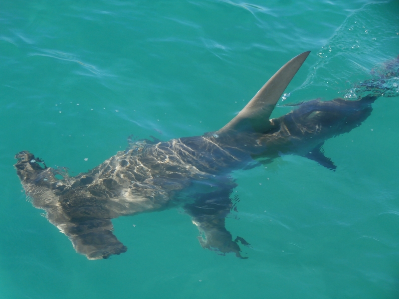
Moved at high tide from Chianti Bay, Alpha Island to Mansion Bay, Hermite Island. Only 5 miles. Yesterday evening we were visited by a 3 metre hammerhead shark who circled The Southern Cross looking for a feed. The shark had a blue stripe on its fin, courtesy of our antifouling.
Yesterday at high tide we moved through narrow passes between rocky outcrops to Chianti Bay, Alpha Island from Main Beach, Trimouille Island, all within the Montebello Island Group. Very pretty scenery. Went for walks on the beach. Four other vessels in this area; we've enjoyed meeting other boaties.
Avg: 2.6knts
24hr: 62.4nm
Departed Eaglehawk Island, Dampier Archipelago at 0200 this morning. Motored in no wind till daylight and then sailed in 15 knot easterlies on one metre seas. Entered the Montebello Island group between Dot and Daisy Islands. Currently anchored off Main Beach, Trimouille Island. This afternoon walked for kilometres along a beautiful beach at low tide.
1800 WST. Motored in no wind and then sailed in a light northerly, from Enderby to Eaglehawk Island, Dampier Archipelago. Easy day, only 7 miles. Went ashore and walked along the eastern beach which had interesting rock formations to the wreck of a ship. Weather looks good to head off early tomorrow for the Montebello Islands.
Departed Hampton Harbour, Dampier yesterday morning. We left behind the red dust, friendly locals and access to shops. Tacked into head winds, which were up to 20 knots apparent at times for the 10 nautical mile trip. Anchored off Enderby Island, in the Dampier Archipelago.
Plan: to anchor off Eaglehawk Island this afternoon in readiness to sail to the Montebello Islands tomorrow, weather permitting.
Hi Catherine, hi Peter!
Monday evening. Moved to Hampton Harbour, Dampier yesterday morning. Lots of friendly people here and the local sailing club is exceptionally welcoming. We are lucky to have a local contact and are grateful to Terry, who drove us into the town of Karratha where we were able to buy bananas and lots of other fresh food. After two months without shops our cupboards were bare.
Avg: 10.2knts
24hr: 245.5nm
2020 WST. Currently anchored off Angel Island, 10 miles north of Dampier, after a two day voyage from Rowley Shoals. We saw lots of marine life while underway: dozens of whales, two sea snakes, pod of dolphins, sea birds, flying fish and a turtle.
1700 WST. We enjoyed our two day at Clerke Reef; good snorkeling and a beautiful sandy islet with red tropic bird population. Departed at midday, came through the narrow channel and there was a whale at the entrance again. Have had to tack 5 times since departure, traveling 17 miles but only 8 towards our destination. Now just south-east of Clerke Reef and sailing on a course for Dampier.
1630 WST. Sailed from Mermaid Reef this morning. Arrived at Clerke Reef at noon, which was high tide. Just on approach to reef entrance we had a whale breaching in front of us, which added to the excitement and degree of difficulty. Very glad that we had a calm day with good visibilty to enter through this narrow pass. Snorkeled at the 'aquarium' this afternoon; saw a plethora of fish, a few white tipped reef sharks and some very good coral.
1630 WST. After a two night sail we arrived this morning at Mermaid Reef, part of Rowley Shoals. Came through the pass at high tide in good light and picked up the mooring we had booked. At high tide there was a bit of swell coming across the reef. Now it is low tide and it is much calmer. Had a wonderful snorkel over some bommies. Clear water, lots of fish and healthy coral. Wore wetsuits. Having fun.
Avg: 4.7knts
24hr: 112.8nm
1500 WST. Travelled 100 miles since leaving Lacepede Islands. Sailing slowly under a reefed jib aiming to arrive at Mermaid Reef in daylight hours tomorrow.
1500 WST. Departed Beagle Bay this morning. Sailed, then motor-sailed to West Island, in the Lacepede Islands. Saw whales, tail slapping and breaching while underway. Day anchorage at West Island to see this wonderful nature reserve. It is home to the largest green turtle rookery on the west coast of Australia. We saw lots of turtle tracks as well as turtles mating in the water. Also saw brown booby birds, frigates and terns. At 1700, underway again, headed westwards for Rowley Shoals.
1800 WST. We came into Beagle Bay to hide from the forecast strong winds. The wind found us. Over 40 knots yesterday morning and up to 39 knots this morning. We are anchored away from the shore, due to shallows, therefore there is a long fetch and we had up to 2 metre seas, quite uncomfortable although always safe. Plan to head towards Rolley Shoals tomorrow.
Sailed 40 miles from Cape Leveque to Beagle Bay yesterday. Wind gradually decreased during the morning from 25 to 30 knots at 6am, down to 10 knots when we arrived at 3pm. Over the day we saw 10 whales: we had to change direction to miss colliding with two of them; two others put on a fine performance, tail slapping for 10 minutes. Beautiful coastline. There is a pearl farm in Beagle Bay, well marked with reflectors. Very cold this morning, down to 19 deg Celsius. Will wait here a few days as strong winds are forecast for tomorrow.
Avg: 4knts
24hr: 96nm
Report at 1830 WST. Moved the boat back into deeper water this afternoon. Pretty spot, friendly fisherfolk, great sunsets over Cape Leveque. Dinghy access to the beach is better at low tide when the reef blocks the swell.
Anchored in one metre of water at low tide near the area where people beach launch their fishing boats. Only a quick stop to go under the boat to check the props. We were advised by the locals that this was the best place to get in the water, no crocodiles and in shallows away from the tiger sharks. Hulls look good although lots of barnacles on the props.
Avg: 43knts
24hr: 1032nm
Returned to Cape Leveque this morning as there is no wind to sail to Rowley Shoals for the next few days. Had a lovely meal ashore at the Kooljaman Restaurant. First salad vegetables we've had for weeks. Were able to purchase half a dozen eggs for $6 but they had no bananas.
Were able to purchase four jerry cans of diesel. They took our cans and had them filled while we ate lunch and then drove us back to the beach and helped launch the dinghy in the surf. Fantastic service.
Report at 2000 WST 26 July 2017. Sailed 10 miles in 10 hours from Cape Leveque. Ran out of wind and tide so anchored in roadstead anchorage off the reef. We tried to anchor in a little closer but there was a rocky bottom.
Report at 1515 WST. Have moved closer to the shore, where the water is smoother and there is less wind against tide effect. Hope to leave for Rowley Shoals in the next day or two.
Report at 1730 WST. Travelled over 30 miles today. Motored in little wind, using the current, across King Sound from Coppermine Creek to Cape Levenque. Beautiful sunny day. Passed Shirley Island along the way. Saw 10 whales, the closest only 100 metres away.
Avg: 116knts
24hr: 2784nm
Report at 1200 WST. Sailed a short distance to Coppermine Creek before the tide turned. Well protected anchorage with flat water. Eight metre tide.
Report at 0900 WST. A brief stop at the entrance to Crocodile Creek and a dinghy explore upstream. Beautiful area with waterfalls.
Report at 1500 WST. We had a few restful days in Talbot Bay waiting for the tidal range to increase so that we could go on a Horizontal Falls jet boat trip. This morning we went on the boat trip and had a wow of a time. At 10am we departed Talbot Bay on a falling tide and motored through remarkable countryside to Silver Gull Creek. Up to two knots of current with us. Went via the Channel and the Gutter. Two other boats in the anchorage and soon we will head to Arrow for sundowners.
Report at 1600 WST. Sailed from Melomys Island to Talbot Bay. We had light winds which helped us along with a favourable tide, up to 3 knots at times. Delightful to be undersail as we entered Talbot Bay, what a pretty place. We plan to be here a few days.
Report at 1640 WST. Motored across to Melomys Island this morning from Raft Point. Arrived at low tide, now its around high tide and the place looks very different; the mudflats have disappeared under water. Felt cold this morning, minimum temperature down to 22 degrees. Had a visit from the Fisheries Department this afternoon and enjoyed their company.
Report at 1640 WST. Sailed in light winds back to Raft Point from Montgomery Reef. Raft Point is picture postcard pretty.
Report at 0930 WST. Perfect day to be out on Montgomery Reef. Sunshine, little wind, few egrets, water rushing down gullies from the reef and us. That is, till the helicopter with sightseers arrived.
Report at 1545 WST. Another beautiful day in the Kimberley. Able to sail all the way from Wilson Point Bay to Raft Point, tacking six times. Flat water, beautiful scenery and up to three knots of current with us. Tide with us reduced our tacking angle to 60 degrees. Yes, we now have no bananas.
Report at 1600 WST. Anchored in Wilson Point Bay, Camden Sound. Departed Sheep Island at 1130 as it was so hot and a light westerly was blowing, perfect for sailing to our next destination. But the wind died and then came up on the nose. No matter what direction we headed, the wind was always on the nose. At Kuri Bay, there was more infrastructure, buildings and barges related to pearl farming, than we've seen since Darwin. Tried to anchor in Kuri Bay but limited space due to pearl farming. Moved on, more wind on the nose and now in a very pleasant bay having a jolly good rest.
Report at 1030 WST. Motored from Hanover Bay, through Roger Strait to Sheep Island. Had up to 4 knots of current with us. A graveyard, for the failed settlement at Camden Harbour, is located on Sheep Island
Avg: 105knts
24hr: 2520nm
Report at 1600 WST. Anchored in Hanover Bay. Sailed in light winds through narrow rocky pass between Glauert Island and the mainland. Beautiful scenery along the way. Down to our last two eggs and two bananas.
Report at 0840 WST. A five mile motor from isolated Ivy Bay on Glauert Island, to Careening Bay, on the mainland. One other boat at anchor in Careening Bay and 20 people ashore. We just had to follow the footsteps in the sand to find the extraordinary boab tree inscribed in 1820 by Philip Parker King who surveyed this area.
Report at 1600 WST. Anchored in Ivy Bay, Port Nelson. A 40 nautical mile sail, which like the curate's egg, was good in parts. From wonderful sailing at 8 knots on flat seas to motor sailing into headwinds in a wind against tide uncomfortable sea. Saw a pod of dolphins underway and a large Boab tree here in the anchorage.
Avg: 53knts
24hr: 1272nm
Report at 1645 WST. Anchored in Boomerang Bay, Bigge Island. Had hoped to sail much further south today but the winds were too light, so we pulled into Boomerang Bay. Saw two dolphins feeding and then our first whale in Western Australia. It was magnficent. Tidal range now about 6 metres.
Report at 0800 WST. Anchored in Wary Bay, Bigge Island. Rock art ashore. Just a quick stop.
Report at 1600 WST. Anchored in Shelter Bay, Prudhoe Island after an easy 16 mile run from Winyalkan Island. Very pretty scenery.
Report at 1615 WST. Still happily ensconced at Winyalkan Island in Montague Sound. We've been dinghy exploring, seen rock art and have met some other cruisers. So nice to spend time with some other boaties. Might move on tomorrow.
Report at 1630 WST. Sailed from Murrangingi Island to Winylakan Island, 19 nautical miles. According to one of the books we have on board, this area is called 'Must See'. We agree, the scenery is very very beautiful. We saw two boats while underway, a 34 metre pleasure craft and a sailing vessel.
Report at 1500 WST. Anchored at Murrangingi Island, Montague Sound, Kimberley Region, Australia. Rounded both Cape Bouganville and Cape Voltaire today, aiming to use the tides. Gradient wind five knots, gusting to 10 knots. Calm seas. Islands and rocks dotted our path, a very scenic trip. Pristine environment. Seems like we are the only ones out here. Stocks are holding out with plenty of apples and root vegetables. All fresh tomatoes eaten, onto the sundried variety. Still have about a week's worth of bananas.
Report at 1630 WST. Motored from Freshwater Bay to Red Island, near Cape Bougainville. Saw a 1 metre sea snake along the way. Hope to round Cape Bougainville tomorrow morning with the tide and head for Parry Harbour or somewhere further south-west. Not much wind at the moment.
Report at 0800 WST. Sailed the 3 nautical miles across the bay to the north-eastern side of Jar Island where there is rock art ashore.
Report at 1600 WST. Motored northwards from Jar Island on a glassy sea. Water gin clear. Extensive pearl farms in this area. Anchored in Freshwater Bay, which we read was the most popular anchorage in the Kimberley with up to ten boats at a time. No one here but us and a couple of sharks, dolphins and numerous birds.
Report at 1645 WST. Left Sir Graham Moore Island this morning, which was the site of a WW II Royal Australian Airforce radar installation and a US Airforce Loran base. After travelling 25 miles, we are now in a roadstead anchorage in Vansittart Bay. Ashore is the site of a DC3 aircraft which crashlanded in WW II.
Report at 1645 WST. A big day. Departed Kooloma Bay at 0500 and sailed around Cape Londonderry, mainland Western Australia's most northern point. Comfortable easy sailing. Now anchored at Sir Graham Moore Island where it is very beautiful.
Report at 1650 WST. Crossed the mouth of King George River towards high tide this morning. Now anchored only 3 miles away in Kooloma Bay. Planning to sail westwards tomorrow, and round Cape Londonderry either tomorrow or Monday. All is well on board
Report at 1730 WST. Anchored near the mouth of King George River, ready to cross on tomorrow morning's rising tide. Plan to head further westwards, rounding Cape Londonderry in next few days. All is well on board
Report at 1700 WST. The Southern Cross is anchored at the head of the King George River near Twin Falls. Earlier today we climbed to the top of the 100 metre high cliffs. Scenery is glorious.
Report at 1715 WST. Sun is setting over Kooloma Bay. We are anchored at the mouth of King George River. Checked depths across the river mouth's sandbar in the dinghy this afternoon and plan to cross into the river tomorrow. Easy trip here, assisted by up to 3 knots of current.
Report at 1700 WST. Anchored at Gallery Bay, two thirds of the way to King George River. Met Malcolm and Mike, both originally from our home port of Adelaide, on board Malcolm's 25 foot trailer sailer. Peter enjoyed talking about Sea Scouts and SA Football. Had a lovely sail, assisted by the tide.
Report at 1715 WST. Have returned to the mouth of Berkeley River and have anchored off first creek. There is another sailing boat here, it has been great to catch up with Rik and Nan from Wings, first met in Darwin. Will listen to weather forecast this evening before deciding whether to head out tomorrow, towards King George River. Berkeley River experience has been wonderful. The scenery is spectacular. We have seen crocs four days out of five, lots of bird life.
Report at 0830 WST Sunday 24 June. Anchored at Red Falls Ampitheatre. No waterfall. This morning motored through a gorgeous gorge upstream on the Berkeley River. Tried to send but not able to connect to sailmail.
Report at 0950 WST. Anchored off Casurarina Creek in the Berkeley River late yesterday afternoon. This is a very beautiful part of the world, with rocky cliffs lit up by the sun at the end and beginning of the day.
Dear Friends, It is good to
Report at 0700 WST. Anchored off first creek in the Berkely River. Plan to go exploring later today.
Underway Darwin to Berkeley River, Kimberley. On flat seas in light winds, currently headed off course due to head winds. Noon to noon run 77 nautical miles. 65 nm to run. Maybe we will arrive at Reverley Island tomorrow. Now in Western Australian waters for the first time. All is well on board.
Above written at 1830 CST Wednesday 21 june but despite trying to send for over an hour, it didn't go.
Trying to send again at 0700 CST Thursday 22 June. A great run over night and now have less than 20 nm to go. Land ahoy
Anchored behind Reveley Island at 0920 WST. Average speed 2.0 knots. Awaiting rising tide before crossing into the Berkeley River. We are having great difficulty connecting to sailmail to send reports. Don't worry if you don't hear from us.
Underway Darwin to Berkeley River, Kimberley. On flat seas in light winds, a comfortable slow trip. Departed Darwin at noon yesterday (19 June). Noon to noon run 56 nautical miles. 150 nm to run. Hope to arrive at Reverley Island, which is at the mouth of Berkeley River, sometime this month. Mainsail up for first time since Bundaberg. All is well on board.
Avg: 2.9knts
24hr: 70.1nm
Anchored in Fannie Bay, Darwin. Last night we ate dinner on shore with our friend Alan. So nice to eat fresh food cooked by someone else. We had a great sail and useful tides, departing Alcaro Bay just before midnight and arriving Darwin at 4pm on 6 June.
Anchored in Alcaro Bay, at Cape Don. Another lovely sail on flat water today. We are only 100 miles from Darwin. Can't wait to eat some fresh food. All we have left on board are two apples and half a cabbage.
Anchored off Croker Island. Had a lovely sail across Montnorris Bay and up Bowen Strait. Such a pleasant change to be sailing on flat seas and to see land along the way.
Currently anchored at North Goulburn Island, Arnhem Land. Took us 35 hours to sail 200 nautical miles from the Wessel Islands.
Avg: 6.8knts
24hr: 162.1nm
We are anchored at Two Island Bay, a few miles down from Cape Wessel. We had a lively crossing of the Gulf of Carpentaria with with an average speed of over 7 knots. Maximum boat speed was 14.7 knots and maximum wind 34 knots. We were hit by a 5-7 metre rogue wave close to Cape Wessel. No damage to boat or crew other than a re-arrangement of the contents of our galley. A large pod of what we thought were Risso's Dolphins put on a wonderful display of leaping and cavorting around the boat for about half an hour. There are strong wind warnings out for the next few days so we may stay a while in this extremely remote area. Report 1800 CST. First time the boat has been on its home port time zone since July 2008.
Avg: 3.7knts
24hr: 89.7nm
Departed Seisia yesterday afternoon and we are now almost half way across the Gulf of Carpentaria. So far, so good. We are headed for the northern Cape Wessel Islands. Report 1400 EST
Sailed overnight from Cape Grenville. Sailed through Albany Passage around 8am this morning. Passed Cape York during a rain squall. I didn't envy the people above us taking a joy ride in a helicopter. Now anchored in Seisia, another squall passing through.
Now anchored in Margaret Bay, near Cape Grenville. Great sailing conditions today. For sailors following in our wake there are the oyster encrusted remains of a WWII P39 Air Cobra (?) on the beach. It is located about 1 NM from the eastern end of the beach and about 100 metres out from the mangroves. There is a walk from Margaret Bay through to Indian Bay which starts on the eastern end of the beach in Margaret Bay. The track is marked by blue plastic and is called the Blue Walk. It is about a 50 minute stroll one way.
Uncle Don, we took photos of the aircraft to send you when we have internet access.
Avg: 5.9knts
24hr: 141nm
Rocking and rolling in Portland Roads 'anchorage' alongside SV Ivory Moon. Had a wonderful 60 mile sail under jib with following seas.
Following your trip up the
Sailed from Flinders Island to Morris Island. Yesterday, the wind blew from 3 to 26 knots, from the South West to the East. Had visuals and VHF radio contact with Australian Border Force in a fixed wing plane (Twin Otter?). From memory this is the anchorage we first saw SV 'Saraoni' back in 2008.
Avg: 3.2knts
24hr: 76.5nm
Sailed from Lizard Island to Owen Channel in the Flinders Island Group. A fast comfortable sail under jib with wind and seas from behind; 84 miles in 12 hours. Strongest gust was 40 knots as we rounded Cape Melville, which according to Peter appears to consist entirely of boulders.
Still anchored at Lizard Island. On our own for three nights. Now we have company. Weather has improved. Snorkeled today and saw moorish idol and nemos. May head further north tomorrow. NB Stefano, 'Prime Time', a Salina is anchored next to us.
Anchored at Lizard Island. When we arrived at lunchtime today we were the only boat here. Now there are two other vessels. Squalls with gusts to 37 knots, strong enough to blow our mobile solar panel off the deck house and into the water. Able to retrieve the panel which is still working, or it would be, if we had any sun.
Avg: 3.1knts
24hr: 75.6nm
Sailed over 75 miles today from the Low Isles to Cape Bedford. At times an exciting ride surfing down waves at 12 knots. Wind blew at 20 to 25 with strongest gust to 30 knots. Plan to sail to Lizard Island tomorrow. All is well on board.
Pleasant downwind sail to Low Isles where we picked up a mooring. Greeted by two black tipped reef sharks.
Anchored behind Cape Grafton, just south of Cairns, Queensland after a short and easy sail up the coast from Fitzroy Island. Large open shallow bay but provides protection from the SE swell. Still watching Cyclone Ella and the sea temperatures further north.
A magical carpet ride from Mourilyan Harbour to Fitzroy Island averaging 6 knots with one metre following seas and 15 to 28 knots of southerly quadrant winds.
Easy sailing under jib from Dunk Island to Mourilyan Harbour, which is on the mainland.
Lieutenant Mourilyan sailed
Anchored off Dunk Island in calm conditions. Had a slow sail here from Garden Island in under 10 knots. Took a delightful walk from Brammo Bay to Muggy Muggy Beach.
Anchored behind the sandspit at Garden Island, which is just north of Hinchinbrook Island. Wind about 15 knots. Will make our way a little further north later today.
Avg: 3.6knts
24hr: 85.4nm
Anchored next to Haycock Island in the Hinchinbrook Channel. Glorious scenery. Surfed our way across the bar at the southern entrance to the channel.
Avg: 6.3knts
24hr: 150.4nm
Currently on a mooring in Little Pioneer Bay, Orpheus Island, in the Palm Island group. Swell wrapping into the anchorage and we are bouncing. Sailed overnight from Butterfly Bay, Hook Island in the Whitsundays: 182 nautical miles in 27 hours. The strongest gust was 36 knots, seas at times over 2 metres. Fortunately wind and seas from behind. Waiting for the tide to turn to cross into the Hinchinbrook Channel.
Overnight stayed on a mooring in Butterfly Bay, Hook Island. Heavy showers and gusts up to 30 knots overnight. Yesterday afternoon we went for a snorkel in Butterfly Bay. Some coral left post Debbie, although the effects of the cyclone can be seen.
This morning heading northwards, hope to be at Hinchinbrook Island tomorrow evening.
On a mooring in Stonehaven Anchorage, Hook Island. Swell is coming into the anchorage, bouncing the boat around. Wind is gusting to 28 knots. May move to Butterfly Bay in the hope it is calmer there.
Now anchored Airlie Beach. Had a pleasant sail from Cid Harbour.
Anchored in Cid Harbour, Whitsundays. Sailed through Dent Passage and saw cyclone damage to some of the trees and buildings on Hamiliton Island. One catamaran was up on the rocks on Dent Island. There is another boat up on the rocks at Cid Harbour. We walked from Sawmill Beach to Dugong Beach. A number of large Norfolk Island Pines had been blown down by Cyclone Debbie. The path is now clear, thanks to some hard work and a couple of chainsaws. We are impressed at how quickly the clean up is occurring.
Anchored off Burning Point, Shaw Island in the Whitsundays. Sailed 30 miles yesterday from Brampton Island. Delightful sail under jib.
Avg: 3.1knts
24hr: 73.8nm
Left Great Keppel Island Saturday 29 April and sailed overnight to Brampton Island. Delightful sailing with winds about 20 knots from the SE pushing us along at 6 knots. Rained this morning and washed salt off the decks. Went ashore this morning and saw a multitude of butterflies as well as many birds: stone curlew, butcher bird, small grey heron, raven, oyster catcher, sulphur crested cockatoo. Did not see any damage due to Cyclone Debbie. The resort which was in full swing 10 years ago when we last visited is closed, apparently there is a caretaker on site.
Will head further north today to see more of the Whitsunday Islands.
Avg: 4.3knts
24hr: 103.2nm
A rollicking good sail, 150 nautical miles in 24 hours. Max gusts 36 knots. Beautiful sailing under jib. Now anchored in Leeke Beach on Great Keppel Island. Just lovely here.
Readying the boat and ourselves to sail northwards later this morning or early afternoon. The pantry, fridge and tanks are full. The weather looks good. Last minute preparations and then we are off.
Berthed at Bundaberg Port Marina.
Anchored near the mouth of the Burnett River.
Anchored off Rooney Point, Fraser Island. Went for along walk on the beach. Turned back when we noticed a dingo which followed us for a mile back to the dinghy.
Anchored at Moon Point. Wonderful place to explore in the dinghy and walk along the beach
Anchored at Kingfisher Bay Eco Resort. More thunderstorms around.
Anchored at Yankee Jack Creek, Fraser Island. Thunderstorm activity with heavy rain.
Sandflies alive and well at Garry's Anchorage, Fraser Island
Crossed the Wide Bay Bar in benign conditions. Anchored at Brown's Gutter, Elbow Point, Fraser Island
Anchored near Scarborough Marina, Moreton Bay
Raby Bay
Avg: 20knts
24hr: 480nm
Spent three nights here at Coochiemudlo Island recovering from working on hardstand. Flat water, cooling breezes, luxury.
This was our position on the hardstand at Redlands City Marina for 8 days. Bottom paint, machined saildrives and new seals, repaired the starboard swim ladder. Very happy with the service we received at Redlands.
Report at 0730 24 November (Queensland time) Moored at Raby Bay. Glorious day.
Report at 0630 21 November (Queensland time) Anchored at Peel Island, Moreton Bay.
Report at 0730 20 November (Queensland time) Anchored at St Helena Island in Moreton Bay just south of the entrance to the Brisbane River. Had a reasonable overnight sail down from Double Island Point, arriving here at 1300 yesterday. Maximum wind was 20 kts and the only issue for us was the large number of ships entering and leaving Moreton Bay.
St Helena Island is named after St Helena Island in the South Atlantic where Napoleon spent his last days. This St Helena Island was also a prison and is now inhabited by hundreds of wallabies and many varieties of shore birds and land birds. It is wonderful to be able, perhaps for the first time since the Galapogas Islands, to be able to observe land based wildlife up close and in abundance.
Report at 1115 18 November (Queensland time) Anchored at Double Island Point in 5m at high tide. Yesterday crossed Wide Bay Bar two hours before high tide. Minimum depth 5.6 metres, no breaking waves. 1m sea and 1m swell with 10 to 15 knots from SE. As we tacked our way to Double Island Point encountered a squall with over 30 knots of wind and heavy rain. Boats two miles to seaward saw 23 knots and light rain. Plan to sail overnight to Moreton Bay.
Report at 0515 17 November (Queensland time) Anchored at Inskip Point, Tin Can Bay, Queensland. Hoping to cross the Wide Bay Bar this morning
Report at 0545 16 November (Queensland time) Anchored at Kingfisher Resort Fraser Island, Queensland. Enjoyed a walk ashore yesterday. Heard dingos howling as the full moon rose. We can hear kookaburras this morning
Report at 1730 15 November (Queensland time) Anchored at Cape Vernon in southern Hervey Bay. Mostly good sail down from Bundaberg Port Marina. Had great time at Down Under Rally welcome week. Boat surrounded by thousands of butterflies.
Avg: 3.8knts
24hr: 91nm
Report at 2200 31 October (Queensland time) Arrived safely at Bundaberg Port Marina at 1400 today. A sporty sail across Hervey Bay. Crossed our outward path and completed our circumnavigation this morning. Celebrated with 40 cruisers and champagne provided by the Go West Rally. It was a wonderful evening.
Congratulations. Well done
Avg: 5.6knts
24hr: 133.5nm
In tonight to join the party. Well done
Congratulations Catherine and
Well done guys!!
Avg: 6.8knts
24hr: 162.4nm
Report at 0430 30 October (Queensland time) Only 122 miles to run to complete our circumnavigation. All is well on board.
Avg: 6.8knts
24hr: 163.6nm
Report at 0520 29 October (New Caledonia time) Just left the tropics. Squalls overnight. Pleasant conditions now. Enjoyed Peter's delicious risotto yesterday and looking forward to homemade pizza today. Still have bananas. All is well on board.
Avg: 6.9knts
24hr: 164.5nm
Report at 0520 28 October (New Caledonia time) Enjoyable trade wind sailing. All is well on board.
Avg: 5.8knts
24hr: 139.2nm
Report at 0500 27 October (New Caledonia time) Enjoyable trade wind sailing. All is well on board.
Avg: 3.5knts
24hr: 85nm
Report at 0530 26 October (New Caledonia time) Departed New Caledonia via Dumbea Pass at 1630 local, where we saw hundreds of birds on the wing. All is well on board.
Report at 0545 25 October (New Caledonia time) Underway, headed for Ile Nge for the day to prepare boat for departure to Bundaberg.
Hope you have a safe trip to
Report at 0515 24 October (New Caledonia time) Anchored at Baie de l'Orphelinat. Plan A: after reviewing the weather this morning, we will check out of New Caledonia, departing tomorrow or Wednesday.
Report at 0515 22 October (New Caledonia time) Anchored at Baie de l'Orphelinat. Preparing the boat for passage to Australia.
Report at 0540 19 October (New Caledonia time) Moored with 20 boats at Ilot Maitre, New Caledonia. Another beautiful calm morning. Good snorkelling yesterday with new (for us) varieties of fish plus turtles and cuttlefish.
Report at 0530 18 October (New Caledonia time) Anchored at Uere Bay, New Caledonia. Beautiful morning. Enjoyed watching young children learning how to sail in 'Optiene' boats yesterday.
Report at 0530 16 October (New Caledonia time) Anchored at Uere Bay, south of Noumea, New Caledonia. Reasonable protection from the strong winds we've had for the past two days.
Report at 0530 15 October (New Caledonia time) Anchored at Baie des Citrons, New Caledonia. Attended the well conducted and informative Down Under Rally event yesterday. Rain held off last evening till we were back on board; thank you David.
Report at 0545 14 October (New Caledonia time) Anchored at Ile Bailly. Beautiful little island covered with dense foliage. Navionics chart says it is a bird sanctuary however we have seen no birds and the main bird noise is a crowing rooster.
Report at 0545 13 October (New Caledonia time) On a mooring at Ile Casy, Baie de Prony. Interesting snorkel around reef. Colourful staghorn coral in good condition. Chainsaw and whippersnipper maintenance gang arrived yesterday and re-started work at 0515 this morning.
Report at 0520 12 October (New Caledonia time) On a mooring in Anse Majic, Baie de Prony. Had a great sail up from Isle of Pines yesterday. Went for a walk to the lighthouse in the afternoon, wonderful views from the top.
Report at 0530 11 October (New Caledonia time) Just underway from Ile des Pins to Baie de Prony. Small lumpy seas. The sun is about to rise above the Island. Heavy rain last evening with distant thunder. Lovely trip around the island yesterday by hire car.
Report at 0545 10 October (New Caledonia time) Anchored in Kuto Bay, Ile des Pins. Heavy rain for 15 mins approx 0330 local time. One clap of thunder heard after rain finished. No wind at the time.
Report at 0600 7 October (New Caledonia time) Still anchored in Kuto Bay, Ile des Pins. Hopefully no cruise ship today. Off to climb N'ga peak this morning.
Report at 0800 6 October (New Caledonia time) Anchored in Kuto Bay, Ile des Pins. Delightful trip across oily calm lagoon yesterday. Able to see the bottom 17m below when crossed a shallow section. Saw a dugong swim near the boat as we were anchoring. So many turtles in this bay.
Report at 1745 4 October (New Caledonia time) Moored at Ile Casy in the Baie du Prony. Beautiful island inhabited by a dog who doubles as the tour guide. Will head off for Ile des Pins at first light.
Report at 0545 4 October (New Caledonia time) Still anchored in Baie des Citrons near Noumea. Beautiful morning. Checked into country yesterday by dinghying in to Customs etc. Plan to leave today for Ile des Pins. Should arrive Wednesday afternoon.
Avg: 3.1knts
24hr: 75.2nm
Report at 0530 3 October (New Caledonia time) Safe landfall at Baie des Citrons at 1pm local time yesterday.
Avg: 7.8knts
24hr: 187.4nm
Report at 0520 1 October (Vanuatu time) Enjoying a fast sail to New Caledonia. Strongest gust of wind 22 knots. ETA at Havannah Pass is midnight.
Report at 0520 30 September (Vanuatu time) About to depart for New Caledonia
Report at 0545 29 September (Vanuatu time) Still anchored at Port Vila, Efate Island. Planning to depart for New Caledonia this evening or tomorrow morning.
Report at 0600 Tuesday 27 September (Vanuatu time) Still anchored off Port Vila, Efate Island. Lovely visit to museum yesterday and great food in Spice Indian restaurant.
Report at 0600 Monday 26 September (Vanuatu time) Anchored off Port Vila, Efate Island.
Avg: 3.3knts
24hr: 78.7nm
Report at 0530 Saturday 24 September (Vanuatu time) Approaching Port Vila, Efate Island with 4 miles to go. A comfortable trip down from Epi Island with maximum wind 17 knots. Initially (1200 local) the wind came from the SW and then clocked through W, NW to NE.
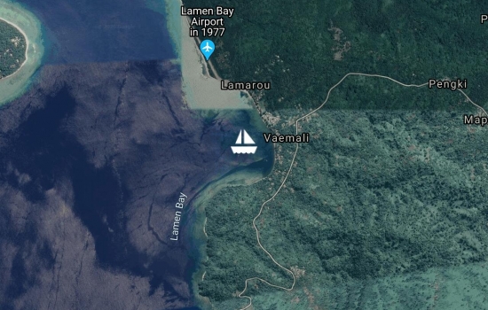
Report at 0530 Friday 23 September (Vanuatu time) Anchored Lamen Bay, Epi Island. Good coral out on the SW point, best to go at high tide. Have seen lots of turtles from the boat.
Report at 0530 Thursday 22 September (Vanuatu time) Anchored Lamen Bay, Epi Island. Had a fabulous sail on flat seas from SW corner of Ambryn to Lamen Bay. There was great visibility which enabled us to see the islands which are normally cloaked in haze. We saw four turtles when snorkelling off the boat.
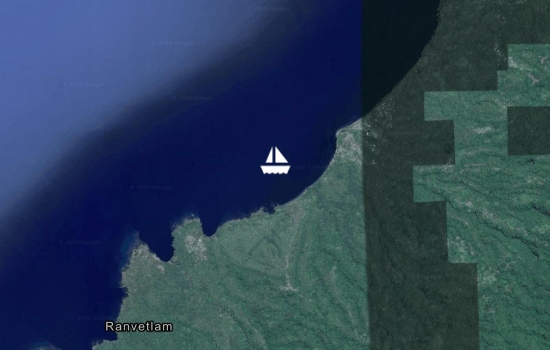
Report at 0445 21 September (Vanuatu time) Still anchored near Ranvetlam Village, Ambryn Island. Visited Ranvetlam Kindergarten yesterday morning. Delightful children whom we taught 'Old MacDonald's Farm' using local dialect for the names of the animals. Note for visiting yachts. Kindergarten has scant resources. Materials for basic craft eg paper, coloured pencils and picture books would be useful. Heading for Epi Island today.

Report at 0445 20 September (Vanuatu time) Moved less than a mile to anchored near Ranvetlam Village, Ambryn Island. Anchored in 10 metres black sand to be closer to friends on their boat. Lovely walk along coastal track to friendly Ranvetlam Village.
Report at 0730 19 September (Vanuatu time) Anchored off Ranon Village, Ambryn Island in 12 metres black sand. A conference encouraging leadership for women in the Presbyterian Church in Ambryn Island is being held in Ranon this week. Last night saw the glow of nearby active volcanoes.
Report at 0840 Saturday 18 September (Vanuatu time) Anchored off Londot, southern Pentecost Island. Open roadstead anchorage. Flat calm overnight as no wind. Anchored in 10m and dropped back into 15m. Good holding. Went ashore, walked northwards along the road and met Paulo and his family in Lonton Village. Paulo guided us to the amazing land diving structure. Able to buy bananas here. No bananas available in Asanvari on Maewo Island due to impact of Cyclone Winston earlier this year.
Report at 1700 Friday 16 September (Vanuatu time) Still anchored in Asanvari Bay, Maewo Island. Flat water. Wind funnels from all points of the compass so allow plenty of swinging room. Plenty of clear sand. Avoid scattered bommies mostly closer to shore. The locals are welcoming and keen to have visitors here. We snorkelled yesterday over a large bommie on the SW point and were joined by a large dugong. This was a thrill for us as it is the first time we have seen a dugong while snorkelling. The water clarity here is exceptional which enhanced our view of the dugong. Hot fresh bread was delivered to our boat this morning. Asanvari's attractions include Alex's waterfall and Carl's snorkelling tour.
Report at 0900 Wednesday 14 September (Vanuatu time) Anchored in Asanvari Bay, Maewo Island. Up to 33 knots of wind on our 12 mile trip from Loltong Bay yesterday. Sitting on flat seas, can see and hear a waterfall from the boat, lush green vegetation surrounds the anchorage.
Report at 0545 Tuesday 13 September (Vanuatu time) Anchored in Loltong Bay, Pentecost Island. Yesterday we walked up the hill to the gardens and gained a view over the anchorage. In the afternoon, Peter worked with Matthew, who runs the local yacht club, to repair and repaint the leads. Hopefully this will make it easier for vessels to see the safe way to enter the pass.
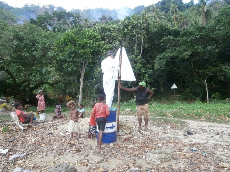
Report at 0545 Monday 12 September (Vanuatu time) Anchored in Loltong Bay, Pentecost Island. Enjoyed a 12 course local cuisine feast yesterday, cooked by Mary, at the Vatulo Yacht Club, Loltong Bay. Some good snorkelling in the anchorage, found a turtle which was asleep and plenty of nemos that were awake.
Report at 0545 Saturday 10 September (Vanuatu time) Anchored in Loltong Bay, Pentecost Island. Arrived yesterday afternoon during a white out. Waited one hour, still no visibility. Entered tricky anchorage with caution. Thank goodness for Google Earth.
Report at 0515 Friday 9 September (Vanuatu time) Anchored in Banam Bay, Malekula Island. About to set sail for Pentacost Island.
We had to snorkel around the anchorage in order to find a spot which was completely coral-free. The snorkelling on the reef on the eastern side of the anchorage is only average. All of the staghorn coral was destroyed by cyclone Pam with a corresponding cut in the fish stocks. Some of the hard corals are impressive.
Unfortunately it seems that there are no Kastom Dances being held here this year. We have been asked by John Eddy (sp) to encourage cruisers to visit next year when they will hold dance demonstrations for yachties and other visitors. They are trying to work out a way of advertising the shows so that people have advance notice and can make plans.
Report at 0530 Thursday 8 September (Vanuatu time) Anchored in Banam Bay, Malekula Island.
Report at 0615 Wednesday 7 September (Vanuatu time) Anchored in Port Sandwich, Malekula Island. Light rain overnight.
Report at 0600 Tuesday 6 September (Vanuatu time) Anchored in Port Sandwich, Malekula Island. Tried anchoring closer to shore but anchor chain rumbling on coral and rocks. Anchored further out in mud. Supply ship came in during the night, so glad we weren't anchored too close to the wharf. The locals were busy yesterday digging trenches with shovels in order to lay pipes which will carry water from a dam to the village. The project is funded by the NZ government.
Report at 0530 Monday 5 September (Vanuatu time) Now anchored in Gaspard Bay adjacent to the Maskelynes Islands off Malekula Island. Came here in search of dugongs. Have seen a few fleeting glimpses of the seacow. This is a beautiful bay surrounded by mangroves. Entering the bay required careful navigation due to surrounding reefs. Yesterday Peter was a VIP at Lamen Bay Presbyterian Church as it was Father's Day.
Report at 0600 Sunday 4 September (Vanuatu time) Moved nearer to the beach in Lamen Bay to avoid a small bommie fouling our anchor chain. Now in clear sand all around. Happy Father's Day today to all Fathers. We enjoyed Peter's birthday yesterday swimming with turtles. Went ashore where Elsie gave us a large hand of bananas. Eating delicious bread baked by Ellen (Joseph's wife). 100 vatu a loaf. Going to attend the Presbyterian Church service at 7.00 am then leave for the Maskelyne Islands 25 nautical miles to the west.
Report at 0545 Friday 1 September (Vanuatu time) Anchored at Lamen Bay, Epi Island. Strongest wind overnight 28 knots.
Report at 0545 Thursday 1 September (Vanuatu time) Anchored at Lamen Bay, Epi Island. Lovely anchorage, good snorkelling, no dugongs in sight yet. Had a comfortable sail yesterday from Emae Island under jib. Maximum true wind 29 knots, two metre following seas.
Report at 0530 Wednesday 31 August (Vanuatu time) Anchored at Sulua Bay, Emae Island. Had a sporty sail yesterday from Efate Island under jib. Maximum true wind 25 knots, two metre seas.
Avg: 32.7knts
24hr: 784nm
Report at 0530 Tuesday 30 August (Vanuatu time) Anchored at Esema Bay, Havannah Harbour, Efate Island. Poor holding in soupy mud. Departing for Emae Island.
Report at 1200 Monday 29 August (Vanuatu time) Anchored at north east end of Lelepa Island. Dinghied around through the pass to the NW end of Lelepa. Drift snorkeled over beautiful corals outside the pass,.
Report at 0530 Monday 29 August (Vanuatu time) Anchored at Black Sands, Mele Bay, Vanuatu. Attended the Sunset Circus on Sundays at Beach Bar. Wonderful mix of comedy, traditional dance and acrobatics with a little fire thrown in for good measure.
Report at 0545 Friday 26 August (Vanuatu time) Enjoying Port Vila Bananas, along with a variety of other fresh produce is available at the market. Twisties, Vegemite and baguettes for sale in the supermarket.
Report at 0600 Thursday 25 August (Vanuatu time) Anchored in Vila Bay, Port Vila.
Avg: 5.6knts
24hr: 134.5nm
Report at 0530 Wednesday 24 August (Vanuatu time) 15nm to Port Vila.
Report at 0545 Tuesday 23 August (Vanuatu time) The Southern Cross is the only boat anchored in Port Resolution, Tanna Island. Saw the spectacular Mt Yasur Volcano yesterday.
Report at 0540 Monday 22 August (Vanuatu time) Departed Aneityum at 0300 local, headed for Tanna Island, Vanuatu. Still in the lee of Aneityum Island.
Report at 06000 Saturday 20 August (Vanuatu time) Still anchored at Ateityum, Vanuatu. Sunshine yesterday morning when we went snorkelling. Wore wetsuits as the water is COLD. Squalls in the afternoon and evening.
Report at 0550 Friday 19 August (Vanuatu time) Still anchored at Ateityum, Vanuatu.
Report at 0600 Thursday 18 August (Vanuatu time) Still anchored at Ateityum, Vanuatu. Very cool here. Temperature below 20 Celsius. Cold wind. We enjoyed the first ever Aneityum music festival last evening. Four boats at anchor, two from Port Adelaide.
Report at 0600 Wednesday 17 August (Vanuatu time) Strongest wind overnight 20 knots. Heavy rain showers yesterday afternoon. Warm welcome ashore. All is well on board.
Avg: 4.7knts
24hr: 112.2nm
Report at 0630 Tuesday 16 August (NZ time) Heading into anchorage at Aneityum, Vanuatu. 2 miles to go. All is well on board.
Avg: 6.7knts
24hr: 160nm
Report at 0630 Monday 15 August (NZ time) Underway Lautoka, Fiji to Aneityum, Vanuatu. 100 nautical miles to go. Nice spinnaker run yesterday.
Avg: 5.7knts
24hr: 137.5nm
Report at 0630 Sunday 14 August (NZ time) Underway Lautoka, Fiji to Aneityum, Vanuatu. Have come half way and now have 230Nm to run.
Avg: 5.3knts
24hr: 126.5nm
Report at 0630 Saturday 13 August (NZ time) Underway Lautoka, Fiji to Aneityum, Vanuatu. 360Nm to go. Strongest wind yesterday 33 knots with 3 metre seas.
Avg: 9.5knts
24hr: 228nm
Report at 0620 Friday 12 August (NZ time) Anchored off Lautoka, Viti Levu Island, Fiji. Will be checking out of Fiji this morning, headed for Aneityum in Vanuatu with ETA late Monday 15 August.
Report at 0630 Thursday 11 August (NZ time) Anchored off Lautoka, Viti Levu Island, Fiji. Planning to buy provisions today and check out of Fiji tomorrow, Friday 12 August
Report at 0630 Wednesday 10 August (NZ time) Still anchored off Musket Cove. Malolo Lailai Island, Fiji. Hoping to depart for Vanuatu Friday 12 August. Update 0700 blue sky seen to the west.
Report at 0630 Tuesday 9 August (NZ time) Still anchored off Musket Cove. Malolo Lailai Island, Fiji. It is still raining.
Report at 0645 Monday 8 August (NZ time) Still anchored off Musket Cove. Malolo Lailai Island, Fiji. Raining off and on, including heavy falls, since 4pm Saturday afternoon. Strongest wind overnight 20 knots. Strongest wind Friday late evening 30 knots.
Report at 0645 Saturday 6 August (NZ time) Anchored off Musket Cove. Malolo Lailai Island, Fiji. 30 boats in the anchorage.
Report at 0645 Friday 5 August (NZ time) Anchored near Lautoka, Viti Levu Island, Fiji. Our granddaughter was born in Adelaide yesterday. The first granddaughter after seven grandsons.
Hei, congratulations!!!
Report at 0630 Thursday 4 August (NZ time) Anchored near Lautoka, Viti Levu Island, Fiji. Found delicious dorsai masala at Hot Snax, Lauoka.
Report at 0650 Wednesday 3 August (NZ time) Anchored near Lautoka, Viti Levu Island, Fiji.
Report at 0630 Tuesday 2 August (NZ time) Still anchored in Saweni Bay near Lautoka, Viti Levu Island, Fiji.
Report at 0700 Monday 1 August (NZ time) Still anchored in Saweni Bay near Lautoka, Viti Levu Island, Fiji.
Report at 0630 Saturday 30 July (NZ time) Anchored in Saweni Bay, Viti Levu Island, Fiji.
Report at 0615 Friday 29 July (NZ time) Anchored in Yalobi Bay, Waya Island, Southern Yasawas, Fiji.
Report at 0645 Thursday 28 July (NZ time) Anchored in Yalobi Bay, Waya Island, Southern Yasawas, Fiji. SW swell is dropping. Yesterday morning we tried to anchor off west side of Waya Island near Octopus Resort but there was a heavy SW swell breaking on shore.
Report at 0630 Wednesday 27 July (NZ time) Anchored near Manta Ray Resort, Drawaqa Island, Yasawa Islands, Fiji. Wind gusting to 20 knots yesterday afternoon and evening. Enjoyed swimming with manta ray yesterday.
Report at 0645 Tuesday 26 July (NZ time) Anchored near Manta Ray Resort, Drawaqa Island, Yasawa Islands, Fiji. Sailed down from Somosomo Bay yesterday in lee of Naviti Island with wind up to 23 knots from the east. Overnight little wind. Wonderful drift snorkel yesterday in the pass.
Report at 0630 Monday 25 July (NZ time) Anchored in Somosomo Bay, Naviti Island, Yasawa Islands, Fiji. Enjoyed a snorkel from the boat to shore and walking along white sandy beach yesterday.
Report at 0630 Saturday 23 July (NZ time) Still anchored in Blue Lagoon, Yasawa Islands, Fiji. We've had 10 to 20 knots from easterly quadrant for past 24 hours.
Report at 0630 Friday 22 July (NZ time) Anchored in Blue Lagoon, Yasawa Islands, Fiji. Departed Manta Ray Bay yesterday morning after swimming with a manta. Over 20 knot winds from the east as we sailed northwards to Blue Lagoon.
Report at 0630 Thursday 21 July (NZ time) Anchored near Mantaray Resort, in the Yasawa Islands in Fiji. Went for a snorkel in the pass where we saw lots of coral and fish, no mantas seen yet.
Report at 0700 Wednesday 20 July (NZ time) Still anchored off north bay of Waya Island at the southern end of the Yasawa Islands in Fiji. Thank you David, you must have waved your magic wand as the westerly swell, which was wrapping around into this north-facing anchorage, dropped yesterday, We didn't need to surf ashore in the dinghy!
Report at 0700 Tuesday 19 July (NZ time) Anchored off north bay of Waya Island at the southern end of the Yasawa Islands in Fiji. Had fun participating in dancing and sevusevu in village.
Question for David: What is the swell forecast for the next few days? West, south and even north exposed anchorages have been rolly for the past few days.
Report at 0700 Saturday 16 July (NZ time) Anchored off Navadra and Vanua Levu islands. A beautiful spot. Crystal clear water and great snorkelling.
Report at 0700 Saturday 16 July (NZ time) Anchored off Navadra and Vanua Levu islands. A beautiful spot. Crystal clear water and great snorkelling.
Report at 0630 Friday 15 July (NZ time) Snorkelled off Castaway Island Resort yesterday. Plan to move northwards today.
Report at 0630 Thursday 14 July (NZ time) Enjoying being anchored off the NW corner of Malolo Island, Fiji.
Report at 0700 Wednesday 13 July (NZ time) Anchored in 15m off NW corner of Malolo Island, Fiji. Lovely anchorage. Much more sheltered than Musket Cove in these conditions. Two boats at anchor.
Report at 0620 Tuesday 12 July (NZ time) Anchored in 16m off Musket Cove, Fiji. Strongest gust overnight 21 knots. Two dozen boats at anchor or on moorings.
Report at 0650 Monday 11 July (NZ time) Anchored in 3m off Port Denarau, Fiji. Light rain overnight.
Report at 07300 Sunday 10 July (NZ time) Anchored in 4 metres, sand, off Robinson Crusoe Island, Fiji. At times strong tidal currents. Enjoyed the Fire and Knife Dancing Show at the resort last night.
Report at 0645 Friday 8 July (NZ time) Anchored in 15 metres, in Malumu Bay, Beqa, Fiji. When we arrived at 12.30pm there was no wind. Yesterday afternoon the wind gusted from 5 to 15 knots. Direction of wind may be due to surrounding hills. This is a beautiful spot. It is great to see a part of Fiji where the vegetation is unaffected by Cyclone Winston.
just motoring out of Suva , heading around the bottom of Viti Levu
Report at 0630 Wednesday 6 July (NZ time) Anchored in Suva, Fiji.
Report at 0700 Saturday 2 July (NZ time) Still anchored in Suva, Fiji. Periods of light and sometimes heavy rain over the past 24 hours. Maximum wind gust over the past 24 hours was about 20 kts from the SSE. Voted in the Australian election yesterday at the Australian High Commission. It's only the weather that's gloomy in Suva as the Fiji Chiefs defeated the Christchurch Crusaders here in Super Rugby last night. Bananas found in the market, the first since NZ!
Report at 0700 Friday 1 July (NZ time) Anchored in Suva, Fiji. All is well on board
Report at 0700 Thursday 30 June (NZ time) Anchored in Vunivatu Bay, Viti Levu, Fiji. Handy anchorage for passage to Suva in light winds. Open to strong winds and seas from the east. Anchored in sand All is well on board
Report at 0600 Wednesday 29 June (NZ time) Anchored in the Fisheries Anchorage Magokai, Fiji. Sea Mercy at work here. All is well on board
Report at 0600 Tuesday 28 June (NZ time) Travelling towards Magokai, Fiji. Sailing under a scrap of jib. 4 POB with guests Ros and Andrew. All is well on board
Avg: 5.5knts
24hr: 130.9nm
Weather: 1013 zero wind, 25% cloud cover, beautiful day. Hope to head for Suva via Makongi later today.
Still moored in Savu Savu. More Sea Mercy aid to co-ordinate and distribute.
stormy day yesterday with winds up to 30s
On a mooring in Savusavu. Fast bumpy ride this morning from Viani Bay. 50 miles in six hours. Maximum wind gust 33 knots, max boat speed 12 knots.
Report at 1900 Sunday 19 June (NZ time) On a mooring in Viani Bay There are two moorings and some space in which to anchor. Jack offers services to yachties including the moorings and snorkelling and dive trips. Very pretty bay. Enjoyed two snorkels over the outer reef, lots of small fish, okay coral.
Report at 0630 Saturday 18 June (NZ time) At anchor off Taveuni Airport. Anchored in 10 metres, sand between wide spaced bommies. Dinghy access on shore at sandy beach next to boat ramp. Short walk to airport. Three small grocery stores, limited fruit and veg. No bananas!
Avg: 2.8knts
24hr: 67.6nm
Report at 0600 Thursday 16 June (NZ time) Travelling towards Matei, Taveuni, Fiji. Lighting seen overnight towards the east. All is well on board
Report at 0710 Wednesday 14 June (NZ time) Anchored off Avea Island, Vanua Balavu, Fiji. 8 Sea Mercy vessels here. Sea Mercy work yesterday included: preparing lumber with chainsaws, commissioning a land based, solar powered water desalinator and a gardening project.
Report at 0615 Monday 13 June (NZ time) Anchored off Lomaloma Village, Vanua Balavu, Fiji. 10 Sea Mercy vessels here. Five World ARC vessels at anchor. Sea Mercy work today includes: delivering aid (mainly food and clothing) to eight villages and providing gardening advice and support at three villages. We need to be in Taveuni on Thursday morning. Looking to depart Lomolomo on Wednesday morning. Could David please include a forecast this morning for this passage?
Report at 0700 Friday 10 June (NZ time) Anchored in sheltered Bay of Islands, tied back to the shore. Six other Sea Mercy vessels anchored nearby. A lovely RnR day yesterday. Dinghied around Mushroom shaped rocks and went snorkelling. Saw the best fan coral we've seen since the Andaman Islands. Thousands of tiny fish who are not afraid of us. Would like to stay longer, however, we need to return to Lomolomo for Sea Mercy work. Looking to move today or tomorrow depending on David's weather report this morning.
Anchored for an R&R day
Report at 0600 Tuesday 7 June (NZ time) Still at anchor off Malaka Village, Vanua Balavu, Fiji. 9 Sea Mercy vessels here. This morning leaving the boat at 7am to go ashore. Sea Mercy work today includes: building a pig proof fence at one village; repairing a long boat at another village; a school visit (dropping off school supplies, a puppet show for the children and fixing the electrical supply); a gardening project at two villages to enhance the women's ability to grow and harvest food crops; and needs assessment reports on a further two villages.
Catherine & Peter, we love
Report at 0700 Wednesday 1 June (NZ time) At anchor off Malaka Village, Vanua Balavu, Fiji.
report 0600 NZ time Tuesday 30 May. Underway sailing under a fraction of a jib to time arrive at Adavaci Pass, Vanua Balavu, Fiji. Completed initial Sea Mercy needs assessment of Cicia Island.
Report at 2000 Sunday 29 May (NZ time) At anchor off Tarakua village on Cicia Island. Anchored in 30 metres hanging back in 60 metres with 85 metres of chain out. This is a settled weather only anchorage. It is an open roadstead and would be untenable in any wind from North to West through to South West. Beautiful calm night. Have spent day performing Sea Mercy assessment and handing over aid including food, materials and clothing.
Thank you David and Patricia for your swell report. It is most useful.
Avg: 3.8knts
24hr: 91.5nm
Report at 1700 Saturday 28 May (NZ time). On passage from Tuvuka to Cicia. Should arrive daybreak Sunday 29 May. Were unable to take The Southern Cross through the reef entrance at Tuvuca for Sea Mercy activities as the SW long period swell was breaking right across the narrow pass. Will try to return to Tavuca after Cicia if the SW very long period swell diminishes.
Question for David at Gulf Harbour Radio for Monday's weather forecast. Is the long period SW swell likely to diminish over the next few days? While the swell seems insignificant at sea, it rears up to over two metres in height when it reaches the western side of Tavuca which is where the pass through the reef is located. The pass is very narrow and requires a sharp turn to Starboard inside when close to the shore which leaves the boat broadside to the next set of waves.
N Lau sounds nice
arrived Lomolomo, Vanua Balavu, Fiji at 1030am NZ time Thursday 26 May. Check in was smooth. Great to see land again after nearly two weeks. Island badly damaged by Cyclone Winston; reconstruction is occurring. No bananas for the foreseeable future.
Avg: 3.6knts
24hr: 86.3nm
report at 0530 NZ time Thursday. Sailed overnight. Now 8nm to Tongan Passage and then another 10nm to anchorage at Lomolomo. ETA this morning. Three other Sea Mercy boats also about to arrive Lomolomo.. Half a banana left. All well on board.
Avg: 4.4knts
24hr: 104.6nm
report at 0615 NZ time Wednesday. Sun just rising. Sailing to Vanua Balavu. 80 miles to run. ETA Lomolomo Thursday lunchtime. Just through Fulanga Passage – grateful for radar. Can see islets to port, starboard and stern. All well on board.
Avg: 4knts
24hr: 96nm
report at 0620 NZ time Tuesday. Motor sailing to Vanua Balavu. 170 miles to run. All well on board.
Avg: 6.1knts
24hr: 146.8nm
report at 0620 NZ time Monday. Sailing under jib to Vanua Balavu. 250 miles to run. All well on board.
report at 1600 NZ time Sunday. Sailing under jib to Vanua Balavu. 325 miles to run. All well on board.
Front came through North Minerva Reef at 0400 this Morning. Barometer dropped to 1006, wind in low thirties. Maximum gust 38 knots from NW. Wind backed to SW.
Avg: 3.3knts
24hr: 78.2nm
anchored safely at North Minerva Reef at 1300 NZ time Friday. Here's a sentence you don't want to hear when you are snorkeling, 'Catherine, look there's a shark right below you.' All is well on board
okotokslaw@gmail.com Glad you
Avg: 4.6knts
24hr: 111.3nm
report at 0600 NZ time Friday. Motoring with the jib up pretending it is helping. Less than 5 miles to South Minerva Reef. Less than 30 nautical miles to North Minerva Reef. Getting excited about arriving at North Minerva Reef around lunch time today. Plenty of bananas and all is well on board.
Avg: 4.5knts
24hr: 108nm
report at 1620 NZ time Thursday. Sailing under spinnaker. 80 nautical miles to North Minerva Reef. ETA Friday lunch time. It is getting warmer and the butter is melting. Had some visitors this afternoon. NZ Orion roared overhead at 1320 and we spoke with them on VHF radio. In the late afternoon we were visited by a pod of 100 dolphins. No VHF contact made. All is well on board
Avg: 6.1knts
24hr: 146.2nm
report at 0530 NZ time Thursday. Motor-sailing. 125 nautical miles to North Minerva Reef. ETA Friday lunch time. Just crossed back into the western hemisphere. All is well on board
report at 0600 NZ time Wednesday. 250 nautical miles to North Minerva Reef. All is well on board
Avg: 5.7knts
24hr: 137.6nm
report at 0600 NZ time Wednesday. 250 nautical miles to North Minerva Reef. All is well on board
Avg: 6.7knts
24hr: 160.6nm
report at 1645 NZ time Tuesday. Glorious sailing. 315 nautical miles to North Minerva Reef. All is well on board
Avg: 5knts
24hr: 121nm
report at 6am NZ time. Motoring. 375 nautical miles to North Minerva Reef and over half way there. Current temperature 21C, during the day yesterday 26C. All is well on board
Avg: 4.6knts
24hr: 111.5nm
report at 6am NZ time. Sailing slowly. 480 nautical miles to North Minerva Reef. What appeared to be a frontal band passed over us at 31 00S 177 05E at 1am NZ time. Prior to front wind was 9knts from SE, then dropped to 3knts from NE. All is well on board
Avg: 5.9knts
24hr: 140.6nm
report at 8am NZ time. motoring on one metre seas with no wind. Have travelled 220 nautical miles from Opua and 570 nautical miles to North Minerva Reef
Avg: 4.7knts
24hr: 112.4nm
100m NE of Opua with not much wind from the NNW. Thanks Remedy for the relay
Avg: 4.8knts
24hr: 114.3nm
report at 6am NZ time. lovely sailing on one metre seas, last night had one gust of 26 knots and boat speed around 8 knots. Average speed overnight 7 knots. Departed 1445 (NZ time) yesterday. Have travelled 105 nautical miles from Opua and 693 nautical miles to North Minerva Reef
anchored in Opua, New Zealand. Leaving for Minerva Reef today
I surely hope that the huge
Bon Voyage!
Aiming to depart for Minerva Reef this afternoon
anchored in Opua, New Zealand Aiming to depart for Minerva Reef this afternoon
In Opua hoping to leave for Minerva Reef Friday 13
Anchored near Russell. Waiting weather window to depart for Fiji
Anchored near Pine Island, Opua. Leaving for Fiji on next weather window
anchored off Urupukapuka Island
anchored at Opua, New Zealand with grateful thanks to Patricia and David for your support during our passage from Tonga to New Zealand: We all know Patricia and David, As Gulf Harbour Radio's favoured.
The fleet on the move Is kept in the grove By weather reports that are savoured.
Catherine and Peter signing off
0430 NZ time. Wednesday 5 Nov. Had a lovely sail yesterday into NZ. Fog descended just as we entered the river into Opua
Avg: 4.3knts
24hr: 102.8nm
1800 NZ time. Tuesday 4 Nov. Wind on the nose until 1600. Now sailing
Avg: 4.4knts
24hr: 105.2nm
0500 NZ time. Tuesday 4 Nov. Wind shift came through at 7pm last night. Went from 16 knots NW to less than 10 from SSW. Has remained out of SSW since.
Avg: 6knts
24hr: 144.9nm
1700 NZ time. Monday 3 Nov. Sailing on rhumb line to Opua, NZ. Light rain
Avg: 5.6knts
24hr: 134.7nm
0600 NZ time. Monday 3 Nov. Sailing on slight seas on rhumb line to Opua, NZ
Avg: 6knts
24hr: 144.3nm
1700 NZ time. Sunday 2 Nov. continuing to motor sail in light winds on for rhumb line to Opua, NZ
Avg: 5.7knts
24hr: 137.9nm
0845 NZ time. Sunday 2 Nov. Motor sailing in light winds aiming for rhumb line to Opua, NZ
Avg: 5.8knts
24hr: 139.5nm
1700 NZ time. Sat 1 Nov. Motor sailing aiming for rhumb line to Opua, NZ
Avg: 5.6knts
24hr: 133.9nm
0500 NZ time. Sat 1 Nov. Motoring in light southerlies. On rhumb line for Opua, NZ
Avg: 4.5knts
24hr: 108.2nm
1700 NZ time. Fri 31 Oct. Front came through in early afternoon. Wind changed from 8NW to South to 8SE as a bank of clouds crossed us. On rhumb line for Opua, NZ
Avg: 9.8knts
24hr: 235.7nm
0500 NZ time. Fri 31 Oct. Motor sailing in light winds. On rhumb line for Opua, NZ
Avg: 5.3knts
24hr: 126.5nm
1700 New Zealand time. Thursday 30 Oct. Motor sailing in light winds. On rhumb line for Opua, NZ
Avg: 6knts
24hr: 145.1nm
0600 New Zealand time. Thursday 30 Oct. Motor sailing in light winds overnight, smooth seas. On rhumb line for Opua, NZ
Avg: 6.4knts
24hr: 152.8nm
1700 New Zealand time. Wednesday 29 Oct. Departed North Minerva Reef just after 9am local time. Sailing and motor sailing aiming to keep boat speed above 6 knots. On our way to Opua, New Zealand
leaving today for NZ
anchored at North Minerva Reef weather: 12 E, flat seas, 10% cloud cover Note to Gulf Harbour Radio: a dozen boats at anchor here. Will listen to David's report and decide whether to leave today for Opua, New Zealand. Hope Patricia had a good birthday.
Avg: 6.3knts
24hr: 152.3nm
1100 New Zealand time. Tuesday 28 October. Now anchored at North Minerva Reef.
Avg: 6.7knts
24hr: 161.3nm
1700 New Zealand time. Monday 27 October. Winds generally 15 to 20 E. Distance to Minerva Reef 100 nm
Other comments:
still no ripe bananas
0830 New Zealand time. Departed pass out of Tongatapu at 1600 on Sunday. Winds 15 to 20 E all night. 100 miles sailed from the pass. Distance to Minerva Reef 150 nm
Other comments:
temperature inside 23C Peter wearing a fleece and talking about donning ugg boots, Catherine in shirt sleeves
Bananas on board:18
bananas ripe enough to eat: 0
Avg: 2.5knts
24hr: 60.1nm
0830 New Zealand time. Departed pass out of Tongatapu at 1600 on Sunday. Winds 15 to 20 E all night. 100 miles sailed from the pass. Distance to Minerva Reef 150 nm
anchored at Pangiomotu, Nuku'alofa, Tonga As at 0730 25/10/2014 Heavy rain yesterday. Very light intermittent rain this morning. 99% cloud cover. 12Kts wind from the ESE. Bar 1013.
We are planning to set off towards Opua New Zealand tomorrow (Sunday). Will if necessary stop at Minerva Reef. Will listen with interest to your comments. At least 10 boats here are looking to leave asap.
anchored at Pangiomotu, Nuku'alofa, TongaWe are awaiting a weather window to head to Opua New Zealand. Will if necessary stop at Minerva Reef.
No blogs available for this yacht.