Tika
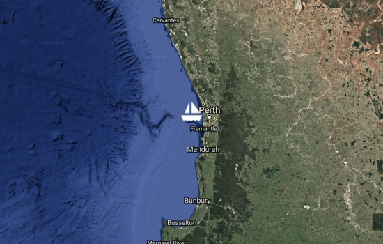
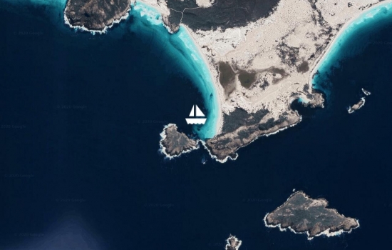
Been living the "Perth dream" on a boat at Parker Point, rottnest. Surrounded by stink pots, but it's a nice spot. Had a good run up and made it in just before dark on Sunday....most of the way in 10-12 knots of breeze - but still managed to knock out 100 miles in 13 hours :). We are all struggling with the idea of joining in the big city lights we can see across the Rottnest Channel ;$. Will move to Longreach Bay today.
Underway to Rottnest Island for what is our last 100 mile run for quite a while, at a guess. Hard not to be a little misty eyed watching the new moon rise with the sun this morning and contemplate what the next "adventure" has in store for us and whether Tika will be a part of that or not. Dunsborough was good for a week. Caught up with Pip and Sharpie which was great. Jaiya also had an old school friend over for a sleepover which made it all the more real just how close we are to Perth ;$. Looking forward to one more week around Rottnest and then we launch back into land life proper.
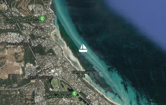
Anchored off Dunsborough town this morning watching the front go through. Just started raining. Pretty smooth last night in the WNW wind - kinda good to experience what it's like along this coast in these winds. Cape Leewin had a 47 knot gust so glad not to be in Hamelin Bay or Gracetown this morning. Had such a nice stay in Bunker Bay and a scenic run down the coast yesterday. Will hunker down for a few days of bad weather before some visitors arrive. Can't believe we are only an extended day sail away from Fremantle. Gotta sit here and contemplate that concept for a while :$.
Driving down Friday so see
Had a good run up to Bunker Bay yesterday and arrived to blue skies, , turquoise water and a long white beach. No wonder you have to put down $5m to own a house here. Shame someone got taken by a shark here many years ago....but didn't stop us getting in the water.
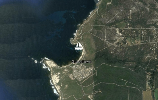
Delightful sail up the scenic surf coast around Margaret River. Lovely long period SW'ly rollers added to the textxure and nice to look along all the surf breaks in the area. Coming into Gracetown looked a little sporty from the outside with fishermen's leads taking you in between two breaking reefs, but was tame once inside and looks far less daunting from the inside! On a friend's mooring in what is a lovely little west australian town full of surf character. A right hander straight behind us and "lefties" (a big left hander) on the south headland are nice backdrops yet the anchorage is surprisingly smooth and comfortable in here. They say this place is actually safe even in large swells and westerly quadrant winds. All the same, will probably move on Saturday when there are forecast westerlies at midday after catching up with some friends in the area.
Avg: 4.4knts
24hr: 106.3nm
Lovely downwind sail around Cape Leeuwin for the rest of the day....Had code 0 out for most of the day and got in by 3pm. Lots of easter crowds on the beach so feels like we have landed in the middle of a perth beach holiday. Pretty sunset over the Indian Ocean makes us feel like we are actually getting close to home....shit just got real :$. Be here for a few days before we go and grab a friends mooring up at Gracetown
Was great to catch up with Steve, Chris and Edward yesterday and the day before. Shelter Island is a rare treat on the south coast for pretty much all round protection from wind and swell. Perhaps if swell got over 4m it might start sneaking through the gap, but we had 3m and it was fine. Left at 5:30pm yesterday for our last overnight passage ;(. Motored through the slop and backwash around the headland for an hour before we found 8 knots to help us glide and rock into the swell. Bit of a sloppy first shift but has smoothed out now we have headed a bit more north and having a lovely sail with the screecher up right now. Hopefully flick around Cape leeuwin before the seabreeze kicks in too hard - but even if not, wind and swell both from behind us will be nice. Hopefully make Hamelin Bay by about 2pm in time for a windsurf :).
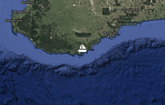
Finally left Albany after a good week of town time while the remnants of TC Marcus disappeared off the weather map. Was also great to catch up with Katy, Brad and family. Even managed to bribe Kai to go to the local high school for 3 days with Josh. Didn't get too far west though as we thought we would check out an anchorage known as either Mutton Bird Island or Shelter Island....one of the few along this coast with true 360 degree protection....although wouldnt want to get in or out in a 5m swell! Tight entry but nice settled anchorage with a close view of the rollers smashing on the rocks 200m to the east. Pretty spot so we may stop for a few days and wait for the eater crowds to leave Hammelin Bay before we set off again.
Moved into the town marina at Albany for a bit of town time. Greer has found some nice yoga classes, Kai is going to his first normal high school for 3 days with an old friend. Been great to catch up with Katy, Brad and family while waiting for the weather map to clear up after the remnants of TC Marcus went through on Monday. Weather looking good to be underway again for Hamelin Bay on Friday
Avg: 3.4knts
24hr: 82.2nm
woops...forgot to update YIT for our Albany arrival :$! Had an uneventful end to the overnight passage with steady easterlies again, thankfully and a dying swell. Anchored off Ledge beach which was a stunning but slightly surgy spot to observe Albany from a distance. Manage to land safely and have a great walk along another beautiful south coast beach.
Avg: 21.5knts
24hr: 515.6nm
Left Esperance at 1pm yesterday in light winds and a solid 3.0m long period swell. Light winds were comfortable but combined with the swell coming towards us made it fairly sloppy and uncomfortable and a constant battle to stop sails slatting for much of yesterday. Sailed down to the head of Bremer subsea Canyon, gybed and sailed south along it hoping we might find the magic Orca spot that is meant to be a wildlife hotspot. UNfortunately we didn't see any wildlife at all - so the location is clearly a little too specific for a lucky fly by. 60 miles to go to an anchorage outside Albany, but comfortable to come in at night, if needs be. Swell has eased off a little and wind is up
Getting close! We will be in
Avg: 3.2knts
24hr: 77.9nm
Woops....had forgotten to update YIT for Albany arrival ;$. Got in and anchored off Ledge Beach. Beautiful quiet beach with a little surge but nice not to head straight into a metropolis after passage

Left Brien's corner yesterday lunch time after a very scratchy bush bash to get to the top of the rocky peak above the anchorage. When will we learn that following a 14 yo's route will not lead to a relaxed morning walk ;). Bit of climbing, plenty of scrub bashing and we made it to the top for some great views. Climbed down and sailed off the mooring and up to dock at Esperance on the inside of Taylor St wharf - which is very convenient to town. Lots of friendly folk at the yacht club last night for dinner and caught up with the Galloways excluding Paul as he is in Cambodia. Will be here until Monday when we will set off on an overbighter for Albany via the Bremer Canyon to see if we can spot some orca's.
Left Lucky Bay just before lunchtime before the SW change arrived. Had a nice sail around Cape Le Grande and into O'Brien's Beach to pick up a mooring. Going for a walk this morning and then head back to Esperance for some town time.
Picking up a mooring - that
Parked in east end of Lucky Bay - apparently one of Australia's or the world's best beaches - although there are many around here that look about the same quality. It is a lovely spot, though. Can probably land a dinghy at the eastern most beach in this swell, although we tend to prefer paddle boarding or swimming in through the waves anyway. Dolphins wandering around the boat. Have loved this coastline despite the challenges with finding all round protection or swell free anchorages. Managed to find a weed free, sandy patch to drop in and comfortable at anchor with the slow rise and fall on the southern ocean swell. A windsurf and long walks along the beach and up some of the far hills beckon after school's done.
Looks like a great spot.
Had a fantastic day with Shaggy, Georg and family. Morning windsurf with all the kids (Jaiya starting to nail her waterstarts!) and lunch on Tika. Really nice to catch up with people from the old tribe :). On the way west again now and stopped off at Victoria Harbour. Not a bad spot - especially on a cat. The usual stark white beaches and turquoise water this area is famous for. Will test the dinghy/ paddleboard landing in the swell after school and have a quick run up to the top of the steep granite headland before we head on to Lucky Bay this afternoon.
Had a marvellous 3 days of glorious weather, no swell and clear skies enjoying our "summer holiday" on Cape Arid. Brilliant turquoise water, interesting granite landscape and sand as white and fine as icing sugar and even a little wave for the kids to surf yesterday. Of course afternoon seabreezes to windsurf on were great too. Such a great spot in the right weather. Dragged ourselves away yesterday afternoon once he seabreeze turned east and shot down to middle island to witness the pink lake...interesting and a great spectacle from the drone, especially. On the way this morning to the south end of Duke of Orleans bay to catch up with "Shaggy" and family (old McCrae yacht club mate). 20-25 and lumpy but Tika handling it with aplomb with two reefs in main and jib. Should be in by 9:30am with any luck.
What a stunning place....WA really does have the best beaches in the world - and cape arid the best in WA. Coupled with a nuclear reinforced seabreeze to get the kids rocketing across turqoise water and we are actually happy to be back in our home state :). Might hang here for a few days but probably have to play musical anchorages a little to ensure we get protection from this SSW change coming tonight
We are watching with interest
Avg: 9.3knts
24hr: 223.5nm
In and anchor down! Great sail for the day and welcomed back into WA with the classic dry heat and a 30 knot seabreeze as we rounded Cape Arid. After not seeing one vessel for the entire passage there is another cat anchored next to us :). We've decided that WA should be called the land of the long white beach. Beautiful turquoise water and stark white beach in a rugged setting - so looking forward to some windsurfing and walking.
Avg: 9.1knts
24hr: 219.5nm
Great smooth sailing, with a lovely sunset to accompany dinner and the game of 500 last night. Gybed over to starboard tack in the morning and had the code 0 on windward hull until about midnight when a few puffs suggested we take it in. Good timing as it suddenly surged past 25 knots (no clouds at all for warning) and had us scrambling to put 2 reefs in. Was back down again within an hour, so shook them both out again, set the screecher, then pulled that in and back to our favourite downwind sail plan of code 0 on windward hull - so a busy second shift for sail changes:$. Set for a 197 mile day and 80 miles to go until anchor down.
Great work. The High
Avg: 10.1knts
24hr: 241.9nm
Great sailing yesterday. If we didn't need jumpers on in the cockpit we could have been in the trade winds! 15-20 knots from the SE, we have had the code 0 on the windward hull for 24 hours and knocked out a 220 mile day. The long period southerly swell has almost disappeared, or at least bent around in our direction slightly. A bit drizzly now as the wind is trying to push in from the ENE, so will need to gybe some time. Unfortunately had some practice at 4am when a rain cloud nudged the wind and we thuoght the shift was in persistently - but no - gybed back again to regain course. Wed arrival looking feasible at this stage with 260 miles to go to cape arid
We watch the weather pattern
Great sailing! Impressive to
Avg: 9.2knts
24hr: 220.9nm
Had a pretty good start. Swell about what we expected and long period so reasonably comfortable. A little more wind than we expected, so while both code 0 and screecher are set on the sprit at the moment, we have been getting along quite nicely under just jib and main for the night. Expecting the wind to back us during today. All well on board and remains of Kai's "mountain" birthday cake is being eaten at a fast rate on late night watches :$
That "Mountain" birthday cake
Left Western River Cove this morning at 4:30am under clear skies and an almost full moon. Wanted to get away early to hopefully avoid any westerly sea breeze and maximise the chances of getting in by Wed evening - but who knows on that front! Wind has dropped from its early 15 knots as we moved away from Kangaroo Island, so gliding along with code 0 up. Reasonably comfortable with long period rolling swell coming towards us from the SW. Had a nice day yesterday for Kai's birthday. Lovely light plays on the grassy hills with a rainbow as we celebrated with a roast dinner. Loved western river cove as an anchorage overall.
Wow ! Did you have the crew
Came back to Western River Cove after a walk up the hill yesterday. Really stunning spot - probably our favourite SA anchorage so far. Strange seabreeze pattern seems to happen here, though where a 10-15 knot westerly seems to kick in from about 11am until 5pm before the SE'ly kicks back in. Makes finding a good spot a little tricky with 180 degree shifts in roadstead type anchorages. We tucked in hard here in shallow water and it was idyllic. Walked off the sterns with our towells in a bag to enjoy a good afternoon lazing and reading on the beach. Fire on the beach last night and Kai's birthday to be celebrated today before we head off before first light tomorrow (to clear land and avoid those pesky westerly seabreezes). Can't believe we have a 14 year old :$.
Fair winds tomorrow. Granny
Nice sail down the interesting landscape of the north coast of kangaroo Island. ran out of wind just near western river cove, but decided it looked a bit swelly as there was a solid 3m of westerly swell. Did the extra 6 miles to Snug Cove. one other boat in there and it was super snug getting the anchor down in the right spot - but nailed it. Only to have another boat charge in and take a mooring way too close the existing boat and us....thankfully no bumps in the night. Other boat have left so we reanchored this morning so don't have to worry about it. Still thinking about a sunday early morning departure at this stage.
Didn't quite get underway yesterday. Was blowing 25 knots and didn't feel like doing the run in that wind. So managed to hitch a lift into town with Des who is a volunteer with RIG, the shipbuilding project they are doing here. Cool project actually. Building a replica tall ship the same as the one built by the americans in 1802. Great to see a bit of the island by car and get Jaiya some more of her beloved avocados. Heading off shortly around to Western River which looks like a nice anchorage. Thinking that our jump off to cross the bite will be Sunday morning at this stage, the day after Kai's birthday,; although we are prepared to be on passage for that if needs be.
Finally got around to a YIT update! Had a good few days in Victor Harbour. Had to swap west side of causeway to east side of causeway depending on winds, but a great stop in a nice regional centre with lots of old buildings and history from the old Murray River trading days. With more time, it would be fun to go up the Coorong and park off Goolwa. Kids got a sleepover to catch up with old cruising friends from Jade and we also caught up with hiking friends (Craig and Wendy) who live there. Left on Sunday and had a bouncy start but ultimately a fast and smooth run to Cape Jarvis where we dropped Craig, Luke and Sturt off in less than ideal conditions. Instead of continuing on to Coffin Bay we pulled into ISland Beach on Kangaroo Island which was absolutely idyllic....then on a mooring in American River the last two nights as the wind clocked to the north and came in last night. Our window tomorrow to cross the bite has shut, so figured we may as well top up on fresh stuff in Kingscote and enjoy cruising this sparse and beautiful island. Off to Kinscote today and then possibly anchorage at Western River if time allows
Avg: 4.9knts
24hr: 117.9nm
Just managed to get in before sunset last night, after a hooking up our third set of cray pot buoys and having to jump in again to cut them away. Super smooth motoring and then sailing north up for most of the day...flew the repaired code 0. Thankfully a friend had managed to find the owner of a private mooring here, so hooked onto that and had a good sleep. Glad to be here and will now hang out and catch up with maintenance, friends and blog!
Well sailed ! ! Has the
Avg: 9knts
24hr: 215.3nm
Had a great run until 5pm, when the wind came in fairly hard. Fairly eventful 24 hours....had 30-35 knots and solid 3m steep seas as we came around the corner. Managed to get our record of 22 knots - although would have preferred to have the second reef in earlier! . Apart from putting the second reef in very boiseterous conditions, had to cut away a couple of fishing buoys off the skeg and get in the engine compartment to manually pump a bilge when the bilge pump failed. Serene conditions once around the corner and motoring as fast we can to make it in before nightfall....but managed to patch the large code 0 'on the fly' this morningafter we got a small hole in the foot yesterday. Then cut away yet a few more fishing buoys, but had to get in the water this time around. Looking forward to Victor Harbour!
Keep safe and wishing you
Hi Tika family. We are
Wow, wow, wow - glad your in
Avg: 10.9knts
24hr: 261.4nm
Swell smoothed out a bit a few hours out of macquarie and wind backed us....had Tika pointed comfortably straight for Esperence....but then there's Jaiya's best ex-cruising buddy now living in Adelaide to consider...and her new puppy. So whatever the logical weather routing decision may have been, a pit stop in Victor Harbour is where we are headed ;). Running dead downwind for the last 12 hours with twin code 0's and no main. Wind should increase and sling shot us around the corner into SA tonight.
Good going. Gale force
Underway for Victor Harbour - although final destination may change depending on how this weather pattern bears out. Pretty sloppy which is to be expected, but wind from behind and heading NW, so life's good. Had a great day whitewater rafting yesterday and going on the old train. Previous day had a tight reach up the harbour in wind that gusted to 35 knots. Battens on mainsail that were "stop gaps" from Hobart (rod not available) did not work out at all (main flogged in the high gusts) so grateful for our delivery to the service station waiting for us when we arrived.
Glad to hear you have a
Heading back to Strahan today. Been raining solidly for 2 days and looks like we will be getting wet on our way back....water tanks full from the awnings. Had an great day up the Franklin on Tuesday....warm weather and managed to drag Tika Taka up 4 small sets of rapids to get to Pengana Cave. This was a pretty decent caving expedition and not for the feint hearted. Several tight, dark, "crawl-throughs" got us to the top cave with a great view overlooking the Franklin. Pumped up two paddle boards on the way back so the kids could have some fun through the rapids. Getting a bit of cabin fever in the cold and wet, so will hopefully have a close reach in 25 knots back to Strahan once we get out of the river. Whitewater rafting and steam train are on the agenda for tomorrow.
Still hanging out in this magnificent location and haven't seen anyone else at all. Apparently there is a rafting group arriving today to get picked up by the local ketch "Storm Breaker" - so may have some company. Went for a Stand up Paddle as a family for 3.5km up stream this morning. Reflections were out yet again as was the mist hanging in the valley. Saw another two platypus. Raining now and getting on with school. not sure if putting the rain awnings out has the same power to chase away the rain here as it did elsewhere.
Hope you are still tucked up
Long time since we have moved the boat and checked in...so much to do and so little time to update YIT :). Contacted local, Ronnie Morrison and borrowed his mooring to hang off while we caught the bus to Lake St Clair for what turned out to be yet another epic walk inspired by Kai and Jaiya. All manifested from meeting a walker in Malaleuca who told us about a camp site at Lake Elysia in the Labyrinth and a bus from Strahan. Turns out that camp site is one of the best we have ever had! Got 4 days of spectacular, low wind, no cloud days. Climbed the Acropolis and Walled Mountain and were in photographers heaven with the evening reflections off Lake Elysia of Mt Geryon and The Acropolis . Bus back, Greer's relaxed birthday on Friday culminating in seeing a platypus in the wild at Hogarth falls. Then yesterday a stop at the convict ruins and shipbuilding site of Sarah Island, then up the Gordon with 30-35 knots and a big black cloud chasing us up the entrance to the Gordon. Went for a stand up paddle this morning for a few miles....what a river! So grateful for Wilderness Society, Bob Brown and all the other protestors from 1982 for saving this river....it's extraordinary. Vertical, rainforest sides and still reflections while a platypus surfaced just in front of Kai and we followed it for 100m down the river. Kinda strange to see Tika's bulk parked at St Johns Falls in the middle of this wilderness....keep expecting to pick up a backpack instead. Not all roses, though. Russ got yet another skin infection while walking and went back on antibiotics and we had a visit from a native water rat last night....sincerely hoping he has left again...no stores eaten into. Finger crossed. Like Port Davey feel incredibly fortunate to be able to spend this time in this remarkable place. Another front coming through Tuesday so will either get back up near Strahan tomorrow afternoon or Thursday.
This is a second attempt -
Avg: 2.8knts
24hr: 67.6nm
An uneventful run up the west coast. Probably only sailed for a third of the way - rest of the time only had about 6 knots and constant low level cloud and drizzle. Nice to get through Hells Gates (very placid) and into Macquarie Harbour. If we can find a mooring we may catch the bus to Lake St Clair and do some hiking around the Labyrinth and possibly look to climb the Acropolis.
Cold and rainy but wind is light and nice to be making miles north again. Went to shore for a great full moon rise last night and then saw the start of the eclipse from tika at about 11:15pm. Looking forward to getting to Strahan and some fresh veggies, but very sad to leave Port Davey....a truly remarkable and beautiful spot.
Nice walk along the long beach yesterday morning before the front came through last night with squalls to 30 knots. Has cooled off a lot! Comfortable in here, although was a little rolly for a while yesterday before the wind shifted more southerly. Hoping it will clear up for the lunar eclipse tonight....if anyone knows what time the eclipse will start and finish for us, email us on vnz2210@sailmail.com :).
Finally got some proper Tasmanian weather yesterday with wall to wall cloud and rain yesterday. Moved around to Spain Bay and hoping for a couple of walks before we head north on thursday or Friday.
The run of extraordinary weather has finally ended after a 30 degree day yesterday! Felt like we were in the tropics again :). Went up Mt Milner for a sunset that ranks in the top 10 two nights ago and up Mt Stokes yesterday. The whole Ocean was glassy in the morning. Not so much as a whisper from the roaring 40's. Probably head around to Spain Bay, Casilda's Cove or Schooner Cove today once the SW change comes in. haven't decided which yet.
Our third spectacular day in a row :). Climbed Mt Beattie two days ago and Mt Rugby yesterday. It was so settled that we hung out on top eating lunch and watching the world go by for 2.5 hours. Moved anchorage yesterday evening and the local family from the boat "Schouten Pass" asked us over for dinner and had a great night - thanks guys :). Might have to walk up Mt Greer today just to make sure the admiral gets a picture on top. Starting to feel entrapped by the spell of this amazing place.
We're keeping an eye on you !
Pushing on! Just checking
Back at Clayton's corner after sailing Tika Taka down to Malaleuca and staying in the bushwalkers huts for the night the previous night. Great sail down there and a 2 hour row back. Incredible to see the famous spot of Deny and Maragret King. Probably hike up mt Beattie today to put some miles in our legs before attempting Mt Rugby tomorrow.
Sailed into Bathurst Harbour from Payne Bay with a 20-25 knot Westerly chasing us in. Lovely sail past all the peaks once on the inside with just the jib up and the clouds cleared for a good view of many of the peaks, which had Kai jumping out of his skin wanting to climb everything in site ;) . Visited Clyde and Win Clayton's house. Amazing story theirs and the King family's. Tossing up whether to take Tika or sail Tika Taka down to Malaleuca Inlet today. Probably make the decision based on how much it is raining, given we are pretty soft in our old age. Fishing boat was going out as we were coming in, but haven't seen another cruising boat, yet - though a few went through in the last 10 days based on the visitors book at Clayton's Corner.
Had another great sail and motor around yesterday in light SE winds. A bit sloppy around SW cape, but managed to sail for most but 1.5 hours with code 0 up. Had a beautiful clear afternoon again and so arrived in Port Davey being able to see the Western Arthurs in the background....side note - could see the Eastern Arthurs and Federation peak 42 km away the previous day as we passed New River Lagoon and Precipitous Bluff in the foreground. Russ still has Federation Peak earmarked as a prize to capture for his 50th - having first seen (ie teased by) the peak when walking the Western Arthurs for his 40th :). Anchored off Carvers Point in Payne Bay, so we could do the dinghy trip up the Davey River to the Davey River Gorge - did this yesterday with a late picnic lunch and it didn't disappoint. Cloudless sky yesterday evening for sunet, made us think we were back in WA already - but today has convinced us otherwise :$. Will go into Bathurst Harbour this morning and pick out a nice spot to hang out and do school until the weather clears again wed/ thur for some walking.
Stopped at Louisa Bay since the weather was so settled....pretty sure the photos from here will go "straight to the pool room" :). Absolutely extraordinary scenery and feel incredibly lucky to have jagged such settled weather. Not a cloud in the sky yesterday and no wind or easterlies blowing for our trip around the bottom....perhaps as far south as we will ever take Tika ;(. Unique mountains, beaches and emptiness, so we interrupted the serenity and flew the drone. Mostly a motor yesterday with an hour of running deep with the code 0 up. Sloppy around south east cape, but other than that long rollers. Anchored in 4.5m tucked in tight behind the kelp beds where we are unaffected by the swell, although would be a little rolly in a mono. Won't hang around too long this morning as the swell is forecast to get to 3-4m which may be slightly awe inspiring coming into Port Davey.
Avg: 3.8knts
24hr: 90.2nm
Managed to get away by 12:45 after an intense morning of work. Boat was a complete mess, so not unhappy to motor for most of the way down to clean up and make water. De Entrecasteaux channel was absolutely stunning. Sunny and glassy waters for most of the way - although did manage to sail an hour or so with the code 0 up. Got in at 7:50pm and tucked in to a 1 boat anchorage with great protection from both the N and SW. Incredibly still night with stunning colours in the long twilight without a cloud in the sky. Looking like a good window around to Port Davey sat afternoon or sunday.
Hello we are in the shack
Morning just saying hello we
After a great week on the MAST free pontoon in the centre of Hobart (thanks MAST for letting us stay while we got our engine mounts done!), we moved to Lindisfarne this morning to finish off and replace the port engine mounts as well! Greg Smith- what a legend of a tradesman. Also Mike from Quantum did a great job at tarting up the main and boom bag after we blew out our first reefing line on a gybe during our windy spell coming into Hobart. Also managed a movie, some shopping and an incredible day at MONA yesterday. Off down to Recherche today after leaving at 12:30 - should make it before dark, hopefully :$
Hi Tika family,... Hamish
Avg: 19.4knts
24hr: 466nm
Did a one day run from Schouten Passage, through Denison Canal to Hobart. Had a solid 25-30 NE across Norfolk Bay but good flat water and could still lay Hobart after we rounded the Iron Pot, which was nice
After a final walk along the beach at Wineglass yesterday afternoon, we moved 10 miles down to Crocketts Beach on Schouten Island. Had a quick walk/ climb up the steep hill of Mt Bear for an outstanding view over the pass and onto Freycinet. That makes 3 mountains in 3 days for Jaiya and Russ....so much fun. Met 3 families from Hobart camping with their trimaran out the front who kindly offered us dinner and enjoyed good company for a few hours. On the way to Hobart this morning before the wind comes in tonight.
Tucked in at Wineglass bay close to the point and managed to get enough protection from the NE'ly and N'ly to stay last night, thus avoiding the "Schouten Shuffle". Grateful for low draft and two hulls ;). Stunning day again today and loving the holiday in Wineglass Bay. Go for a walk tomorrow and probably head around to Hobart on thursday before the weather comes in on Friday
Keep the two hull benefits
Hey guys!! Just heading to
Avg: 4.3knts
24hr: 102.7nm
Mixed bag yesterday. Some great lightwind sailing and then the northerly steadily built to 25 knots. Warm front passed over and we got 30-35kts for a period and then nothing at all. Kept switching NE, NW, back to NE. Had 1.5m NE swell as we were approaching wineglass bay and the wind kicked again to 30-35 from the NW. Wind would have been good for wineglass but swell would have made it horrible so we diverted into sleepy bay and got the anchor down using radar to measure our distance to shore at 10pm. Will stop by Wineglass Bay this morning as a coffee stop before heading to Bryan's corner in Schouten Passage to do the "Schouten Shuffle" for the changing winds in the next few days.
Gosh, bringing back magic
Had a great day yesterday. Rigged tika taka, and sailed across the bay with Stackbouses on the hobie and had a lovely crayfish lunch at Stacky's bite. Sailed back and enjoyed the light and bright weather. Also enjoyed windsurfing the previous day Mick's birthday the previous night - been a great stopover. Left at sunset last night and had a super smooth and pleasant sail, although more motoring today than anticipated....not sure where the forecast wind has gone. Hopefully still make wineglass bay by sunset. Passed Banks Strait in glassy seas....quite the contrast to 24 years ago when Pipedream was surfing 15' seas in a 45-55 knot NW'ly gale on mum and dad's first overnight cruise :).
Good sail over from Deal Island in the afternoon - although fairly washy leaving Deal with the current in that area. Now on a mooring in Killiecrankie Bay on NW Flinders Island. Another very picturesque spot on a Bass Strait Island. Slightly rolly in the westerly wind, but friendly locals. Unbeknownst to us prior, it turns out that this was the place on Flinders Island that Russ came here in about 1986 on a school Scuba trip when there were only two houses on the point, both owned by Alfie Stackhouse (one for his family and one to rent out). Alfie Stackhouse is Pete and Allan Stackhouse's uncle and about 10 years later, Greer met Pete Stackhouse while she was doing a signwriting apprenticeship in Cairns. What are the chances!
Anchored in Garden Cove, Deal Island. Had a nice sail over here on New Year's Eve from Flinders with a few knots more wind than expected and a solid swell early but nothing too uncomfortable. Stunning spot. Walked up over the hill to visit the Parks caretaker volunteers, but lighthouse not open for tours, unfortunately. Will head off to Flinders Island this afternoon when the wind backs around to the west a little more.
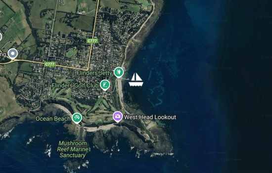
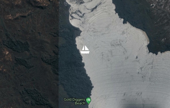
Went through the heads yesterday before the front while conditions were benign....motored most of the way around to Flinders and currently anchored off the pier enjoying watching the sailing school and club races. Nice little town and good spot to prop while waiting for ideal weather to head across Bass Strait to Deal Island. Might wait another day for the swell to die down before we leave, though - so it looks as though NYE will be on passage :$
Went through the heads yesterday before the front while conditions were benign....motored most of the way around to Flinders and currently anchored off the pier enjoying watching the sailing school and club races. Nice little town and good spot to prop while waiting for ideal weather to head across Bass Strait to Deal Island. Might wait another day for the swell to die down before we leave, though - so it looks as though NYE will be on passage :$
Went through the heads yesterday before the front while conditions were benign....motored most of the way around to Flinders and currently anchored off the pier enjoying watching the sailing school and club races. Nice little town and good spot to prop while waiting for ideal weather to head across Bass Strait to Deal Island. Might wait another day for the swell to die down before we leave, though - so it looks as though NYE will be on passage :$
Moved up to safety beach in the northerly chop and discovered a lovely anchorage. Went shopping and got accosted by the marina security guard for typing the dinghy up in the wrong spot, despite having been told by him that it was fine to tie it up there. Anchorage great - avoid spending any $'s in the marina, it is horrible. And tie up your dinghy to the floating dock at the boat ramp....then it all works!
Moved across to anchor straight off McCrae yacht club. This is the dinghy club where it all started....with mum and dad learning to sail on a 470 in their 50's. Nice to hang out and have friends drop by and say hi while we wind up to xmas madness
Stopped at Portsea for a swim along the way. beautiful warm days at the moment, but a change coming tomorrow. Tied up to the marina at Blairgowrie Yacht Squadron. AMAZING facilities....highly recommended outside of silly season. nice area and close to granny and papa at Mccrae :)
Great downwind run in mostly light breezes from the prom. Left at 5.20am and managed to be in through the heads right on slack water at dusk. Tied up to a free mooring at queenscliff where the cousins disembarked....been a great week for all 4 cousins.
Avg: 4.9knts
24hr: 118.8nm
Amazingly placid passage from our short Gabo Island stopover. Downwind in 8-12 knots meant the boat was calmer than at anchor for the most part. Beautiful quiet sailing and great sunsets in mostly cloudless skies. Jumped to 22-30 knots from the NE as it got dark approaching the Prom last night, but snuck our way in and had the anchor down by 10pm. Such a beautiful part of the world.
Our grand daughters name is
Avg: 5knts
24hr: 120.8nm
Super smooth sailing with wind from almost dead behind. Motored to Gabo Island yesterday and spent a delightful 3 hours walking and meeting the fill in lighthouse keepers, Tony and Karen. Got a tour up to the top of the lighthouse (2nd highest in australia) which was a heap of fun and also amazing to see the stone work from 1862. Watched our friends on Steely Dan sail past before getting back underway ourselves at 5pm. Hoping to make it into Refuge Cove at Wilsons Prom before dark.
Avg: 5.2knts
24hr: 125.9nm
What an awesome stop for 3 hours while we waited for the wind to pop up! Motored around the corner in glassy seas and then dropped the pick in a delightful anchorage. Walked across the island and met the lighthouse keeper who took us up the lighthouse where we watched Steely Dan sail on by again. Extraordinary lighthouse. Saw two different seal colonies and the kids got super close to a baby seal. thoroughly recommend the stop!
Avg: 2.9knts
24hr: 70.5nm
Pulled into Bittangabea creek - stunning little 2 boat anchorage with a beach and all round protection. Good to get the Kai, Jaiya, Jordan and Oliver (cousins) out and exercising after a day and a half sitting still. Starlit night with fire on the beach. Head to Gabo island some time this morning to see some penguins - then a sunset departure for Wilson's Prom. It's getting cold - thermals and sleeping bags have been dug out!
Avg: 14.5knts
24hr: 347.8nm
Left Manly at 11 yesterday once the NE wind had come in. Had a stunning sail in 20-22 knots until about midnight when the wind died. Motored for about 5.5 hours and now the SE'ly has come in as forecast by GRIBS. Should be a nice sail now and hopefully be into Eden by about 2.
Nice catch up with a few of the magnet crew yesterday. Heading off to head south towards Melbourne via Eden and Wilsons prom today when the wind comes in
Moved around to store beach next to manly. Beautiful spot and close enough to still go shopping in manly :)
Had a spectacular sail down the Syndey Northern beaches in 15-20 knot NE'lies. Turned into Sydney harbour and sailed past all the famous landmarks to land at Blackwattle Bay. Can't believe you can anchor almost in the city centre! Was an amazing and exhilaerating day.
Sounds wonderful, sorry to
Had a gentle but nice sail down from Coffs. Left yesterday lunchtime and got in just before sunset at 8pm. Beautiful spot and wish we could have stayed longer. Sail was amusing as, at times we were doing 6.5 knots in 5 knots if true wind. Gotta love the east australian current!
Avg: 2.5knts
24hr: 61nm
Made it to Coffs yesterday at 12pm. Had motor on for the last 11 hours, but a great passage overall. Relatively painless check in. I think we're happy to be back in Australia....
Avg: 9.3knts
24hr: 222.3nm
Champagne sailing with the screecher for most of the day yesterday in 6-12 knots of easterly winds and smooth seas. Motoring since 1am as the last of the wind disappeared, and due into Coffs about midday today. Looking forward to some fresh veggies and fresh coffee beans.
Avg: 11.2knts
24hr: 268.7nm
Cracking day. Hooked into the East Australian Current and looking at close to a 240 mile day! A solid 2-3 knots for a lot of the time. A few showers over night, cleared up again this morning with very pleasant sailing. It's getting cold! Left the tropics officially yesterday :(.
Avg: 10knts
24hr: 239.1nm
Fairly bouncy day and night but laying Coffs easily with swell and wind steadily decreasing. More wind than expected early on but at a far better angle than expected as it backed us 25 degrees throughout the day. Motion settling down more now so overall happy with progress, making an arrival at Coffs on Friday a possibility.
Will be underway in an hour or two - hopefully headed for Coffs if it is not too bouncy once we get out there. Will probably lay off 20 degrees for the first 36 hours until the wind and swell die off a bit and then harden up.
Beautiful day yesterday. Only 10 knonts of wind, so got up early and watched a couple of huge sea turtles make a very slow crawl back into the ocean after nesting. Thinking about leaving tomorrow or Wednesday for Coffs or Bundaberg
cranked up to 20-24 knots for most of yesterday. Nice long walk along the beach observing the birds and myriad of turtle tracks up the beach to nesting sites. Haven't spotted any actual turtles yet. May go on a foray tonight.
Avg: 5.7knts
24hr: 137.3nm
Safely at anchor on east side of Chesterfield. Textbook tradewind sailing yesterday - 12-15 knots, very little swell, good relaxed day and one tuna on the way in. Looks like we will be here for 4-5 days before heading on to Aus
Well done, Team Tika! Enjoy
Avg: 6.9knts
24hr: 166nm
Nice smooth sailing, albeit a little slower than we are used to. GFS seems about spot on for wind strength and direction. Current now against us by about 1 knot. Hoping to get into Chesterfield before dark - should just make it.
Avg: 9.8knts
24hr: 236.3nm
Fast run yesterday with winds 18-24 knots of SE in the evening. Backed off a lot since midnight but still on target for a 215 mile day. Lost two lures yesterday :(. One was a monster which Jaiya reckons she saw the bill of a marlin or sailfish come to the surface on one of the big splashes....unfortunately line loooped around the top of the rod, jammed as it was running out and promptly snapped.
Had a delightful sail inside the lagoon up the coast yesterday. Stopped by Teana - nice wavesailing spot on the south side of the pass - but sadly no wave gear on board ;(. Wind cranked up to 22-27 knots in the afternoon so went to Puen for the night. Just got underway to Chesterfield now
Packed up the wind toys after a great last blast yesterday. May just make a 30 mile run up the coast to Teana today, though and wait for the southerly swell to die down and leave tomorrow morning from there instead. Anyone might think we are reluctant to head the boat towards Australia :$
Enjoying the windsurfing and last of New Cal before we head off on Monday
Back at Ilot Maitre to soak up our waiting time windsurfing. Wind piped in 8pm last night - lots of south in it but should swing during the day, it seems. Pretty set on leaving Monday unless something really nasty appears on the weather horizon. Just need to pop up the mast again today to replace some split pins.
Jobs almost done. Will check out today and are close to locking into a monday departure for chesterfield. Go out to Ilot Maitre for some windsurfing today.
Finally back in Noumea after a nice sail in NE winds yesterday. mirror smooth this morning in the harbour and fairly hot and humid. Diesel, Doctor and supermarket done. checkout, fresh and boat jobs to go before we head back to Ilot Maitre for some pre passage windsurfing
Beautiful beach time without a cloud in the sky in the morning yesterday (ua is up there as a favourite with Gadji) meant we couldn't quite force ourselves into Noumea so had a nice sail in 15 knot SE stopped at Ilot Mato. Definitely out of food now, so the call of the criossant is strong. Considering anything between sat and tuesday as departure for Cheterfield depending on likely winds into Chesterfield and a blind guess of how long we will hang out in chesterfield before making the run for Bundaberg
Long and arduous passage of 3 miles up to Ua. Just another stunning island anchorage....this one with a couple of resident Ospreys on it. Coral alive and great for leisurely snorkel straight off the boat. Reluctantly heading up to Noumea today to check out later in the week and considering a Sunday departure for Chesterfield
Finally moved on from Bae De Gadji out to Kuare in the southern lagoon. Perfect sail yesterday in 8-10 knots of wind, dead flat with code 0 and even managed to pick up a mahi mahi on the way. Getting used to the boat actually moving at anchor again :$. Stunning location, but a little bouncy last night at high tide so may move up to Ua today before heading to Noumea on Monday.
Still at Bae De Gadji. Finished the inaugural Bae De Gadji regatta yesterday after 2 days and about 15 races with 2 windsurfers, 2 sailing dinghies, and 2min start sequence. Had a ball with the kids all swapping out and racing on time trials :). Might move today to Kuare - not sure.
relaxed days....glassy mornings and 12-14 knots in the afternoon for sailing and windsurfing. Going to have to tear ourselves away from here one of these days - most likely thursday. BBQ on the beach for Halloween tonight as Vicky and Jaiya have been baking witches fingers and eyeballs :)
Spectacular morning. Had 10-15 knots yesterday but has dropped out. 2 sailing dinghies carrying 5 kids from 3 countries have gone exploring and found a good camping spot to run their own jurisdiction and haven't really been seen for the last 2 days - although they did call in a lat and long :)
Avg: 2.6knts
24hr: 61.7nm
Great sail to Bae De Gadji yesterday. Had 12-20 knots from the NE. Hard on the breeze most of the way, but fun flat water beating. Beautiful spot in the inner anchorage here - 360 degree protection.
Left noumea at 5am en route to Bae de Gadji while there'e NE'lies.
Gusty and squally today. Great day yesterday - school sandwiched between two windsurfing sessions. Jaiya now stand-starting on a waveboard :).
Didn't make it far from Noumea. Stopped at Ile Maitre and found a whole tribe of kiters, windsurfers and kid boats so pulled the windsurfers out and have been here ever since :). Look to take the NE down to Bae De Gadji on Sunday, probably. Gonna get some serious wind tomorrow, it seems.
Windy yesterday anchored off Noumea. Checked in and looking to beat back up to Bae de Gadji on the isle of pines in the next few days to find a nice windsurfing spot to settle into for the upcoming blow :)
Avg: 2.9knts
24hr: 69.8nm
Avg: 3.1knts
24hr: 75nm
Avg: 2.6knts
24hr: 63.1nm
Asinvari - what a great spot - did bat cave and had Jaiya's birthday. Beautiful location and lovely village
Conned our way into a nice little anchorage. Well protected but a little current
Anchored off Ratua Island Resort. Great spot and lovely owners of the resort
Avg: 62.9knts
24hr: 1509.2nm
Moved over from Ambrym to Port Stanley on Malakula...no wind and lost two lures with big strikes on the fishing lines. Off to Louganville today in preparation for Granny and Papa coming tomorrow ;). Less rain than we thought in the last two days...chased it away again by putting up the rain awnings.
Avg: 3.3knts
24hr: 79.4nm
Snuck into anchorage closest to Olal on North Coast of Ambryum in small coral lagoon with two other boats (Alexander and Ka Pai)....Thank Chris from Ohana for surveying this spot a few years ago! Well protected from swell at low tide but a little jiggly at high tide. Should make it convenient for the festival today...rumour has it that it might have shifted a day earlier and start today - will find out for sure when we go ashore this morning.
En route to Ambrym from Port Resolution. Nice solid wind for the overnight broad reach. Black night given cloud cover and no moon.
Avg: 7.7knts
24hr: 185.4nm
Safely tucked up at anchor in Port Resolution, after getting in at midnight on sat chart, friend's track and radar - although conning our way in was easy compared to finding an anchoring spot in amongst the forrest of masts of the pacific circuit rally :$. Turned engine on at 1pm yesterday and glassy smooth ever since - spectacular sunset and starlit night with glow of volcano on approach. Seems like things are happening 6-12 hours ahead of GFS GRIBS (wind change in Fiji when we left was about 6 hours ahead of GRIB)
Avg: 9.8knts
24hr: 234.4nm
Nice night, wind dropping and backing, swell has settled down. Gliding along but probably have to put the motor on later in the day. Due in some time around midnight tonight. 122 miles to go. Caught a tuna at dusk last night, so the Tika sushi production line kicked into action for dinner :).
Left Vuda at 2.30pm yesterday, bound for Port Resolution. Fast but uncomfortable night with a washing machine (short period) southerly swell running, no doubt generated from the depression to the south. Wind and swell seem to have backed us a little this morning, hoping they will continue to do so during the day today so we can do an arc down towards Tanna.
Having a great time at Navadra for a kid boat catch up....6 boats, 14 kids, camping on the beach...don't come near unless you want a noisy anchorage :$
Avg: 4.3knts
24hr: 103.2nm
Great sail yesterday but were kept busy. 108 miles in 12.5 hours, two fish (mahi mahi and tuna), 4 gybes including swinging code 0 between each hull and had the code 0 in and out about 10 times between gybes, fish and wind gusts :). We're getting better at stopping the boat quickly when the fishing line goes. Great surfing down west coast of viti levu. Max speed 18.6 on main only :$. . Got the anchor down just before dark at Musket cove.
Left Kokomo private resort at 5:30am for a run up to Musket Cove. Hoping to get in before dark, but if not, will anchor at Momi bay
made the most of the glassy day yesterday and drifted the Naigoro pass at low tide, did Sevu Sevu and then came back up to swim with the Manta's at high tide. Great day!
On the way to go drift dive the pass. Amazing day yesterday once rain cleared at 10am and stunning again today :)
Fast and bouncy ride down from Suva yesterday afternoon - but caught a yellowfin coming in through kadavu channel and beautiful anchorage here now. Looking forward to explore the area as weather settles.
Avg: 4.6knts
24hr: 111nm
nice fast day run yesterday after a super quiet passage. Got in an hour after dark, just before the rain started to eat some of the two wahoo caught yesterday :)
Hi, your longitude put you
Avg: 7.3knts
24hr: 175.4nm
Beautiful, albeit slightly slow sailing. Managed to pull in two wahoo at the same time yesterday morning. Passed an east west cloud bank last night with a light sprinkle of rain - only an extra 4 knots of wind in it. Hoping to be in Suva right on sunset tonight.
Avg: 8.1knts
24hr: 194.1nm
super quiet night with wind between 6 and 8 knots, but swinging 30 degrees, so glad to have autopilot on wind angle
En route to Suva from Ha'apai. Spectacular day, great sailing and nice view of Tofua Volcanoe as we sail past
Stopped briefly at one of our favourite atols in the haapai's
Anchored off Matafonua, enjoying the windsurfing and clear water now the rain has cleared and the sun has come out. Managed to drop the go pro off Kai's mast today, mark the spot with a buoy and actually find it with snorkelling gear later. Happy about that :). amazing sail down past about 20 pods of whales on Thursday.
Stayed overnight in Mananita on way back to Ha'apai. Stunningly beautiful spot. hosted a Swiss family for dinner who are camping out for 4 weeks.
Anchored off Kenutu. Lovely spot :)
Anchored in the lagoon off Foeata Island. Stunning spot - a little jiggly at high tide. Good wave on south side, but beyond our equipment and abilities. Heading into Neiafu today to rig the dinghy, Tika Taka, and compete in the King's Birthday regatta.
Anchored in an uncharted lagoon on the SW side of Nomuka Ika, nicely protected from wind and swell. Good snorkelling.
Anchored off Haafeva waiting for the wind to blow itself out a bit. Hopefuly we might be able to resupply some onions eggs and potatoes at the village
Anchored off Tofanga Island in Ha'apai Group, Tonga, enjoying the windsurfing, snorkelling and dinghy sailing :). Will think about moving some time in the next few days as the wind goes up one more notch.
Anchored just off the Tofanga Island in Ha'apai. School, windsurfing and fires on the beach :)
Anchored off the sandspit next to Uonukuhihfo Island in Ha'apai, Tonga, enjoying the windsurfing :)
Stunning day in Ha'apai, anchored next to Limu in gin blue water
Avg: 9.7knts
24hr: 231.9nm
Heaved to next to the outer reefs of Ha'apai. Stunning night and fantastic sailing for last 24 hours. 2.5m long period swell and 20 knots on the beam made it fast and fun. Should have anchor down by 10am. Beautiful day and nice to have the family home back in the tropics! Just realised had typos in last 2 positions (should have been W not E longitude)
Avg: 8.4knts
24hr: 202.2nm
Tried to put the brakes on for a period yesterday by pulling in the tiny bit of jib we had out (already on 3rd reef in main). Worked a little. Squalls of yesterday have now left us which is nice. Swell has backed us a little and wind eased so slightly more comfortable and back moving along well again without too many crashes and bangs.
Avg: 4.8knts
24hr: 116.1nm
Hard night. Lots of squalls. Short period building easterly swell makes it a washing machine right now. Considering running off to Minerva to take pressure off the boat.
Avg: 5.4knts
24hr: 129.3nm
Intend staying until Wednesday but need to clarify this decision as DOC have not given a permit for anchoring here due the Myrtle rust problems. There is no transiting or anchoring within 1000m of any island in the Kermadecs.
Avg: 10.5knts
24hr: 252.3nm
Lovely quiet night. Wind, swell and seas all from straight behind. planning to head east until the wind swings then slowly come back to the west until the depression goes through. Probably "jog on the spot" until tue or wed.
Left yesterday and now wondering what to do with the weather situation on route.
Anchored in Pipi Bay in Port underwood after a great, fast sail through Cook Strait yesterday. Making the run up the east coast tomorrow and hoping for good weather!
Just finished up a wonderful 2.5 weeks in nelson, including an epic 8 day hike and catching up with nearby friends...as well as waiting out the remnants of 2 cyclones
Moored in Port Taranaki...awaiting some northerly winds to take us back down to Nelson
Avg: 6.9knts
24hr: 165.3nm
On Quarantine dock in Opua. Arrived at 11:30pm last night after a seriously fun sleigh past North Cape....solid 12 and 13 knots and hit 18.9 on one occasion surfing the family home :). Drizzly, cold and very windy as front seems like it is just starting to come through. So happy to have made it! x Russ, Greer, Kai and Jaiya
Hi guys! We just left Opua
Avg: 10.5knts
24hr: 250.8nm
Motorailed until 4pm and then spectacular sailing. Sailed under full moon with Code 0 all night, smooth and fast. ETA Opua about midnight just before the front hopefully. X Greer, Russ, Kai and Jaiya
Avg: 6knts
24hr: 143.3nm
Left Norfolk Island at 2pm yesterday. Good sail for first 3 hours then Motor sailing since. Have about 1 knot current against us. Racing this front in and looking forward to the northerlies joining us in 12 hours so we can turn the motor off. X Russ, Greer, Kai and Jaiya
Avg: 4.3knts
24hr: 102.9nm
anchored yesterday and had very pleasant check in on the back of a 4WD. Will stay until sat/Sunday time frame
Avg: 2.6knts
24hr: 63nm
Anchored in Sydney Bay, Norfolk Island. Nice and sunny and good to have some fresh fish, fresh veggies and fresh internet! Will move around to Ball Bay on the the SE side of the island this afternoon to wait out the front
Avg: 8.8knts
24hr: 212.2nm
Reverted back to Plan A, so 55 miles to go until a pitstop in Norfolk - we were going to be cutting slightly too fine getting in before the next front. Will head off to NZ late Saturday and plan to arrive in Opua first light Tuesday (again depending on how the second front develops). Stunning night - gliding along with code 0 again now after motoring for 6 hours last night when our wind dropped below 5 knots. x Greer, Russ, Kai and Jaiya
Avg: 7.9knts
24hr: 190.5nm
Bouncy night as our NW'ly turned slowly into a SSE and then SE. heading into a long period large SW swell which also increased the bounce. x Greer, Russ, Kai and Jaiya
Avg: 9.2knts
24hr: 220nm
Spectacular light downwind sailing...we've had rougher nights at anchor. Gybed onto starboard tack at shift change as we pass the very top of the last front (hopefully!) before we meet up with the weather high near Norfolk Island and make the decision whether to turn left towards Opua and try and run in before the next one
Avg: 9.2knts
24hr: 220.8nm
Mixed bag - mostly downwind gliding, then a fast reach last night with 15-20 knots from SE, now downwind glide again this morning
Avg: 7.9knts
24hr: 189.3nm
Stunning day's sailing yesterday. Passed through the frontal band of cloud last night and had plentiful rain and lightning for 4 hours. Wind swung but only got to 13 knots. Back gliding along with code 0 this morning
Departed for NZ, heading towards Norfolk. Beautiful light wind sailing - if only it could be like this the whole way!
most likely leaving fri PM or sat AM now
May leave this afternoon
waiting for weather window in Fulanga after pulling in for engine maintenance en route to NZ
waiting for weather window in Fulanga after pulling in for engine maintenance en route to NZ
heading west. Will thread through the Lau tomorrow on route to Vuda Marina on the west side of Viti Levu
Tahuata
Hiva Oa
Avg: 7knts
24hr: 167.1nm
Avg: 18.3knts
24hr: 438.1nm
San Christobal
En route to Galapagos
Avg: 2.5knts
24hr: 60.2nm
Panama City
Back to shelter Bay
El porvenir
Avg: 3.1knts
24hr: 74.3nm
Back at swimming pool in San Blas
Avg: 10.5knts
24hr: 253.1nm
Catagena
en route to Cartagena
Bonaire
en route bonaire
Los Aves
Clarkes Court Haul out Grenada
Underwater statues
Union Island
Saltwhistle Bay
Tobago Keys
Saint Pierre, Martinique
Dominica
Guadeloupe
En route to Guadeloupe
Avg: 4.5knts
24hr: 109nm
Antigua
Arrived into St MArtin to pick up Stu and Nat
Avg: 11.3knts
24hr: 270.3nm
Arrive BVI's to Little Jost Van Dyke
Avg: 5.1knts
24hr: 121.6nm
En route to BVI's
En route to BVI's
Long Island
Avg: 2.7knts
24hr: 65.1nm
George town...just in the nick of time!
En route to Bahamas for xmas! Just escaped fort lauderdale (with our lives!)
Fort Lauderdale
En route to Fort Lauderdale
Key West - unexpected stop after a rough crossing of Florida Straits
Avg: 3.5knts
24hr: 82.9nm
Havana
En route to Havana
Avg: 7.9knts
24hr: 190.3nm
En route to Havana
Isla Rosario
Playa Serena, Cay Largo
cienfuegos
Avg: 4.5knts
24hr: 107.4nm
rio de Jardines -
Avg: 4.1knts
24hr: 99.4nm
Overnighter to rio de jardines
Chivirico
Coco Banderas
Left Shelter Bay after 2 weeks of hard work cleaning and getting Tika ready
No blogs available for this yacht.
Hi ... we note you are