Taranui
Sailed yesterday from Crocketts bay, Schouten Island to Prosser Bay stopping at Darlington Harbour on Maria Island for a few hours on route.
Schouten Passage shuffle yesterday from Crocketts Bay on Schouten Island to Bryans Corner on Freycinet Peninsula; 2.8 NM. Cowering from the gale force winds that the Sydney to Hobart leaders are using to potentially shave hours off last years record. They flew past us a few hours ago at between 20 and 30 knots!!
In Crocketts Bay, Schouten Island. Climbed the granite peak Bear Hill.
After fuel and water in Triabunna six hours to Bryans Bay in the Schouten Passage, Freycinet National Park.32.7 NM. 6km return walk to Cooks Beach and swim.
From Shoal Bay, Maria Island to Prosser Bay (11.3 NM) ready to motor into Triabunna tomorrow for fuel and water.
17.9NM from Dunalley and back to Shoal Bay, Maria Island for the third time..
Back on-board Taranui after 16 days exploring the inland world heritage wilderness areas. Over 200 km on "the pegs".

5.6NM from Connelly's to Dunalley via the Denison Canal.
8.1 NM from Lagoon Beach to Connelly's.
Left Constitution Dock 0900. 26.2 NM to Lagoon Beach in Frederick Henry Bay. Beautiful white sand beach.
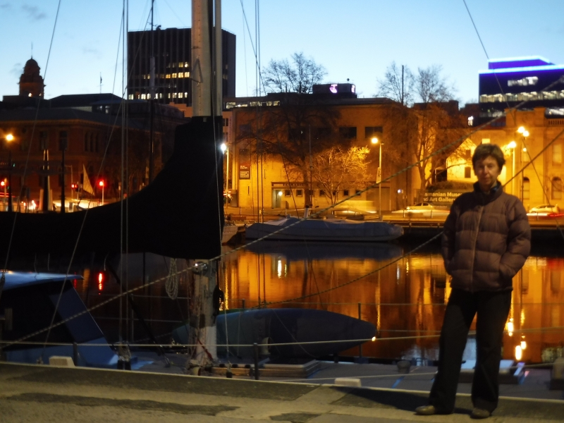
Home Alone in Constitution Dock!!
Hilary flew back to Nelson, NZ for two weeks for a catch-up and our visitors dropped off at the Hobart airport this morning.


23.7 NM from Shoal Bay, Maria Island to Connellys Bay, Fredrick Henry Bay via Dennison Canal. Using the Canal reduces the distance to Hobart by approximately 40NM.
Darlington, Maria Island again with visiting nephew and fiancée. Up onto Bishop and Clerk again yesterday.
Back on MAST mooring in Prosser Bay.
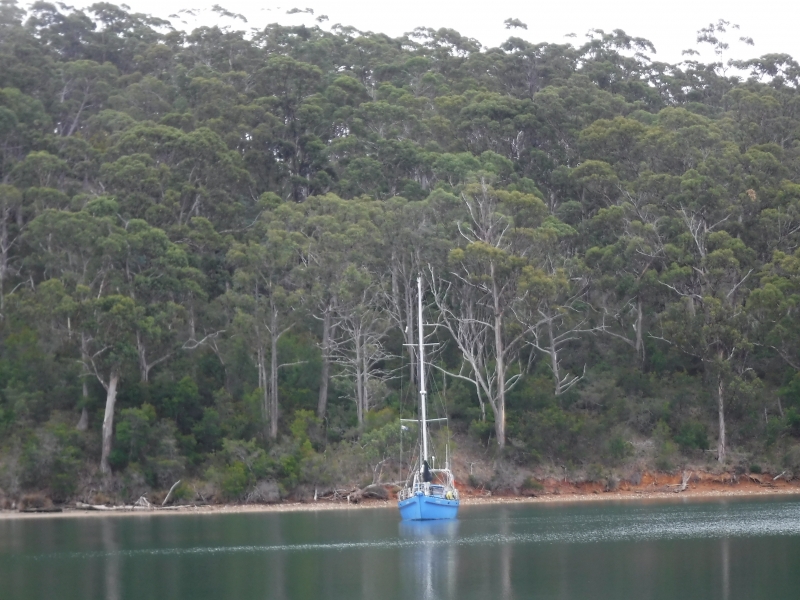
Whalers Cove for two nights as part of Maria Island circumnavigation.
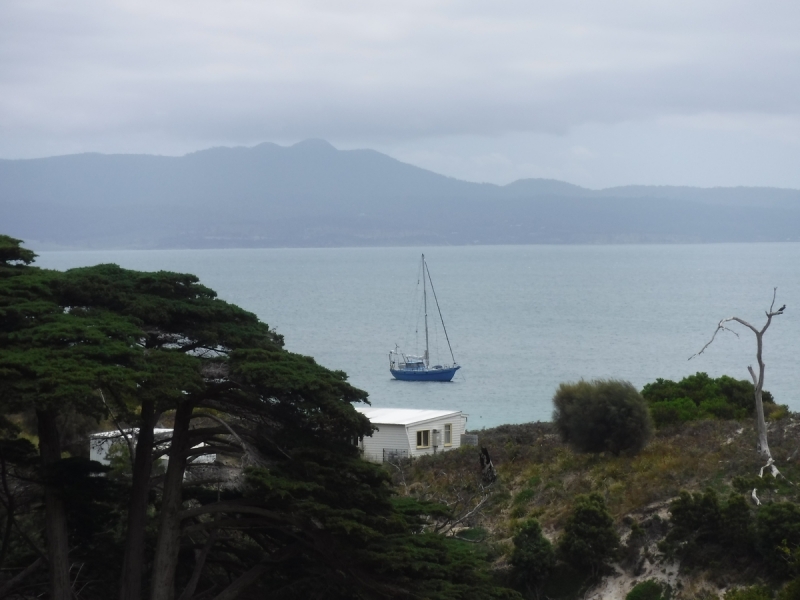
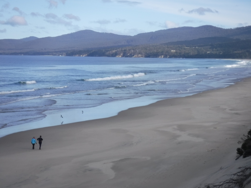
In Shoal Bay, Maria Island. The depth in the Bay is a fairly consistent 4 metres apart from "The Hole" which drops to 9 metres and easily seen on the google map. Climbed the peak Bishop and Clerk today. Spectacular!!
Avg: 5.2knts
24hr: 124.8nm
Encampment Cove sheltering from last nights strong westerly wind. Now veered to the more favourable NW. Continuous equinoctial winds all around the clock lately with ccasional light winds and variables.
In "The Hole", Shoal Bay (9 metres) for a few Flatheads for dinner. Quickly successful!! Flatheads are great eating and put them up there with NZ Blue Cod. Apart from "The Hole", Shoal Bay is consistently about 4 metres deep.
Avg: 30.7knts
24hr: 735.6nm
Beaut sail from Darlington Harbour back to Shoal or Chinaman Bay. Magic moonrise.

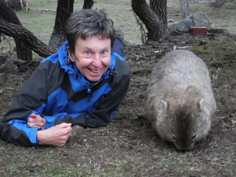
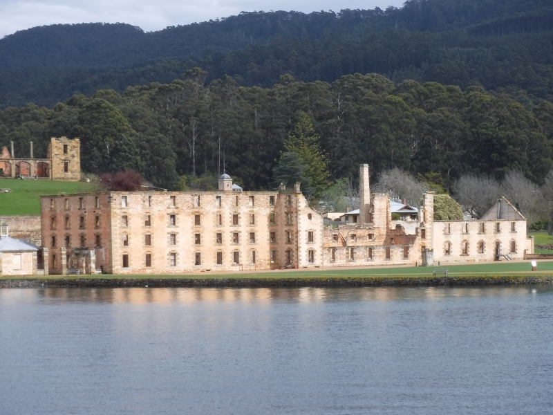
In Darlington Harbour on Maria Island for the day before sailing 8NM northward to anchor in Shoal Bay again for protection from the 20 to 30 knot NE forecasted. Walked the Fossil Cliff and Painted Rocks circuits as well as snooping around the historic penal colony. many Wombats and other wildlife.
Departed Triabunna marina this evening for Prosser Bay. On another of those wonderful MAST (Marine Safety Tasmania) free moorings. Smooth sea, no wind and a full moon. Absolutely gorgeous! Back to Maria Island tomorrow.
Made a 12NM dash across Mercury Passage and into the very sheltered Triabunna Marina on mainland Tasmania to resupply and replenish while a low pressure system passes over. On a brand new marina dock not shown on Google Earth. Back out to Maria Island for plenty more exploring tomorrow.
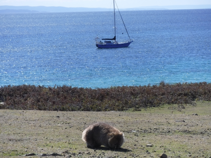
In Chinamans, Shoal Bay on Maria Island in approximately 3.5 metres of crystal clear water.. This Island is absolutely stunningly unique. Zillions of Wombats.

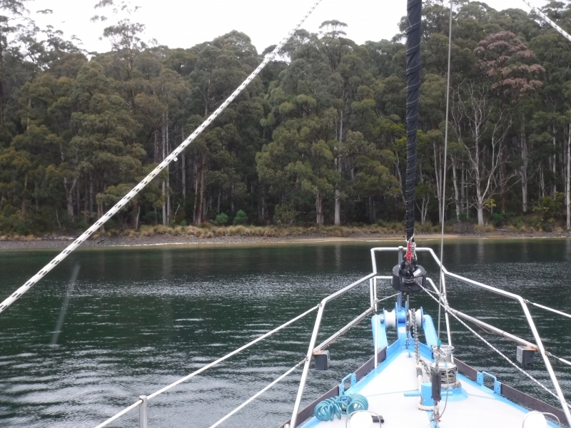
In beautiful Canoe Bay in Fortescue Bay tucked in behind a wreck in about 3 metres of crystal clear water. 20km walk above the dolerite sea cliffs to Mt Lichen and return. Stunning!!
After two days of stories of escaping convicts, punishment strategies and solitary confinement at the most fascinating Port Arthur Penal Colony Historic Site, Taranui is now anchored at the most delightful Ladies Bay. Calm, sheltered clear water, excellent holding in 4 to 6 metres with a beautiful beach back dropped by mature Australian trees and the diesel heater murmuring away providing dry heat; it is as good as anywhere to enjoy a breakfast of banana fritters and coffee during the present frontal system passing!!
40nm from Duckpond on Bruny Island to Port Arthur.
Left Constitution Dock this morning for Deep Bay in Cygnet. Stopped off en-route at the Neck, walked over to other side to walk along the Adventure Bay beach.
Still in Constitution Dock and will be for another few days. Been active in land based activities such as mountain biking and walking.
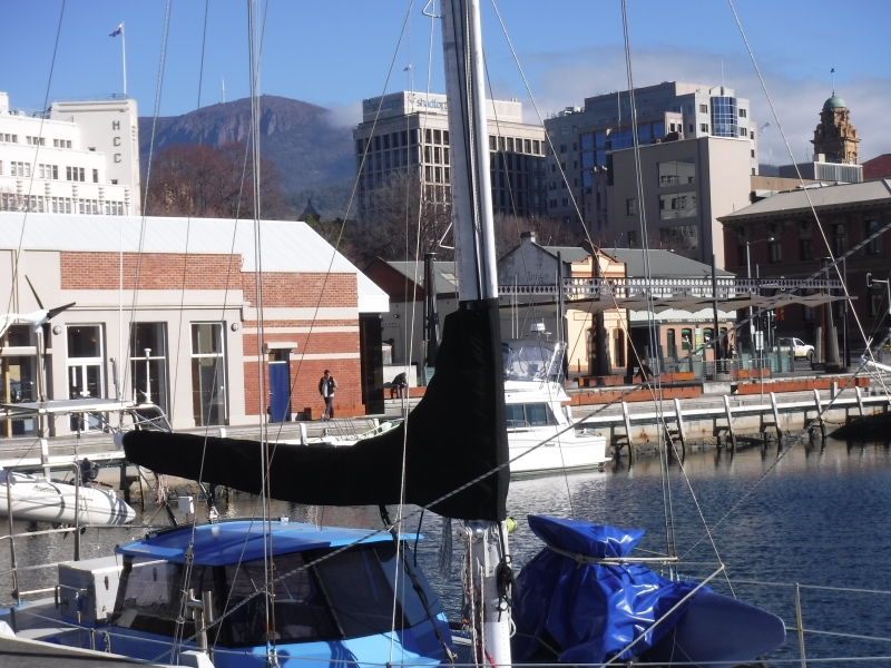
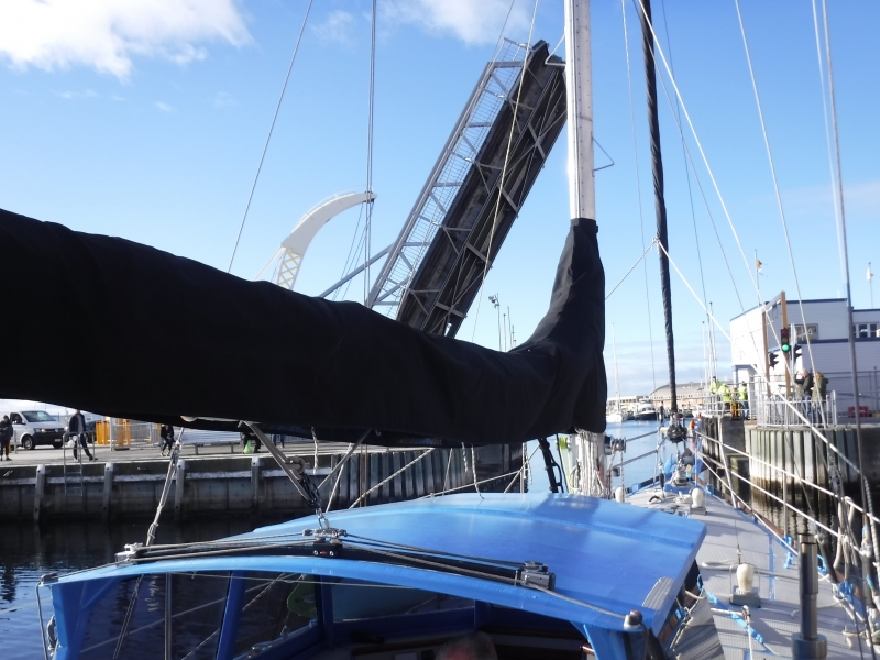
18NM from Duckpond and into Constitution Dock, Hobart. The bridge has to be lifted then into a "large swimming pool" only 100 to 200 metres from the Museum, Nautical Museum, Mawson's replica hut and more. Easy walk to everywhere in the city. A prime piece of real estate at minimal rent. Be here for 12 days.
Back in Duckpond. Quack! Quack!
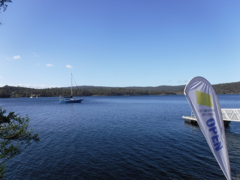
Day visiting the historic site of Tasmania's Quarantine station. Back on board Taranui just on dusk with diesel heater burning ready for another cozy evening. Were in Duckpond last night but internet signal "touch and go" so wasn't able to post position.
Another visit into Port Esperance, Dover. Anchored next to picturesque Rabbit Island.
Back from UK (flying) a few days back so on mooring in Cygnet. However, did anchor over at Deep Bay last two nights. Moved back over to mooring this morning. Diesel heater humming away keeping interior cozy!!
Back on rented mooring in Cygnet.
Arrived Deep Bay, Cygnet from Duckpond via Kettering for fuel; 25.3NM. NW 10knots and slight sea. Water temperature now 12 degrees.
Back in the Duckpond after a week snooping around Hobart on the bikes. Museums, Mawson's replica Antarctic Hut, ride to Kingston, Salamanca Saturday market ++++
Back on the Sandy Bay mooring in Hobart after two and a half months. In for some resupplying and the dentist before heading slowly back to Cygnet.
Moved into Duck Pond this morning for better protection from the light southerly and to launch the bikes for a 25km circular ride to northern tip of Bruny Island; Dennes Point.
From Snake Bay to Kettering for fuel, water and an engine oil change on the visitors day berth. Then over to Quarantine Bay to anchor just on dark. Had some incredibly calm, windless and sunny days.
After 3 days of bike riding from Simpson Bay totaling 150km we have moved 6.4 NM northward to the delightful Snake By anchorage.
Moved Taranui close to a public boat ramp so we can launch the bikes!
17.1 nm sail from Cygnet to Aitkens Point, Simpson Bay close to the neck between south and north Bruni Islands. Tranquil millpond conditions in here.
On rented mooring in Gardners Bay in Cygnet. Taranui will be based here for local sailing (SE coast) and so we can do some land based trips.
Cool light southerly with leaden sky assists 18.7nm passage from Deep Hole in Southport to Deep Bay in Cygnet.
A very relaxed 1.4 nautical mile passage this morning across Southport to Deep Hole for better protection from the predicted post frontal southwest. It has a very tropical look here with its clear water, white sand and native forest. That's where it ends though because the water temperature is 14 degrees celcius.
Headed a little further north to Southport this morning after a couple of recuperating nights from the west coast passage at Coalbins, Recherché. Increasing northerlies today ahead of a frontal system. Looks like we may be in for another high next week.
Arrived in Coalbins Bay in Recherché Bay at 1000 after motor-sailing entire 144NM passage due to a "fat high" parked over us. However beautiful sunset, sunrise, coastal scenery (especially south and southeast capes) and the southern lights (Aurora Australis).
Avg: 3.3knts
24hr: 79.3nm
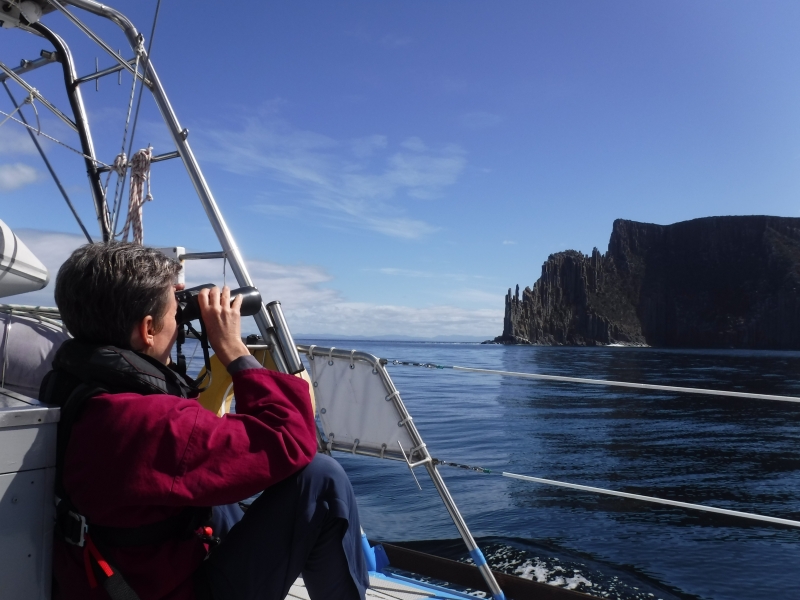
Anchored in Pilot Bay after navigating back out of Macquarie harbor through "Hells Gate". At the "starting blocks" to sail back to Recherché Bay, SE Tasmania (144 NM). Will leave at 0700 tomorrow and should arrive in Recherché Bay mid-morning next day. Walked the 2km to the most magnificent Cape Sorrell Lighthouse from Pilot Bay. Supposedly the second highest in Australia with the structure standing 53 metres.
Avg: 284.4knts
24hr: 6825.2nm
Strahan in preparation for 170 NM coastal passage back to Recherché Bay, SE Tasmania. Depart Tuesday early morning.
Explored historic Sarah Island. Was a penal island.
Ledger Point Bay in Macquarie Harbour
Kelly Basin in Macquarie Harbour
Sir John Falls
Snag Point
Heritage Landing
After a fortnight in Port Davey climbing peaks, walking, kayaking gorges and enjoying the tranquil waters of this World Heritage Wilderness Area we have arrived in Strahan in McQuarie Harbour. The entrance into the Harbour is called Hells Gate and was particularly interesting and scenic.
Bramble Cove.
Scooners Cove
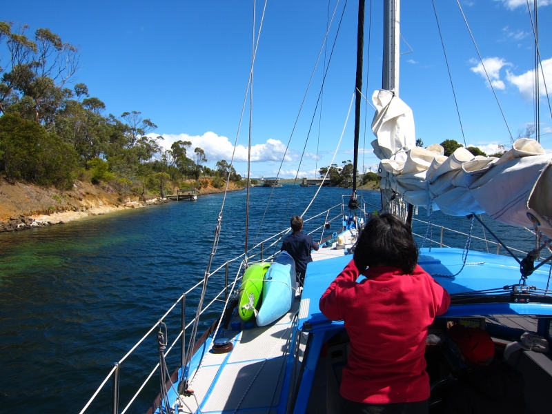
Two nights at Carvers Point to explore 5nm up Port Davey river by dinghy towing kayaks to access Hells Gate gorge with rapids.
Claytons Corner at mouth of Melaleuca Inlet. From here we climbed Mt Beatie and kayaked 4nm up the Melaleuca River to the only bush settlement in Port Davey. Airstrip, tramping hut, bird hide and museum here. Also dinghed up the river on another occasssion to walk 24 km return walk on South Coast trail to Coxes Beach on the south coast.
Moulders Inlet. From here we climbed Kroanna Hill.
Iowa Bay is like a cute little holding pen. From here we dinghy across channel to start of trail to climb Mt Rugby.
Anchored in Wombat Cove in Port Davey after 70nm motor.sail from Recherce. Sunny day.
Sailed approximately another 20NM south in the D'Entrecousteaux Channel to Port Esperance anchoring adjacent to Rabbit Island. Passed many salmon farms before entering this beautiful bush clad bay with Mt Hartz Peak (1254m) in the Hartz National Park as a backdrop.
Vacated Prince of Wales marina after a week of giving Taranui some TLC including getting her heat exchanger raw water flowing more efficiently, main sail repair and a few other fix ups which always take longer than expected. However all done and motored out past the docked Queen Mary 2 and twenty nautical miles onward to Quarantine Bay stopping at Kettering Marina en-route for fuel.
Moved into Prince of Wales marina for probably one week so we can easily tend to a few boat tasks mixed with some "playtime" as well. Rode the bikes up to Tolosa Park this evening for the "Symphony Under the Stars" featuring the Tasmania Symphony Orchestra with a very perky Jessica Cottis as conductor and guest saxophonist Amy Dickson. Rhk Goddard a New Zealander was the compere. World class performances.
Sailed into Hobart behind the Wooden Boat Festival Sail Parade and anchored in Sandy bay, Hobart. have since moved onto a nearby mooring. Although Taranui is steel we felt it appropriate to be part of the fleet as we do have NZ native Rimu and Totara inside!!
Shifted to Duckpond after this mornings southerly change. Yacht dragged anchor on to us as well in Quarantine resulting in a small scrap on starboard side. Taranui doesn't deserve that kind of treatment!!!
Lowered anchor in Quarantine Bay, Barnes Bay 2100 yesterday after a 109 NM passage from Wineglass Bay. Incredible coastal scenery passing through "the hole in the wall" and rounding Cape Raul. Wooden boat festival atmosphere already in the Bay.
Crossing Stormy Bay for north Bruny Island and down D'Entrecasteaux Channel to potentially anchor in Quarantine Bay. Left midnight from Wineglass Bay to get in before two days of mischievous weather. Very nice day today and passing through some amazing landscapes. Bi-annual wooden boat festival begins Friday.
Arrived Wineglass Bay, Tasmania from Eden 0320 this morning. Overall an excellent and varied 329 nautical mile sail taking 55 hours (2 days 7 hours). Left Eden 2000 Thursday 2 Feb motor sailing first 70NM before the predicted SW was strong enough to sail. The SW headed us eastward off the rhumbline by 25 NM before the wind became westerly, then north westerly so we could lay toward the waypoint off Wineglass Bay. This was excellent fast sailing which became more thrilling passing the wind constricted Banks Strait with winds in excess of 40 knots and boat speed between 7 and 10 knots with storm tri and staysail set. Eased later in the evening and motored last 17 NM. Wineglass Bay is stunning with its white sand beach, bush and granite rock formations!
Well sailed, happy
Avg: 2.7knts
24hr: 64nm
Arrived in Eden at 0800 after a 23 hour 130 NM sail from Jervis Bay. Some motor sailing but predominantly good sailing with the wind 10 to 20 knots NE and N. So we are now in the "starting blocks" for Bass Straight along with at least three other yachts
12 Nautical miles off the coast and ENE of Bermagui heading for Eden; the starting blocks for Bass Strait! 50 NM to run. Good sailing through the day with 10 to 15 knots NE. 20 to 25 knots northerly was forecasted for now but only experiencing light winds hence motor sailing between 6 and 7 knots,
Arrived in Jervice Bay 0600 after a benign 89 nautical mile light northerly wind passage. Dolphins led us to the mooring area!! The Bay is pristine with clear water and white sandy beaches with courtesy moorings so that the sea grass seabed is protected against anchor damage. It is part of the Booderee National Park.
Anchored in Rose Bay in preparation for a Sydney departure and a sail to Port Hacking tomorrow.
Anchored by the Roseville Bridge in Middle Harbour. Twenty minute walk to Killarney Heights Coles Supermarket today to re-provision. Running low on Rum and Raisin chocolate and Gingernuts!! Good shelter from tonight's fresh southerly.
Changed anchorage to Bantry Bay in Middle Harbour both for a scene change and to access further walking tracks in Garigal National Park. May as well stay tight in Sydney Harbour, in particularly in the very protected waters of Middle Harbour, to wait for the weather to settle further south. A welcome southerly change this morning to help cool the air temperature.
<p>Hi,</p>
Approximately 5 NM from Manly and passing under a time-tabled opening bascule bridge we are now anchored in Castle Cove in Middle Harbour, Sydney Harbour. Surrounded by a national park and tracked Australian native bush and the water temperature 25.5 degrees C we are yet again in another yacht cruisers paradise.
Still in Q beach Manly and not moving anywhere today. Predicted maximum temperatures for Sydney today is 39 degrees and 41 degrees in the west. The local radio said to be aware of "heat stress" today so doing our best to avoid it by doing little except frequent immersions off the swimming platform into the 22 degree water! Temperature on Taranui at 0830 was 30 degrees. Managing "heat stress" ok so far!
Back to our Manly anchorage thinking about starting south again.
Re anchored this morning from Rose Bay to Blackwattle Bay virtually in the heart of the city. This move involved passing under the Sydney Harbour Bridge, through the permanently opened Glebe Island Bridge and under the modern Anzac Bridge before anchoring opposite "The Fish Market".
Moved from Athol Bay where we viewed New Years fireworks to Sirius Cove. On the bikes for a cruise around "bike friendly" Sydney which included crossing the harbour bridge. Returned to Taranui resting in beautiful Sirius Cove and then re anchored in Rose Bay 2.5 nautical miles to the south east. Southerly forecasted tonight.
Happy New Year with continued
No blogs available for this yacht.